Seismic Refraction Survey for Groundwater Potentials of Northern Paiko Area. Niger State, Nigeria.

This paper titled Seismic Refraction Survey for Groundwater Potentials of Southern Paiko Area. Niger State, Nigeria, employs the service of seismic refraction survey method. A twelve-channel seistronix was used for the data collection. The profiles were marked at 100 m intervals, while the profiles lines traversed 1000 m (1km). A Total of 44 spreads were shot. Data were collected, Time – distance (T-S) graphs were plotted using matrix laboratory software, velocities of the underlying layers obtained and depths to the refractor layer computed and geologic cross sections were obtained. The results obtained gave an overview of the lateral variation in the lithological changes of the subsurface earth materials in the surveyed area. The basement surface varied in depth, from 10.16 m to a maximum of 14.80 m. weathered layer velocities ranging from 809 m/s to 3612 m/s and consolidated layer velocities varying between 2858 m/s to 9696 m/s. Four shot points were delineated as aquifer potentials of the area having depth to refractor varying between 13.70 m and 14.80 m with overburden velocities ranging from 1940 m/s to 3462 m/s. The rock materials identified in the surveyed area are chiefly sand, saturated clay, gravel, gneiss, igneous rock and granite.

Recommended
More Related Content
What's hot
What's hot (20)
Viewers also liked
Viewers also liked (20)
Similar to Seismic Refraction Survey for Groundwater Potentials of Northern Paiko Area. Niger State, Nigeria.
Similar to Seismic Refraction Survey for Groundwater Potentials of Northern Paiko Area. Niger State, Nigeria. (20)
More from iosrjce
More from iosrjce (20)
Recently uploaded
Recently uploaded (20)
Seismic Refraction Survey for Groundwater Potentials of Northern Paiko Area. Niger State, Nigeria.
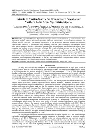
- 1. IOSR Journal of Applied Geology and Geophysics (IOSR-JAGG) e-ISSN: 2321–0990, p-ISSN: 2321–0982.Volume 3, Issue 2 Ver. I (Mar - Apr. 2015), PP 41-48 www.iosrjournals.org DOI: 10.9790/0990-03214148 www.iosrjournals.org 41 | Page Seismic Refraction Survey for Groundwater Potentials of Northern Paiko Area. Niger State, Nigeria. 1 Alhassan D.U, 2 Ugbor D.O, 3 Ejepu, S.J, 3 Mufutau, O.J and 4 Mohammed, A. 1 Department of Physics, Federal University of Technology, Minna 2 Department of Physics and Astronomy, University of Nigeria, Nsukka 3 Department of Geology, Federal University of Technology, Minna 4 Department of General Studies, College Of Education Minna Abstract: This paper titled Seismic Refraction Survey for Groundwater Potentials of Southern Paiko Area. Niger State, Nigeria, employs the service of seismic refraction survey method. A twelve-channel seistronix was used for the data collection. The profiles were marked at 100 m intervals, while the profiles lines traversed 1000 m (1km). A Total of 44 spreads were shot. Data were collected, Time – distance (T-S) graphs were plotted using matrix laboratory software, velocities of the underlying layers obtained and depths to the refractor layer computed and geologic cross sections were obtained. The results obtained gave an overview of the lateral variation in the lithological changes of the subsurface earth materials in the surveyed area. The basement surface varied in depth, from 10.16 m to a maximum of 14.80 m. weathered layer velocities ranging from 809 m/s to 3612 m/s and consolidated layer velocities varying between 2858 m/s to 9696 m/s. Four shot points were delineated as aquifer potentials of the area having depth to refractor varying between 13.70 m and 14.80 m with overburden velocities ranging from 1940 m/s to 3462 m/s. The rock materials identified in the surveyed area are chiefly sand, saturated clay, gravel, gneiss, igneous rock and granite. Keyword: Seistronix, time-distance graph, velocity, basement, geologic, aquifer and Paiko. I. Introduction The study area (Paiko) is the headquarter of Paikoro local government area of Niger state, located in the central part of Nigeria. It has an elevation of 304 m above sea level with population of about 736,133 people as at 2006 census and lies between latitude 9ο 25′N to 9ο 27′N and longitudes 6 ο 37′E to 6 ο 39′E. The study is aimed at evaluating groundwater potentials of the area through seismic refraction survey. In seismic refraction survey energy is introduced into the ground by striking the steel plate at the ground surface with a hammer. The seismic energy generated was detected by a line of 12 equally spaced geophones which are placed in the ground and produced a small voltage in response to earth vibration. The foundation of seismic refraction theory is Snell’s law, which governs the refraction of a sound or light ray across the boundary between layers of different physical properties. As sound waves travel from a medium of low seismic velocity into a medium of higher velocity, some are refracted towards the lower velocity medium, and some are reflected back into the first medium. As the angle of incidence of the sound ray approaches the critical angle (an angle where the refracted ray grazes the surface of the contact between the two media), most of the compressional energy is transmitted along the surface of the second layer as the velocity of sound in the second layer. As this energy propagate, it generates new sound waves in the upper medium that in turn propagate back to the surface at the critical angle and at the seismic velocity of layer one. For seismic refraction to work, therefore, the velocity of sound in each deeper layer must be greater than in the layer above it. When this condition is met, the refracted wave arrives at the Earth’s surface where it can be detected by a geophone which generates an electrical signal and sends the signal to a seismograph. The seismic refraction method uses the seismic energy that returns to the surface of the earth after traveling along ray paths through the ground, to locate refractors that separate layers of different seismic velocities (Keller et al., 1981). Thus in hydrogeological investigation the seismic refraction method provides direct information on the level of water table, since an increase in water content causes a significant increase of seismic velocity (for a homogeneous lithology). By implication, zones of saturation (e.g. medium to coarse grained unconsolidated deposits) are therefore, excellent refractors, the upper boundary of which can be determined with a considerable accuracy by the seismic refraction method (Kearey et al., 2002). The over burden material of Minna formation consist of granite, lateritic rocks and gravels and the overbunden weathered basement constitutes a major component of the aquifer system in basement complex (Alhassan et al., 2010). Mohammed et al. (2012) carried out seismic refraction and electrical resistivity investigation for ground water at Fatu Maimasa Nasarawa State and they observed that it is reasonable to assume that zones with large regolith thickness down to the weathered (decomposed) basement where clay content is very low are zones with highest permeability. It is reasonable to assume that zones with light
- 2. Seismic Refraction Survey for Groundwater Potentials of Northern Paiko Area. Niger State, Nigeria. DOI: 10.9790/0990-03214148 www.iosrjournals.org 42 | Page thickness of decomposed rocks are due to intense fracturing of the basement having the highest permeability with greater depth where the clay content from the weathered basement is very low (Egbai, 2011). The basement complex terrain has many challenges as regards groundwater potential evaluation (Olasehinde and Amadi, 2009) and it explains why well yield in basement complex is lower than well yield in sedimentary terrain (Adeleye, 1976 and Amadi, 2010). Seismic refraction is a commonly used geophysical technique to determine depth-to bedrock, competence of bedrock, depth to the water table, or depth to other seismic velocity boundaries (Salako et al., 2010) Geology Of The Study Area Generally, the area mapped forms part of the Minna- granitic formation that consists of Metasediment and metavolcanics. The Metasediment include quartzites, gneisses and the metavolcanics are mainly granites. Among the main rock groups are granites which occur at the central and northern part s of the area, while on the south and east, cobbles of quartzite are found especially along the channels and valley. However, the other bodies like pegmatites and quartz veins also occur within the major rock types (figure 1). The rocks are mainly biotite –granites with medium to coarse grained, light colored rocks with some variation in biotite content. The mineral constituents are leucocratic to mesocratic. However the biotite minerals are thread like and are arranged rough parallel streak, although some are disoriented in the groundmass. The feldspar minerals occur as fine to medium grained though grains are cloudy as a result of alteration mostly along the twin planes while the quartz minerals are constituents of the granitic rocks which show strong fracturing in the granitic rocks of the area (Ajibade, 1980). Figure 1: Geological Map of Paiko area (Modified after NGSA 2010). The raining period runs from April to October with the highest amount of rainfall recorded in August while the average annual rainfall is between 1200 mm- 1300 mm (Niger State water and sanitation board Minna, 2001). The mean annual temperature is between 220 c to 250 c. The period between November and February are
- 3. Seismic Refraction Survey for Groundwater Potentials of Northern Paiko Area. Niger State, Nigeria. DOI: 10.9790/0990-03214148 www.iosrjournals.org 43 | Page marked with the NE trade wind called the harmattan, which often causes very poor visibility during its period. The available surface water of the area was contaminated as a result of man and animals activities in the water. The study area is a basement complex terrain. II. Materials And Method The instrument used in this survey for the field data acquisition is made up of five basic units. These are a twelve-channel signals enhancement seistronix, twelve geophones, a wave-generating source (sledge hammer and steel plate), a laptop computer (output signal unit) and Global positioning system (GPS). The Remote Acquisition System (RAS-12) is a flexible, high resolution seismic acquisition system intended for shallow refraction. The profiling arrangement used in the field for this survey work is the unreversed refraction profiling, since the survey coverage is large and thus the layering is assumed horizontal. In this survey, a linear spread of twelve geophones, five meters apart was arranged in line with the shot point, five meters away from the first geophone. The entire study area was divided into four profiles (E, F, G, and H), one hundred meters apart. A total of fourty four seismic refraction shots were carried out along four profile lines. Eleven shots in each profile line in southeast - northwest direction. Profile lines were separated by a distance of one hundred meters (100 m), they are run parallel to each other. The distance between shot points was fifty meters (50 m), while the distance between geophones for every spread was five meters (5 m). The seismic wave is generated by a hammer blow on a steel plate and the seismic energy propagated through the ground is picked up as signals by the geophones placed some distances away at regular spacing along a straight line directed towards the energy source. The travel times for this energy from the source to the twelve detector positions which corresponds to shot points were recorded. To reduce the effect of noise from wind and air waves, the geophones were completely buried in the ground. The seismic recorder was always kept behind the first geophone and offset from the geophone cable. When the amplifier gains and filters were set, a sledge hammer was used (for the shooting) to provide sufficient energy to traverse the shot recording range, by impacting it on to a plate at the shot point S. The record was allowed to develop, and then examined for first arrival signals before storing same in the memory for processing after the field exercise. The first arrival time recorded at shot points was plotted against the geophone separations from the shot point to obtain the time distance graphs using Matrix Laboratory software (figure 2). First and second layer velocities were obtained. Depths to the refractor (Z) were calculated using Z = Ti 2 V1V2 V2 2−V1 2 . Where Z = depth to refractor V1 = Velocity of layer 1 V2 = Velocity of layer 2, underlying layer 1 Ti = Intercept time Depths to refractor were used to generate the geologic sections of the area in order to identify suitable areas for groundwater potential using Matlab software. Isovelocity maps of overburden and refractor layers were produced using Surfer 11 software to investigate the continuous variation of velocity with depths so as to view regions with high or low velocity values. III. Results And Discussion The summary of the interpreted seismic refraction survey is presented in Tables 1, 2 and 3.Table 1 shows the overburden velocities (V1) of the study area which consists of profiles E to H with an overburden velocities ranging from 809 m/s to 3612 m/s. It has the least velocity at shot point H9 while the highest velocity is observed at shot point H3. The geologic cross sections show the depth to refractor of the various shot points laterally. The weathered layer is the loose material of the earth while consolidated layer is the refractor layer. Isovelocity maps were generated in other to investigate the continuous variation of velocity with depths. From the Isovelocity map obtained for overburden layer, high velocity is observed at the north western and south western regions of the map. Low velocities are concentrated around central and south eastern portions of the map (figure 7). Isovelocity map produced for refractor layer has its highest velocity around the south west part of the map, while the low velocities are at the north east and south east portions of the map (figure 8). Table 2 shows the refractor velocities (V2) of the area. These refractor velocities ranged from 2858 m/s to 9696 m/s. The lowest refractor velocity is observed at the shot point G7 and the highest is at point F5. Table 3 shows the depth to refractor of the study area. The depth varies between 10.16 m to 14.80 m. The lowest depth is obtained at the shot point E10 while the highest depth is recorded at point E8. These depth values were used to obtained the geological cross sections of the area (figures 3 - 6), and reveals that the study area is a shallow depth basement.
- 4. Seismic Refraction Survey for Groundwater Potentials of Northern Paiko Area. Niger State, Nigeria. DOI: 10.9790/0990-03214148 www.iosrjournals.org 44 | Page Table 1: First Layer Velocities, V1 (m/s) for Different Shot Profile Location Profile Name E F G H 1 2898 1693 2306 1170 2 2259 2284 1427 1094 3 3612 1183 1104 1560 4 3499 1430 1645 1205 5 3141 2272 2087 1940 6 3326 2555 1464 3087 7 2368 3576 938 1048 8 2005 1903 1863 2101 9 1753 2800 2593 809 10 1746 2548 1353 3462 11 2631 3034 2883 1290 Table 4 shows aquifer potential points obtained from the result of the study. These aquifer potentials points were delineated using series of factors, consists of geologic cross sections, velocity values, thickness of the overburden materials, Isovelocity maps and standard wave velocities in earth materials (Keary et al., 2002; John, 2003). Table 2: Second Layer Velocities, V2 (m/s) for Different Shot Profile Location Profile Name E F G H 1 8464 6707 5403 6355 2 7946 8549 6353 5066 3 7524 8185 5241 6078 4 8804 6656 4587 4152 5 7025 9696 8687 5147 6 6263 7566 8410 7052 7 6497 8087 2858 3952 8 6739 5116 3906 5392 9 8165 4962 5964 3957 10 6992 7744 4420 9101 11 9107 7283 5289 4274 Table 3: Depths to Refractor, Z (m) for Different Shot Points Profile Location Profile Name E F G H 1 13.94 10.90 11.50 13.25 2 14.41 12.95 13.17 13.19 3 12.34 11.51 13.22 12.99 4 11.64 13.04 12.07 10.67 5 11.21 13.09 13.05 13.70 6 11.58 12.22 11.42 12.96 7 12.10 12.70 10.56 12.73 8 14.80 10.16 11.36 11.81 9 13.57 11.63 11.34 11.28 10 11.05 10.42 12.55 14.64 11 12.65 11.69 11.29 10.52 Figure 2 is the time – distance graph, the straight line passing through the origin gives the information about the first layer (overburden) velocity and the line that cut the time axis provides information about the second layer (refractor) velocity.
- 5. Seismic Refraction Survey for Groundwater Potentials of Northern Paiko Area. Niger State, Nigeria. DOI: 10.9790/0990-03214148 www.iosrjournals.org 45 | Page Figure 2: Time – distance Graph Figure 3: Geologic Section for Profile E Figure 4: Geologic Section for Profile F
- 6. Seismic Refraction Survey for Groundwater Potentials of Northern Paiko Area. Niger State, Nigeria. DOI: 10.9790/0990-03214148 www.iosrjournals.org 46 | Page Figure 5: Geologic Section for Profile G Figure 6: Geologic Section for Profile H Figure 7: Isovelocity Map for the First Layer
- 7. Seismic Refraction Survey for Groundwater Potentials of Northern Paiko Area. Niger State, Nigeria. DOI: 10.9790/0990-03214148 www.iosrjournals.org 47 | Page Figure 8: Isovelocity Map for the Second Layer Table 4: Aquifer Potentials of the Area. Shot points Latitude (degrees) Longitude (degrees) Elevation (m) Overburden Velocity, V1 (m/s) Refractor Velocity, V2 (m/s) Depth to Refractor, Z (m) E2 9.46551 6.63751 313 2259 7946 14.41 E8 9.46549 6.63309 298 2005 6739 14.80 H5 9.46389 6.63524 300 1940 5147 13.70 H10 9.46391 6.63301 296 3462 9101 14.64 IV. Conclusion The result of the survey conducted has revealed the study area to compose of two geological cross sections. The overburden materials observed consists of sand, clay, laterite, gravels and alluvial deposit. The maximum depth to refractor was estimated to be 14.80 m. Four shot points were considered promising aquifer potentials of area and therefore delineated for groundwater development. Groundwater usually occurs in discontinuous aquifers in basement complex area. Defining the potentials of the aquifers is normally a tedious exercise because of the intricate properties of the basement rocks (Adeniji et al, 2013). Therefore the uses of various seismic refraction parameters (velocity of the weathered layer, depth to refractor layer, geologic cross section and Isovelocity map) were employed in classifying the groundwater potentials of the area. Groundwater developments can be concentrated in the areas of possible groundwater potentials as indicated in table 4. References [1]. Adeleye, D.R (1976): The Geology of the Middle Niger Basin, (In) The Geology Of Nigeria, Ed. C.A. Kogbe, Elizabeth Press, Lagos. Pp 283-287. [2]. Adeniji, A.E,Obiora, D.N, Omonona, O.V and Ayuba, R (2013): Geoelectrical evaluation of Groundwater Potentials of Bwari Basement Area, Central Nigeria. International Journal of Physical Sciences. [3]. Ajibade, A.C (1980): The Geology of the Country around Zungeru, Northwestern state of Nigeria. Unpublished M.Sc. Thesis, University of Ibadan, Ibadan. [4]. Alhassan D. U, Dangana L.M, Salako K.A, Jonah,S.A and Ofor N.P.(2010): Seismic Refraction Investigation Of The Subsurface Structure At The Southern Part Of Niger State College Of Education, Minna, Nigeria. Bayero Journal of Pure and Applied Science. Vol 3, No 2, pp 56-61 [5]. Amadi, A.N (2010): Hydrogeological and Geophysical study of Bosso Area of Minna, North-Central Nigeria. Bayero Journal of Physics and Mathematical Sciences, Vol. 3 No 1, pp 66-73.
- 8. Seismic Refraction Survey for Groundwater Potentials of Northern Paiko Area. Niger State, Nigeria. DOI: 10.9790/0990-03214148 www.iosrjournals.org 48 | Page [6]. Egbai, J.C (2011): A Combination of Electrical Resistivity and Seismic Refraction Surveys for Ground water Exploration in Basement Region of Ifon, Ondo State, Nigeria. Australian Journal of Basic and Applied Sciences, Vol 5, No 5, pp 1007-1016. [7]. John Milson (2003): Field geophysics, the geological field guide series, third edition. London. [8]. Kearey P, Brooks M and Hill T. (2002): An Introduction to Geophysical Exploration. Black Well Publishing. [9]. Keller, G.R, Sinno, Y.A and Sbar, M.L (1981): Seismic Refraction in West and Central Auzona. Journal of Geophysical Research, New York, U.S.A. Vol. 86, No. 36, pp 50. [10]. Mohammed, B.I, Yakubu, W.L and Annu, U.J (2012): Seismic Refraction and Electrical Resistivity Investigation for Ground water at Fatu Maimasa along Kogin Gabas Road Nasarawa State. Journal of Engineering and Applied Sciences. Vol 4. Pp 71-78. [11]. Olasehinde, P.I and Amadi, A.N (2009): Assesment Of groundwater Vulnerability in Owerri and Its Environs, Southern Nigeria. Nigeria Journal of Technological Research, Vol. 4, No. 1, pp 27-40. [12]. Salako K.A, Abdulrashid,U.A, Adetona,A.A, Rafiu, A.A., Ofor, N.P, Jonah, S.A. Alhassan D.U. (2010): Geophysical Investication of Western Part of Federal University of Technology, Gidan Kwano Campus, Minna, Niger State, Using Electrical and Seismic Refraction Methods. Natural and Applied Sciences Journal. Vol 11, No 2, pp 249-264.