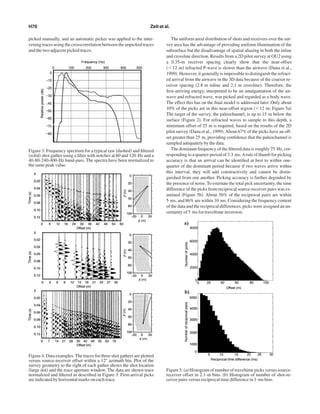
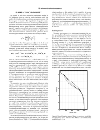
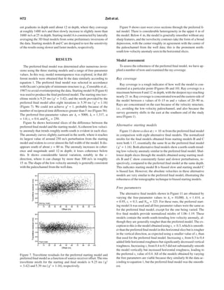
Downloaded 18 times

This document summarizes a study applying 3D seismic refraction traveltime tomography to characterize shallow subsurface geology at a groundwater contamination site. The study area is a 95x40 meter region over an aquifer contaminated with dense nonaqueous phase liquids (DNAPLs). The goal is to image subsurface velocity structure and identify a paleochannel that acts as a trap for DNAPLs. Traveltime tomography was used to invert over 187,000 first-arrival times and obtain a 3D velocity model showing a north-south trending low-velocity feature interpreted as the paleochannel, which agrees with over 100 existing well logs. The model provides 7.5-10 meter lateral resolution to a depth of 15 meters.