
Recommended
More Related Content
What's hot
What's hot (20)
Similar to Lecture 1 introdcution to engineering surveying
Similar to Lecture 1 introdcution to engineering surveying (20)
More from Sarhat Adam
More from Sarhat Adam (13)
Recently uploaded
Recently uploaded (20)
Lecture 1 introdcution to engineering surveying
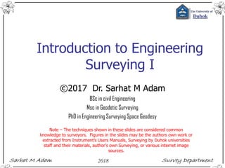
- 1. Introduction to Engineering Surveying I ©2017 Dr. Sarhat M Adam BSc in civil Engineering Msc in Geodetic Surveying PhD in Engineering Surveying Space Geodesy Note – The techniques shown in these slides are considered common knowledge to surveyors. Figures in the slides may be the authors own work or extracted from Instrument’s Users Manuals, Surveying by Duhok universities staff and their materials, author's own Surveying, or various internet image sources.
- 2. Outlines Introduction Reading Materials Table of Contents History of Surveying Purpose of Surveying Basic concept of Surveying Basic Measurement Control Network Locating Position
- 3. Introduction Course Details Two courses in two semester 6 units total for 2 courses. 2 hrs Theory, 2 hrs practical Activities involve lectures, practicals, tutorials, quizzes, and a field practice Every 2 weeks a group discussion (Practical) and a quiz (5%). Practicals involve carry out measurements and processing.
- 4. Introduction Course evaluation 1st & 2nd semester 1st exam Total =50 (20 theory, 10 practical, 20 activity) 1st & 2nd semester final exam Total = 50 (40 theory, 10 practical)
- 5. Introduction Course assessment Excellent 90-100 % Very good 80- 89 % Good 70- 79 % Average 60- 69 % Pass 50- 59 % Fail 00- 49 % You’re required to achieve a minimum of 50% to pass the course.
- 6. Introduction Lecturers (Theory) Dr. Sarhat M Adam (Sarhat@uod.ac) Senior Lecturer Sami Mamlook Practical Hishyar Ali Attendance monitoring system < 90 % may lead to failing the cours. Each 1 hr absence = 0.5 mark lose
- 7. Introduction-the Plan Date Day Lecture Activities 10-Oct-17 Tuesday Lecture 01: Introduction to Surveying 17-Oct-17 Tuesday Lecture 02: Error & Uncertainty 24-Oct-17 Tuesday Lecture 02: Error & Uncertainty (cont.) Quiz 01 (5%) 31-Oct-17 Tuesday Lecture03: Distance Measurment 7-Nov-17 Tuesday Lecture03: Distance Measurment (cont.) Assignment 01 (5%) 14-Nov-17 Tuesday Lecture04: Veritcal Control 21-Nov-17 Tuesday Lecture04: Veritcal Control 28-Nov-17 Tuesday PPT01 (Seminar Day 5%) 5-Dec-17 Tuesday Lecture05: Levelling Applications 12-Dec-17 Tuesday Lecture05: Levelling Applications 19-Dec-17 Tuesday Lecture05: Levelling Applications Quiz 02 (5%) 24-Dec-17 Tuesday Midterm Exam Expected (20%) 9-Jan-18 Tuesday Lecture06: Earht Works 16-Jan-18 Tuesday Lecture06: Earht Works 23-Jan-18 Tuesday Final exam expected (40%)
- 8. Reading Materials Online Help in , Engineering Surveying on YouTube, or Web Surveying forum, for example engineeringsurveyor, http://www.engineeringsurveyor.com/ Books - for example, Introduction to Visual Basic® for Applications for Autodesk® AutoCAD® Engineering Surveying 6th ed. W. Schofield and M. Breach Engineering Surveying, Theory and Examination Problems for Students, V2, 2nd ed. Surveying Engineering & instruments. Valeria Shank Surveying; problem solving with theory & objective type questions. ADJUSTMENT COMPUTATIONS, Spatial Data Analysis 4th ed. CHARLES D. GHILANI and PAUL R. WOLF. Elementary Surveying, an introduction to Geomatics, 13th ed. CHARLES D. GHILANI and PAUL R. WOLF. Instruments manuals and field books. Lecture periods, Practical periods, & Consultation hours – Working individually or in pairs ?
- 9. Table of Contents Basic concept of Surveying (1st Semester) Definition – Basic measurements – Control networks – Locating position Error and uncertainty (1st Semester) Units of measurement – Scale – Significant figures –– Errors in measurement – Indices of precision – Weight – Rejection of outliers – Combination of errors. Distance measurement (1st Semester) Tapes – Field work – Distance adjustment – Errors in taping – Accuracies –Electromagnetic distance measurement (EDM) – Measuring principles – Meteorological corrections – Geometrical reductions – Errors, checking and calibration – Other error sources – Instrument specifications – Development in EDM.
- 10. Table of Contents Vertical Control (1st Semester) Introduction – Levelling – Definitions – Curvature and refraction – Equipment – Instrument adjustment – Principle of levelling – Sources of error – Closure tolerances – Error distribution – Levelling applications – Reciprocal levelling – Precise levelling – Digital levelling – Trigonometrical levelling – vertical measurement with GPS. Earthworks (1st Semester) Areas – Partition of land – Cross-sections – Dip and strike – Volumes – Mass-haul diagrams Angle Measurement (2nd Semester) The theodolite – Instrumental errors – Instrument adjustment – Field procedure – Measuring angles – Sources of error. Conventional control surveys (2nd Semester) Plane rectangular coordinates – Traversing – Triangulation – Networks.
- 11. Table of Contents Curves (2nd Semester) Circular curves – Setting out curves – Compound and reverse curves – Short and/or small-radius curves – Transition curves – Setting-out data – Cubic spiral and cubic parabola – Curve transitional throughout – The osculating circle – Vertical curves. Position (2nd Semester) Introduction – Reference ellipsoid – Coordinate systems – Local systems – Computation on the ellipsoid – Datum Transformations – Orthomorphic projection – The Universal Transverse Mercator Projection – Ordnance Survey National Grid – Practical applications. Satellite positioning (2nd Semester) Introduction – GPS segments – GPS receivers – Satellite orbits – Basic principle of position fixing – Differencing data – GPS observing methods – Error sources. GPS survey planning – Transformation between reference systems – Datums.
- 12. History of Surveying The Early Days Of Surveying Surveying has been around approximately 6000 years ago Monument Stonehenge may have included the use of surveyors, employing peg and rope geometry.
- 13. History of Surveying The Early Days Of Surveying 2700 BC by Egyptian Great Pyramid by using basic geometry. 1400 B.C by Egyptian land division into plots for the purpose of taxation. Romans were the Next an official land surveyor was employed by the empire
- 14. History of Surveying The Early Days Of Surveying 120 B.C Greeks developed the science of geometry and were using it for precise land division. Greeks developed the first piece of surveying equipment (Diopter). Greeks standardized procedures for conducting surveys.
- 15. History of Surveying The Early Days Of Surveying 1800 A.D. Beginning of the industrial revolution. - "exact boundaries" importance. - demand for public improvements (i.e. railroads, canals, roads). - More accurate instruments were developed. - Science of Geodetic and Plane surveying were developed.
- 16. History of Surveying Survey Today - To map the earth above and below the sea. - Prepare navigational maps (land, air, sea). - Establish boundaries of public and private lands. - Develop data bases for natural resource management. - Development of engineering data for Bridge construction. Roads. Buildings. Land development.
- 17. History of Surveying Chain Compass Plane table Barometer Alidade
- 18. History of Surveying Three of these four famous faces were surveyors Washington, Jefferson, and Lincoln George Washington (1732–1799), Thomas Jefferson (1743–1826), Theodore Roosevelt (1858–1919), and Abraham Lincoln (1809–1865)
- 19. Purpose of Surveying To prepare a topographical maps. Show both natural and man-made features
- 20. Purpose of Surveying To prepare the engineering detailed plans and sections of roads and other structures.
- 21. Purpose of Surveying To determine the required areas and volumes of a land.
- 22. Purpose of Surveying To ensure that the construction takes place in the correct relative and absolute position on the ground.
- 23. Purpose of Surveying To record the final position of the construction, including any design changes.
- 24. Purpose of Surveying To provide permanent and temporary control points.
- 25. Purpose of Surveying To prepare a map of a country of detailed out location of cities, towns, villages and major roads.
- 26. Purpose of Surveying To develop artificial vision, examples, an autonomous car or robot vacuum cleaner
- 27. Purpose of Surveying To record archeological, crimes scenes
- 28. Basic concept of Surveying Definition The art of making measurements of the relative positions of natural and man-made features on the Earth’s surface, and the presentation of this information either graphically or numerically. surveying requires management and decision making in deciding the appropriate methods and instrumentation required to complete the task satisfactorily to the specified accuracy and within the time limits available.
- 29. Basic Measurement Earth is not mathematically definable. Surface close to fit the mean position of the oceans called Geoid. Geoid is equipotential surface that most closely approximates to mean sea level (MSL). A level or equipotential surface through a point is normal to the direction of gravity (plumb line). Geoid, which although very smooth is still an irregular surface and so cannot be used to locate position mathematically. best is an ellipsoid formed by rotating an ellipse about its minor axis.
- 31. Basic Measurement Earth surface EllipsoidSea surface Geoid
- 32. Basic Measurement Most engineering surveys are carried out in small areas. The reference surface may be taken tangent plane to the geoid, fig. For areas < 10 KM 2 Principle of plane survey is applied and curvature is neglected. Knowing that for 200 KM 2 , the difference between the sum of the spherical angles and the plane angles would = 1”. Difference of 20 km Arc to its chord length is about 8mm. Above assumption is true for positional applications but not elevations. Cause geoid deviate from tangent plane by about 80 mm / 1 km. Or error due to earth curvature in elevation is about 80 mm / 1 km.
- 34. Control Network A large or small areas of land require control network. Control network are series of control points for topographic surveying control supplementary points, or dimensional control on site. Projects require set out of structure to sub-cm accuracy. Design of survey stations for CPs based mainly on the time of project Long wooden peg with nail in middle and concrete around is enough for most construction projects.
- 35. Control Network Possible procedures for CPs 1) Reconnaissance. 2) Structure of Survey station. 3) Survey of CPs using one of the following: 1) Intersection or resection 2) Traversing 3) Networks 4) GPS satellites
- 36. Locating position Positions of CPs could be known by polar coordinates (Total station) or by GPS. With total station (2 points should be known AB). If positions of all points in network known, then details survey starts. Intersection Resection No check
- 37. Possible exam questions What is the approximate date of first survey activity and where it was? Earth is ____________ definable. What surface close to fit the mean position of the oceans called? Geoid is equipotential surface that most closely approximates to mean sea level (MSL). (TRUE or FALS). A level or equipotential surface through a point is normal to the direction of gravity (plumb line). (TRUE or FALS). Geoid is an irregular surface. (TRUE or FALS). Mathematical can be carried out on Ellipsoid. (TRUE or FALS). How model of earth ellipsoid is formed? Draw a diagram to show ellipsoid, geoid and physical earth. Most engineering surveys carried out in small areas (TRUE or FALS).
- 38. Possible exam questions In small area, what reference system could be taken for survey? For areas < 10 KM 2 Principle of plane survey is applied and curvature is neglected. (True or False) For areas of 200 km square, what is the sum difference between the spherical and plane angles? Prove mathematically that the difference of 20 km Arc of earth surface to its chord length is about 8mm. Prove that error due to earth curvature in elevation is about 80 mm / 1 km