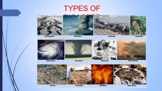
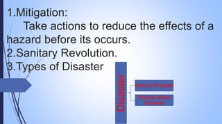
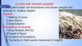
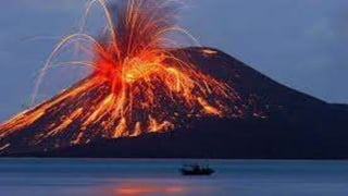
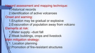
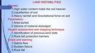
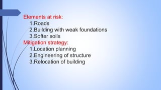
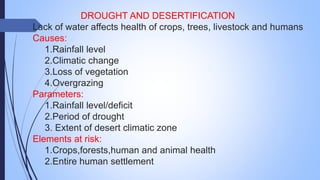
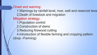
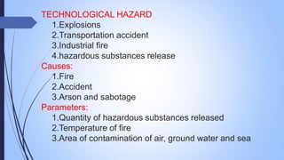
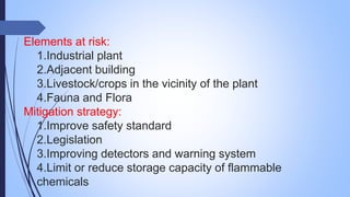
2. 1.Mitigation:
Take actions to reduce the effects of a
hazard before its occurs.
2.Sanitary Revolution.
3.Types of Disaster
Disaster
Natural Disaster
Human Made
Disaster
3.
4. FLOOD AND WATER HAZARD
Turbulent water can knockdown and drown people and
animals in shallow depths.
Causes:
1.Melting of snow
2.dam failure
3.Deforestation
Parameters of severity:
1.Area flooded (Km^2)
2.Height of flood
3.Duration of inundation.
4.Tsunamis or tidal waves measured in heights
5. Hazard assessment and Mapping Technique:
1.Historical Records
2.TopograicMap and height around river system.
3.Precipitation and snow-melt record.
Onset and Warning:
1.High tides with high winds-coastal flood-some hours before.
2.tsunamisarrives hrs/mts after earthquake.
Elements most at risk:
1.Undergfround buildings
2.Sewage,power,water supply, electronics and agriculture etc..
3.fishing boats and maritime industries.
Main mitigation strategy:
1.land use control
2.Seepage-Resistance Infrastructure
6.
7. EARTHQUAKE
Vibrational energy transmitted through the earth’s
surface from depth.
Causes:
1.tectonic process
2.Volcanic activity
3.Local geomorphology shift
Parameters:
1.Magnotude scale (seismograph)
2.Intensity scale (like7.1)
Onset warning:
Sudden and not currently possible to predict short term
earth quake occurrence.
8. Elements most at risk:
1.Buildings with heavy roof.
2.Industrial and chemical plant
3.Buildings on loose soil
4.tall buildings.(twin tower)
Mitigation strategy:
1.Construction of building with quality.(Chennai)
2.Insurance
3.Location planning
4.Seismic zonation
5.seismic building codes
9.
10. VOLCANIC ERUPTION
Gradual or explosive eruption, ejecting hot ashes,
gases and dust.
Causes:
1.Ejection of magma
2.Tectonic process
Parameters:
1.Depth of ash deposit
2.Volume of material ejected
3.Explosiveness and duration of eruption
11. Hazard assessment and mapping technique:
1.Historical records
2.Identification of active volcanoes
Onset and warning:
1.Eruption may be gradual or explosive
2.Evacuvation of population away from volcano
Elements at risk:
1.Water supply –dust fall
2.Weak buildings, crops and livestock
Main mitigation strategy:
1. Location planning
2.Promotion of fire-resistant structures
12. LAND INSTABILITIES
Causes:
1.High water content make the soil heavier
2.Liquefaction of soil
3.Heavy rainfall and Gravitational force on soil
Parameters:
1.Area buried
2.Volume of material dislodged
Hazard assessment and mapping technique:
1.identification of previous land slide
2.Rock-fall protection barriers
Onset and warning:
1.Debris flow
2.Sudden failure
3.Rock fall
13. Elements at risk:
1.Roads
2.Building with weak foundations
3.Softer soils
Mitigation strategy:
1.Location planning
2.Engineering of structure
3.Relocation of building
14. DROUGHT AND DESERTIFICATION
Lack of water affects health of crops, trees, livestock and humans
Causes:
1.Rainfall level
2.Climatic change
3.Loss of vegetation
4.Overgrazing
Parameters:
1.Rainfall level/deficit
2.Period of drought
3. Extent of desert climatic zone
Elements at risk:
1.Crops,forests,human and animal health
2.Entire human settlement
15. Onset and warning:
1.Warnings by rainfall level, river, well and reservoir leve
2.Death of livestock and migration
Mitigation strategy:
1.Population control
2.Construction of dams
3.Reducing firewood cutting
4.introduction of flexible farming and cropping pattern
(drop –Farming)
17. Elements at risk:
1.Industrial plant
2.Adjacent building
3.Livestock/crops in the vicinity of the plant
4.Fauna and Flora
Mitigation strategy:
1.Improve safety standard
2.Legislation
3.Improving detectors and warning system
4.Limit or reduce storage capacity of flammable
chemicals