Gully Erosion.pptx
•
1 like•1,630 views

This presentation describes gully erosion, development of gullies, stages of gully development, classification of gullies based of shape, state and size.

Recommended
More Related Content
What's hot
What's hot (20)
Similar to Gully Erosion.pptx
Similar to Gully Erosion.pptx (20)
More from Ajay Singh Lodhi
More from Ajay Singh Lodhi (20)
Recently uploaded
Recently uploaded (20)
Gully Erosion.pptx
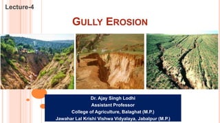
- 1. GULLY EROSION Lecture-4 Dr. Ajay Singh Lodhi Assistant Professor College of Agriculture, Balaghat (M.P.) Jawahar Lal Krishi Vishwa Vidyalaya, Jabalpur (M.P.)
- 2. GULLY EROSION Gully erosion is the advance stage of channel or rill erosion in which the size of rills is so enlarged which cannot be smoothened by ordinary tillage implements. The process of gully formation depends mainly on following factors :- Resistance offered by top soil and underlying hard layer. Rainfall characteristics, which favour to increase the volume of runoff cover the land surface. Vegetative cover on the soil surface Topography of the area including land slope. Causes of gully erosion :- Creating the land surface without vegetation Adoption of faulty tillage practices Overgrazing and other forms of biotic pressure on the vegetative cover existing on the land surface. Not smoothening of rills, channels or depressions on the channel surface. Improper construction of water channels, roads, soil lines, cattle trails etc.
- 3. DEVELOPMENT OF GULLIES The main processes in the development of gullies are waterfall erosion and channel erosion. These two erosions are commonly found in the same gully. The extension of the gully head is usually by waterfall erosion; while the scouring of bottom and sides which enlarges the depth and width of gullies is by channel erosion. Gullies usually start with channel erosion. These processes of gully erosion are given as : Scouring of soil particles from the bottom and sides of the gully by flowing water plus abrasive materials as hard particles or debris carried by the water. Water fall erosion at gully head which resulted the cutting of gully bank and there by extending of gully into non gullied land. Sliding or mass development of the soil from gully bank due to seepage, alternate freezing and thawing undercutting by flow.
- 4. STAGES OF GULLY DEVELOPMENT Stage -1:- During this stage the channel erosion and deepening of the gully bed take place. This stage normally proceeds slowly, where the top soil is fairly resistant to erosion. Stage 1 is basically the initial stage or formation Stage. Stage -2 :- This stage is known as development stage in which due to runoff flow up stream portion of the gully head, size of the gully i.e. width and depth is enlarged. The depth of gully reaches upto ‘C’ horizon’ and the weak percent materials are rapidly washed away. A waterfall often starts when flow plunges from upstream segment to the eroded channel, below. Stage -3 :- This is healing stage, in which vegetation are started to grow in channel. During this stage, there is no appreciable erosion in any form, from the gully erosion. Stage -4 :- This is stabilization stage and also last stage of gully development, in which the gully has been fully established. No further change to develop the gully, unless healing process is distributed. The channel secured a stable gradient and gully walls gain a stable slope. The vegetation begins to grow in abundance to cover the soil surface and also develop a new top soil.
- 5. CLASSIFICATION OF GULLIES Classification of Gully Based on shape (cross - section) of the gully Based on state of the gully Based on dimensions of the gully Based on shape of the gully :- U-Shaped: These are formed where both the topsoil and subsoil have the same resistance against erosion. Because the subsoil is eroded as easily as the topsoil, nearly vertical walls are developed on each side of the gully. V-Shaped Gully:- This type of gullies are basically found in the alluvial plains where the surface and sub-surface soils are easily erodible. In this case as resistance to erosion increases with depth, the width of cut decrease accordingly and thus resulted into development of V-shaped gully. V- shaped gullies are common in hill regions, where land surface is accompanied with steel slope. At steep face flow velocity is high but flow volume in less causing the development of V-gullies.
- 6. CLASSIFICATION OF GULLIES U –shaped gullies have following main characteristics: U-shaped gullies are recognized by their U-shaped cross-section. Longitudinal slope of gully bottom is usually parallel to the land slope through which gully passes. Developed in the land with low slopes almost approaching zero. The runoff contributing catchment area is large causing the discharge passing through these gully is large. The velocity of flow relatively less than in the V-shape gullies The runoff enters the gully from the head (upper end) and from the water flows over the vertical wall in cascade and drop into the flat bottom, forming a deep pool. U-shaped gullies are formed by undercutting and collapse of bank. U-shaped gullies are continued to grow, head ward. The lateral spacing of these gullies is large. Active erosion from these gullies is form sidewalls and headwall is a result of undercutting at the base of vertical cut. The gullies do not grow deeper but becomes wider and lengthened head ward. Permanent drop structures are used to raise the bottom of such gullies.
- 7. CLASSIFICATION OF GULLIES V –shaped gullies have following main characteristics: These are recognized by V-shaped cross-section. Generally appear on slopping fields. Longitudinal gradient of channel is greater than the land slope. The erosion from these gullies is in the form of downward cutting at the centre of gully, causing them to make deeper and to grow backward i.e. up the slope. Catchment area contributing the runoff is small. Lateral spacing between these gullies is small. Amount of discharge, passing through these gullies is small but with greater velocity. The V-gullies make the contour cultivation difficult. V-shaped gullies often develop from rill erosion, when water is concentrated flow several rills into one. The check dams are used to control V-shaped gullies, most commonly, semi permeable check dams are preferred.
- 8. CLASSIFICATION OF GULLIES Based on state of the gully :- Active gullies:- Active gullies are those whose dimensions are enlarged with time. The size enlargement is based on the soil characteristics, land use and volume of runoff passing through the gully. These gullies found in plain area are active in nature. Inactive gullies:- Inactive gullies are these whose dimensions are constant with time. The gullies found in rocky areas are inactive because rocks are very tough to erosion by runoff flow. Based on dimensions of gully :- Small gullies Medium gullies Large gullies
- 9. CLASSIFICATION OF GULLIES Small Gully :- Small gullies are these which can be easily crossed by farm implements and can also be removed by ploughing and smoothing operations and by stabilizing the vegetation. Medium Gully :- Medium gullies are those that cannot be easily crossed by farm implements. They can be controlled by terracing or ploughing operations. In medium gullies, the sides are established by creating vegetative growth on them. Large Gully:- Large gullies are those which have gone beyond their reclaimable stage and where for reclamations, the cropping system or meadow is freely adopted. for controlling such gullies tree planting is done as an effective method.
- 10. CLASSIFICATION OF GULLIES Very small gullies (G1) – Up to 3 m deep and bed width not greater than 18m, side slope varies Small gullies (G2) – Up to 3 m deep, bed width greater than 18m, side slope varies Medium gullies (G3) - Depth range between 3 to 9m, bed width not less than 18 m, side are uniformly slopping between 8% to 15 % Deep and Narrow gullies (G4) - (a) 3 to 9 m deep, bed width less than 18m side slope varies (b) Depth greater than 9m, bed width varies, side slope varies, mostly steep or vertical.
- 11. Thank You