
Recommended
More Related Content
What's hot
What's hot (20)
Similar to Week-2: Basics of Groundwater,
Similar to Week-2: Basics of Groundwater, (20)
More from Suyog Khose
More from Suyog Khose (20)
Recently uploaded
Recently uploaded (20)
Week-2: Basics of Groundwater,
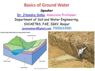
- 1. 1 Basics of Ground Water Speaker Dr. Jitendra Sinha, Associate Professor Department of Soil and Water Engineering, SVCAETRS, FAE, IGKV, Raipur jsvenusmars@gmail.com, 7000633581
- 2. • Groundwater, water that occurs below the surface of Earth, where it occupies all or part of the void spaces in soils or geologic strata. ... It is also called subsurface water to distinguish it from surface water, which is found in large bodies like the oceans or lakes or which flows overland in streams. • Groundwater is the water found underground in the cracks and spaces in soil, sand and rock. It is stored in and moves slowly through geologic formations of soil, sand and rocks called aquifers. 2
- 3. • Groundwater is water that exists underground in saturated zones beneath the land surface. The upper surface of the saturated zone is called the water table. ... It fills the pores and fractures in underground materials such as sand, gravel, and other rock, much the same way that water fills a sponge. • Groundwater, which is in aquifers below the surface of the Earth, is one of the Nation's most important natural resources. ... It often takes more work and costs more to access groundwater as opposed to surface water, but where there is little water on the land surface, groundwater can supply the water needs of people. 3
- 4. • Generally, both ground water and surface water can provide safe drinking water, as long as the sources are not polluted and the water is sufficiently treated. ... Through wells, ground water can be tapped where it is need, whereas surface waters are concentrated in lakes and streams. • Groundwater can be found in aquifers. An aquifer is a body of water-saturated sediment or rock in which water can move readily. There are two main types of aquifers: unconfined and confined. An unconfined aquifer is a partially or fully filled aquifer that is exposed to the surface of the land. 4
- 5. • Ground water can be obtained by drilling or digging wells. A well is usually a pipe in the ground that fills with ground water. This water can then be brought to the land surface by a pump. Shallow wells may go dry if the water table falls below the bottom of the well, as illustrated at right. • In fact, there is a over a thousand times more water in the ground than is in all the world's rivers and lakes. Some water underlies the Earth's surface almost everywhere, beneath hills, mountains, plains, and deserts. ... Groundwater is a part of the natural water cycle 5
- 6. • How do I find my water table? • The most reliable method of obtaining the depth to the water table at any given time is to measure the water level in a shallow well with a tape. If no wells are available, surface geophysical methods can sometimes be used, depending on surface accessibility for placing electric or acoustic probes. • What is the benefit of groundwater recharge? • Groundwater recharge can act as a barrier to seawater intrusion in coastal basins and to the migration of contaminants. Other potential benefits include improving flows in rivers and streams, flood control, and wildlife and bird habitat. 6
- 7. 4 Types Of Water • Surface Water. Surface waters include streams, rivers, lakes, reservoirs, and wetlands. ... • Ground Water. Groundwater, which makes up around 22% of the water we use, is the water beneath the earth's surface filling cracks and other openings in beds of rock and sand. ... • Wastewater • Stormwater Then we have: Blue water, Green water, Grey water, Black water Any idea? 7
- 9. Occurrence of ground water in alluvial formation
- 10. Occurrence of ground water in hard rock formation 9/8/2020
- 15. 15 Source: Water Wells and Pumps, Michael and Khepar
- 16. Per capita water availability reducing Year Water Availability (cu.m.)/pp/yr 1951 5177 2001 1820 2025 1341 Falkenmark Water Stress Indicator water stress areas < 1700 Cu.m./pp/yr Many parts of India is under water stress in whole of the year or in some parts of the year
- 17. Pattern of water use Agriculture ~92% (50% from GW) Domestic ~ 5% (>85% rural and >50% urban from GW) Industry ~3% (>50% from GW ) Different sources of Irrigation 39% 13% 48% Major & Medium Irrigation Minor(S urface Water) Minor(Ground Water)
- 18. Groundwater Reservoirs / Water Bearing Formations Aquifer, Aquiclude, Aquitard and Aquifuge Aquifers 1. Unconfined Aquifers / WT aquifer 2. Confined Aquifers (Artesian Aquifers / Pressure Aquifers / Flowing Aquifers) 3. Semi-confined aquifers (Leaky confined aquifers) 4. Perched aquifer 5. Semi-unconfined aquifers 6. Aquifers bounded by recharge boundaries 7. Aquifers bounded by barrier boundaries 8. Idealized aquifers 18
- 19. Idealized aquifers- homogeneous, isotropic and infinite in areal extension Interstices and Porosity Void ratio Specific yield (Sy) Specific retention (Sr) Four parameters for an aquifer Coefficient of Permeability or Hydraulic Conductivity K Transmissivity or Coefficient of Transmissivity T Storativity / Coefficient of storage S Drainage factor D or B Some characters for confined beds Hydraulic resistance, C Leakage coefficient or Leakance, L Leakage factor B Hydraulic Diffusivity (D) 19
- 20. • Ground Water: Sources of groundwater Meteoric Water – It is the water derived from precipitation (rain and snow) although bulk of the rain water or melt water from snow and ice reaches the sea through the surface flows or runoffs a considerable part of precipitation gradually infiltrates into ground water. This infiltrated water continue its downward journey till it reaches the zone of saturation to become the ground water in the aquifer. • Almost entire water obtained from ground water supplies belongs to this category. • Ground Water Connote Water • This is the water present in the rocks right from the time of their deposition in an aqueous environment. During the process of formation of sedimentary rock in a lake or sea or river, depositions is followed by compaction, which leads to the squeezing out of most of the water present between the sediments. Sometimes however, incomplete compaction may cause retention of some water by these rocks which is known as connote water. And it may be found in rocks like limestone, sandstone and gravels. It is saline in nature and is of no importance as a source for exploitable groundwater. 20
- 21. • Ground Water Juvenile Water • It is also called magmatic water and is of only theoretical importance as far as water supply scheme is concerned. It is the water found in the cracks or crevices or porous of rocks due to condensation of steam emanating from hot molten masses or magmas existing below the surface of the earth. Some hot springs and geysers are clearly derived from juvenile water. 21
- 22. • Ground Water Distribution: The water that goes below the surface of the land may be found to exist in two main zones or environments classified as Vadose Water and phreatic water or groundwater • In the vadose water zone itself, three different types of environment are distinguished; soil water, intermediate vadose water and capillary water. • The soil water forms a thin layer confined to the near surface depth of the land. It may occur at depth between 1.0 to 9 m and is held up by the root zone of vegetable cover of the globe It is lost to the atmosphere by transpiration and evaporation. • The intermediate vadose zone occurs immediately below the zone of soil water. It is in fact a zone of non saturation; water in this zone is moving downward under the influence of gravity. It is generally of smaller thickness and may be even absent in many cases. The above zones are sometimes collectively referred as zone of aeration. 22
- 23. • The zone of capillary water, also called as capillary fringe., is present only in soil and rocks of fine particles size underlying the vadose zone. In the fine particle size zone, groundwater is drawn upward by capillary action, sometimes to height of 2-3 m above saturated zone lying underneath. Growth of vegetation in some desert is very often dependent on presence of capillary fringe. • Ground Water The Phreatic Water Zone, also known as zone of saturation lies below the capillary fringe and is the water held in this zone that is called groundwater in the real sense. The upper surface of water in the zone marks the water table in the area. In this zone the layers or bodies of rocks which are porous and permeable, have all their open spaces such as pores, cavities, cracks etc. completely filled with water. All these openings are interconnected, so that a well dug into this openings are completely filled with water, there is no or very little downward movement of groundwater. In all ground water exploration programmes, the main objective is to locate this zone and determine its extent, geometry and character. • Forms of Subsurface Water • Water in the soil mantle is called subsurface water and is considered in two zones • Saturated Zone • Aeration Zone.23
- 24. • Saturated Zone • This Zone is also known as groundwater zone in which all the pores of the soil are filled with water. The water table forms the upper limit and marks a free surface, i.e. a surface having atmospheric pressure. • Zone of Aeration • In this zone the soil pores are only partially saturated with water. The spaces between the land surface and the water table marks the extent of this zone. The zone of aeration has three subzones. • Soil water zone • This lies close to the ground surface in the major band of the vegetation from which the water is lost to the atmosphere by evapotranspiration. Capillary Fringe • In this the water is held by the capillary action. This zone extends from water table upwards to the limit of the capillary rise. Intermediate Zone • This lies between the soil water zone and the capillary fringe. The soil texture and moisture content and vary from region to region. The soil moisture in the zone of aeration is of importance in agricultural practices and irrigation engineering. • Saturated Formations • All earth materials from soils to rocks have pore spaces. Although these pores are completely saturated with water table below, from the groundwater utilization aspect only such material through which water moves easily and hence can be extracted with ease are significant. • On this basis the saturated formation are classified into four categories. • Aquifer • Aqitard • Aquiclude • Aquifuge 24
- 25. 25
- 26. 26
- 27. 27 Aquifer An aquifer is a geological unit that is saturated and permeable enough to yield sufficient amount of water to wells. Aquitard Aquitard is a geological unit of low permeability that can store groundwater and also transmit it slowly from one aquifer to another. Aquiclude Aquiclude is an impermeable geological unit that does not transmit any water at all. Aquifuge The term Aquifuge is sometimes used synonymously with Aquiclude. However, there is a minor difference that the Aquiclude may have some water storage whereas Aquifuge may not.
- 28. 28 Unconfined aquifers Dewatering . This results in significant volumes of water being released from storage per unit volume of earth material in the cone of depression. Confined aquifers No Dewatering Pumping causes a decrease in head and an accompanying decrease in water pressure in the aquifer within the cone of depression. This decrease in water pressure allows the water to expand slightly and causes a slight relaxation of the solid skeleton The volume of water released from storage per unit volume of earth material in the cone of depression in a confined aquifer is small Release of water from confined and unconfined aquifers
- 29. 29 Isotropic and Anisotropic The Isotropy means that parameters does not vary with direction. Anisotropy indicates that the parameters vary with respect to direction. The parameter mostly we consider is Hydraulic Conductivity. The directions we consider normally are the Directions of Coordinate axes viz. X, Y, Z
- 30. 30 Homogeneous and Heterogeneous The Homogeneity means that the parameters do not vary with respect to location. On the contrary, The Heterogeneity means that the parameters do vary with respect to location. The parameter mostly we consider is Hydraulic Conductivity.
- 31. 31 Steady State & Unsteady State Flow Steady State Flow: Theoretically the inflows into the system are equal to the outflows from the system. Hence There will not be any change in head over time. Unsteady State or Transient Flow Theoretically the inflows into the system are not equal to the outflows from the system. Hence This will be reflected as change in head over time. :
- 32. •Rainfall •Runoff •Interflow •Infiltration •Percolation •Soil water zone •Zone of aeration •Capillary fringe •Water table Recharge is defined as the downward flow of water reaching the water table forming an addition to the ground water reservoir. Recharge Processes
- 33. Recharge Worthy Area Hilly areas with slope >20 % are to be demarcated as areas not suitable for recharge.
- 34. • Water in storage is the volume, that underlies a given area of land surface. • It represents the volume of water that could be recovered if that area of aquifer were pumped dry. Water in Storage
- 35. Ground Water Resources Ground Water Resources Static Resource Dynamic Resource Amount of groundwater available in the permeable portion of the aquifer below the zone of water level fluctuation. Amount of groundwater available in the zone of water level fluctuation.
- 36. Static and Dynamic GW Resources Static Resource Dynamic Resource Fluctuation of Water Table
- 37. Unsaturated zone Saturated zone Rainfall Evapotranspiration Pumping Baseflow River/Stream Infiltration Water Table Changes in ground water reserve involves RECHARGE: DISCHARGE: Rainfall Evapotranspiration Recharge from Rivers/Canals Pumping Recharge from ponds Baseflow Recharge from irrigation fields Dynamics of Ground Water Reservoir
- 38. Basic Equation Inflow-Outflow=Change in Storage Dynamic Resource Static Resorce Seepage from canals Return flow from Irrigation Seepage from tanks and ponds Draft for Irrigation Draft for domestic and industrial use Natural Losses Rainfall Ground Water Resource Estimation Using GEC’97 Methodology
- 39. Inflow Components Rainfall Recharge Recharge From canals Recharge From Surface Water Irrigation Recharge From Ground Water Irrigation Recharge From Tanks & Ponds Recharge From Water Conservation Structures Ground Water Resource Estimation Using GEC’97 Methodology
- 40. Outflow Components Gross Draft Ground Water Resource Estimation Using GEC’97 Methodology
- 41. Draft can be of three types 1. Domestic draft 2. Irrigation draft 3. Industrial draft Estimation Of Ground Water Draft
- 42. Domestic Draft Well Census Method No of different types of abstraction structures Unit draft Requirement Method Population census Per-capita requirement Estimation Of Ground Water Draft
- 43. Irrigation Draft Well Census Method No. of different types of abstraction structures Unit draft Cropping Pattern Method Cropping pattern Crop water requirement Power Consumption Method Total power consumed Unit power required for unit water lift Estimation Of Ground Water Draft
- 44. Industrial Draft Well Census Method No. of different types of abstraction structures Unit draft Power Consumption Method Total power consumed Unit power required for unit water lift Estimation Of Ground Water Draft
- 45. Water Well • It is a shaft or hole, usually vertical, excavated in earth for bringing ground water to the surface. 45
- 46. The objective of well • To provide good quality water, • To provide a sufficient quantity of water, • To provide water for a long time, and • To provide water at low cost 46
- 47. The water wells sites are taken in a) The point at which aquifer having high potential to provide sufficient quantity of water to well b) Around 50 m away from contamination sites, c) Choose an area that is not prone to flooding d) An appropriate distance from another production wells 47
- 48. Abstraction structures Open dug well – small diameter Open well & large diameter irrigation well Tube well Filter point well Bore well Surangam / Tunnel well Auto flow well / Artesian well / Free Flow Well48
- 49. Surangam 49
- 50. How water is tapped through water-wells? 1. Drilling Operation 2. Lowering of Assembly & Fitting of Pump 3. Development & Utilization of well Water saturated zone 50
- 51. Sources of fresh water on Earth GROUNDWATER
- 52. GROUNDWATER water in pores between sediments water in fractures, faults, cracks water in larger openings like vugs or caves
- 53. GROUNDWATER high porosity --well sorted low porosity--- poorly sorted high porosity-- small platy sediments—well sorted most sandstones most conglomerates— filling of openings mudstones and shales low porosity—igneous and metamorphic rocks
- 54. GROUNDWATER high permeability—most sandy materials--sandstones high permeability—well connected cracks low permeability—mudstones- shales low permeability--pumice
- 55. GROUNDWATER • specific yield – the percent water obtained from a substance • specific retention – the percent water retained by a substance after water extraction – an example of a non rock substance displaying specific yield and retention would be a sponge in which after squeezing out all water there still remains some water
- 56. GROUNDWATER Unconfined water free to move up, but not down aquitard--aquiclude
- 59. Groundwater zones GROUNDWATER Vadose or Aeration zone Capillary Fringe Area Water Table
- 60. GROUNDWATER vadose (aeration) zone--unsaturated zone of saturation water table
- 61. GROUNDWATER• changing levels of water table – lowering (discharge) of water table takes place if the following usage is greater than replenishment to zone of saturation » continued pumping of groundwater » plant usage » leaking of water at the Earth’s surface into streams and lakes – rising (recharge) of water table » rate of replenishment (primarily by infiltration) is greater than rate of depletion » a spring is a natural surface emission of groundwater-- streams can form this way and many streams in the Ozarks are spring-fed--a hot spring is about 10-15 degrees F warmer than local annual mean air temperature because of an association of water with subsurface igneous intrusion
- 62. Mammoth Hot Springs in Yellowstone National Park GROUNDWATER
- 63. Old Faithful Geyser in Yellowstone National Park A geyser is a hot spring which ejects steam and water at the surface with great force and in some cases at a consistent interval (see example below)
- 64. GROUNDWATER • interrelationship of groundwater and streams – in some cases streams can directly supply groundwater and vice versa » an effluent (gaining) stream is supplied by groundwater and abundant in humid climates— a type of spring
- 65. GROUNDWATER» an influent (losing) stream supplies water to the zone of saturation and is characteristic for arid climates— not a spring
- 66. GROUNDWATER a spring forming a river or lake a spring gushing out from cracks More Kinds of Springs
- 67. GROUNDWATER springs from limestone aquifers springs from faults or fractures etc. spring from water forced up encountering a less or non permeable rock
- 68. A spring related to a perched water table (this arises when there is groundwater in the zone of aeration above the main or regional water table)
- 69. GROUNDWATER• pumping of groundwater – heavy pumping can cause a cone of depression of the water from drawdown and may leave many shallower wells dry at the surface
- 71. GROUNDWATER Most caves form below the water table, these formed above the water table
- 72. GROUNDWATER – Surface features • Karst topography is a pitted looking Earth surface resulting from subsurface solution action and include sinkholes and solution valleys--enormous sinkholes are an example of mass wasting
- 73. GROUNDWATER– Saltwater encroachment and pollution of groundwater • pumping effects or mixing of groundwater and saltwater near ocean areas can cause undesirable effects or pumping too much water can cause the rising of salt water
- 74. GROUNDWATER– Septic tank leaks • Sequiota Springs in Springfield is a good example of this
- 75. Another example of septic tank leakage
- 76. What is the water table? Zone of aeration- Pore spaces contain mostly air Zone of saturation-pore spaces contain mostly water WATER TABLE- TOP OF THE ZONE OF SATURATION
- 77. OBJECTIVE OF GW MONITORING The main objectives of the GW regime monitoring are ; • To obtain the information on GW quantity & quality data through representative observation wells • To record the response of GW systems to a natural/artificial recharge and output.
- 78. The Monitoring Cycle Definition of information needed Design monitoring program Data collection Data storage and interpretation
- 79. Types of data for Groundwater Management DATA TYPE BASELINE DATA (from archives) TIME-VARIANT DATA (from field stations) Groundwater Occurrence & Aquifer Properties hydrogeologic logs, grdwater levels, quality, etc. pumping tests grdwater level monitoring grdwater quality monitoring Groundwater use water well pump installations Water use inventories Population registers & forecasts Irrigation energy consumption water well abstraction monitoring (direct/indirect) grdwater level variations Supporting Information climatic data land-use inventories geologic maps/sections riverflow gauging meteorologic observations satellite land-use
- 80. Organizations involved • CGWB • State Ground Water Board • Agricultural Department • Irrigation Department • R & D Organization
- 81. 81
- 82. 82
- 83. 83
- 84. 84
- 85. 85
- 86. 86
- 87. REFERENCES 1. Water Wells and Pumps: AM Michael & Khepar 2. courses.missouristate.edu › creative › PPTglg110 › gro... 3. Watershed Hydrology, R. Suresh, Standard Publisher Distributor
- 89. 89 ? THANK YOU