
Recommended
Recommended
More Related Content
What's hot
What's hot (20)
Similar to Restoration Techniques on the Rio Mora National Wildlife Refuge and Surrounding Area
Similar to Restoration Techniques on the Rio Mora National Wildlife Refuge and Surrounding Area (20)
Recently uploaded
Recently uploaded (20)
Restoration Techniques on the Rio Mora National Wildlife Refuge and Surrounding Area
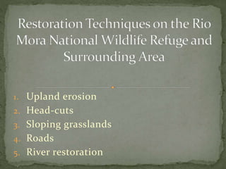
- 1. 1. Upland erosion 2. Head-cuts 3. Sloping grasslands 4. Roads 5. River restoration
- 2. U.S. Fish and Wildlife Service owns the land which was donated to them by Eugene and Clare Thaw Pueblo of Pojoaque own the bison that are on the Rio Mora National Wildlife refuge New Mexico Highlands University is active in education, restoration, and research.
- 3. We are not like other Refuges. We do not exclusively work inside our borders. We want conservation science serving as models that can be exported to other areas. We have about 125,000 Ha. of neighbors who partner with us at some level.
- 4. There is a surrounding conservation area of 400,000 Ha in the watershed and Rio Mora National Wildlife Refuge is the central part of that conservation area. Richard Pritzlaff is donating his ranch which will add 1,200 Ha to Rio Mora NWR. The Pritzlaff Ranch is mostly ponderosa pine and is in the headwaters.
- 8. The trees in this picture are a drainage leading to the river. The drainage holds moisture and potential for restoration. Restoration is based on “reading the landscape.”
- 9. 1. Conservation and Restoration 2. Research for Students 3. Expose Youth to Nature 4. Cooperation with neighbors, tribes, NGOs, and Agencies
- 10. To engage in scientific programs that make a meaningful contribution to the conservation of biodiversity, ecosystem-function, and landscape permeability in the southwestern U.S.
- 11. Restoration is designed to reverse the adverse effects of erosion and regenerate soil so that it increases the soil’s capacity to hold water, supports more vegetation, and thus stores carbon taken from the atmosphere. Throughout the West, ecosystems have been severely degraded by unmanaged human uses. Restoration improves resiliency in the face of disturbance and changing climate conditions
- 12. Restoration works to restore ecological function to the river and riparian areas that are so important to wildlife. Landscape restoration works to restore key species in number and distribution so that those species can resume their role in driving ecological and evolutionary function.
- 13. All restoration methods that we use were developed by Bill Zeedyk (see bibliography at the end). We give a short synopsis here, so please refer to his original writing for full detail and full effectiveness.
- 14. Controlling upland erosion is a key to nearly all restoration efforts on the Refuge. Upland erosion degrades soils, reduces plant diversity, reduces plant densities and cover, lowers the water table, and increases sediment in the river. Erosion happens when there is not enough soil cover to protect surface from the sheer force of flowing water.
- 15. To return life to the land, soils must recover the ability to hold water. Slowing the flow of water allows it to soften the ground and increases the amount of infiltration into the soil. Water stored in the soil is less vulnerable to evaporation, it flows slowly downhill to feed seeps, wetlands, and springs, and creates riparian habitat— one of the valuable habitats in the Southwest
- 16. Soil moisture boosts micro-organisms, such as mycelium, that help transport water to plant roots. Restoring plants to a degraded area slows air movement, provides shade, reduces evaporation, stores carbon, slows water flow, holds soil in place, and the ground litter from plants adds organic content. This structural change provides habitat for a host of vertebrates and invertebrates.
- 17. The Rio Mora Refuge built over 400 one-rock restoration dams in arroyos to slow water and reverse the effects of erosion. The structure is called a one- rock restoration dam because it is only one rock high. Importantly, the dams do not stop water, they slow the flow. The rocks act as mulch and vegetation springs from sediment captured between rocks. This binds the structure more firmly and cools the microclimate.
- 18. The rocks should not be taller than 1/3 bank-full depth of the channel, and the rocks should be placed in several parallel rows from the upstream to downstream edge; the top of the structure should be level from upstream to downstream edge. It is important to have a rock footer at the downstream edge of the rock structure. Without a footer, water will spill over onto dirt and undercut the rock structure causing it to collapse. Slide 25 has no footer, but that is because it is built on bedrock.
- 19. The rocks are not stacked on top of each other. To withstand flow pressure, the distance of the one- rock structure from the upstream to downstream edge should be at least 1/3 the width of the arroyo at bank-full. If the arroyo is 3 meters wide, then the upstream to downstream distance of the parallel rows of rock in the one-rock restoration structure should be 1 meter. Alternatively, it can be 5 rows of rocks front to back.
- 20. The structures trap sediment to raise the floor of the arroyo, slow the erosive effect of the water, and allow water to flow over the top of the structure. Structures must extend far enough from bank to bank that flow does not push around the edge and cut a new channel. Below there are two different rock structures: Loma Parda Canyon shows rocks sitting flat. Silva Canyon has them stacked upright like books on a shelf.
- 28. When structures have collected enough sediment to raise the bed equal to the height of the one-rock restoration structure, one can build a second layer. The last two photos of Silva canyon are after two layers. The second layer should be staggered so that the downstream edge is half-way back on the first structure. That provides a rock base for water flowing over the top of the second structure. The rock base to catch water flowing over the structure prevents the water from undercutting the structure and collapsing the structure.
- 31. You need to clip the branches facing the arroyo bottom so that the trunk lies flat. Logs should be about 10 meters long and 6 to 8 inches thick if water moves quickly. You can use a bend to hold the logs. If the butt of the log is at the top of the bend, and the log is longer than the curve, they will hold during the flow.
- 32. -Photo points for visual change -Measuring soil moisture -Changes in geomorphology in the channel -Vegetation density and diversity -Measuring changes in fauna (camera traps, etc.)
- 33. Juniper and piñon compete with grass for water. When they move from the rocky slopes onto grassland they change grassland into savanna. Millions of acres of grasslands have been lost in this conversion. Bison played a role in keeping grasslands in grass.
- 35. Head-cuts are dry waterfalls at the start (head) of an arroyo or they can also be found in an abrupt change in the slope of the arroyo floor. They are characterized by a crumbling lip at the point of the falls, a pool at the base of the falls, dehydration of soil, and undercutting.
- 36. Head-cuts lengthen the arroyo by migrating up- flow. When water flows over the drop, it splashes both forward in the arroyo and back against the drop. The splash-back of water erodes the wall. This erosion of the drop exposes plant roots and kills plants. Without plants, the next rain erodes the lip. They deepen the arroyo by accelerating the flow and thus the erosive effects. The higher the falls, the more power there is to feed erosion. Doubling the velocity cubes the erosive power
- 37. To heal head-cuts, the direct drop (dry waterfall) is reduced to at least 3:1 or 4:1 slope. In the next photo, a 1-meter drop was changed into a gentle slope of about 5:1 and the slope is lined with flat rocks. The base of the rock run-down is covered with baseball sized rocks. The base of the slope must be hardened to protect it from erosion. After slowing on the baseball-sized rocks, the water is released by a concave media-luna (concave line of rocks at the bottom), which disperses water over a wide area. The rock run-down is like mulch by cooling and holding moisture for plants.
- 40. Another technique is called a Zuni Bowl, which was developed by the Zuni Pueblo. That turns a large drop into a series of smaller cascades . This create a pool that wildlife can use. The pool slows the sheer force of the water at the bottom of the cascade.
- 42. Sloping grasslands are often alluvial fans The depositions of soils makes alluvial fans some of the richest parts of grasslands. Dense vegetation slows the flow of water and spreads the flow across these sloping grasslands allowing the moisture to be absorbed into the soil (each blade of grass is like a dam that holds sediment-don’t overgraze during rainy season). The sheet-flow of water going downhill on the sloping grassland is spread naturally across the slope by vegetation. That is why alluvial fans are triangular in shape and advance upslope.
- 44. These old, abandoned roads were used to take equipment to the fields. They capture water that would normally disperse widely across an alluvial fan or other kind of slope; that dispersed water was very important to high productivity in the grasslands. The old road on the left ran down the slope. It pulls water into the arroyo and away from the surrounding grasses. The road on the right cuts across the sloping grassland. It captures water and carries it away. Notice how dense and tall grasses are upslope of the road compared to the grass downslope of the road.
- 45. The captured water is concentrated in the old road and that accelerates down-cutting from erosion. This prevents the spread of water in a natural manner across the grassland. As the channel cuts more deeply, the water table is lowered. When the water table lowers, it loses capacity to wick out under the surrounding grass. The effects also lower the capacity of the soil to hold water. Climate change will heighten the problem.
- 46. Plug and spread design To get water out of abandoned road and onto the grassland
- 47. The “plug” is placed in the incised channel in a location and way that will maximally re-wet the largest amount of grassland. The earthen plug is built in layers of 3 to 6 inches and compacted after each layer. The plug will be equal to the height of the bank, with a “freeboard” that extends above the height of the gully to capture and divert water during a flood.
- 48. Dirt for the plug is taken from the downhill side of the slope at the location of the plug. This forms a bay to direct water out of the arroyo formed by the old road and onto the grasslands. To maximize flow onto the grasslands, the bay should be wide and shallow instead of narrow and deep. You need a rock lip to direct water onto the grassland, preventing the water from flowing back into the arroyo below the plug (see next photo).
- 50. By returning water to its natural dispersed flow across the slope, it will reduce the amount of bare ground and increase density and productivity of grasses. Wetland vegetation, such as Carex spp., will stabilize the plug and bay.
- 52. Again, notice in the above photo that the grass upslope from the road is robust while the grass downslope of the road is sparse. The road deprives some areas of moisture while channeling it to a place where the release concentrates the water to a small area. Done wisely this can harvest water for the grassland. Done poorly it causes erosion and sedimentation.
- 53. Non-natural sedimentation from roads causes water pollution and turbidity. Road run-off is a major source of non-point pollution. Unfortunately roads are often built in valley bottoms near rivers. Another problem when roads are near channels is that flooding can result in the road capturing the flow, taking it out of the natural channel.
- 54. Roads are usually designed by engineers with the idea that water on the road is a nuisance and should be removed as quickly as possible. The ecological value of water is not considered. Culverts and ditches designed to get water off the road quickly usually don’t consider how much concentrated flow and accelerated velocity can increase erosion and sedimentation. Double the rate of flow and cube the erosive power
- 55. On the other hand, roads can be constructed and managed to improve vegetation cover, increase productivity of grasses, and reduce erosion. A hectare of impermeable road surface (approximately 5 meters wide and 2 km long) can yield 60,000 gallons of water from a 2.5 cm of rainfall. This is water that can be used to irrigate grassland vegetation—water that would have flowed down the roadway to the nearest gully otherwise.
- 56. If the road cuts across a gentle slope, one can try to keep the road equal to the natural slope so that water can flow across the road uninhibited. Even a crown in the road can divert this natural flow. If the road is dirt, tire tracks cutting into the road can also capture and divert the flow. If there is a berm beside the road, it must be removed.
- 57. You can use culverts, particularly if the road slopes into the cut bank instead of out- sloping, but they need to be cleaned to prevent clogging. The pipe must be large enough in diameter to carry the run-off and have a cross-slope of 2%. You should put rock at the outlet to prevent gully formation.
- 58. Roads that go up a slope may be drained by lead- out ditches. Lead out ditches take water away from the road at about a 300 angle to place water back on the grassland. A water bar will divert the water running down the ranch road into the lead-out ditch. The bar should not be perpendicular to the road. In that case it will catch sediment and render the bar ineffective. The berm should be angled at about 300, 15 to 30 cm high, and wide enough to allow easy vehicle clearance.
- 59. The best method of harvesting water from a ranch road is by rolling dips. These rolling dips are most effective with a grade of 3% to 15% and a cross section slope of 5%. The dips collect run-off from the road and direct it onto the grassland. The velocity of the flow has to be great enough to prevent puddles and to keep sediment moving through the drain. The lead-out ditch should be wide, at a 30o angle, and slope downward at 4 to 6%.
- 61. A rolling dip outline: length of dip should be 10 to 13 meters and so should the following rise. The slope between dip and rise should be 2 to 4%
- 62. A river that is disconnected from its floodplain is a river that has lost ecological function. This river is incised and disconnected.
- 63. Natural rivers have functional floodplains. Floodplains are vegetated areas that begin at the edge of the river at bank-full. They spread water during flood events. A flood significant enough to extend out of bank-full and onto the floodplain happens nearly every other year. A natural river has the river height at bank-full equal to the height of the floodplain. When flood waters spread across the floodplain, it spreads the energy of the river. By dissipating energy and having vegetation slow the flow, floodplains reduce erosion of the bank and bed of a flooding river.
- 64. Flooding over bank-full deposits rich sediments onto the floodplain, recharges water tables, creates diverse habitats, and sustains communities of plants and animals. Unfortunately, rivers have been altered by straightening, dredging, erosion, dams, sedimentation, pollution, agriculture, lowered water tables, separation from their floodplains, removing trees and willows from the riparian areas, and elimination, or drastic reduction, of key species that shape ecological processes (e.g. beavers).
- 65. When rivers are straightened or disturbed, they become incised and after incision, they can no longer flow onto the floodplain. When the floor of the river cuts down, it increases the force of floods down-stream, erodes banks, lowers the water table, and reduces wildlife habitat. The floor of the river stops undulating and flattens, which destroys fish habitat.
- 66. Rivers naturally meander from side to side. This reduces the velocity of flow, reduces down-river flooding, reduces sediment transport, allows more connection between the river and groundwater, and it increases the length of the river. Meandering is seen in rivers and streams of all sizes and all around the world. It is central to function. In addition to side to side meanders, the floor of the river also undulates with a pool, glide, riffle, and run series in coordination with the meanders sequence.
- 67. A typical meander pattern of a river with undulating river floor.
- 68. A one Km stretch of the Mora River on the Refuge had been straightened long ago for agriculture. That stretch is the most incised part of river on the Refuge. The river there has cut-down at least 6 feet from its historic floodplain. It would take a 100-year flood to leave its steep banks.
- 69. We are restoring that section of the river with the Induced Meandering techniques of Bill Zeedyk. Induced Meandering relies on geology, hydrology, biology, and ecology to understand and use the river’s own processes and rules. The river’s force is to be respected, not coerced. Work within nature and not on top of nature.
- 70. Induced Meandering uses natural materials gathered at the site (rocks in our case) to help water flows recreate a meandering channel. Structures include vanes and baffles to deflect water into the incised walls to help create a meander; cross-vanes prevent further incision of the river-bed. The next two photos show the river pre- and post restoration. The third is a cross vane.
- 71. Before restoration: The straightened channel that has incised.
- 72. Mora River with an induced meander and a rock baffle that forces water flow into the opposite bank, eroding that bank and creating a meander.
- 73. Cross vane arch to control grade and protect the river- bed from incision. The cross vane creates a pool when water flows over it, restoring the pool, glide, riffle, run sequence on the river floor.
- 74. Induced meandering methods are appropriate for entrenched channels of the below channel types.
- 75. The best approach for planning meanders is to use a reference stretch of river where it flows naturally as a guide. If that is not available, one can calculate meander length by multiplying the bank-full width by 10 to 14 times (top of a meander on one side to the top of the next meander on that same side). Refer again to the next diagram (repeated from slide 60).
- 76. Meander and river-bed pattern.
- 77. A baffle will deflect flow into the opposite bank and erode into that bank. This will eventually move the river to create a meander; the opposite bank will develop a floodplain. The developing floodplain means that as the meander extends farther out, the river stays the same width.
- 78. Because the meander increases the velocity of flow as it eats into the opposite bank, it creates a pool at that spot. That helps restore the pool, glide (when leaving the pool), riffle, and run series. The slower velocity on the inside of the meander deposits sediment to form the floodplain, which becomes vegetated with sedges and willows. The riffle comes at the straight part of the sequence between meanders. The run follows the riffle as the flow increases the velocity needed to form the next pool and outer meander.
- 79. The best baffle shape to deflect flow is a 30o - 600 right triangle. The triangular baffle has the long leg as the base at the bank. That leg should be level with bank- full stage of the river. That allows floods to flow over the structure with minimum disturbance (a taller height creates an eddy that prevents formation of a point bar). The hypotenuse is the face of the baffle that deflects flow into the opposite bank. The bank-side of the hypotenuse is bank-full height. The tip of the hypotenuse extending into the river should be about 1/3rd of bank-full height.
- 80. The baffle serves to deflect water toward the opposite bank and also provides a substrate for a floodplain and vegetation. Slide 66 shows the location of the rock baffle at the start of the floodplain to deflect flows into the opposite bank to move the meander outward. In deeply incised regions, about half of the large baffle rocks should be buried beneath the river floor. Rocks must be large enough to resist floods.
- 81. In sand or clay river bottoms, baffles can be made by pounding pickets of wood into the bed. The design is the same. Whole trees can also be used if limbs are cut so that the tree lies on the river-bed.
- 82. In New Mexico you can’t overemphasize the value of cottonwoods (Populus spp.) and willows as habitat. While cottonwoods and willows cover only a small percentage of the area, perhaps less than 2%, these sites are biological hot spots, affecting a large variety of animals. Willow thickets along the river provide neo-tropical migratory bird habitat and improve the structure and quality of the riparian area. These plants also stabilize the banks. Roots extending under the floor of the river support the river-bed and reduce down-cutting of that bed.
- 83. Zeedyk, B. 2009. An introduction to induced meandering: A method of restoring stability to incised stream channels. Paper Tiger, Santa Fe, New Mexico, USA. Zeedyk, B. 2012. Water harvesting from low-standard rural roads. New Mexico Environment Department, Santa Fe, New Mexico, USA. Zeedyk, B. and V. Clothier. 2009. Let the water do the work: Induced meandering, an evolving method for restoring incised channels. Quivira Coalition. Santa Fe, New Mexico, USA.
- 84. Zeedyk, B., M. Walton, and T. Gadzia. 2014. Characterization and restoration of slope wetlands in New Mexico: A guide for understanding slope wetlands, causes of degradation, and treatment options. New Mexico Environment Department Surface Water Quality Bureau, Wetlands Program. Santa Fe, New Mexico, USA. Zeedyk, B. and J.-Willem Jansens. 2006. An introduction to erosion control. Earth Works Institute and Quivira Coalition. Santa Fe, New Mexico, USA.