AusPlots field data collection with AusScribe
•
0 likes•259 views

AusPlots collects standardized ecological data from permanent plots across Australian rangelands to facilitate long-term monitoring and decision making. Field data is collected using a custom mobile app, AuScribe, which follows a rigorous protocol. This generates clean integrated data that is easily curated and published through various platforms. The iterative development of AuScribe and a component-based architecture allowed for fast results handling the complex data needs while mobile. The standardized long-term data made available through AusPlots informs ecological research and management.

Recommended
Recommended
More Related Content
What's hot
What's hot (20)
Similar to AusPlots field data collection with AusScribe
Similar to AusPlots field data collection with AusScribe (20)
More from TERN Australia
More from TERN Australia (20)
Recently uploaded
Recently uploaded (20)
AusPlots field data collection with AusScribe
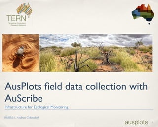
- 1. 1 09/03/16, Andrew Tokmakoff AusPlots field data collection with AuScribe Infrastructure for Ecological Monitoring
- 2. 2 Objectives ✤ To cover: ✤ introduce AusPlots, and explain why it exists ✤ show how AusPlots data is collected (and handled and published) ✤ a small demo of the AuScribe field data collection App ✤ For you to consider: ✤ what our work might mean for you
- 3. What is AusPlots Rangelands? ✤ AusPlots is based at Adelaide University and is one of 12 Terrestrial Ecosystem Research Network (TERN) facilities ✤ AusPlots identifies, prioritises, and fills data gaps in environmental monitoring of Australian rangelands bioregions (81% of the continent) ✤ AusPlots has defined a standardised survey methodology and undertakes surveys over a national network of permanent 1 hectare plots, collecting baseline vegetation and soils ecological data. ✤ This work facilitates ongoing evidence-based decision making at local, regional, national and international levels. 3
- 4. So, what do Australian Rangelands look like? 4
- 5. 5
- 6. Collecting field data in a prescribed methodology ✤ Prescribes a survey methodology for collecting plot-based vegetation and soils data ✤ consistency of both data and collection method ✤ allows analysis of consistent data over time, by future researchers 6
- 7. What is collected? General ✤ High accuracy (DGPS) location data for the plot’s corners, centre and transect start/end points ✤ Site observations in regard to condition, erosion, drainage, micro-relief, lithologies and landform pattern/element. 7
- 8. What is collected? Vegetation ✤ Vouchering ✤ Vouchered vegetation species (barcoded) over the plot; later sent for Herbarium Determinations. ✤ Genetic vouchering (barcoded) of species and extra sampling of dominant species (up to 4 samples). 8
- 9. What is collected? Vegetation ✤ Point Intercept ✤ consists of 1010 points, where each point records: ✤ any vegetation intercept(s), indicating the species and intercept height ✤ the substrate; 9
- 10. ✤ Basal Area ✤ recordings in each of the 9 segments of the plot, each consisting of: ✤ a set of vegetation species under observation, the associated wedge factor and the number of ‘hits’ What is collected? Vegetation 10
- 11. What is collected? Vegetation ✤ Leaf Area Index (LAI) ✤ Site Structural Summary ✤ recording the three most dominant species in the Upper, Middle and Lower strata, (with floristics comments). 11
- 12. What is collected? Soils ✤ Characterisation of soils (barcoded) ✤ 1 metre deep pit, in 10cm increments (ec, ph, texture and colour) ✤ 9 subsite samples: ✤ barcoded meta-genomics surface soil samples and soil samples in 10cm increments to 30cm depth 12
- 13. What is collected? Soils ✤ 3 bulk density measurements, which quantify soil fine earth and gravel. 13
- 14. Where are the plots? 14
- 16. The AusPlots Approach: tooling 16
- 17. Some requirements.. ✤ Core function: support data collection according to the protocol ✤ Minimise data double-handling ✤ Maximise integrity of data (e.g. transcription errors) ✤ Use ‘off-the-shelf’ where appropriate (rapid development) ✤ Be able to function without a network (remote locations) ✤ Offer efficiency gains vs. traditional data collection methods 17
- 19. AusPlots Rangelands Field Data Collection App ‘AuScribe’ 19 A quick demo…
- 21. ✤ Soils 2 Satellites offers visualisation ✤ (e.g. for land managers, consultants) ✤ Aekos offers raw data access, data enrichment and search ✤ (e.g. for ecological scientists) Publishing to external services 21 Field App cron REST/ JSON (Cloud) SWARM Server
- 22. 22
- 23. 23 image of 2s2 map page
- 24. Reflecting.. ✤Benefits: ✤ Integrity of data ✤ Speed of data availability ✤Challenges: ✤ getting the UI right; resistance when it is slower than “recording audio” (with subsequent data entry later on). ✤ dealing with legacy data at the same time as introducing new tools. 24
- 25. Looking ahead… ✤ New modules and protocols ✤ Woodlands, Soils,Veg Condition, and Fauna are likely to be first ✤ iOS support ✤ ‘R’ API to AusPlots data (via Aekos) 25
- 26. Summary ✤ The AusPlots field data collection App generates clean data that is readily curated and easy to publish. ✤ The solution was developed iteratively, based upon experience from field use and adopted a component-based design for fast results. ✤ Complexity of the data collected led to a custom solution. ✤ ÆKOS and S2S provide publishing platforms for AusPlots data. ✤ Together, we have a field-to-web solution that makes data accessible for use in long-term studies and facilitates informed ecological decision-making. 26
- 27. Any Questions? andrew.tokmakoff@adelaide.edu.au Andrew Tokmakoff 27 Opportunities: Protocol training, collecting AusPlots data, using collected AusPlots data