
Recommended
More Related Content
Similar to TERN Surveillance Training 2019 - Day 1, Session 4
Similar to TERN Surveillance Training 2019 - Day 1, Session 4 (20)
More from bensparrowau
More from bensparrowau (11)
Recently uploaded
Recently uploaded (20)
TERN Surveillance Training 2019 - Day 1, Session 4
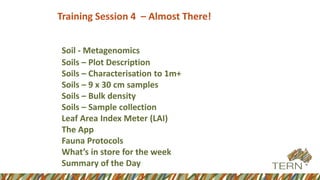
- 1. Training Session 4 – Almost There! Soil - Metagenomics Soils – Plot Description Soils – Characterisation to 1m+ Soils – 9 x 30 cm samples Soils – Bulk density Soils – Sample collection Leaf Area Index Meter (LAI) The App Fauna Protocols What’s in store for the week Summary of the Day
- 3. Plot Description • Plot name • Plot location – SW corner marker • Erosion • Micro relief • Drainage • Disturbance • Surface condition • Other optional measures if a soil scientist available – covered in the field section
- 4. ¢ ¢ ¢ ¢ ¢ ¢ ¢ ¢ ¢ ¢ Soil core to 30cm 1 m core/pit outside, but adjacent to quadrat 5 samples in the primary soil individual (25 x 25m quadrat in SW corner) 4 other samples throughout the bigger quadrat
- 6. Two Options • Pit or auger • Advantages and disadvantages to both • Pit can see profile • Auger easier – If no experienced soil scientist there is little benefit from a pit • Pit can see layers
- 7. Either way you will lay out your soil samples for characterisation Record – why stopped Type of observation Take a photo of the pit if dug Record depths Identify horizons Samples discussed later
- 8. Photo Colour chart Horizon identification Soil texturing
- 9. • Optional collections available if a soil scientist present – Detailed in the manual • At least 500 g collected in a plastic bag for each 10 cm increment through the profile (eg. 0-10, 10-20, 20-30, 30-40 etc. • If experienced can identify horizons and collect within these • Sample increased if significant amount of coarse fragments
- 10. Method Soils: Observations (9 x 30cm samples)
- 12. Scrape loose material from soil surface Use a trowel or small shovel to take a sample from the soil surface Ensuring that the trowel is not contaminated with soil from another site. Do include surface crust occurring at the site – max depth 3cm. Place the sample in a calico bag and label with a barcode Scan the barcode using the app.
- 13. Tie the calico bag and place in a labelled plastic bag that contains 1/3 of a cup of silica that contains some indicator silica Seal the bag Replace the silica until the indicator no longer changes colour Place the 9 plastic bags from the one site into a large calico bag and label for that site.
- 14. • 9 samples collected throughout the quadrat • 5 in the primary soil individual • 4 throughout the rest of the quadrat • In both cases aim to sample from the variety of cover / terrain options available. • Samples collected, bagged and labelled • At least 500 g from 0-10, 10-20 and 20-30cm unless stopped • GPS each location • 3 samples x 9 locations per site should be placed in a larger bag and labelled for that site
- 15. Dig shallow pits for the 9 samples Take samples at 10 cm increments Store samples in bags
- 16. Method Soils: Bulk Density Measures
- 17. • Bulk density essential to convert any soil measures to volume • Precision required for accuracy • Start by clearing veg from a small area • Done at 3 depths
- 18. 1. Remove the plastic caps from a stainless steel ring 2. Place the tanner sampler on flat ground – Push the feet in gently until the whole bottom surface is flush with the ground 3. Load the stainless steel ring 4. Place the top of the sampler in the top of the tube to rest on the stainless steel ring 5. Hit this with a rubber mallet until it is flush with the top of the device 6. Remove all of the device leaving the ring in the ground.
- 19. Either... • trim around the ring enough to place a cap on it Insert a trowel well below the cylinder and remove it with excess soil - none of the soil in the cylinder can be disturbed
- 20. Or.... • Dig around the cylinder carefully • Place the trowel a little under the cylinder and prise it out of the soil with excess • The soil in the ring cannot be disturbed
- 21. Carefully trim excess soil from the edge of the cylinder – this surface must be flush – this can take some time to do well Once one surface is complete, cap that end, turn the cylinder over and repeat for the other side Tape the two caps and the ring together well Clearly label and transport to a drying oven
- 23. At the end of the site you should have.... • 1 large calico bag containing 9 snaplock bags containing 9 calico bags with silica for metagenomic samples • 1 large plastic bag with 9 medium calico bags each containing x 3 x 500 g snaplock bags with soil samples (from 9 distributed sites) • 1 large plastic bag with 10 x 500 g snaplock bag soil samples from the pit or core • 1 medium calico bad with 3 x bulk density rings in it • ALL CLEARLY LABELLED!
- 25. LAI Measurements • AusCover desire to validate LAI and FPC products • FPC validated by point intercept • LAI can be validated by Hemispherical Photography or LAI2200 • Hemispherical Photography - Potentially more accurate - Harder to set up in the field - Lowest height about 40-50 cm above ground level - Harder to process in the office – more work - Harder to get high number of samples - Larger volume of data
- 26. LAI 2200 – Operates closer to the ground – more appropriate for Rangelands – Easy to take a high number of samples – Instant processing – no work later – Easy to use for non experts to use in the field – Much quicker to use LAI 2200 seen as best outcome considering the needs of both AusCover (data) and AusPlots (speed and ease of use)
- 27. LAI 2200 • Need to avoid direct sunlight – diffuse light – constant cloud – dawn or dusk • Need above/clear sky reference fairly regularly (issue in really high canopy areas) • Recent field trip collected data to inform of optimal sampling strategy • Not operationally useful for chenopods – (re: number of samples)
- 28. The device will come pre-set up – There will be no need to connect the “wand” to the console. You will only need to use the “wand”. Remove it from the Pelican case. The manual will be in the case but we ask that you follow the AusPlots manual in the first instance, and then attempt calling AusPlots staff before you use the manual or change any settings. The device is significantly more complex than our application. We have simplified its operation to make it easier to use in the field.
- 29. The Sensor head and fitting the lens cover
- 30. Taking an “above” Reference – Note the overcast sky The wand set up for logging points and an above reference Before
- 31. During After
- 33. Field data collection: tooling • Core function: support data collection according to the protocol • Minimise data double- handling • Maximise integrity of data (e.g. transcription errors) • Use ‘off-the-shelf’ where appropriate (rapid development) • Be able to function without a network (remote locations) • Offer efficiency gains vs. traditional data collection methods
- 35. AuScribe: Field Data Collection App
- 36. Plot Creation
- 37. Site Description
- 39. Site Description
- 40. Point Intercept
- 41. Basal Wedge
- 43. Plot Upload
- 45. Benefits: • Integrity of data • Speed of data availability Challenges: • Getting the UI right; resistance when it is slower than “recording audio” (with subsequent data entry later on). • More automation (Soils and DGPS integration). • Multi-tablet system. Reflecting…
- 47. How to get Further Info http://www.tern.org.au/AusPlots-pg26979.html Product / Service Description For more information Accepted method The AusPlots Rangelands Survey Protocols Manual provides a simple agreed method for anyone undertaking research or monitoring in the rangelands. Developed in collaboration with all of the rangelands' jurisdiction the method is the first nationally agreed and consistent method for rangelands monitoring. It is freely available, and is supported by a field app that streamlines data entry and download processes. In 2014 AusPlots will release further protocols so keep an eye on this website for updates. The AusPlots Forests Survey Protocols Manual outlines the field methodology for AusPlots Forests. The background and rationale of the project and details of bioregional stratification and site selection will be outlined in a separate document. This version of the manual (v1.0) details the methodology for (a) the installation of plot infrastructure, (b) the description of the site and (c) the core measurements that form the minimum dataset for AusPlots Forests plots. This draft edition is provided as an online resource and material from the document or its attachments should not be republished without written consent. If you have any feedback on this draft version please contact Dr Sam Wood. Click here to view or download the AusPlots Rangelands Survey Protocols Manual Click here to view or download the AusPlots Forests Survey Protocols Manual Data AusPlots data is available via TERN's Soils to Satellites and AEKOS Data Portal. As at March 2014 data from approximately 130 sites is available, with more being added regularly as herbarium identifications are received. The program has collect >430 plots to date. AusPlots site locations can be downloaded here (.kml file) Soils to Satellites AEKOS Data Portal Contact Andrew Tokmakoff Samples Soil and plant samples collected by AusPlots are contributed to the CSIRO National Soil Archive and regional herbaria, with some samples stored at the AusPlots facility. These samples are available for further use by researchers. Traditional soil samples, soil metagenomic samples, vegetation voucher samples and vegetation genetic and isotope samples may all be available for use. For more information on applying to access and use these samples, please contact Ian Fox
- 71. Practical What is in store for the rest of the week?
- 72. Structure of each Day From 6:30 am Breakfast 7:30 – 7:45 am Day Plan 8:00 am Leave homestead 8:30 am Arrive at field sites 10:30 am Morning tea 11:00 am Field Training 12:30 am Lunch on Site 1:15 pm Field Training 3:00 pm Arvo tea 3:30 pm Field Training 5:00 pm Return to Homestead then free time 6:30pm Dinner 8:00 pm + Free time/ informal discussions on method
- 75. Today – 4 Theory Sessions • Session 1 Context + Stratification + Manual • Session 2 Stratification, permissions and planning • Session 3 All Vegetation Components • Session 4 Soils and Fauna
- 76. Summary