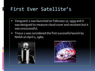
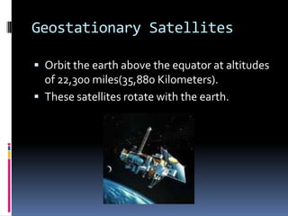
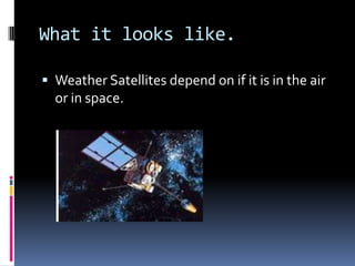
Weather SatellitesBy: Kyle Schaeffer and Tori Roeder
InventorsArthur C. Clark was the inventor of the satellite in October 1945.John Daniell’s research lead to the invention of Tirous -1 in 1820.
First Ever Satellite’s Vanguard-2 was launched on February 17, 1959 and it was designed to measure cloud cover and resistant but it was unsuccessful.Tirous-1 was considered the first successful launch by NASA on April 1, 1960.
Geostationary SatellitesOrbit the earth above the equator at altitudes of 22,300 miles(35,880 Kilometers).These satellites rotate with the earth.
Polar Orbiting SatellitesCircle the earth at altitudes of 530 miles(850 Kilometers)These satellites pass over the poles in there continuous flight.These offer much better resolution then the Geostationary Satellites because its closer to the earth.
Visible SpectrumMeasures clouds, cloud systems such as fronts and tropical storms, lakes, forest, mountains, snow ice, fires and pollution such as smoke smog, dust and haze and even wind can be determined by cloud patterns.
Infrared SpectrumIt records infrared or thermal image.  This is recorded by sensors called scanning radiometers.  This determines clud heights and types to calculate land and surface water temperatures.
Uses of Weather SatellitesIt is used to trace and locate weather systems like hurricanes, thunderstorms, tornadoes, rain, hail, and it also shows the temperature of water, land, and air.
What it looks like.Weather Satellites depend on if it is in the air or in space.

Weather satellites period 3

  • 1.
    Weather SatellitesBy: KyleSchaeffer and Tori Roeder
  • 2.
    InventorsArthur C. Clarkwas the inventor of the satellite in October 1945.John Daniell’s research lead to the invention of Tirous -1 in 1820.
  • 3.
    First Ever Satellite’sVanguard-2 was launched on February 17, 1959 and it was designed to measure cloud cover and resistant but it was unsuccessful.Tirous-1 was considered the first successful launch by NASA on April 1, 1960.
  • 4.
    Geostationary SatellitesOrbit theearth above the equator at altitudes of 22,300 miles(35,880 Kilometers).These satellites rotate with the earth.
  • 5.
    Polar Orbiting SatellitesCirclethe earth at altitudes of 530 miles(850 Kilometers)These satellites pass over the poles in there continuous flight.These offer much better resolution then the Geostationary Satellites because its closer to the earth.
  • 6.
    Visible SpectrumMeasures clouds,cloud systems such as fronts and tropical storms, lakes, forest, mountains, snow ice, fires and pollution such as smoke smog, dust and haze and even wind can be determined by cloud patterns.
  • 7.
    Infrared SpectrumIt recordsinfrared or thermal image. This is recorded by sensors called scanning radiometers. This determines clud heights and types to calculate land and surface water temperatures.
  • 8.
    Uses of WeatherSatellitesIt is used to trace and locate weather systems like hurricanes, thunderstorms, tornadoes, rain, hail, and it also shows the temperature of water, land, and air.
  • 9.
    What it lookslike.Weather Satellites depend on if it is in the air or in space.