SlideShare a Scribd company logo
1 of 7
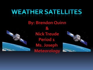
Weather Satellites By: Brendon Quinn & Nick Treude Period 1  Ms. Joseph  Meteorology
The Inventor  ,[object Object],[object Object]
What it is used for A weather satellite is a satellite that is used to gather information about the weather.  They will show a view of weather patterns over a large area.  This allows meteorologists to track weather pattern and make accurate predictions about the weather.  They can also be used for thermal imaging, X-ray sensors, high-energy proton detectors, alpha detectors, and energetic particles.
How it works They carry things called radiometers, they will scan the Earth for images.  They detect visible, infrared, or microwave radiation to monitor the weather on Earth.  All the information is transmitted to receiving stations that are on the ground.  It takes less then a minute for the information to be readable.  They will usually operate for about 3 to 7 years.
Extra Information Weather satellites travel in geostationary or polar orbits.  Geostationary orbits provide views of the earth’s surface all day.  Polar orbits go across earth’s surface and provide a view of the entire planet over the course of 12 hours.  NASA uses Geostationary Operational Environmental Satellite or GEOS.  The satellite in the western hemisphere is 2240 miles above Earth.
Works Cited http://www.noaa.gov/satellites.html http://www.wired.com/dangerroom/2008/02/us-may-shoot-do http://www.tech-faq.com/weather-satellite.html http://seabass.gsfc.nasa.gov/ http://www.oso.noaa.gov/history/ http://www.weatherquestions.com/How_do_weather_satellites_work.htm
Weather satellites

More Related Content

What's hot

Weather forecasting
Weather forecastingWeather forecasting
Weather forecastingESSBY
 
. Atmospheric window and reflectance curve
. Atmospheric window and  reflectance curve. Atmospheric window and  reflectance curve
. Atmospheric window and reflectance curvemarutiChilame
 
Remote sensing by priyanshu kumar,9608684800
Remote sensing by priyanshu kumar,9608684800Remote sensing by priyanshu kumar,9608684800
Remote sensing by priyanshu kumar,9608684800PRIYANSHU KUMAR
 
Remote Sensing PPT
Remote Sensing PPTRemote Sensing PPT
Remote Sensing PPTAmal Murali
 
History of remote sensing
History of remote sensingHistory of remote sensing
History of remote sensingSumant Diwakar
 
Sensors for remote sensing
Sensors for remote sensingSensors for remote sensing
Sensors for remote sensingMohsin Siddique
 
Remote sensing - Sensors, Platforms and Satellite orbits
Remote sensing - Sensors, Platforms and Satellite orbitsRemote sensing - Sensors, Platforms and Satellite orbits
Remote sensing - Sensors, Platforms and Satellite orbitsAjay Singh Lodhi
 
Remote Sensing Data Acquisition,Scanning/Imaging systems
Remote Sensing Data Acquisition,Scanning/Imaging systemsRemote Sensing Data Acquisition,Scanning/Imaging systems
Remote Sensing Data Acquisition,Scanning/Imaging systemsdaniyal rustam
 
Fundamentals of Remote Sensing
Fundamentals of Remote Sensing Fundamentals of Remote Sensing
Fundamentals of Remote Sensing Pallab Jana
 
Earth Observation Satellites
Earth Observation SatellitesEarth Observation Satellites
Earth Observation SatellitesDivya Basuti
 
Chapter 3: Remote sensing Technology
Chapter 3: Remote sensing TechnologyChapter 3: Remote sensing Technology
Chapter 3: Remote sensing TechnologyShankar Gangaju
 

What's hot (20)

Weather forecasting
Weather forecastingWeather forecasting
Weather forecasting
 
. Atmospheric window and reflectance curve
. Atmospheric window and  reflectance curve. Atmospheric window and  reflectance curve
. Atmospheric window and reflectance curve
 
Remote sensing by priyanshu kumar,9608684800
Remote sensing by priyanshu kumar,9608684800Remote sensing by priyanshu kumar,9608684800
Remote sensing by priyanshu kumar,9608684800
 
Remote Sensing PPT
Remote Sensing PPTRemote Sensing PPT
Remote Sensing PPT
 
History of remote sensing
History of remote sensingHistory of remote sensing
History of remote sensing
 
Introduction to Remote Sensing
Introduction to Remote SensingIntroduction to Remote Sensing
Introduction to Remote Sensing
 
Sensors for remote sensing
Sensors for remote sensingSensors for remote sensing
Sensors for remote sensing
 
Remote sensing - Sensors, Platforms and Satellite orbits
Remote sensing - Sensors, Platforms and Satellite orbitsRemote sensing - Sensors, Platforms and Satellite orbits
Remote sensing - Sensors, Platforms and Satellite orbits
 
Remote sensing
Remote sensingRemote sensing
Remote sensing
 
Weather forecasting
Weather forecastingWeather forecasting
Weather forecasting
 
Remote Sensing Data Acquisition,Scanning/Imaging systems
Remote Sensing Data Acquisition,Scanning/Imaging systemsRemote Sensing Data Acquisition,Scanning/Imaging systems
Remote Sensing Data Acquisition,Scanning/Imaging systems
 
Fundamentals of Remote Sensing
Fundamentals of Remote Sensing Fundamentals of Remote Sensing
Fundamentals of Remote Sensing
 
Concept of remote sensing
Concept of remote sensingConcept of remote sensing
Concept of remote sensing
 
Earth Observation Satellites
Earth Observation SatellitesEarth Observation Satellites
Earth Observation Satellites
 
introduction-of-GNSS-1
introduction-of-GNSS-1introduction-of-GNSS-1
introduction-of-GNSS-1
 
Remote sensing
Remote sensingRemote sensing
Remote sensing
 
Visual Interpretation
Visual InterpretationVisual Interpretation
Visual Interpretation
 
Chapter 3: Remote sensing Technology
Chapter 3: Remote sensing TechnologyChapter 3: Remote sensing Technology
Chapter 3: Remote sensing Technology
 
Soil moisture
Soil moistureSoil moisture
Soil moisture
 
Weather forecasting
Weather forecastingWeather forecasting
Weather forecasting
 

Viewers also liked

Satellites presentation
Satellites presentationSatellites presentation
Satellites presentationVikas Sharma
 
Weather forecasting technology
Weather forecasting technologyWeather forecasting technology
Weather forecasting technologyzionbrighton
 
Lecture - Spy Satellites In The World Around Us - JASON Institute 2011
Lecture - Spy Satellites In The World Around Us - JASON Institute 2011Lecture - Spy Satellites In The World Around Us - JASON Institute 2011
Lecture - Spy Satellites In The World Around Us - JASON Institute 2011Peter Staal
 
Daniel 4 kingdoms from Daniel Chapter 2 prespective
Daniel 4 kingdoms from  Daniel Chapter 2 prespectiveDaniel 4 kingdoms from  Daniel Chapter 2 prespective
Daniel 4 kingdoms from Daniel Chapter 2 prespectivePrepare Your Ways
 
Basic Principles and Design of The Antenna in Mobile Communications
Basic Principles and Design of The Antenna in Mobile CommunicationsBasic Principles and Design of The Antenna in Mobile Communications
Basic Principles and Design of The Antenna in Mobile CommunicationsTempus Telcosys
 
What a Wonderful World - beautiful mother nature with beautiful music ‘what a...
What a Wonderful World - beautiful mother nature with beautiful music ‘what a...What a Wonderful World - beautiful mother nature with beautiful music ‘what a...
What a Wonderful World - beautiful mother nature with beautiful music ‘what a...P.K. ☮♫♬ ♪♩♭♪☮
 
Cell Phone Antennas
Cell Phone AntennasCell Phone Antennas
Cell Phone AntennasNaveen Kumar
 
Global positioning system ppt
Global positioning system pptGlobal positioning system ppt
Global positioning system pptSwapnil Ramgirwar
 
11 Amazing Facts About Prayer
11 Amazing Facts About Prayer11 Amazing Facts About Prayer
11 Amazing Facts About PrayerPaul Bass
 
Global Positioning System (GPS)
Global Positioning System (GPS) Global Positioning System (GPS)
Global Positioning System (GPS) richard_craig
 

Viewers also liked (20)

Satellites presentation
Satellites presentationSatellites presentation
Satellites presentation
 
Weather forecasting technology
Weather forecasting technologyWeather forecasting technology
Weather forecasting technology
 
Ari pd 3 ppt
Ari pd 3 pptAri pd 3 ppt
Ari pd 3 ppt
 
Communication satellite
Communication satelliteCommunication satellite
Communication satellite
 
Adults training v1
 Adults training v1 Adults training v1
Adults training v1
 
Lecture - Spy Satellites In The World Around Us - JASON Institute 2011
Lecture - Spy Satellites In The World Around Us - JASON Institute 2011Lecture - Spy Satellites In The World Around Us - JASON Institute 2011
Lecture - Spy Satellites In The World Around Us - JASON Institute 2011
 
Daniel 4 kingdoms from Daniel Chapter 2 prespective
Daniel 4 kingdoms from  Daniel Chapter 2 prespectiveDaniel 4 kingdoms from  Daniel Chapter 2 prespective
Daniel 4 kingdoms from Daniel Chapter 2 prespective
 
Gold of the last days
Gold of the last daysGold of the last days
Gold of the last days
 
Satellitespp
SatellitesppSatellitespp
Satellitespp
 
World around us
World around usWorld around us
World around us
 
Basic Principles and Design of The Antenna in Mobile Communications
Basic Principles and Design of The Antenna in Mobile CommunicationsBasic Principles and Design of The Antenna in Mobile Communications
Basic Principles and Design of The Antenna in Mobile Communications
 
Weather Forecasting
Weather ForecastingWeather Forecasting
Weather Forecasting
 
What a Wonderful World - beautiful mother nature with beautiful music ‘what a...
What a Wonderful World - beautiful mother nature with beautiful music ‘what a...What a Wonderful World - beautiful mother nature with beautiful music ‘what a...
What a Wonderful World - beautiful mother nature with beautiful music ‘what a...
 
Cell Phone Antennas
Cell Phone AntennasCell Phone Antennas
Cell Phone Antennas
 
Prophecy graphics
Prophecy graphicsProphecy graphics
Prophecy graphics
 
Antenna types
Antenna typesAntenna types
Antenna types
 
And I Will Shape You
And I Will Shape YouAnd I Will Shape You
And I Will Shape You
 
Global positioning system ppt
Global positioning system pptGlobal positioning system ppt
Global positioning system ppt
 
11 Amazing Facts About Prayer
11 Amazing Facts About Prayer11 Amazing Facts About Prayer
11 Amazing Facts About Prayer
 
Global Positioning System (GPS)
Global Positioning System (GPS) Global Positioning System (GPS)
Global Positioning System (GPS)
 

Similar to Weather satellites

Similar to Weather satellites (20)

Remote Sensing - by Ashwini
Remote Sensing - by AshwiniRemote Sensing - by Ashwini
Remote Sensing - by Ashwini
 
Meteorological satellites and their types
Meteorological satellites and their typesMeteorological satellites and their types
Meteorological satellites and their types
 
F3-Sc-C9.pptx
F3-Sc-C9.pptxF3-Sc-C9.pptx
F3-Sc-C9.pptx
 
Overview of NASA's Science Mission Directorate
Overview of NASA's Science Mission DirectorateOverview of NASA's Science Mission Directorate
Overview of NASA's Science Mission Directorate
 
Satellite Applications
Satellite ApplicationsSatellite Applications
Satellite Applications
 
A gallery of_planet_hunters
A gallery of_planet_huntersA gallery of_planet_hunters
A gallery of_planet_hunters
 
Sem 44.pptx
Sem 44.pptxSem 44.pptx
Sem 44.pptx
 
Artificial satellites
Artificial satellitesArtificial satellites
Artificial satellites
 
Earth
EarthEarth
Earth
 
Terra presentation
Terra presentationTerra presentation
Terra presentation
 
New horizon jupiter presskit
New horizon jupiter presskitNew horizon jupiter presskit
New horizon jupiter presskit
 
Space Sechnology
Space SechnologySpace Sechnology
Space Sechnology
 
Chapter 22 – astronomical technology
Chapter 22 – astronomical technologyChapter 22 – astronomical technology
Chapter 22 – astronomical technology
 
Redone final project
Redone final projectRedone final project
Redone final project
 
2024-pdfcalendar-print-version-tagged.pdf
2024-pdfcalendar-print-version-tagged.pdf2024-pdfcalendar-print-version-tagged.pdf
2024-pdfcalendar-print-version-tagged.pdf
 
STEREO Science Writer's Guide
STEREO Science Writer's GuideSTEREO Science Writer's Guide
STEREO Science Writer's Guide
 
Remote Sensing and its Application
Remote Sensing and its ApplicationRemote Sensing and its Application
Remote Sensing and its Application
 
Bella's Abad
Bella's AbadBella's Abad
Bella's Abad
 
Space
SpaceSpace
Space
 
Terra Seismic : Global Earthquake Prediction Systems
Terra Seismic : Global Earthquake Prediction SystemsTerra Seismic : Global Earthquake Prediction Systems
Terra Seismic : Global Earthquake Prediction Systems
 

More from FC Meteorology (20)

Science project
Science projectScience project
Science project
 
Clouds and precipitation
Clouds and precipitationClouds and precipitation
Clouds and precipitation
 
Clouds and precipitation
Clouds and precipitationClouds and precipitation
Clouds and precipitation
 
4aklee
4aklee4aklee
4aklee
 
4jpfleger
4jpfleger4jpfleger
4jpfleger
 
2Kcoldren
2Kcoldren2Kcoldren
2Kcoldren
 
3qrogers
3qrogers3qrogers
3qrogers
 
3jeannine
3jeannine3jeannine
3jeannine
 
5fmartin
5fmartin5fmartin
5fmartin
 
2JessB
2JessB2JessB
2JessB
 
Clouds and precipitation by Ian Slavin
Clouds and precipitation by Ian SlavinClouds and precipitation by Ian Slavin
Clouds and precipitation by Ian Slavin
 
Clouds and precipitation
Clouds and precipitationClouds and precipitation
Clouds and precipitation
 
Clouds and percipitation powerpoint
Clouds and percipitation powerpointClouds and percipitation powerpoint
Clouds and percipitation powerpoint
 
1jschan
1jschan1jschan
1jschan
 
1kspieker
1kspieker1kspieker
1kspieker
 
3jlaubach
3jlaubach3jlaubach
3jlaubach
 
Clouds and precipitation19
Clouds and precipitation19Clouds and precipitation19
Clouds and precipitation19
 
5nmann
5nmann5nmann
5nmann
 
Clouds and precipitation-nate mann
Clouds and precipitation-nate mannClouds and precipitation-nate mann
Clouds and precipitation-nate mann
 
5jrodriguez
5jrodriguez 5jrodriguez
5jrodriguez
 

Weather satellites

  • 1. Weather Satellites By: Brendon Quinn & Nick Treude Period 1 Ms. Joseph Meteorology
  • 2.
  • 3. What it is used for A weather satellite is a satellite that is used to gather information about the weather. They will show a view of weather patterns over a large area. This allows meteorologists to track weather pattern and make accurate predictions about the weather. They can also be used for thermal imaging, X-ray sensors, high-energy proton detectors, alpha detectors, and energetic particles.
  • 4. How it works They carry things called radiometers, they will scan the Earth for images. They detect visible, infrared, or microwave radiation to monitor the weather on Earth. All the information is transmitted to receiving stations that are on the ground. It takes less then a minute for the information to be readable. They will usually operate for about 3 to 7 years.
  • 5. Extra Information Weather satellites travel in geostationary or polar orbits. Geostationary orbits provide views of the earth’s surface all day. Polar orbits go across earth’s surface and provide a view of the entire planet over the course of 12 hours. NASA uses Geostationary Operational Environmental Satellite or GEOS. The satellite in the western hemisphere is 2240 miles above Earth.
  • 6. Works Cited http://www.noaa.gov/satellites.html http://www.wired.com/dangerroom/2008/02/us-may-shoot-do http://www.tech-faq.com/weather-satellite.html http://seabass.gsfc.nasa.gov/ http://www.oso.noaa.gov/history/ http://www.weatherquestions.com/How_do_weather_satellites_work.htm