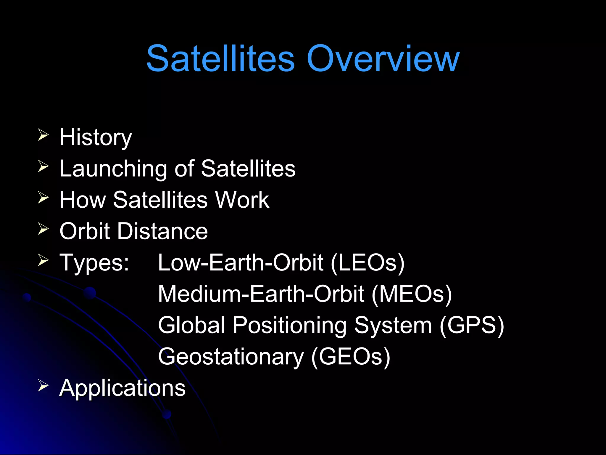
Satellites orbit Earth for a variety of purposes such as communication, weather monitoring, and navigation. They come in different types depending on their distance from Earth, including low-Earth orbit, medium-Earth orbit, and geostationary orbit. The Global Positioning System is a constellation of 24 satellites that provides location and time information to GPS receivers anywhere on Earth.
hiee guyes this is swapnil thaware here i uploaded slide for your knowledge if you want more detail msg me on fb or mail i will help you
thanking you and slideshare.com
hiee guyes this is swapnil thaware here i uploaded slide for your knowledge if you want more detail msg me on fb or mail i will help you
thanking you and slideshare.com
Presentation on Satellite Communication
Outlines:
History
Definition
Communication system
Architecture
Operation of satellite
Elements
>Space Segment
>Ground Segment
Earth Stations
Digital Earth Station
Orbits
Geostationary Orbit (GSO)
Non-Geostationary Orbit (NGSO)
Different Satellite Communications : Services
Advantages OF SATELLITE COMMUNICATION
Applications OF SATELLITE COMMUNICATION
Future
Conclusion
this presentation is about satellite communication which includes working of gps ,vsat ,frequency bands ,needs of communication satellite ,types of satellite ,working ,orbits ,elements involved in working ,transponder ,satellite control center ,satellite network
This presentation covers:
Basics of Satellite communication
Indian Communication satellites
Satellite link and elements of satellite communication
Frequency bands of satellite communication
Different orbits of satellite communication
Link budget calculations
In India, agriculture is one of the major application areas of the remote sensing technology. Various national level agricultural applications have been developed which showcases the use of remote sensing data provided by the sensors/satellites launched by the country’s space agency, Indian Space Research Organisation (ISRO)
Application of Remote Sensing in AgricultureUTTAM KUMAR
Remote sensing has been found to be a valuable tool in evaluation, monitoring and management of land, water and crop resources. The launching of the Indian remote sensing satellite (IRS) has enhanced the capabilities for better utilization of this technology and significant progress has been made in soil and land cover mapping, land degradation studies, monitoring of waste land, assessment of crop conditions crop acreage and production estimates
you can be friend with me on orkut
"mangalforyou@gmail.com" : i belive in sharing the knowledge so please send project reports ,seminar and ppt. to me .
The theory of satellites was simple enough - shoot something out into space at the right speed and on the correct trajectory and it will stay up there, orbiting Earth, for years - if not forever. If the orbit is the right distance in space the satellite will keep pace with the rotation of the Earth.
Early in October 1957 communications stations started picking up a regular beeping noise coming from space.
The signals were coming from Russia's Sputnik 1, the world's first man-made satellite.
It was January 1958, before a Jupiter rocket successfully launched Explorer 1, the first American satellite
Geostationary Earth Orbit (GEO) Satellite Systems • A geostationary orbit is a special type of geosynchronous orbit. • When an object is in geostationary orbit, it is orbiting at the same speed as the Earth rotates, but it orbits around the equator.
Information for Satellite, What is a Satellite...YaserKhan21
What is a Satellite?, Types of Satellite, Satellite Architecture and Organization, Application
Advantages of satellite over terrestrial communication, Disadvantage, Brief History of Artificial Satellites, Parts of a Satellite, What Keeps A Satellite from Falling to Earth?, What stops a Satellite from crashing into another Satellite?, Moons Around Other Worlds, About the International Space Station, Satellites in ISRO, Chandrayaan-1, Chandrayaan-2 and Chandrayaan-3
Satellites have evolutionized communication. Satellite communication has served mankind in many ways for instance its is used to predict weather and broadcast storm warnings and also provides a wide range of communication services in the fields of relaying television programs, digital data for a multitude of business services. It might not surprise us if, in near future satellite links are used for voice and fax transmission to aircraft on international routes. Communications satellite systems have entered a period of transition from point-to-point high-capacity trunk communications between large, costly ground terminals to multipoint-to-multipoint communications between small, low-cost stations. As any invention develops with the passage of time, satellite communication has also moved a step ahead from what it was in the past with the use of several techniques such as frequency reuse, interconnecting many ground stations spread over the world, concept of multiple spot beam communications, these days lasers are effectively used for transmission through satellites. The latest development in satellites is the use of networks of small satellites in low earth orbits.
We all have good and bad thoughts from time to time and situation to situation. We are bombarded daily with spiraling thoughts(both negative and positive) creating all-consuming feel , making us difficult to manage with associated suffering. Good thoughts are like our Mob Signal (Positive thought) amidst noise(negative thought) in the atmosphere. Negative thoughts like noise outweigh positive thoughts. These thoughts often create unwanted confusion, trouble, stress and frustration in our mind as well as chaos in our physical world. Negative thoughts are also known as “distorted thinking”.
2024.06.01 Introducing a competency framework for languag learning materials ...Sandy Millin
http://sandymillin.wordpress.com/iateflwebinar2024
Published classroom materials form the basis of syllabuses, drive teacher professional development, and have a potentially huge influence on learners, teachers and education systems. All teachers also create their own materials, whether a few sentences on a blackboard, a highly-structured fully-realised online course, or anything in between. Despite this, the knowledge and skills needed to create effective language learning materials are rarely part of teacher training, and are mostly learnt by trial and error.
Knowledge and skills frameworks, generally called competency frameworks, for ELT teachers, trainers and managers have existed for a few years now. However, until I created one for my MA dissertation, there wasn’t one drawing together what we need to know and do to be able to effectively produce language learning materials.
This webinar will introduce you to my framework, highlighting the key competencies I identified from my research. It will also show how anybody involved in language teaching (any language, not just English!), teacher training, managing schools or developing language learning materials can benefit from using the framework.
The Art Pastor's Guide to Sabbath | Steve ThomasonSteve Thomason
What is the purpose of the Sabbath Law in the Torah. It is interesting to compare how the context of the law shifts from Exodus to Deuteronomy. Who gets to rest, and why?
This is a presentation by Dada Robert in a Your Skill Boost masterclass organised by the Excellence Foundation for South Sudan (EFSS) on Saturday, the 25th and Sunday, the 26th of May 2024.
He discussed the concept of quality improvement, emphasizing its applicability to various aspects of life, including personal, project, and program improvements. He defined quality as doing the right thing at the right time in the right way to achieve the best possible results and discussed the concept of the "gap" between what we know and what we do, and how this gap represents the areas we need to improve. He explained the scientific approach to quality improvement, which involves systematic performance analysis, testing and learning, and implementing change ideas. He also highlighted the importance of client focus and a team approach to quality improvement.
Instructions for Submissions thorugh G- Classroom.pptxJheel Barad
This presentation provides a briefing on how to upload submissions and documents in Google Classroom. It was prepared as part of an orientation for new Sainik School in-service teacher trainees. As a training officer, my goal is to ensure that you are comfortable and proficient with this essential tool for managing assignments and fostering student engagement.
Model Attribute Check Company Auto PropertyCeline George
In Odoo, the multi-company feature allows you to manage multiple companies within a single Odoo database instance. Each company can have its own configurations while still sharing common resources such as products, customers, and suppliers.
The Indian economy is classified into different sectors to simplify the analysis and understanding of economic activities. For Class 10, it's essential to grasp the sectors of the Indian economy, understand their characteristics, and recognize their importance. This guide will provide detailed notes on the Sectors of the Indian Economy Class 10, using specific long-tail keywords to enhance comprehension.
For more information, visit-www.vavaclasses.com
2. Satellites Overview
History
Launching of Satellites
How Satellites Work
Orbit Distance
Types: Low-Earth-Orbit (LEOs)
Medium-Earth-Orbit (MEOs)
Global Positioning System (GPS)
Geostationary (GEOs)
Applications
3.
History of Satellites
The First Satellites
The theory of satellites was simple enough - shoot something out into space
at the right speed and on the correct trajectory and it will stay up there,
orbiting Earth, for years - if not forever.
If the orbit is the right distance in space the satellite will keep pace with the
rotation of the Earth.
Early in October 1957 communications stations started picking up a regular
beeping noise coming from space.
The signals were coming from Russia's Sputnik 1, the world's first man-
made satellite.
It was January 1958, before a Jupiter rocket successfully launched Explorer
1, the first American satellite.
4. History of Satellites
On October 4, 1957, the Soviet Union successfully launched Sputnik I.
The world's first artificial satellite was about the size of a basketball,
weighed only 183 pounds, and took about 98 minutes to orbit the
Earth on its elliptical path
on November 3, Sputnik II was launched
On January 31, 1958, the United States successfully launched Explorer I
The first satellite that was used for communication purpose in INDIA was
ARYABHATTA and it was launched in 19th April.1975. APPLE was
launched in space which was the first Indian Experimental
communication satellite
INSAT (Indian National Satellite System) is a series of multipurpose
geostationary satellites launched by ISRO to satisfy the
telecommunications, broadcasting, and search-and-rescue needs of
India. Commissioned in 1983, INSAT is the largest domestic
communication system in the Asia-Pacific Region
Chandrayaan-1)). It was launched by the Indian Space Research
Organisation in October 2008, and operated until August 2009.
5. 1957
First Artificial Satellite
(Sputnik)
The first artificial satellite was
Sputnik 1, launched by the
Soviet Union on October 4,
1957. At about the size of a
basketball, Sputnik 1 was
equipped with a radio
transmitter that gave off a
beeping signal—helping the
Soviets to track it on its 98-
minute orbit and to signal to
the world that the U.S.S.R.
was the leader in space
6. Photograph courtesy
NOAA/NESDIS Headquarters
1960
First Orbiting Observations
(TIROS-1 Weather Satellite)
The first aerial images of the
Earth from space were taken by
TIROS 1 (Television InfraRed
Observation Satellite). TIROS 1
was launched in 1960 to find out if
it was possible to watch cloud
cover and weather patterns from
space. Although it was an
experimental satellite, TIROS
images were immediately put to
use by meteorologists
7. 1972
First Surveying Satellite (Landsat)
The first Landsat satellite was called
the Earth Resources Technology
Satellite, or ERTS. Since its launch on
July 23, 1972, six Landsats have
followed, with the latest, Landsat 7,
lifting off on April 15, 1999. Over the
years successive Landsats have not
only carried better land-viewing
sensors, but they have created a
valuable archive of images that are
being used to see how the land is
changing over the years. Landsat 7
carries the Enhanced Thematic
Mapper Plus, which scans the Earth in
eight bands of visible and invisible light
8. 1974
First Geostationary Satellite
(GOES)
Best known as weather satellites,
the first GOES (Geostationary
Operational Environmental Satellite)
was launched on October 16, 1975.
Their high orbits and visible-light and
infrared sensors allow for constant
surveillance of weather patterns over
the entire planet and have enabled
GOES to revolutionize the science of
weather prediction. GOES-10,
launched in 1998, images the 48
contiguous U.S. states every five
minutes.
10. To enable a satellite to orbit around any planet, we have
to consider height from which the satellite must be
thrown.
Consider yourself, if you throw a stone, it comes to earth
after some time, why? It is because of the gravitational
attraction of earth and the stone. By the Newton 's law of
gravitation, stone and earth would be attracted towards
each other by force
F = GMm / R2
Where M is mass of earth
m is mass of stone
R is distance between centre of earth and stone
11.
Since, throwing the satellite from earth's surface will make the satellite to
come down to earth's surface due to gravitational pull
F α 1/ R2
i.e. greater is the distance, lesser the force of attraction. As we have seen
earlier that value of g decreases with increase in height and expression is
given by
gh / g = g ( 1 - 2h / R )
We can say that to put on object into earth's orbit.
• Move the object to suitable height.
• Then, project it with high velocity.
Remember, less the height to which object is moved, greater the velocity
needed for projecting.
I would like to state that the velocity that I was talking about is called as ‘
ORBITAL VELOCITY
12. Satellite
A Satellite is a solid object which revolves around some heavenly
body due to the effect of gravitational forces which are mutual in
nature. We can categorize satellites in two types, namely Passive
Satellites and Active satellites. A passive satellite can be further
subdivided into two types, namely Natural satellites and artificial
satellites. A moon is a natural satellite of earth. But spherical balloon
with metal coated plastic serve as artificial satellites.
Active satellites are complicated structures having a processing
equipment called Transponder which is very vital for functioning of
the satellite. These transponders serve dual purpose i.e. provides
amplification of the incoming signal and performs the frequency
translation of the incoming signal to avoid interference between the
two signals.
13. How Satellites Work
1. A Earth Station sends
message in GHz range.
(Uplink)
2. Satellite Receive and
retransmit signals back.
(Downlink)
3. Other Earth Stations
receive message in
useful strength area.
(Footprint)
14.
15. Microwaves are electromagnetic waves with frequency from
30MHz to 1 GHz. The ionosphere cannot reflect microwaves back
to the earth. They pass through the ionosphere A satellite used to
receive microwaves and then transmit them back to the earth.
Satellites provide links in two ways. Firstly a satellite provide point
to point communication link between one ground station and the
other. One ground station transmit signal to the other satellite and
next ground station receives them from the satellite. Secondly,
satellite receives signals from one ground station and transmits to
them to the number of ground receivers.
Most satellite use frequency bandwidth through from 5.92 to
6.4GHz from transmission of data from earth to the satellite and a
frequency bandwidth from 3.7 to 4.1GHz for transmission from
satellite to the earth.
17. Low-Earth-Orbit (LEO)
Altitude (375-1000 miles)
Revolution time: 90 min - 3 hours.
Advantages:
Reduces transmission delay
Eliminates need for bulky
receiving equipment.
Disadvantages:
Smaller coverage area.
Shorter life span (5-8 yrs.)
than GEOs (10 yrs).
18. Middle-Earth-Orbiting (MEO)
MEOs orbits between the altitudes
of 5,600 and 9,500 miles.
These orbits are primarily reserved
for communications satellites that
cover the North and South Pole.
Unlike the circular orbit of the geostationary satellites,
MEOs are placed in an elliptical (oval-shaped) orbit.
19. GPS: What is it ?
A constellation of 24 satellites
The Global Positioning System (GPS) is a
space-based global navigation satellite system
(GNSS) that provides reliable location and time
information in all weather and at all times and
GPS Satellites
anywhere on or near the Earth
The Global Positioning System (GPS) is a Name: NAVSTAR
worldwide radio-navigation system formed from a Manufacturer: Rockwell International
constellation of 24 satellites and their ground Altitude: 10,900 nautical miles
stations. Weight: 1900 lbs (in orbit)
They are constantly moving, making two Size: 17 ft with solar panels
extended
complete orbits in less than 24 hours.
Orbital Period: 12 hours
These satellites are traveling at speeds of Orbital Plane: 55 degrees to
roughly 7,000 miles an hour. equatorial plane
Planned Lifespan: 7.5 years
Current constellation: 24 Block II production
satellites
The spacing of the satellites are arranged so
that a minimum of five satellites are in view
from every point on the globe.
20. Geosynchronous-Earth-Orbit (GEO)
Orbit is sychroneous
with the earths
rotation.
From the ground the
satellite appears
fixed.
Altitude is about
23,000 miles.
Coverage to 40% of
planet per satellite.
21. Basics of GEOs
Geostationary satellites are commonly used for communications and
weather-observation.The typical service life expectancy of a geostationary
satellite is 10-15 years. Because geostationary satellites circle the earth at
the equator, they are not able to provide coverage at the Northernmost and
Southernmost latitudes.
Advantages:
Weather images can be displayed.
Television broadcasts are uninterrupted.
Used to track major developments such as hurricanes 24 hours a day.
Disadvantages:
It takes longer for the signal to get to earth and back to satellite.
Increased difficulty of telephone conversations.
GEOs are not positioned in the farthest northern and southern orbits.
22. Applications
India uses its satellites communication network – one of the largest in the world – for
applications such as land management, water resources management, natural
disaster forecasting, radio networking, weather forecasting, meteorological imaging
and computer communication
The INSAT-2 satellites also provide telephone links to remote areas; data
transmission for organizations such as the mobile satellite service communications
for private operators, railways and road transport; and broadcast satellite services,
used by India’s state-owned television agency as well as commercial television
channels
ISRO has applied its technology to "telemedicine", directly connecting patients in
rural areas to medical professionals in urban locations via satellites Since high-
quality healthcare is not universally available in some of the remote areas of India,
the patients in remote areas are diagnosed and analyzed by doctors in urban
centres in real time via video conferencing
INSAT-4CR was launched on 2 September 2007 by GSLV-F04. It is a replacement
satellite of INSAT-4C which was lost when GSLV-F02 failed and had to be destroyed
on its course
This satellite is used by Airtel Digital TV and Sun Direct DTH to broadcast their DTH
services.
India to Launch 3D Weather Forecasting Satellite in 2011