Water resources assessment is important for developing and managing water resources sustainably. A water resources assessment was conducted for Guatemala City that analyzed current water usage and quality issues. It found that while Guatemala has abundant water resources, rapid population growth and lack of management have led to uneven distribution, water contamination, and overuse. Surface water is largely unusable due to pollution. The assessment evaluated water usage by sector, legislative framework, and recommended improved data collection, management, and investment in wastewater treatment to address Guatemala's water challenges.
•Initial (reconnaissance) assessment….
♦Basic knowledge of geological and environmental conditions
♦Review of previous investigation results
♦Measurements of water levels
♦Sampling & preliminary assessment of water quality
Groundwater modeling has several purposes including understanding aquifer properties, characteristics, and response. It requires collecting hydrological, physical, and boundary condition data. Common groundwater modeling software includes MODFLOW and Sutra. The modeling process involves defining the problem, collecting data, choosing a code, running simulations, verifying results match field data through calibration, and using the model to inform management decisions.
Water resources planning involves collecting data on water availability, future needs, and environmental impacts to formulate alternative development projects at local, regional, state, national, and international levels. Projects are evaluated based on their ability to meet single or multiple purposes like irrigation, water supply, power generation, flood control, and navigation in an economically efficient manner while minimizing environmental damage. Careful projection of future water demands and consideration of all relevant social, economic, legal, and environmental factors is needed to develop successful water resources projects.
Hydrological cycle- Meteorological measurements – Requirements, types and forms of Precipitation-Rain Gauges-Spatial analysis of rainfall data using Thiessen and Isohyetal methods Infiltration-Infiltration Index-Interception-Evaporation, Watershed, catchment and basin - Catchment characteristics - factors affecting runoff – Runoff estimation using empirical
This document provides an introduction and overview of groundwater modeling. It discusses why groundwater modeling is needed for effective groundwater management. It outlines the modeling process, including developing a conceptual model, selecting governing equations, model design, calibration, validation, and using the model for prediction. It describes different types of mathematical models, including analytical, finite difference, and finite element models. It emphasizes that a modeling protocol should establish the modeling purpose and ensure the conceptual model adequately represents the system behavior. The document stresses the importance of calibration, verification, and sensitivity analysis to evaluate a model's ability to reproduce measured conditions and the effects of uncertainty.
- A hydrograph shows the rate of water flow over time at a specific point along a river or channel. It is used in sewer system design.
- The main components of a hydrograph are the rising limb, peak discharge, recession limb, lag time, time to peak, and discharge rate.
- A unit hydrograph represents the runoff from 1 unit of effective rainfall over a given watershed's duration. It allows prediction of runoff from different rainfall amounts. Synthetic unit hydrographs use watershed characteristics to model ungauged areas.
This document presents an overview of water balance calculations. It defines water balance and its components such as precipitation, evapotranspiration, soil moisture, surplus and deficit. It describes different types of water balances including surface water, groundwater, soil water, lake water and oceanic water balances. The document discusses applications of water balance calculations and limitations. It concludes that water balance estimation is an important tool for assessing water resources and supporting water management decisions.
This document discusses floods and methods for estimating peak flood discharge. It begins by defining a flood and design flood. It then describes various methods for estimating peak flood discharge, including using physical indicators, empirical formulas, unit hydrographs, the rational method, and flood frequency studies. As an example of applying the rational method, it calculates the peak discharge for a culvert project in Alberta, Canada with a 50-year return period. It also provides an example of using Gumbel's extreme value distribution to estimate flood discharges with 100-year and 150-year return periods based on annual maximum flood data from 1951-1977.
This document discusses reservoir sedimentation. It begins by defining reservoirs and classifying them. It then explains how sedimentation occurs as rivers carry sediments that are deposited when the river flow is blocked by a reservoir. This leads to a reduction in water storage capacity over time. The document lists indicators of reservoir sedimentation and discusses trap efficiency. It also outlines the different forms of sediment transport in rivers and the impacts of reservoir sedimentation, such as reduced storage and hydroelectric power generation. In conclusion, sedimentation diminishes storage capacity and benefits of the reservoir over the long run.
Groundwater is water located beneath the Earth's surface that infiltrates through soil and fills pores and cracks in rock. It is found within two main zones - the unsaturated zone above the water table where pores contain both air and water, and the saturated zone below where all pores are filled with water. Groundwater is recharged from precipitation and flows through the ground via gravity and pressure differences, discharging through springs, streams or being extracted by wells. Contamination can enter groundwater from various sources like spills, waste disposal or fertilizers, spreading through the subsurface over time. Treatment methods aim to filter out contaminants but remediating polluted groundwater is challenging.
This document discusses integrated water resources management (IWRM) and its practical implementation. It provides an overview of IWRM, including its relevance to key development issues, characteristics, status of adoption globally, and challenges to practical application. Examples of successful IWRM applications and case studies that address problematic water management scenarios are also presented. The document explores linking IWRM programs to goals like the Millennium Development Goals and climate change adaptation through setting achievement milestones.
This document discusses groundwater hydrology and various aspects of wells. It defines groundwater and factors that influence its occurrence. There are four main types of geological formations - aquifers, aquitards, aquicludes, and aquifuges. The document describes properties of aquifers like porosity, permeability, and transmissibility. It also discusses Darcy's law, methods to measure soil permeability, and types of wells, well construction, and well development techniques.
A hand note on water resource management, specially in the context of Bangladesh. I prepared the note for the MS final exam on the course water resource management.
Please Read and then contact me mapesanestory@yahoo.com/ kabaganga@gmail.com/ mapesanestory@outlook.com or +255752997756/+255684248202 For more readings
This document discusses surface runoff, stream flow, hydrographs, and unit hydrographs. It begins by defining surface runoff and stream flow, explaining that surface runoff occurs when precipitation is unable to infiltrate the ground and flows overland into streams, rivers, and other bodies of water. It then discusses measuring stream flow through various methods like current meters and weirs to determine discharge. The document introduces the concept of hydrographs, which plot discharge over time, and unit hydrographs, which represent the hydrograph resulting from 1 unit of excess precipitation. It provides examples of using unit hydrographs and the S-curve method to develop hydrographs of different durations.
Definition of drought, Causes of drought, measures for water conservation and
augmentation, drought contingency planning. Water harvesting: rainwater
collection, small dams, runoff enhancement, runoff collection, ponds, tanks.
The document provides an overview of hydrology presented to Sir Hassan Rehman by Group #2. It discusses key topics of the presentation including the definition of hydrology, its scope and applications in civil engineering. It also examines various hydrological hazards such as floods, heavy rain, acidic rain and their effects. The presentation outlines steps to control hydrological hazards and discusses structures involved in hazard control as well as those affected by hazards. It concludes by asking if there are any questions.
This document provides an introduction to hydrology. It discusses the hydrologic cycle and its components like evaporation, transpiration, infiltration, etc. It also discusses different types of precipitation like rain, snow, drizzle and methods of precipitation classification. Measurement of rainfall using rain gauges and estimation of rainfall for areas between gauges using methods like arithmetic mean, Thiessen polygon and isohyetal maps are described. Optimum density of rain gauges for different terrains is also mentioned.
The document discusses different types of reservoirs and their purposes. It describes storage/conservation reservoirs which retain excess water supplies during high flows for gradual release during low flows. Flood control reservoirs store flood waters to minimize downstream flood peaks. Multipurpose reservoirs serve multiple functions like water supply, flood control, power generation, and irrigation. Distribution reservoirs supply water to consumers according to demand fluctuations and provide local storage in emergencies.
Aquifer mapping is a multidisciplinary scientific process wherein a combination of geological, hydrogeological, geophysical, hydrological, and quality data are integrated to characterize the quantity, quality and movement of ground water in aquifers.
Sources of water, Assessment of domestic and industrial requirement, Impurities in
water, Indian standards for drinking water, Water borne diseases and their control.
Impact of Climate Change on Groundwater ResourcesC. P. Kumar
This document summarizes the impact of climate change on groundwater resources. It discusses how climate change can affect factors like precipitation, temperature, and evapotranspiration, which then impact groundwater recharge and levels. Higher temperatures and variability in rainfall from climate change could mean more fluctuations in groundwater levels and potential saline intrusion in coastal aquifers. Quantifying the full impact on groundwater requires downscaling climate models and coupling them with hydrological models to estimate changes in groundwater recharge over time. Key concerns are potential decreases in groundwater supplies and quality issues, as groundwater serves as a major global source of potable water.
This document provides an overview of environmental engineering and water quality topics. It discusses various water sources including surface sources like rivers, lakes, and streams, and subsurface sources like wells and aquifers. Water quality parameters that are tested are described, including physical parameters like turbidity, color and odor, and chemical parameters like pH, hardness, dissolved solids, and nitrogen content. Microbiological quality indicators like E. coli are also mentioned. Standards for drinking water quality are outlined.
Risk Management in the Iullemeden Aquifer System - Abdel Kader Dodo - Iulleme...Iwl Pcu
The document discusses risk management in the Iullemeden Aquifer System (IAS), which underlies parts of Mali, Niger, and Nigeria. It outlines the goals of establishing mechanisms for identifying transboundary risks, developing a joint management strategy, and creating a legal framework for cooperation between the three countries. Key risks identified include increasing water demand, climate change, land degradation, and a lack of information sharing. The project aims to facilitate cooperation through activities such as a transboundary risk analysis, strengthening scientific understanding of the aquifer, and building awareness of sustainable management.
This document discusses water issues in Mexico. It summarizes that water supply and demand are uneven across regions, with the north experiencing high population and economic growth but lower renewable water. Climate change is projected to increase temperatures and decrease rainfall, exacerbating water stresses. The document outlines Mexico's commitments to climate change and identifies 10 critical topics for effective water sector adaptation to climate change impacts, including improving irrigation, sanitation, and adopting more water-efficient agricultural crops.
This document provides an overview of the methodology for assessing the Pretashkent Aquifer. It discusses collecting data on the aquifer's hydrogeology, environment, socioeconomics, and legal framework. Indicators will be used to simplify complex systems and provide opinions on the aquifer's status. Projections for 2030/2050 will indicate changes in groundwater availability and use. Maps, graphs, tables and a report will communicate the assessment results and identify issues and actions.
• Rainwater is a valuable water resource. Rainwater harvesting has been practiced for more than 4,000 years. In developing countries, it is becoming essential owing to the temporal and spatial variability of rainfall.
This document discusses wetland resources, management, and case studies on ecosystem services, wise use, and conservation. It summarizes the key ecosystem services provided by urban wetlands like stormwater storage, flood retention, water quality improvement, and habitat. The document also outlines a framework for the wise use of wetlands, including integrating wetlands into catchment management and developing management plans through multi-stakeholder platforms. Case studies from India, including the East Kolkata Wetlands, are presented to illustrate approaches to wetland conservation and generating livelihoods through ecosystem services.
Managing Transboundary Risks in the Iullemeden Aquifer System (Dodo)Iwl Pcu
The document discusses the transboundary Iullemeden Aquifer System (IAS) shared by Mali, Niger, and Nigeria. It notes key issues facing sustainable management of the system's groundwater resources, including increasing water demand, climate change, land degradation, and lack of cooperation between countries. The project aims to establish capacity for identifying, reducing, and mitigating transboundary risks. It has made progress in developing shared maps and databases, modeling groundwater flow and interactions, and creating consultative mechanisms. Key ongoing challenges include further quantifying and analyzing transboundary risks, addressing lack of data through capacity building, rational joint management of surface and groundwater, and implementing cooperative management frameworks.
Strategic Action Program for the Bermejo River Binational Basin: Argentina- B...Iwl Pcu
A PowerPoint Presentation by Salvador Bahia on June 2005 during the GEF 3rd International Waters Conference. Topics discussed in the slide are the following:
(1) Overview of Bermejo River
(2) Environmental Problems Identifies in the Transboundary Analysis
(3) Causes of Environmental Problems
(4) Long Term Mitigation Strategy
(5) Short Term Mitigation Strategy
(6) Comprehensive Strategy
This document provides an outline for a presentation on exploring alternative water transfer markets on the Colorado River. It discusses researching water wheeling policies and building relationships with agricultural users outside the Central Arizona Project to facilitate water transfers. Decision support tools that will be used include geospatial data on crops and water usage, as well as examining the complex water governance institutions involved in Colorado River management. The goal is to create better functioning water markets that move undervalued water to higher uses through the use of these decision support tools and investment in social capital.
This document discusses applications of remote sensing and modeling for flood risk analysis and irrigation water management. It identifies global flood hotspots, particularly in Asia, and quantifies associated economic and human losses. Products including 8-day flood inundation maps of South Asia at 500m resolution from 2000-2011 are presented. Successful operational flood mapping and forecasting systems developed for the Gash Delta region of Sudan using MODIS and Landsat imagery, biomass modeling, and HEC modeling tools like HMS and RAS are summarized. The systems provide weekly flood maps and crop/irrigation performance updates to help farmers manage land and water resources.
This document discusses institutionalizing water accounting. It provides an overview of the International Water Management Institute (IWMI), which conducts research to generate innovative water solutions for sustainable development. The document then discusses what water accounting is, including that it systematically assesses water supply, demand, distribution, accessibility and use. It notes water accounting can inform water management and governance. Key elements of water accounting discussed include temporal and spatial scales and scope. The document emphasizes that water accounting can help answer policy questions and increase transparency in water management. It outlines potential users and benefits of water accounting reports and information. Finally, it discusses adding momentum to institutionalizing water accounting through water regulations and policies.
Villholth, K., Klingbeil, R., Ruz Vargas, C., et al., 2020. Assessing Groundwater Quality: A Global Perspective. Importance, methods and potential data sources. Presentation at the SADC 3rd Groundwater Conference, 24-26 Nov 2020.
This document discusses integrated water resource management (IWRM) and groundwater resource management. It defines IWRM as an approach that promotes coordinated development and management of land and water resources, as well as surface and groundwater. Regarding groundwater specifically, the document states that management aims to balance groundwater recharge and withdrawals to ensure long-term sustainability of resources and water quality. It notes that excessive pumping from the Aynalem well field in Mekelle, Ethiopia led to a decline in water levels and abandonment of infrastructure due to unsustainable abstraction rates that did not account for aquifer recharge limits. Proper groundwater management is needed to avoid such consequences of mismanagement.
This document summarizes Thailand's implementation of integrated water resources management (IWRM) from 2000 to 2010 in terms of policy, legal, and institutional aspects. Key developments include establishing river basin committees at the national and basin levels, developing integrated basin management plans for 25 river basins, and enacting a national water resources policy and strategic plan. However, challenges remain regarding legal frameworks, inter-agency coordination, stakeholder participation, water storage and demand imbalances, flooding and drought risks, and water quality degradation. Recommendations focus on reviewing and amending existing policies, promoting policy research, strengthening legislative frameworks, and providing technical assistance.
Rainwater harvesting is an important technique for water conservation and mitigating water scarcity issues around the world. It involves collecting rainwater from surfaces like rooftops and storing it for future use, which recharges groundwater supplies. The document discusses how population growth, urbanization, climate change and other factors are depleting water resources in many places. It then outlines various rainwater harvesting methods, components, benefits like reducing water demand and flooding, and some limitations. The conclusion emphasizes that rainwater harvesting is a sustainable solution for communities facing water scarcity issues.
Groundwater Status in India:
- 54% of India's groundwater wells are declining and 21 major cities are expected to run out of groundwater by 2020, impacting over 600 million people with water stress.
- Water quality is poor with approximately 70% contaminated, placing India 120th out of 122 countries on water quality. Key contaminants affecting many districts include fluoride, nitrate, arsenic, and heavy metals.
- While per capita water availability has declined from 5,177 cubic meters per year in 1951 to 1,869 cubic meters in 2011, groundwater irrigation has increased, now supplying over 60% of irrigation nationwide. However, widespread overexploitation and poor management threaten groundwater sustainability.
The presentation summarizes concerns about a proposed raceway development, arguing that it does not conform to provincial planning policies and poses risks to the local environment and water resources. Specifically, it is inconsistent with the Planning Act and Provincial Policy Statement, could degrade water quality and quantity, and negatively impact natural heritage features. The development appears to represent "bad planning" that prioritizes private interests over environmental protection and long-term community interests.
Assessment of water management efficiency in EgyptICARDA
The document assesses the impacts of irrigation management transfer on crop water use, yields, and productivity in northern Egypt. Key findings include:
- Significant reductions in irrigation time and costs for farmers after the transfer, with irrigation time decreasing 50-60% for various crops.
- Some improvements in equitable water distribution and prevention of tail-end water losses.
- Higher crop yields and cultivated areas in improved irrigation areas compared to unimproved areas.
- Livelihood expenses accounted for over 70% of total household expenses both before and after the transfer, with total expenses increasing with wealth scale but not significantly different between improved and unimproved areas.
This document discusses water resources management challenges posed by population growth, urbanization, land use changes, environmental degradation, and climate change. It emphasizes an integrated approach to water resources management (IWRM) involving all stakeholders. IWRM follows the river basin concept and promotes multi-stakeholder participation and cooperation between government agencies, civil society, and the private sector to balance competing water demands. The document outlines frameworks and principles for adaptive water resources planning and management in the face of these drivers of change.
Goal 16 of the UN Sustainable Development Goals is dedicated to promoting peaceful and inclusive societies through access to justice for all and building effective institutions. It includes targets to significantly reduce violence and related death rates, end abuse of children, promote rule of law, reduce illicit financial and arms flows and corruption, develop accountable institutions, and ensure inclusive decision-making. While Nepal has made efforts to ensure good governance, it still performs relatively poorly in transparency, accountability and integrity, and experiences issues like high rates of violence against children and deaths from armed conflict. Fully achieving Goal 16 will require strengthening transparency, accountability, and participation.
Labor based vs Equipment based rural road construction technologySubhash sapkota
This document discusses labor-based technology, which uses mainly human labor and non-mechanical tools for construction projects. A case study from Ramechhap District, Nepal is presented that used labor-based technology for infrastructure projects, generating employment for 1000 people and improving livelihoods through income. The study found benefits including financial gains, local resource use, gender equity, environmental sustainability, and poverty alleviation. Labor-based technology is concluded to be a sustainable approach when there are available workers, local materials, low wages, and lack of heavy equipment.
The document discusses appropriate technology as presented by Bikash Subedi at the WRC in Pokhara, Nepal on August 13, 2017. It defines appropriate technology as tools and techniques that allow communities to decide their future and address local needs using locally available materials. Appropriate technologies are meant to address problems like extreme poverty, starvation, unemployment, and urban migration. Examples of appropriate technology used in rural Nepal include rainwater harvesting, wind and micro hydro power, biogas, animal dung as fuel, and bicycles for transportation.
This document provides an overview of multi-criteria decision analysis (MCDA) and its application. MCDA is a formal methodology that assists decision makers in evaluating complex problems with multiple criteria. It works by structuring the decision problem, determining criteria weights, and integrating both objective measurements and subjective judgments. The analytical hierarchy process (AHP) is the most widely used MCDA method, in which criteria and alternatives are compared in pairs to determine their relative importance. MCDA helps decision makers gain a better understanding of problems, organize information, make tradeoffs explicit, and ensure all factors are considered.
This document discusses decision making processes. It begins by explaining what decision making is, noting that it is the cognitive process of selecting a course of action from various alternatives. Several barriers to good decision making are then outlined, such as being hasty, narrow, scattered, or fuzzy. Tools that can help with decision making are presented, including the six C's of decision making (construct, compile, collect, compare, consider, commit) and analytical frameworks like SWOT analysis. SWOT analysis is then explained in more detail as a technique to identify strengths, weaknesses, opportunities, and threats in order to evaluate projects or make strategic decisions.
The document discusses environmental scanning as a technique for strategic planning. It defines environmental scanning as collecting, analyzing, and distributing information for strategic purposes. It notes that environmental scanning is needed to develop appropriate plans, strategies to get ahead of competitors, and to effectively utilize resources. The document outlines factors to consider in environmental scanning like external environment, events, trends, and expectations of people. It also discusses integrating environmental scanning into the strategic planning cycle through steps like SWOT analysis.
Poverty stickiness is preventing development in developing countries. Poverty stickiness refers to factors that keep people trapped in poverty even as development programs aim to reduce poverty. These factors include cultural traditions, fear of change, and easy access to loans and grants without productive investment. Poverty also leads to a sense of helplessness and exclusion from decision-making. To overcome poverty stickiness, policies need to prioritize the social inclusion of the poor in development programs and promote optimistic thinking. Poverty stickiness poses a major obstacle to development if the perspectives of the poor are not adequately represented in programs aimed at reducing poverty.
Infrastructure refers to the basic physical structures and facilities needed for the functioning of a society, such as roads, buildings, power, and telecommunications. Infrastructure is categorized into economic infrastructure, such as energy, transport, and telecommunications, and social infrastructure like health, education, and social services. Infrastructure plays a key role in economic development by increasing agricultural and industrial output, attracting foreign investment, generating employment, and contributing to tourism and national defense. As income levels rise, the composition of infrastructure needs changes, from basic infrastructure in low-income countries to more advanced areas like power and telecommunications in high-income nations. A developed infrastructure is crucial for sustained economic growth.
A technical audit evaluates processes, systems, or projects to identify deficiencies or areas for improvement. The document outlines the objectives, stages, and benefits of technical audits. It also discusses how to plan and conduct an audit, including staffing an audit team, developing a plan and checklists, analyzing results, documenting findings, and addressing resistance to recommendations. Technical audits aim to improve processes, ensure quality, manage risks, and enhance transparency and cost-effectiveness.
The document summarizes key aspects of water resource treaties between Nepal and India related to the Kosi, Gandak, and Mahakali rivers. The Kosi treaty from 1954 established provisions for flood control, irrigation and hydropower projects on the Kosi river. The Gandak treaty from 1959 outlined irrigation and hydropower benefits for both countries, including the construction of canals and a power plant for Nepal. The Mahakali treaty from 1996 aimed to jointly develop the Sarada, Tanakpur and proposed Pancheshwar projects based on equal partnership and mutual benefits.
The document presents an environmental impact assessment report prepared by Group D students at the Institute of Engineering, Paschimanchal Campus in Lamachour, Pokhara, Nepal. The report outlines the principles of environmental impact assessments and their benefits. It discusses Nepal's policies, laws, and practices regarding EIAs and describes the key stages of an EIA, including project screening, scoping, baseline data collection, impact identification and mitigation, environmental monitoring, and auditing. The report concludes that EIAs are important for balancing economic development and environmental sustainability in Nepal and makes recommendations to strengthen their implementation.
Rainfall intensity duration frequency curve statistical analysis and modeling...bijceesjournal
Using data from 41 years in Patna’ India’ the study’s goal is to analyze the trends of how often it rains on a weekly, seasonal, and annual basis (1981−2020). First, utilizing the intensity-duration-frequency (IDF) curve and the relationship by statistically analyzing rainfall’ the historical rainfall data set for Patna’ India’ during a 41 year period (1981−2020), was evaluated for its quality. Changes in the hydrologic cycle as a result of increased greenhouse gas emissions are expected to induce variations in the intensity, length, and frequency of precipitation events. One strategy to lessen vulnerability is to quantify probable changes and adapt to them. Techniques such as log-normal, normal, and Gumbel are used (EV-I). Distributions were created with durations of 1, 2, 3, 6, and 24 h and return times of 2, 5, 10, 25, and 100 years. There were also mathematical correlations discovered between rainfall and recurrence interval.
Findings: Based on findings, the Gumbel approach produced the highest intensity values, whereas the other approaches produced values that were close to each other. The data indicates that 461.9 mm of rain fell during the monsoon season’s 301st week. However, it was found that the 29th week had the greatest average rainfall, 92.6 mm. With 952.6 mm on average, the monsoon season saw the highest rainfall. Calculations revealed that the yearly rainfall averaged 1171.1 mm. Using Weibull’s method, the study was subsequently expanded to examine rainfall distribution at different recurrence intervals of 2, 5, 10, and 25 years. Rainfall and recurrence interval mathematical correlations were also developed. Further regression analysis revealed that short wave irrigation, wind direction, wind speed, pressure, relative humidity, and temperature all had a substantial influence on rainfall.
Originality and value: The results of the rainfall IDF curves can provide useful information to policymakers in making appropriate decisions in managing and minimizing floods in the study area.
Null Bangalore | Pentesters Approach to AWS IAMDivyanshu
#Abstract:
- Learn more about the real-world methods for auditing AWS IAM (Identity and Access Management) as a pentester. So let us proceed with a brief discussion of IAM as well as some typical misconfigurations and their potential exploits in order to reinforce the understanding of IAM security best practices.
- Gain actionable insights into AWS IAM policies and roles, using hands on approach.
#Prerequisites:
- Basic understanding of AWS services and architecture
- Familiarity with cloud security concepts
- Experience using the AWS Management Console or AWS CLI.
- For hands on lab create account on [killercoda.com](https://killercoda.com/cloudsecurity-scenario/)
# Scenario Covered:
- Basics of IAM in AWS
- Implementing IAM Policies with Least Privilege to Manage S3 Bucket
- Objective: Create an S3 bucket with least privilege IAM policy and validate access.
- Steps:
- Create S3 bucket.
- Attach least privilege policy to IAM user.
- Validate access.
- Exploiting IAM PassRole Misconfiguration
-Allows a user to pass a specific IAM role to an AWS service (ec2), typically used for service access delegation. Then exploit PassRole Misconfiguration granting unauthorized access to sensitive resources.
- Objective: Demonstrate how a PassRole misconfiguration can grant unauthorized access.
- Steps:
- Allow user to pass IAM role to EC2.
- Exploit misconfiguration for unauthorized access.
- Access sensitive resources.
- Exploiting IAM AssumeRole Misconfiguration with Overly Permissive Role
- An overly permissive IAM role configuration can lead to privilege escalation by creating a role with administrative privileges and allow a user to assume this role.
- Objective: Show how overly permissive IAM roles can lead to privilege escalation.
- Steps:
- Create role with administrative privileges.
- Allow user to assume the role.
- Perform administrative actions.
- Differentiation between PassRole vs AssumeRole
Try at [killercoda.com](https://killercoda.com/cloudsecurity-scenario/)
Generative AI Use cases applications solutions and implementation.pdfmahaffeycheryld
Generative AI solutions encompass a range of capabilities from content creation to complex problem-solving across industries. Implementing generative AI involves identifying specific business needs, developing tailored AI models using techniques like GANs and VAEs, and integrating these models into existing workflows. Data quality and continuous model refinement are crucial for effective implementation. Businesses must also consider ethical implications and ensure transparency in AI decision-making. Generative AI's implementation aims to enhance efficiency, creativity, and innovation by leveraging autonomous generation and sophisticated learning algorithms to meet diverse business challenges.
https://www.leewayhertz.com/generative-ai-use-cases-and-applications/
Build the Next Generation of Apps with the Einstein 1 Platform.
Rejoignez Philippe Ozil pour une session de workshops qui vous guidera à travers les détails de la plateforme Einstein 1, l'importance des données pour la création d'applications d'intelligence artificielle et les différents outils et technologies que Salesforce propose pour vous apporter tous les bénéfices de l'IA.
Embedded machine learning-based road conditions and driving behavior monitoringIJECEIAES
Car accident rates have increased in recent years, resulting in losses in human lives, properties, and other financial costs. An embedded machine learning-based system is developed to address this critical issue. The system can monitor road conditions, detect driving patterns, and identify aggressive driving behaviors. The system is based on neural networks trained on a comprehensive dataset of driving events, driving styles, and road conditions. The system effectively detects potential risks and helps mitigate the frequency and impact of accidents. The primary goal is to ensure the safety of drivers and vehicles. Collecting data involved gathering information on three key road events: normal street and normal drive, speed bumps, circular yellow speed bumps, and three aggressive driving actions: sudden start, sudden stop, and sudden entry. The gathered data is processed and analyzed using a machine learning system designed for limited power and memory devices. The developed system resulted in 91.9% accuracy, 93.6% precision, and 92% recall. The achieved inference time on an Arduino Nano 33 BLE Sense with a 32-bit CPU running at 64 MHz is 34 ms and requires 2.6 kB peak RAM and 139.9 kB program flash memory, making it suitable for resource-constrained embedded systems.
Introduction- e - waste – definition - sources of e-waste– hazardous substances in e-waste - effects of e-waste on environment and human health- need for e-waste management– e-waste handling rules - waste minimization techniques for managing e-waste – recycling of e-waste - disposal treatment methods of e- waste – mechanism of extraction of precious metal from leaching solution-global Scenario of E-waste – E-waste in India- case studies.
Applications of artificial Intelligence in Mechanical Engineering.pdfAtif Razi
Historically, mechanical engineering has relied heavily on human expertise and empirical methods to solve complex problems. With the introduction of computer-aided design (CAD) and finite element analysis (FEA), the field took its first steps towards digitization. These tools allowed engineers to simulate and analyze mechanical systems with greater accuracy and efficiency. However, the sheer volume of data generated by modern engineering systems and the increasing complexity of these systems have necessitated more advanced analytical tools, paving the way for AI.
AI offers the capability to process vast amounts of data, identify patterns, and make predictions with a level of speed and accuracy unattainable by traditional methods. This has profound implications for mechanical engineering, enabling more efficient design processes, predictive maintenance strategies, and optimized manufacturing operations. AI-driven tools can learn from historical data, adapt to new information, and continuously improve their performance, making them invaluable in tackling the multifaceted challenges of modern mechanical engineering.
Digital Twins Computer Networking Paper Presentation.pptxaryanpankaj78
A Digital Twin in computer networking is a virtual representation of a physical network, used to simulate, analyze, and optimize network performance and reliability. It leverages real-time data to enhance network management, predict issues, and improve decision-making processes.
Electric vehicle and photovoltaic advanced roles in enhancing the financial p...IJECEIAES
Climate change's impact on the planet forced the United Nations and governments to promote green energies and electric transportation. The deployments of photovoltaic (PV) and electric vehicle (EV) systems gained stronger momentum due to their numerous advantages over fossil fuel types. The advantages go beyond sustainability to reach financial support and stability. The work in this paper introduces the hybrid system between PV and EV to support industrial and commercial plants. This paper covers the theoretical framework of the proposed hybrid system including the required equation to complete the cost analysis when PV and EV are present. In addition, the proposed design diagram which sets the priorities and requirements of the system is presented. The proposed approach allows setup to advance their power stability, especially during power outages. The presented information supports researchers and plant owners to complete the necessary analysis while promoting the deployment of clean energy. The result of a case study that represents a dairy milk farmer supports the theoretical works and highlights its advanced benefits to existing plants. The short return on investment of the proposed approach supports the paper's novelty approach for the sustainable electrical system. In addition, the proposed system allows for an isolated power setup without the need for a transmission line which enhances the safety of the electrical network
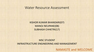
1. Water Resource Assessment
KISHOR KUMAR BHANDARI(07)
MANOJ NEUPANE(08)
SUBHASH CHHETRI(17)
MSC STUDENT
INFRASTRUCTURE ENGINEERING AND MANAGEMENT
NAMASTE and WELCOME1
2. Water resources assessment (WRA) is the
process of measuring, collecting and
analyzing relevant parameters on the
quantity and quality of water resources for
the purposes of a better development and
management of water resources.
(HUBERT n.y.)
2
3. Why Water Resource Assessment??
• World’s expanding population place an increasing demand of water on
drinking, food production, sanitation and other basic social and economic
needs.
But…. World’s water resources is finite
• Human activities is leading to Depletion of resources and Pollution is
increasing at alarming rate
• Water related natural hazards are most destructive to human life and
property.
• Climate change, global warming…… 3
6. ASPECT OF WRA
1.
• WATER RESOURCE
DEVELOPMENT
2.
• MANAGEMENT
3.
• PLANNING
6
7. WATER RESOURCE ASSESSMENT
• Water resource assessment is a systematic study of the status of
water services and resources, and of trends in accessibility and
demand within a specific domain of interest.
• Applicable at any relevant level, e.g. village, sub-catchment or
municipality
• Known under various different names, such as water accounting and
water resource audits
7
8. WATER RESOURCE ASSESSMENT
WRAs can help to clarify:
• Current status of water resources at different scales, including inter-and intra-
annual variability
• Current water use (including variability), and the resulting societal and
environmental trade-offs
• Scale related externalities, especially when patterns of water use are considered
over a range of temporal and spatial scales
• Social and institutional factors affecting access to water and their reliability
• Opportunities for saving or making more productive, efficient and/or equitable
use of water;
• Efficacy and transparency of existing water-related policies decision-making
processes
• Conflicts between existing information sets, and the overall accuracy of
government (and other) statistics
8
9. COMPONENTS OF WRA
Source: UNESCO and WMO (1997)
• Collection of hydrological data - the collection of historical data on water cycle
components at a number of points distributed over the assessment area such as quantity
and quality of surface and groundwater.
• Collection of physiographic data - obtaining data on the natural characteristics of the
terrain that determine the areal and time variations of the water cycle components, such
as topography, soils, surface and bed rock geology, land-use and land-cover. These
characteristics are designated for brevity as physiographic characteristics.
• Collection of data from basic and applied research - further research related to water
resources can be essential especially when some data is missing or the available date is
out of date. Furthermore, research may be needed in order to develop the required
technology used for the water resources assessment.
• Education and training – All the basic water resources assessment activities require
skilled manpower and this in turn require training and education of the manpower need.
• Techniques of areal assessment of water resources - techniques of transforming data
into information and of relating the hydrological data to the physiographic data for the
purpose of obtaining information on the water-resource characteristics at any point of
the assessment area.
9
10. Illustration of main components
10
Collection of hydrological
data
(e.g. in data banks)
(water cycle components,
including quantity and
quality of surface and
groundwater, station
information)
Collection of
physiographic data
(e.g. in a GIS)
(topographic, soils,
geology, political borders,
catchment borders, land
use, river network)
Education
and training
Basic and
applied
research
Techniques of
areal
assessment of
water
resources
(regionalisation
techniques)
Water
resources
information
(publications,
maps, etc.)
Users
(planning for
water resources
facilities)
Components of a water resources
assessment (WRA) program.
Source: UNESCO and WMO (1997)
11. Content Example for a Water Resources Assessment
(Adapted from US ARMY CORPS OF ENGINEERS 1999)
• The following list is an example how the content of a water resources
assessment could look like for your project area:
•
• 1. Introduction
• 2. Country Profile
• Geography
• Population and social impacts
• Economy
• Flood control
• Legislative framework
11
12. Content Example for a Water Resources Assessment
(Adapted from US ARMY CORPS OF ENGINEERS 1999)
• 3. Current Uses of Water Resources
• A .Water supply
• Domestic uses and needs
• Industrial/commercial uses and needs
• Agricultural uses and needs
• Hydropower
• Stream gauge network
• Waterway transportation
• 4. Surface Water Resources
• Precipitation and climate
• Rivers and basins
• Lakes and swamps
• Deforestation effects
12
13. Content Example for a Water Resources Assessment
(Adapted from US ARMY CORPS OF ENGINEERS 1999)
• 5. Ground Water Resources
• Aquifer definition and characteristics
• Hydrogeology
• 6. Water Quality
• Surface water
• Ground water
• Domestic waste disposal
13
14. Application of WRA
A case study of Guatemala city (investigation done by US ARMY CORPS OF ENGINEER IN 1999 )
Statement of the problem:
Guatemala has abundant water resource(+ rainfall) but:
No proper management to develop and maintain the w/s system
Uneven distribution of population(high density) in water deficit area
No public waste water treatment facilities
River are used for sewage disposal( no comprehensive water law)
Highest child mortality rate (in central American countries) due to water
contamination
Surface water is not usable for w/s
Surface water has decreased to 60-70% due to deforestation and increased
population
Shallow aquifer are contaminated
Hydrological data is lacking
14
15. Report
A case study of Guatemala city (investigation done by US ARMY CORPS OF ENGINEER IN 1999 )
A. Introduction
Importance of water
Major issue: quantity and quality
Factor affecting water
Purpose of assessment
B. Country profile
1. Geography
• 108,890 sq. km of territory
• S.E. of Mexico and N.W. And west of other
• Terrain is mainly mountainous with narrow costa
plains and rolling limestone plateaus
• Susceptible to volcanic eruption(with earthquakes)
15
16. Report
A case study of Guatemala city (investigation done by US ARMY CORPS OF ENGINEER IN 1999
2. POPULATION AND SOCIAL IMPACT
• Present population (10,322,000 in year 1994 with increasing rate of 2.9)
• Forecasted population (16 million by 2010.)
• Which region is densely populated
• Poverty (About 55 percent of the total population live in extreme poverty)
• Population according to age (By the year 2000, it is estimated that 65 percent
of the population will be under the age of 25)
• Population with respect to area(average population density of the country is
94.8 people per square kilometer)
3. ECONOMY
• GDP (mostly agriculture dominant(coffee, sugar, bananas), 50-60% labor
force )
• Industry (20% GDP, 15% of labor force) 16
17. Report
A case study of Guatemala city (investigation done by US ARMY CORPS OF ENGINEER IN 1999
4. Flood control
• Agency responsible for conducting R&D in flood control (in Guatemala
INSIVUMEH)
• Affect of flood if any (flood and hurricane in 1998, loss by banana companies
130 million US dollar, 40 km of dikes, 68km of road, SL of railroad, one bridge
were damaged, 60,000 inhabitants were affected)
• Flood control model (develop by Danish Institute in 1998 )
5. Legislative framework
• According to the constitution, the water of the country belongs to the people.
• Deforestation laws exist, but enforcement is extremely difficult.
• A national water law, negotiated for the past 10 years, has not yet passed, but
is expected to pass in the new government in the year 2000.
17
18. C. CURRENT USES OF WATER RESOURCE
A. water supply
1. Domestic use and needs
Demand: 12.78 cubic meter per second (1994)
forecasted: 26 cubic meter per second (2010)
• Surface water not usable(contaminated)
• In urban areas GW is mostly used(deep wells or springs)
• Each municipality is responsible for its own w/s and maintenance
• w/s by municipality is of poor quality and 50% is loss in conveyance
• In rural areas each community is responsible for their own w/s
• 3 million people in rural areas do not have access to potable water
• Most part of area has latrines but no conventional sewerage
EMPAGUA, DSM-MSPYAS, INFOM, NGO……….(different agencies for water
administration) 18
19. 2. Industrial and commercial uses
• Own w/s operations
• Minimal data exist of industrial water use
3. Agriculture uses and needs
• Bananas, sugarcane, and coffee are the main irrigated crops of the
country. The private sector irrigates 80,000 hectares for bananas,
sugarcane, and hay, and the government irrigates 20,000 hectares for
vegetables, berries, and watermelon.
• Presently, most (about 95 percent) of the water irrigation is from
surface water sources, but since the quantity of surface water
available for irrigation is decreasing due to deforestation, ground
water is beginning to be used more.
• Drip irrigation is the type of irrigation system used in the country 19
20. B. Hydropower and Geothermal power
• INDE is responsible for the electrical energy system. Five major hydropower
plants and one geothermal plant operate in the country. In Guatemala, about
half of the electricity is supplied by hydropower and the other half by thermal
power (other than geothermal). More geothermal power is expected to be used
in the future.
20
The two most serious problems facing the
hydropower projects are water contamination and
deforestation, which cause erosion and
sedimentation that is rapidly filling the reservoirs.
21. C. Stream Gage network
• INSIVUMEH is the agency responsible for water data collection
• No proper data exist:
• Due to civil war that lasted 36 year(data recovery in process)
• Budget, disrepair
D. Waterway Transportation
• Guatemala has an estimated 1,035 kilometers of navigable channels and
950 square kilometers of navigable lakes 34.
E. Recreation
• Tourism is considered as the second source of income after coffee. Most
tourism deals with history and archaeology, but adventure and ecological
tourism are closely related to water resources. The country possesses
much natural beauty, such as mountains, valleys, volcanoes, and tropical
jungles with more than 30 ecological reserves rich in flora and fauna.
35Lakes and rivers are a vital part of the landscape.
21
24. E. WATER RESOURCE DEPARTMENT SUMMARY
This chapter summarizes the water resources information of
Guatemala, which can be useful to water planners as a countrywide
overview of the available water resources.
each department consists of a general and regional
summary of the surface water and ground water
resources
(Summary is provided by 22 departments)
24
25. F. RECOMMENDATIONS
• Integral watershed management is needed to control deforestation and
the resulting erosion and sedimentation. Development of comprehensive
watershed and basin management plans is needed to curb these impacts.
• Plans should include (1) short-term measures (i.e., erosion stabilization,
small water supply systems, hydrologic and meteorological stations,
including the repair of the existing gages); (2) interim measures (i.e.,
sediment control programs, flood plain management, small reservoirs); and
(3) long-term measures(i.e., reforestation, large impoundment for flood
control, hydropower, and water supply).
• In certain areas of the country, the construction of small impoundments
for capturing water for water supply may be considered.
• Wastewater treatment is needed to improve the quality of the surface
water resources of the country, as much of the population uses surface
water for their water supply needs. 25
26. G. Overall summary
Water resources of Guatemala are a major concern. Reasons for the increased competition
for limited water resources are:
• Uneven rainfall distribution; • degradation of the watersheds caused by deforestation; •
no single agency responsible for management of water resources; • lack of wastewater
collection and treatment, and proper solid waste disposal; • poor water resources
management; • lack of adequate data needed to make informed decisions; • poor
irrigation supply network leading to underdevelopment of sector; • rapid growth in urban
areas increasing demand beyond system capacity; • lack of a national water law to protect
and preserve the resources; and • poor distribution networks.
Critical issues are the lack of access to water and sanitation, the high infant mortality rate,
the extensive environmental damage caused by deforestation, the lack of hydrologic data,
and the lack of watershed management. The solution to these issues presents significant
challenges to the managers of water resources of Guatemala. Throughout our meetings
with the managers, the recognition of the task before them and willingness to address the
issues were evident.
The lack of a national water and sanitation commission is the main reason for the absence
of minimum health conditions in the country. There are no clear strategies, policies, or
investment programs. Data is dispersed and unreliable. Coverage of potable water and
sanitation services is extremely low.
The recommendations offered in this report present the opportunities to improve the
water resources situation. If adopted, these actions can have positive long-term impacts.
Many of the other issues discussed in this report will require long-term institutional
commitments to affect change. Proper management of abundant water resources of
Guatemala can provide adequately for the needs of the country. 26
27. ADVANTAGE OF WRA
• Conducting a water resources assessment provides you with a
comprehensive understanding of the quality and quantity of water
resources in your area.
• Only by having a detailed understanding of the water resources in
your area, allows large-scale change in your water system.
27
28. DISADVANTAGE
• “Classic” Water Resource Assessment focuses predominantly on
water on a regional or national level and does usually not consider
the nutrient cycle and sanitation.
• Conducting a water resources assessment requires considerable time
and resources.
• Requires the training and education of manpower in order to conduct
a comprehensive analysis of the water resources in your area.
• Requires a network of experts who are able to conduct, analyze and
share the data needed for the water resources assessment.
28
29. WATER RESOURCE ASSESSMENT
WRA is the “determination of sources, extent, dependability and quality of
water resources for their utilization and control.”
(HUBERT n.y.)
29