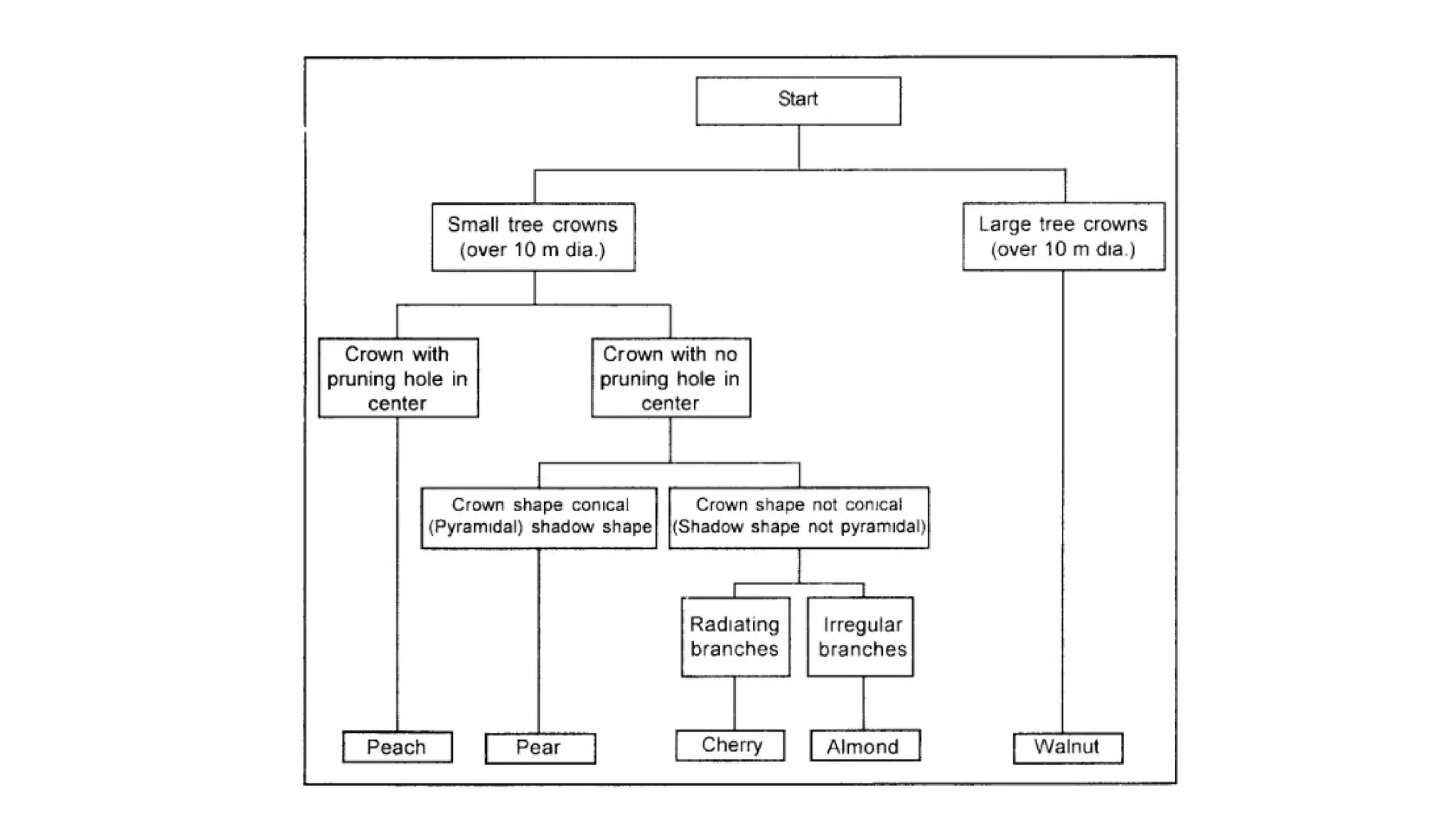
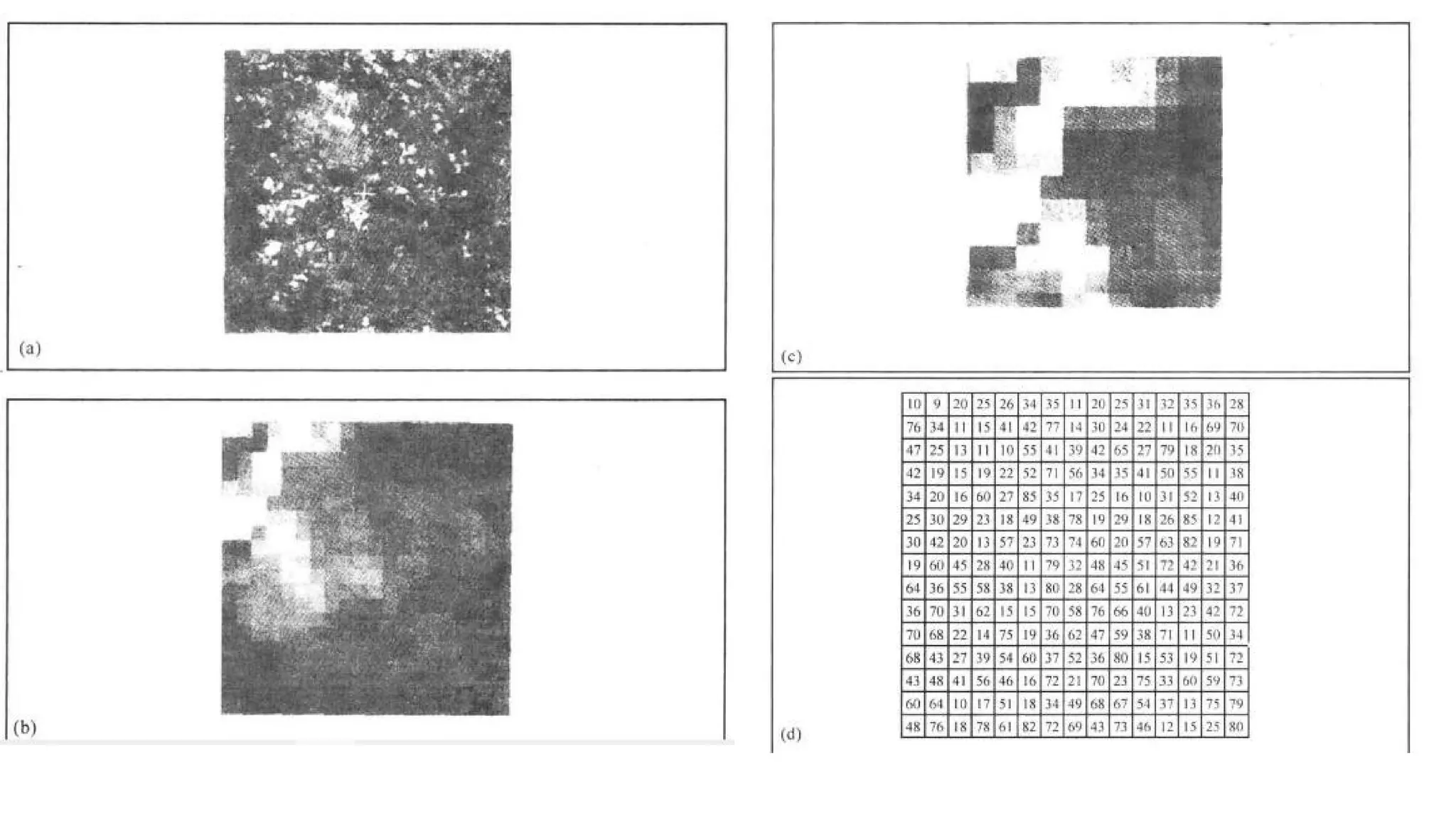
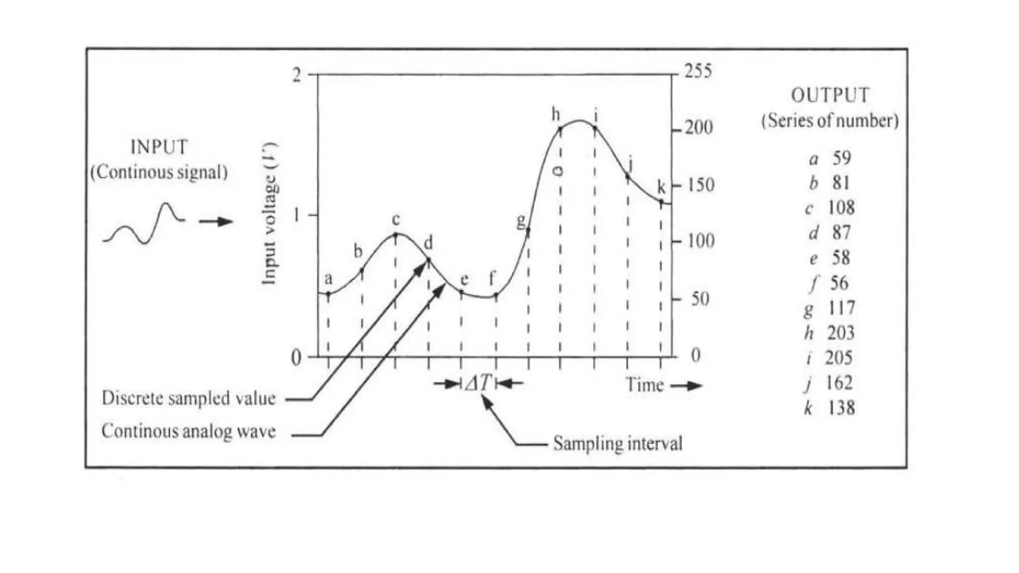
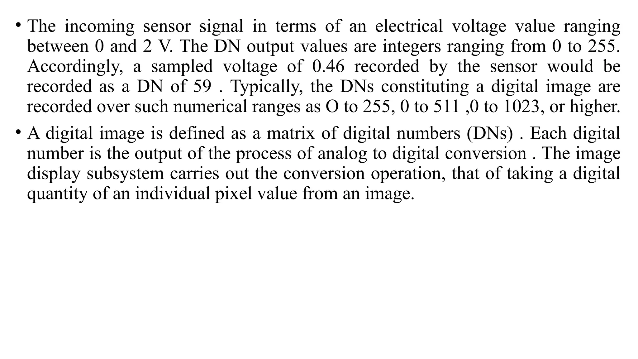
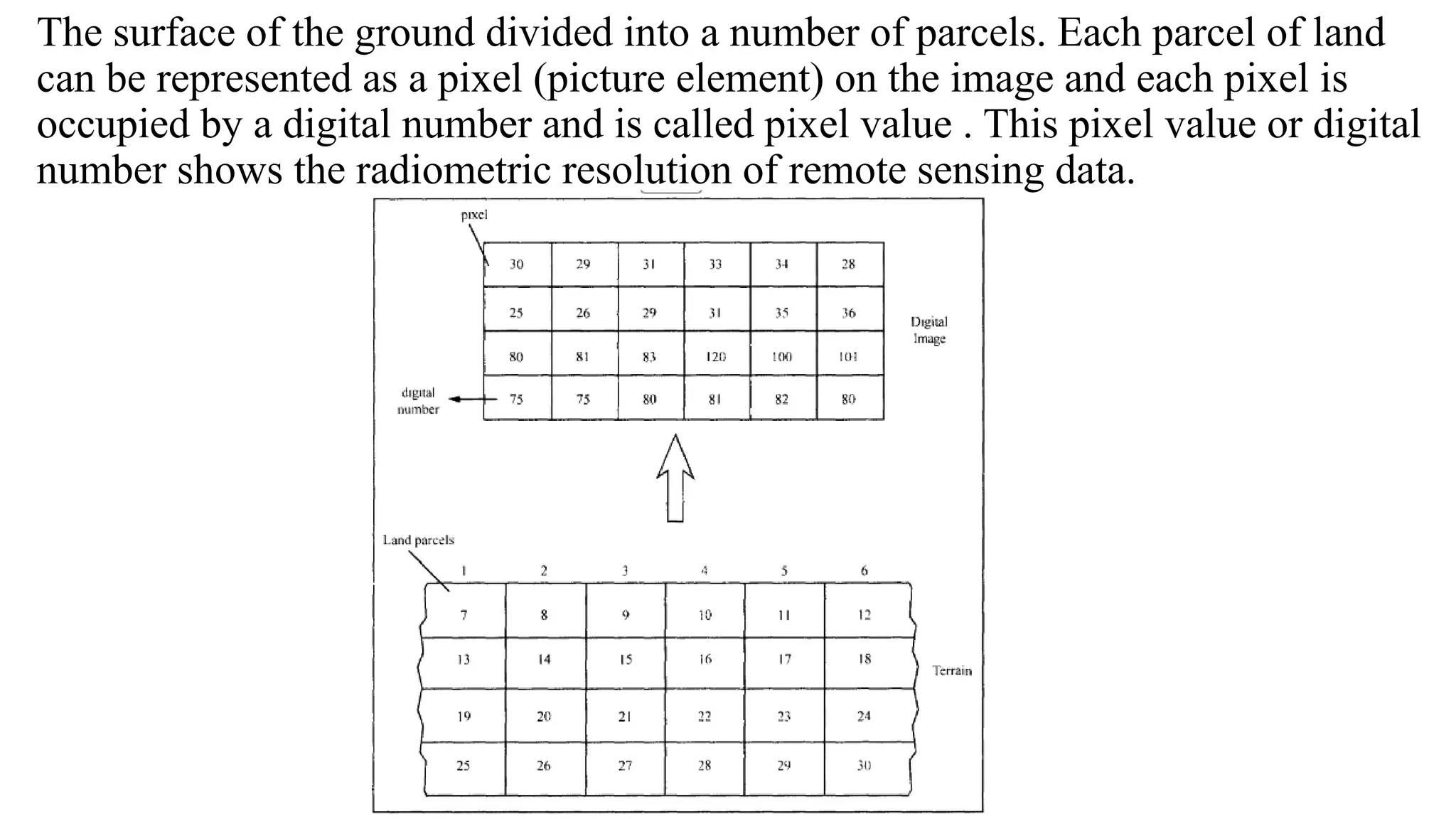
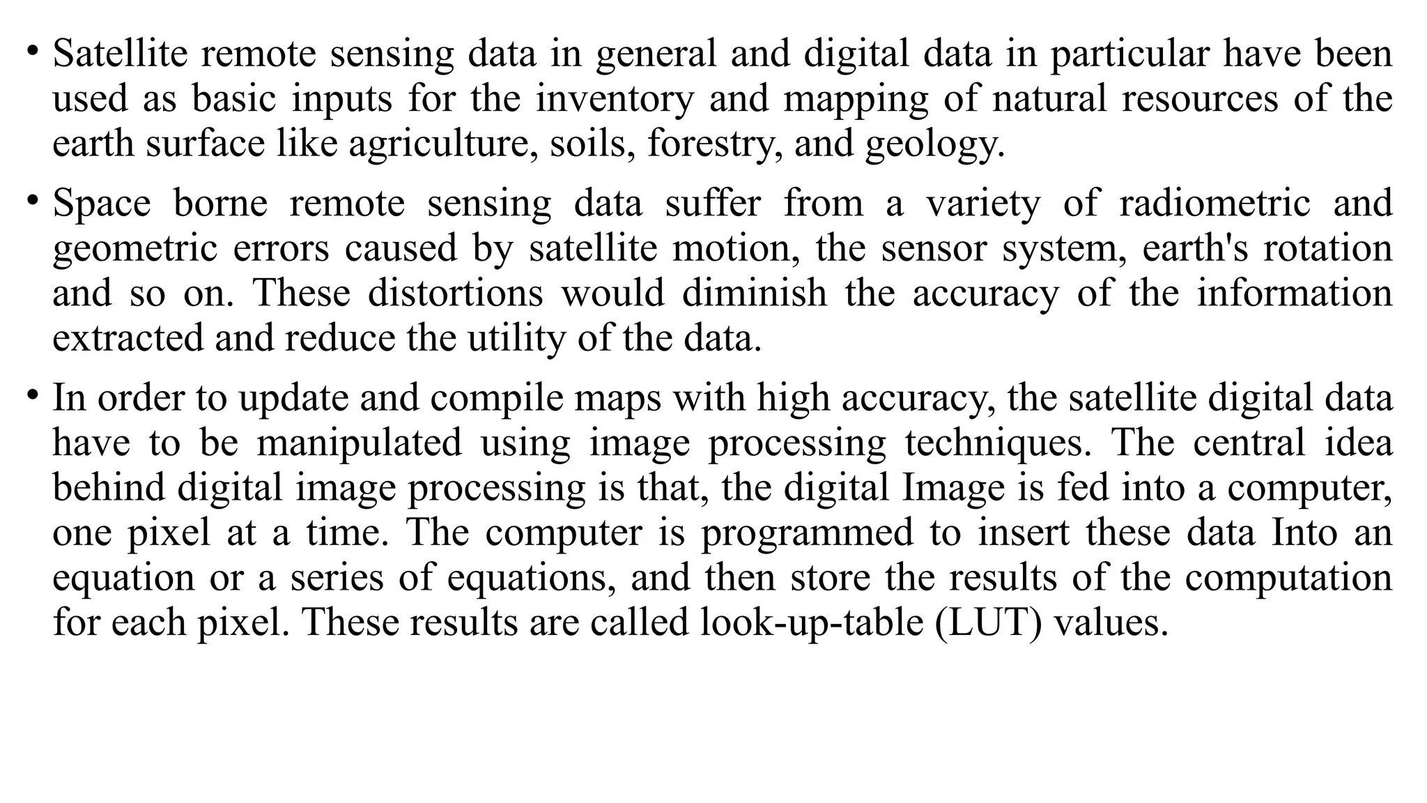
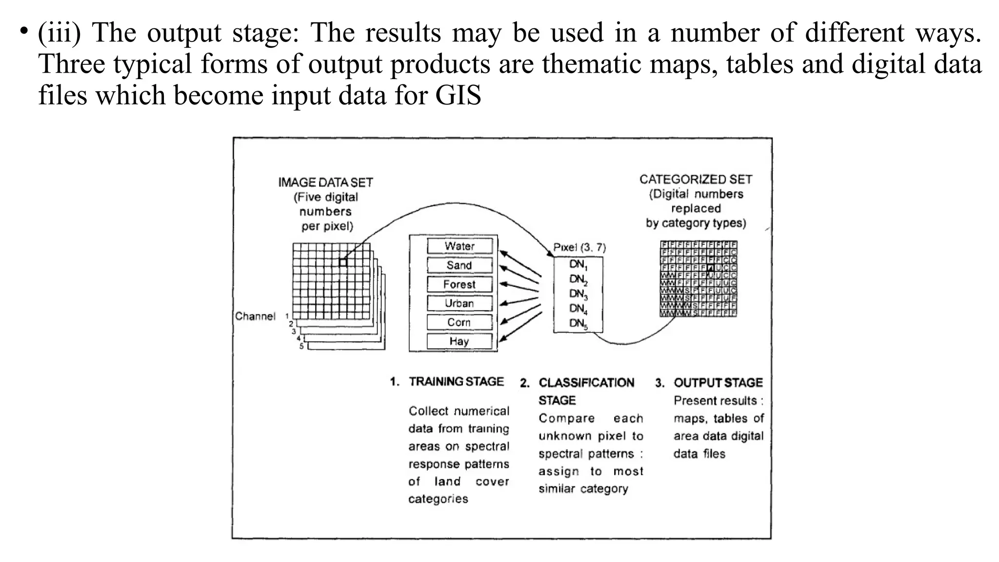
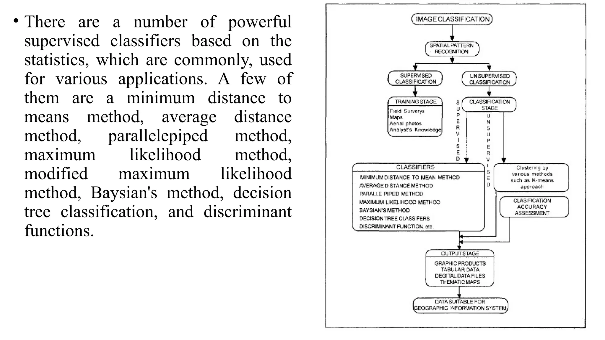
The document discusses data products and image analysis in geoinformatics, specifically focusing on remote sensing data types - raster and vector. It outlines various categories of data products based on processing levels, output media, and area coverage, emphasizing the importance of georeferencing and providing examples of standard, value-added, and derived products. Additionally, it covers image interpretation techniques, the significance of scale in maps, and how remote sensing data is utilized for insightful analysis.