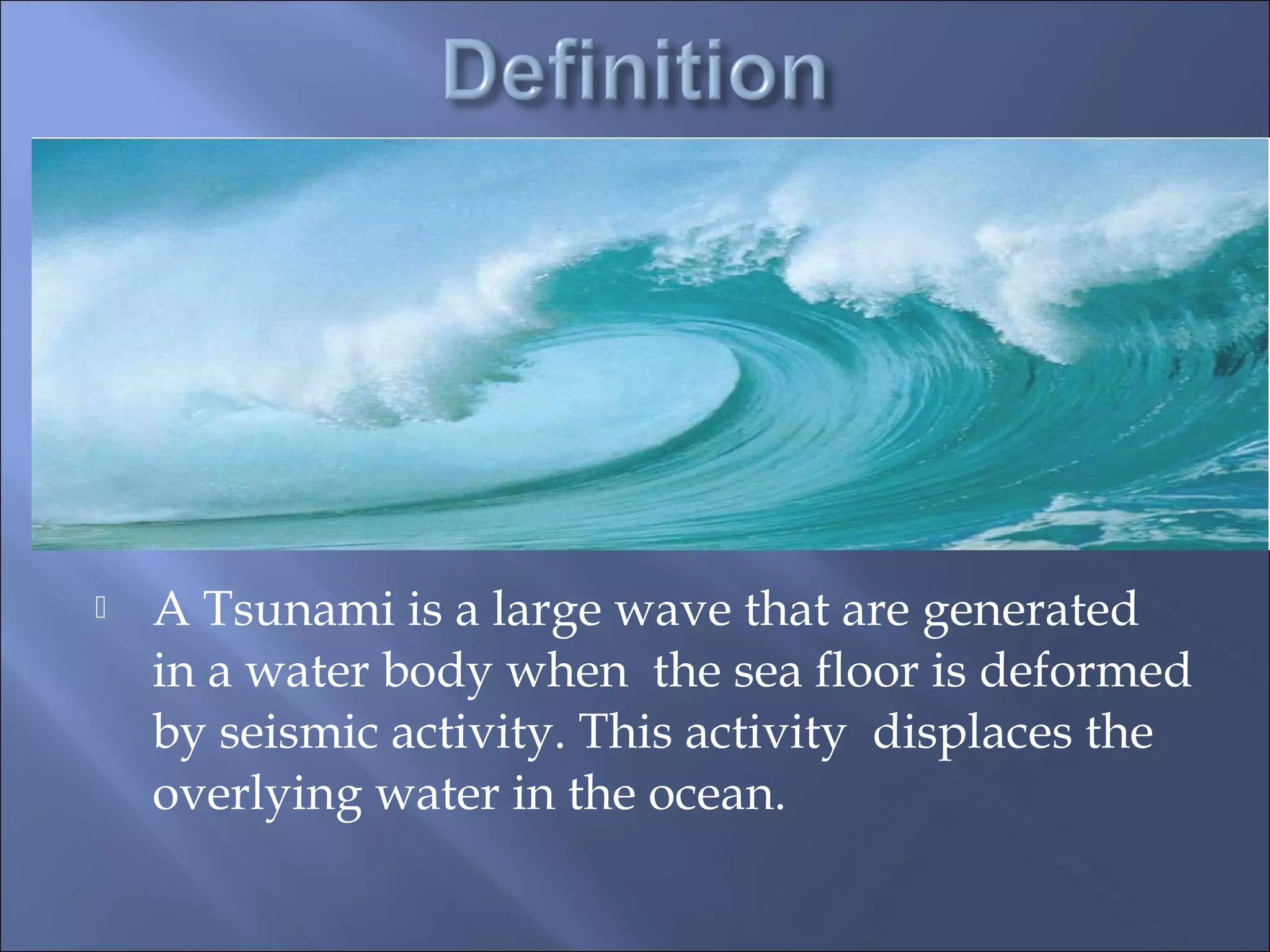
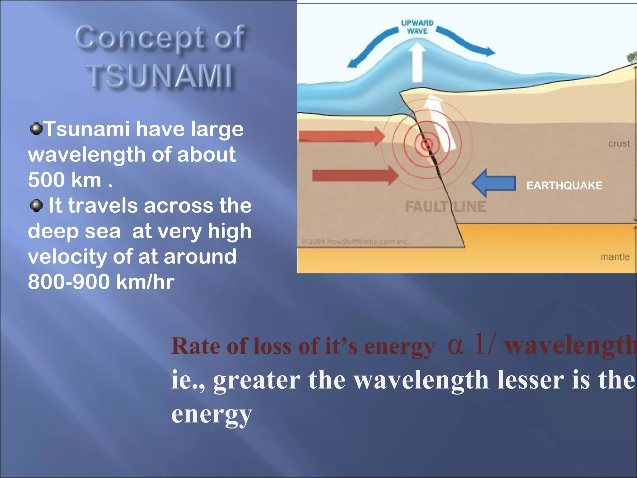
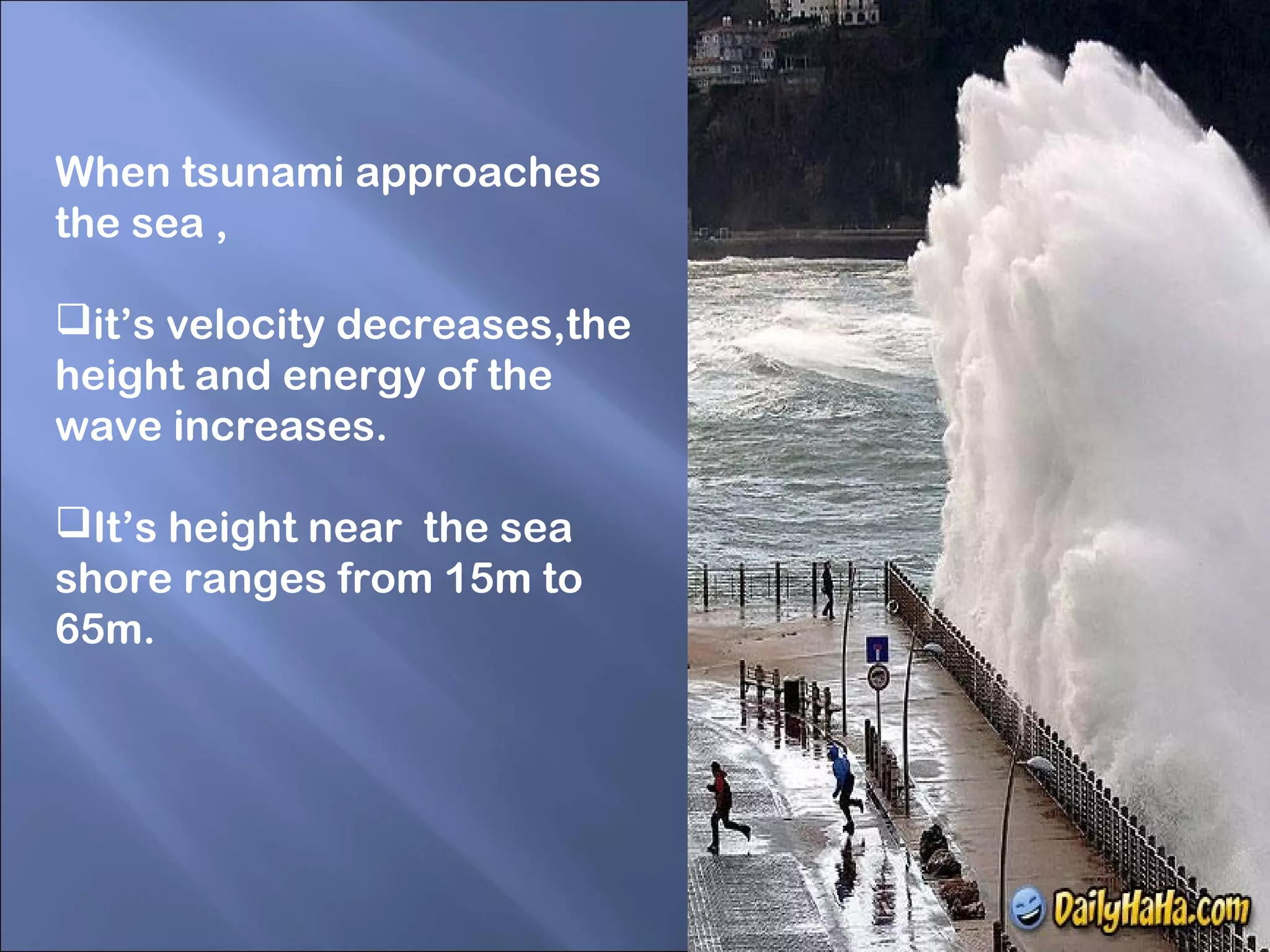
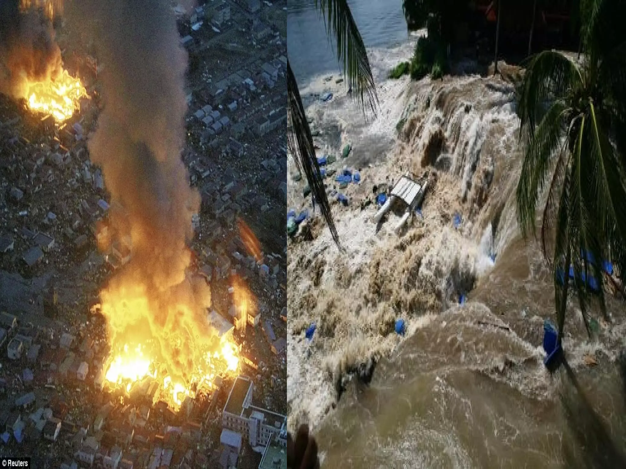
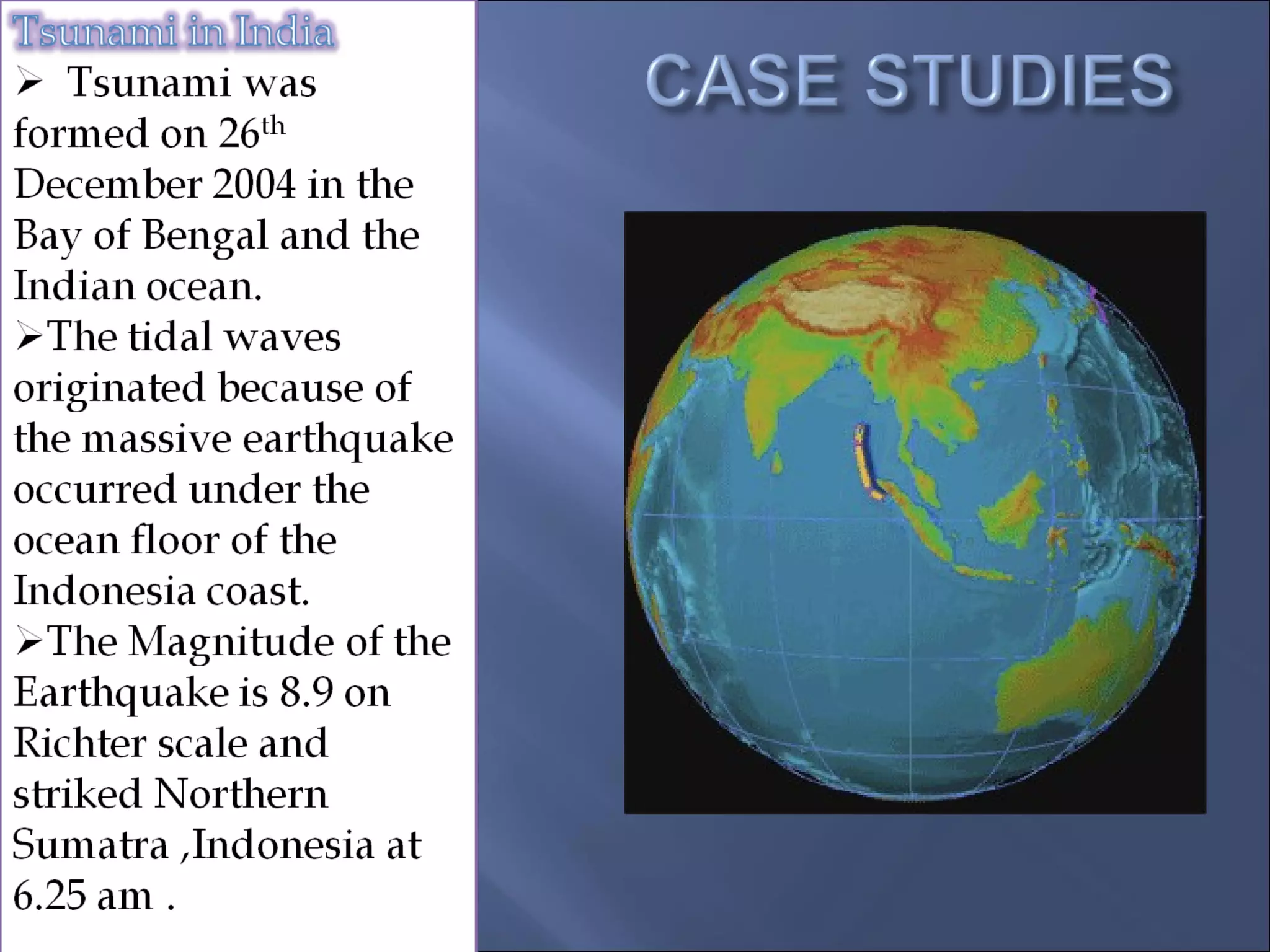
Tsunami
“tsu” – meaning harbour
“nami”– meaning wave
 A Tsunami is a large wave that are generated
in a water body when the sea floor is deformed
by seismic activity. This activity displaces the
overlying water in the ocean.
It causes seismic
activities like
earthquake ,
landslides,volconic
eruptions,explosions
can create Tsunami.
Deformation of sea
floor due to the
movement of plates.
EARTHQUAKE
Tsunami have large
wavelength of about
500 km .
It travels across the
deep sea at very high
velocity of at around
800-900 km/hr
Rate of loss of it’s energy α 1/ wavelength
ie., greater the wavelength lesser is the
energy
When tsunami approaches
the sea ,
it’s velocity decreases,the
height and energy of the
wave increases.
It’s height near the sea
shore ranges from 15m to
65m.
i. Tsunami is generated when the sea floor
abruptly deforms and vertically displaces
the overlying water.
ii.Earthquake are associated with the
earth’s crystal deformation.
iii.When the earthquake occurs beneath the
sea , the water above the deformed area is
displaced from it’s equilibrium position.
iv.Waves are generated , when the
displaced water mass regains it’s
equilibrium.
Tsunami attacks
mostly the coastlines
,causing devastating
property ,damage
and loss of life.
Tsunami affected
the wealth of the
country.
It may also
spread lot of water
borne diseases.
Step 1:
Earthquakes, under the
water , are monitored by
sensors on the floor on the
sea.
Step 2:
The sensors send the
information of floating
buoys on the surface,
whenever they detect any
changes in pressure of the
sea.
Step 3:
The information is then
relayed to satellites, which
passes it on to the earth
stations.
Step 4:
All member nations of the
warning system are then
warned of the danger
approaching.
Step 5:
Finally country make the
people alert through the
media to take all necessary
precautions.
The tsunami would
have travelled at the
speed of jet engine of
700-800 km/hr and
hit Tamilnadu and
Srilanka coast about
2-3 hours after the
Earthquake.
 Death number in
India
 Tamilnadu: 7950
 Pondicherry: 580
 Kerala: 170
 Andhra Pradesh: 105
 Nagapatnam
alone(Tamilnadu):6050
Courtesy of DigitalGlobe Jan 1, 2004
Courtesy of DigitalGlobe Dec 26, 2004
Tsunami
Tsunami

Tsunami

  • 1.
  • 2.
    “tsu” – meaningharbour “nami”– meaning wave
  • 3.
     A Tsunamiis a large wave that are generated in a water body when the sea floor is deformed by seismic activity. This activity displaces the overlying water in the ocean.
  • 4.
    It causes seismic activitieslike earthquake , landslides,volconic eruptions,explosions can create Tsunami. Deformation of sea floor due to the movement of plates.
  • 5.
    EARTHQUAKE Tsunami have large wavelengthof about 500 km . It travels across the deep sea at very high velocity of at around 800-900 km/hr Rate of loss of it’s energy α 1/ wavelength ie., greater the wavelength lesser is the energy
  • 7.
    When tsunami approaches thesea , it’s velocity decreases,the height and energy of the wave increases. It’s height near the sea shore ranges from 15m to 65m.
  • 8.
    i. Tsunami isgenerated when the sea floor abruptly deforms and vertically displaces the overlying water. ii.Earthquake are associated with the earth’s crystal deformation. iii.When the earthquake occurs beneath the sea , the water above the deformed area is displaced from it’s equilibrium position. iv.Waves are generated , when the displaced water mass regains it’s equilibrium.
  • 9.
    Tsunami attacks mostly thecoastlines ,causing devastating property ,damage and loss of life. Tsunami affected the wealth of the country. It may also spread lot of water borne diseases.
  • 12.
    Step 1: Earthquakes, underthe water , are monitored by sensors on the floor on the sea. Step 2: The sensors send the information of floating buoys on the surface, whenever they detect any changes in pressure of the sea. Step 3: The information is then relayed to satellites, which passes it on to the earth stations.
  • 13.
    Step 4: All membernations of the warning system are then warned of the danger approaching. Step 5: Finally country make the people alert through the media to take all necessary precautions.
  • 15.
    The tsunami would havetravelled at the speed of jet engine of 700-800 km/hr and hit Tamilnadu and Srilanka coast about 2-3 hours after the Earthquake.
  • 16.
     Death numberin India  Tamilnadu: 7950  Pondicherry: 580  Kerala: 170  Andhra Pradesh: 105  Nagapatnam alone(Tamilnadu):6050
  • 17.
  • 18.
  • 19.
  • 20.

Editor's Notes

  • #4 The tsunami, or seismic sea wave, is a wave generated by an undersea geologic event, such as a great earthquake, volcanic explosion, or underwater landslide. The word “tsunami” is from the Japanese language, and means “harbor wave.” Since the tsunami is not felt in deep water, it is not experienced by ships at sea. It is only when the wave enters shallow water that it becomes apparent, and thus the name “harbor wave.” Tsunamis are not “tidal waves”—they are generated by entirely different forces than the tides.
  • #17 Although the final totals are not yet in, the Indian Ocean Tsunami appears to be the costliest natural disaster to date.
  • #18 This image and the three following ones show Kalutara Beach, Sri Lanka, before and after the tsunami. Sri Lanka recorded more than 30,000 casualties as a result of the event. Note the pattern of gentle wind waves breaking on the beach. You can also see a small inlet crossing the beach road as a dark line near the top of the photo. At the right is a low stream valley.
  • #19 This image catches the tsunami as it is receding from the land. Muddy floodwaters cover the ground and fill the buildings. The stream valley is inundated and the inlet is channeling a strong outflow back to the ocean.
  • #20 A little farther along the coast, the tsunami has retreated several hundred meters from the beach. A confused surf of wind waves continues to break, but the sea level is far below its usual stand. Note the turbid water, rich in sediment dragged from the shoreline.The beach is no longer a tidy line of brown against a green park zone, but a sequence of brown sandy patches washed oceanward and gullied by the receding waters.
  • #21 In this close-up of the previous image, muddy water still inundates the coastal strip.