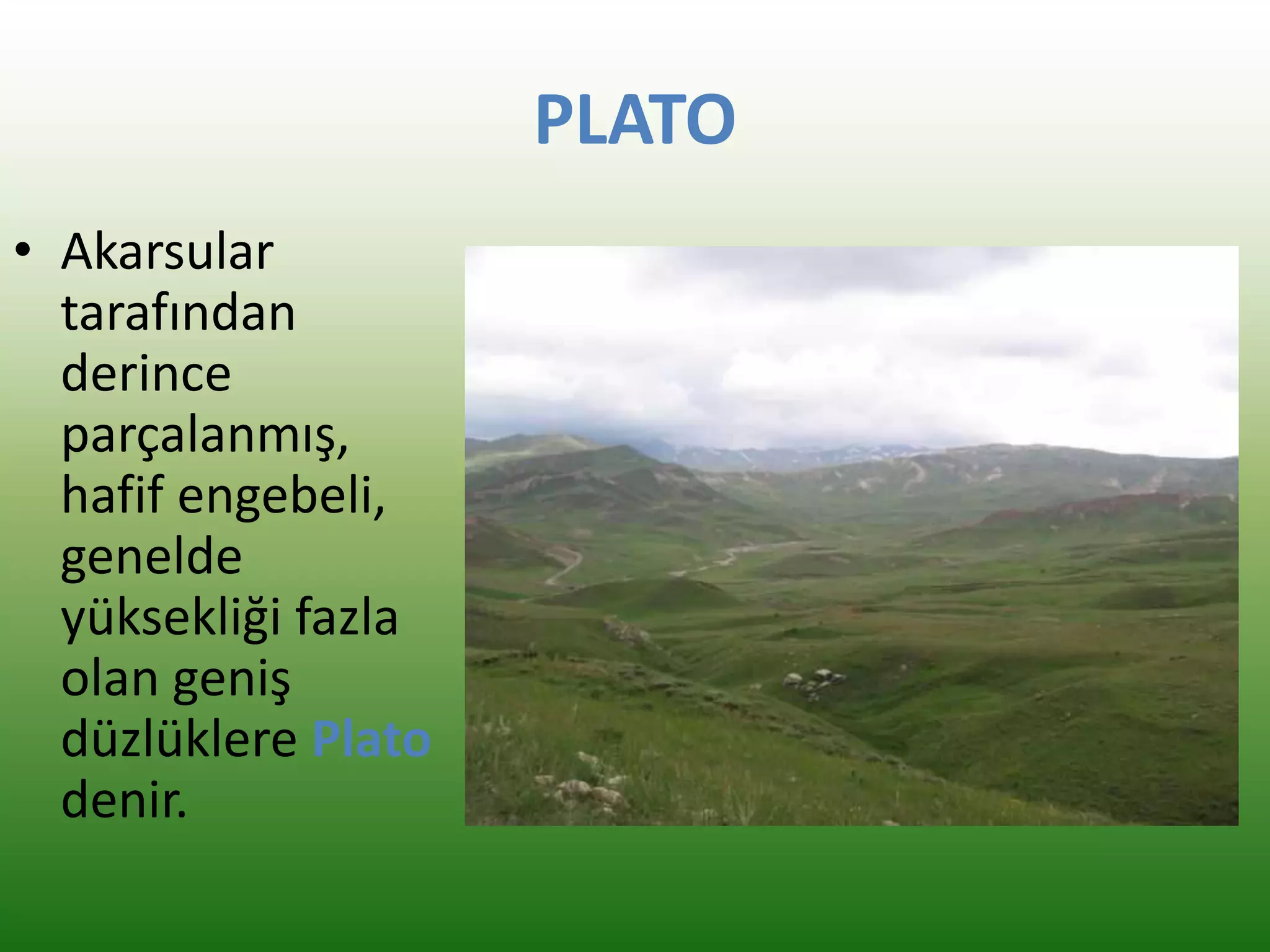
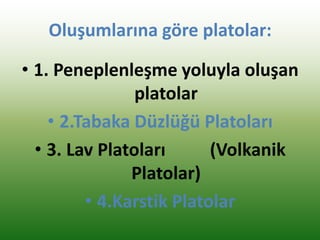
• Plato ileyayla kavramlarını birbirinden ayrı
tutmak gerekir.
• Yayla daha çok yaz aylarında hayvan otlatılan,
ya da turizm amaçlı kullanılan geçici bir
yerleşme şekli iken; plato bir yeryüzü şeklidir.
3.
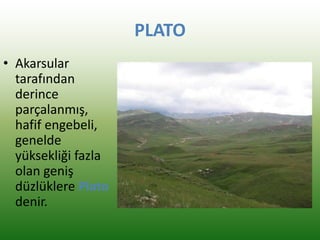
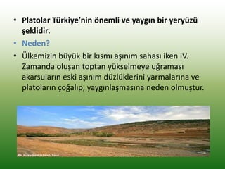
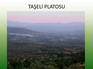
• Platolar Türkiye’ninönemli ve yaygın bir yeryüzü
şeklidir.
• Neden?
• Ülkemizin büyük bir kısmı aşınım sahası iken IV.
Zamanda oluşan toptan yükselmeye uğraması
akarsuların eski aşınım düzlüklerini yarmalarına ve
platoların çoğalıp, yaygınlaşmasına neden olmuştur.
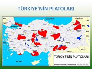
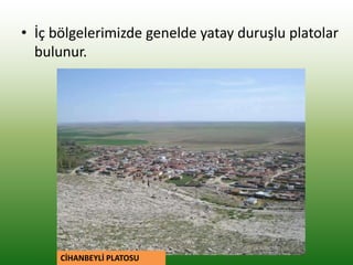
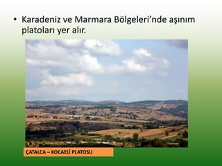
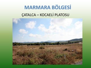
• Karadeniz veMarmara Bölgeleri’nde aşınım
platoları yer alır.
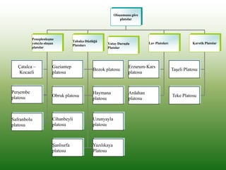
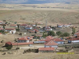
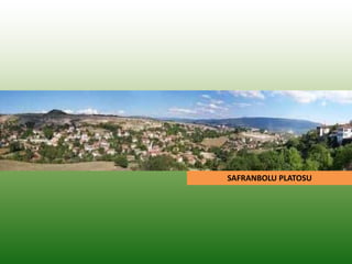
ÇATALCA – KOCAELİ PLATOSU
12.
İÇ ANADOLU BÖLGESİ
•Tuz Gölü çevresinde platolara yaygın olarak rastlanır.
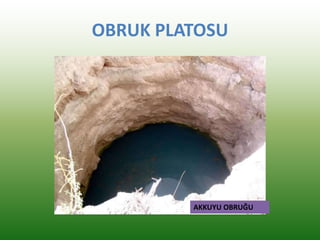
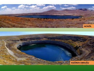
• Tuz Gölü ile Konya Ovası arasında OBRUK ,
• Tuz Gölü’nün batısında CİHANBEYLİ,
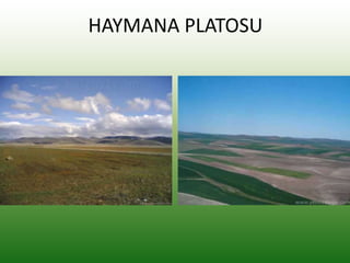
• Tuz Gölü’nün kuzeybatısında HAYMANA,
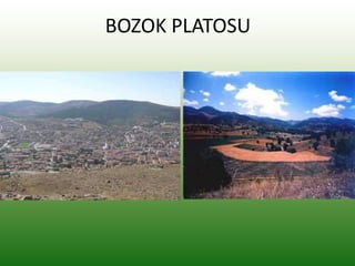
• Kızılırmak yayı içerisinde BOZOK,
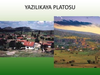
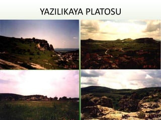
• İçbatı Anadolu eşiği üzerinde YAZILIKAYA,
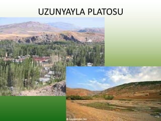
• İç Anadolu ile Doğu Anadolu arasında UZUNYAYLA
Platoları yer alır.
• Niğde, Kayseri, Nevşehir arasında kalan saha
Türkiye'deki lav platolarına örnek alanlardır.
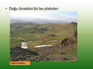
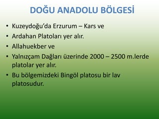
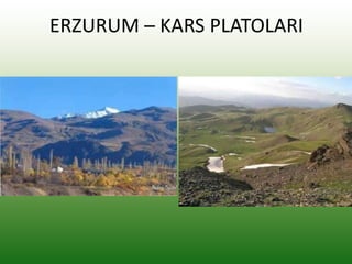
DOĞU ANADOLU BÖLGESİ
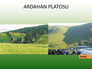
•Kuzeydoğu’da Erzurum – Kars ve
• Ardahan Platoları yer alır.
• Allahuekber ve
• Yalnızçam Dağları üzerinde 2000 – 2500 m.lerde
platolar yer alır.
• Bu bölgemizdeki Bingöl platosu bir lav
platosudur.
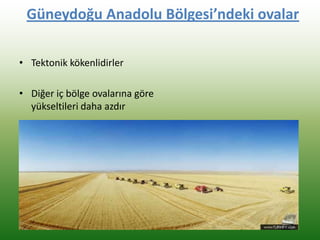
GÜNEYDOĞU ANADOLU BÖLGESİ
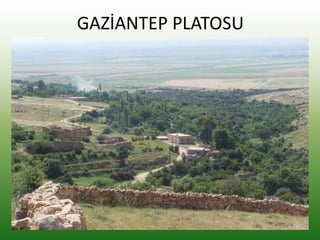
•Gaziantep ve
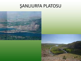
• Şanlıurfa Platoları yer alır
• Güneydoğu Anadolu'daki Karacadağ
Platosu bir lav platosudur
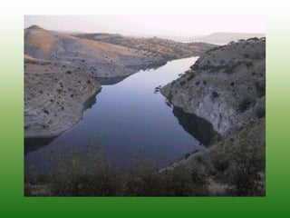
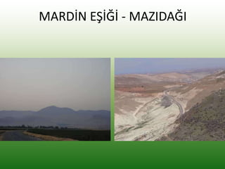
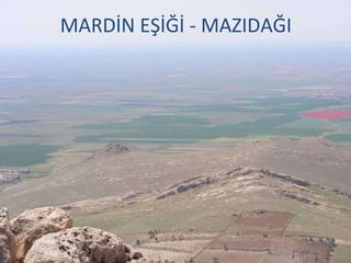
• Diyarbakır Havzası, Mardin Eşiği ve Mazıdağı
çevresi de akarsular tarafından parçalanmıştır.
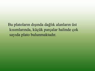
Bu platoların dışındadağlık alanların üst
kısımlarında, küçük parçalar halinde çok
sayıda plato bulunmaktadır.
42.
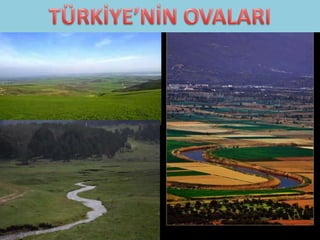
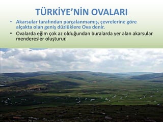
TÜRKİYE’NİN OVALARI
• Akarsulartarafından parçalanmamış, çevrelerine göre
alçakta olan geniş düzlüklere Ova denir.
• Ovalarda eğim çok az olduğundan buralarda yer alan akarsular
menderesler oluşturur.
43.
Ovaların Özellikleri
• 1-)Çevrelerine göre alçak alanlardır.
• 2-) Akarsular tarafından yarılmamıştır.
• 3-) Düz bir yapıya sahiptirler.
• 4-) Toprakları genel olarak verimlidir.
• 5-) Nüfus, yerleşme ve ekonomik
faaliyetlere uygun sahalardır.
44.
Oluşumlarına göre ovalar:
•Ülkemizdeki ovaların oluşumunda tektonik,
volkanik, karstik olaylar ve akarsu biriktirmesi
etkili olmuştur.
• En etkili olanı tektonik olaylardır.
• Tektonik ovalar genelde 3.ve 4. zamanda
çöken sahalarda oluşmuştur.
45.
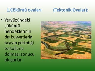
1.Çöküntü ovaları (TektonikOvalar):
• Yeryüzündeki
çöküntü
hendeklerinin
dış kuvvetlerin
taşıyıp getirdiği
tortullarla
dolması sonucu
oluşurlar.
46.
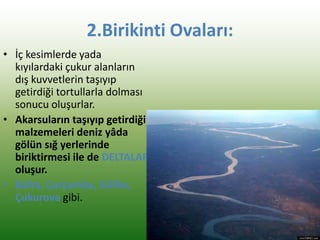
2.Birikinti Ovaları:
• İçkesimlerde yada
kıyılardaki çukur alanların
dış kuvvetlerin taşıyıp
getirdiği tortullarla dolması
sonucu oluşurlar.
• Akarsuların taşıyıp getirdiği
malzemeleri deniz yâda
gölün sığ yerlerinde
biriktirmesi ile de DELTALAR
oluşur.
• Bafra, Çarşamba, Silifke,
Çukurova gibi.
47.
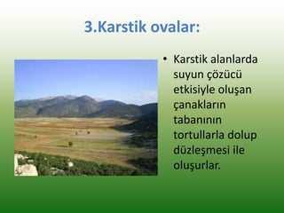
3.Karstik ovalar:
• Karstikalanlarda
suyun çözücü
etkisiyle oluşan
çanakların
tabanının
tortullarla dolup
düzleşmesi ile
oluşurlar.
48.
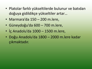
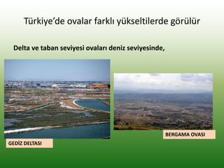
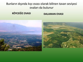
Türkiye’de ovalar farklıyükseltilerde görülür
Delta ve taban seviyesi ovaları deniz seviyesinde,
GEDİZ DELTASI
BERGAMA OVASI
49.
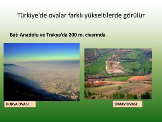
Türkiye’de ovalar farklıyükseltilerde görülür
Batı Anadolu ve Trakya’da 200 m. civarında
BURSA OVASI SİMAV OVASI
50.
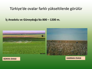
Türkiye’de ovalar farklıyükseltilerde görülür
İç Anadolu ve Güneydoğu’da 800 – 1200 m.
KONYA OVASI HARRAN OVASI
51.
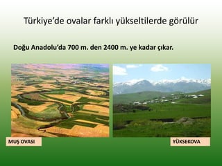
Türkiye’de ovalar farklıyükseltilerde görülür
Doğu Anadolu’da 700 m. den 2400 m. ye kadar çıkar.
MUŞ OVASI YÜKSEKOVA
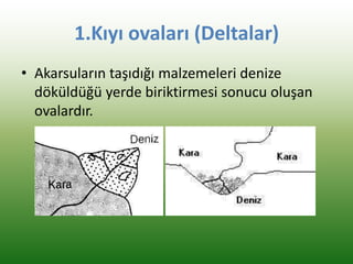
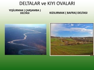
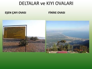
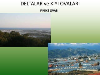
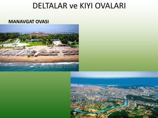
1.Kıyı ovaları (Deltalar)
•Akarsuların taşıdığı malzemeleri denize
döküldüğü yerde biriktirmesi sonucu oluşan
ovalardır.
54.
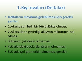
1.Kıyı ovaları (Deltalar)
•Deltaların meydana gelebilmesi için gerekli
şartlar;
• 1.Akarsuyun belli bir büyüklükte olması.
• 2.Akarsuların getirdiği alüvyon miktarının bol
olması.
• 3.Kıyının çok derin olmaması.
• 4.Kıyılardaki güçlü akıntıların olmaması.
• 5.Kıyıda gel-gitin etkili olmaması gerekir.
55.
Kıyı ovaları (Deltalar)
•Türkiye’nin deltaları oldukça genç oluşumludur
• 100.000 yıl önce son buzul döneminden sonra
deniz seviyesinin yükselmesine bağlı olarak
bugünkü görünümlerini almışlardır
• Deltalar oldukça hızlı gelişirler ( Menderesler –
Söke ovası, Gediz, Efes Antik şehri)
56.
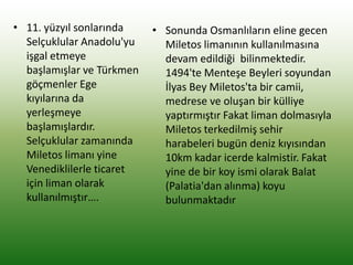
• 11. yüzyılsonlarında
Selçuklular Anadolu'yu
işgal etmeye
başlamışlar ve Türkmen
göçmenler Ege
kıyılarına da
yerleşmeye
başlamışlardır.
Selçuklular zamanında
Miletos limanı yine
Venediklilerle ticaret
için liman olarak
kullanılmıştır….
• Sonunda Osmanlıların eline gecen
Miletos limanının kullanılmasına
devam edildiği bilinmektedir.
1494'te Menteşe Beyleri soyundan
İlyas Bey Miletos'ta bir camii,
medrese ve oluşan bir külliye
yaptırmıştır Fakat liman dolmasıyla
Miletos terkedilmiş sehir
harabeleri bugün deniz kıyısından
10km kadar icerde kalmistir. Fakat
yine de bir koy ismi olarak Balat
(Palatia'dan alınma) koyu
bulunmaktadır
57.
2-İç Ovalar
• İçovalarımızın çoğu 3.Zamanda tektonik hareketle
çöken sahalardaki çanaklar içinde oluşan göllerin
içine akarsuların taşıdığı malzemelerin birikmesiyle
meydana gelmiştir.
• Bunlar bazen fay hatlarında diziler halinde bazen de
tek tek bulunurlar.
• Bunların çoğunun yükseltileri fazladır.
• Bundan dolayı bunlara yüksek ovalar da denir.
58.
Ovaların Ekonomik Önemi:
•1.Tarımın en yoğun yapıldığı verimli alanlardır.
• 2.Ulaşım en kolay olduğu alanlardır.
• 3. Yerleşmeler kurulduğu ve nüfusun en yoğun
yaşadığı yerlerdir.
• 4-Kıyı ovaları başta olmak üzere su kaynaklarının en
bol olduğu yerlerdir.
• Genel olarak ovalar fay hatlarında olduğu için
deprem riskinin en yüksek olduğu yerlerdir.
• Ayrıca alçak oldukları için de sel ve taşkın tehlikesi
fazla olan alanlardır.
59.
• Genel olarakovalar fay hatlarında olduğu için
deprem riskinin en yüksek olduğu yerlerdir.
• Ayrıca alçak oldukları için de sel ve taşkın tehlikesi
fazla olan alanlardır.
Söke Ovası- Söke Ovası Denize Döndü
Söke Ovası’nda bu kışta binlerce dönüm arazi sular altında kaldı.
25 Ocak 2012 Çarşamba Nazilli.com.tr
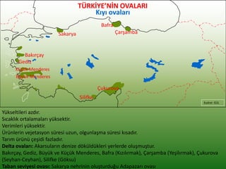
TÜRKİYE’NİN OVALARI
Yükseltileri azdır.
Sıcaklıkortalamaları yüksektir.
Verimleri yüksektir.
Ürünlerin vejetasyon süresi uzun, olgunlaşma süresi kısadır.
Tarım ürünü çeşidi fazladır.
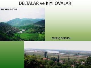
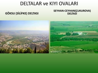
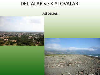
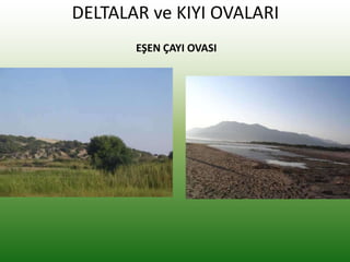
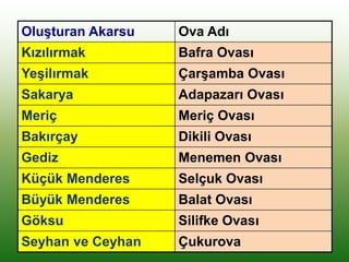
Delta ovaları: Akarsuların denize döküldükleri yerlerde oluşmuştur.
Bakırçay, Gediz, Büyük ve Küçük Menderes, Bafra (Kızılırmak), Çarşamba (Yeşilırmak), Çukurova
(Seyhan-Ceyhan), Silifke (Göksu)
Taban seviyesi ovası: Sakarya nehrinin oluşturduğu Adapazarı ovası
Kudret GÜL
Çukurova
Silifke
Gediz
Bakırçay
Sakarya
Bafra
Çarşamba
Küçük Menderes
Büyük Menderes
Kıyı ovaları
Oluşturan Akarsu OvaAdı
Kızılırmak Bafra Ovası
Yeşilırmak Çarşamba Ovası
Sakarya Adapazarı Ovası
Meriç Meriç Ovası
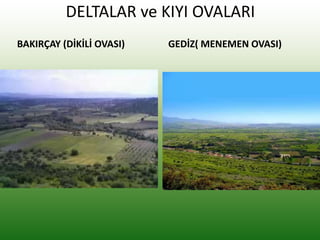
Bakırçay Dikili Ovası
Gediz Menemen Ovası
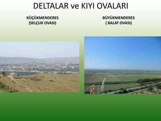
Küçük Menderes Selçuk Ovası
Büyük Menderes Balat Ovası
Göksu Silifke Ovası
Seyhan ve Ceyhan Çukurova
76.
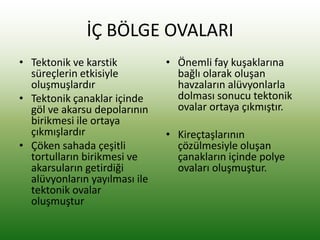
İÇ BÖLGE OVALARI
•Tektonik ve karstik
süreçlerin etkisiyle
oluşmuşlardır
• Tektonik çanaklar içinde
göl ve akarsu depolarının
birikmesi ile ortaya
çıkmışlardır
• Çöken sahada çeşitli
tortulların birikmesi ve
akarsuların getirdiği
alüvyonların yayılması ile
tektonik ovalar
oluşmuştur
• Önemli fay kuşaklarına
bağlı olarak oluşan
havzaların alüvyonlarla
dolması sonucu tektonik
ovalar ortaya çıkmıştır.
• Kireçtaşlarının
çözülmesiyle oluşan
çanakların içinde polye
ovaları oluşmuştur.
77.
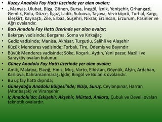
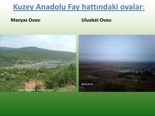
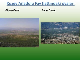
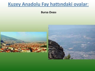
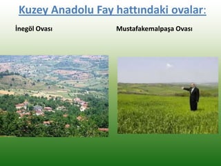
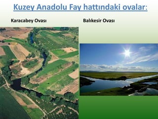
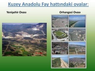
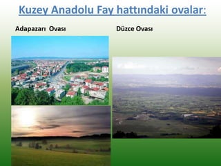
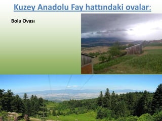
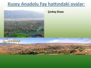
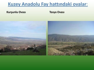
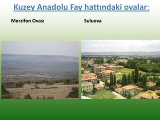
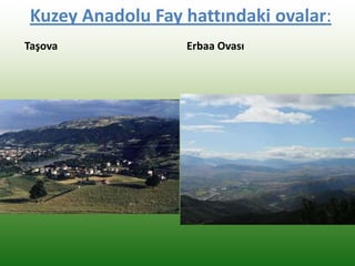
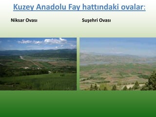
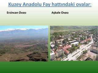
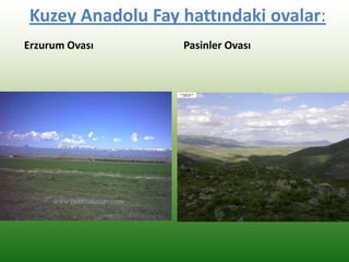
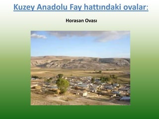
• Kuzey AnadoluFay Hattı üzerinde yer alan ovalar;
• , Manyas, Ulubat, Biga, Gönen, Bursa, İnegöl, İznik, Yenişehir, Orhangazi,
Gemlik, Bolu, Düzce, İlgaz, Ladik, Suluova, Taşova, Vezirköprü, Turhal, Kargı,
Eleşkirt, Kaynaştı, Zile, Erbaa, Suşehri, Niksar, Erzincan, Erzurum, Pasinler ve
Ağrı ovalarıdır.
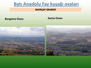
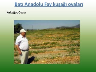
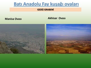
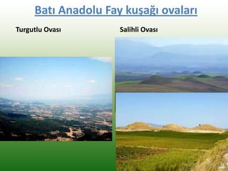
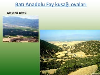
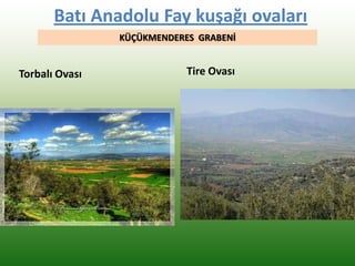
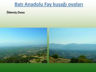
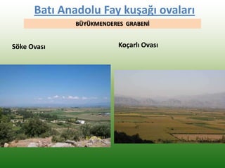
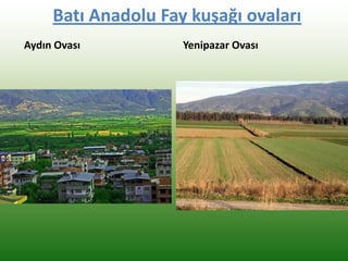
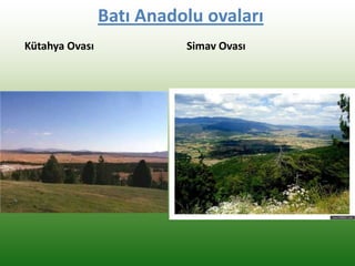
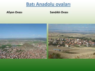
• Batı Anadolu Fay Hattı üzerinde yer alan ovalar;
• Bakırçay vadisinde; Bergama, Soma ve Kırkağaç
• Gediz vadisinde; Manisa, Akhisar, Turgutlu, Salihli ve Alaşehir
• Küçük Menderes vadisinde; Torbalı, Tire, Ödemiş ve Bayındır
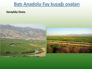
• Büyük Menderes vadisinde; Söke, Koçarlı, Aydın, Yeni pazar, Nazilli ve
Sarayköy ovalan bulunur.
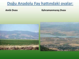
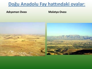
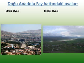
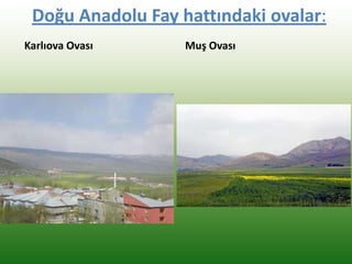
• Güney Anadolu Fay Hattı üzerinde yer alan ovalar;
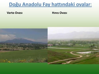
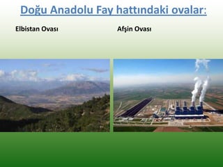
• Amik, Malatya, Elazığ, Hınıs, Muş, Varto, Elbistan, Göynük, Afşin, Ardahan,
Karlıova, Kahramanmaraş, Iğdır, Bingöl ve Bulanık ovalarıdır.
• Bu üç fay hattı dışında;
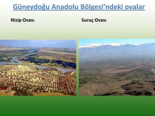
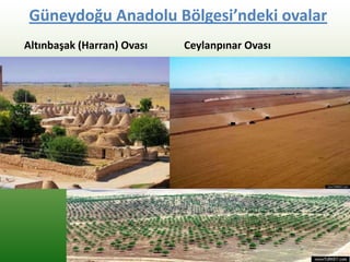
• Güneydoğu Anadolu Bölgesi'nde; Nizip, Suruç, Ceylanpınar, Harran
(Altınbaşak) ve Viranşehir
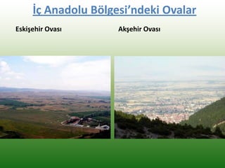
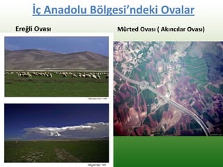
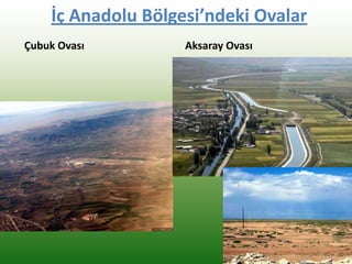
• İç Anadolu'da; Eskişehir, Akşehir, Mürted, Ankara, Çubuk ve Develi ovaları
teknotik ovalardır.
78.
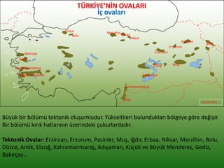
Büyük bir bölümütektonik oluşumludur. Yükseltileri bulundukları bölgeye göre değişir.
Bir bölümü kırık hatlarının üzerindeki çukurlardadır.
Tektonik Ovalar: Erzincan, Erzurum, Pasinler, Muş, Iğdır, Erbaa, Niksar, Merzifon, Bolu,
Düzce, Amik, Elazığ, Kahramanmaraş, Adıyaman, Küçük ve Büyük Menderes, Gediz,
Bakırçay…
Kudret GÜL
Erzincan
Erzurum
Pasinler
Muş
Iğdır
Erbaa
Niksar
Elazığ
Merzifon
Bolu
Düzce
Amik
Kahramanmaraş
Adıyaman
Küçük Menderes
Büyük Menderes
Gediz
Bakırçay
TÜRKİYE’NİN OVALARI
İç ovaları
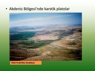
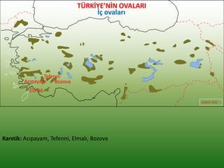
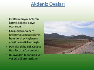
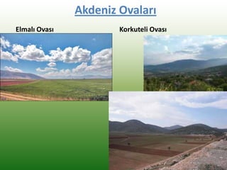
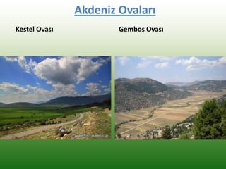
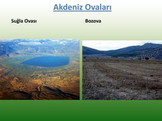
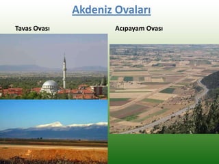
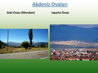
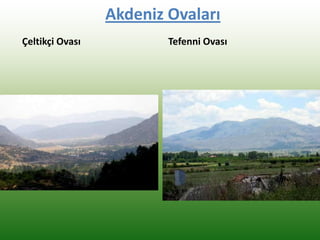
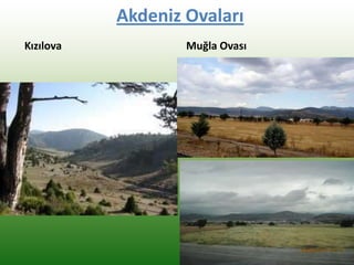
Akdeniz Ovaları
• Ovalarınbüyük bölümü
karstik kökenli polye
ovalarıdır.
• Oluşumlarında hem
faylanma sonucu çökme,
hem de kireç taşlarının
çözülmesi etkili olmuştur.
• Polyeler daha çok Orta ve
Batı Toroslar’da bulunur
• Bu ovaların tabanında yer
yer sığ göllere rastlanır.
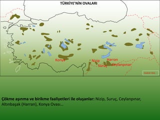
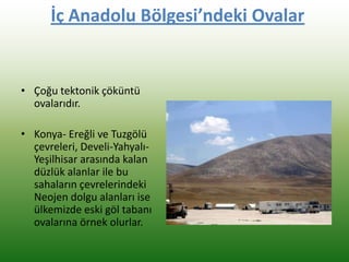
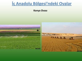
İç Anadolu Bölgesi’ndekiOvalar
• Çoğu tektonik çöküntü
ovalarıdır.
• Konya- Ereğli ve Tuzgölü
çevreleri, Develi-Yahyalı-
Yeşilhisar arasında kalan
düzlük alanlar ile bu
sahaların çevrelerindeki
Neojen dolgu alanları ise
ülkemizde eski göl tabanı
ovalarına örnek olurlar.