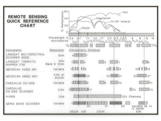
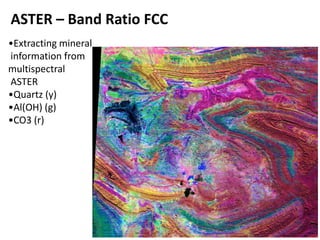
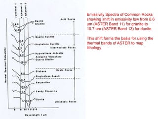
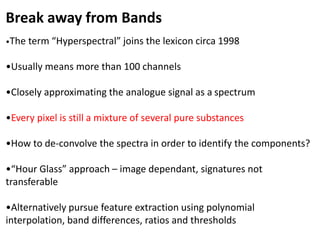
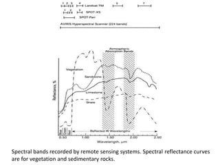
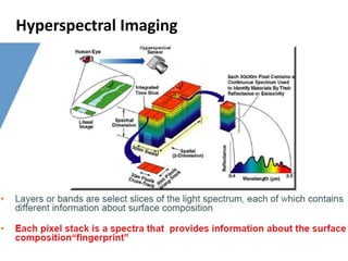
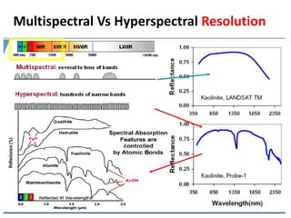
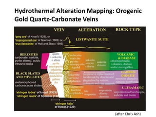
This document discusses the use of hyperspectral remote sensing for geological mapping and mineral exploration. It explains that hyperspectral sensors provide more detailed spectral information than multispectral sensors by collecting over 100 spectral bands. This allows for the identification of alteration minerals and lithologies by analyzing their diagnostic absorption features. Methods for processing hyperspectral data include linear and non-linear spectral unmixing to separate mixed pixel spectra into individual mineral components. Challenges include addressing atmospheric effects, topographic variations and developing representative spectral libraries for specific geological terrains.