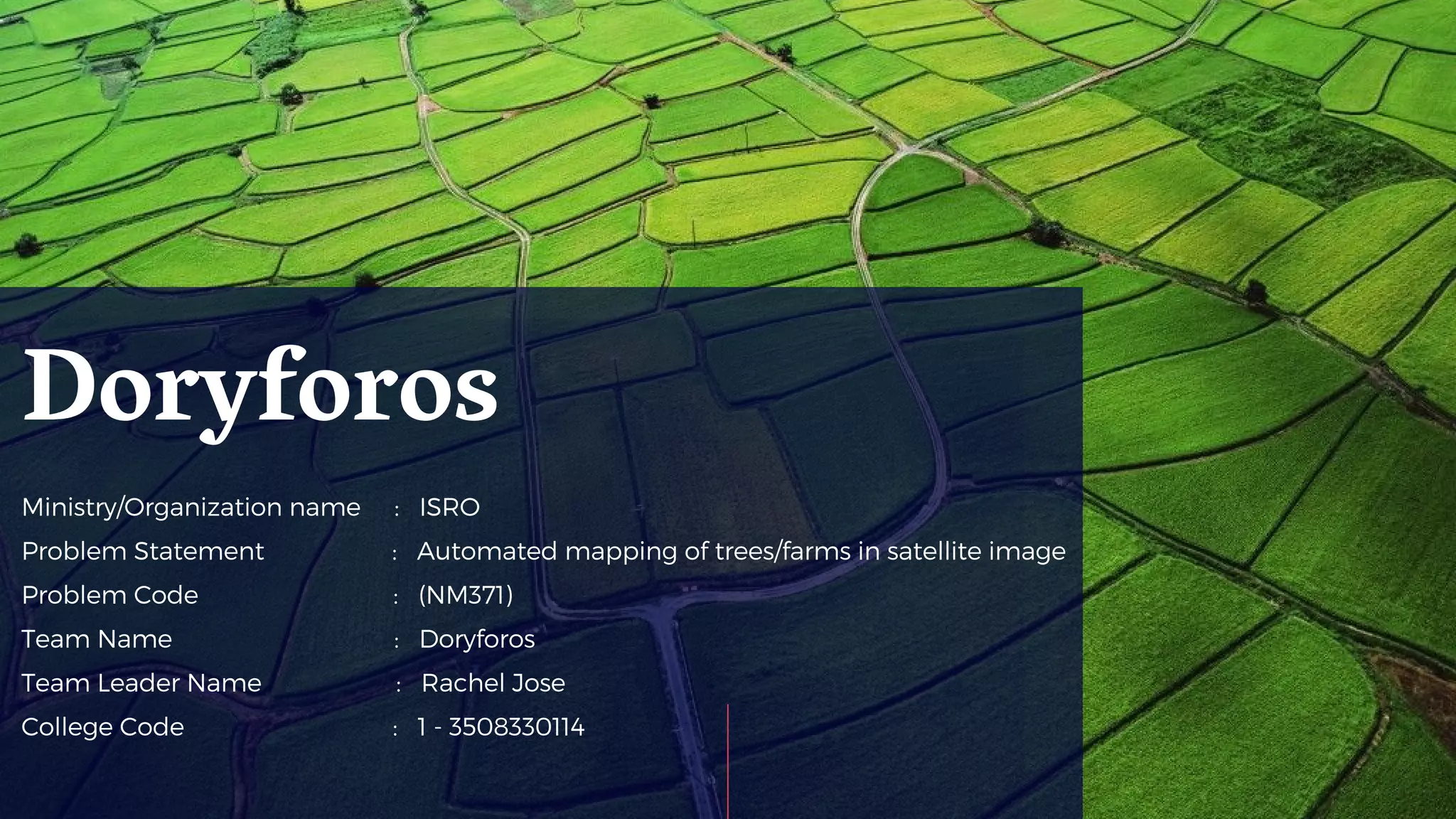
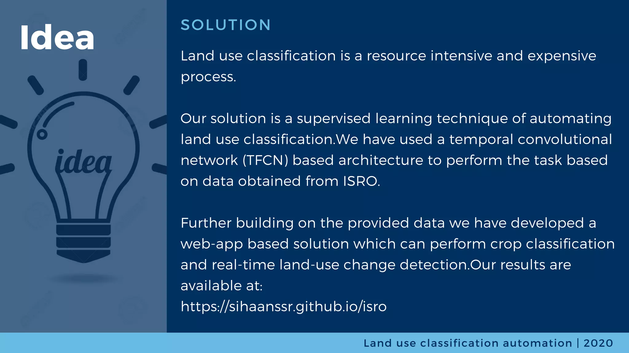
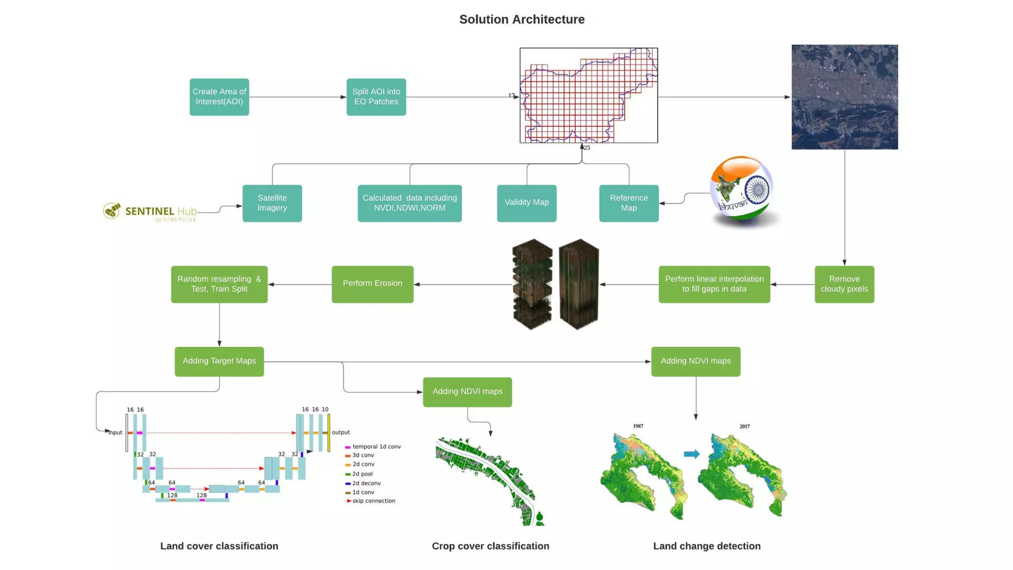
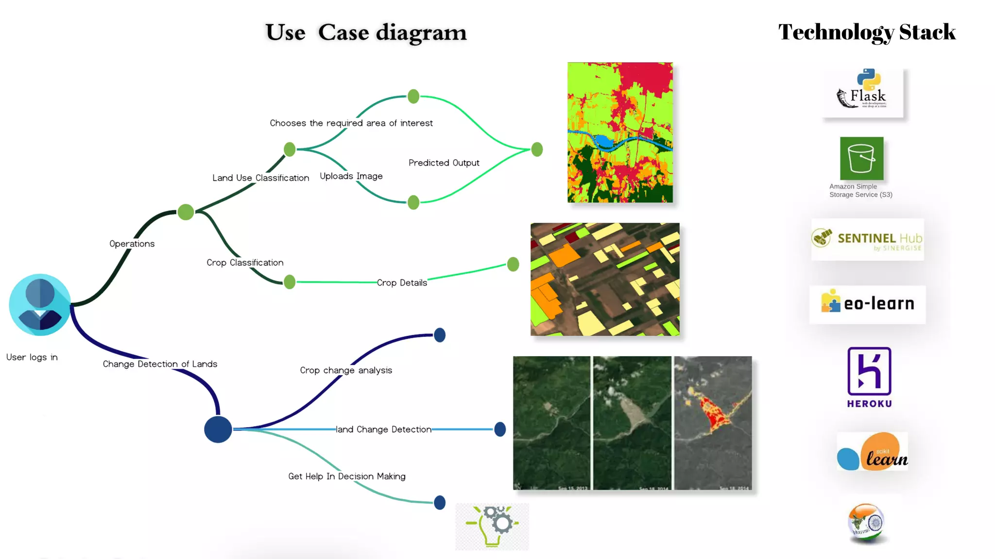
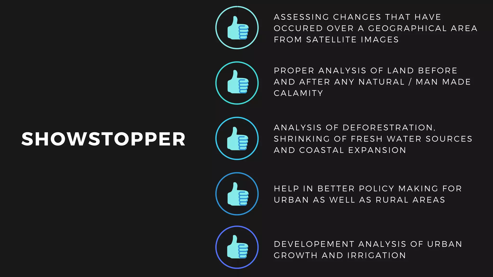
Ministry/Organization name :  ISRO
Problem Statement : Automated mapping of trees/farms in satellite image 
Problem Code : (NM371)
Team Name : Doryforos
Team Leader Name : Rachel Jose  
College Code : 1 - 3508330114
Doryforos
SOLUTION
Land use classification is a resource intensive and expensive
process.
Our solution is a supervised learning technique of automating
land use classification.We have used a temporal convolutional
network (TFCN) based architecture to perform the task based
on data obtained from ISRO.
Further building on the provided data we have developed a
web-app based solution which can perform crop classification
and real-time land-use change detection.Our results are
available at:
https://sihaanssr.github.io/isro
Land use classification automation | 2020
Idea
Technology Stack
SHOWSTOPPER
DEVELOPEMENT ANALYSIS OF URBAN
GROWTH AND IRRIGATION
PROPER ANALYSIS OF LAND BEFORE
AND AFTER ANY NATURAL / MAN MADE
CALAMITY
ANALYSIS OF DEFORESTRATION,
SHRINKING OF FRESH WATER SOURCES
AND COASTAL EXPANSION
HELP IN BETTER POLICY MAKING FOR
URBAN AS WELL AS RURAL AREAS
ASSESSING CHANGES THAT HAVE
OCCURED OVER A GEOGRAPHICAL AREA
FROM SATELLITE IMAGES
THANK YOU

Sih ppt doryforos (1)

  • 1.
    Ministry/Organization name : ISRO Problem Statement : Automated mapping of trees/farms in satellite image  Problem Code : (NM371) Team Name : Doryforos Team Leader Name : Rachel Jose   College Code : 1 - 3508330114 Doryforos
  • 2.
    SOLUTION Land use classificationis a resource intensive and expensive process. Our solution is a supervised learning technique of automating land use classification.We have used a temporal convolutional network (TFCN) based architecture to perform the task based on data obtained from ISRO. Further building on the provided data we have developed a web-app based solution which can perform crop classification and real-time land-use change detection.Our results are available at: https://sihaanssr.github.io/isro Land use classification automation | 2020 Idea
  • 4.
  • 5.
    SHOWSTOPPER DEVELOPEMENT ANALYSIS OFURBAN GROWTH AND IRRIGATION PROPER ANALYSIS OF LAND BEFORE AND AFTER ANY NATURAL / MAN MADE CALAMITY ANALYSIS OF DEFORESTRATION, SHRINKING OF FRESH WATER SOURCES AND COASTAL EXPANSION HELP IN BETTER POLICY MAKING FOR URBAN AS WELL AS RURAL AREAS ASSESSING CHANGES THAT HAVE OCCURED OVER A GEOGRAPHICAL AREA FROM SATELLITE IMAGES
  • 6.