Hawaii Pacific GIS Conference 2012: Forestry and Tree Mapping - The Oahu Urban Tree Canopy Assessment: Methods and Uses
•
1 like•579 views

This document summarizes a study that used aerial imagery to analyze existing and potential tree canopy cover across 149,268 acres of land. It found 56,218 acres of existing tree canopy cover and an additional 50,727 acres of grass/shrub lands and 20,890 acres of impervious surfaces that could support more tree planting. The study analyzed tree canopy at high resolution down to individual tax parcels and census blocks to help identify opportunities for increasing urban forest cover.
Report
Share
Report
Share
Download to read offline

Recommended
Free GIS in the Classroom
This document discusses using GIS (Geographic Information Systems) in geography classrooms. It provides examples of free and easy to use GIS tools for students, such as Google Earth. It also discusses the benefits of using GIS to help students explore and analyze geographic data, and recommends starting by finding questions the students want to answer. The document encourages teachers to have students think critically about the maps and data they are presented with.
GIS in Geography
GIS allows users to visualize, analyze, and interpret geographic data by overlaying layers of information on maps. It integrates multiple datasets, performs spatial analyses like distance measurement, and creates maps, reports, and charts to reveal relationships within the data. GIS is widely used in fields like emergency response, transportation, and urban planning to more efficiently address problems and make informed decisions by viewing geographic patterns and trends.
Taking 3D to the next Level with 3D Streaming Maps
Taking 3D to the next Level with 3D Streaming MapsHawaii Geographic Information Coordinating Council
This document discusses streaming 3D maps as a high return, low risk investment for cities. Streaming 3D maps are 100% web-based solutions that enable maximum communication and awareness. They have benefits such as being browser-based so no additional software is needed, turnkey assembly of content is available, and superior 3D technologies can be used in an open architecture with minimal costs, training needs, and risks.US Army Real Estate Holdings in Hawaii
The document discusses the U.S. Army Military Land Tract Project to convert paper records of Army real estate holdings into a digital database and GIS system. It provides an overview of the project objectives and tasks. As a case study, it summarizes the history of land holdings at Fort Shafter in Hawaii from 1899 to present day, showing how the single tract has been subdivided over time into 50 active tracts today. Maps of Army sites on Oahu and Hawaii islands are also presented.
NOAA's Coastal Change Analysis Program
NOAA's Coastal Change Analysis Program provides nationally standardized data on land cover and land use collected every five years. It includes high resolution data for several Pacific islands at 2.4m resolution. This level of detail is useful for small-scale analysis, extracting specific land cover components, and site-specific studies. The high resolution data has been used for applications like vulnerability assessments, studying climate change impacts, and modeling sediment erosion. It is made more useful through data products like the Land Cover Atlas, sea level rise viewer, and other tools to analyze and understand the land cover data.
Hawaii and US Pacific Basin Orthoimagery Update
This document summarizes the status of orthoimagery for Hawaii and the US Pacific Basin. It discusses the various satellite sensors used to acquire the imagery, including WorldView-2 and WorldView-3. It provides timelines of imagery acquisition for different islands from 1997 to 2015. It also describes how the imagery data is distributed and the costs associated with acquiring the imagery from 2013 to 2015.
The ArcGIS Platform: Appyling Geography Everywhere
The ArcGIS Platform: Appyling Geography EverywhereHawaii Geographic Information Coordinating Council
The document discusses the ArcGIS platform which enables employees to easily discover, use, make and share maps from any device. It provides mapping, analysis, data management and collaboration capabilities through an integrated web GIS platform including ArcGIS Desktop, ArcGIS Online and Portal for ArcGIS. The ArcGIS platform supports embedding web maps across various business systems and on any device through web browsers and applications.Web based Data and Tools for Coastal Management
The document discusses NOAA's Digital Coast website and tools for coastal management. Digital Coast provides data like LiDAR, land cover maps, historical imagery, and ocean use maps for several Pacific islands. It also offers tools like a tsunami information tool, land cover atlas, sea level rise viewer, and economic data. Training is provided through various methods. The goal is to bring geospatial and coastal management communities together on an integrated platform to support coastal resource management.
Ecosystem Vulnerability and Cumulative Impacts on th eOceans of hawaii
Ecosystem Vulnerability and Cumulative Impacts on th eOceans of hawaiiHawaii Geographic Information Coordinating Council
This document discusses key threats to Hawaiian reefs from various human activities and natural stressors. It provides details on potential data sources that could be used to map the spatial distribution and intensity of each threat, such as sediment export models, land use maps, commercial fishing records, buoy locations, and satellite sea surface temperature data. The goal is to develop comprehensive spatial datasets characterizing multiple threats to better understand their combined impacts and inform management decisions.Using GIS to Connect Communities
The document discusses how The Trust for Public Land uses geographic information systems (GIS) to connect communities through conservation planning. It explains that TPL works with communities to create "Greenprints", which are plans that identify local conservation priorities through public engagement and GIS modeling. Greenprints incorporate weighted criteria like recreation, habitat protection, and water quality to create composite maps of conservation value. These maps guide land prioritization and stakeholder action planning. The document provides examples of TPL's Greenprinting work in Hawaii and its Climate Smart Cities initiative, which uses GIS to help communities increase greenspace and mitigate climate impacts.
Assessing Reef Health Using a Low Altitude Sensing Platform
Assessing Reef Health Using a Low Altitude Sensing PlatformHawaii Geographic Information Coordinating Council
This document discusses using low-altitude aerial surveys with unmanned aerial vehicles to assess coral reef health in Kaneohe Bay, Hawaii. The goals are to develop a cheap, fast, and spatially accurate technique to survey entire reef areas at a high resolution. Test flights with a DJI Phantom 2 drone captured imagery over 1500 square meters that was processed into orthomosaics and used texture/color models to classify and map coral species, bleaching, and health. This could create a reef atlas for Kaneohe Bay, inform management, and increase understanding of reef dynamics by providing long-term monitoring at various spatial scales.Hawaii DOT Monitoring Stations Versus National Performance Measurement Resear...
Hawaii DOT Monitoring Stations Versus National Performance Measurement Resear...Hawaii Geographic Information Coordinating Council
This presentation compares speed data from Hawaii DOT monitoring stations to the National Performance Measurement Research Data Set (NPMRDS) probe data. It finds that the two data sources match fairly well overall but that finer-grained Hawaii DOT data is needed for detailed analysis. The presentation demonstrates how to link NPMRDS travel time data to road network maps using open-source tools and provides examples of mapping and animating travel times using this data to estimate the impacts of traffic events. It concludes that the NPMRDS and Hawaii DOT data can both be used to analyze traffic conditions when combined with open-source spatial analysis tools.Use of GIS Technology to Inform Planning Efforts Through Visualization of Com...
Use of GIS Technology to Inform Planning Efforts Through Visualization of Com...Hawaii Geographic Information Coordinating Council
This document summarizes Donald Hayes' presentation on the use of geographic information systems (GIS) technology and community level data visualization to inform planning efforts in Hawaii. Some key points:
- The Hawaii Department of Health uses a variety of health and socioeconomic datasets to identify needs, support grant applications, research, legislation and program evaluation.
- Data is compiled into a Primary Care Data Book which provides indicators by community on health outcomes, risk factors and socioeconomics using data sources like the census and vital records.
- The Data Book is used to assess primary care needs, highlight differences between communities, and facilitate data-driven decision making. It has supported funding and policy decisions and is utilized by various organizations.Expanding GIS Access to Technical and Non-Technical Users to Enhance Project ...
Expanding GIS Access to Technical and Non-Technical Users to Enhance Project ...Hawaii Geographic Information Coordinating Council
The document discusses how GIS was used to enhance collaboration and decision making for the Honolulu Rail Transit Project. GIS provided a platform for HART, HDOH, and contractors to easily share and access environmental, planning, and construction data. Task-based apps within the GIS system allowed non-technical and technical users to efficiently view relevant project information. Organizing data within the GIS cloud-based system reduced data management costs and improved access to real-time project data compared to traditional approaches. Overall, the use of GIS created a powerful collaborative decision making tool that improved project planning, oversight and efficiency.STEMworks: K12 Education in Hawaii in Science Technology Engineering and Math
STEMworks: K12 Education in Hawaii in Science Technology Engineering and MathHawaii Geographic Information Coordinating Council
The Women in Technology project in Hawaii aims to encourage girls, women, Native Hawaiians, and other underrepresented groups to pursue STEM education and careers. It works to build a homegrown technical workforce through various initiatives like STEMWorks, which partners students with industry mentors on projects that address community needs. Key elements of STEMWorks include service-learning courses, promoting equity and cultural understanding, and facilitating self-directed learning through critical thinking and teamwork skills. The program also offers teacher professional development, student internships, and GIS training and workshops across various Hawaiian islands.Planning for Technological Change
Zachary Smith outlines a plan to upgrade the organizational GIS system at the Office of Hawaiian Affairs. The current system uses outdated software and individual project files stored on a network drive. The upgrade will implement an enterprise GIS by moving all data and maps to a centralized geodatabase on a SQL Server, publishing feature services, and hosting web applications on ArcGIS Online. This will allow for better sharing of maps and data across the organization and with the public. The implementation will involve contracting a developer, upgrading servers and software, and publishing all assets as web services on the new system.
Now & the Future of geodesy in Hawaii for the GIS Users
Now & the Future of geodesy in Hawaii for the GIS UsersHawaii Geographic Information Coordinating Council
Geodesy is the science of measuring and monitoring the shape and size of the Earth. It provides the foundation for geospatial data through establishing accurate coordinate systems. The National Geodetic Survey is working to modernize and improve the National Spatial Reference System through new geometric and vertical datums by 2022, which will change coordinates by up to a few meters. Users should adopt the latest realizations of NAD 83 to prepare for these changes and ensure accurate positioning into the future.314 woods- uav mapping history
This document summarizes the capabilities of aerial cameras used for unmanned aerial vehicle (UAV) imaging and mapping. It provides details on fixed-wing and rotary-wing UAVs, including payload, flight time, and advantages. The document discusses historical map-making techniques like plane table surveying and photogrammetry. It also demonstrates the high quality data and 3D models that can be generated from UAV imagery, including orthomosaics, point clouds, digital surface models, and meshes. Accuracy is assessed by comparison to lidar elevation data. The document shows examples of UAV products like 3D meshes of structures.
314 smith 2015 higicc-final
The document discusses preparations for the 2020 Census and Geographic Partnerships. It provides updates on the 2020 Census program, the Geographic Support System Initiative (GSS-I), the Local Update of Census Addresses Program (LUCA), and the Redistricting Data Program (RDP). It summarizes various census tests conducted in 2015, 2016, and future tests planned for 2017 and 2018. The goals are to test new address canvassing methods, self-response optimization, use of administrative records, and field operations to improve the 2020 Census.
Real Time Corrections for GNSS Receivers
This document discusses real-time GNSS correction sources and their applications and accuracy levels. It describes satellite-based augmentation systems (SBAS), Omnistar satellite differential corrections, Trimble RTX internet and satellite corrections, single base radio/internet corrections, and real-time networks. Accuracies range from 10-15 meters for autonomous GNSS to 1-3 centimeters for fixed baseline survey systems using corrections. The document provides an overview of correction options for different uses like survey, mapping, and their availability in Hawaii.
Honolulu Board of Water Supply: Enterprise GIS
The Honolulu Board of Water Supply (BWS) uses geographic information systems (GIS) to manage its water infrastructure data and provide services to over 500 employees. BWS' GIS program started in 1989 and maintains spatial data for over 160,000 service connections and 2,100 miles of pipelines. Key GIS applications include HONU for web mapping, MANO for mobile workforce management, and GISMO for work order integration. BWS shares data with the City/County and other agencies and is developing live data feeds. The GIS program supports asset management, field data collection, and enterprise mapping, analysis, and collaboration tools.
State of Hawaii Digital Leveling Project
The document outlines Hawaii's plans for height modernization from 2015 to 2026. Digital leveling of Oahu is underway from 2015 to 2016. Maui plans to issue an RFP for leveling consultants. Leveling of the Big Island and Kauai is planned from around 2018 to 2022. Lidar data collection for the islands is planned to begin in 2025. A new geoid model for Hawaii incorporating the leveling and lidar data is planned for 2026. The effort aims to benefit the private sector, government, and public utilities through improved vertical accuracy and control across the state.
Urban Tree Canopy Change Assessment for Southern Oahu
Urban Tree Canopy Change Assessment for Southern OahuHawaii Geographic Information Coordinating Council
The document analyzes tree canopy coverage and potential tree planting areas in an urban zone using remote sensing data. It finds that the urban zone covers 76,761 acres of land, of which 15,274 acres are existing tree canopy coverage. An additional 27,224 acres of grassland/shrub and 13,760 acres of impervious surfaces are identified as possible areas for increasing tree canopy coverage. However, 20,613 acres of the land is not suitable for planting due to existing buildings and roads. The analysis is part of research conducted by the University of Vermont, Smart Trees Pacific, and Pictometry International Corp to understand urban forestry.The Evolving GIS Enterprise
This document discusses the evolution of enterprise GIS systems from highly customized single applications to a more configurable and sustainable approach. It outlines that customized solutions are unsustainable due to increasing pace of technology change and user expectations for focused applications. The document recommends breaking processes into simpler focused applications and configuring applications whenever possible using tools like model builders, workflows, tasks and app builders instead of customization. This configurable approach allows for easier deployment, lower costs and more sustainable solutions that can still cover most customer needs.
Successes of the Certificate Competence in GIS in Ecosystem Management Program
Successes of the Certificate Competence in GIS in Ecosystem Management ProgramHawaii Geographic Information Coordinating Council
The document outlines a Geographic Information Systems (GIS) certificate program offered across several Hawaiian community colleges. It provides details on the program structure including two 8-week condensed courses on introductory GIS and ecosystem management. The program utilizes online modules combined with hands-on labs and field trips. Since 2014 the program has graduated 49 students total. It aims to teach real-world skills to meet the needs of the local GIS workforce, with 30% of graduates obtaining GIS jobs. The program has formed partnerships with over 60 local organizations and companies to engage students. It is partially funded by a US Department of Labor grant.using ArcGIS Online to Assist in Mapping Hawaii's Agricultural Footprint
using ArcGIS Online to Assist in Mapping Hawaii's Agricultural FootprintHawaii Geographic Information Coordinating Council
This document discusses a project to map Hawaii's agricultural footprint using ArcGIS Online. The project aims to create the first statewide agricultural map since 1980 by mapping commercial farms across Hawaii at a minimum size of 3 acres. It will produce digital maps, layers and reports to help the State Department of Agriculture update its data on agricultural production and spatial mapping. An interactive web mapping application was built using ArcGIS Online and open-source tools to allow users to view and add information to the agricultural maps online.GIS at the Oahu invasive Species Committee
The O'ahu Invasive Species Committee (OISC) uses GIS tools to target and map invasive species across the island for control and eradication efforts. OISC focuses on high-threat species like Miconia, Cane Ti, and Little Fire Ant that can be feasibly controlled. GIS is used in both field surveys and office analysis to map infestations, monitor control progress over time, and model potential future spreads. OISC works collaboratively with various partners and agencies to protect native Hawaiian ecosystems and species from invasive threats.
Coastal Zone Mapping and Monitoring with High Resolution Aerial Imaging
Coastal Zone Mapping and Monitoring with High Resolution Aerial ImagingHawaii Geographic Information Coordinating Council
This document provides contact information for an organization called ReMap Hawaii that performs resource mapping in the Hawaiian islands. It lists two locations where mapping was done, Kahuku on O'ahu and Kamilo on the Big Island, and provides an email address and website for the organization as well as their Twitter handle if there are any questions.LF Energy Webinar: Carbon Data Specifications: Mechanisms to Improve Data Acc...
This LF Energy webinar took place June 20, 2024. It featured:
-Alex Thornton, LF Energy
-Hallie Cramer, Google
-Daniel Roesler, UtilityAPI
-Henry Richardson, WattTime
In response to the urgency and scale required to effectively address climate change, open source solutions offer significant potential for driving innovation and progress. Currently, there is a growing demand for standardization and interoperability in energy data and modeling. Open source standards and specifications within the energy sector can also alleviate challenges associated with data fragmentation, transparency, and accessibility. At the same time, it is crucial to consider privacy and security concerns throughout the development of open source platforms.
This webinar will delve into the motivations behind establishing LF Energy’s Carbon Data Specification Consortium. It will provide an overview of the draft specifications and the ongoing progress made by the respective working groups.
Three primary specifications will be discussed:
-Discovery and client registration, emphasizing transparent processes and secure and private access
-Customer data, centering around customer tariffs, bills, energy usage, and full consumption disclosure
-Power systems data, focusing on grid data, inclusive of transmission and distribution networks, generation, intergrid power flows, and market settlement data
[OReilly Superstream] Occupy the Space: A grassroots guide to engineering (an...
The typical problem in product engineering is not bad strategy, so much as “no strategy”. This leads to confusion, lack of motivation, and incoherent action. The next time you look for a strategy and find an empty space, instead of waiting for it to be filled, I will show you how to fill it in yourself. If you’re wrong, it forces a correction. If you’re right, it helps create focus. I’ll share how I’ve approached this in the past, both what works and lessons for what didn’t work so well.
More Related Content
More from Hawaii Geographic Information Coordinating Council
Ecosystem Vulnerability and Cumulative Impacts on th eOceans of hawaii
Ecosystem Vulnerability and Cumulative Impacts on th eOceans of hawaiiHawaii Geographic Information Coordinating Council
This document discusses key threats to Hawaiian reefs from various human activities and natural stressors. It provides details on potential data sources that could be used to map the spatial distribution and intensity of each threat, such as sediment export models, land use maps, commercial fishing records, buoy locations, and satellite sea surface temperature data. The goal is to develop comprehensive spatial datasets characterizing multiple threats to better understand their combined impacts and inform management decisions.Using GIS to Connect Communities
The document discusses how The Trust for Public Land uses geographic information systems (GIS) to connect communities through conservation planning. It explains that TPL works with communities to create "Greenprints", which are plans that identify local conservation priorities through public engagement and GIS modeling. Greenprints incorporate weighted criteria like recreation, habitat protection, and water quality to create composite maps of conservation value. These maps guide land prioritization and stakeholder action planning. The document provides examples of TPL's Greenprinting work in Hawaii and its Climate Smart Cities initiative, which uses GIS to help communities increase greenspace and mitigate climate impacts.
Assessing Reef Health Using a Low Altitude Sensing Platform
Assessing Reef Health Using a Low Altitude Sensing PlatformHawaii Geographic Information Coordinating Council
This document discusses using low-altitude aerial surveys with unmanned aerial vehicles to assess coral reef health in Kaneohe Bay, Hawaii. The goals are to develop a cheap, fast, and spatially accurate technique to survey entire reef areas at a high resolution. Test flights with a DJI Phantom 2 drone captured imagery over 1500 square meters that was processed into orthomosaics and used texture/color models to classify and map coral species, bleaching, and health. This could create a reef atlas for Kaneohe Bay, inform management, and increase understanding of reef dynamics by providing long-term monitoring at various spatial scales.Hawaii DOT Monitoring Stations Versus National Performance Measurement Resear...
Hawaii DOT Monitoring Stations Versus National Performance Measurement Resear...Hawaii Geographic Information Coordinating Council
This presentation compares speed data from Hawaii DOT monitoring stations to the National Performance Measurement Research Data Set (NPMRDS) probe data. It finds that the two data sources match fairly well overall but that finer-grained Hawaii DOT data is needed for detailed analysis. The presentation demonstrates how to link NPMRDS travel time data to road network maps using open-source tools and provides examples of mapping and animating travel times using this data to estimate the impacts of traffic events. It concludes that the NPMRDS and Hawaii DOT data can both be used to analyze traffic conditions when combined with open-source spatial analysis tools.Use of GIS Technology to Inform Planning Efforts Through Visualization of Com...
Use of GIS Technology to Inform Planning Efforts Through Visualization of Com...Hawaii Geographic Information Coordinating Council
This document summarizes Donald Hayes' presentation on the use of geographic information systems (GIS) technology and community level data visualization to inform planning efforts in Hawaii. Some key points:
- The Hawaii Department of Health uses a variety of health and socioeconomic datasets to identify needs, support grant applications, research, legislation and program evaluation.
- Data is compiled into a Primary Care Data Book which provides indicators by community on health outcomes, risk factors and socioeconomics using data sources like the census and vital records.
- The Data Book is used to assess primary care needs, highlight differences between communities, and facilitate data-driven decision making. It has supported funding and policy decisions and is utilized by various organizations.Expanding GIS Access to Technical and Non-Technical Users to Enhance Project ...
Expanding GIS Access to Technical and Non-Technical Users to Enhance Project ...Hawaii Geographic Information Coordinating Council
The document discusses how GIS was used to enhance collaboration and decision making for the Honolulu Rail Transit Project. GIS provided a platform for HART, HDOH, and contractors to easily share and access environmental, planning, and construction data. Task-based apps within the GIS system allowed non-technical and technical users to efficiently view relevant project information. Organizing data within the GIS cloud-based system reduced data management costs and improved access to real-time project data compared to traditional approaches. Overall, the use of GIS created a powerful collaborative decision making tool that improved project planning, oversight and efficiency.STEMworks: K12 Education in Hawaii in Science Technology Engineering and Math
STEMworks: K12 Education in Hawaii in Science Technology Engineering and MathHawaii Geographic Information Coordinating Council
The Women in Technology project in Hawaii aims to encourage girls, women, Native Hawaiians, and other underrepresented groups to pursue STEM education and careers. It works to build a homegrown technical workforce through various initiatives like STEMWorks, which partners students with industry mentors on projects that address community needs. Key elements of STEMWorks include service-learning courses, promoting equity and cultural understanding, and facilitating self-directed learning through critical thinking and teamwork skills. The program also offers teacher professional development, student internships, and GIS training and workshops across various Hawaiian islands.Planning for Technological Change
Zachary Smith outlines a plan to upgrade the organizational GIS system at the Office of Hawaiian Affairs. The current system uses outdated software and individual project files stored on a network drive. The upgrade will implement an enterprise GIS by moving all data and maps to a centralized geodatabase on a SQL Server, publishing feature services, and hosting web applications on ArcGIS Online. This will allow for better sharing of maps and data across the organization and with the public. The implementation will involve contracting a developer, upgrading servers and software, and publishing all assets as web services on the new system.
Now & the Future of geodesy in Hawaii for the GIS Users
Now & the Future of geodesy in Hawaii for the GIS UsersHawaii Geographic Information Coordinating Council
Geodesy is the science of measuring and monitoring the shape and size of the Earth. It provides the foundation for geospatial data through establishing accurate coordinate systems. The National Geodetic Survey is working to modernize and improve the National Spatial Reference System through new geometric and vertical datums by 2022, which will change coordinates by up to a few meters. Users should adopt the latest realizations of NAD 83 to prepare for these changes and ensure accurate positioning into the future.314 woods- uav mapping history
This document summarizes the capabilities of aerial cameras used for unmanned aerial vehicle (UAV) imaging and mapping. It provides details on fixed-wing and rotary-wing UAVs, including payload, flight time, and advantages. The document discusses historical map-making techniques like plane table surveying and photogrammetry. It also demonstrates the high quality data and 3D models that can be generated from UAV imagery, including orthomosaics, point clouds, digital surface models, and meshes. Accuracy is assessed by comparison to lidar elevation data. The document shows examples of UAV products like 3D meshes of structures.
314 smith 2015 higicc-final
The document discusses preparations for the 2020 Census and Geographic Partnerships. It provides updates on the 2020 Census program, the Geographic Support System Initiative (GSS-I), the Local Update of Census Addresses Program (LUCA), and the Redistricting Data Program (RDP). It summarizes various census tests conducted in 2015, 2016, and future tests planned for 2017 and 2018. The goals are to test new address canvassing methods, self-response optimization, use of administrative records, and field operations to improve the 2020 Census.
Real Time Corrections for GNSS Receivers
This document discusses real-time GNSS correction sources and their applications and accuracy levels. It describes satellite-based augmentation systems (SBAS), Omnistar satellite differential corrections, Trimble RTX internet and satellite corrections, single base radio/internet corrections, and real-time networks. Accuracies range from 10-15 meters for autonomous GNSS to 1-3 centimeters for fixed baseline survey systems using corrections. The document provides an overview of correction options for different uses like survey, mapping, and their availability in Hawaii.
Honolulu Board of Water Supply: Enterprise GIS
The Honolulu Board of Water Supply (BWS) uses geographic information systems (GIS) to manage its water infrastructure data and provide services to over 500 employees. BWS' GIS program started in 1989 and maintains spatial data for over 160,000 service connections and 2,100 miles of pipelines. Key GIS applications include HONU for web mapping, MANO for mobile workforce management, and GISMO for work order integration. BWS shares data with the City/County and other agencies and is developing live data feeds. The GIS program supports asset management, field data collection, and enterprise mapping, analysis, and collaboration tools.
State of Hawaii Digital Leveling Project
The document outlines Hawaii's plans for height modernization from 2015 to 2026. Digital leveling of Oahu is underway from 2015 to 2016. Maui plans to issue an RFP for leveling consultants. Leveling of the Big Island and Kauai is planned from around 2018 to 2022. Lidar data collection for the islands is planned to begin in 2025. A new geoid model for Hawaii incorporating the leveling and lidar data is planned for 2026. The effort aims to benefit the private sector, government, and public utilities through improved vertical accuracy and control across the state.
Urban Tree Canopy Change Assessment for Southern Oahu
Urban Tree Canopy Change Assessment for Southern OahuHawaii Geographic Information Coordinating Council
The document analyzes tree canopy coverage and potential tree planting areas in an urban zone using remote sensing data. It finds that the urban zone covers 76,761 acres of land, of which 15,274 acres are existing tree canopy coverage. An additional 27,224 acres of grassland/shrub and 13,760 acres of impervious surfaces are identified as possible areas for increasing tree canopy coverage. However, 20,613 acres of the land is not suitable for planting due to existing buildings and roads. The analysis is part of research conducted by the University of Vermont, Smart Trees Pacific, and Pictometry International Corp to understand urban forestry.The Evolving GIS Enterprise
This document discusses the evolution of enterprise GIS systems from highly customized single applications to a more configurable and sustainable approach. It outlines that customized solutions are unsustainable due to increasing pace of technology change and user expectations for focused applications. The document recommends breaking processes into simpler focused applications and configuring applications whenever possible using tools like model builders, workflows, tasks and app builders instead of customization. This configurable approach allows for easier deployment, lower costs and more sustainable solutions that can still cover most customer needs.
Successes of the Certificate Competence in GIS in Ecosystem Management Program
Successes of the Certificate Competence in GIS in Ecosystem Management ProgramHawaii Geographic Information Coordinating Council
The document outlines a Geographic Information Systems (GIS) certificate program offered across several Hawaiian community colleges. It provides details on the program structure including two 8-week condensed courses on introductory GIS and ecosystem management. The program utilizes online modules combined with hands-on labs and field trips. Since 2014 the program has graduated 49 students total. It aims to teach real-world skills to meet the needs of the local GIS workforce, with 30% of graduates obtaining GIS jobs. The program has formed partnerships with over 60 local organizations and companies to engage students. It is partially funded by a US Department of Labor grant.using ArcGIS Online to Assist in Mapping Hawaii's Agricultural Footprint
using ArcGIS Online to Assist in Mapping Hawaii's Agricultural FootprintHawaii Geographic Information Coordinating Council
This document discusses a project to map Hawaii's agricultural footprint using ArcGIS Online. The project aims to create the first statewide agricultural map since 1980 by mapping commercial farms across Hawaii at a minimum size of 3 acres. It will produce digital maps, layers and reports to help the State Department of Agriculture update its data on agricultural production and spatial mapping. An interactive web mapping application was built using ArcGIS Online and open-source tools to allow users to view and add information to the agricultural maps online.GIS at the Oahu invasive Species Committee
The O'ahu Invasive Species Committee (OISC) uses GIS tools to target and map invasive species across the island for control and eradication efforts. OISC focuses on high-threat species like Miconia, Cane Ti, and Little Fire Ant that can be feasibly controlled. GIS is used in both field surveys and office analysis to map infestations, monitor control progress over time, and model potential future spreads. OISC works collaboratively with various partners and agencies to protect native Hawaiian ecosystems and species from invasive threats.
Coastal Zone Mapping and Monitoring with High Resolution Aerial Imaging
Coastal Zone Mapping and Monitoring with High Resolution Aerial ImagingHawaii Geographic Information Coordinating Council
This document provides contact information for an organization called ReMap Hawaii that performs resource mapping in the Hawaiian islands. It lists two locations where mapping was done, Kahuku on O'ahu and Kamilo on the Big Island, and provides an email address and website for the organization as well as their Twitter handle if there are any questions.More from Hawaii Geographic Information Coordinating Council (20)
Ecosystem Vulnerability and Cumulative Impacts on th eOceans of hawaii
Ecosystem Vulnerability and Cumulative Impacts on th eOceans of hawaii
Assessing Reef Health Using a Low Altitude Sensing Platform
Assessing Reef Health Using a Low Altitude Sensing Platform
Hawaii DOT Monitoring Stations Versus National Performance Measurement Resear...
Hawaii DOT Monitoring Stations Versus National Performance Measurement Resear...
Use of GIS Technology to Inform Planning Efforts Through Visualization of Com...
Use of GIS Technology to Inform Planning Efforts Through Visualization of Com...
Expanding GIS Access to Technical and Non-Technical Users to Enhance Project ...
Expanding GIS Access to Technical and Non-Technical Users to Enhance Project ...
STEMworks: K12 Education in Hawaii in Science Technology Engineering and Math
STEMworks: K12 Education in Hawaii in Science Technology Engineering and Math
Now & the Future of geodesy in Hawaii for the GIS Users
Now & the Future of geodesy in Hawaii for the GIS Users
Urban Tree Canopy Change Assessment for Southern Oahu
Urban Tree Canopy Change Assessment for Southern Oahu
Successes of the Certificate Competence in GIS in Ecosystem Management Program
Successes of the Certificate Competence in GIS in Ecosystem Management Program
using ArcGIS Online to Assist in Mapping Hawaii's Agricultural Footprint
using ArcGIS Online to Assist in Mapping Hawaii's Agricultural Footprint
Coastal Zone Mapping and Monitoring with High Resolution Aerial Imaging
Coastal Zone Mapping and Monitoring with High Resolution Aerial Imaging
Recently uploaded
LF Energy Webinar: Carbon Data Specifications: Mechanisms to Improve Data Acc...
This LF Energy webinar took place June 20, 2024. It featured:
-Alex Thornton, LF Energy
-Hallie Cramer, Google
-Daniel Roesler, UtilityAPI
-Henry Richardson, WattTime
In response to the urgency and scale required to effectively address climate change, open source solutions offer significant potential for driving innovation and progress. Currently, there is a growing demand for standardization and interoperability in energy data and modeling. Open source standards and specifications within the energy sector can also alleviate challenges associated with data fragmentation, transparency, and accessibility. At the same time, it is crucial to consider privacy and security concerns throughout the development of open source platforms.
This webinar will delve into the motivations behind establishing LF Energy’s Carbon Data Specification Consortium. It will provide an overview of the draft specifications and the ongoing progress made by the respective working groups.
Three primary specifications will be discussed:
-Discovery and client registration, emphasizing transparent processes and secure and private access
-Customer data, centering around customer tariffs, bills, energy usage, and full consumption disclosure
-Power systems data, focusing on grid data, inclusive of transmission and distribution networks, generation, intergrid power flows, and market settlement data
[OReilly Superstream] Occupy the Space: A grassroots guide to engineering (an...
The typical problem in product engineering is not bad strategy, so much as “no strategy”. This leads to confusion, lack of motivation, and incoherent action. The next time you look for a strategy and find an empty space, instead of waiting for it to be filled, I will show you how to fill it in yourself. If you’re wrong, it forces a correction. If you’re right, it helps create focus. I’ll share how I’ve approached this in the past, both what works and lessons for what didn’t work so well.
Biomedical Knowledge Graphs for Data Scientists and Bioinformaticians
Dmitrii Kamaev, PhD
Senior Product Owner - QIAGEN
Dandelion Hashtable: beyond billion requests per second on a commodity server
This slide deck presents DLHT, a concurrent in-memory hashtable. Despite efforts to optimize hashtables, that go as far as sacrificing core functionality, state-of-the-art designs still incur multiple memory accesses per request and block request processing in three cases. First, most hashtables block while waiting for data to be retrieved from memory. Second, open-addressing designs, which represent the current state-of-the-art, either cannot free index slots on deletes or must block all requests to do so. Third, index resizes block every request until all objects are copied to the new index. Defying folklore wisdom, DLHT forgoes open-addressing and adopts a fully-featured and memory-aware closed-addressing design based on bounded cache-line-chaining. This design offers lock-free index operations and deletes that free slots instantly, (2) completes most requests with a single memory access, (3) utilizes software prefetching to hide memory latencies, and (4) employs a novel non-blocking and parallel resizing. In a commodity server and a memory-resident workload, DLHT surpasses 1.6B requests per second and provides 3.5x (12x) the throughput of the state-of-the-art closed-addressing (open-addressing) resizable hashtable on Gets (Deletes).
Session 1 - Intro to Robotic Process Automation.pdf
👉 Check out our full 'Africa Series - Automation Student Developers (EN)' page to register for the full program:
https://bit.ly/Automation_Student_Kickstart
In this session, we shall introduce you to the world of automation, the UiPath Platform, and guide you on how to install and setup UiPath Studio on your Windows PC.
📕 Detailed agenda:
What is RPA? Benefits of RPA?
RPA Applications
The UiPath End-to-End Automation Platform
UiPath Studio CE Installation and Setup
💻 Extra training through UiPath Academy:
Introduction to Automation
UiPath Business Automation Platform
Explore automation development with UiPath Studio
👉 Register here for our upcoming Session 2 on June 20: Introduction to UiPath Studio Fundamentals: https://community.uipath.com/events/details/uipath-lagos-presents-session-2-introduction-to-uipath-studio-fundamentals/
"$10 thousand per minute of downtime: architecture, queues, streaming and fin...
Direct losses from downtime in 1 minute = $5-$10 thousand dollars. Reputation is priceless.
As part of the talk, we will consider the architectural strategies necessary for the development of highly loaded fintech solutions. We will focus on using queues and streaming to efficiently work and manage large amounts of data in real-time and to minimize latency.
We will focus special attention on the architectural patterns used in the design of the fintech system, microservices and event-driven architecture, which ensure scalability, fault tolerance, and consistency of the entire system.
Northern Engraving | Nameplate Manufacturing Process - 2024
Manufacturing custom quality metal nameplates and badges involves several standard operations. Processes include sheet prep, lithography, screening, coating, punch press and inspection. All decoration is completed in the flat sheet with adhesive and tooling operations following. The possibilities for creating unique durable nameplates are endless. How will you create your brand identity? We can help!
Introduction of Cybersecurity with OSS at Code Europe 2024
I develop the Ruby programming language, RubyGems, and Bundler, which are package managers for Ruby. Today, I will introduce how to enhance the security of your application using open-source software (OSS) examples from Ruby and RubyGems.
The first topic is CVE (Common Vulnerabilities and Exposures). I have published CVEs many times. But what exactly is a CVE? I'll provide a basic understanding of CVEs and explain how to detect and handle vulnerabilities in OSS.
Next, let's discuss package managers. Package managers play a critical role in the OSS ecosystem. I'll explain how to manage library dependencies in your application.
I'll share insights into how the Ruby and RubyGems core team works to keep our ecosystem safe. By the end of this talk, you'll have a better understanding of how to safeguard your code.
Harnessing the Power of NLP and Knowledge Graphs for Opioid Research
Gursev Pirge, PhD
Senior Data Scientist - JohnSnowLabs
The Microsoft 365 Migration Tutorial For Beginner.pptx
This presentation will help you understand the power of Microsoft 365. However, we have mentioned every productivity app included in Office 365. Additionally, we have suggested the migration situation related to Office 365 and how we can help you.
You can also read: https://www.systoolsgroup.com/updates/office-365-tenant-to-tenant-migration-step-by-step-complete-guide/
Mutation Testing for Task-Oriented Chatbots
Conversational agents, or chatbots, are increasingly used to access all sorts of services using natural language. While open-domain chatbots - like ChatGPT - can converse on any topic, task-oriented chatbots - the focus of this paper - are designed for specific tasks, like booking a flight, obtaining customer support, or setting an appointment. Like any other software, task-oriented chatbots need to be properly tested, usually by defining and executing test scenarios (i.e., sequences of user-chatbot interactions). However, there is currently a lack of methods to quantify the completeness and strength of such test scenarios, which can lead to low-quality tests, and hence to buggy chatbots.
To fill this gap, we propose adapting mutation testing (MuT) for task-oriented chatbots. To this end, we introduce a set of mutation operators that emulate faults in chatbot designs, an architecture that enables MuT on chatbots built using heterogeneous technologies, and a practical realisation as an Eclipse plugin. Moreover, we evaluate the applicability, effectiveness and efficiency of our approach on open-source chatbots, with promising results.
Day 2 - Intro to UiPath Studio Fundamentals
In our second session, we shall learn all about the main features and fundamentals of UiPath Studio that enable us to use the building blocks for any automation project.
📕 Detailed agenda:
Variables and Datatypes
Workflow Layouts
Arguments
Control Flows and Loops
Conditional Statements
💻 Extra training through UiPath Academy:
Variables, Constants, and Arguments in Studio
Control Flow in Studio
QA or the Highway - Component Testing: Bridging the gap between frontend appl...
These are the slides for the presentation, "Component Testing: Bridging the gap between frontend applications" that was presented at QA or the Highway 2024 in Columbus, OH by Zachary Hamm.
Crafting Excellence: A Comprehensive Guide to iOS Mobile App Development Serv...
Crafting Excellence: A Comprehensive Guide to iOS Mobile App Development Serv...Pitangent Analytics & Technology Solutions Pvt. Ltd
Discover top-tier mobile app development services, offering innovative solutions for iOS and Android. Enhance your business with custom, user-friendly mobile applications.ScyllaDB Tablets: Rethinking Replication
ScyllaDB is making a major architecture shift. We’re moving from vNode replication to tablets – fragments of tables that are distributed independently, enabling dynamic data distribution and extreme elasticity. In this keynote, ScyllaDB co-founder and CTO Avi Kivity explains the reason for this shift, provides a look at the implementation and roadmap, and shares how this shift benefits ScyllaDB users.
Connector Corner: Seamlessly power UiPath Apps, GenAI with prebuilt connectors
Join us to learn how UiPath Apps can directly and easily interact with prebuilt connectors via Integration Service--including Salesforce, ServiceNow, Open GenAI, and more.
The best part is you can achieve this without building a custom workflow! Say goodbye to the hassle of using separate automations to call APIs. By seamlessly integrating within App Studio, you can now easily streamline your workflow, while gaining direct access to our Connector Catalog of popular applications.
We’ll discuss and demo the benefits of UiPath Apps and connectors including:
Creating a compelling user experience for any software, without the limitations of APIs.
Accelerating the app creation process, saving time and effort
Enjoying high-performance CRUD (create, read, update, delete) operations, for
seamless data management.
Speakers:
Russell Alfeche, Technology Leader, RPA at qBotic and UiPath MVP
Charlie Greenberg, host
AppSec PNW: Android and iOS Application Security with MobSF
Mobile Security Framework - MobSF is a free and open source automated mobile application security testing environment designed to help security engineers, researchers, developers, and penetration testers to identify security vulnerabilities, malicious behaviours and privacy concerns in mobile applications using static and dynamic analysis. It supports all the popular mobile application binaries and source code formats built for Android and iOS devices. In addition to automated security assessment, it also offers an interactive testing environment to build and execute scenario based test/fuzz cases against the application.
This talk covers:
Using MobSF for static analysis of mobile applications.
Interactive dynamic security assessment of Android and iOS applications.
Solving Mobile app CTF challenges.
Reverse engineering and runtime analysis of Mobile malware.
How to shift left and integrate MobSF/mobsfscan SAST and DAST in your build pipeline.
Leveraging the Graph for Clinical Trials and Standards
Katja Glaß
OpenStudyBuilder Community Manager - Katja Glaß Consulting
Marius Conjeaud
Principal Consultant - Neo4j
Principle of conventional tomography-Bibash Shahi ppt..pptx
before the computed tomography, it had been widely used.
"NATO Hackathon Winner: AI-Powered Drug Search", Taras Kloba
This is a session that details how PostgreSQL's features and Azure AI Services can be effectively used to significantly enhance the search functionality in any application.
In this session, we'll share insights on how we used PostgreSQL to facilitate precise searches across multiple fields in our mobile application. The techniques include using LIKE and ILIKE operators and integrating a trigram-based search to handle potential misspellings, thereby increasing the search accuracy.
We'll also discuss how the azure_ai extension on PostgreSQL databases in Azure and Azure AI Services were utilized to create vectors from user input, a feature beneficial when users wish to find specific items based on text prompts. While our application's case study involves a drug search, the techniques and principles shared in this session can be adapted to improve search functionality in a wide range of applications. Join us to learn how PostgreSQL and Azure AI can be harnessed to enhance your application's search capability.
Recently uploaded (20)
LF Energy Webinar: Carbon Data Specifications: Mechanisms to Improve Data Acc...
LF Energy Webinar: Carbon Data Specifications: Mechanisms to Improve Data Acc...
[OReilly Superstream] Occupy the Space: A grassroots guide to engineering (an...
[OReilly Superstream] Occupy the Space: A grassroots guide to engineering (an...
Biomedical Knowledge Graphs for Data Scientists and Bioinformaticians
Biomedical Knowledge Graphs for Data Scientists and Bioinformaticians
Dandelion Hashtable: beyond billion requests per second on a commodity server
Dandelion Hashtable: beyond billion requests per second on a commodity server
Session 1 - Intro to Robotic Process Automation.pdf
Session 1 - Intro to Robotic Process Automation.pdf
"$10 thousand per minute of downtime: architecture, queues, streaming and fin...
"$10 thousand per minute of downtime: architecture, queues, streaming and fin...
Northern Engraving | Nameplate Manufacturing Process - 2024
Northern Engraving | Nameplate Manufacturing Process - 2024
Introduction of Cybersecurity with OSS at Code Europe 2024
Introduction of Cybersecurity with OSS at Code Europe 2024
Harnessing the Power of NLP and Knowledge Graphs for Opioid Research
Harnessing the Power of NLP and Knowledge Graphs for Opioid Research
The Microsoft 365 Migration Tutorial For Beginner.pptx
The Microsoft 365 Migration Tutorial For Beginner.pptx
QA or the Highway - Component Testing: Bridging the gap between frontend appl...
QA or the Highway - Component Testing: Bridging the gap between frontend appl...
Crafting Excellence: A Comprehensive Guide to iOS Mobile App Development Serv...
Crafting Excellence: A Comprehensive Guide to iOS Mobile App Development Serv...
Connector Corner: Seamlessly power UiPath Apps, GenAI with prebuilt connectors
Connector Corner: Seamlessly power UiPath Apps, GenAI with prebuilt connectors
AppSec PNW: Android and iOS Application Security with MobSF
AppSec PNW: Android and iOS Application Security with MobSF
Leveraging the Graph for Clinical Trials and Standards
Leveraging the Graph for Clinical Trials and Standards
Principle of conventional tomography-Bibash Shahi ppt..pptx
Principle of conventional tomography-Bibash Shahi ppt..pptx
"NATO Hackathon Winner: AI-Powered Drug Search", Taras Kloba
"NATO Hackathon Winner: AI-Powered Drug Search", Taras Kloba
Hawaii Pacific GIS Conference 2012: Forestry and Tree Mapping - The Oahu Urban Tree Canopy Assessment: Methods and Uses
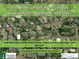
- 1. Sean MacFaden, Jarlath O’Neil-Dunne, Teresa Trueman-Madriaga*, and Wai Lee* University of Vermont, Smart Trees Pacific* Pictometry International Corp
- 7. How much tree canopy do we have? How much room is there to plant trees?
- 13. Courtesy of Dodson & Associates
- 15. X = 477589.675 Y = 786620.334 Z = 532 X = 47780.122 Y = 786621.913 Z = 384
- 28. Tree Canopy Grass/Shrub Bare Earth Water Buildings Roads Other Paved Surfac
- 42. Comparison to National Datasets Worldview-2 Satellite TC National Land Imagery Land Cover Cover Dataset 100% 0% TC Estimates 34% 24% Derived from 2010 imagery Derived from 2001 satellite (0.5m) and 2009 LiDAR imagery, 30m resolution
- 43. Grass/Shrub Tree Canopy Bare Soil Other Paved
- 44. • 149,268 acres of land (excludes water) • 56,218 acres of Existing UTC • 50,727 acres of Possible UTC that is grass/shrub • 20,890 acres of Possible UTC that is impervious (includes AG, Bare Soil) • 21,725 acres is not suitable for tree canopy (buildings, roads)
- 46. Tax Parcels
- 48. Zoning
- 49. Watersheds
- 50. Elevation Zones
- 51. Rainfall Zones
- 53. Funding Provided by USDA Forest Service University of Vermont, Smart Trees Pacific Pictometry International Corp
- 54. http://letters-sal.blogspot.com http://nrs.fed.us./urban/utc http://smarttreespacific.org Sean.MacFaden@uvm.edu Jarlath.Oneil-Dunne@uvm.edu ttm@hawaii.rr.com wlee@smarttreespacific.org University of Vermont, Smart Trees Pacific Pictometry International Corp