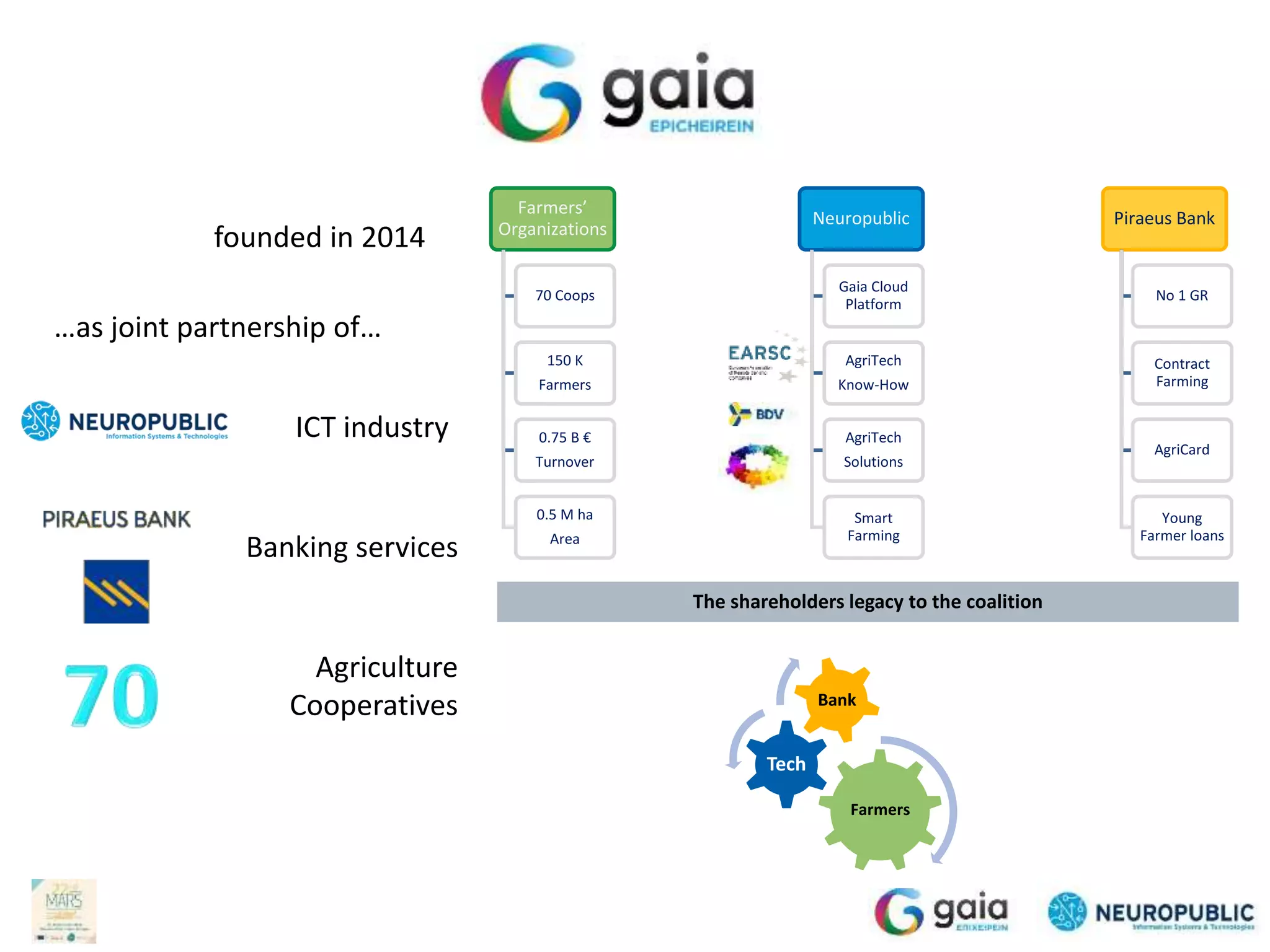
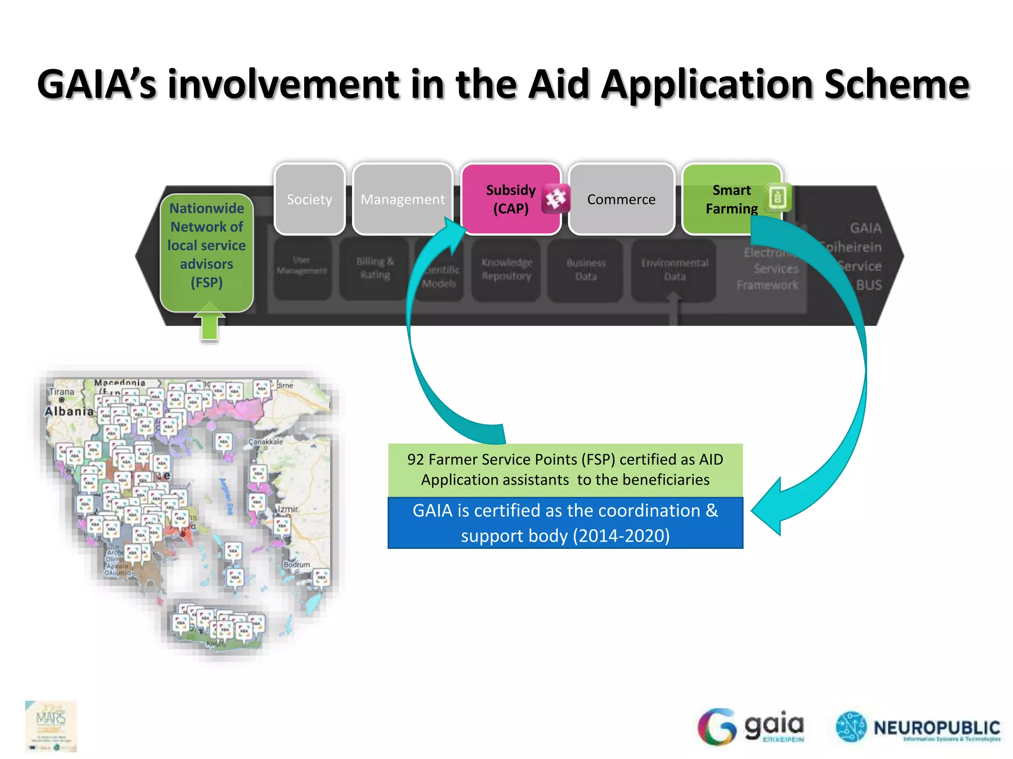
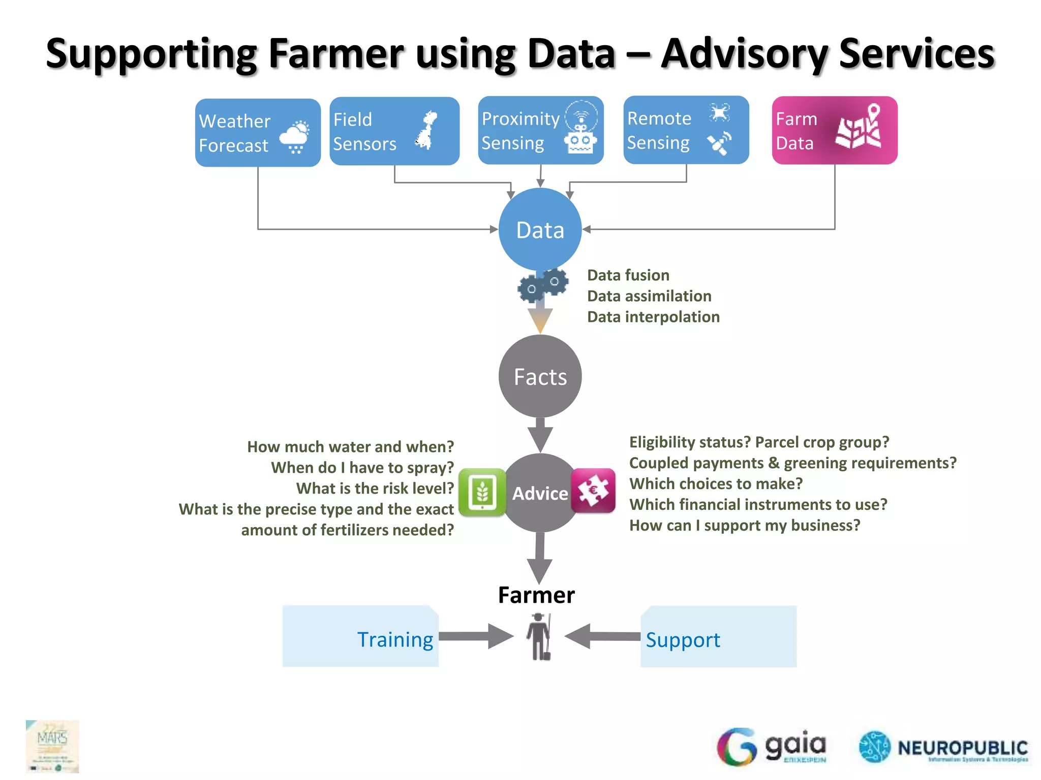
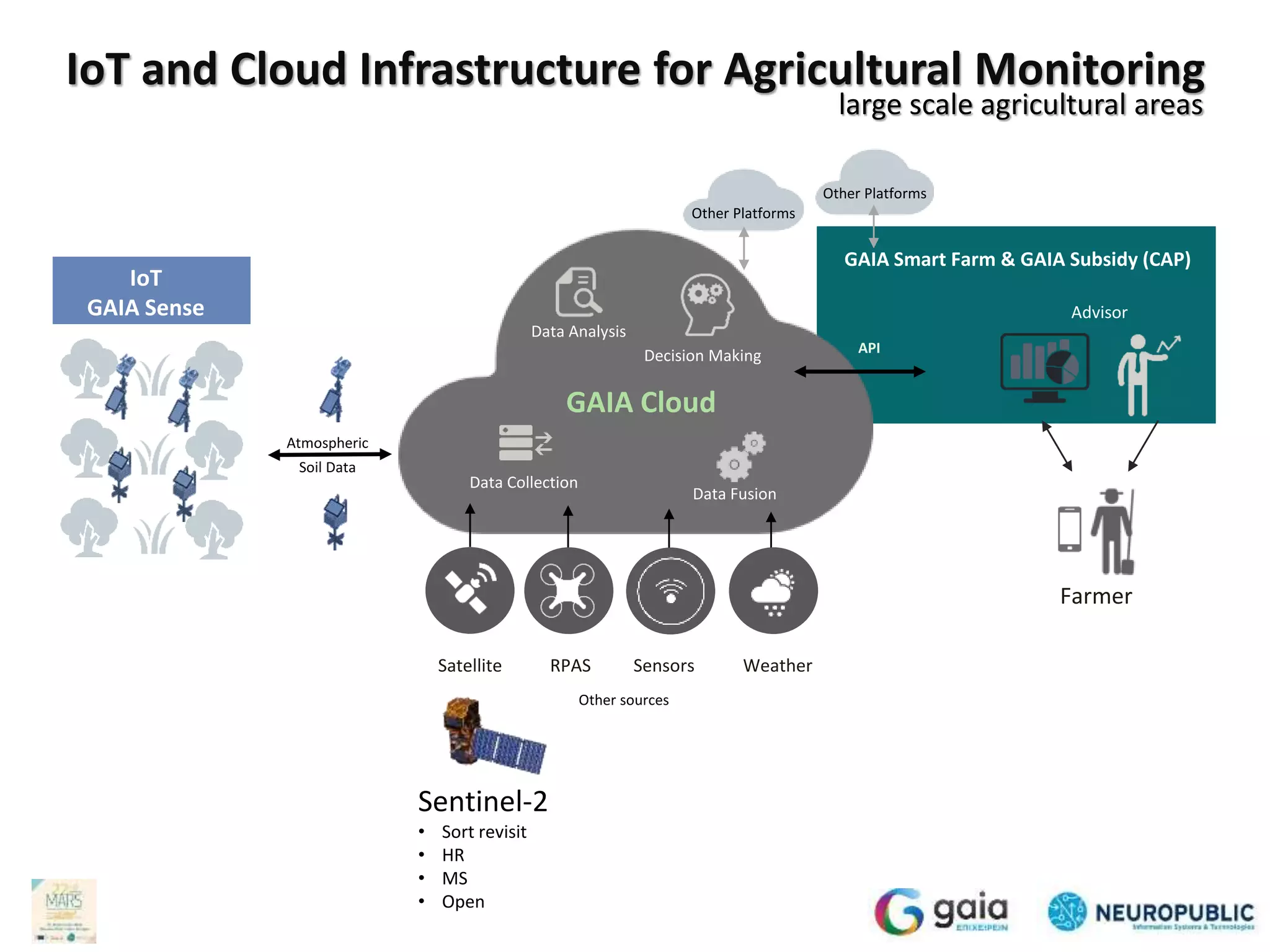
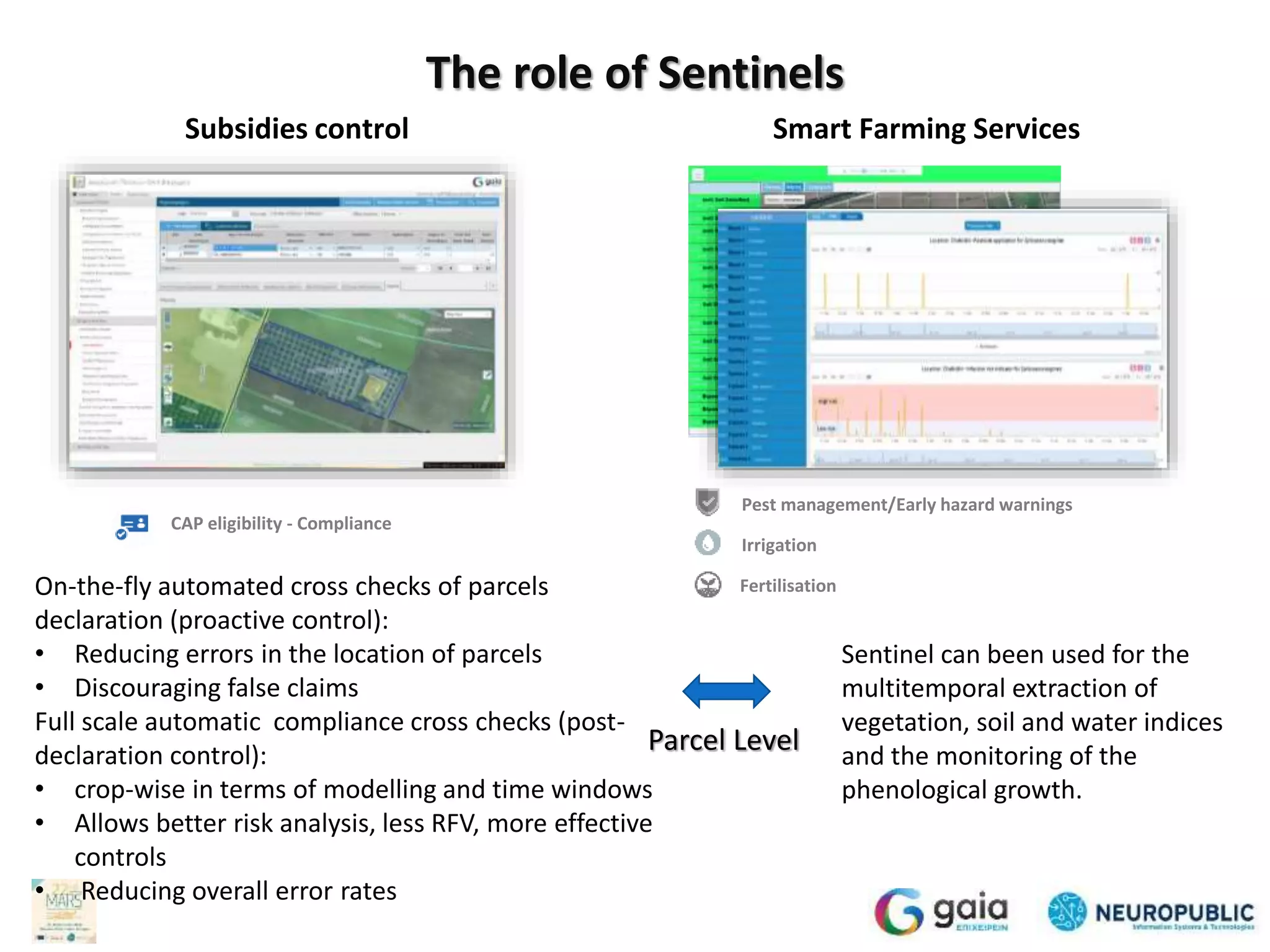
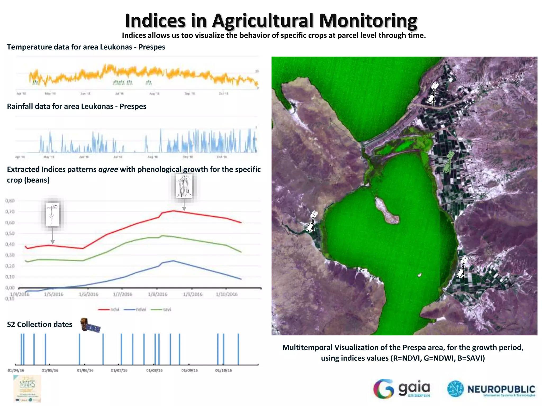
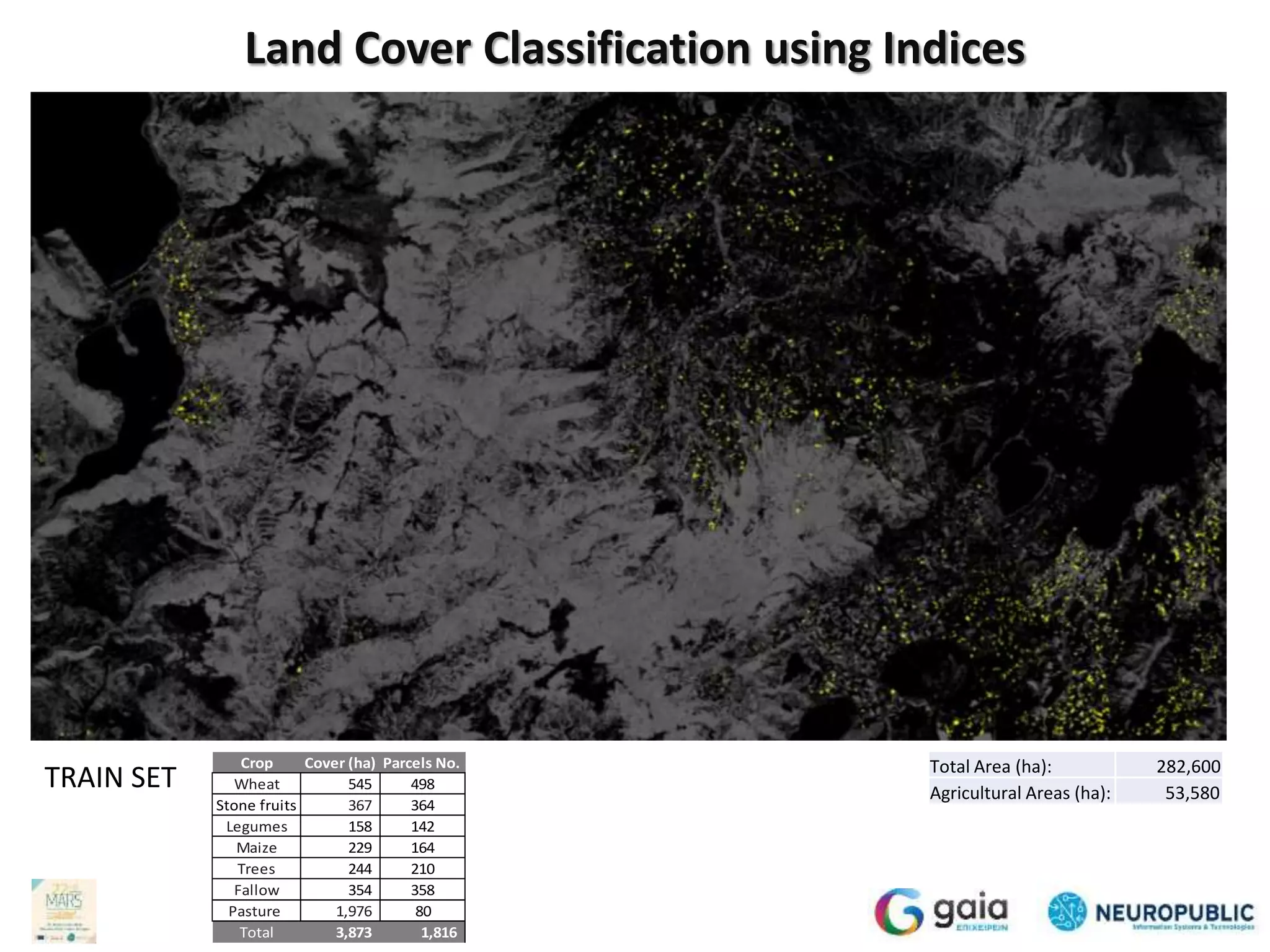
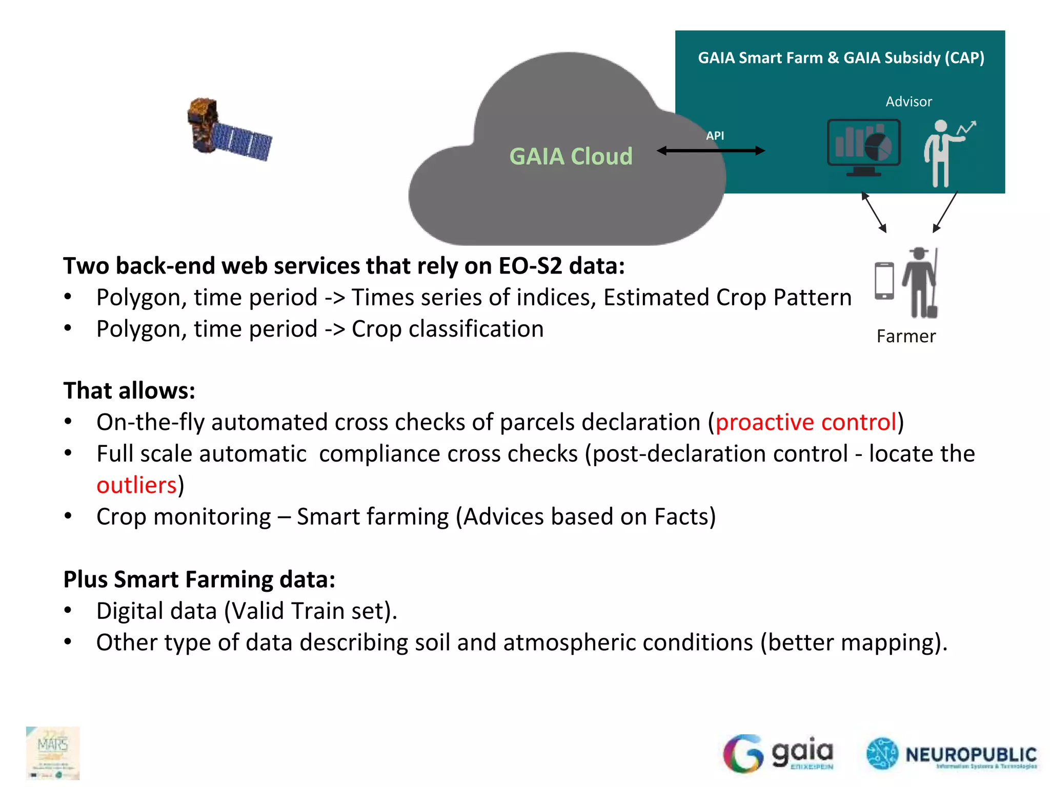
The document discusses the automated classification of land cover using Sentinel data for the Common Agricultural Policy (CAP), highlighting a proactive approach to support farmers through smart farming solutions and advisory services. It emphasizes the integration of various data sources, including satellite imagery, weather data, and soil sensors, to enhance decision-making and compliance monitoring. The initiative aims to improve crop management, reduce errors, and increase overall efficiency in agriculture through advanced data analytics and cloud-based technologies.

![Multi-Temporal Object-based Monitoring
Collect
Store
Define
Objects
Assign
Properties
Create
Models
Decision
Making
Take
Actions
Monitor
Actions
[ 0. 0.2 0.5 0.8 0.2 0.7 0.2 0.9 0.7 0. 0.74 0.97
0. 0. 0. 0. 0. 0. 0. 0. 0. 0. 0. 0. 0.
0. 0. 0.39 1. 0.07 0.01 0. 0. 0. 0. 0. 0. 0.
0. 0. 0. 0.1 1. 0.26 0.06 0.04 0. 0. 0. 0. 0.
0. 0. 0. 0. 0. 0. 0. 0. 0. 0. 0. 0. 0.
0. 1. 0.14 0.03 0. 0. 0. 0. ]
Time
Space
Vegetation – Soil – water Indices at parcel level,
for (single or multi) crop growing period
Crop Models
Parcel = Object
Cloud based services that integrate earth observation data with Image Processing, Machine Learning, Spatial Modeling](https://image.slidesharecdn.com/marsjrcgaianpfinal-161127173716/75/Automated-classification-of-land-cover-for-the-needs-of-CAP-using-Sentinel-data-A-proactive-approach-8-2048.jpg)
![Land Cover Classification using +Indices
b1
b2
b3
bn
Image (b1, b2, b3, … , bn) Object (reference parcel or holding LPIS) Land Cover Class System
Crop Code & Crop Description
1.1.1 xxxxxxxxxxxx1.1.1
Segment
(Polygon: x1y1, x2y2, x3y3, x4y4)
PHASE 2: Descriptor Extraction for each object per Image
Feature Extraction t22
All pixels
All Bands or/ and Indices
SIFT
SURF
ORB
CHIST
Method(s)
[ 0, 0, 0, 32, 0 , 0, …., 123, 0 ]
Descriptor (scaling)
PHASE 1: Indices (i) extraction using atmospherically corrected bands (b)
PHASE 3: Model Creation (data driven)
Train set
Input (time series data for polygons) Output( Labe)l
[ 0, 0, 0, 22, 0, 5, …., 100, 0, 12/04/2016] [1.1.1]
[ 0, 0, 0, 32, 0, 0, …., 123, 0, 07/05/2016] [1.1.1]
…….
[ 4, 1, 1, 22, 0, 0, …., 123, 0, 22/10/2016] [1.1.1]
Training
SVM
RF
NN
Evaluation
PHASE 4: Crop estimation for other parcels using the data-driven input -output model(s)
Input (time series data for a polygon)
[ 0, 0, 0, 22, 0 , 5, …., 100, 0, 12/8/2016 ]
…….
[ 4, 1, 1, 22, 0 , 0, …., 123, 0, 12/8/2016 ]
Land Cover
Classification Model
Model
Multi-Dimensional
Dimension varies
i1
i2
i3
in
Image (i1, i2, i3, … , in)
b1
b2
b3
bn
Image (b1, b2, b3, … , bn) Object (reference parcel or holding LPIS) Land Cover Class System
Crop Code & Crop Description
1.1.1 xxxxxxxxxxxx1.1.1
Segment
(Polygon: x1y1, x2y2, x3y3, x4y4)
PHASE 2: Descriptor Extraction for each object per Image
Feature Extraction t22
All pixels
All Bands or/ and Indices
SIFT
SURF
ORB
CHIST
Method(s)
[ 0, 0, 0, 32, 0 , 0, …., 123, 0 ]
Descriptor (scaling)
PHASE 1: Indices (i) extraction using atmospherically corrected bands (b)
PHASE 3: Model Creation (data driven)
Train set
Input (time series data for polygons) Output( Labe)l
[ 0, 0, 0, 22, 0, 5, …., 100, 0, 12/04/2016] [1.1.1]
[ 0, 0, 0, 32, 0, 0, …., 123, 0, 07/05/2016] [1.1.1]
…….
[ 4, 1, 1, 22, 0, 0, …., 123, 0, 22/10/2016] [1.1.1]
Training
SVM
RF
NN
Evaluation
PHASE 4: Crop estimation for other parcels using the data-driven input -output model(s)
Input (time series data for a polygon)
[ 0, 0, 0, 22, 0 , 5, …., 100, 0, 12/8/2016 ]
…….
[ 4, 1, 1, 22, 0 , 0, …., 123, 0, 12/8/2016 ]
Land Cover
Classification Model
Model
Multi-Dimensional
Dimension varies
i1
i2
i3
in
Image (i1, i2, i3, … , in)](https://image.slidesharecdn.com/marsjrcgaianpfinal-161127173716/75/Automated-classification-of-land-cover-for-the-needs-of-CAP-using-Sentinel-data-A-proactive-approach-10-2048.jpg)


![[DSC Europe 25] Sara Polak - The Ancient Operating System: What Archaeology T...](https://cdn.slidesharecdn.com/ss_thumbnails/3vch2p6tttdnwhsgazoz-3-sara-polak-smart-cities-251208152532-64404202-thumbnail.jpg?width=640&height=640&fit=bounds)
![[DSC Europe 25] Bogdan Daniel Maruneac - AI - It starts with you.pptx](https://cdn.slidesharecdn.com/ss_thumbnails/odov3snhrcqs9hx5ny2n-4-251205085715-f1daacfe-thumbnail.jpg?width=640&height=640&fit=bounds)

![[DSC Europe 25] Katherine Forrest - AI NOW: Understanding the Velocity of Cha...](https://cdn.slidesharecdn.com/ss_thumbnails/wvvbruqfrci0sfq9xwgb-4-251212104007-e5ad1987-thumbnail.jpg?width=640&height=640&fit=bounds)
![[DSC Europe 25] Andy Cotgreave - Nothing is new in analytics.pptx](https://cdn.slidesharecdn.com/ss_thumbnails/mba4vzcurvoh5lfrd5zw-6-251205194645-341bbbbe-thumbnail.jpg?width=640&height=640&fit=bounds)

![[DSC Europe 25] Dusan Nesic - Securing Tomorrow’s Infrastructure: Why Cyber-P...](https://cdn.slidesharecdn.com/ss_thumbnails/qikbszfftyowjm2q6duw-1-251211083848-8f2ead6b-thumbnail.jpg?width=640&height=640&fit=bounds)

![[DSC Europe 25] Dragana Ilic - AI for Big Data in Astronomy.pptx](https://cdn.slidesharecdn.com/ss_thumbnails/8palya86qaatvjhva1ms-2-dragana-ilic-ai-ilic-251208151906-652b819c-thumbnail.jpg?width=640&height=640&fit=bounds)
![[DSC Europe 25] Jovan Bogicevic - Legacy to AI-Driven Defense: Transforming D...](https://cdn.slidesharecdn.com/ss_thumbnails/rsarluadt563hntyfc8q-3-251211083849-3e7bc4c0-thumbnail.jpg?width=640&height=640&fit=bounds)
![[DSC Europe 25] Goran Obradovic - The Rise of Sovereign AI: Building the Regi...](https://cdn.slidesharecdn.com/ss_thumbnails/7nw2xxixrxqdxvrb5wca-6-251205085714-ab09a2ac-thumbnail.jpg?width=640&height=640&fit=bounds)

![[DSC Europe 25] Bassam Maharmeh - Artificial Intelligence: Opportunities and ...](https://cdn.slidesharecdn.com/ss_thumbnails/thhfmr2fqpawzj7hsjpg-5-251211083048-2c23204f-thumbnail.jpg?width=640&height=640&fit=bounds)

![[DSC Europe 25] Milan Sekuloski - Data, Defence, and Development: Cybersecuri...](https://cdn.slidesharecdn.com/ss_thumbnails/dfrkwwx4qly6atqpbl4z-4-251209104645-c3d4b0ca-thumbnail.jpg?width=640&height=640&fit=bounds)
![[DSC Europe 25] Dusan Pavlov - There Is No Spoon: Inferring Vision from Neura...](https://cdn.slidesharecdn.com/ss_thumbnails/wg0v1umoqjm4nnbd3p0v-there-is-no-spoon-251205085715-6d81d6c5-thumbnail.jpg?width=640&height=640&fit=bounds)
![[DSC Europe 25] Vladimir Jelic - The AI-Driven Security Shift From Reactive D...](https://cdn.slidesharecdn.com/ss_thumbnails/6g5gj25mtjwayniqem1t-6-251209104645-7a5a5fc6-thumbnail.jpg?width=640&height=640&fit=bounds)

![[DSC Europe 25] Nikola Rajovic - Hardware Technologies Under the Hood: RISC-V...](https://cdn.slidesharecdn.com/ss_thumbnails/o2gptrmtoyqndgoshwgq-dsc2025-tenstorrent-rajovic-251205090438-814685f5-thumbnail.jpg?width=640&height=640&fit=bounds)
