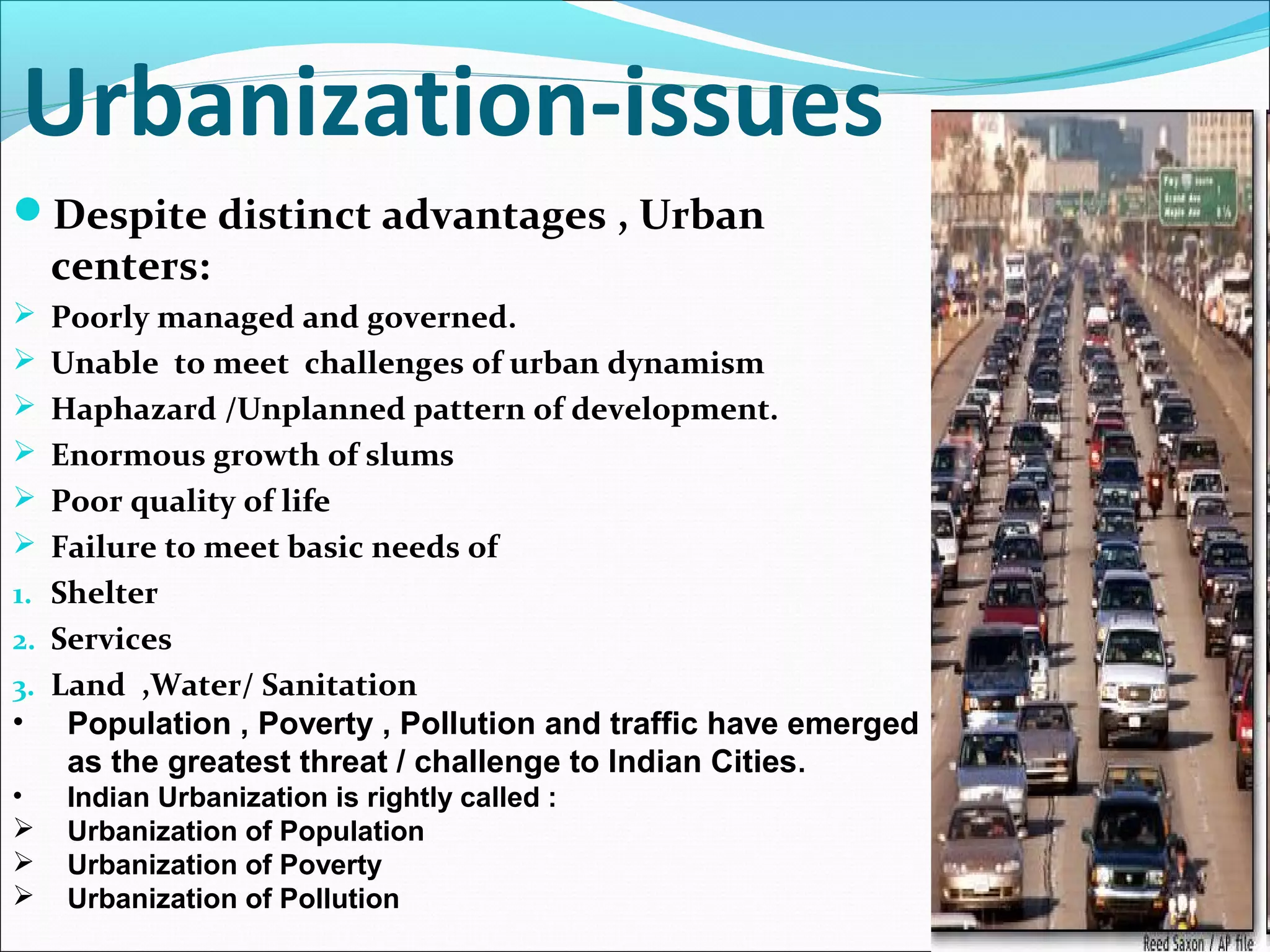
Jit Kumar Gupta,
former Director, College
of Architecture, IET
Bhaddal
Jit.kumar1944@gmail.com
REDEFINING
MASTER PLANS TO
PROMOTE SMART
AND SUSTAINABLE
CITIES
State of World
Cities
State of World’s Cities
 UN Habitat Report, State of World’s Cities 2008/2009-
Harmonious Cities, defines cities in terms of --
Cities contain both order and chaos.
In them reside beauty and ugliness--virtue and vice.
 They can bring out best or worst in human kind.
 They are physical manifestation of history and culture
They are incubators of innovations, industry, technology,
entrepreneurship and creativity.
 Cities are materialization of humanity’s noblest ideas, ambitions and
aspirations,
 but when not planned or governed properly, can be repository of
society’s ills.
Cities drive national economies by creating wealth, enhancing social
development and providing employment but
 they can also be breeding grounds for poverty, exclusion and
environmental degradation.
Hierarchy of Human Settlements
Population--
Global, Indian
Population Scenario-World World population recorded:World population recorded:
 1 Billion in 18041 Billion in 1804
 2 Billion in 1927 (123 yrs. Later)2 Billion in 1927 (123 yrs. Later)
 3 Billion in 1960 (33 yrs. Later)3 Billion in 1960 (33 yrs. Later)
 4 Billion in 1974 (14 yrs. Later)4 Billion in 1974 (14 yrs. Later)
 5 Billion in 1987 (13 yrs. Later)5 Billion in 1987 (13 yrs. Later)
 6 Billion in 1999 (12 yrs. Later)6 Billion in 1999 (12 yrs. Later)
 7 Billion in 2010 (11 yrs. Later)7 Billion in 2010 (11 yrs. Later)
 UNO population projection ranges from 8.9-10.9UNO population projection ranges from 8.9-10.9
billion for 2050.billion for 2050.
 60% population to live in cities by 2030-adding 1.460% population to live in cities by 2030-adding 1.4
billionbillion
 65 million people added annually to cities- 1.7965 million people added annually to cities- 1.79
lakh/daylakh/day
 China and Indian have population over 1 billionChina and Indian have population over 1 billion
 India to be most populated country by 2036.India to be most populated country by 2036.
 Tokyo largest Urban Agglomeration with 34Tokyo largest Urban Agglomeration with 34
million residents (2011).million residents (2011).
 26 Urban Agglomerations with + 10 million26 Urban Agglomerations with + 10 million
population in world – with 3 in India (Mumbai,population in world – with 3 in India (Mumbai,
Kolkata & Delhi).Kolkata & Delhi).
Contribution to increase in urban population , 2014 to 2050
Population Scenario- India-2011Population of India reached
 250 million in 1919
 500 million in 1966 (47 yrs. Later)
 1000 million in 2000 ( 34 yrs. Later)
 1027 million in 2001 (1yr Later)
 1210 million in 2011 (10 yrs. Later)
 Last century --- 5 fold growth in population
 2050- Indian population- 1600 mil. -- 50% in Urban India.
 Metropolitan Centres -5 (1951)- -53 (2011)-68(2031)
 10 m plus- nil (1951)- 3 (2011) -7 (2031)-9 (2051
 Urban India -- added more persons(91m) than Rural
India(90m)in last decade
 massive shift of population
 -not simply a shift of demographics
 -- places cities/towns at centre of India’s development trajectory.
 Increased population requires
 More cities,
 More housing,
 More educational healthcare/ institutions
 More commercial space ,
 More transportation
 – More infrastructure
 – more Resources
Indian Urbanization
Indian Urbanization
Population Distribution- India-2011
* Urban Pop. (2011)--377 m (31.1 %)- 7935 towns/cities
- Mega Cities with Pop > 10m - 4% of total pop
- Cities with Population 5-10m- 3%
- Cities with Population 1-5m- 6%
- Cities with Population 0.1-1m- 9%
- Cities with Population < 0.1 m- 9%
** Rural Pop (2011) - 833 m ( 68.9%) - 6,40, 867 villages
---- Very large (>10k) and large villages(>5k)-17%
-- Medium villages (2-5 k)— 24%
--- Small villages (1-2000) — 17%
------Hamlets (5 00-1000) — 8%
---- Small Hamlets(<5 00)— 3%
 Every 3rd Indian lives in urban areas
 Every 5th
Indian lives in cities
 Every 8th
Urbanite lives in Mega city
 4 3% urbanites live in 53 metro cities
 7 0% urbanites are residing in cities.
 Large and medium villages house 60%rural pop.
Indian Urbanization
URBAN INDIA- 2030- Mckinsey Global Inst-
 India Urban Awakening :Building Inclusive Cities-
Report- April, 2010 -- by 2030:
 590 m to live in Urban India- twice the US population
 70% GDP generated by cities
 80% Revenue generated by cities
 4 fold increase in per capita income
 5 times the number by which GDP would multiply
 270 million net increase in working age group
 70% of new jobs(170 mil) generated in cities
 91 M urban households will be middle class-- up from 22 M
 68 Cities will be Metropolises-Europe has 35 only
 $ 1.2T capital needed to meet projected infrastructure demand
 700-900 million Sqmts of residential/ commercial area needed
annually- a new Chicago to be created
 2.5 b Sqmts roads paved-20times created in last decade
 7400km (350-400 km/year) of metro needed -20times created in last
decade
 200 million Rural Indians to benefit-living close to top 70 cities
 75%urban India to live in bottom segment -earning Rs 80 per day
Indian Urbanization
Indian Urbanization
Indian Urbanization
Indian Urbanization
• Urban area are important because they are
 Areas of future concentration of population,
 Providers of large employment.
 Areas of large investment.
 Housing major infrastructure & services.
 Hub around which entire economy gravitates.
 Promoters of higher order of productivity
• Major contributors to the national wealth/GDP
 1950-51 - 29% (level of urbanization - 17.29%)
 1970-71- 37% (level of urbanization - 19.91%)
 1990-91- 50% (level of urbanization - 25.72%)
 2001-02- 60% (level of urbanization - 27.78%)
 2011- 12- 65% (level of urbanization - 31.1%)
 10 Largest cities house 8%pop and produce 15%GDP
 53 Metro cities house 13 %pop and produce 33%GDP
 100 Largest cities house 16%pop and produce 43%GDP
Indian Urbanization
 Urbanization -- determinant and consequence of
economic development.
-- development and urbanization synonymous
 Urban growth & economic growth go hand in hand
 Cities called engines of economic growth
 -- make large contribution to national wealth.
 Economy hinges on productivity of urban settlements.
 Building Smart cities critical to boost rural economy
 Urban centers need to be planned to
 Attract investment
 Provide Employment.
 Ensure quality of life.
 Make them Smart ,Sustainable, Productive, Livable,
Humane and Eco- friendly.
Lack of policies to manage Urban India will
 jeopardize growth
 risking employment generation.
 India
Urbanization-
issues
Urbanization-issues
Despite distinct advantages , Urban
centers:
 Poorly managed and governed.
 Unable to meet challenges of urban dynamism
 Haphazard /Unplanned pattern of development.
 Enormous growth of slums
 Poor quality of life
 Failure to meet basic needs of
1. Shelter
2. Services
3. Land ,Water/ Sanitation
• Population , Poverty , Pollution and traffic have emerged
as the greatest threat / challenge to Indian Cities.
• Indian Urbanization is rightly called :
 Urbanization of Population
 Urbanization of Poverty
 Urbanization of Pollution
• Cities profoundly alter :
--quality of life
-Impact local/ global environment
- consume 70% energy
- generate 73% carbon footprints
•Cities fast emerging as GREY CITIES,
• the way they:
 Use land
 Consume resources
 Create high energy demand
 Increase travel needs
Create heat islands
Generate waste
Create ecological problems
Destroy natural habitat
Add to water pollution
Adversely impact environment
Lower down quality of life
Urbanization-issuesUrbanization-issues
Cities fast emerging as large consumers of resources and
generators of waste due to:
 Concentration of population.
 Concentration of activities.
 Increasing size of cities.
 Increasing travel demand.
 Increased travel distance.
 Increased personal vehicles.
 Construction of large number of buildings
 Cooling / heating spaces for comfortable
living/working.
Energy consumptions levels rising rapidly due to:
 Increasing income level.
 Higher car ownership.
 Travel becoming a habit.
 Designing Cities without caring for energy
implications
 Designing buildings without caring for energy
implications
 Increasing level of living comforts.
--Considering multiple impacts
-essential to make cities sustainable
Urbanization-issuesUrbanization-issues
Approach to
Planning Cities in
India– Master
Plans
Urban Planning and Legal Framework
• Facing rapid / massive urbanization-- major concerns to all
governments :
 urban land development and
 urban development process --because
• Planning/ Managing urban settlements have major implications on:
 economic development,
 social change,
 Environmental sustainability,
 operational efficiency of society
 Welfare of community
• Central to such development / administration--
- human beings their
- Basic requirements -- living, working, cobs and travel
- Land -- its allocation -- planning and management
-- Sub-division of land
--- Use of Land
• Accordingly--Land-use planning emerges-- most powerful element
in process of urban development.
• Sustainable development-- key to urban sustainability
Master Plans/ Development Plans
 Master Plans used extensively by urban Planner for;
-- promoting planned development
-- guiding / rationalizing future urban growth
--Endorsing urban growth in desired direction,
-- promoting economic development,
--Rationalizing transportation
--Promoting operational efficiency of city
-- providing basic/essential amenities to people.
-- improving service delivery
Master plans focus on land use planning
-- period spanning 20 years
---Process -- generally office centric-
-- limited involvement of city/ stakeholders/ communities /
professionals
-- only 30% cities in India have completed master plans.
Defining Master Plans/ Development Plans
City of Trenton, NJ has defined Master Plan in terms of;--
--A comprehensive plan
-- providing long-range vision for built environment of a community/
guiding appropriate use of lands within a municipality
-- to protect the public health and safety
-- to promote general welfare
 identify Suitable locations for—
 commercial, housing/ mixed-use dev;
-- increasing density/ use redevelopment
Opportunities to extend/ improve open space, recreational areas/
civic facilities;
Strategies for increasing economic development;
Environmental, historic/ cultural resources that need conservation;
Strategies for solving congestion and improving transit services.
Defining Master Plans/ Development Plans
. Master Plan has also been defined as--- A plan that
-- shows an overall development concept that includes
-- urban design, landscaping, infrastructure, service provision,
circulation, present and future land use and built form.
-- Consisting of three dimensional images,
- texts,
- -- diagrams,
- -- statistics,
- -- reports
- -- maps and
- -- aerial photos
- -- describing how a specific location will be developed
- --. provides a structured approach
- -- creates a clear framework for developing an area.
Defining Master Plans/ Development Plans
.. Looking at definitions, Master Plans are mandated to be ;
--definer of physical environment,
-- social environment and
--economic environment
-- promoter of planned development.
-- having all ingredients which can make a city--
--people centric, more liveable, sustainable, productive
--sustainers of quality living besides
-- an attractive investment destination.
--Accordingly, governments create--comprehensive legal
framework --defining objectives, intent, scope / contents /
methodology
-- for preparing Master Plan
-- to launch cities
OBJECTIVES
 Envisioned to Promote systematic & planned growth of city by:
 (i) Identifying existing gaps in physical / social infrastructure & to bridge
those gaps
 (ii) Making assessment of city-- suggest strategies for economic
development.
 (iii) Leveraging economy
 (iv) Rationalizing land uses
 (v) Minimizing haphazard / uncontrolled growth
 (vi) Achieving planned growth /planned development
 vii Creating healthy living environment
 (vii) Promoting better urban governance/ resource generation.
(viii) Rationalizing orderly movement of traffic and transportation
 (ix) defining area for network of various services.
 (x) Indicating spatial distribution of physical/social infrastructure
 (xi) Ensuring balanced/ integrated development
(xii) Framing strategies for resolving core area problems
 xiii)Promoting Urban Sustainability, inclusiveness,
 xiv) Reducing carbon footprints
Master Plan- Objectives
Preparing Master Plan
 Preparing Master Plan Involves:
 • Collection / review of available data, documents, reports, etc.
 site visits.
 Studying demand/supply and identifying gaps in service delivery. ,
 identifying strengths, weaknesses, opportunities and threats,
 preparing Existing Land use Plan--thematic maps,
 • Reviewing ongoing / proposed development projects and other Govt schemes
 • Formulating vision and Mission
 Making population projection for next 20 years
 • Locating / estimating extent of land uses such as residential, industrial, commercial,.
 Preparing Proposed Land use Plan and Zonal Development Plan etc.
 Defining Development Control Regulations.
 Evolving framework for implementation of Master Plan
 Prioritizing projects
 • Formulating Investment Plan with appropriate financing strategies.
 • Focusing on reforms to be carried out to promote planned interventions
Master Plans—
Issues
MASTER PLANS - Problems
 Master Plan involves;
--Lengthy, cumbersome time consuming process for preparation
and approvals
-- Planning chasing the development
--Expensive--Requires enormous resources-- financial /
manpower
 Freezes city for next 20 years--Rigid- lacks flexibility
Focus on defining land use of each piece of land
Largely ignoring social, economic, environmental issues
-putting emphasizes on plan preparation
--Based primarily on secondary data;
-- Minimizes stakeholders participation-- Lack of transparency
-- Plan generally based on hafbaked base plan/existing land use
plan
Mismatch between plan proposals and ground realities
MASTER PLANS - Problems
Divorce between Plan preparation and plan implementation
Creating large disputes in plan interpretation
Non- involvement of Professionals- Architects, urban designers
Engineers, environmentalists, conservationists landscape experts
in plan preparation/implementation
inability to meet emerging urban challenges/ address urban
dynamism
Controller of Development
 major road block in promoting planned development
Based on philosophy of exclusion-- informal sector
 Does not address the needs of the informal sector-
living/working
 emergence of Slums/ haphazard development
- elitist in nature

Master Plans- ProblemsDespite Master Plans – Majority of growth marked by dualities and
contradictions
-- where planned /unplanned development and
-- slums/sky-scrappers-- rub shoulders
‘ where exclusion of majority is principle rather than exception
--Cities continue to remain unsustainable
-- because of lopsided policy/ approach making these plans—
--Plan focuses on expanding/melting the city
--increasing distances/travel demand
--bringing more vehicles roads
--lacking focus to reduce travel demand and traffic
- make development --economical,, cost effective
Focussing on promoting mobility rather than accessibility
 – planning for Vehicles rather than planning for people
Master Plans- Problems
Energy efficiency --no priority in planning- making cities
unsustainable / energy inefficient
City Plans remains a two dimensional document-- where vital
third dimension remains absent- urban design
Does not give clear picture of final shape, form / typology of city
Built environment– covering > 75% of city -- has no definition/
details
Majority of city growth– unplanned/ haphazard/ sub- standard
due to rigid land use planning
 urban designers find no place in city planning-- making cities
-- half planned and
-- half baked
-- groping in dark about its future
Master Plans- Problems
City viewed as a commodity rather than a living organism
Consumer of large amount of precious agricultural land
Promoters of low density settlements
Cities missing quality urban spaces– due to absence of urban
designers
Cities missing quality Green Spaces- due to absence of Landscape
experts
Changing Context
of Master Plans-
Better Master
Plan
CHANGING CONTEXT OF MASTER PLANS
Need to make Master Plan a better Master Plan
by:
-- changing its intent, content, approach and
philosophy
-- making it more people/city centric
-- involving participatory approach
-- bringing flexibility
-- preparing in a limited time,
--City structure defined through
 road network,
 infrastructure network and
CHANGING CONTEXT OF MASTER PLANS
Master Plan to be;
-- promoter of Planned development
--rather than controller of development
-- making city compact
 -- prepared with energy efficiency as focus
-- Reducing carbon footprints of city promote Sustainability
-- Promoting mixed landuse-- rather than pure land use
planning
---Promoter of Green Transportation-- pedestrianisation, cycling,
public transport as the-- preferred mode of transportation
-- Promoting TOD to minimise travel
Minimising use of Agricultural land/ minimum land under
urbanization- 2.45land vs 16.7% population

CHANGING CONTEXT OF MASTER PLANS
Promoting self-sufficiency in day to day needs
Promoting Decentralization
Providing open spaces on defined norms
Planning city on well defined norms / planning
parameters
Promote water sufficiency
Promote reducing/ recycling/ reuse of water/waster
Make informal sector integral part of planning process
Promoting Green Energy - Solar, Wind, Bio-mass, Geo-
thermal energy-as sources of energy
Preparing Master Plan using nature as the basis- SUN,
SPACE, VERDURE
CHANGING CONTEXT OF MASTER PLANS
Cities can be made Smart/sustainable
if they are:
Visioned Smartly
 Planned Smartly
 Built Smartly
 Developed Smartly,
Operated Smartly
 Financed Smartly
Governed Smartly
 Smart Leadership
 Smart Mobility
 having high environmental quality
--. Assured/ gainful employment for all
Smart Vision
Vision is the starting point for any city to be smart
Vision to be defined :
After detailed study
Carrying out SWOT analysis
Looking at future potential
Building on existing strength
Creating vision achievable and realistic
-Vision to be outcome of--
 participatory approach
Using a consultative process
Involving all stakeholders
Creating a think tank
Involving intelligentia of city
Sustainable/
Smart Planning
–Goal 11—focuses on-- making human settlements
inclusive, safe, resilient , sustainable- to minimize global
warming and climate change-
Changing context of Urban Planning
• For making cities smart in past-urban planning concepts revolved
around promoting:
 Planned cities
 Inclusive Cities
 Sustainable Cities
 Green Cities
 Intelligent Cities
 Smart Cities
 Looking at the solutions:
 Garden City
 Linear City
 Industrial City
 Vertical Cities
 Compact Cities
 Radiant Cities
• City Planning needs to be leveraged to make cities Smart, cleaner,
greener & Sustainable,
Garden City
GARDEN CITY
Linear City
COBS
WORKINGLIVING
CIRCULATION
• The Radiant City
•An organism capable of housing the
works of man of machine-age society.
• placed under the masterful
government of natural conditions:
•Sun
•Space
•Greenery
•And its mission is the service of
mankind:
•To live
•To work
•To cultivate body and spirit
•To travel about
(in this order and obeying this
hierarchy)
PLANNING CITIES- Regional Context
New Order of Urban Planning will focus on:
Regional Planning- involving urban and rural settlements
Regional approach/model has help in
-- minimizing local competition and conflicts,
--- over/under investment in infrastructure
- overcoming confusion over role / responsibilities of various
agencies
-- making city smart.
-- promoting higher order of co-operation and growth
-- of not only city-- but of region.
-- Looking outward helps in
-- achieving the objectives of
-- integration and
-- decentralized planning,
th
Compact City
PLANNING COMPACT CITIES
Critically reviewing Planning tools to make
cities--
-- more livable
- more sustainable
-- more productive
-- more cost effective
- more operationally efficient
- least consumers of resources
 least consumers of energy
 least generator of waste
- minimizing travel
--making cities Compact
Compact City-- Advantages
-Minimizes land to be used for urbanisation
--Optimizes use of available urban land
--Spares more land for agriculture
--Minimises service network
--Makes cost of services lower- w/s, sewerage, roads, sanitation,
lighting etc- planning, development, management
- making development --cost- effective
--Makes service delivery cost- effective
- lowering life-cycle cost of services
- Lowering cost to city and residents
--Minimises cost of recycling/reuse of waste
-- Minimises distances between place of work/living/services etc
--Minimises trip length
-- Minimises travel demand
Compact City-- Advantages
--Minimises area under road network
-- Optimises Mass transportation
- Minimises the need for personal vehicles
-- Reduces problems of congestion and parking
-- Improves road safety
-- Promotes pedestrianisation/cycling
-- Reduces environmental pollution-- making city clean
- Reduces social cost of meeting large open spaces
--Promoting Pedestrianisation
--makes city socially more inclusive- improves interface between residents
--Promoting 24x7 use of infrastructure and services
-Making communities more safe and free from crime
--Creating Better rural- urban interface- city & periphery
Compact city makes perfect business sense and creates win -win
situation for all the stakeholders- including residents, communities’
state and nations--by reducing life –cycle cost of operation of cities
/reducing tax liabilities of the residents- making cities operationally
PLANNING COMPACT CITIES
Making cities compact by ;
. –Building inside not outside
--- Building vertical not horizontal
--- Building High not low
--- Building mix not pure
---Building dense not shallow
---Building accessibility not mobility
-- Building for people not for vehicles
-- optimizing current infrastructure.
-- promoting High-density development
-- adopting Transit oriented development
-- Raising Height and
-Rationalizing land uses and Building bye-laws
.
PLANNING COMPACT CITIES
• Parameters for making cities compact ;
•--Defining shape of the city-- maximizing area with
minimum circumference
•-- Minimizing Area of city
•--Increasing density
•-- Redefining/ Rationalizing FAR
•--Increasing Height
•-Rationalizing Land use
•--Changing Typology of buildings- Flatted Vs Plotted
development
•--Re-densification of existing Cities
•--Promoting Mixed Land-use Planning
•--Promoting Regional Planning
PLANNING COMPACT CITY
Transit Oriented Development
Curitiba's BRT corridors run along high-
density developed area
 A city of 50,000population
 City of no cars , no waste
Planned to make use of cool sea winds
Using solar energy on rooftop
Narrow streets shading houses
Total recycling of waste/water
 working/ living area not farther than200
mts from transportation nodes).
Electric powered light rail on elevated
track to permit easy transport between
Musdar and Abu Dhabi.
•for Intra-city travel people use
personal rapid transit pods (PRT) run
on magnetic tracks using electric
power.
•Aim is to create:
Zero Carbon
Zero Waste
Zero Car city
ianjn
•Introduction
•Master Plan
•Milestones
-City developed as joint effort between China and Singapore Governments.
-Located 40 kms from Tianjin city centre and 150 KMS from Beijing city
-Total land area of 30 sq. km.
- When fully completed in around 2020,-- population of 350,000 residents.
, Site made of saltpans, barren land and polluted water-bodies,
included a 2.6 sq km large wastewater pond.
Site selected --- a derelict area with shortage of drinking water
..
1. Land-use Planning -planned to be compact, with a good mix of land uses and
Transit-Oriented Development (TOD) principles.
2. Transport Planning -Green transport .--to increase trips via public transport
and non-motorised modes of transport --- bicycles and walking, within Eco-city.
3. Green and Blue Network Planning---City planned with extensive green
(vegetation) and blue (water) networks to provide quality living /working
environment. The green network comprises a green lung at core and eco-corridors
emanating from the lung to the other parts of city.
4. Water bodies linked for water circulation to enhance ecology ,provide attractive
environment , recreational activities.
5. A wastewater pond rehabilitated /transformed into a clean/beautiful lake.
6. Master Plan can be summed as- 1 axis-3 centres-4 districts
.
SMART PLANNING-- Rules
-----Avoid Urban Sprawl
-- Stop melting of cities
--Make cities more compact,
reduce carbon footprints
-- Make cities energy efficient
Plan for People not vehicles
-Promote accessibility not mobility
Make streets safe
Create dedicated spaces for Pedestrians
Provide safe connected network for Cyclists
-Ensure high quality Public Transport
Use data to detect problem areas
- Involve communities
-Pan for Need and not Greed
Future cities
• HIGH RISE BUILDINGS:
have enormous capacity to create large volume of built space
sparing large ground space for non -urban uses.
provide optimum solutions for housing large
population/activities using minimum area.
 Make cities more compact
Reduce the need of long travels.
Offer opportunities for pedestrianising cities.
Make cities more humane & eco-friendly.
Create well knit & close communities.
•Providing work space & amenities within/near the
buildings
•High rise buildings connected by efficient means of
mass transportation-- minimize use of personalized
vehicles.
• Cities would look more green, open and eco-
friendly.
Looking Forward - Reshaping
Cities
Presentation1.pptx
Future Cities-Conceptual
Ultima Tower- 2Mile High Sky City
•Location: Any densely populated urban
environment
•Date: 1991
•Cost: $150,000,000,000
•Population: 1,000,000 people
•Exterior surface area of building: 150,000,000
sft.
•Enclosed volume: 53,000,000,000 cubic feet
•Total enclosed acreage: 39,000 acres-156
secors
•Elevator speed: 20 feet per second (13 miles
per hour) 9 minutes and 40 seconds to reach
top floor from ground floor.
•Dimensions: Height--10,560 feet;
•Diameter at the base--6000 feet;
•Number of stories--500;
•Total Square Feet: Approximately 5,000,000 sft
Mile-High Tower-
Jeddah, Saudi Arabia
• Location Jeddah, Saudi Arabia
• Cost US$28.5 billion
• Height 1 mile (1,600 m; 5,280 ft)
• Floor area 3,530,000 m2 (38,000,000 sft)
• Capacity 80,000 people
•
• The tower will have -275 floors
• Lobby upto 5 th floor
• Offices 6- 50 floors
• Five-star hotel &Conference halls 51-75 floors
• Deluxe residential units 76-195 floors and
• Retail facilities 196-275 floors
• Alternate Energy Generation 196-275 floor
• -- project already under construction since
2008
Earth Scrapper – Mexico City
Location- Mexico City
Depth 300 mtrs. Below ground
Designed as Inverted Pyramid
Glass floor to cover 240 mtrs X
240 mtrs. hole in cities main
square to filter natural light
Preserve the cities historic centre
and the heritage buildings
surrounding the square.
Interior of the building to look
natural.
Building to be the city”s top
retail destination.
VERTICAL CITY- PARIS
Defining Smart Cities
Forbes identified Nine key
aspects that define a
Smart City: ‘
•smart governance
• Smart education
•smart energy,
•smart building,
• smart mobility,
•smart infrastructure,
•smart technology,
•smart healthcare
•smart citizen
Making Cities Great
Way Forward-Defining a realistic / achievable Vision for city based on:
-- in-depth study, and analysis
-- including SWOT analysis,
 -- using a consultative process
-- involving stakeholders/ experts / parastatal agencies
 De-freezing City by changing:
-- approach from defining land uses of all parcels of land
-- providing a developmental framework
-- within which city should grow
-- for meeting ever changing needs / people aspirations
-- to emerging technologies and ever changing urban contexts
. Making City Compact
-- by redefining shape and size of the city
-- adopting high rise / high density / Mixed landuse/ Transit Oriented
-- to optimise land, minimise travel, reduce carbon footprints and
-- make city development cost / energy efficient.
Way ForwardPromoting Green Transport
-- by changing our approach
-- from planning for vehicle to planning for people
-- with order of priority for travel placed-- as pedestrianisation /cycling/ mass
transportation / personal vehicles
-- minimising congestion/ lowering environmental pollution /avoiding traffic
blues.
 Making city energy efficient through;
-- preparing Master Plan with
-- minimising energy consumption as the focus
-- by adopting mixed land use/ avoiding pure land use
-- redefining living-working-leisure relationship
-- and adopting transit oriented development approach
Promoting Regional Context by viewing / planning city
-- in larger context by
-- linking cities and towns
-- linking urban areas to rural areas
Way Forward
Making urban villages integral part of planning process
-- by defining policy framework/ agenda for
-- planning / development of villages
-- falling in urban/ urbanisable/ planning area
Making informal sector integral part of planning process
-- by earmarking appropriate and dedicated space
-- for their living and working
Creating Ownership of plan by
-- avoiding multiplicity of agencies and
-- designating a single agency for co-ordination / implementation plan
Using latest, state of art and innovative technologies for
-- preparing/ approval/implementation / interpretation of Master Plan
-- besides using public consultation/ receiving suggestions / views
-- communicating status of planning
Way ForwardUsing a Group approach
-- comprising of architects/planners/ engineers/urban designer/ transport
planner/ landscape expert/ sociologist/ geographer/ environmentalist/
conservationist
-- to prepare MP/ evaluate all projects presented for approval
 Planning city on a set of well defined parameters of
-- open spaces/ services/ mobility/sanitation/services/energy etc
-- to ensure amenities/ services on a defined scale .
 Addressing issues like poverty, employment and economy
-- by redefining approach
--from merely land use planning to
-- planning for economic development/ environment /employment generation
Making city Smart by preparing Master plan with focus on
-- people, energy, environment, employment, sustainability, services, mobility
and shelter
-- to create zero car, zero energy, zero slum, zero waste/ zero carbon city.
Way ForwardPreserving heritage,
--both natural and manmade,
-- to showcase / preserve past glory /cultural values for posterity
Adopting a participatory approach
-- by creating forum/institutional framework for involving
-- people, communities, NGO’s, CBO’s, industry, trade & commerce, academic
institutions etc
-- to create local ownership
Making Master Plan promoter of development
--. rather than controller of developing
-- by providing space for inclusion of all
-- people centric development activities which promote public and city interest
Promoting use of land 24x7
-- to minimise diversion of land under agriculture to non-agricultural uses,
--making cities more compact/ ensuring optimisation of infrastructure
-- making urban development highly cost-efficient.
Way Forward
 Generating resources for
-- plan preparation, implementation, revision and reframing
-- creating/maintaining city/local level infrastructures, amenities / services
Redefining the legal framework
-- for preparing the Master Plan in a time bound manner
-- making it simple cost/ time efficient / more participatory.
Ensuring effective implementation of Master Plan
-- by creating/designating a dedicated agency,
-- duly equipped with manpower and financial resources
-- having adequate legal backing to punish violators
Preserving all Water bodies
- using all low lying areas for creating green spaces/ water
bodies
- to make city self-sufficient in its water needs
•
Three Mantra to make Cities
Great/Smart/Sustainable
 1. Achieve smart growth-- cities need economic growth for
people –
to earn good livelihood and
-- enjoy a good quality of life.
-- Smart growth is about finding best way to do that sustainably
2. Do more with less– cities need enough money to accomplish
all it wants /needs to do.
- cities must collect, manage, and spend their resources
effectively and efficiently
3. Win support for change-- City leaders need to deliver fast,
positive, and visible results,
-- to build support for more change.
-- Based on high-performing civil servants made accountable for
their work—Singapore model
COBS
WORKINGLIVING
CIRCULATION
• The Radiant City
•An organism capable of housing the
works of man of machine-age society.
• placed under the masterful
government of natural conditions:
•Sun
•Space
•Greenery
•And its mission is the service of
mankind:
•To live
•To work
•To cultivate body and spirit
•To travel about
(in this order and obeying this
hierarchy)
THANKS FOR
YOUR
ATTENTION &
TIME
TO MAKE
MASTER PLAN
A BETTER
MASTER PLAN

Role and Importance of master plan

  • 1.
    Jit Kumar Gupta, formerDirector, College of Architecture, IET Bhaddal Jit.kumar1944@gmail.com REDEFINING MASTER PLANS TO PROMOTE SMART AND SUSTAINABLE CITIES
  • 2.
  • 3.
    State of World’sCities  UN Habitat Report, State of World’s Cities 2008/2009- Harmonious Cities, defines cities in terms of -- Cities contain both order and chaos. In them reside beauty and ugliness--virtue and vice.  They can bring out best or worst in human kind.  They are physical manifestation of history and culture They are incubators of innovations, industry, technology, entrepreneurship and creativity.  Cities are materialization of humanity’s noblest ideas, ambitions and aspirations,  but when not planned or governed properly, can be repository of society’s ills. Cities drive national economies by creating wealth, enhancing social development and providing employment but  they can also be breeding grounds for poverty, exclusion and environmental degradation.
  • 4.
    Hierarchy of HumanSettlements
  • 5.
  • 6.
    Population Scenario-World Worldpopulation recorded:World population recorded:  1 Billion in 18041 Billion in 1804  2 Billion in 1927 (123 yrs. Later)2 Billion in 1927 (123 yrs. Later)  3 Billion in 1960 (33 yrs. Later)3 Billion in 1960 (33 yrs. Later)  4 Billion in 1974 (14 yrs. Later)4 Billion in 1974 (14 yrs. Later)  5 Billion in 1987 (13 yrs. Later)5 Billion in 1987 (13 yrs. Later)  6 Billion in 1999 (12 yrs. Later)6 Billion in 1999 (12 yrs. Later)  7 Billion in 2010 (11 yrs. Later)7 Billion in 2010 (11 yrs. Later)  UNO population projection ranges from 8.9-10.9UNO population projection ranges from 8.9-10.9 billion for 2050.billion for 2050.  60% population to live in cities by 2030-adding 1.460% population to live in cities by 2030-adding 1.4 billionbillion  65 million people added annually to cities- 1.7965 million people added annually to cities- 1.79 lakh/daylakh/day  China and Indian have population over 1 billionChina and Indian have population over 1 billion  India to be most populated country by 2036.India to be most populated country by 2036.  Tokyo largest Urban Agglomeration with 34Tokyo largest Urban Agglomeration with 34 million residents (2011).million residents (2011).  26 Urban Agglomerations with + 10 million26 Urban Agglomerations with + 10 million population in world – with 3 in India (Mumbai,population in world – with 3 in India (Mumbai, Kolkata & Delhi).Kolkata & Delhi).
  • 7.
    Contribution to increasein urban population , 2014 to 2050
  • 8.
    Population Scenario- India-2011Populationof India reached  250 million in 1919  500 million in 1966 (47 yrs. Later)  1000 million in 2000 ( 34 yrs. Later)  1027 million in 2001 (1yr Later)  1210 million in 2011 (10 yrs. Later)  Last century --- 5 fold growth in population  2050- Indian population- 1600 mil. -- 50% in Urban India.  Metropolitan Centres -5 (1951)- -53 (2011)-68(2031)  10 m plus- nil (1951)- 3 (2011) -7 (2031)-9 (2051  Urban India -- added more persons(91m) than Rural India(90m)in last decade  massive shift of population  -not simply a shift of demographics  -- places cities/towns at centre of India’s development trajectory.  Increased population requires  More cities,  More housing,  More educational healthcare/ institutions  More commercial space ,  More transportation  – More infrastructure  – more Resources
  • 9.
  • 10.
  • 11.
    Population Distribution- India-2011 *Urban Pop. (2011)--377 m (31.1 %)- 7935 towns/cities - Mega Cities with Pop > 10m - 4% of total pop - Cities with Population 5-10m- 3% - Cities with Population 1-5m- 6% - Cities with Population 0.1-1m- 9% - Cities with Population < 0.1 m- 9% ** Rural Pop (2011) - 833 m ( 68.9%) - 6,40, 867 villages ---- Very large (>10k) and large villages(>5k)-17% -- Medium villages (2-5 k)— 24% --- Small villages (1-2000) — 17% ------Hamlets (5 00-1000) — 8% ---- Small Hamlets(<5 00)— 3%  Every 3rd Indian lives in urban areas  Every 5th Indian lives in cities  Every 8th Urbanite lives in Mega city  4 3% urbanites live in 53 metro cities  7 0% urbanites are residing in cities.  Large and medium villages house 60%rural pop.
  • 12.
  • 13.
    URBAN INDIA- 2030-Mckinsey Global Inst-  India Urban Awakening :Building Inclusive Cities- Report- April, 2010 -- by 2030:  590 m to live in Urban India- twice the US population  70% GDP generated by cities  80% Revenue generated by cities  4 fold increase in per capita income  5 times the number by which GDP would multiply  270 million net increase in working age group  70% of new jobs(170 mil) generated in cities  91 M urban households will be middle class-- up from 22 M  68 Cities will be Metropolises-Europe has 35 only  $ 1.2T capital needed to meet projected infrastructure demand  700-900 million Sqmts of residential/ commercial area needed annually- a new Chicago to be created  2.5 b Sqmts roads paved-20times created in last decade  7400km (350-400 km/year) of metro needed -20times created in last decade  200 million Rural Indians to benefit-living close to top 70 cities  75%urban India to live in bottom segment -earning Rs 80 per day
  • 14.
  • 15.
  • 16.
  • 17.
    Indian Urbanization • Urbanarea are important because they are  Areas of future concentration of population,  Providers of large employment.  Areas of large investment.  Housing major infrastructure & services.  Hub around which entire economy gravitates.  Promoters of higher order of productivity • Major contributors to the national wealth/GDP  1950-51 - 29% (level of urbanization - 17.29%)  1970-71- 37% (level of urbanization - 19.91%)  1990-91- 50% (level of urbanization - 25.72%)  2001-02- 60% (level of urbanization - 27.78%)  2011- 12- 65% (level of urbanization - 31.1%)  10 Largest cities house 8%pop and produce 15%GDP  53 Metro cities house 13 %pop and produce 33%GDP  100 Largest cities house 16%pop and produce 43%GDP
  • 18.
    Indian Urbanization  Urbanization-- determinant and consequence of economic development. -- development and urbanization synonymous  Urban growth & economic growth go hand in hand  Cities called engines of economic growth  -- make large contribution to national wealth.  Economy hinges on productivity of urban settlements.  Building Smart cities critical to boost rural economy  Urban centers need to be planned to  Attract investment  Provide Employment.  Ensure quality of life.  Make them Smart ,Sustainable, Productive, Livable, Humane and Eco- friendly. Lack of policies to manage Urban India will  jeopardize growth  risking employment generation.
  • 19.
  • 20.
    Urbanization-issues Despite distinct advantages, Urban centers:  Poorly managed and governed.  Unable to meet challenges of urban dynamism  Haphazard /Unplanned pattern of development.  Enormous growth of slums  Poor quality of life  Failure to meet basic needs of 1. Shelter 2. Services 3. Land ,Water/ Sanitation • Population , Poverty , Pollution and traffic have emerged as the greatest threat / challenge to Indian Cities. • Indian Urbanization is rightly called :  Urbanization of Population  Urbanization of Poverty  Urbanization of Pollution
  • 21.
    • Cities profoundlyalter : --quality of life -Impact local/ global environment - consume 70% energy - generate 73% carbon footprints •Cities fast emerging as GREY CITIES, • the way they:  Use land  Consume resources  Create high energy demand  Increase travel needs Create heat islands Generate waste Create ecological problems Destroy natural habitat Add to water pollution Adversely impact environment Lower down quality of life Urbanization-issuesUrbanization-issues
  • 22.
    Cities fast emergingas large consumers of resources and generators of waste due to:  Concentration of population.  Concentration of activities.  Increasing size of cities.  Increasing travel demand.  Increased travel distance.  Increased personal vehicles.  Construction of large number of buildings  Cooling / heating spaces for comfortable living/working. Energy consumptions levels rising rapidly due to:  Increasing income level.  Higher car ownership.  Travel becoming a habit.  Designing Cities without caring for energy implications  Designing buildings without caring for energy implications  Increasing level of living comforts. --Considering multiple impacts -essential to make cities sustainable Urbanization-issuesUrbanization-issues
  • 23.
  • 25.
    Approach to Planning Citiesin India– Master Plans
  • 26.
    Urban Planning andLegal Framework • Facing rapid / massive urbanization-- major concerns to all governments :  urban land development and  urban development process --because • Planning/ Managing urban settlements have major implications on:  economic development,  social change,  Environmental sustainability,  operational efficiency of society  Welfare of community • Central to such development / administration-- - human beings their - Basic requirements -- living, working, cobs and travel - Land -- its allocation -- planning and management -- Sub-division of land --- Use of Land • Accordingly--Land-use planning emerges-- most powerful element in process of urban development. • Sustainable development-- key to urban sustainability
  • 27.
    Master Plans/ DevelopmentPlans  Master Plans used extensively by urban Planner for; -- promoting planned development -- guiding / rationalizing future urban growth --Endorsing urban growth in desired direction, -- promoting economic development, --Rationalizing transportation --Promoting operational efficiency of city -- providing basic/essential amenities to people. -- improving service delivery Master plans focus on land use planning -- period spanning 20 years ---Process -- generally office centric- -- limited involvement of city/ stakeholders/ communities / professionals -- only 30% cities in India have completed master plans.
  • 28.
    Defining Master Plans/Development Plans City of Trenton, NJ has defined Master Plan in terms of;-- --A comprehensive plan -- providing long-range vision for built environment of a community/ guiding appropriate use of lands within a municipality -- to protect the public health and safety -- to promote general welfare  identify Suitable locations for—  commercial, housing/ mixed-use dev; -- increasing density/ use redevelopment Opportunities to extend/ improve open space, recreational areas/ civic facilities; Strategies for increasing economic development; Environmental, historic/ cultural resources that need conservation; Strategies for solving congestion and improving transit services.
  • 29.
    Defining Master Plans/Development Plans . Master Plan has also been defined as--- A plan that -- shows an overall development concept that includes -- urban design, landscaping, infrastructure, service provision, circulation, present and future land use and built form. -- Consisting of three dimensional images, - texts, - -- diagrams, - -- statistics, - -- reports - -- maps and - -- aerial photos - -- describing how a specific location will be developed - --. provides a structured approach - -- creates a clear framework for developing an area.
  • 30.
    Defining Master Plans/Development Plans .. Looking at definitions, Master Plans are mandated to be ; --definer of physical environment, -- social environment and --economic environment -- promoter of planned development. -- having all ingredients which can make a city-- --people centric, more liveable, sustainable, productive --sustainers of quality living besides -- an attractive investment destination. --Accordingly, governments create--comprehensive legal framework --defining objectives, intent, scope / contents / methodology -- for preparing Master Plan -- to launch cities
  • 31.
    OBJECTIVES  Envisioned toPromote systematic & planned growth of city by:  (i) Identifying existing gaps in physical / social infrastructure & to bridge those gaps  (ii) Making assessment of city-- suggest strategies for economic development.  (iii) Leveraging economy  (iv) Rationalizing land uses  (v) Minimizing haphazard / uncontrolled growth  (vi) Achieving planned growth /planned development  vii Creating healthy living environment  (vii) Promoting better urban governance/ resource generation. (viii) Rationalizing orderly movement of traffic and transportation  (ix) defining area for network of various services.  (x) Indicating spatial distribution of physical/social infrastructure  (xi) Ensuring balanced/ integrated development (xii) Framing strategies for resolving core area problems  xiii)Promoting Urban Sustainability, inclusiveness,  xiv) Reducing carbon footprints Master Plan- Objectives
  • 32.
    Preparing Master Plan Preparing Master Plan Involves:  • Collection / review of available data, documents, reports, etc.  site visits.  Studying demand/supply and identifying gaps in service delivery. ,  identifying strengths, weaknesses, opportunities and threats,  preparing Existing Land use Plan--thematic maps,  • Reviewing ongoing / proposed development projects and other Govt schemes  • Formulating vision and Mission  Making population projection for next 20 years  • Locating / estimating extent of land uses such as residential, industrial, commercial,.  Preparing Proposed Land use Plan and Zonal Development Plan etc.  Defining Development Control Regulations.  Evolving framework for implementation of Master Plan  Prioritizing projects  • Formulating Investment Plan with appropriate financing strategies.  • Focusing on reforms to be carried out to promote planned interventions
  • 33.
  • 34.
    MASTER PLANS -Problems  Master Plan involves; --Lengthy, cumbersome time consuming process for preparation and approvals -- Planning chasing the development --Expensive--Requires enormous resources-- financial / manpower  Freezes city for next 20 years--Rigid- lacks flexibility Focus on defining land use of each piece of land Largely ignoring social, economic, environmental issues -putting emphasizes on plan preparation --Based primarily on secondary data; -- Minimizes stakeholders participation-- Lack of transparency -- Plan generally based on hafbaked base plan/existing land use plan Mismatch between plan proposals and ground realities
  • 35.
    MASTER PLANS -Problems Divorce between Plan preparation and plan implementation Creating large disputes in plan interpretation Non- involvement of Professionals- Architects, urban designers Engineers, environmentalists, conservationists landscape experts in plan preparation/implementation inability to meet emerging urban challenges/ address urban dynamism Controller of Development  major road block in promoting planned development Based on philosophy of exclusion-- informal sector  Does not address the needs of the informal sector- living/working  emergence of Slums/ haphazard development - elitist in nature 
  • 36.
    Master Plans- ProblemsDespiteMaster Plans – Majority of growth marked by dualities and contradictions -- where planned /unplanned development and -- slums/sky-scrappers-- rub shoulders ‘ where exclusion of majority is principle rather than exception --Cities continue to remain unsustainable -- because of lopsided policy/ approach making these plans— --Plan focuses on expanding/melting the city --increasing distances/travel demand --bringing more vehicles roads --lacking focus to reduce travel demand and traffic - make development --economical,, cost effective Focussing on promoting mobility rather than accessibility  – planning for Vehicles rather than planning for people
  • 37.
    Master Plans- Problems Energyefficiency --no priority in planning- making cities unsustainable / energy inefficient City Plans remains a two dimensional document-- where vital third dimension remains absent- urban design Does not give clear picture of final shape, form / typology of city Built environment– covering > 75% of city -- has no definition/ details Majority of city growth– unplanned/ haphazard/ sub- standard due to rigid land use planning  urban designers find no place in city planning-- making cities -- half planned and -- half baked -- groping in dark about its future
  • 38.
    Master Plans- Problems Cityviewed as a commodity rather than a living organism Consumer of large amount of precious agricultural land Promoters of low density settlements Cities missing quality urban spaces– due to absence of urban designers Cities missing quality Green Spaces- due to absence of Landscape experts
  • 39.
    Changing Context of MasterPlans- Better Master Plan
  • 40.
    CHANGING CONTEXT OFMASTER PLANS Need to make Master Plan a better Master Plan by: -- changing its intent, content, approach and philosophy -- making it more people/city centric -- involving participatory approach -- bringing flexibility -- preparing in a limited time, --City structure defined through  road network,  infrastructure network and
  • 41.
    CHANGING CONTEXT OFMASTER PLANS Master Plan to be; -- promoter of Planned development --rather than controller of development -- making city compact  -- prepared with energy efficiency as focus -- Reducing carbon footprints of city promote Sustainability -- Promoting mixed landuse-- rather than pure land use planning ---Promoter of Green Transportation-- pedestrianisation, cycling, public transport as the-- preferred mode of transportation -- Promoting TOD to minimise travel Minimising use of Agricultural land/ minimum land under urbanization- 2.45land vs 16.7% population 
  • 42.
    CHANGING CONTEXT OFMASTER PLANS Promoting self-sufficiency in day to day needs Promoting Decentralization Providing open spaces on defined norms Planning city on well defined norms / planning parameters Promote water sufficiency Promote reducing/ recycling/ reuse of water/waster Make informal sector integral part of planning process Promoting Green Energy - Solar, Wind, Bio-mass, Geo- thermal energy-as sources of energy Preparing Master Plan using nature as the basis- SUN, SPACE, VERDURE
  • 43.
    CHANGING CONTEXT OFMASTER PLANS Cities can be made Smart/sustainable if they are: Visioned Smartly  Planned Smartly  Built Smartly  Developed Smartly, Operated Smartly  Financed Smartly Governed Smartly  Smart Leadership  Smart Mobility  having high environmental quality --. Assured/ gainful employment for all
  • 44.
    Smart Vision Vision isthe starting point for any city to be smart Vision to be defined : After detailed study Carrying out SWOT analysis Looking at future potential Building on existing strength Creating vision achievable and realistic -Vision to be outcome of--  participatory approach Using a consultative process Involving all stakeholders Creating a think tank Involving intelligentia of city
  • 45.
  • 46.
    –Goal 11—focuses on--making human settlements inclusive, safe, resilient , sustainable- to minimize global warming and climate change-
  • 47.
    Changing context ofUrban Planning • For making cities smart in past-urban planning concepts revolved around promoting:  Planned cities  Inclusive Cities  Sustainable Cities  Green Cities  Intelligent Cities  Smart Cities  Looking at the solutions:  Garden City  Linear City  Industrial City  Vertical Cities  Compact Cities  Radiant Cities • City Planning needs to be leveraged to make cities Smart, cleaner, greener & Sustainable,
  • 48.
  • 49.
  • 50.
  • 51.
    COBS WORKINGLIVING CIRCULATION • The RadiantCity •An organism capable of housing the works of man of machine-age society. • placed under the masterful government of natural conditions: •Sun •Space •Greenery •And its mission is the service of mankind: •To live •To work •To cultivate body and spirit •To travel about (in this order and obeying this hierarchy)
  • 52.
    PLANNING CITIES- RegionalContext New Order of Urban Planning will focus on: Regional Planning- involving urban and rural settlements Regional approach/model has help in -- minimizing local competition and conflicts, --- over/under investment in infrastructure - overcoming confusion over role / responsibilities of various agencies -- making city smart. -- promoting higher order of co-operation and growth -- of not only city-- but of region. -- Looking outward helps in -- achieving the objectives of -- integration and -- decentralized planning, th
  • 53.
  • 54.
    PLANNING COMPACT CITIES Criticallyreviewing Planning tools to make cities-- -- more livable - more sustainable -- more productive -- more cost effective - more operationally efficient - least consumers of resources  least consumers of energy  least generator of waste - minimizing travel --making cities Compact
  • 55.
    Compact City-- Advantages -Minimizesland to be used for urbanisation --Optimizes use of available urban land --Spares more land for agriculture --Minimises service network --Makes cost of services lower- w/s, sewerage, roads, sanitation, lighting etc- planning, development, management - making development --cost- effective --Makes service delivery cost- effective - lowering life-cycle cost of services - Lowering cost to city and residents --Minimises cost of recycling/reuse of waste -- Minimises distances between place of work/living/services etc --Minimises trip length -- Minimises travel demand
  • 56.
    Compact City-- Advantages --Minimisesarea under road network -- Optimises Mass transportation - Minimises the need for personal vehicles -- Reduces problems of congestion and parking -- Improves road safety -- Promotes pedestrianisation/cycling -- Reduces environmental pollution-- making city clean - Reduces social cost of meeting large open spaces --Promoting Pedestrianisation --makes city socially more inclusive- improves interface between residents --Promoting 24x7 use of infrastructure and services -Making communities more safe and free from crime --Creating Better rural- urban interface- city & periphery Compact city makes perfect business sense and creates win -win situation for all the stakeholders- including residents, communities’ state and nations--by reducing life –cycle cost of operation of cities /reducing tax liabilities of the residents- making cities operationally
  • 57.
    PLANNING COMPACT CITIES Makingcities compact by ; . –Building inside not outside --- Building vertical not horizontal --- Building High not low --- Building mix not pure ---Building dense not shallow ---Building accessibility not mobility -- Building for people not for vehicles -- optimizing current infrastructure. -- promoting High-density development -- adopting Transit oriented development -- Raising Height and -Rationalizing land uses and Building bye-laws .
  • 58.
    PLANNING COMPACT CITIES •Parameters for making cities compact ; •--Defining shape of the city-- maximizing area with minimum circumference •-- Minimizing Area of city •--Increasing density •-- Redefining/ Rationalizing FAR •--Increasing Height •-Rationalizing Land use •--Changing Typology of buildings- Flatted Vs Plotted development •--Re-densification of existing Cities •--Promoting Mixed Land-use Planning •--Promoting Regional Planning
  • 59.
  • 60.
  • 61.
  • 62.
    Curitiba's BRT corridorsrun along high- density developed area
  • 64.
     A cityof 50,000population  City of no cars , no waste Planned to make use of cool sea winds Using solar energy on rooftop Narrow streets shading houses Total recycling of waste/water  working/ living area not farther than200 mts from transportation nodes). Electric powered light rail on elevated track to permit easy transport between Musdar and Abu Dhabi. •for Intra-city travel people use personal rapid transit pods (PRT) run on magnetic tracks using electric power. •Aim is to create: Zero Carbon Zero Waste Zero Car city
  • 65.
    ianjn •Introduction •Master Plan •Milestones -City developedas joint effort between China and Singapore Governments. -Located 40 kms from Tianjin city centre and 150 KMS from Beijing city -Total land area of 30 sq. km. - When fully completed in around 2020,-- population of 350,000 residents. , Site made of saltpans, barren land and polluted water-bodies, included a 2.6 sq km large wastewater pond. Site selected --- a derelict area with shortage of drinking water
  • 66.
    .. 1. Land-use Planning-planned to be compact, with a good mix of land uses and Transit-Oriented Development (TOD) principles. 2. Transport Planning -Green transport .--to increase trips via public transport and non-motorised modes of transport --- bicycles and walking, within Eco-city. 3. Green and Blue Network Planning---City planned with extensive green (vegetation) and blue (water) networks to provide quality living /working environment. The green network comprises a green lung at core and eco-corridors emanating from the lung to the other parts of city. 4. Water bodies linked for water circulation to enhance ecology ,provide attractive environment , recreational activities. 5. A wastewater pond rehabilitated /transformed into a clean/beautiful lake. 6. Master Plan can be summed as- 1 axis-3 centres-4 districts
  • 68.
  • 69.
    SMART PLANNING-- Rules -----AvoidUrban Sprawl -- Stop melting of cities --Make cities more compact, reduce carbon footprints -- Make cities energy efficient Plan for People not vehicles -Promote accessibility not mobility Make streets safe Create dedicated spaces for Pedestrians Provide safe connected network for Cyclists -Ensure high quality Public Transport Use data to detect problem areas - Involve communities -Pan for Need and not Greed
  • 72.
  • 73.
    • HIGH RISEBUILDINGS: have enormous capacity to create large volume of built space sparing large ground space for non -urban uses. provide optimum solutions for housing large population/activities using minimum area.  Make cities more compact Reduce the need of long travels. Offer opportunities for pedestrianising cities. Make cities more humane & eco-friendly. Create well knit & close communities. •Providing work space & amenities within/near the buildings •High rise buildings connected by efficient means of mass transportation-- minimize use of personalized vehicles. • Cities would look more green, open and eco- friendly. Looking Forward - Reshaping Cities Presentation1.pptx
  • 74.
    Future Cities-Conceptual Ultima Tower-2Mile High Sky City •Location: Any densely populated urban environment •Date: 1991 •Cost: $150,000,000,000 •Population: 1,000,000 people •Exterior surface area of building: 150,000,000 sft. •Enclosed volume: 53,000,000,000 cubic feet •Total enclosed acreage: 39,000 acres-156 secors •Elevator speed: 20 feet per second (13 miles per hour) 9 minutes and 40 seconds to reach top floor from ground floor. •Dimensions: Height--10,560 feet; •Diameter at the base--6000 feet; •Number of stories--500; •Total Square Feet: Approximately 5,000,000 sft
  • 75.
    Mile-High Tower- Jeddah, SaudiArabia • Location Jeddah, Saudi Arabia • Cost US$28.5 billion • Height 1 mile (1,600 m; 5,280 ft) • Floor area 3,530,000 m2 (38,000,000 sft) • Capacity 80,000 people • • The tower will have -275 floors • Lobby upto 5 th floor • Offices 6- 50 floors • Five-star hotel &Conference halls 51-75 floors • Deluxe residential units 76-195 floors and • Retail facilities 196-275 floors • Alternate Energy Generation 196-275 floor • -- project already under construction since 2008
  • 76.
    Earth Scrapper –Mexico City Location- Mexico City Depth 300 mtrs. Below ground Designed as Inverted Pyramid Glass floor to cover 240 mtrs X 240 mtrs. hole in cities main square to filter natural light Preserve the cities historic centre and the heritage buildings surrounding the square. Interior of the building to look natural. Building to be the city”s top retail destination.
  • 77.
  • 79.
    Defining Smart Cities Forbesidentified Nine key aspects that define a Smart City: ‘ •smart governance • Smart education •smart energy, •smart building, • smart mobility, •smart infrastructure, •smart technology, •smart healthcare •smart citizen
  • 80.
  • 81.
    Way Forward-Defining arealistic / achievable Vision for city based on: -- in-depth study, and analysis -- including SWOT analysis,  -- using a consultative process -- involving stakeholders/ experts / parastatal agencies  De-freezing City by changing: -- approach from defining land uses of all parcels of land -- providing a developmental framework -- within which city should grow -- for meeting ever changing needs / people aspirations -- to emerging technologies and ever changing urban contexts . Making City Compact -- by redefining shape and size of the city -- adopting high rise / high density / Mixed landuse/ Transit Oriented -- to optimise land, minimise travel, reduce carbon footprints and -- make city development cost / energy efficient.
  • 82.
    Way ForwardPromoting GreenTransport -- by changing our approach -- from planning for vehicle to planning for people -- with order of priority for travel placed-- as pedestrianisation /cycling/ mass transportation / personal vehicles -- minimising congestion/ lowering environmental pollution /avoiding traffic blues.  Making city energy efficient through; -- preparing Master Plan with -- minimising energy consumption as the focus -- by adopting mixed land use/ avoiding pure land use -- redefining living-working-leisure relationship -- and adopting transit oriented development approach Promoting Regional Context by viewing / planning city -- in larger context by -- linking cities and towns -- linking urban areas to rural areas
  • 83.
    Way Forward Making urbanvillages integral part of planning process -- by defining policy framework/ agenda for -- planning / development of villages -- falling in urban/ urbanisable/ planning area Making informal sector integral part of planning process -- by earmarking appropriate and dedicated space -- for their living and working Creating Ownership of plan by -- avoiding multiplicity of agencies and -- designating a single agency for co-ordination / implementation plan Using latest, state of art and innovative technologies for -- preparing/ approval/implementation / interpretation of Master Plan -- besides using public consultation/ receiving suggestions / views -- communicating status of planning
  • 84.
    Way ForwardUsing aGroup approach -- comprising of architects/planners/ engineers/urban designer/ transport planner/ landscape expert/ sociologist/ geographer/ environmentalist/ conservationist -- to prepare MP/ evaluate all projects presented for approval  Planning city on a set of well defined parameters of -- open spaces/ services/ mobility/sanitation/services/energy etc -- to ensure amenities/ services on a defined scale .  Addressing issues like poverty, employment and economy -- by redefining approach --from merely land use planning to -- planning for economic development/ environment /employment generation Making city Smart by preparing Master plan with focus on -- people, energy, environment, employment, sustainability, services, mobility and shelter -- to create zero car, zero energy, zero slum, zero waste/ zero carbon city.
  • 85.
    Way ForwardPreserving heritage, --bothnatural and manmade, -- to showcase / preserve past glory /cultural values for posterity Adopting a participatory approach -- by creating forum/institutional framework for involving -- people, communities, NGO’s, CBO’s, industry, trade & commerce, academic institutions etc -- to create local ownership Making Master Plan promoter of development --. rather than controller of developing -- by providing space for inclusion of all -- people centric development activities which promote public and city interest Promoting use of land 24x7 -- to minimise diversion of land under agriculture to non-agricultural uses, --making cities more compact/ ensuring optimisation of infrastructure -- making urban development highly cost-efficient.
  • 86.
    Way Forward  Generatingresources for -- plan preparation, implementation, revision and reframing -- creating/maintaining city/local level infrastructures, amenities / services Redefining the legal framework -- for preparing the Master Plan in a time bound manner -- making it simple cost/ time efficient / more participatory. Ensuring effective implementation of Master Plan -- by creating/designating a dedicated agency, -- duly equipped with manpower and financial resources -- having adequate legal backing to punish violators Preserving all Water bodies - using all low lying areas for creating green spaces/ water bodies - to make city self-sufficient in its water needs
  • 87.
    • Three Mantra tomake Cities Great/Smart/Sustainable  1. Achieve smart growth-- cities need economic growth for people – to earn good livelihood and -- enjoy a good quality of life. -- Smart growth is about finding best way to do that sustainably 2. Do more with less– cities need enough money to accomplish all it wants /needs to do. - cities must collect, manage, and spend their resources effectively and efficiently 3. Win support for change-- City leaders need to deliver fast, positive, and visible results, -- to build support for more change. -- Based on high-performing civil servants made accountable for their work—Singapore model
  • 90.
    COBS WORKINGLIVING CIRCULATION • The RadiantCity •An organism capable of housing the works of man of machine-age society. • placed under the masterful government of natural conditions: •Sun •Space •Greenery •And its mission is the service of mankind: •To live •To work •To cultivate body and spirit •To travel about (in this order and obeying this hierarchy)
  • 92.
    THANKS FOR YOUR ATTENTION & TIME TOMAKE MASTER PLAN A BETTER MASTER PLAN