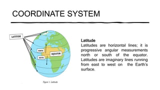
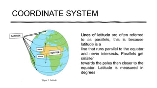
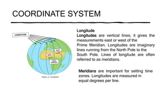
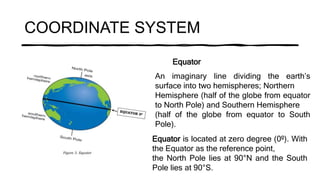
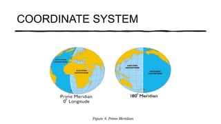
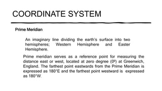
A coordinate system uses imaginary lines on Earth's surface to determine locations. The main lines are latitudes which run parallel east-west of the equator and measure angles north and south, longitudes which run perpendicular north-south through the poles and measure angles east and west of the prime meridian, the equator which divides the northern and southern hemispheres, and the prime meridian which divides the eastern and western hemispheres.