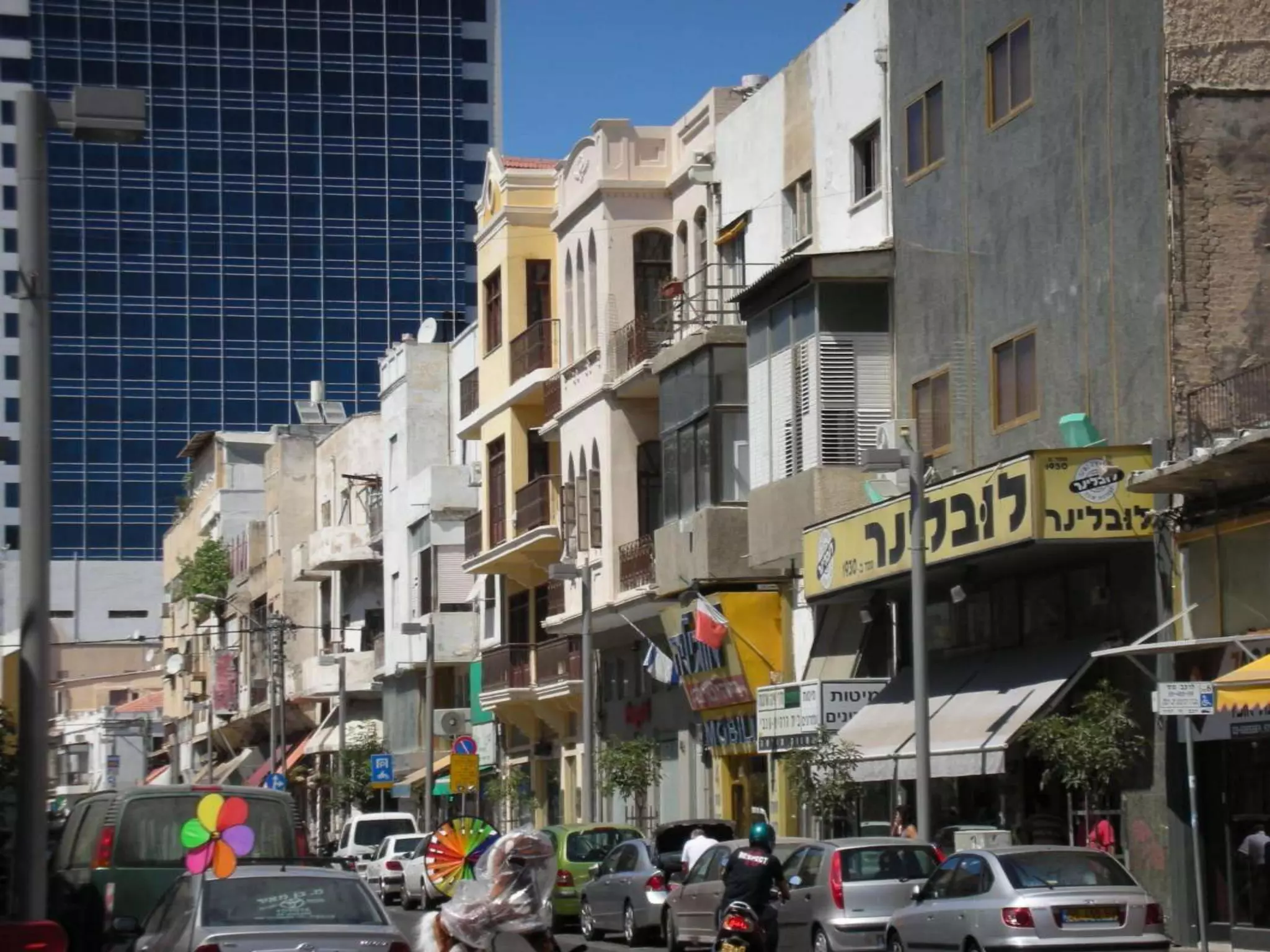
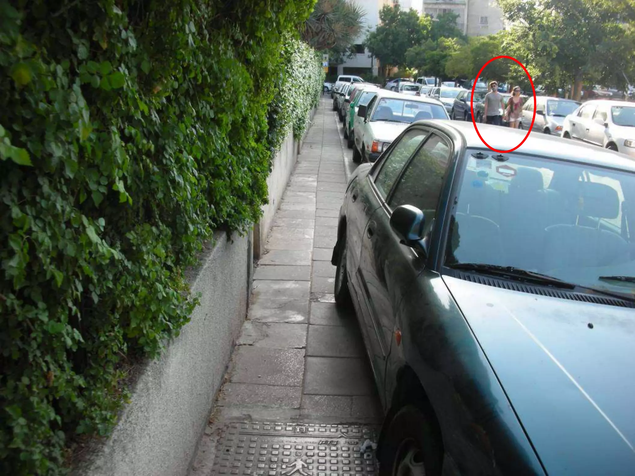
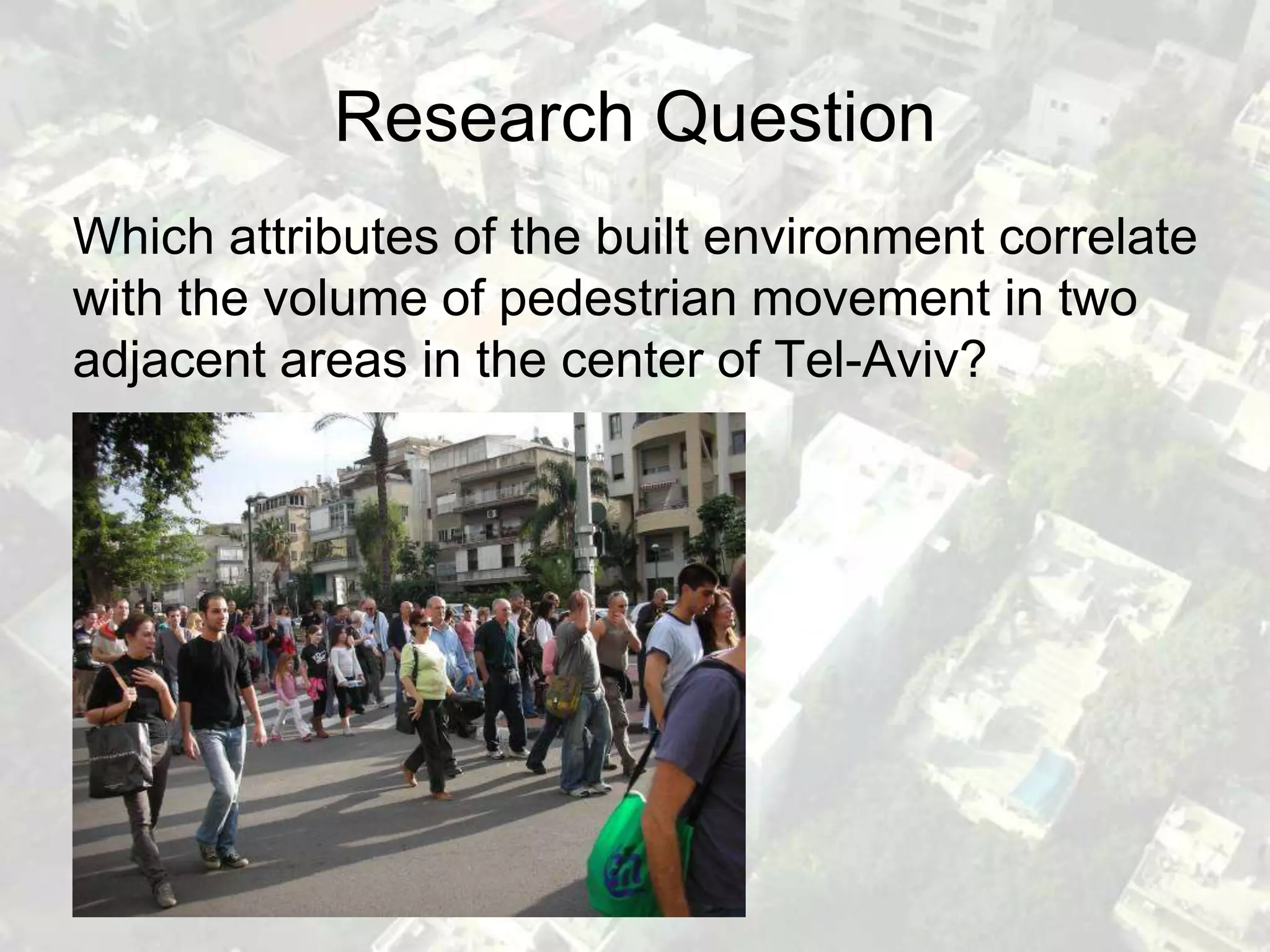
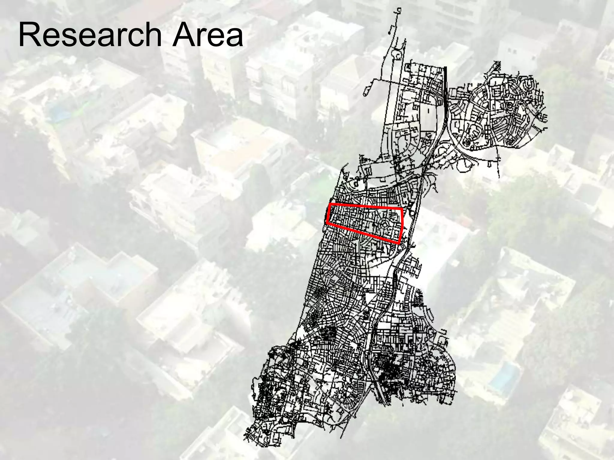
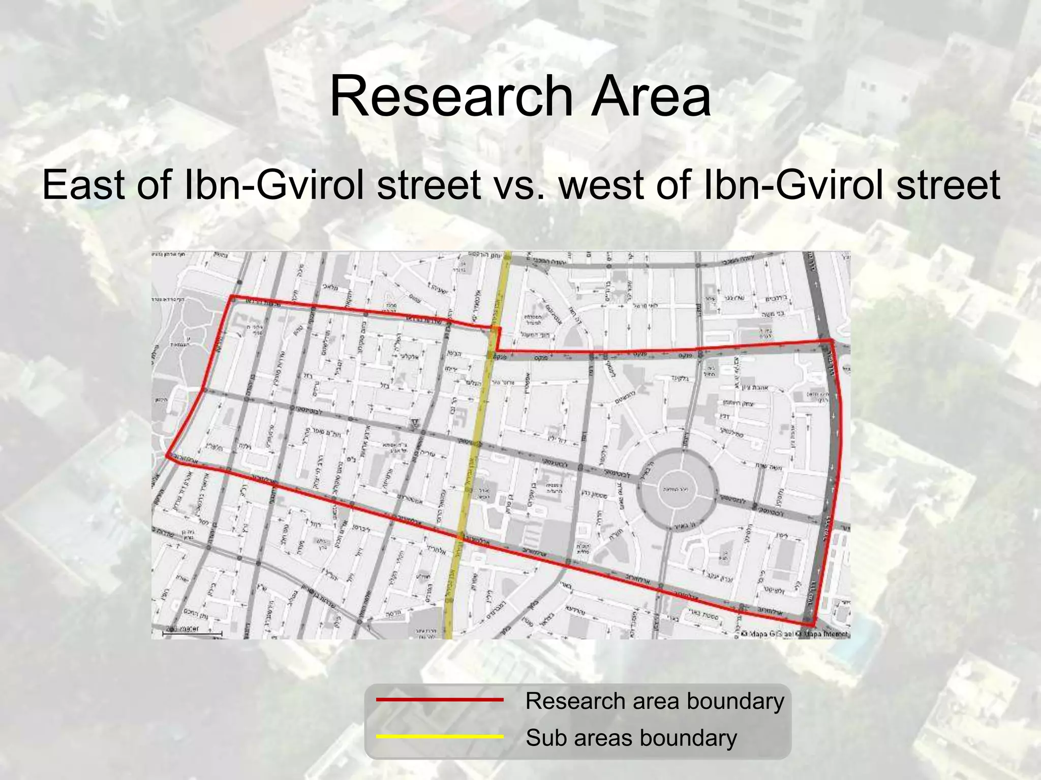
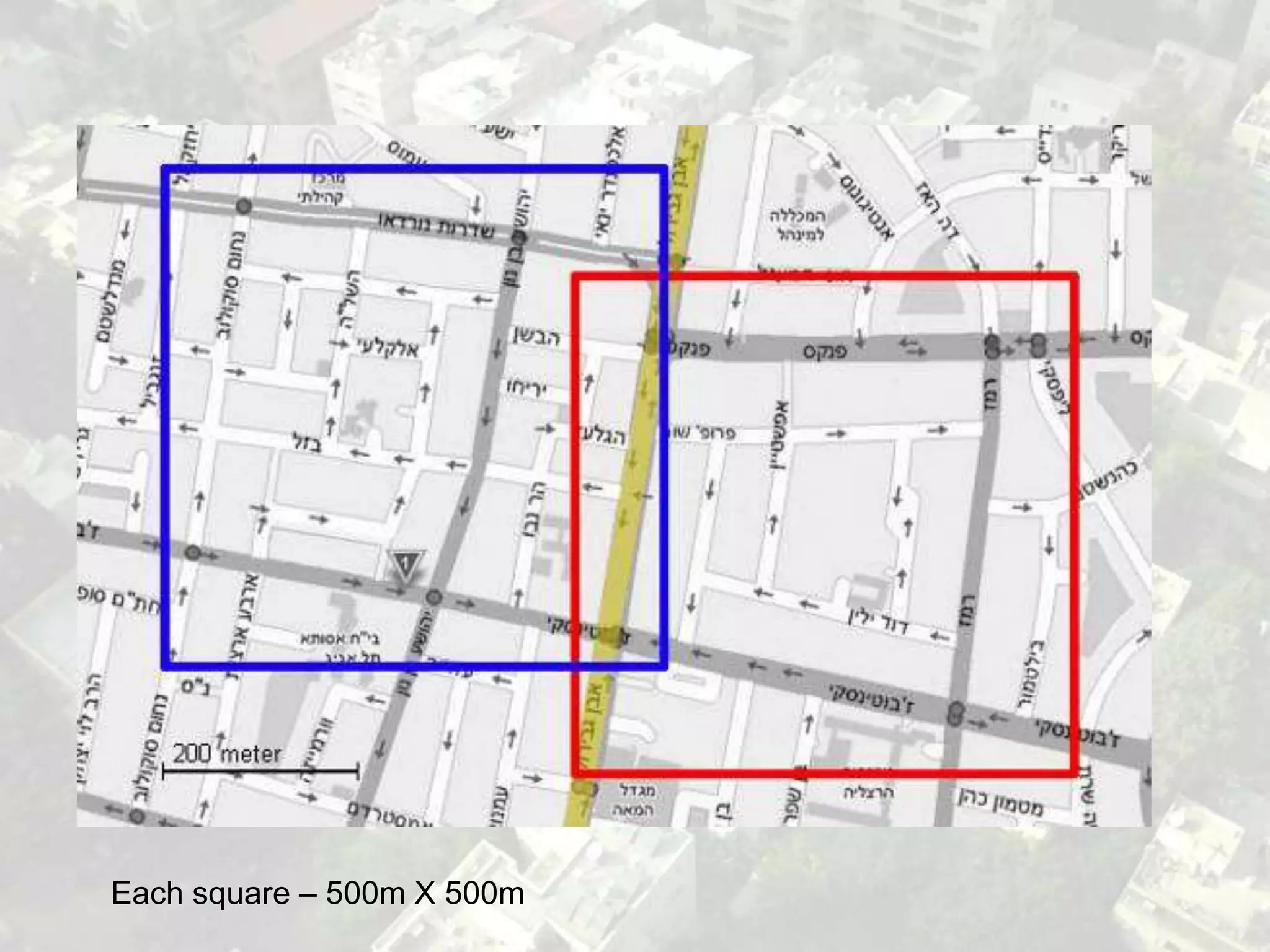
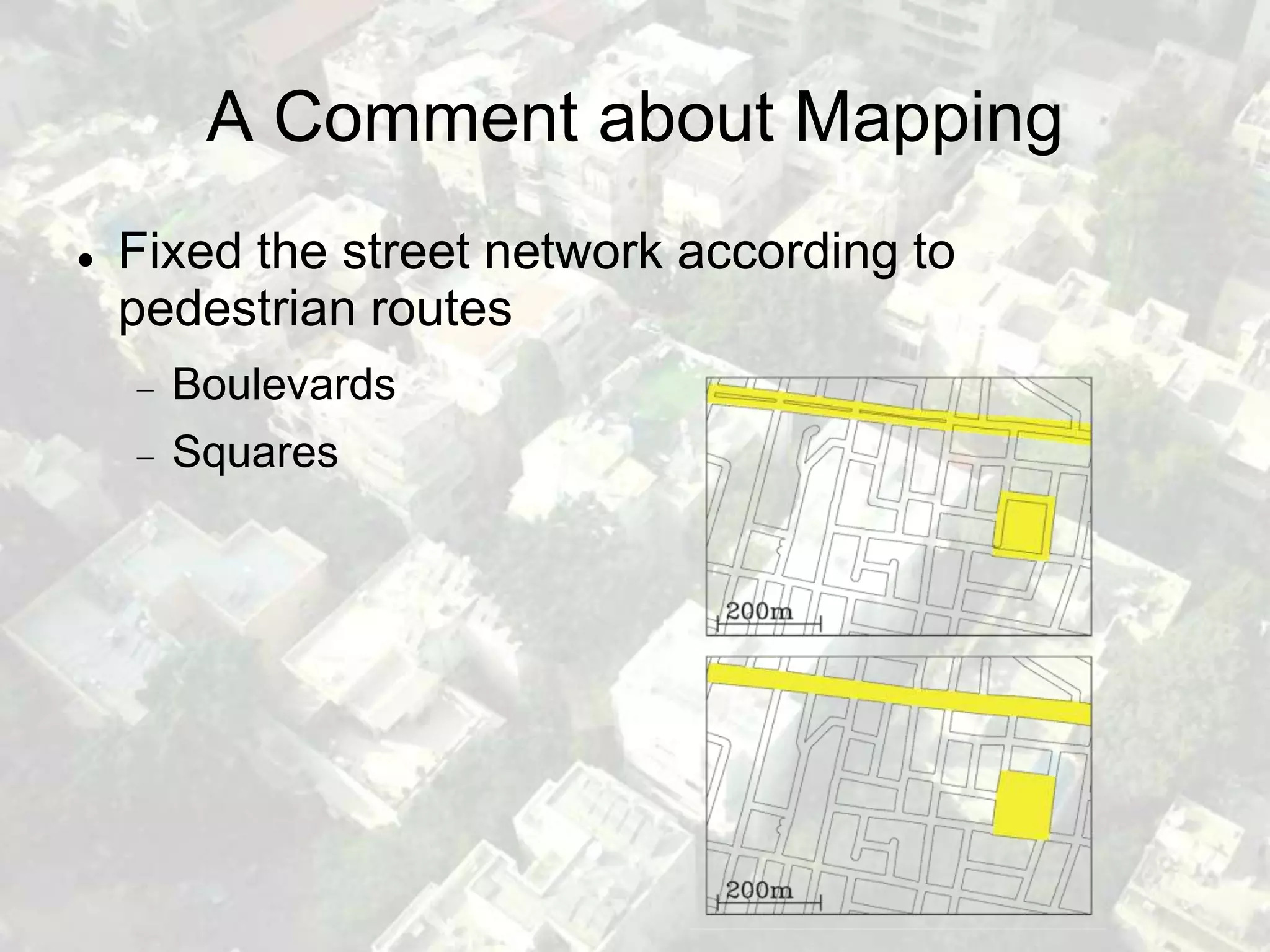
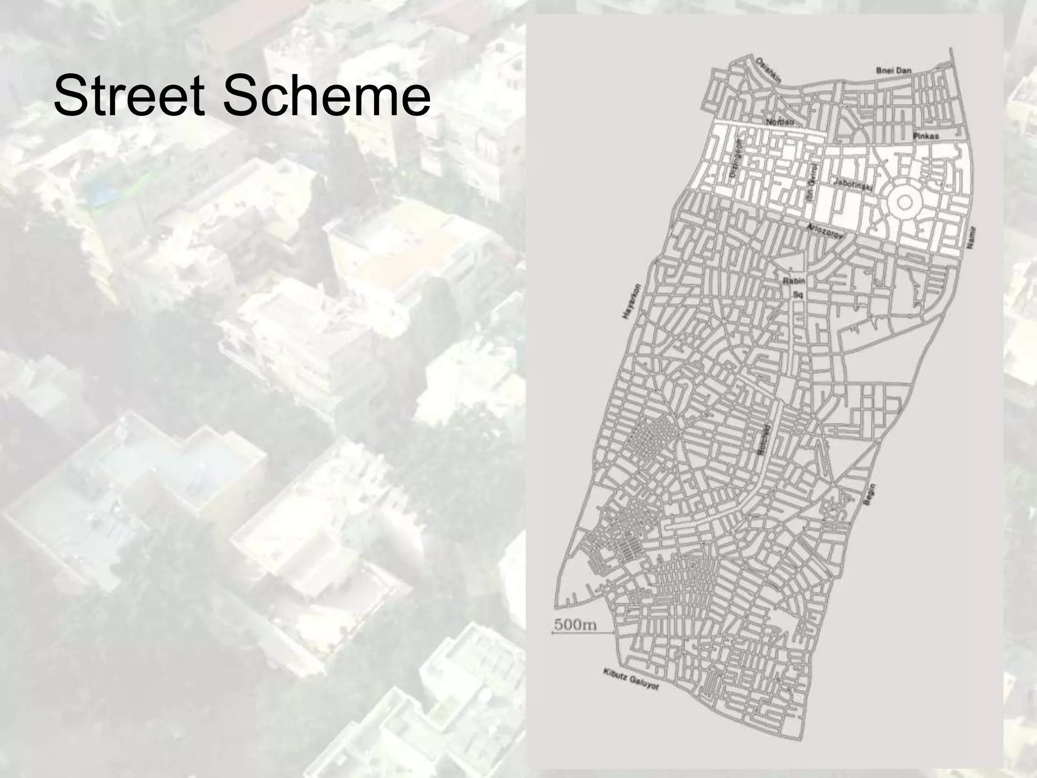
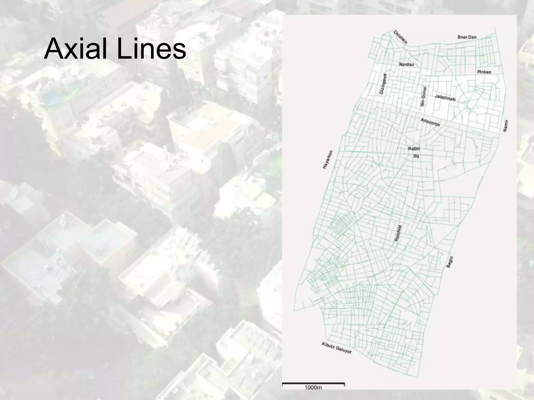
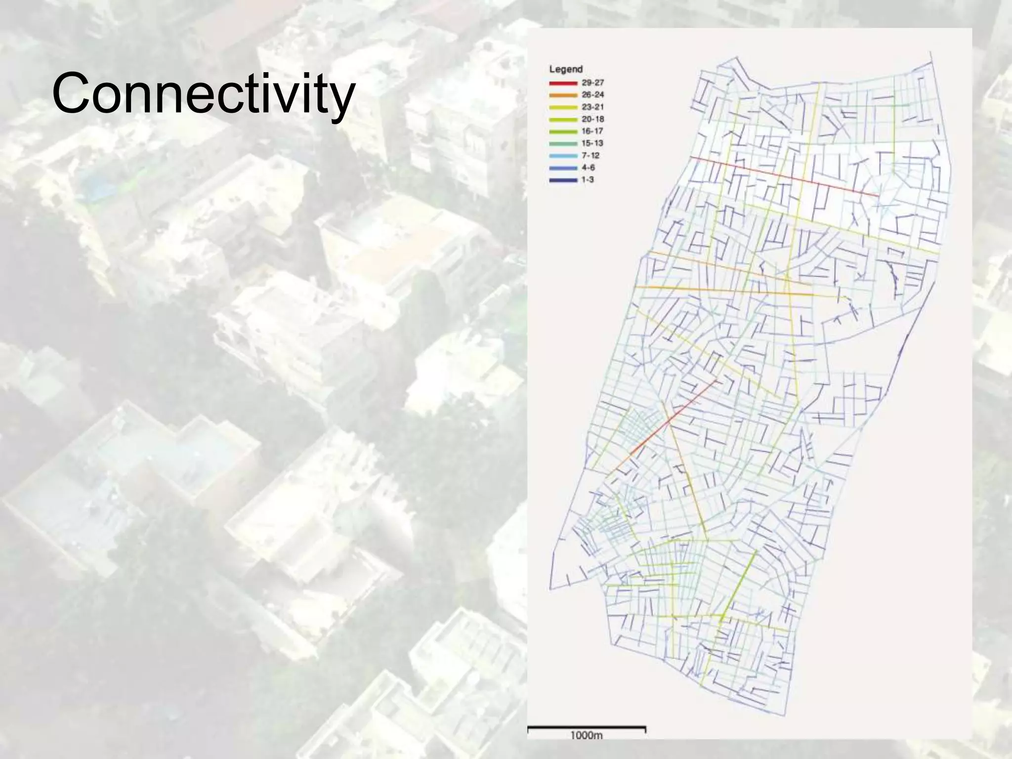
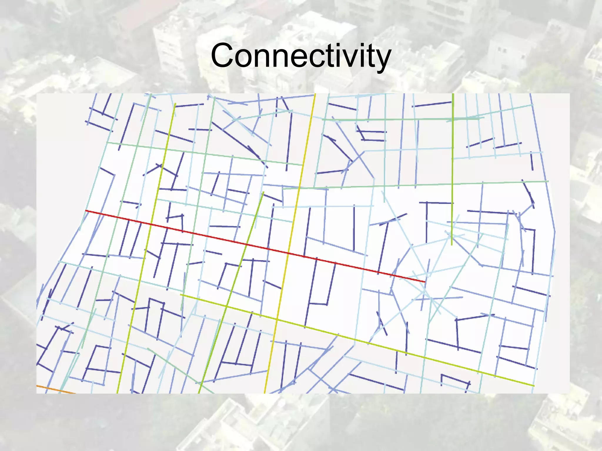
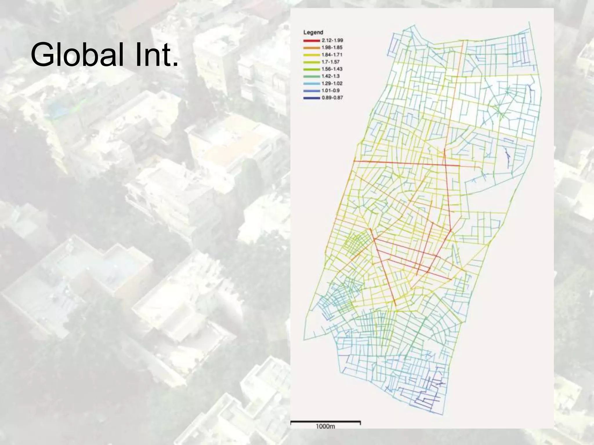
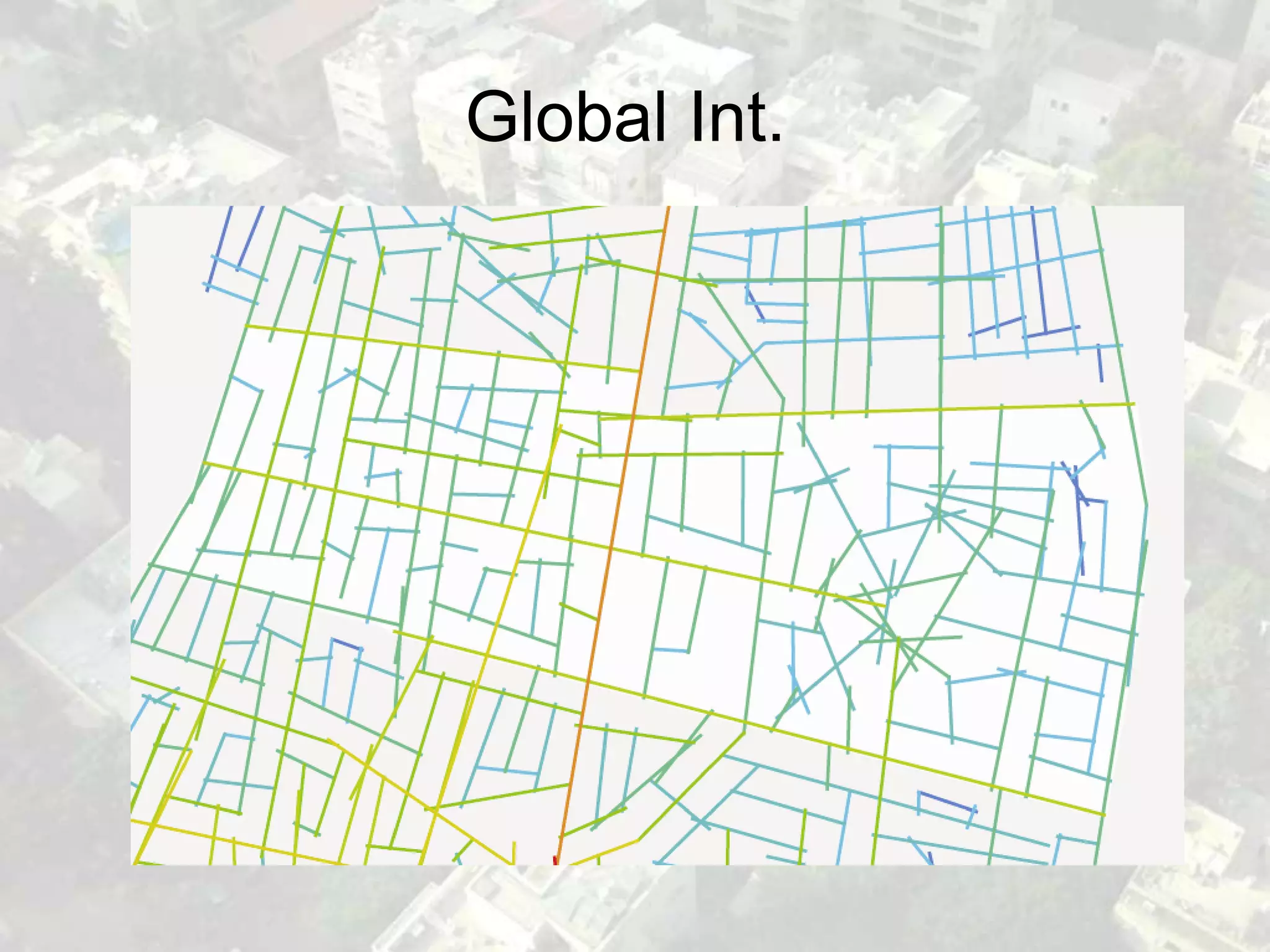
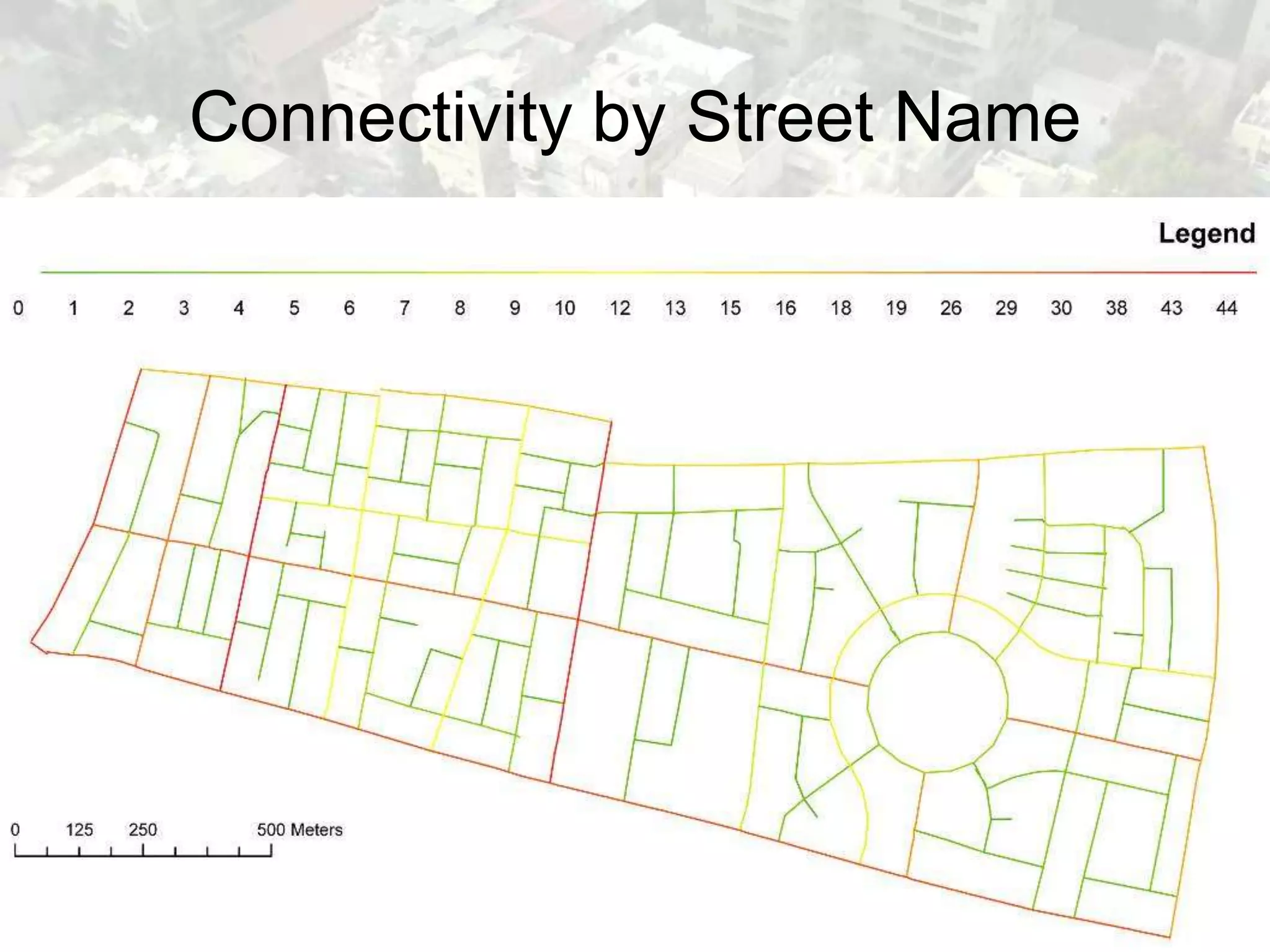
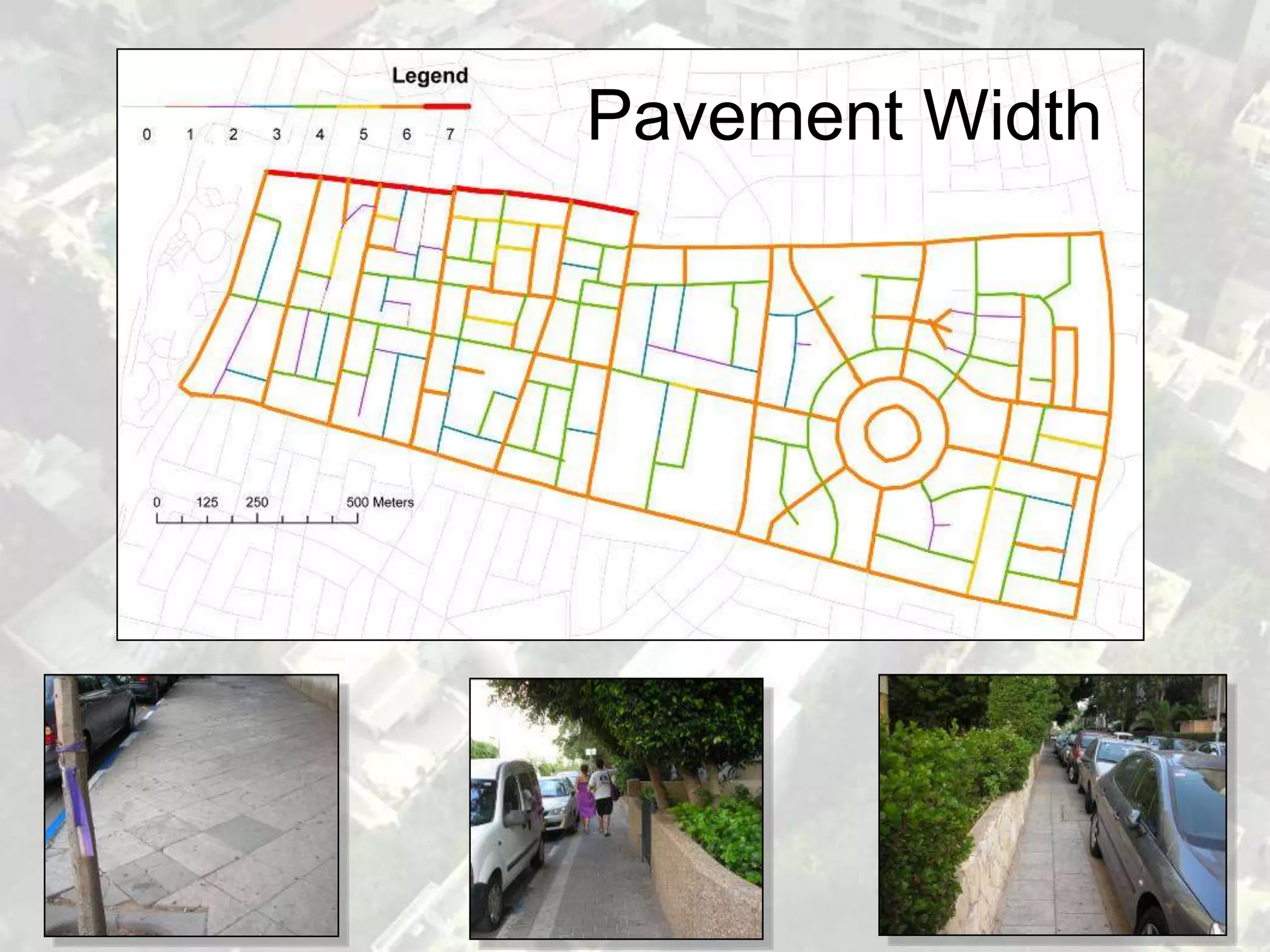
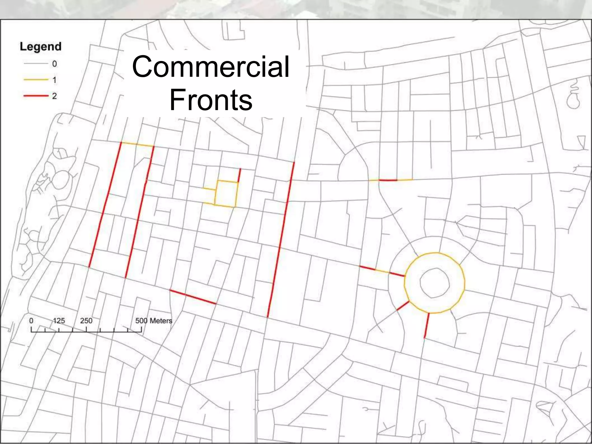
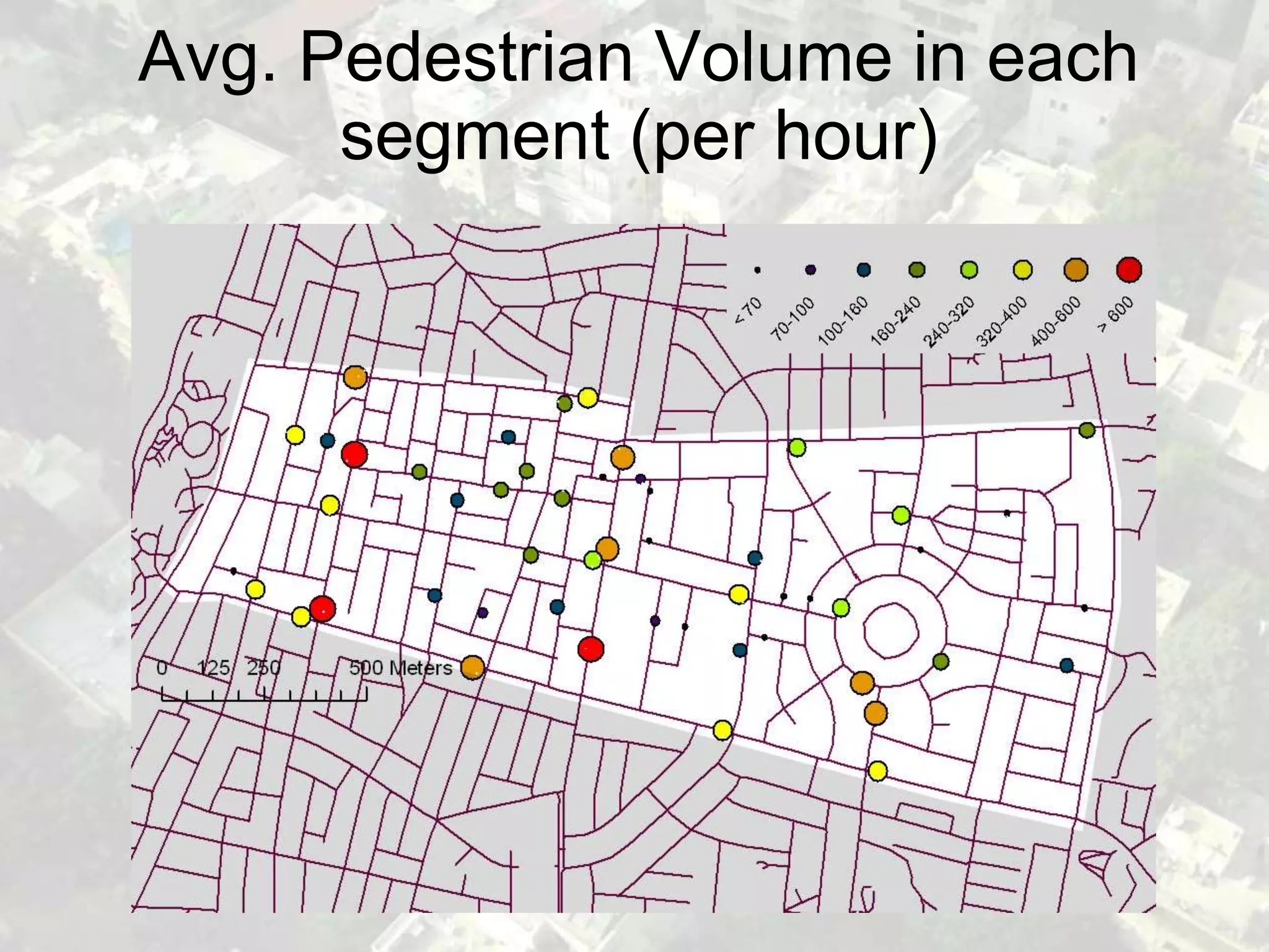
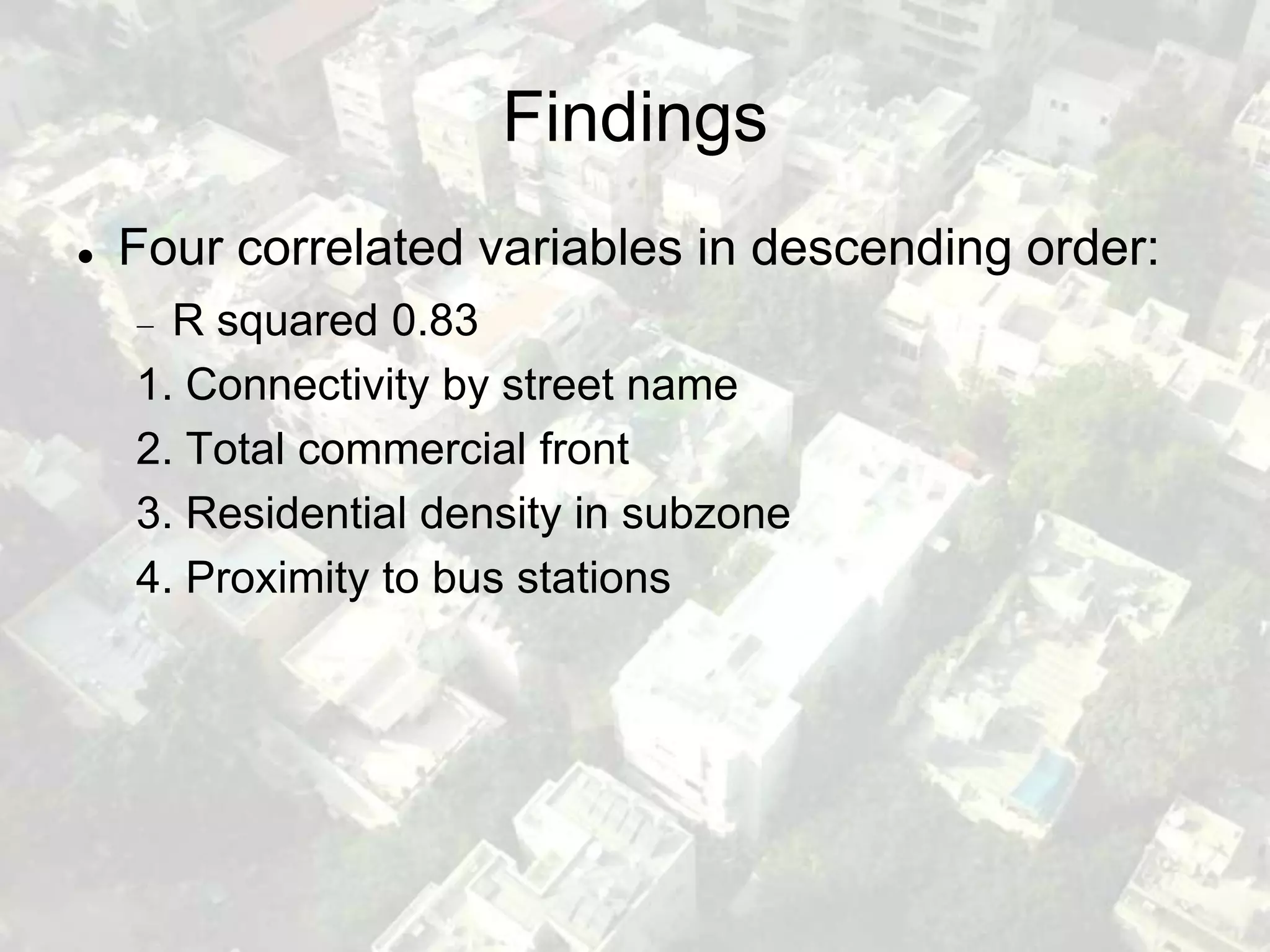
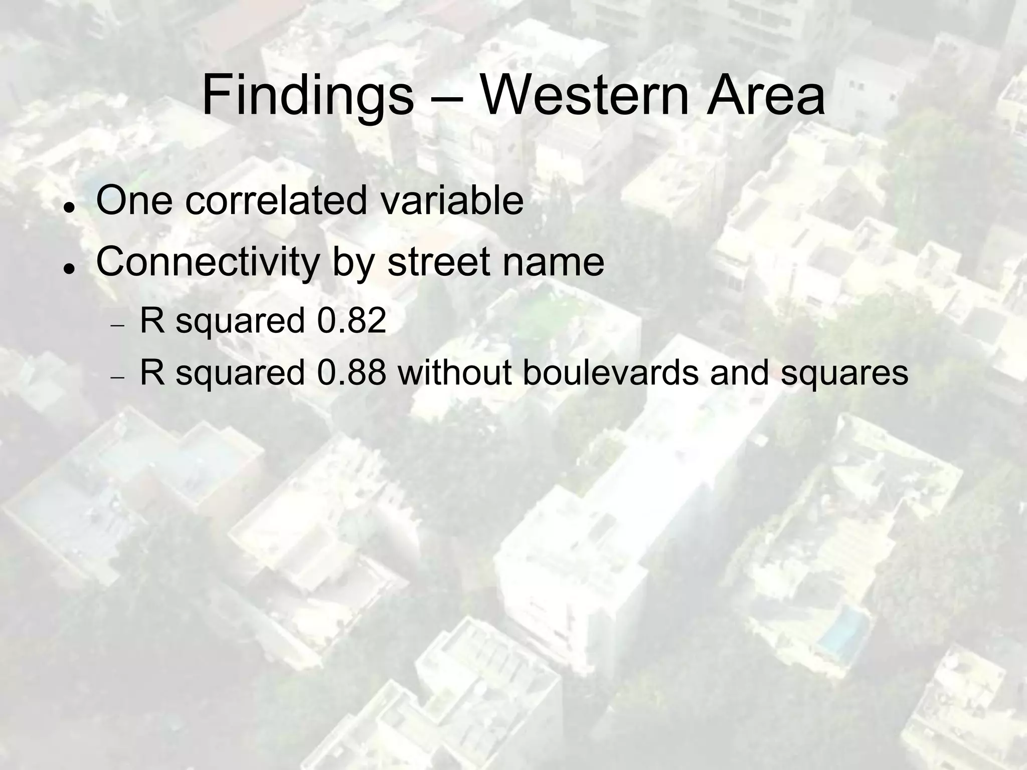
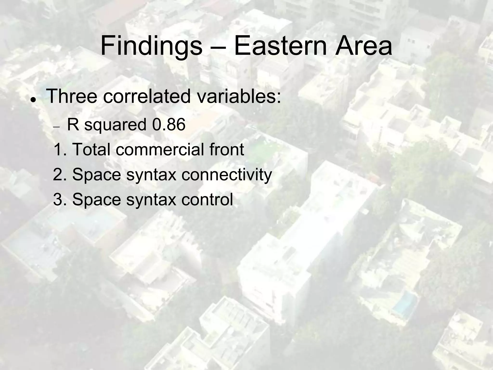
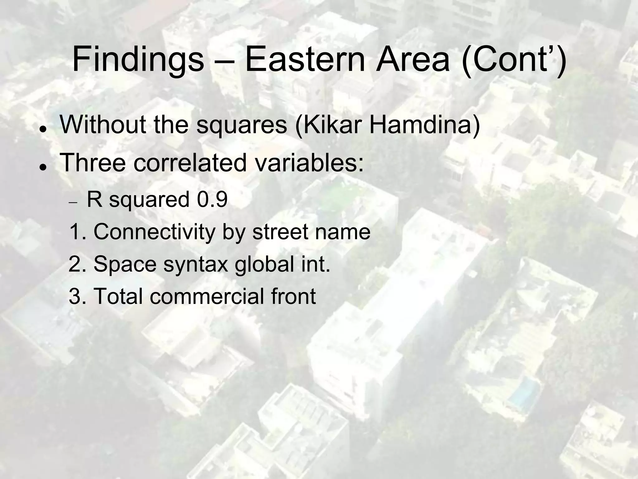
Morphological and Functional
Attributes of the Urban Environment
    and Pedestrian Movement
      Presented by: Yoav Lerman
          Tel-Aviv University
The joy of being a pedestrian
The sorrow of being a pedestrian
Tel-Aviv Basics
Founded: 1909
Population: 400,000
Land size: 52 sq. km
Metro Population: 3 million
Agenda
Research question
Research area location
Methodology
 Spatial-physical dimension
 Functional dimension
Findings
Research Question
Which attributes of the built environment correlate
with the volume of pedestrian movement in two
adjacent areas in the center of Tel-Aviv?
Research Area
Research Area
East of Ibn-Gvirol street vs. west of Ibn-Gvirol street


                           Research area boundary
                           Sub areas boundary
Methodology
   Dependent variable: pedestrian counts
   Independent variables: built environment
    attributes
   Positivist methodology based on non-intrusive
    observations
   Looking for statistical correlations between the
    independent variables and the dependent
    variable
Each square – 500m X 500m
Two dimensions of the built
               environment
   Spatial-physical dimension
      The basis of the urban form
      Extremely durable and rarely modified
   Functional dimension
      The content that fills the form
      Relatively fast changes
Spatial-Physical Variables
   Space syntax measures
   Connectivity by street name
   Pavement width
   Road crossing difficulty
   Intersection density
Functional Variables
   Commercial fronts
   Residential density
   Proximity to bus stations
Space Syntax Measures
Use of DepthMap software based upon axial lines
analysis:
  Connectivity
  Control
  Integration
   - Global Integration – Mean distance from the entire street network

   - Local Integration – Mean distance from nearby streets
A Comment about Mapping
   Fixed the street network according to
    pedestrian routes
      Boulevards
      Squares
Street Scheme
Axial Lines
Connectivity
Connectivity
Global Int.
Global Int.
Connectivity by Street Name
Pavement Width
Commercial
  Fronts
Pedestrian Count Points
   95 count points
   51 street segments
      24 western segments
      24 eastern segments
      3 border segments
   Count method:
      5 minutes at each point
      5 counts at each point
      (once per hour for 5
      hours)
Pedestrian Count Points Location
Avg. Pedestrian Volume in each
      segment (per hour)
Findings
   Four correlated variables in descending order:
      R squared 0.83
    1. Connectivity by street name
    2. Total commercial front
    3. Residential density in subzone
    4. Proximity to bus stations
Findings – Western Area
   One correlated variable
   Connectivity by street name
      R squared 0.82
      R squared 0.88 without boulevards and squares
Findings – Eastern Area
   Three correlated variables:
      R squared 0.86
    1. Total commercial front
    2. Space syntax connectivity
    3. Space syntax control
Findings – Eastern Area (Cont’)
   Without the squares (Kikar Hamdina)
   Three correlated variables:
      R squared 0.9
    1. Connectivity by street name
    2. Space syntax global int.
    3. Total commercial front
Summary
   In most cases the spatial-physical structure has
    greater correlation than the functional structure
    with pedestrian movement
   There are major differences between the
    western and eastern areas correlations
   Connectivity by street name correlated better
    than space syntax variables
   The large square in the eastern side changes
    the correlation model significantly
Pedestrian Movement Analysis

Pedestrian Movement Analysis

  • 1.
    Morphological and Functional Attributesof the Urban Environment and Pedestrian Movement Presented by: Yoav Lerman Tel-Aviv University
  • 2.
    The joy ofbeing a pedestrian
  • 3.
    The sorrow ofbeing a pedestrian
  • 4.
    Tel-Aviv Basics Founded: 1909 Population:400,000 Land size: 52 sq. km Metro Population: 3 million
  • 10.
    Agenda Research question Research arealocation Methodology Spatial-physical dimension Functional dimension Findings
  • 11.
    Research Question Which attributesof the built environment correlate with the volume of pedestrian movement in two adjacent areas in the center of Tel-Aviv?
  • 12.
  • 13.
    Research Area East ofIbn-Gvirol street vs. west of Ibn-Gvirol street Research area boundary Sub areas boundary
  • 14.
    Methodology  Dependent variable: pedestrian counts  Independent variables: built environment attributes  Positivist methodology based on non-intrusive observations  Looking for statistical correlations between the independent variables and the dependent variable
  • 15.
    Each square –500m X 500m
  • 16.
    Two dimensions ofthe built environment  Spatial-physical dimension The basis of the urban form Extremely durable and rarely modified  Functional dimension The content that fills the form Relatively fast changes
  • 17.
    Spatial-Physical Variables  Space syntax measures  Connectivity by street name  Pavement width  Road crossing difficulty  Intersection density
  • 18.
    Functional Variables  Commercial fronts  Residential density  Proximity to bus stations
  • 19.
    Space Syntax Measures Useof DepthMap software based upon axial lines analysis: Connectivity Control Integration - Global Integration – Mean distance from the entire street network - Local Integration – Mean distance from nearby streets
  • 20.
    A Comment aboutMapping  Fixed the street network according to pedestrian routes Boulevards Squares
  • 21.
  • 22.
  • 23.
  • 24.
  • 25.
  • 26.
  • 27.
  • 28.
  • 29.
  • 30.
    Pedestrian Count Points  95 count points  51 street segments 24 western segments 24 eastern segments 3 border segments  Count method: 5 minutes at each point 5 counts at each point (once per hour for 5 hours)
  • 31.
  • 32.
    Avg. Pedestrian Volumein each segment (per hour)
  • 33.
    Findings  Four correlated variables in descending order: R squared 0.83 1. Connectivity by street name 2. Total commercial front 3. Residential density in subzone 4. Proximity to bus stations
  • 34.
    Findings – WesternArea  One correlated variable  Connectivity by street name R squared 0.82 R squared 0.88 without boulevards and squares
  • 35.
    Findings – EasternArea  Three correlated variables: R squared 0.86 1. Total commercial front 2. Space syntax connectivity 3. Space syntax control
  • 36.
    Findings – EasternArea (Cont’)  Without the squares (Kikar Hamdina)  Three correlated variables: R squared 0.9 1. Connectivity by street name 2. Space syntax global int. 3. Total commercial front
  • 37.
    Summary  In most cases the spatial-physical structure has greater correlation than the functional structure with pedestrian movement  There are major differences between the western and eastern areas correlations  Connectivity by street name correlated better than space syntax variables  The large square in the eastern side changes the correlation model significantly