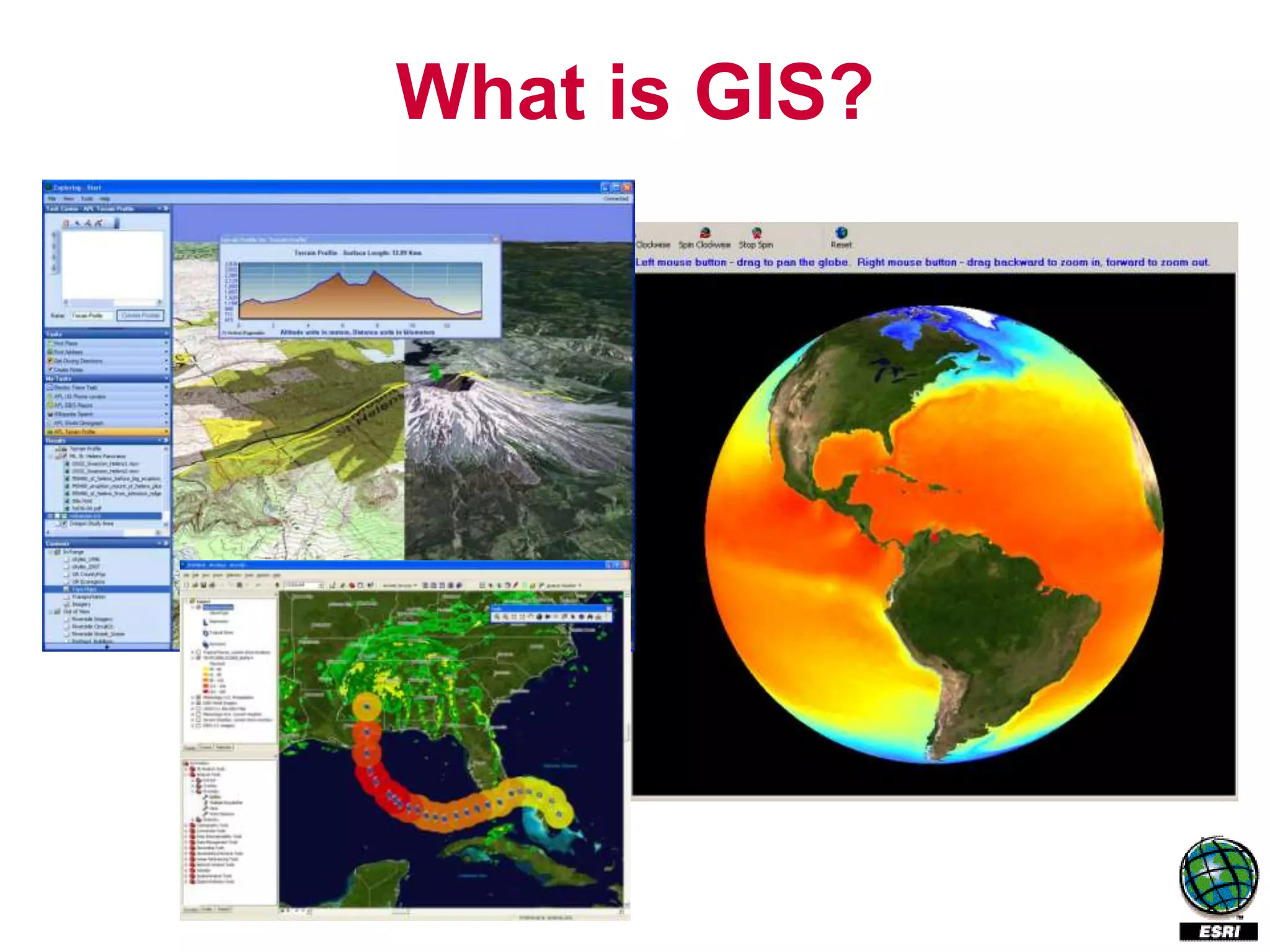
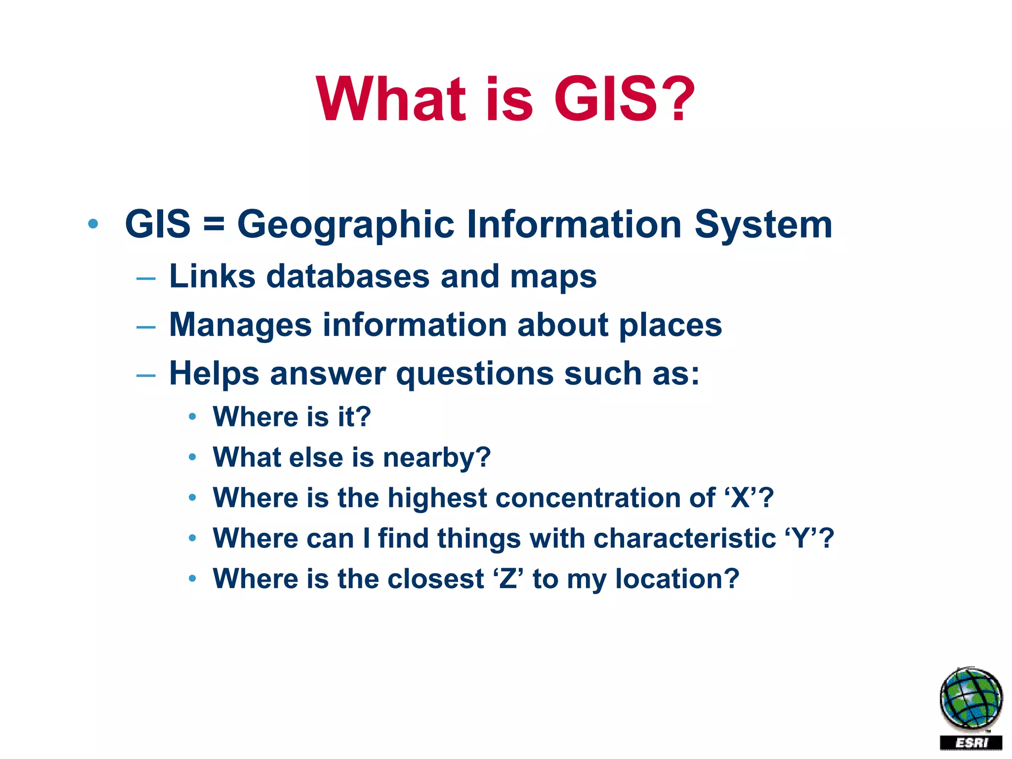
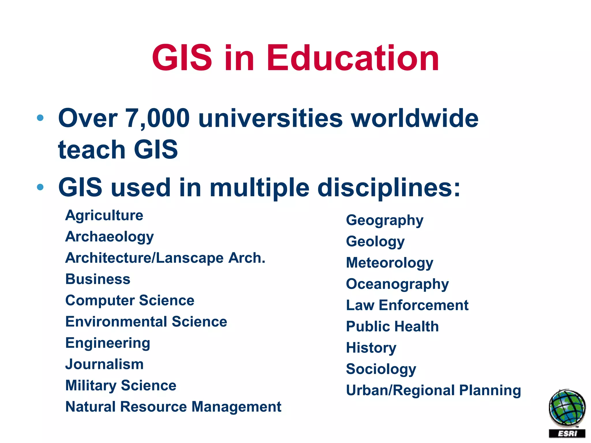
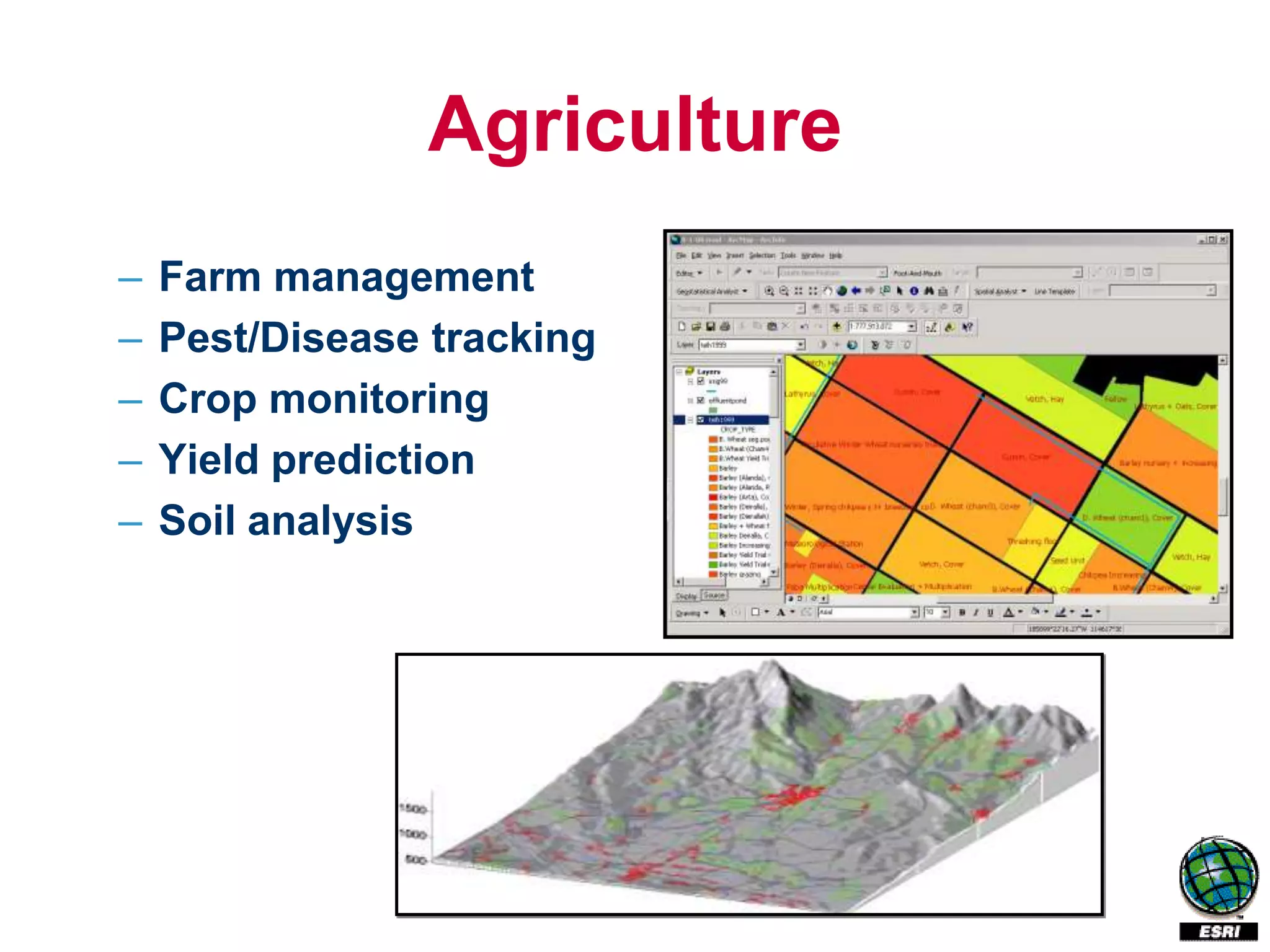
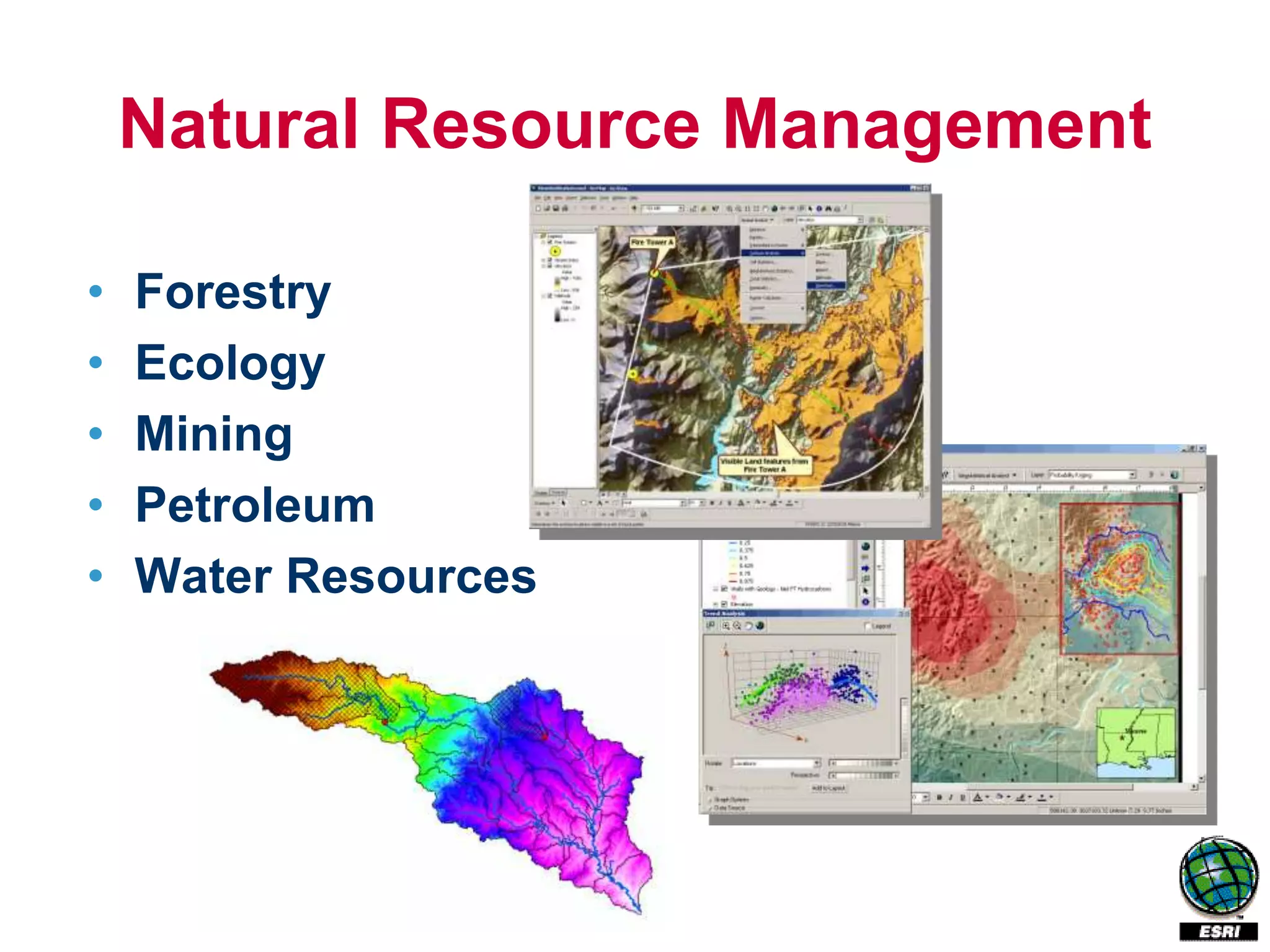
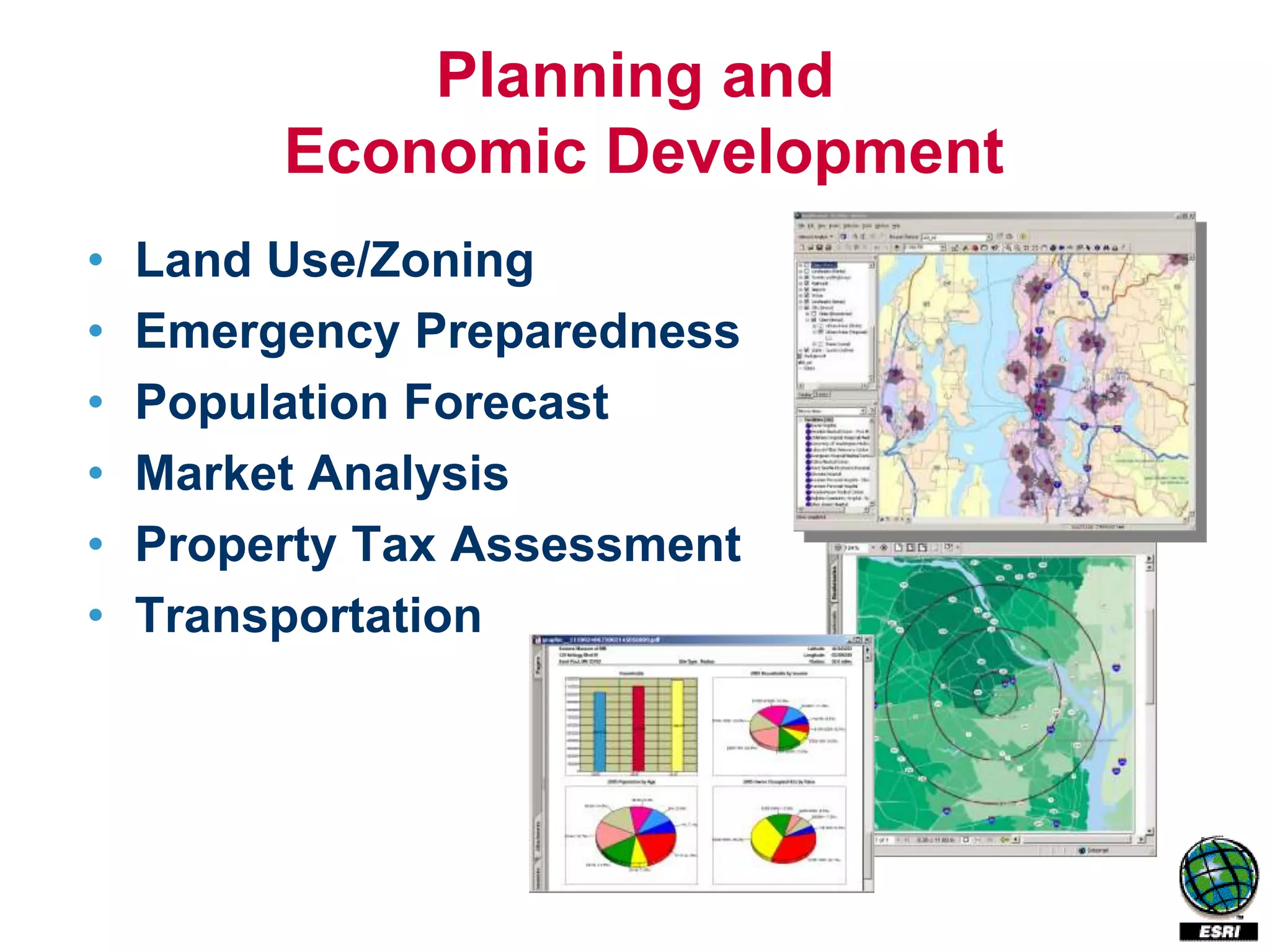
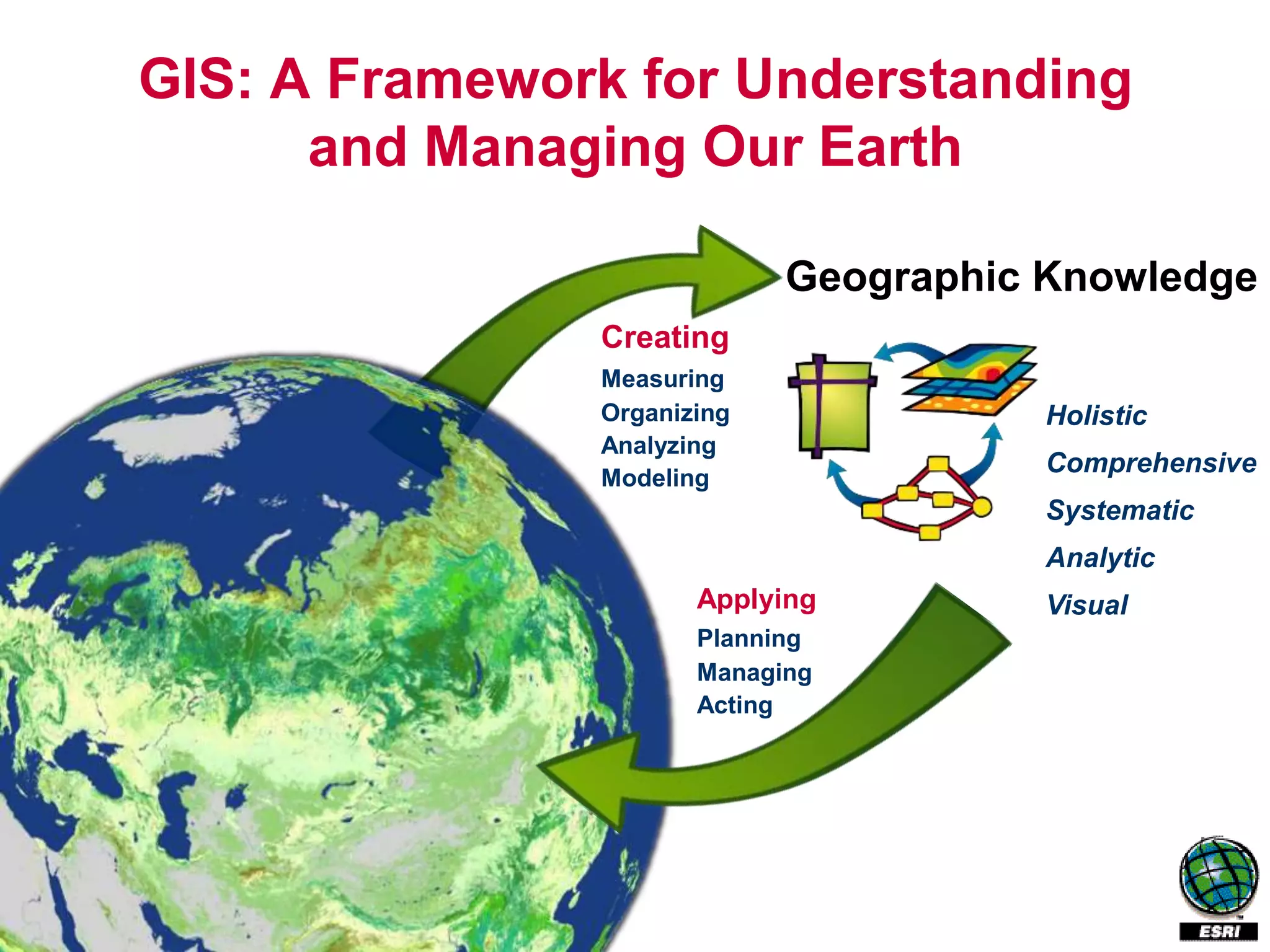
What is GIS?
What is GIS?
• GIS = Geographic Information System
  – Links databases and maps
  – Manages information about places
  – Helps answer questions such as:
     •   Where is it?
     •   What else is nearby?
     •   Where is the highest concentration of ‘X’?
     •   Where can I find things with characteristic ‘Y’?
     •   Where is the closest ‘Z’ to my location?
GIS in Education
• Over 7,000 universities worldwide
  teach GIS
• GIS used in multiple disciplines:
  Agriculture                   Geography
  Archaeology                   Geology
  Architecture/Lanscape Arch.   Meteorology
  Business                      Oceanography
  Computer Science              Law Enforcement
  Environmental Science         Public Health
  Engineering                   History
  Journalism                    Sociology
  Military Science              Urban/Regional Planning
  Natural Resource Management
Agriculture
–   Farm management
–   Pest/Disease tracking
–   Crop monitoring
–   Yield prediction
–   Soil analysis
Natural Resource Management

•   Forestry
•   Ecology
•   Mining
•   Petroleum
•   Water Resources
Planning and
         Economic Development
•   Land Use/Zoning
•   Emergency Preparedness
•   Population Forecast
•   Market Analysis
•   Property Tax Assessment
•   Transportation
GIS: A Framework for Understanding
      and Managing Our Earth

                            Geographic Knowledge
               Creating
               Measuring
               Organizing              Holistic
               Analyzing
               Modeling
                                       Comprehensive
                                       Systematic
                                       Analytic
                      Applying         Visual
                      Planning
                      Managing
                      Acting
GIS enhances
      education because it is:
•   Multi-disciplinary
•   A real-world technology using real data
•   Involves authentic tasks / assessments
•   Promotes holistic / systematic approach
•   Engages multiple ways of learning
•   Encourages community connections
•   Used at scales from local to global
Geography matters
Today’s challenges require geographic approach
• Climate Change
• Urban Growth
• Sustainable Agriculture
• Water Quality and Availability
• International and National Security
• Energy
• Epidemiology/Disease Tracking
• Natural Hazards: Seismicity, Weather Events
GIS skills needed in workforce
• 2004: US Secretary of Labor identifies geospatial
  technology as one of the 3 most important
  evolving fields.

• GIS part of US Department of Labor High Growth
  Job Training Initiative

• Emily DeRocco, US Dept of Labor Employment
  and Training Administration: 2005 budget
  includes $1.6 billion for secondary, technical, and
  adult education programs.
GIS and Distance Education
• Current workforce needs GIS training,
  distance education meets their needs
• Examples of online GIS programs:
  –   University of California Riverside
  –   Emporia State University
  –   University of Montana
  –   University of Denver
  –   Louisiana Tech University
  –   Pennsylvania State University
  –   Northwest Missouri State University
GIS as Infrastructure
• Because GIS is used in many
  departments, coordination is needed
  – Software licensing
  – Instruction
  – Data
GIS as infrastructure
• Data is greatest expense
  – Previously: Data scattered in multiple
    departments, not coordinated
  – Future: Data accessible anywhere, GIS
    portal and Web services facilitate
    sharing

• Libraries / Data Centers key
  – GIS data has unique characteristics
GIS as infrastructure
                                     Mobile GIS
                                       PC, PDA
                                       Phone


  Desktop GIS
    ArcInfo
    ArcEditor
    ArcView              Network
    ArcReader                                     Virtual Globes
                                                    ArcGIS Explorer
                                                    Google Earth
                        Server GIS                  Virtual Earth
                        ArcGIS Server
                        Portal Toolkit


Geodatabases                                       XML
                Files          DBMS
ESRI Education Program
• Resources
  – Software Site License Program
    www.esri.com/sitelicense
  – ESRI Virtual Campus online training
    traning.esri.com


• www.esri.com/highered
Questions?
highered@esri.com

Ann Johnson, Higher Education Industry Manager
ajohnson@esri.com


Angela Lee, Libraries & Museums Industry Manager
alee@esri.com


Ann Masangcay, Education Industry Coordinator
amasangcay@esri.com

Gis

  • 3.
  • 4.
    What is GIS? •GIS = Geographic Information System – Links databases and maps – Manages information about places – Helps answer questions such as: • Where is it? • What else is nearby? • Where is the highest concentration of ‘X’? • Where can I find things with characteristic ‘Y’? • Where is the closest ‘Z’ to my location?
  • 5.
    GIS in Education •Over 7,000 universities worldwide teach GIS • GIS used in multiple disciplines: Agriculture Geography Archaeology Geology Architecture/Lanscape Arch. Meteorology Business Oceanography Computer Science Law Enforcement Environmental Science Public Health Engineering History Journalism Sociology Military Science Urban/Regional Planning Natural Resource Management
  • 6.
    Agriculture – Farm management – Pest/Disease tracking – Crop monitoring – Yield prediction – Soil analysis
  • 7.
    Natural Resource Management • Forestry • Ecology • Mining • Petroleum • Water Resources
  • 8.
    Planning and Economic Development • Land Use/Zoning • Emergency Preparedness • Population Forecast • Market Analysis • Property Tax Assessment • Transportation
  • 9.
    GIS: A Frameworkfor Understanding and Managing Our Earth Geographic Knowledge Creating Measuring Organizing Holistic Analyzing Modeling Comprehensive Systematic Analytic Applying Visual Planning Managing Acting
  • 10.
    GIS enhances education because it is: • Multi-disciplinary • A real-world technology using real data • Involves authentic tasks / assessments • Promotes holistic / systematic approach • Engages multiple ways of learning • Encourages community connections • Used at scales from local to global
  • 11.
    Geography matters Today’s challengesrequire geographic approach • Climate Change • Urban Growth • Sustainable Agriculture • Water Quality and Availability • International and National Security • Energy • Epidemiology/Disease Tracking • Natural Hazards: Seismicity, Weather Events
  • 12.
    GIS skills neededin workforce • 2004: US Secretary of Labor identifies geospatial technology as one of the 3 most important evolving fields. • GIS part of US Department of Labor High Growth Job Training Initiative • Emily DeRocco, US Dept of Labor Employment and Training Administration: 2005 budget includes $1.6 billion for secondary, technical, and adult education programs.
  • 13.
    GIS and DistanceEducation • Current workforce needs GIS training, distance education meets their needs • Examples of online GIS programs: – University of California Riverside – Emporia State University – University of Montana – University of Denver – Louisiana Tech University – Pennsylvania State University – Northwest Missouri State University
  • 14.
    GIS as Infrastructure •Because GIS is used in many departments, coordination is needed – Software licensing – Instruction – Data
  • 15.
    GIS as infrastructure •Data is greatest expense – Previously: Data scattered in multiple departments, not coordinated – Future: Data accessible anywhere, GIS portal and Web services facilitate sharing • Libraries / Data Centers key – GIS data has unique characteristics
  • 16.
    GIS as infrastructure Mobile GIS PC, PDA Phone Desktop GIS ArcInfo ArcEditor ArcView Network ArcReader Virtual Globes ArcGIS Explorer Google Earth Server GIS Virtual Earth ArcGIS Server Portal Toolkit Geodatabases XML Files DBMS
  • 17.
    ESRI Education Program •Resources – Software Site License Program www.esri.com/sitelicense – ESRI Virtual Campus online training traning.esri.com • www.esri.com/highered
  • 18.
    Questions? highered@esri.com Ann Johnson, HigherEducation Industry Manager ajohnson@esri.com Angela Lee, Libraries & Museums Industry Manager alee@esri.com Ann Masangcay, Education Industry Coordinator amasangcay@esri.com