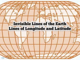
longitude-latitude-and-equator-prime meridian lines of the globe.ppt
framework for describing locations Facts about lines of latitude Facts about lines of latitude Facts about lines of longitude Facts about lines of longitude Lines of latitude (also called parallels) are imaginary lines that circle Earth’s surface, running east and west parallel to the Equator. Lines of longitude (also called meridians) run between the geographic North Pole and the geographic South Pole and are used to measure distances from the prime meridian. Both latitude and longitude are measured in degrees (°), which may be broken down into smaller units called minutes (′) and seconds (″). (Or they may be expressed in decimal degrees; negative values of decimal degrees represent latitudes in the Southern Hemisphere and longitudes in the Western Hemisphere.) The latitudes of the North Pole and South Pole are 90° north (N) and 90° south (S), respectively. Lines of latitude north of the Equator (the line that marks 0° latitude) are numbered from 1° to 89° N, and those south of the Equator are numbered from 1° to 89° S. Lines of longitude east of the prime meridian (the line that marks 0° longitude) are numbered from 1° to 179° east (E). Lines of longitude west of the prime meridian are numbered from 1° to 179° west (W). The 180th meridian, or 180°—which can be drawn north-south from pole to pole across the middle of the Pacific Ocean—is the line of longitude exactly opposite the prime meridian.

Recommended
Recommended
More Related Content
Recently uploaded
Recently uploaded (20)
Featured
Featured (20)
longitude-latitude-and-equator-prime meridian lines of the globe.ppt
- 2. How is it possible to find the exact location of a place on Earth?
- 3. Using Latitude and Longitude to Locate Places • • Photo courtesy of silvia-elisa (@flickr.com) granted under creative commons licence - attribution
- 7. Imagine the Earth cut in half...
- 8. Longitude • • • • 105° 75° 60° 45° 30° 15° 0° 15° 30° 90°
- 9. How do we use this information to locate a place? • • • • • • • • •
- 10. The World 0° 20° 60°E 100°140° 180° 20° 60°W 100° 140° 180° 80° 60° 40N° 20° 0° 20° 40S° 60° 80° 0° 20° 60°E 100°140° 180° 20° 60°W 100° 140° 180° 80° 60° 40N° 20° 0° 20° 40S° 60° 80°
- 11. The World Answers 0° 20° 60°E 100°140° 180° 20° 60°W 100° 140° 180° 80° 60° 40N° 20° 0° 20° 40S° 60° 80° 0° 20° 60°E 100°140° 180° 20° 60°W 100° 140° 180° 80° 60° 40N° 20° 0° 20° 40S° 60° 80° Edinburgh Canberra Yamoussoukro Madrid
- 13. ”