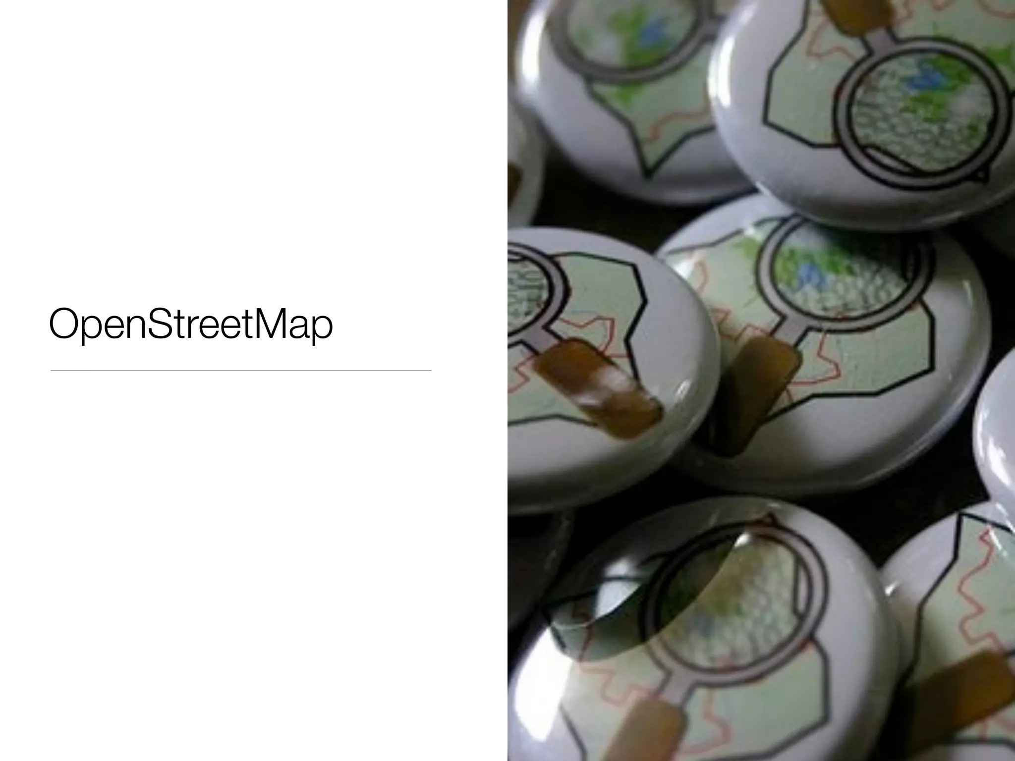
Download as PDF, PPTX


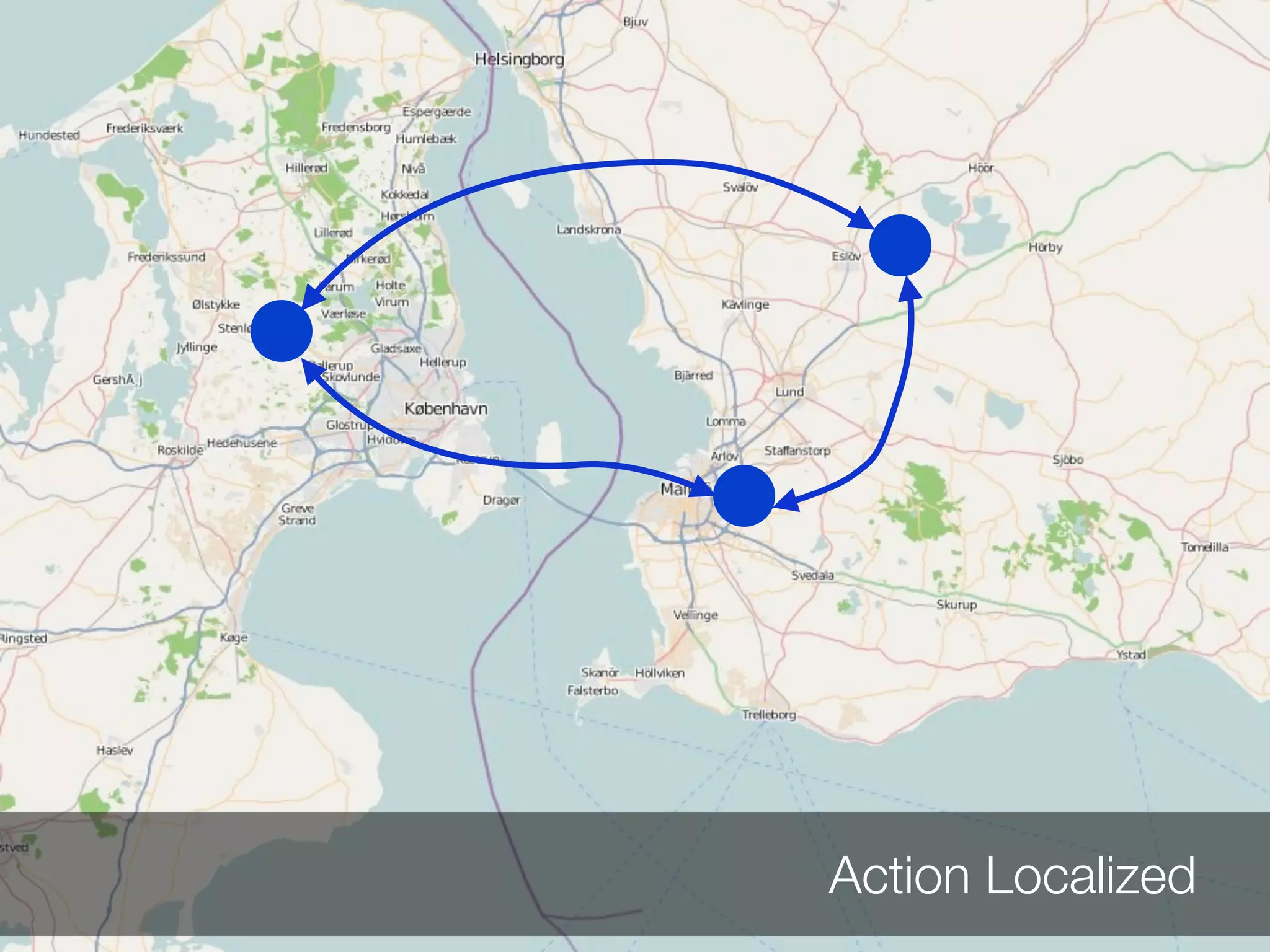

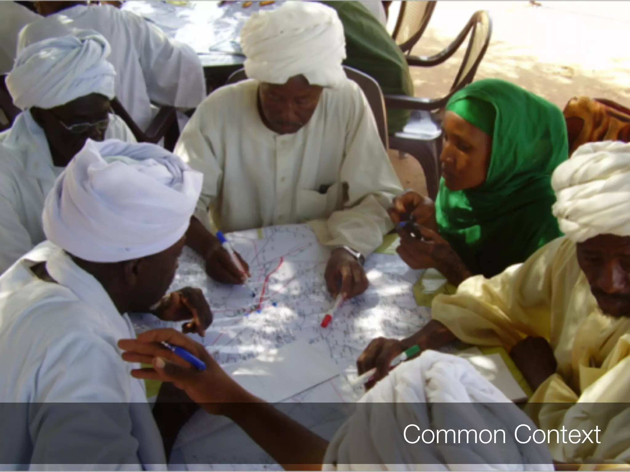
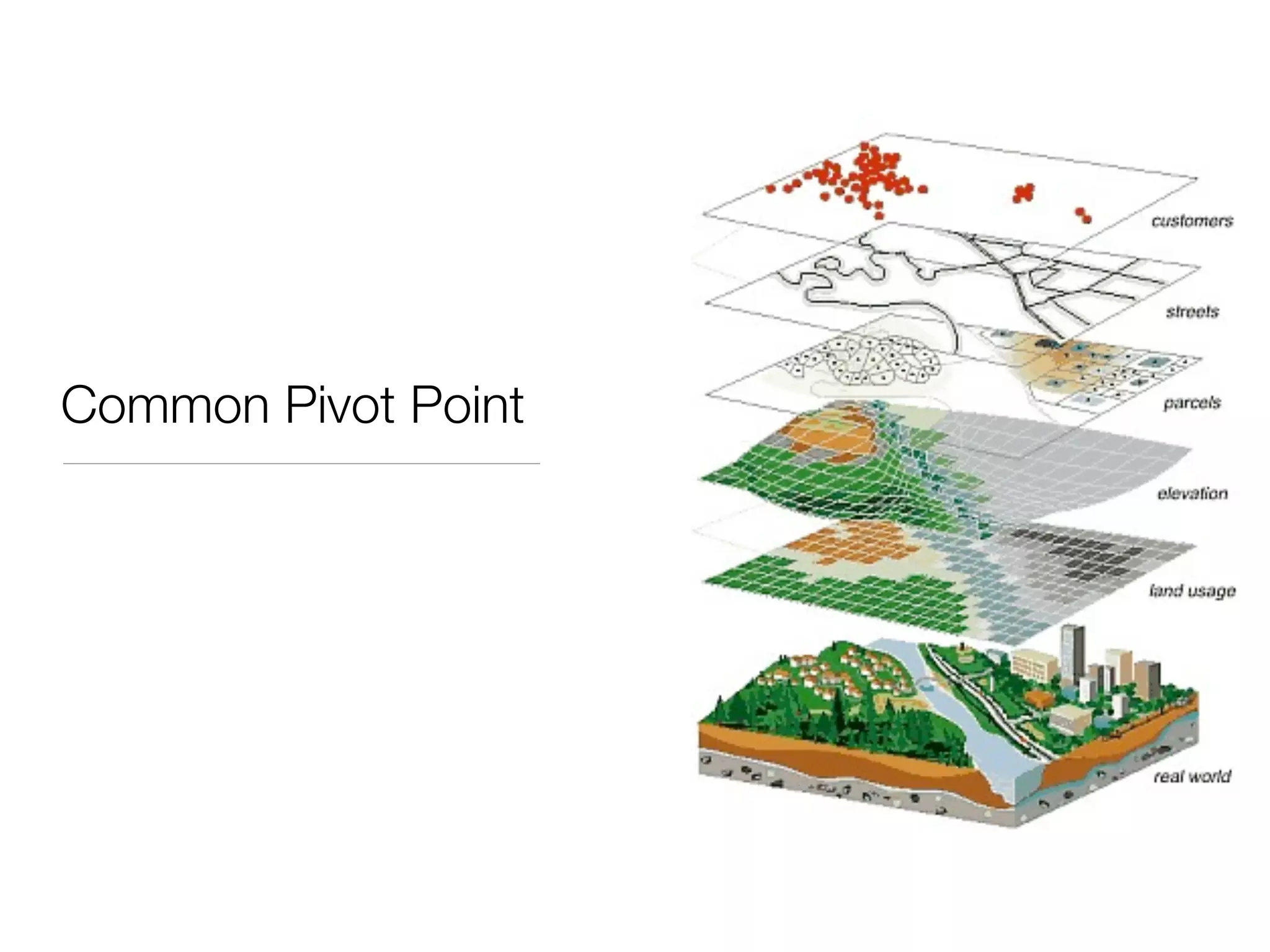
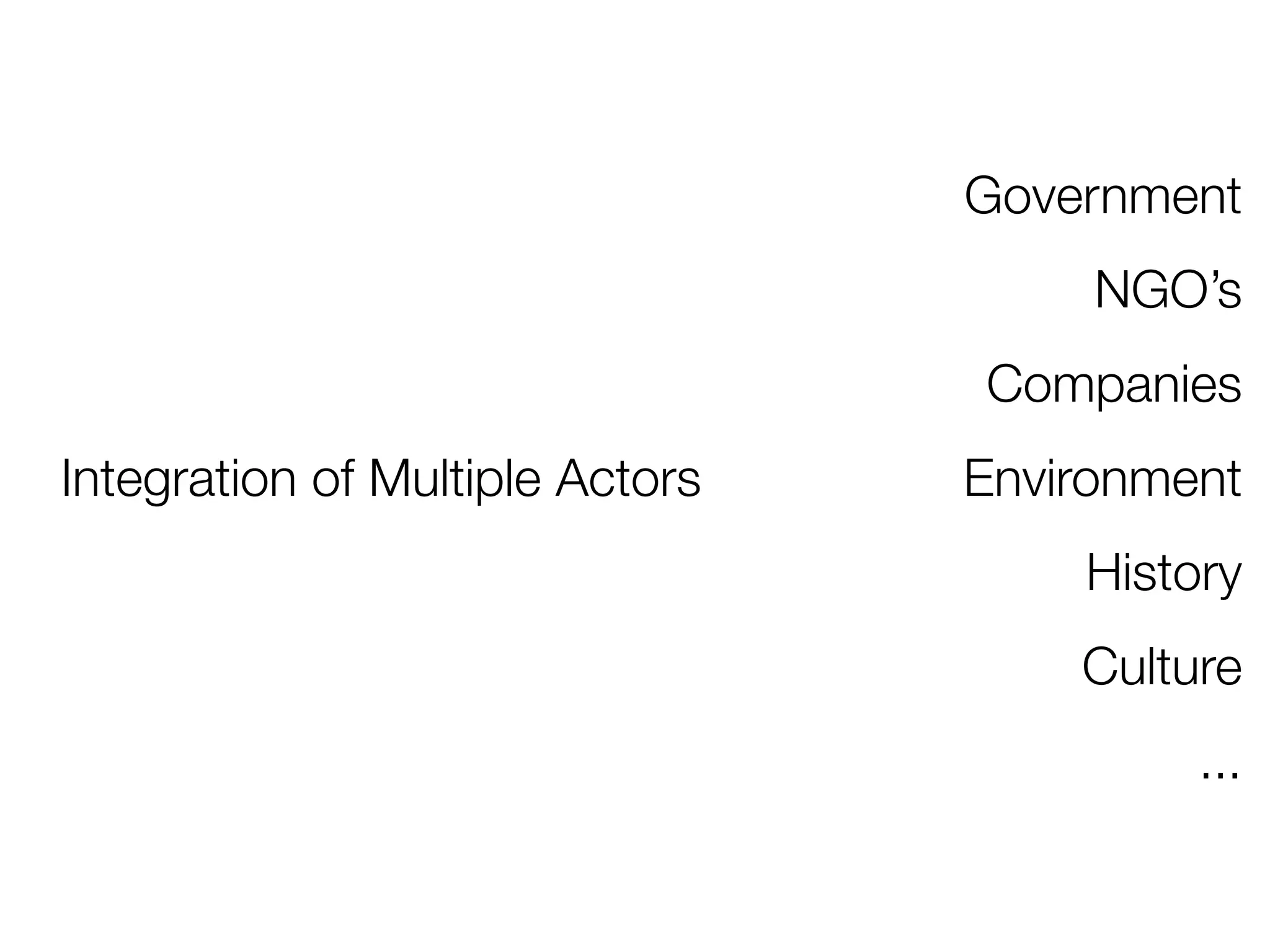

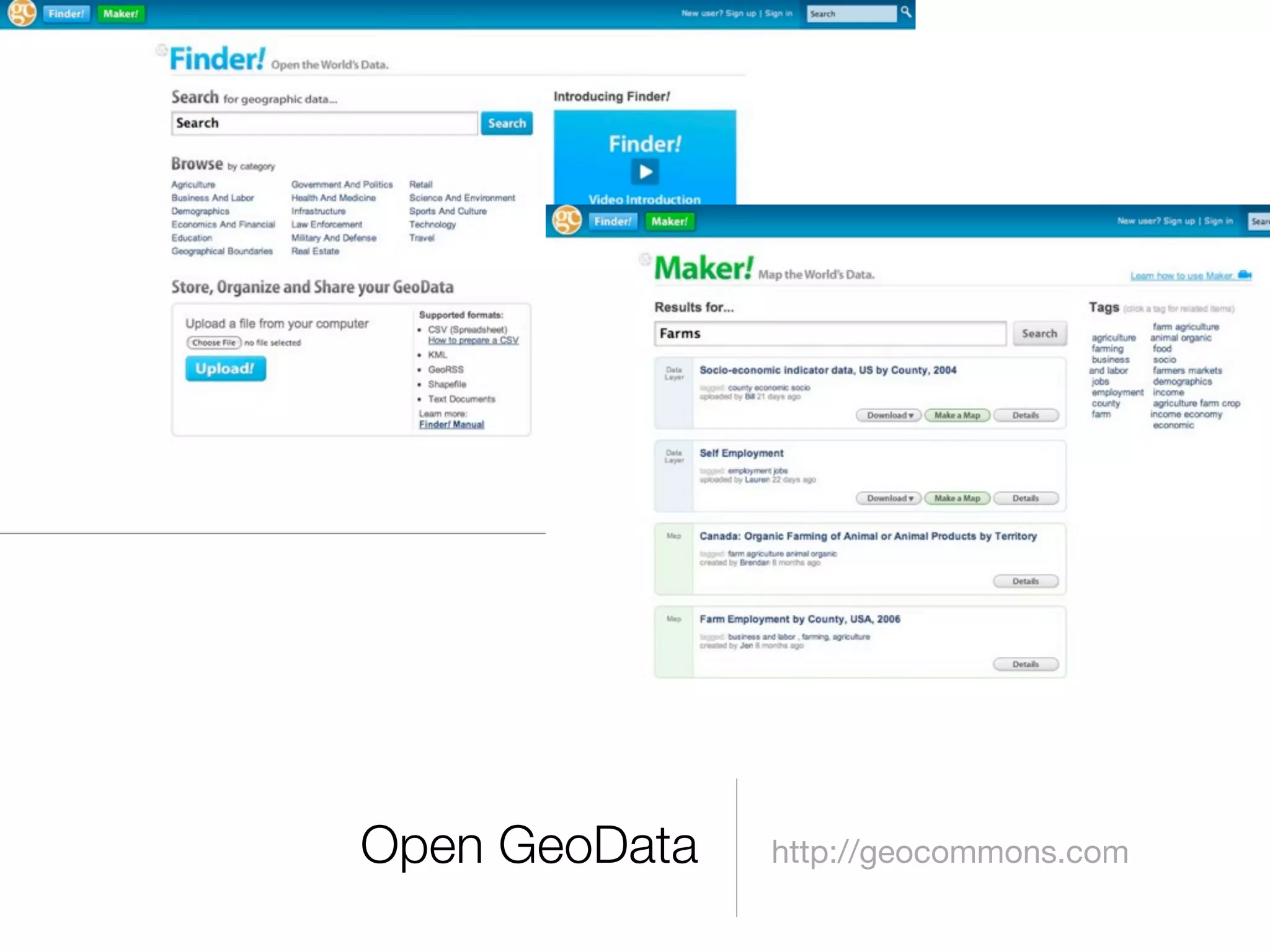
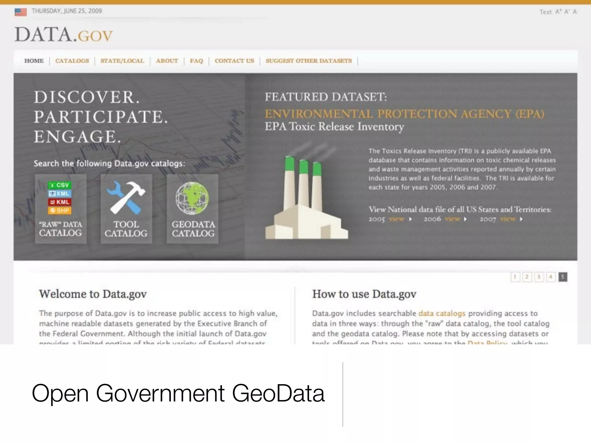


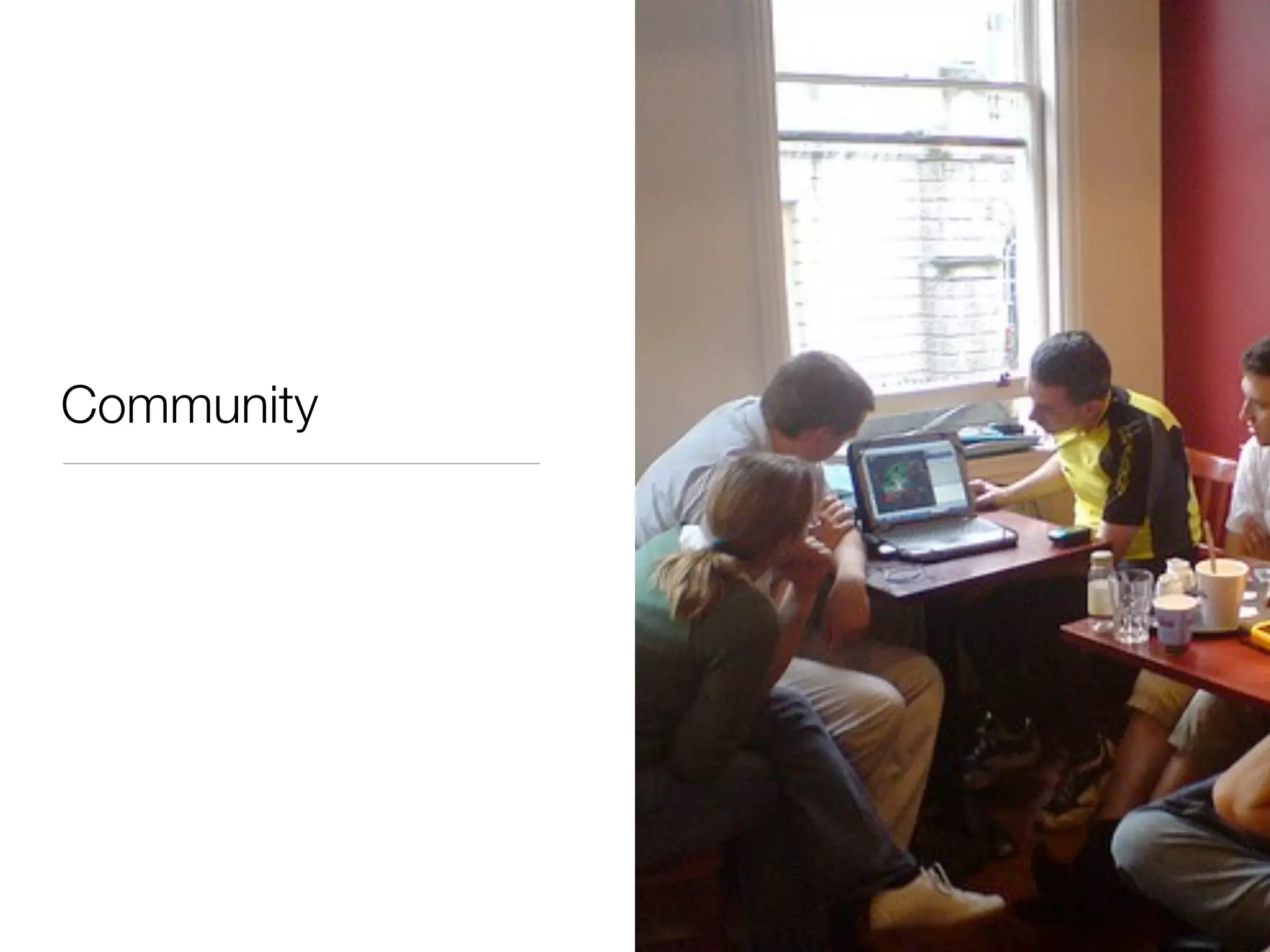

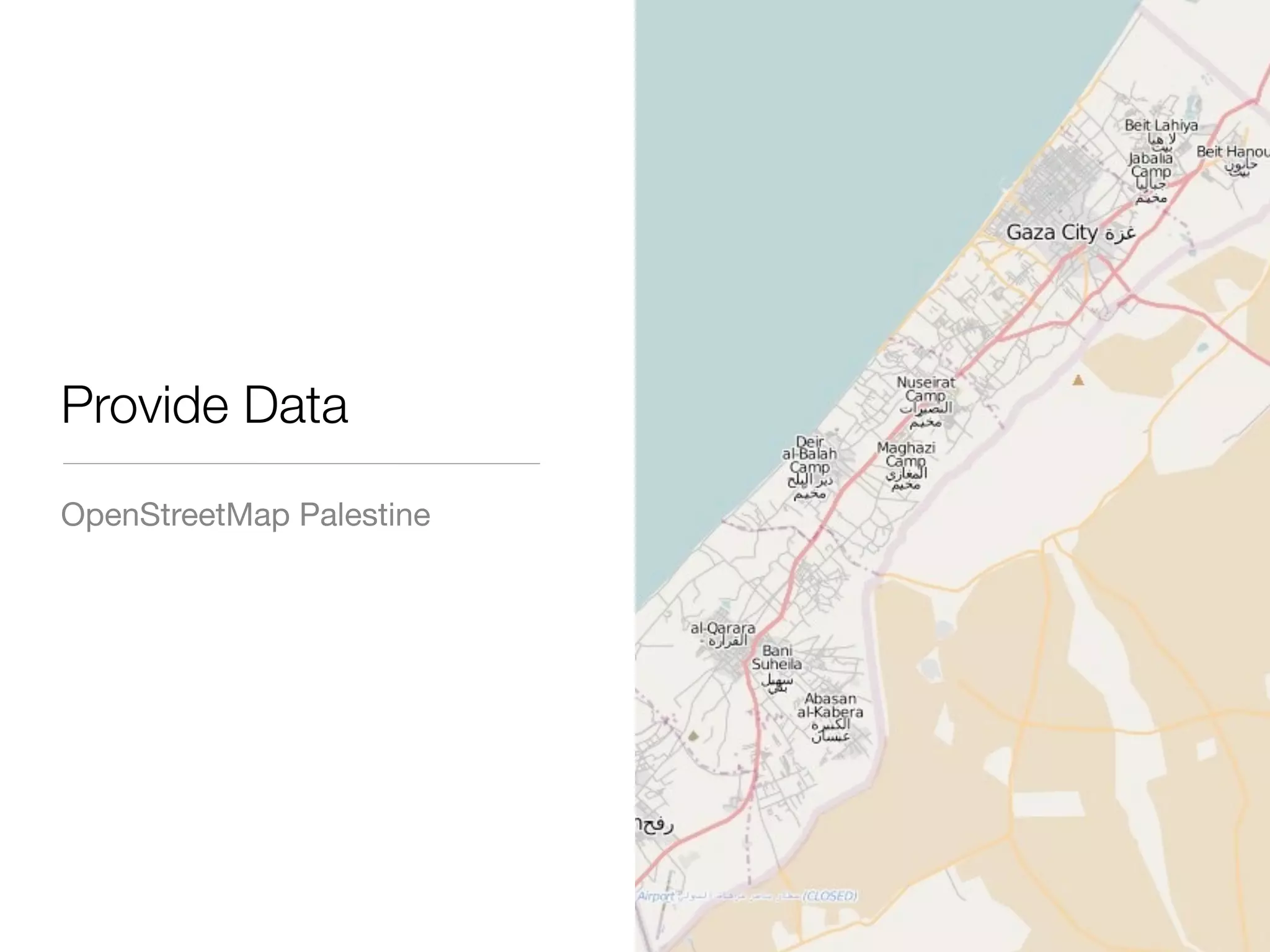
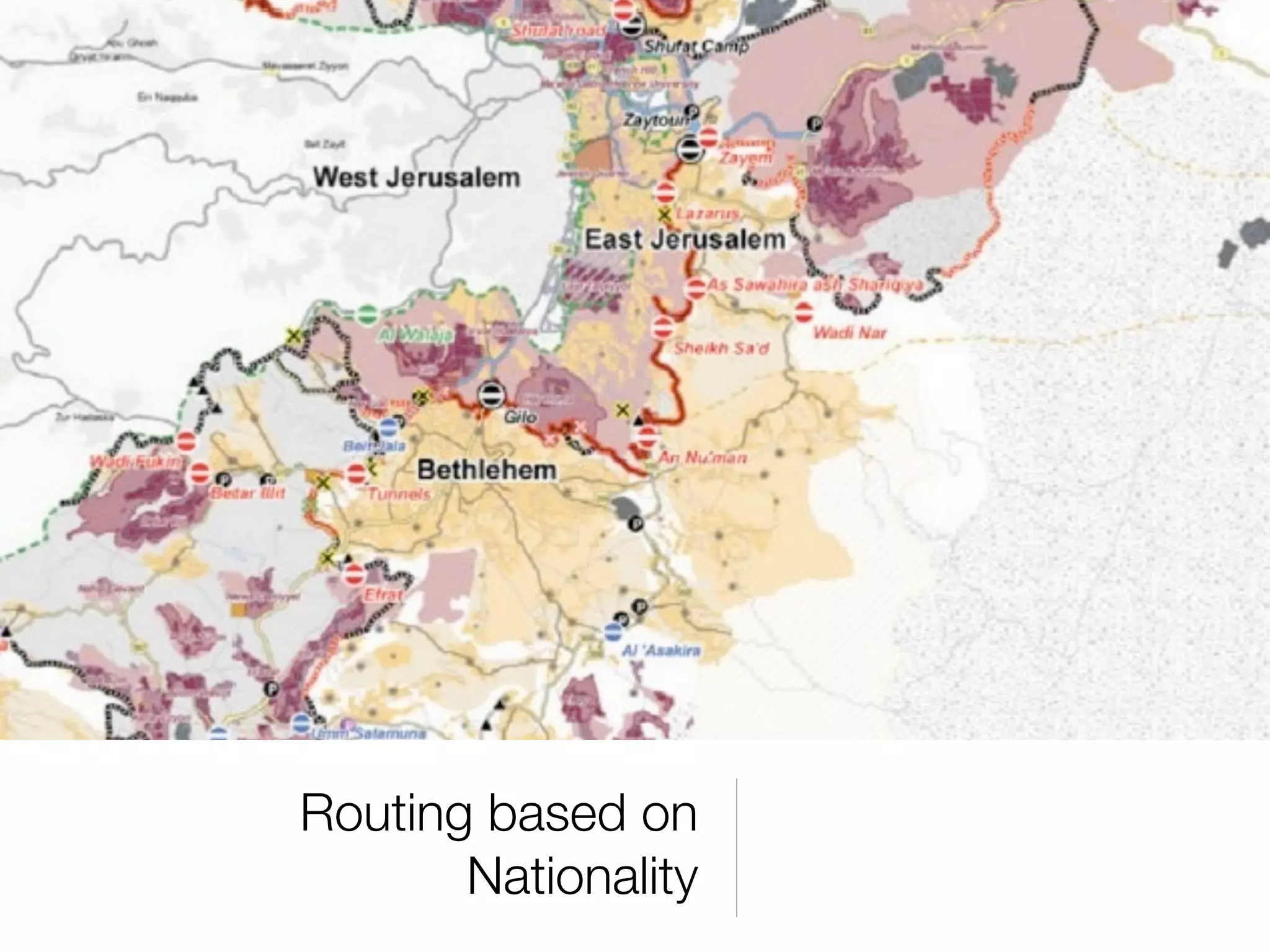

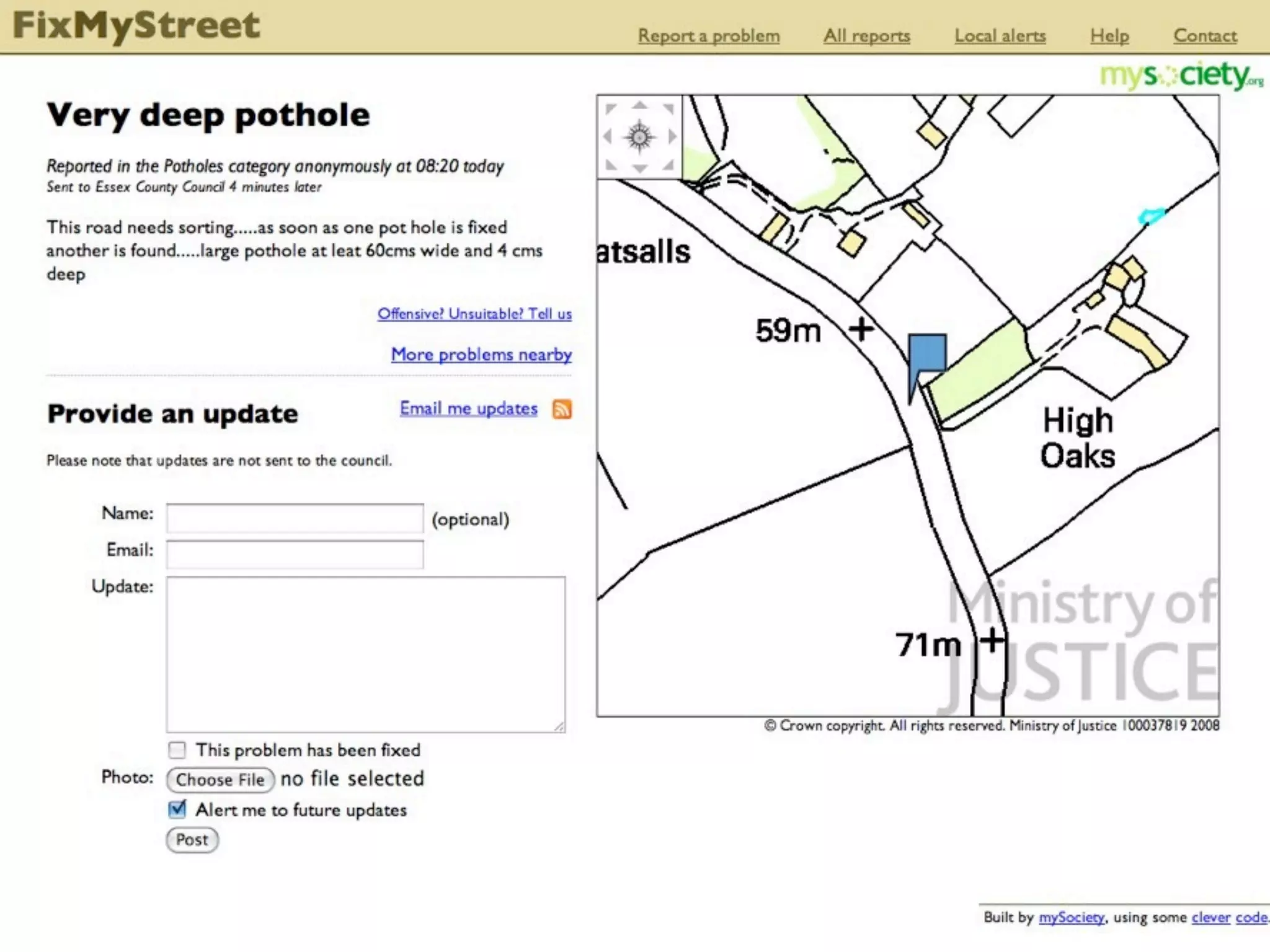
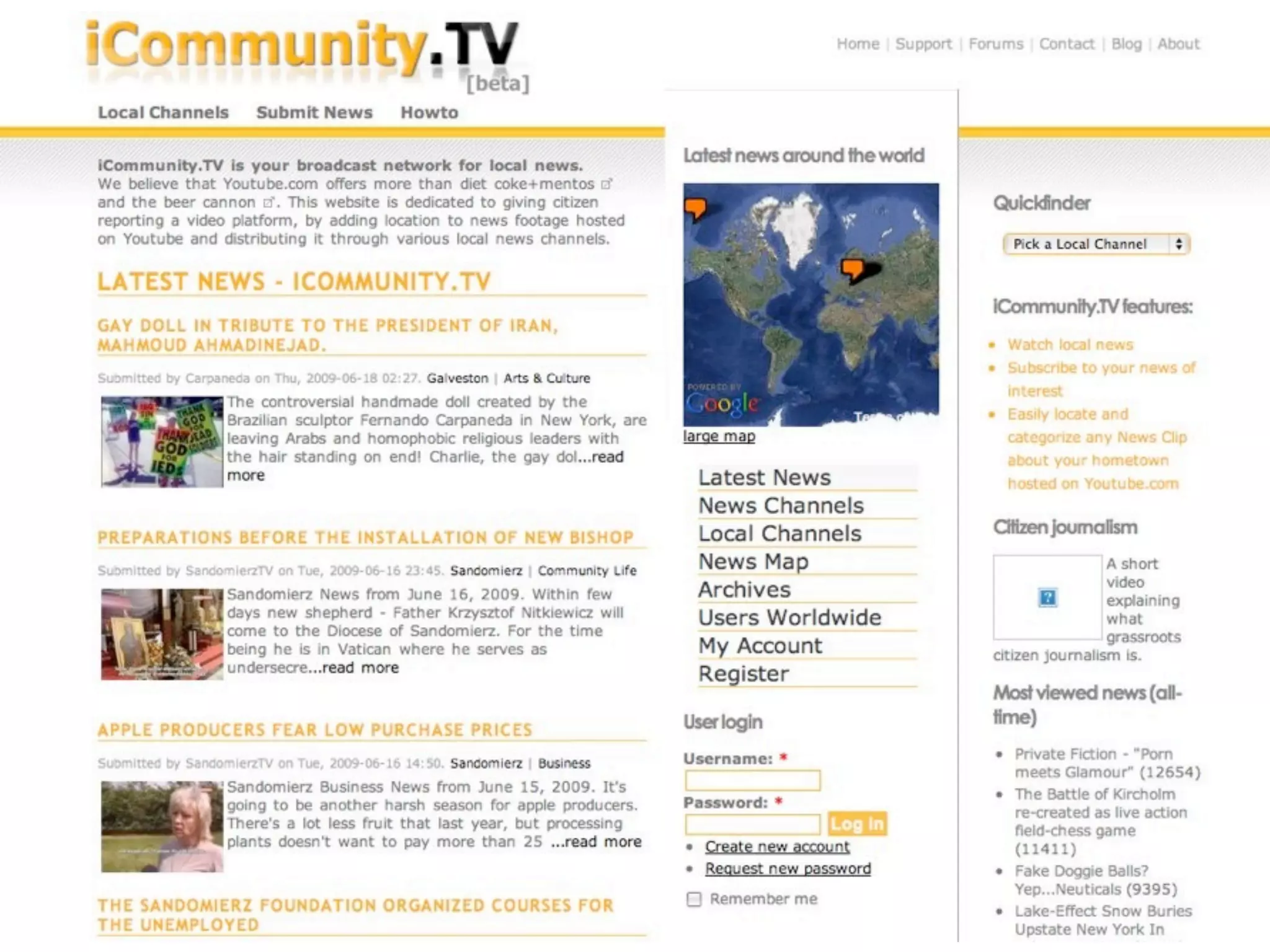
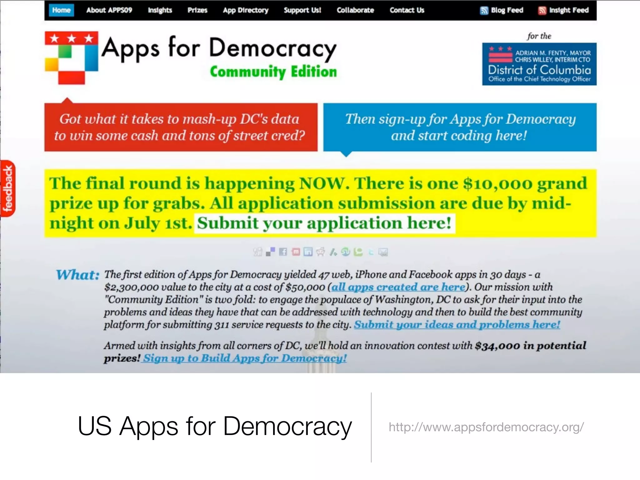
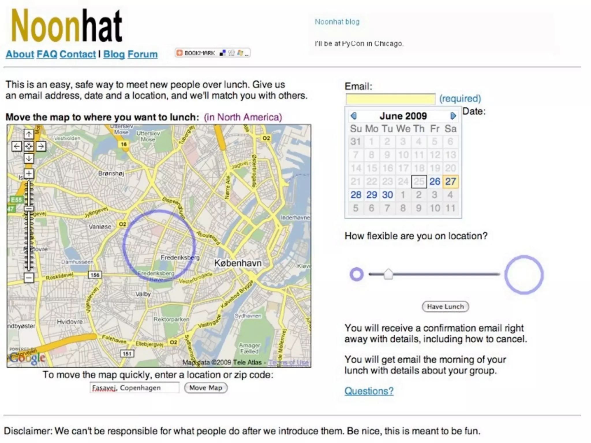


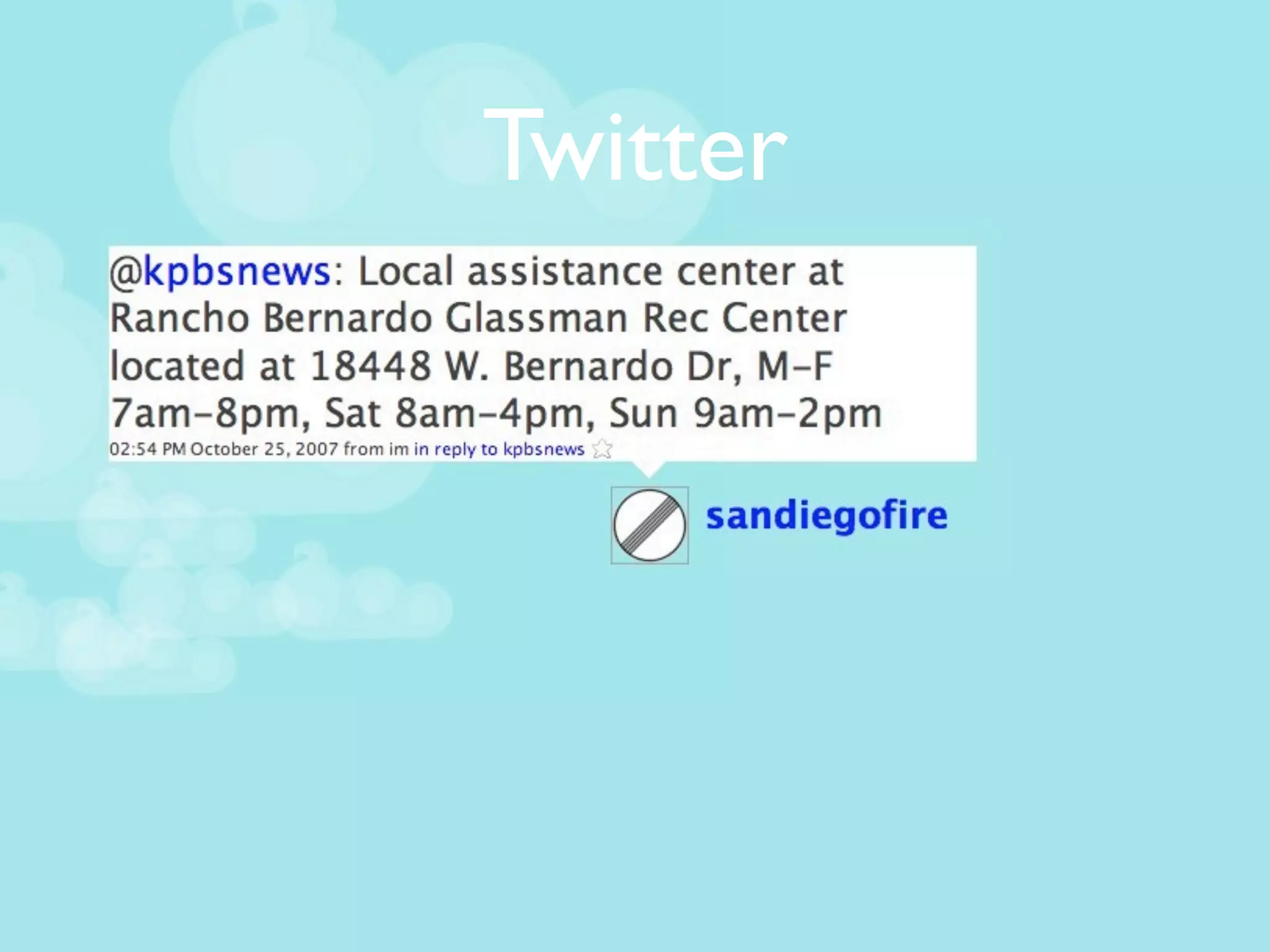
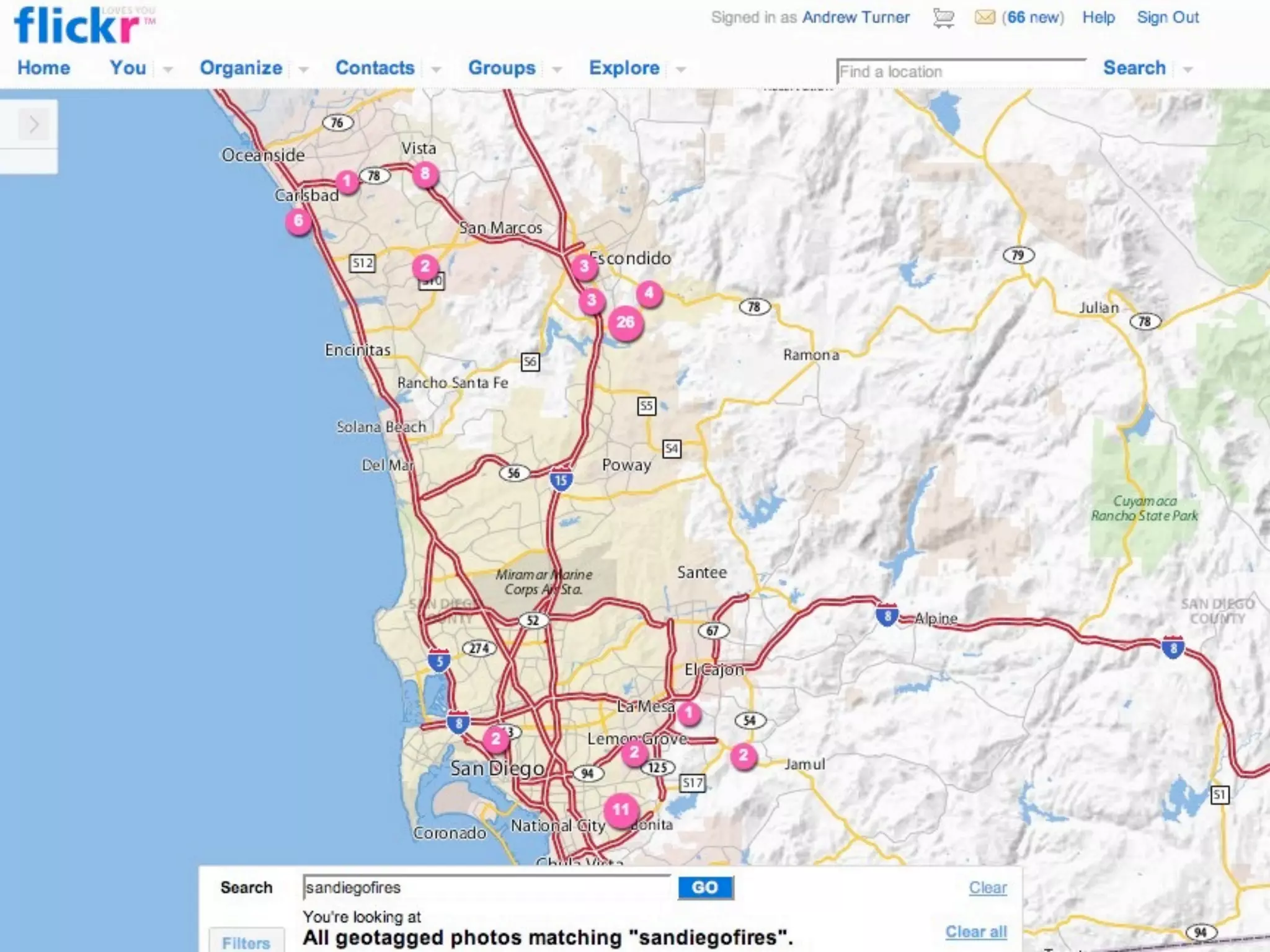
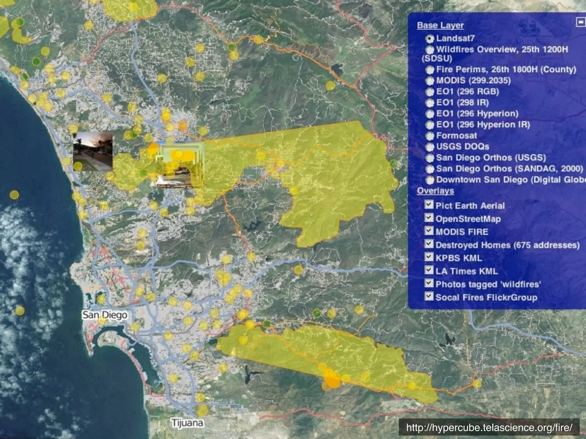
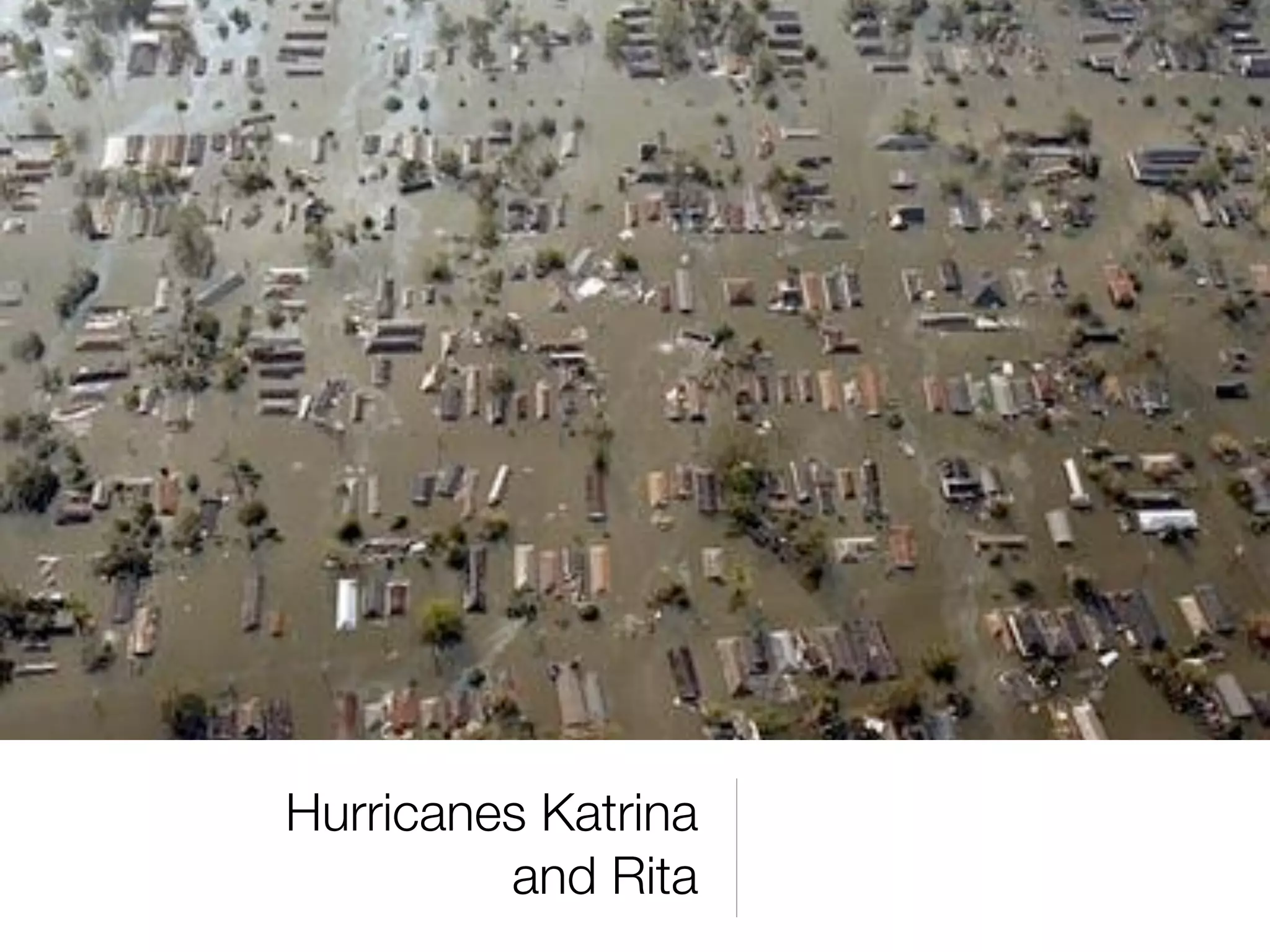
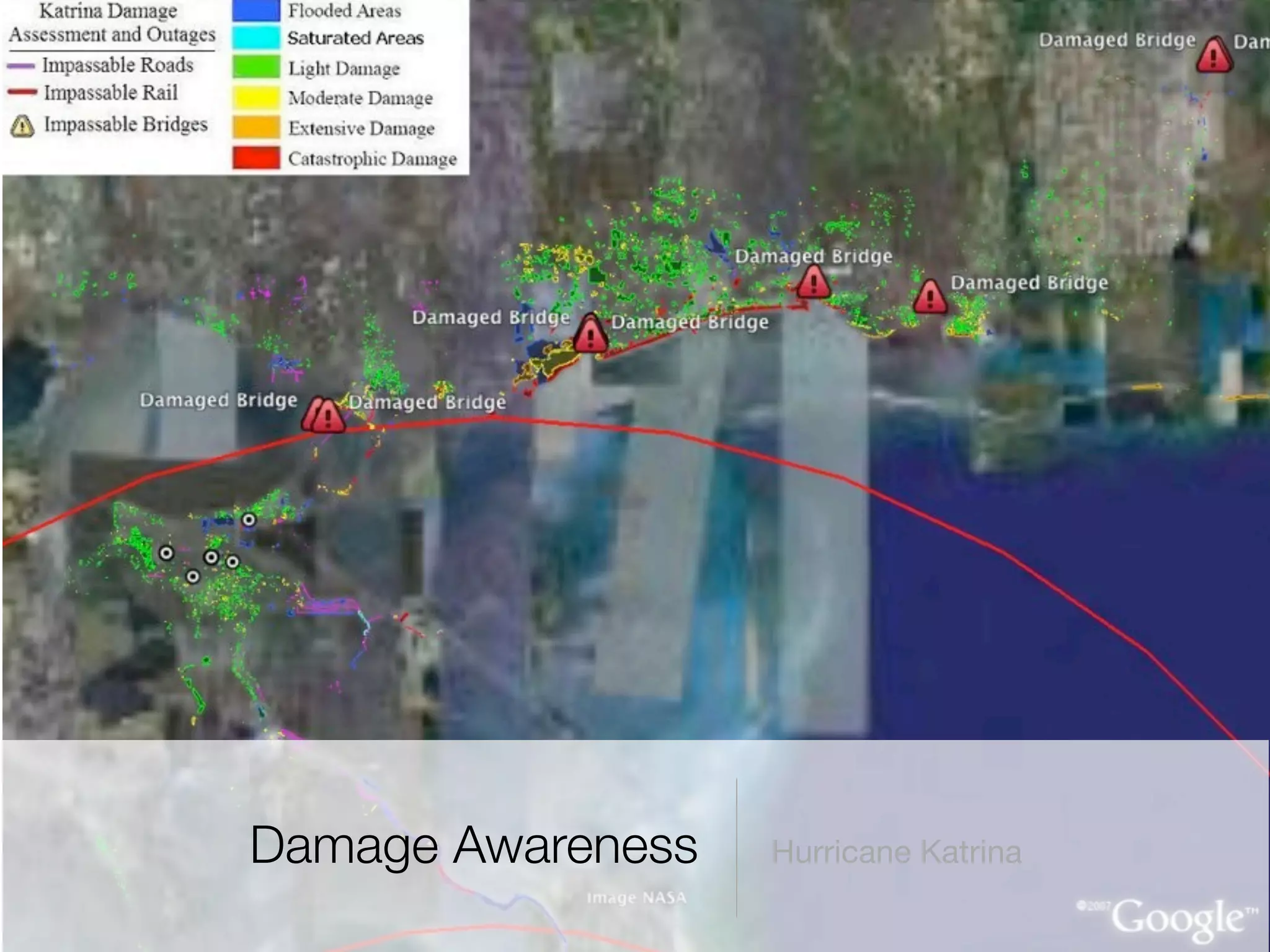
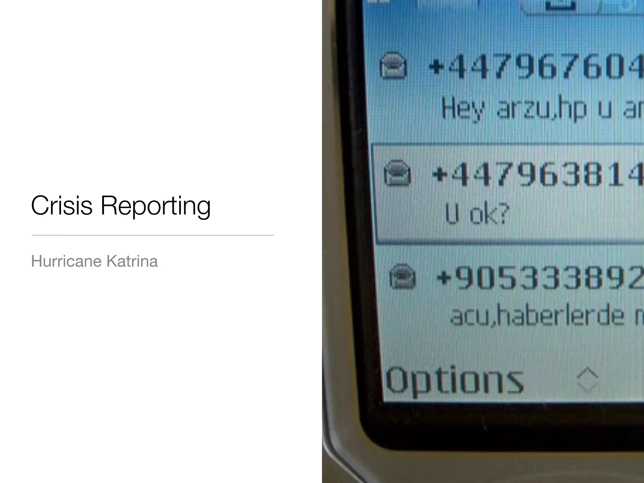

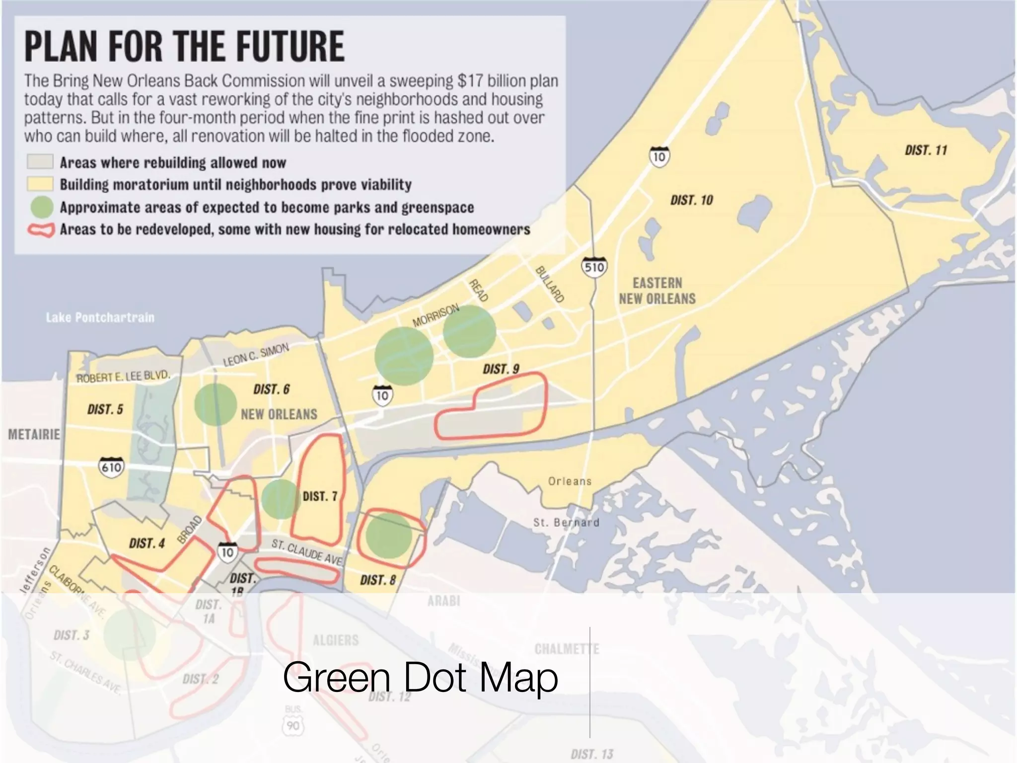

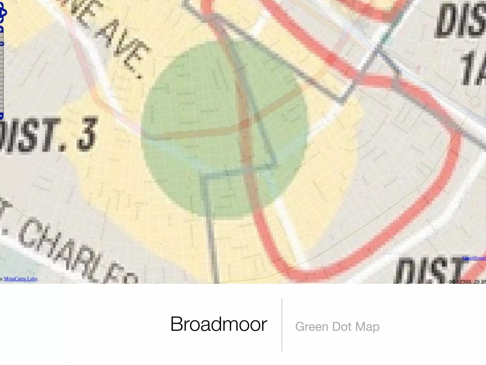

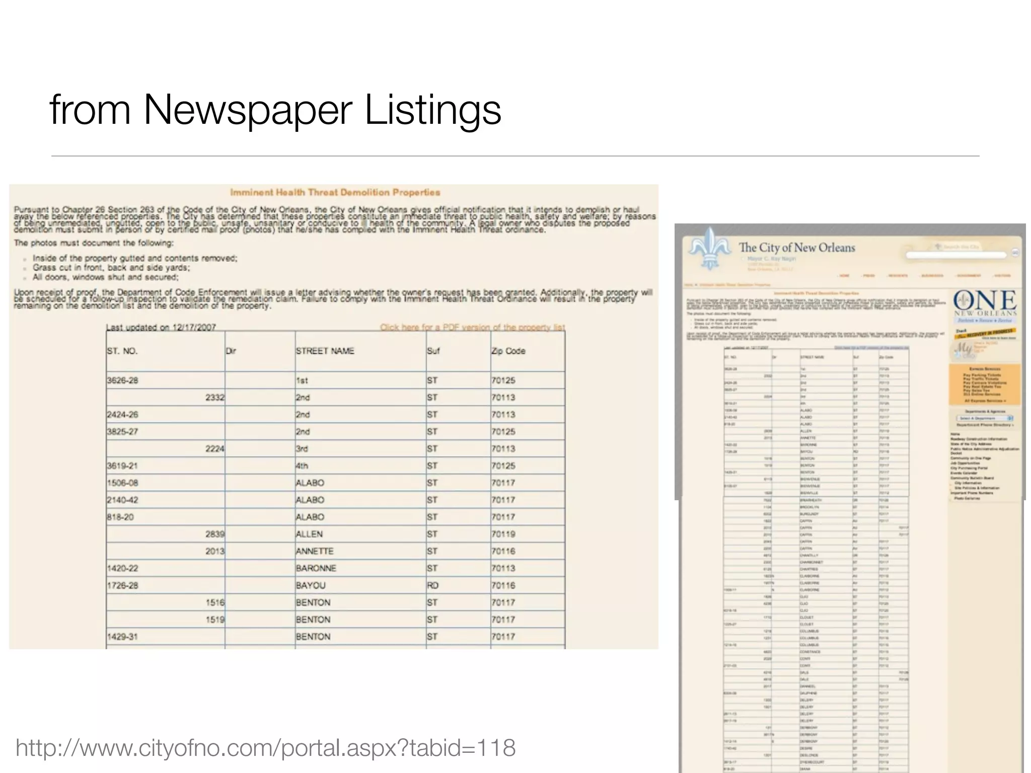
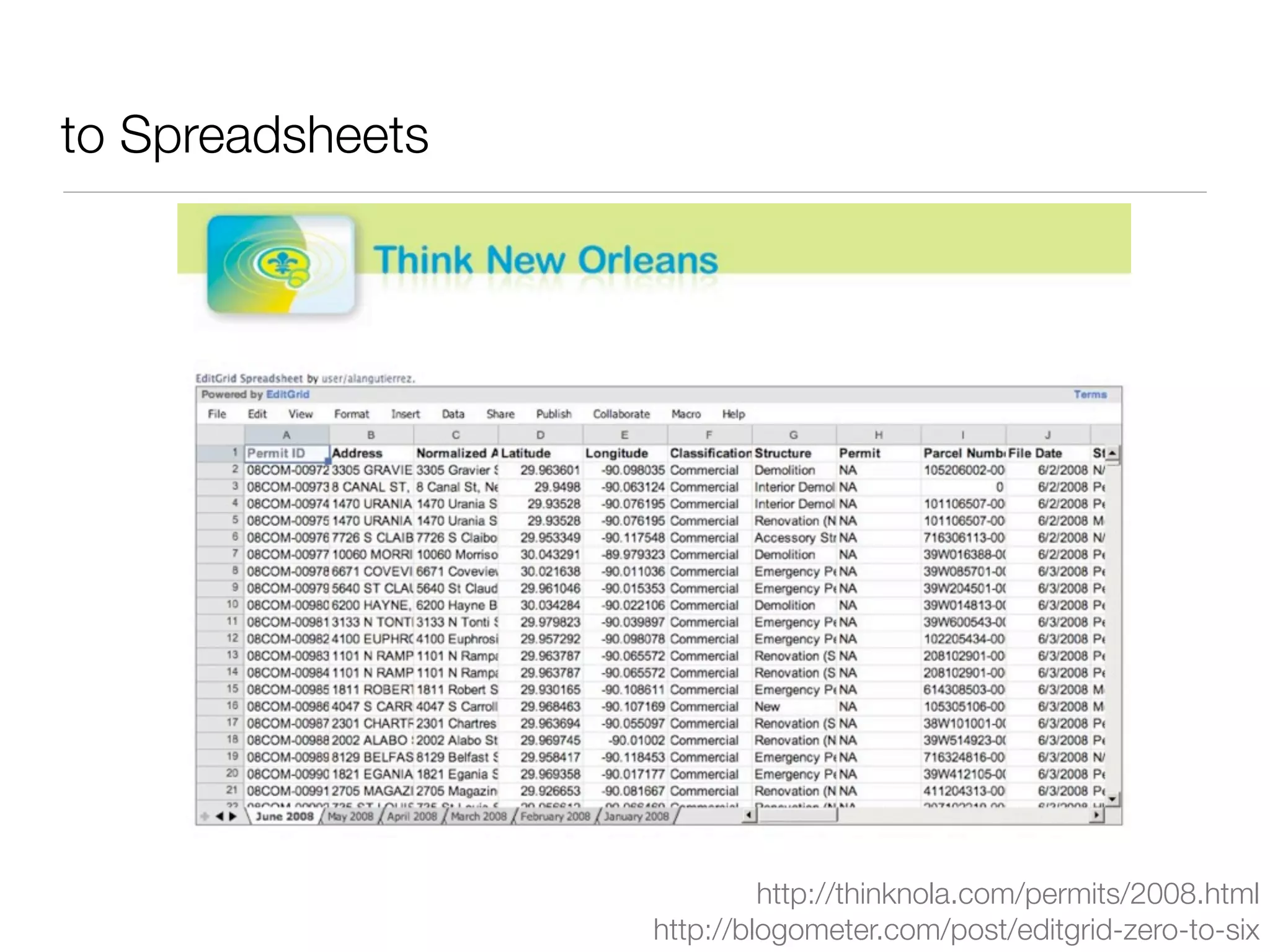
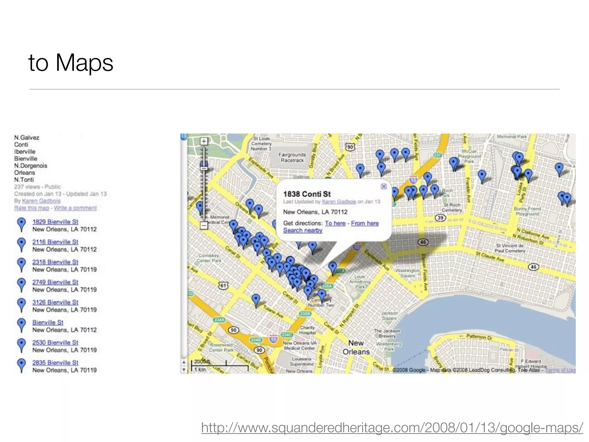
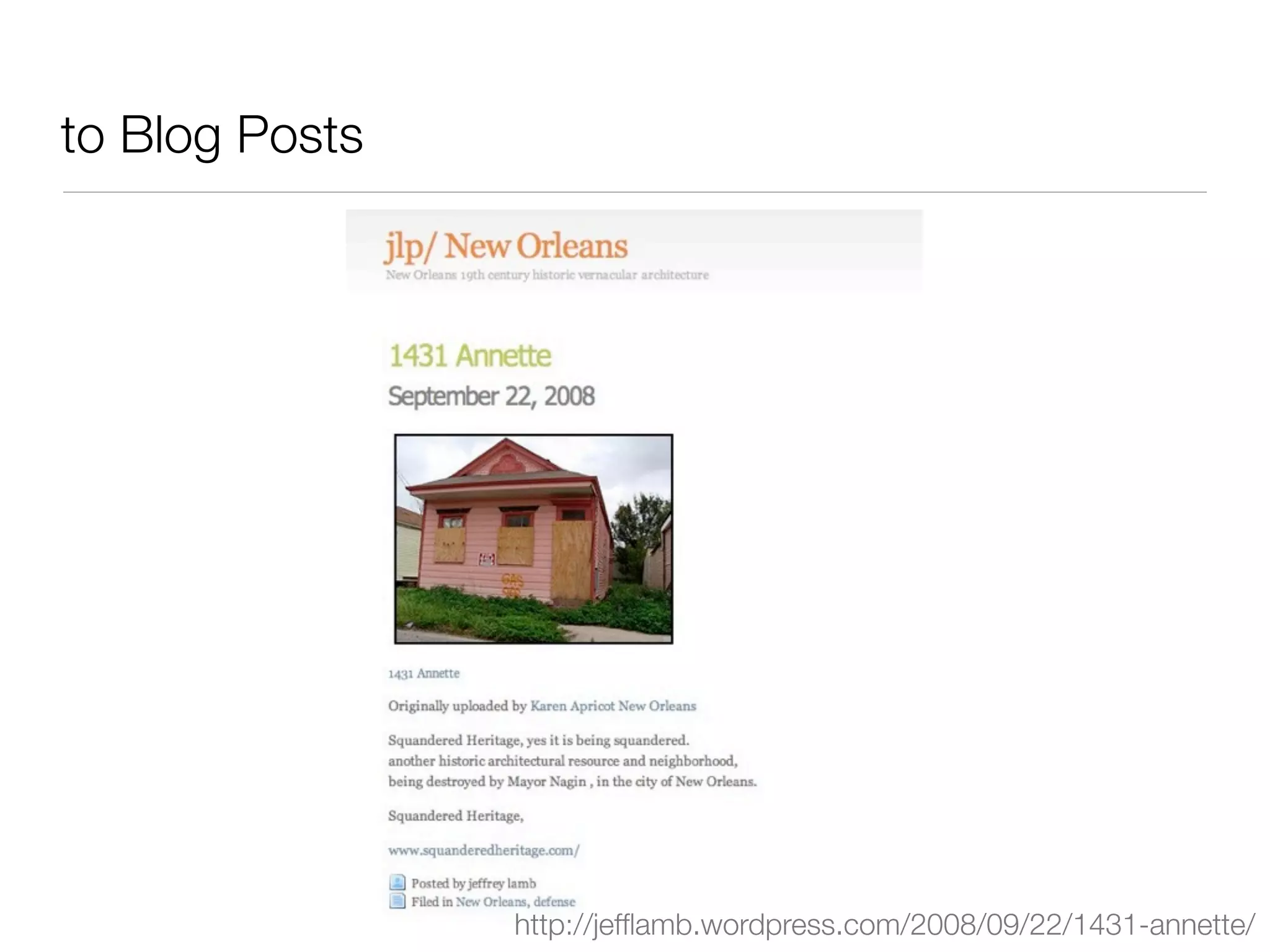
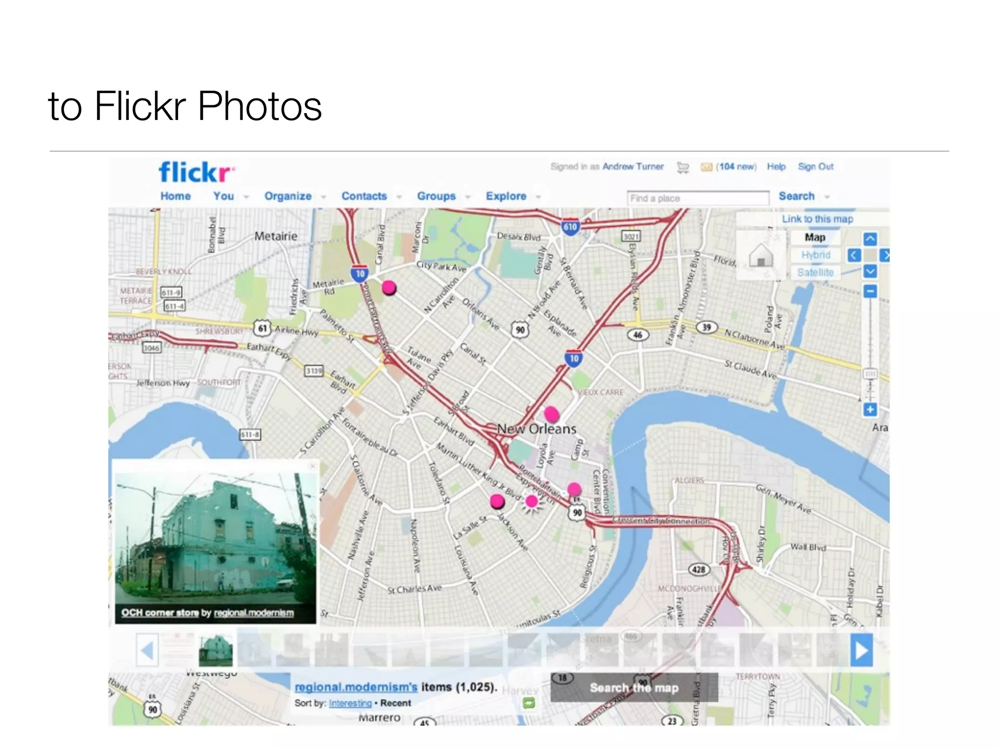
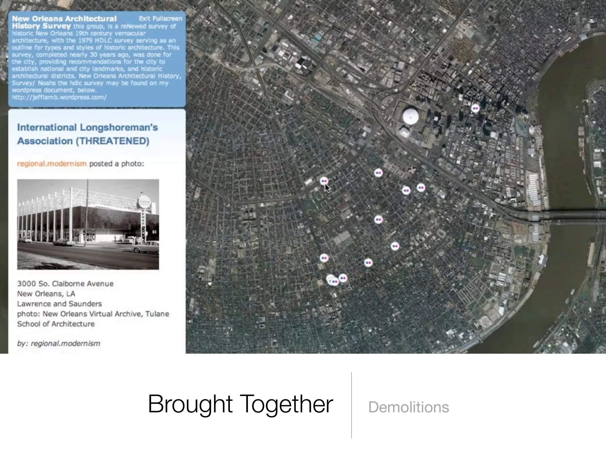

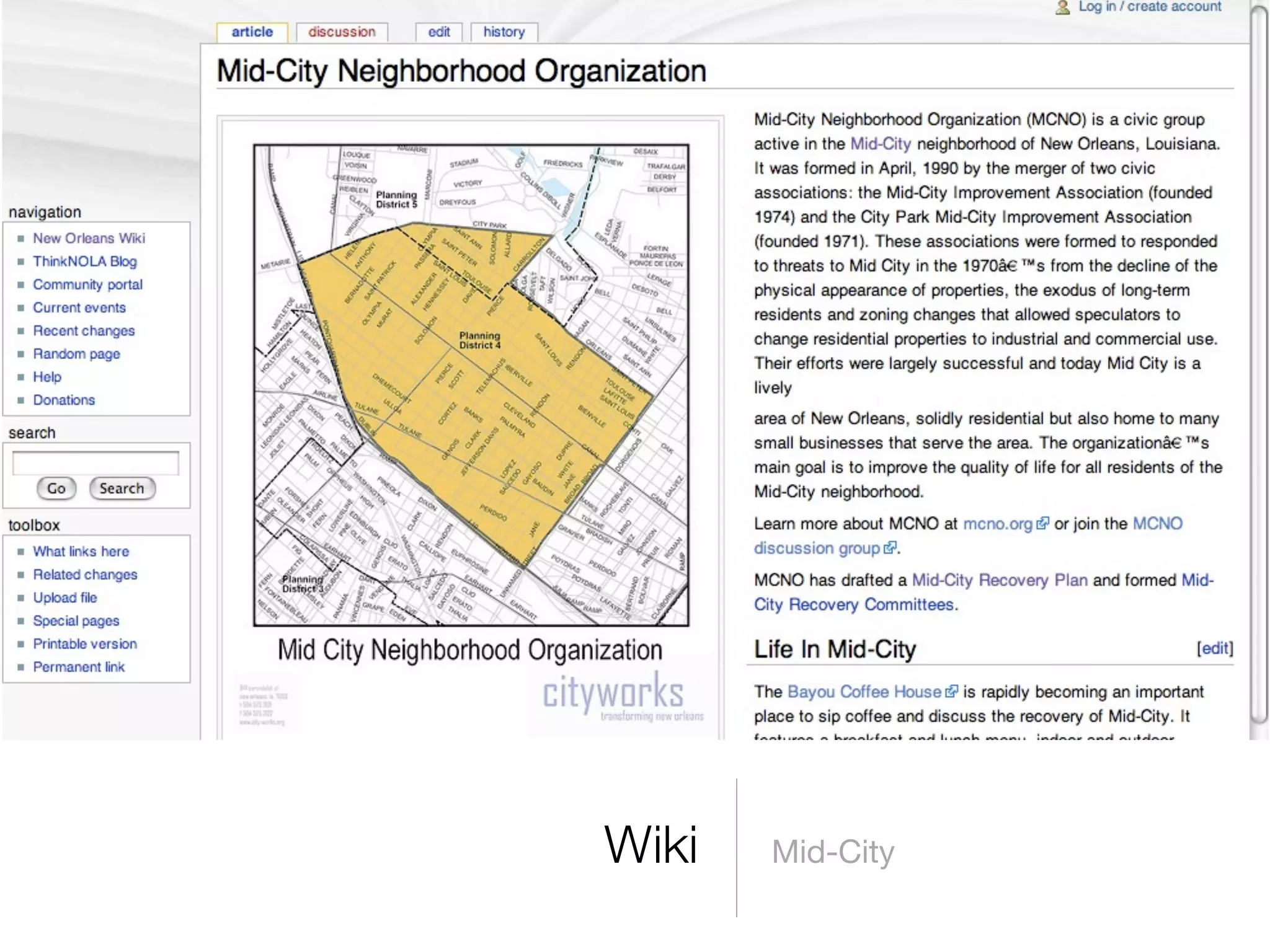
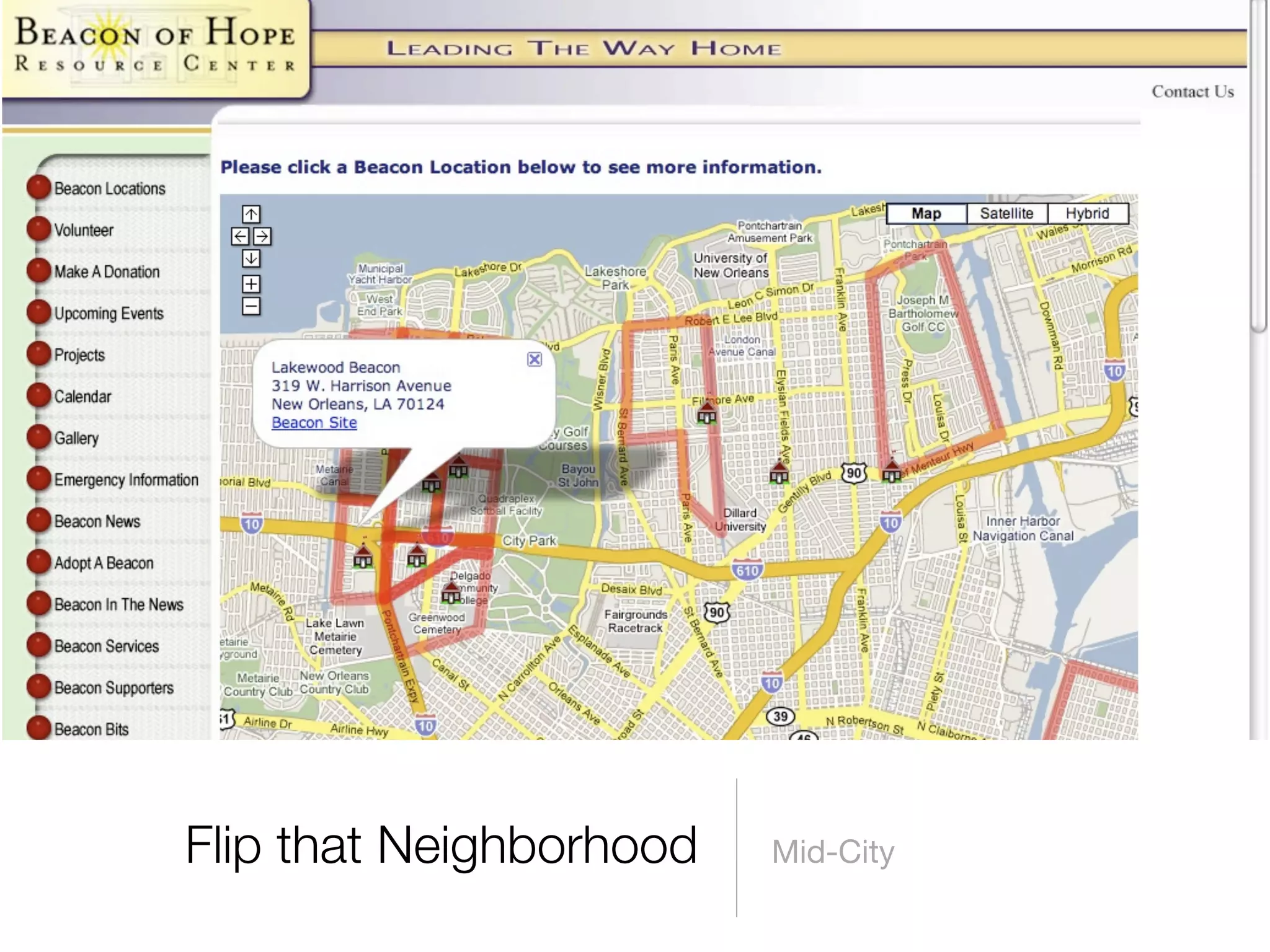

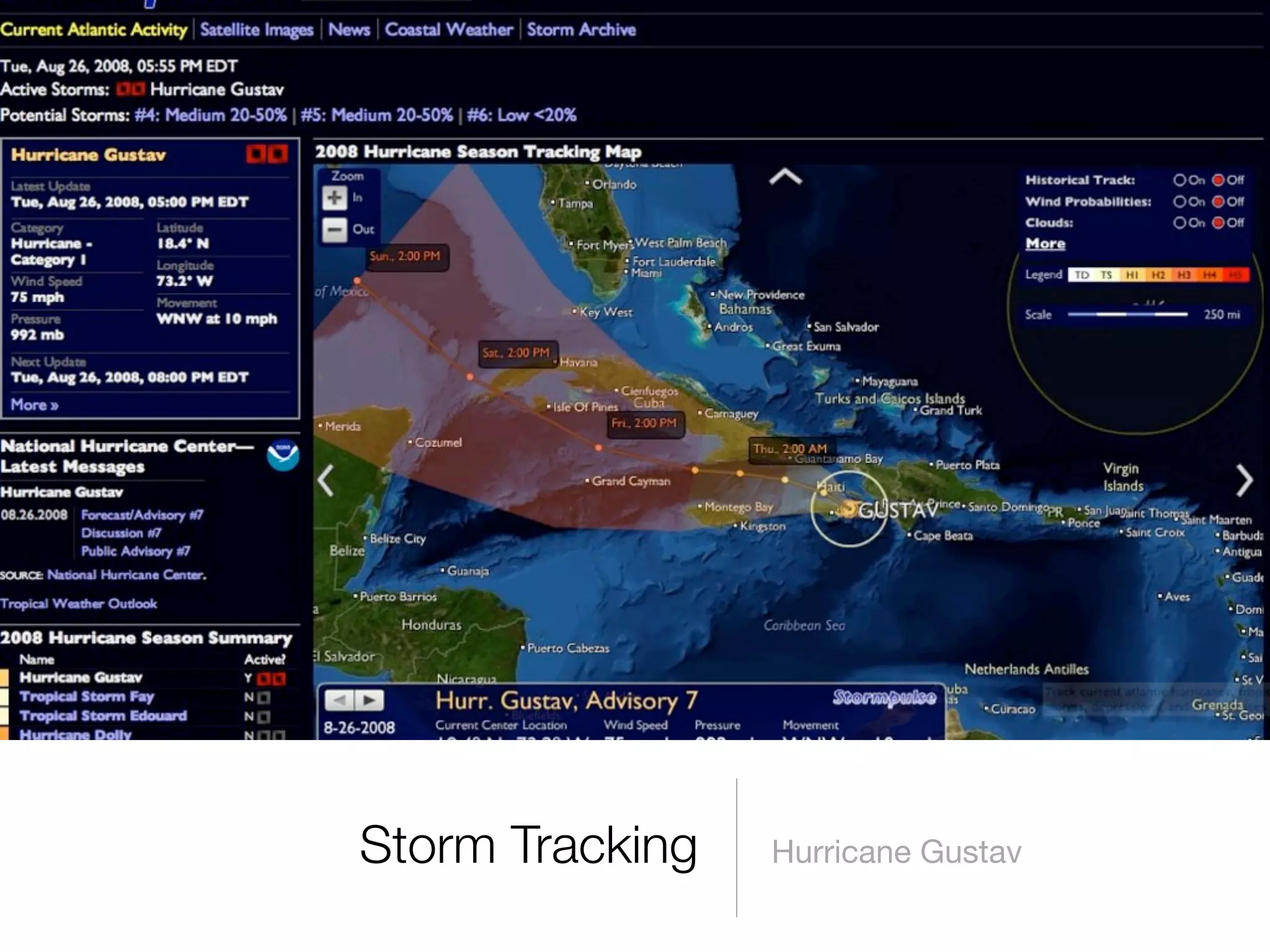
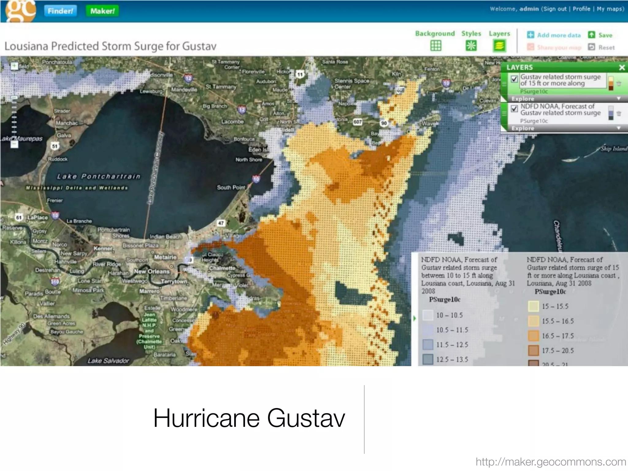

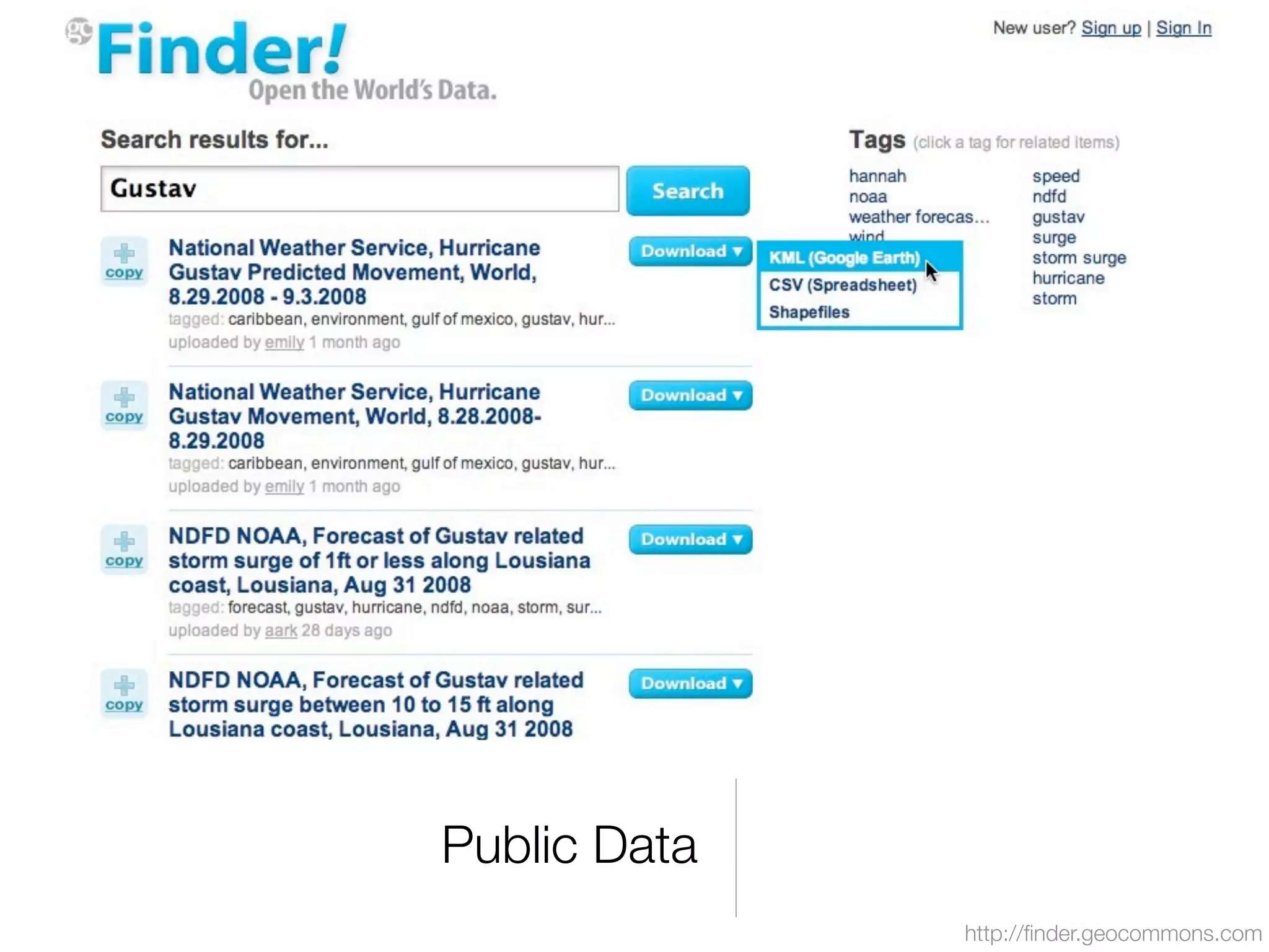
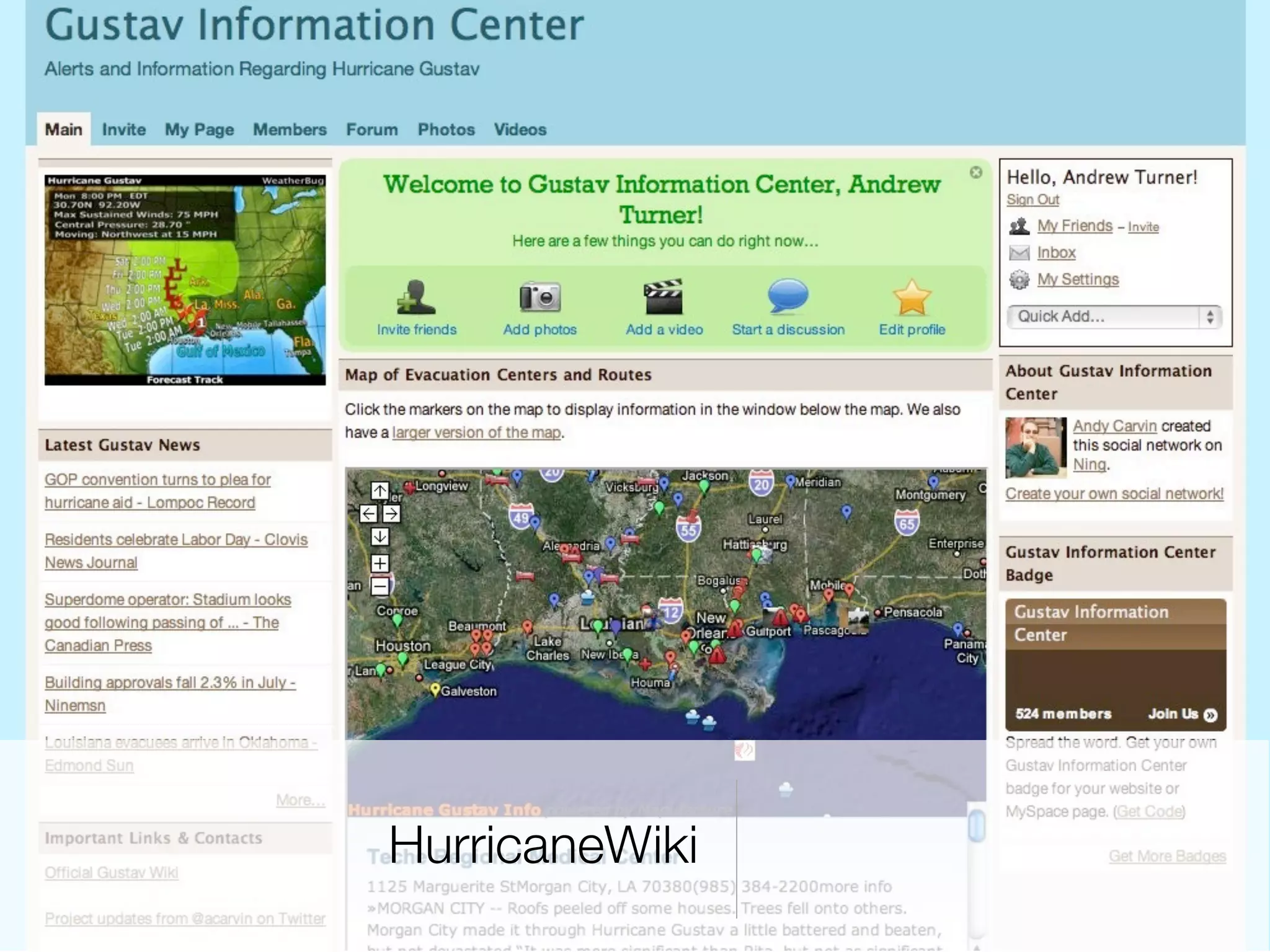
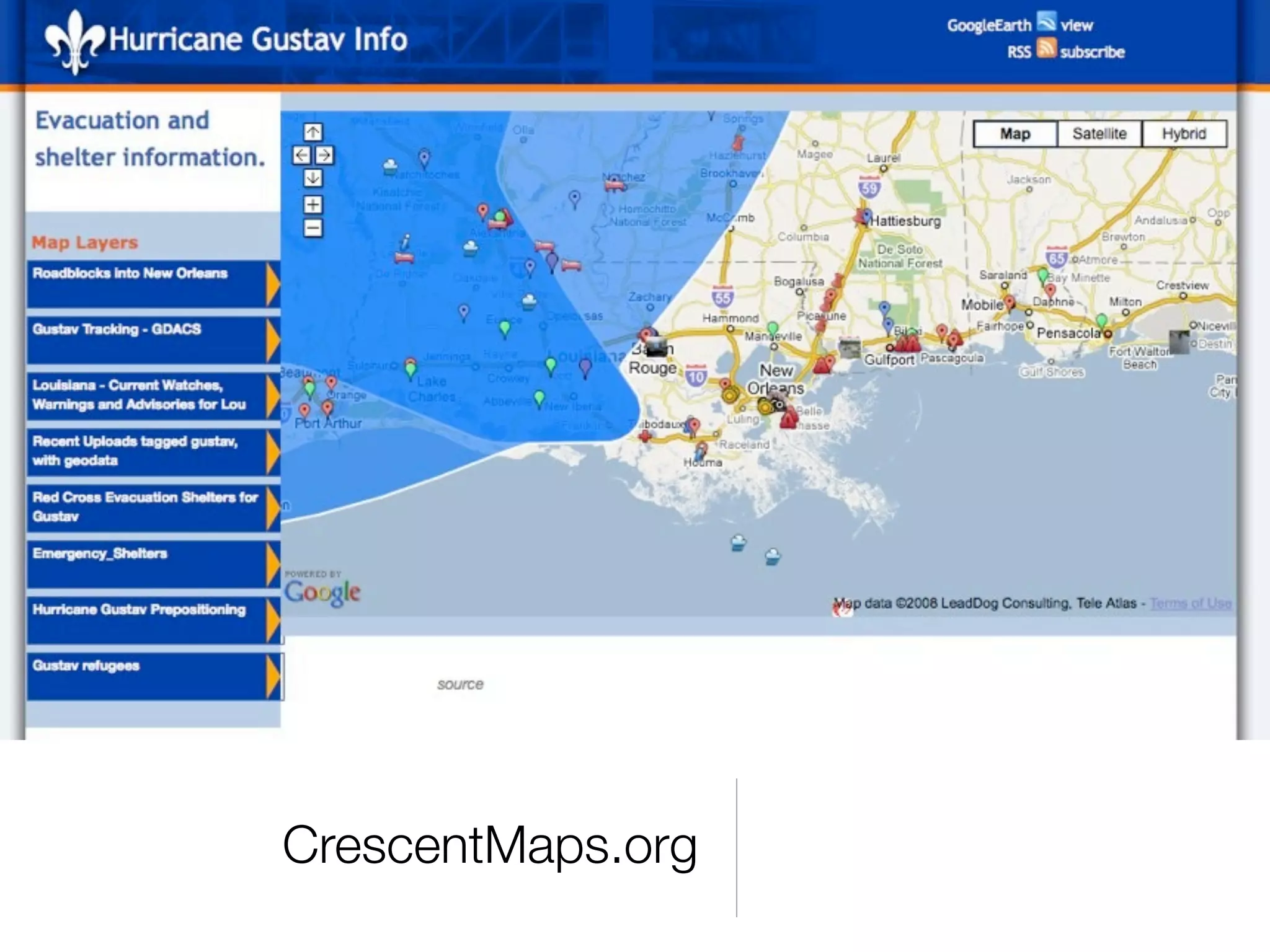
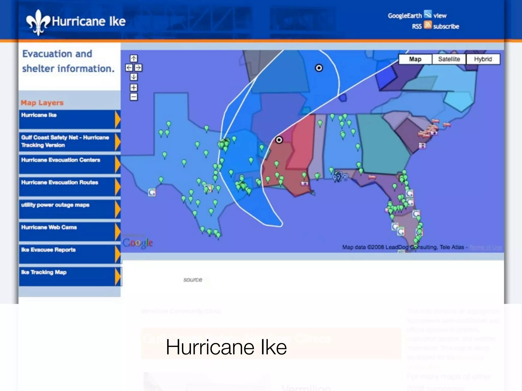
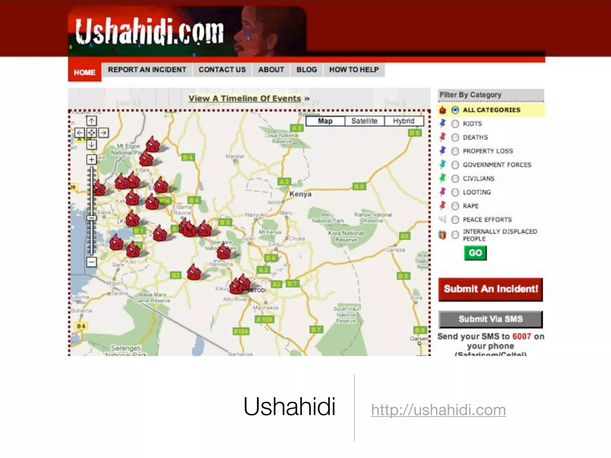

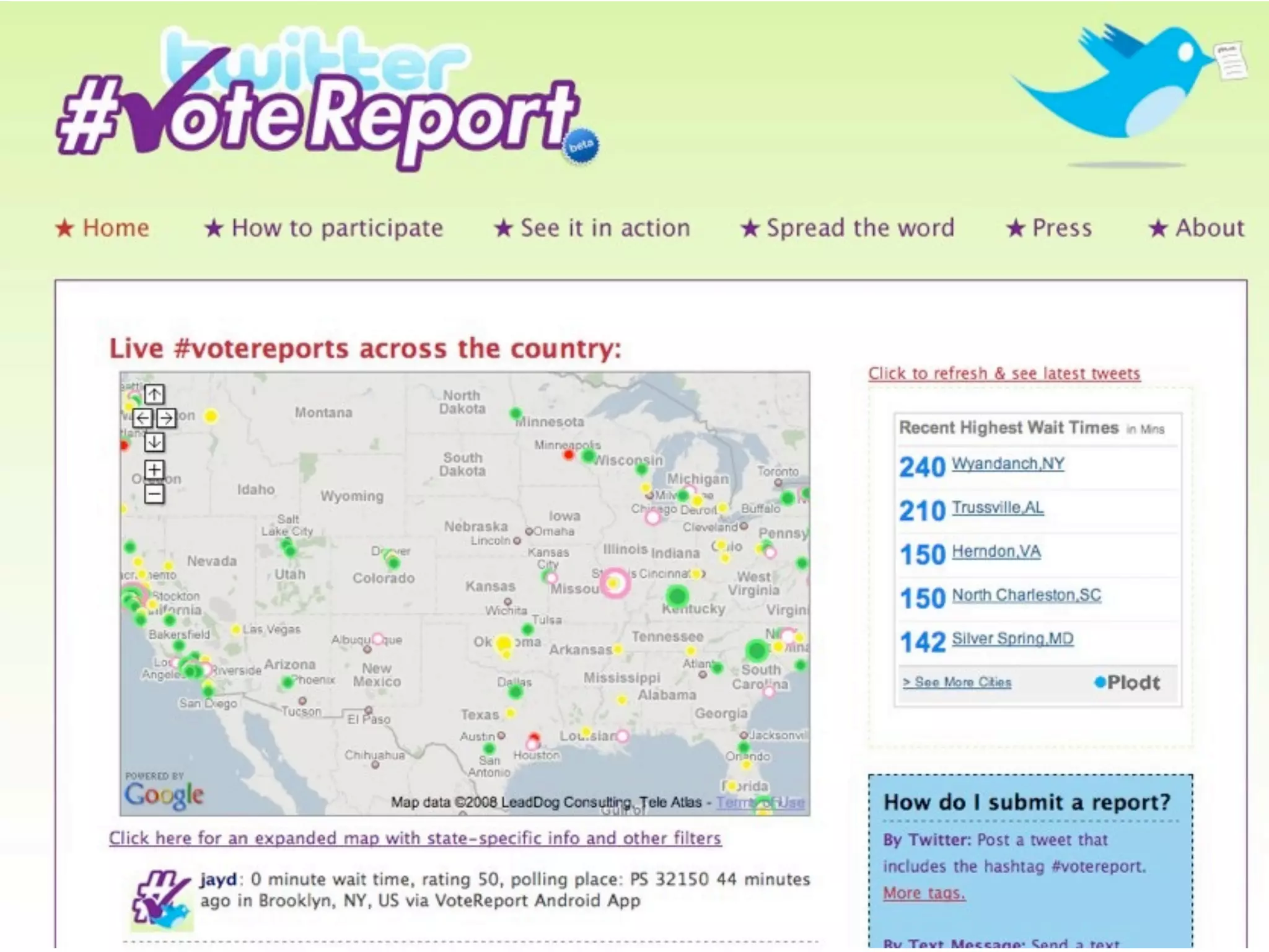
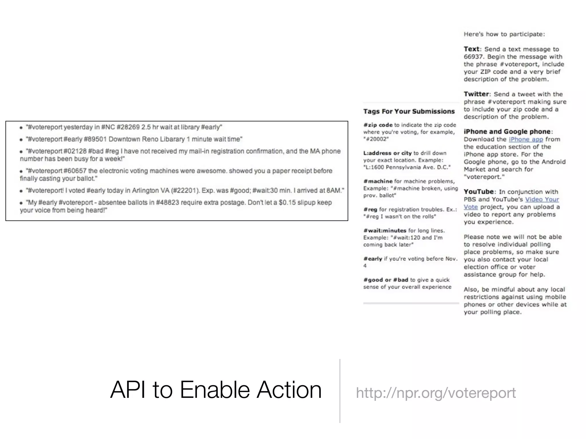
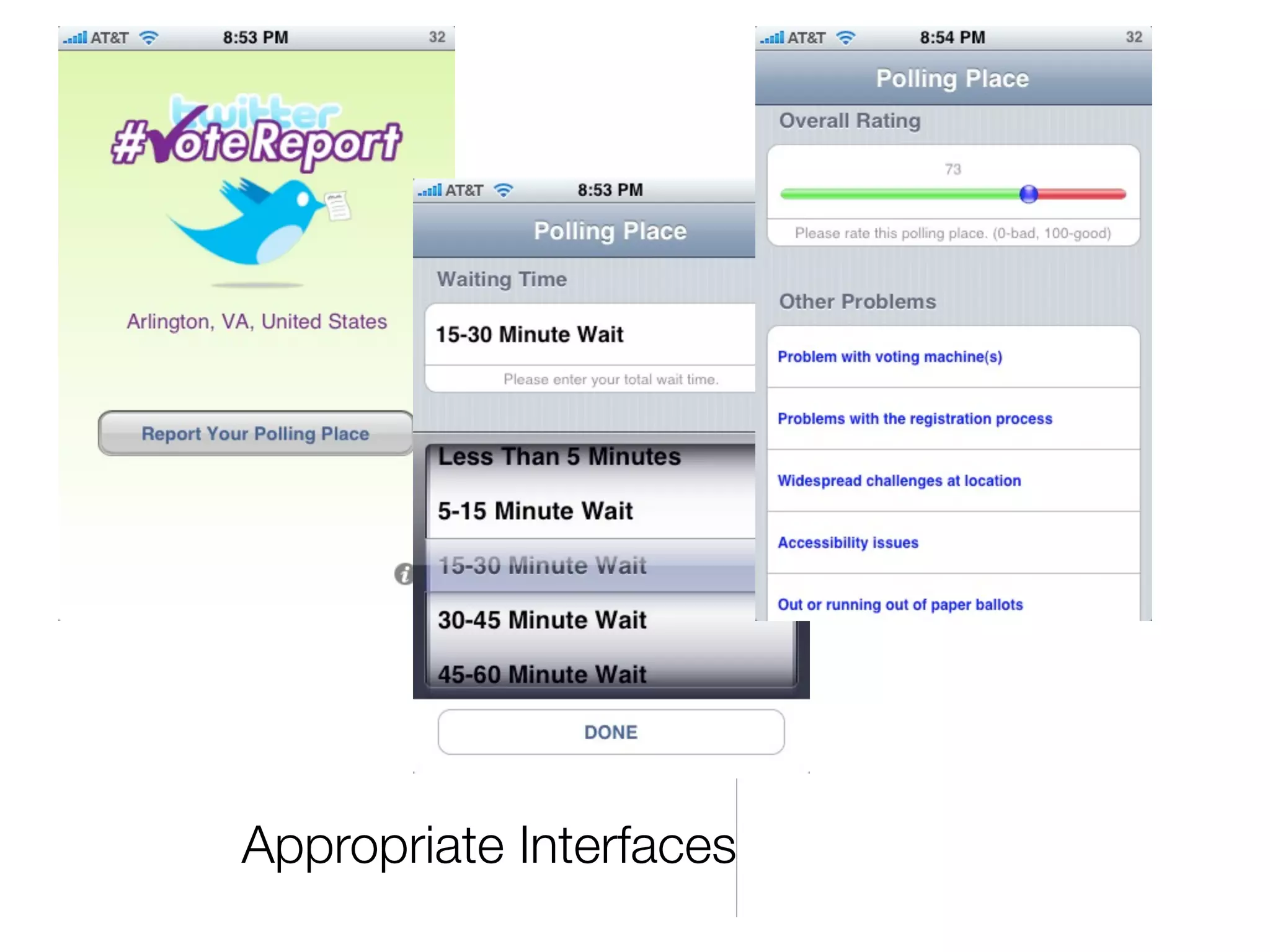
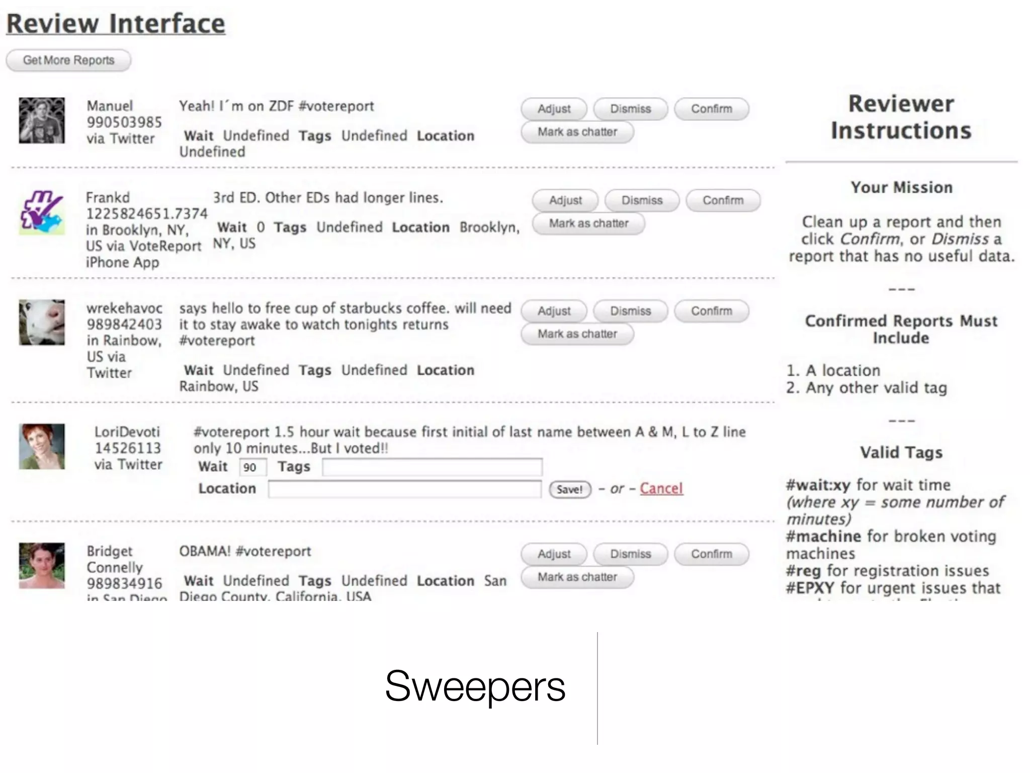
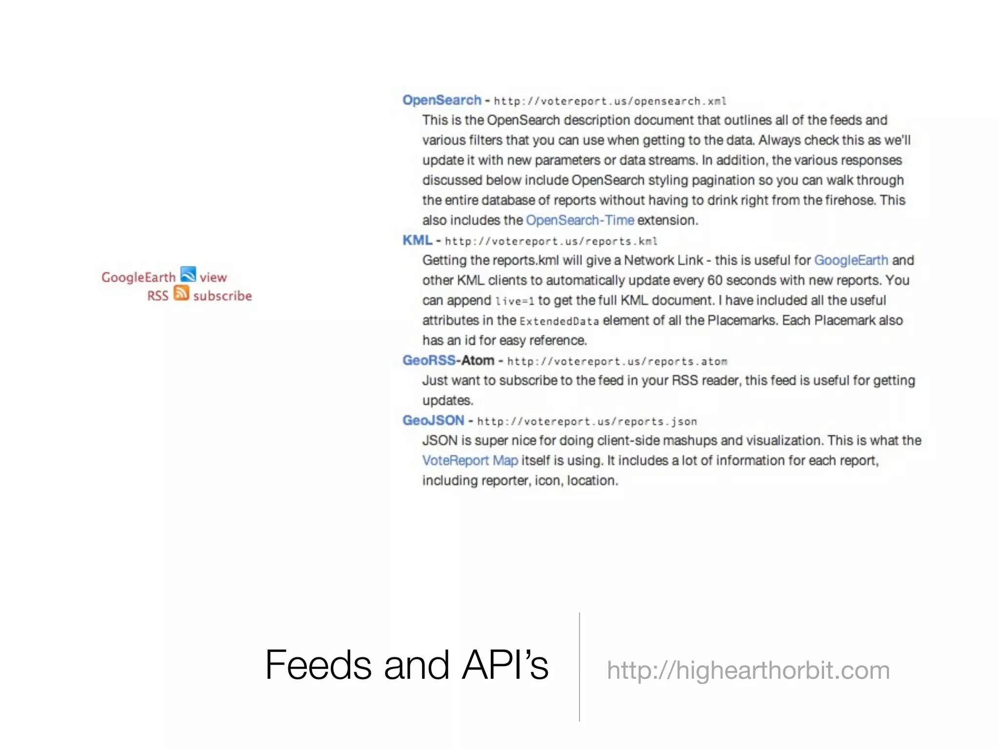
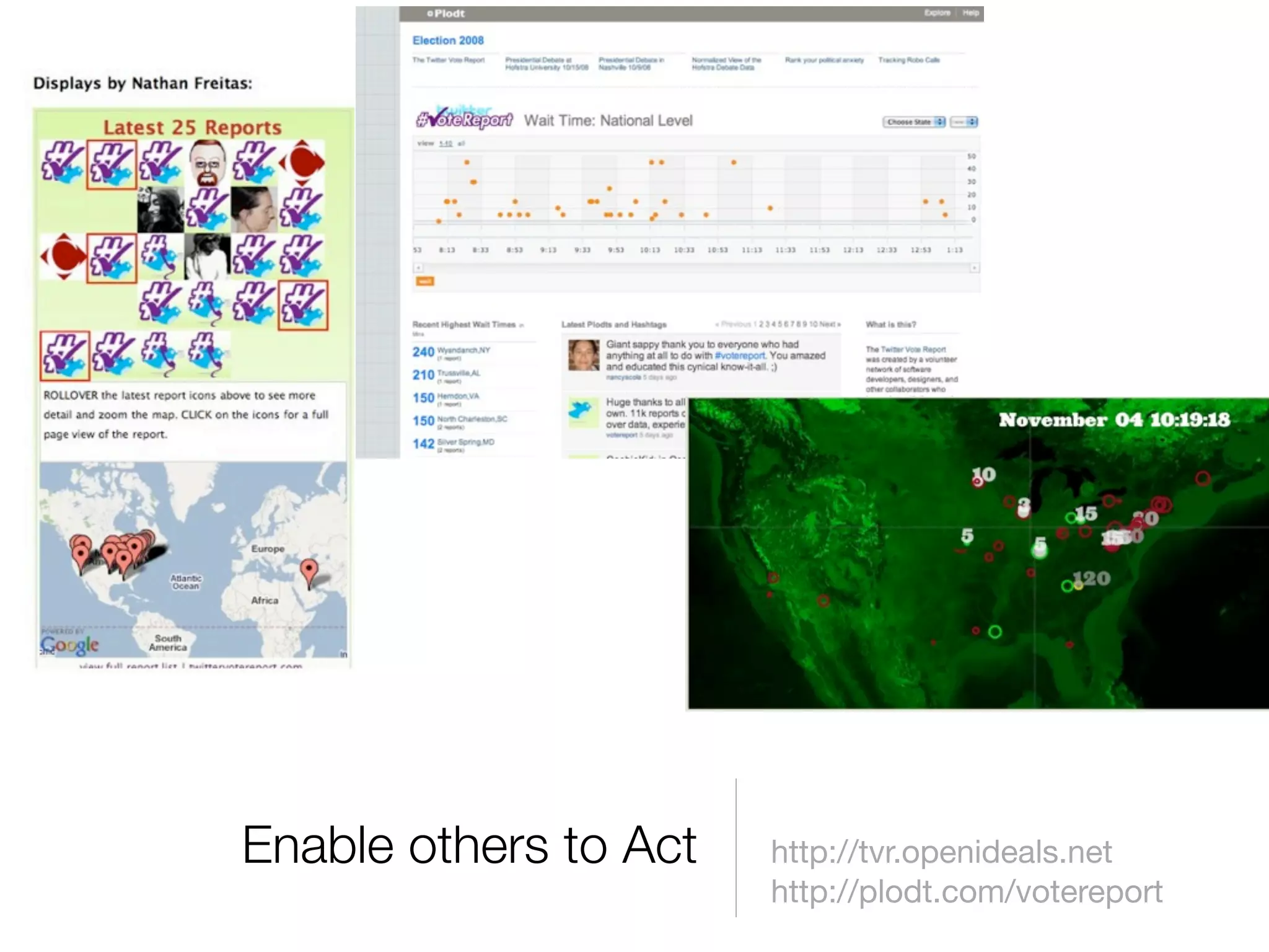
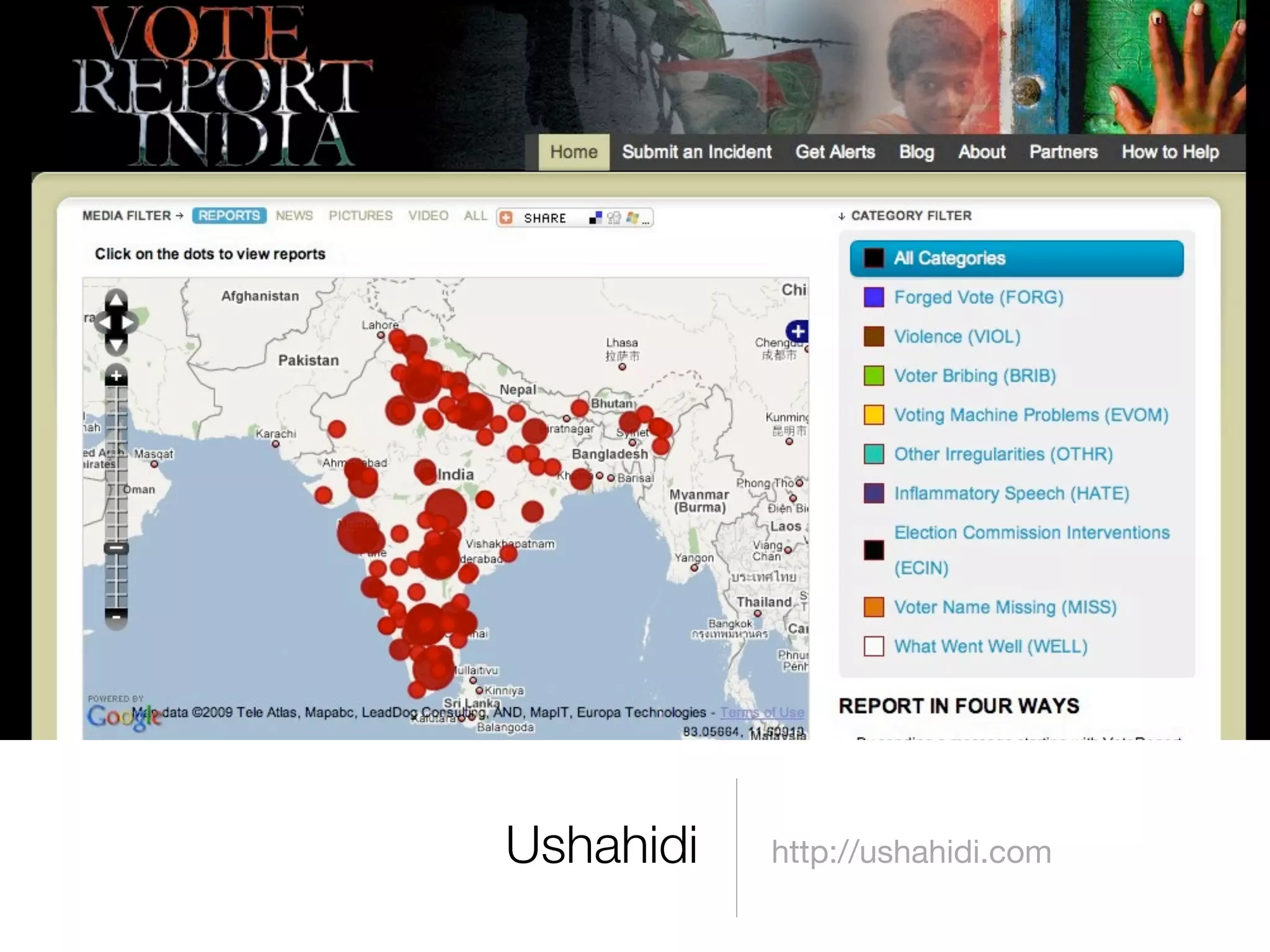
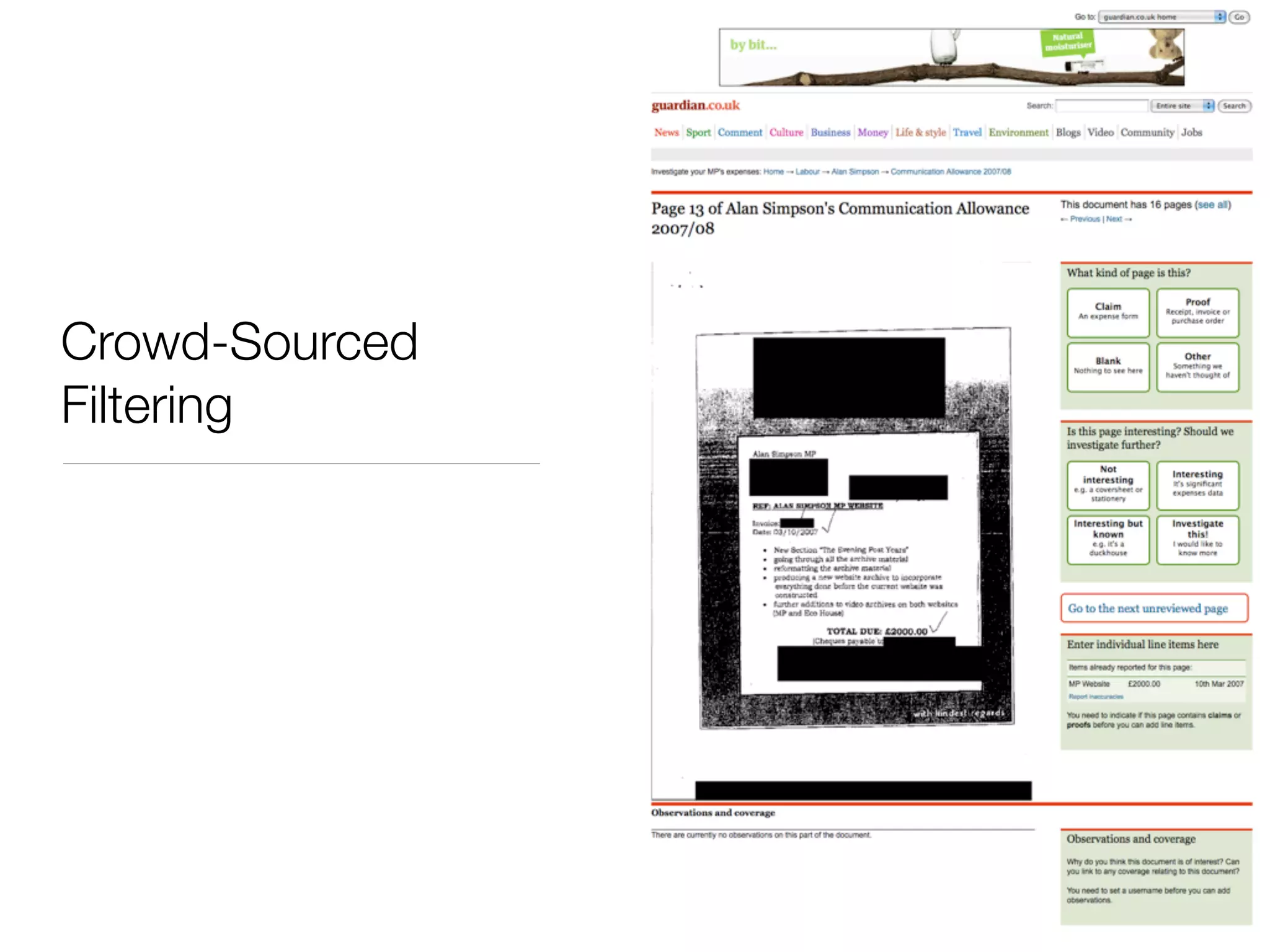
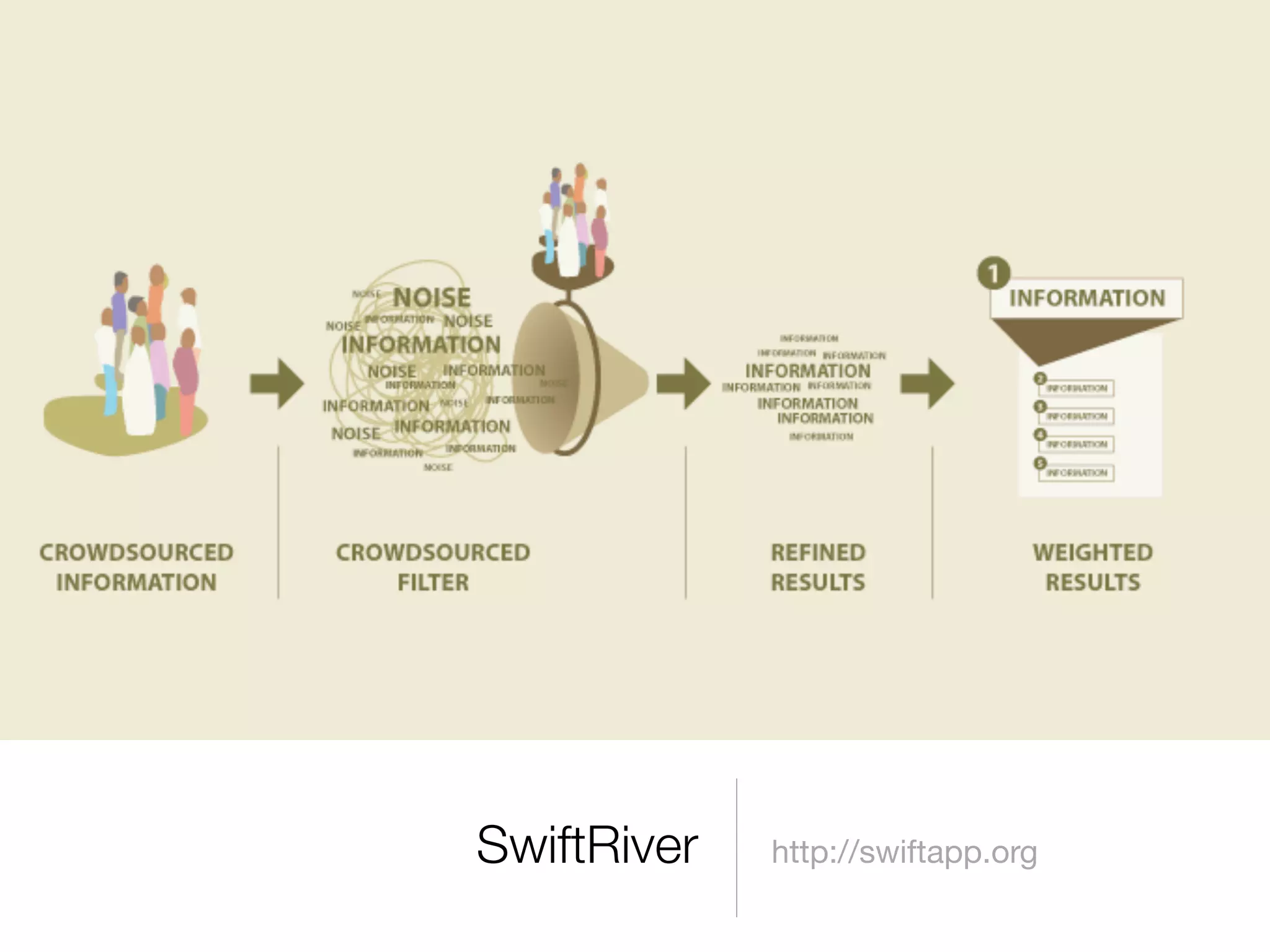


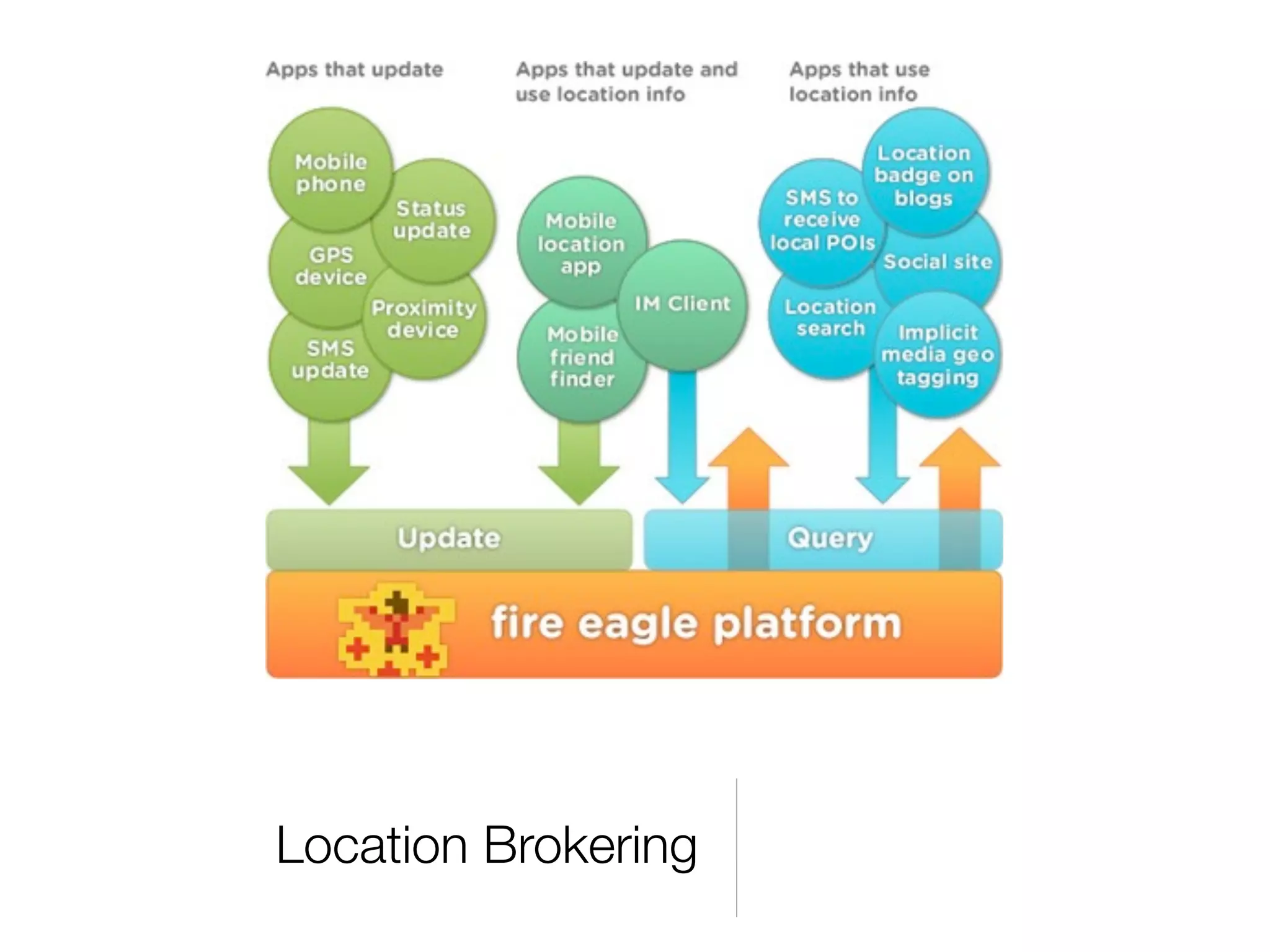

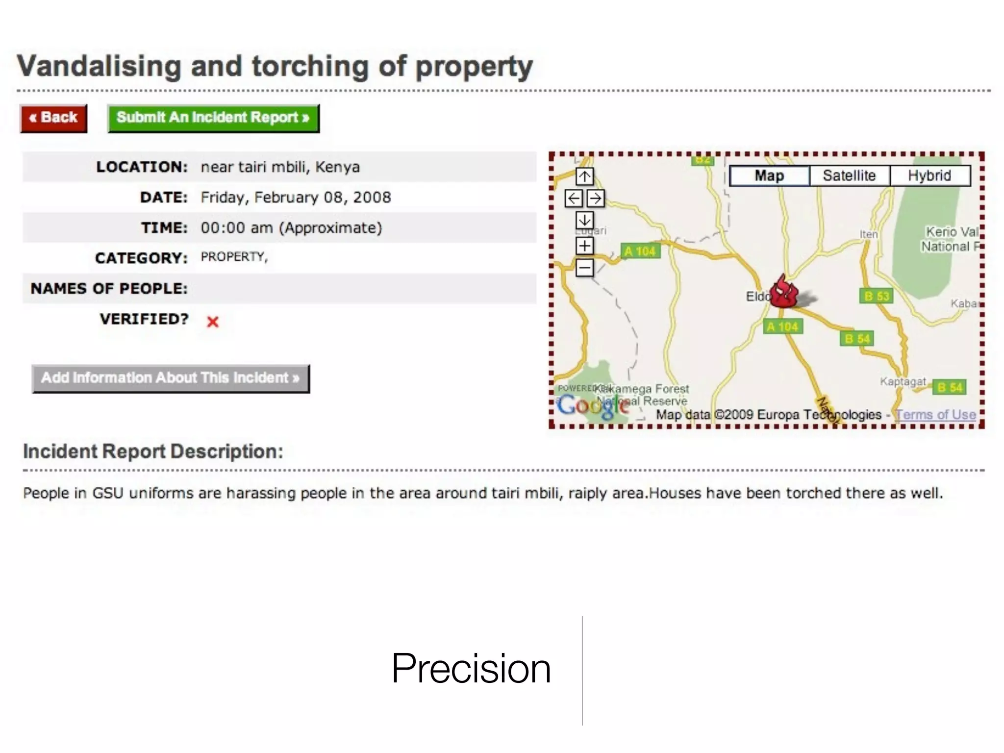
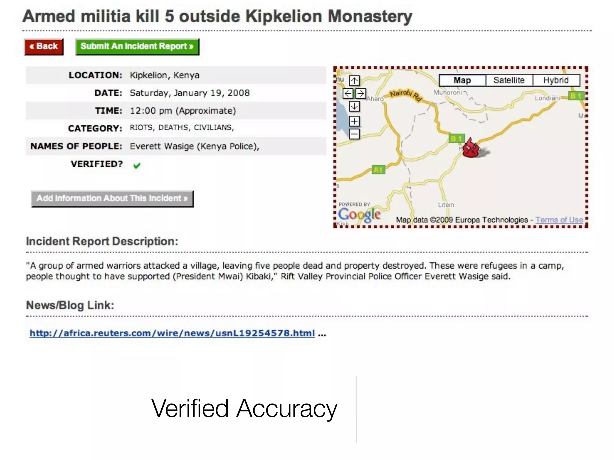


The document discusses the importance of location in enabling action across various domains, highlighting the integration of government, NGOs, and companies to utilize geodata for community engagement. It covers various instances of using open geodata and locative devices for crisis reporting, disaster response, and civic involvement. The text emphasizes the role of technology and collaboration in empowering individuals and organizations to take action based on geospatial information.


![Short Intro to OSM [Gnome Asia 2015]](https://cdn.slidesharecdn.com/ss_thumbnails/shortintrotoopenstreetmapgnomeasia-150510144101-lva1-app6892-thumbnail.jpg?width=640&height=640&fit=bounds)


![Coded Agents – with UiPath SDK + LangGraph [Virtual Hands-on Workshop]](https://cdn.slidesharecdn.com/ss_thumbnails/codedagentsdeck-251215155422-5497c599-thumbnail.jpg?width=640&height=640&fit=bounds)


