Downloaded 18 times

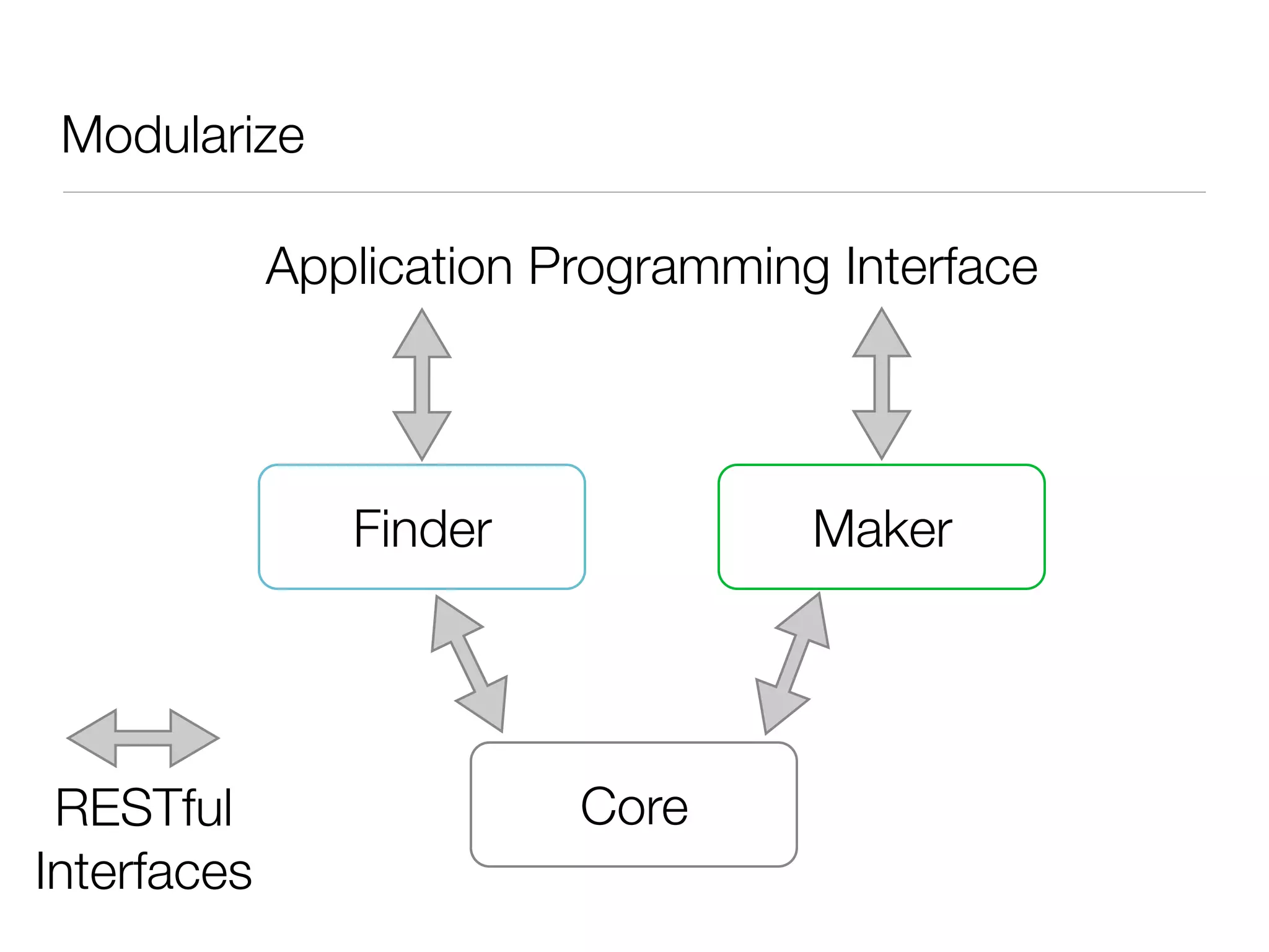
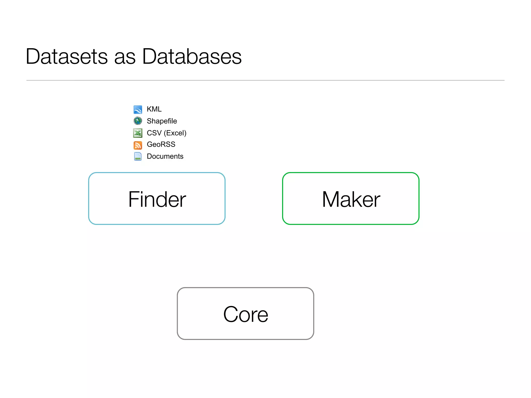
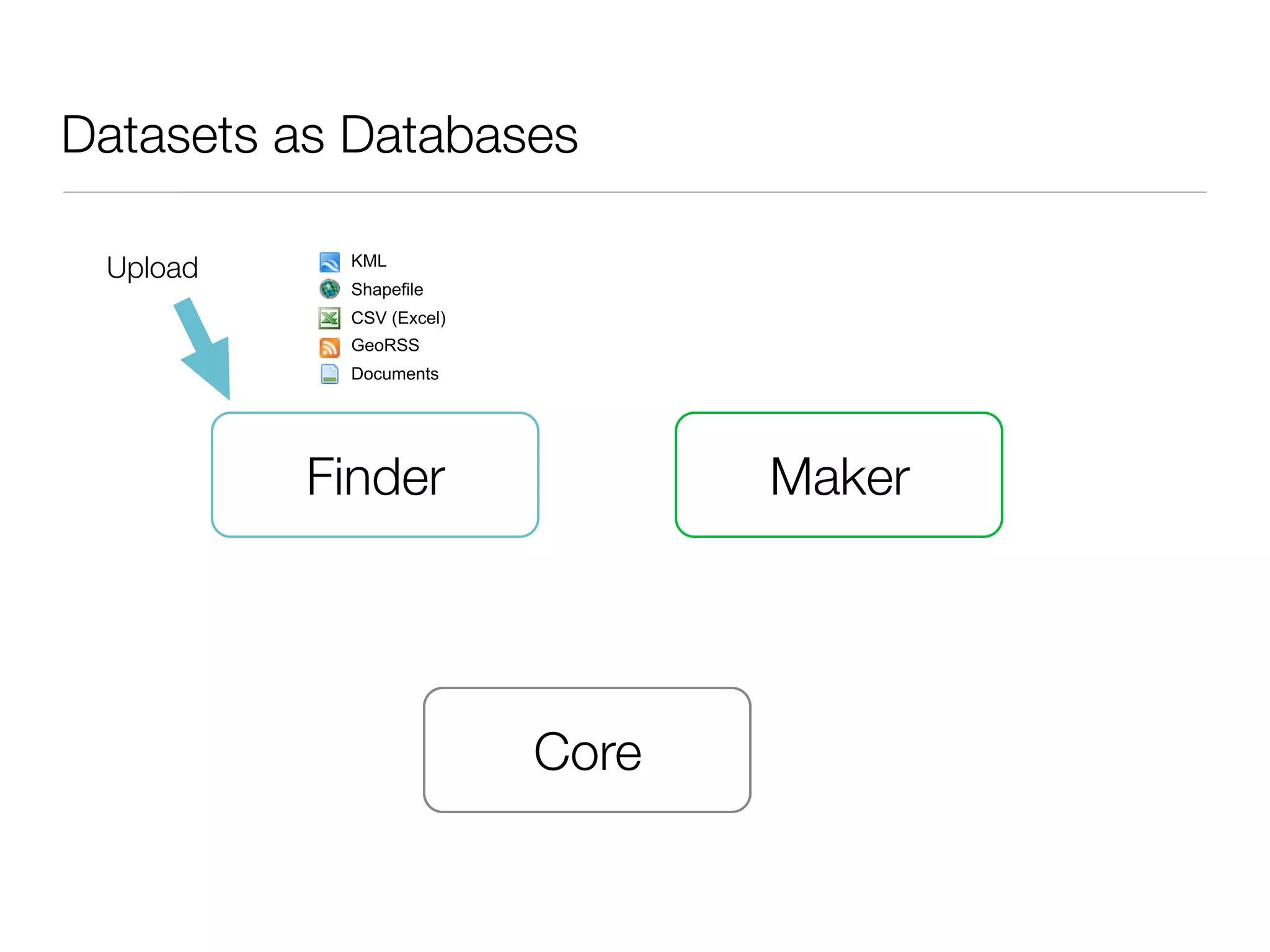
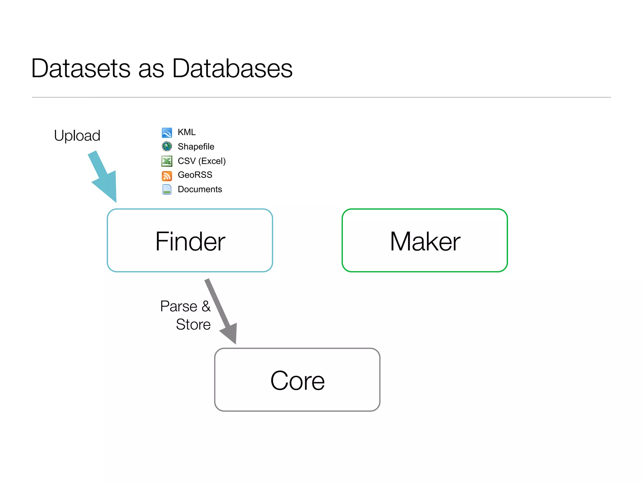
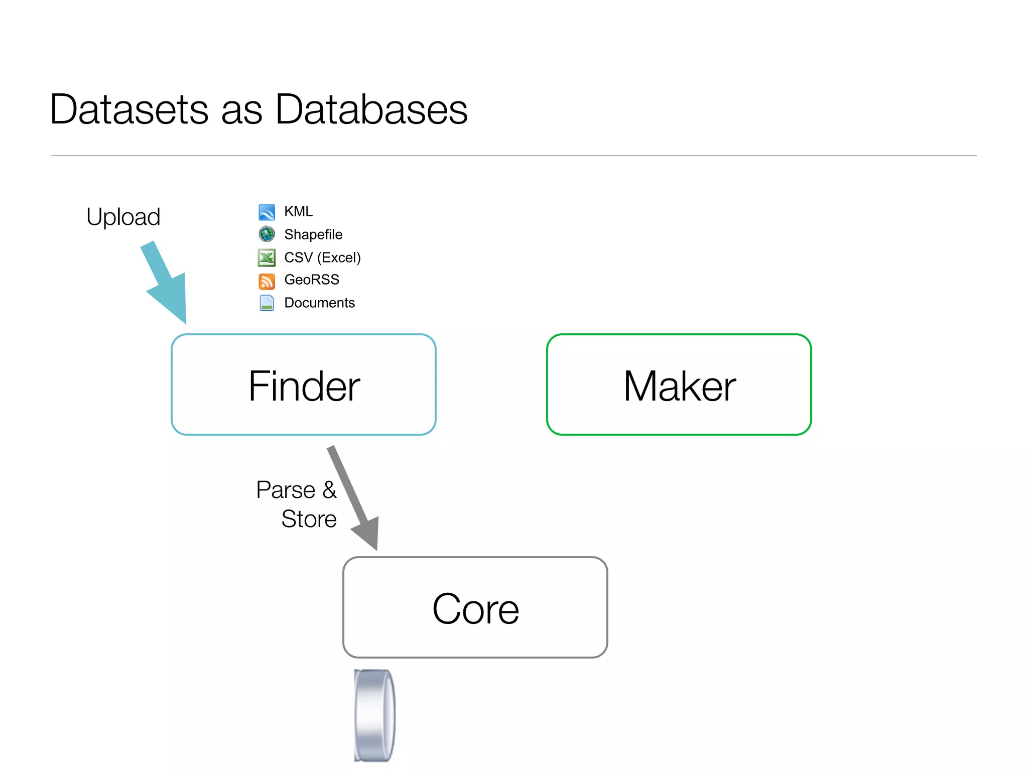
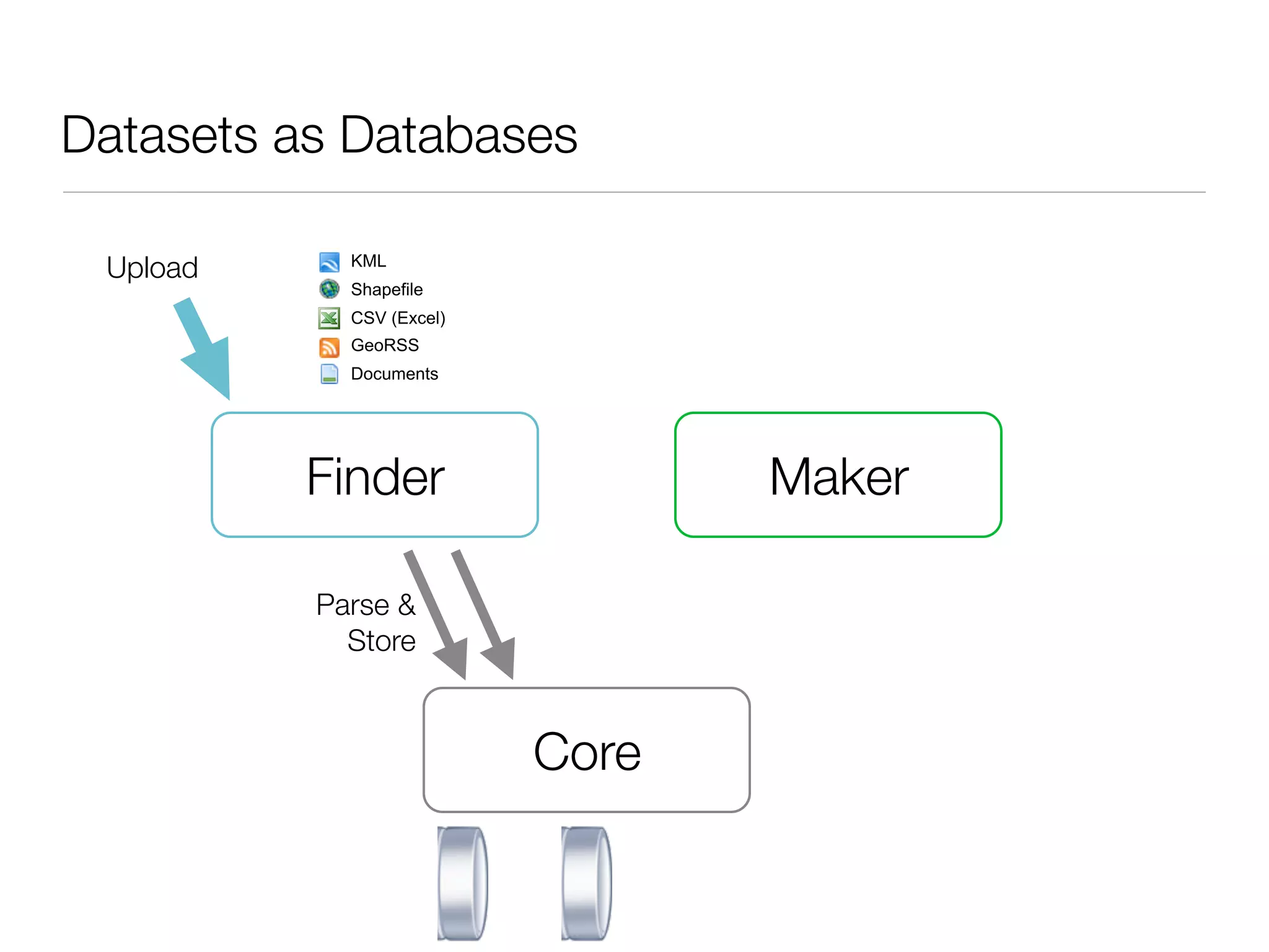
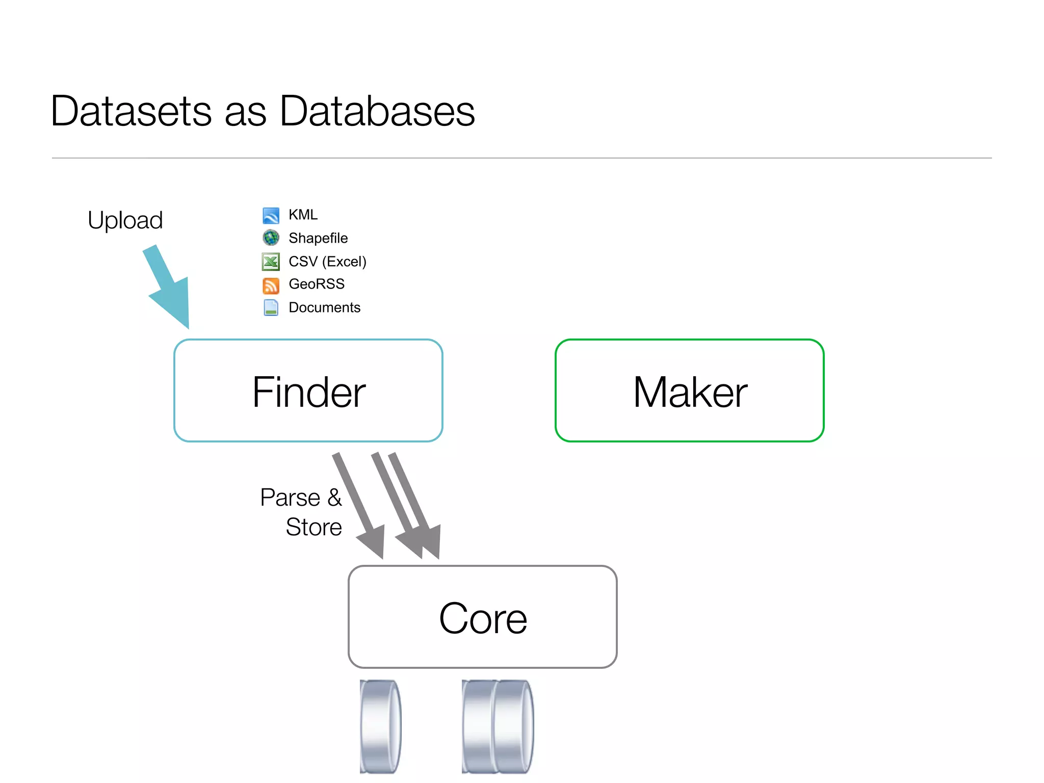
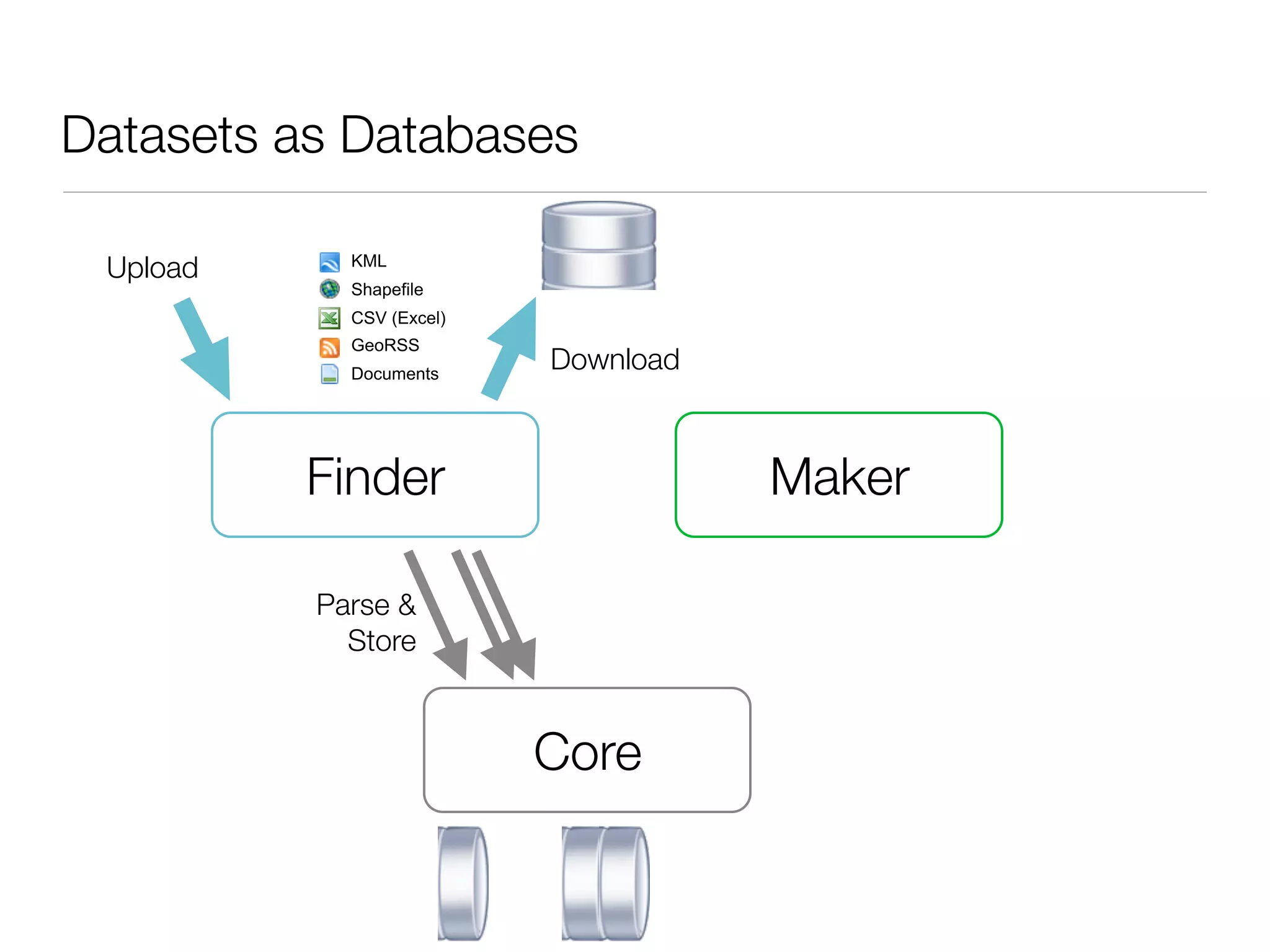
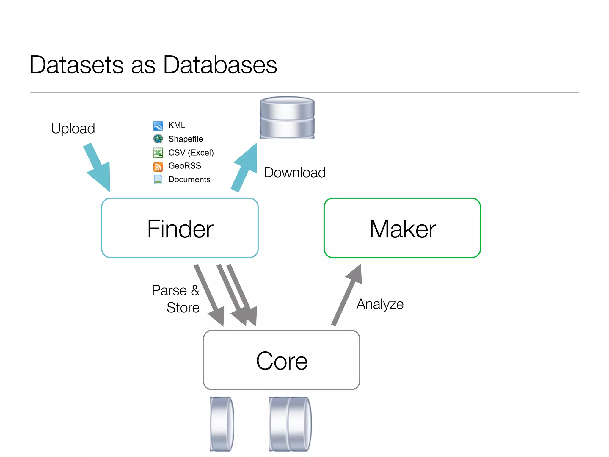
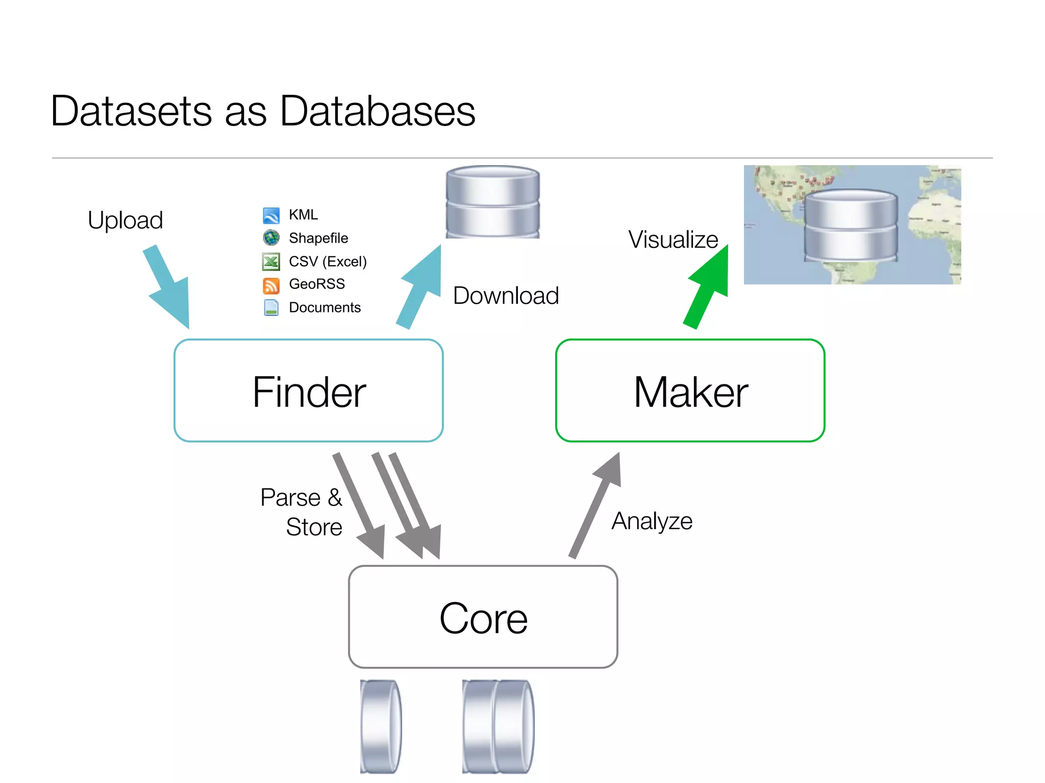
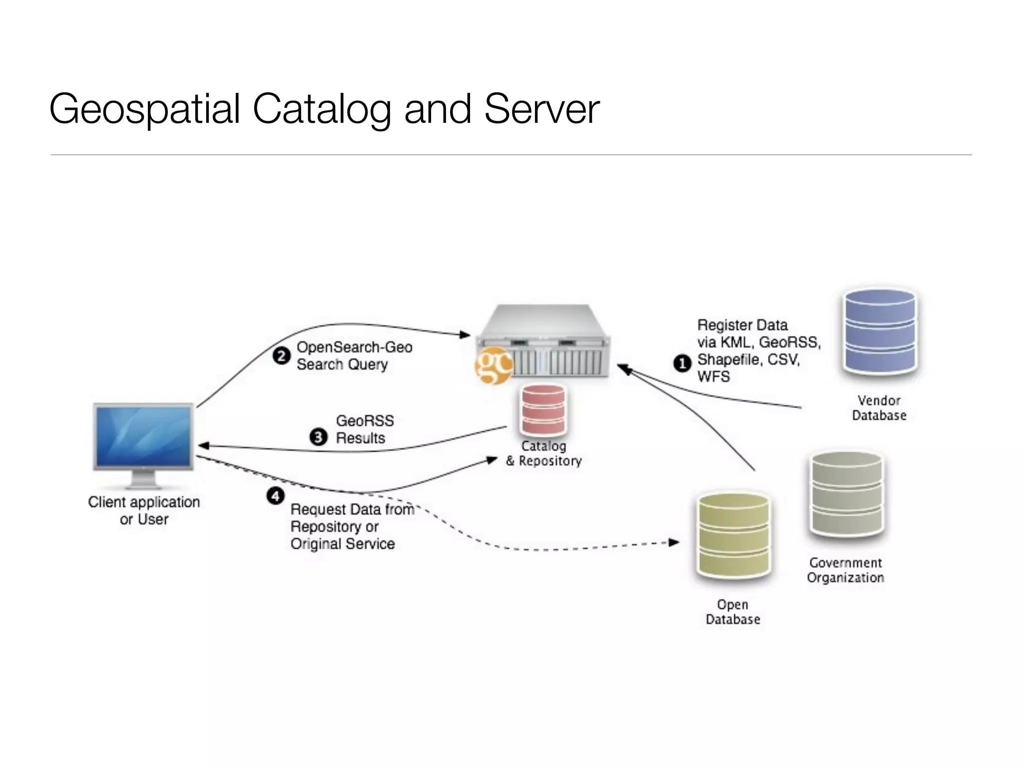


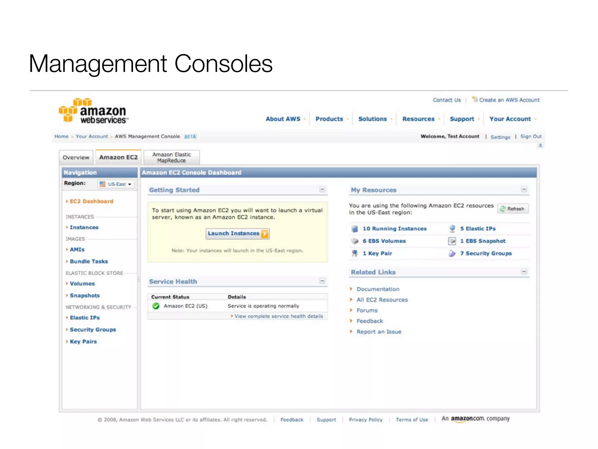
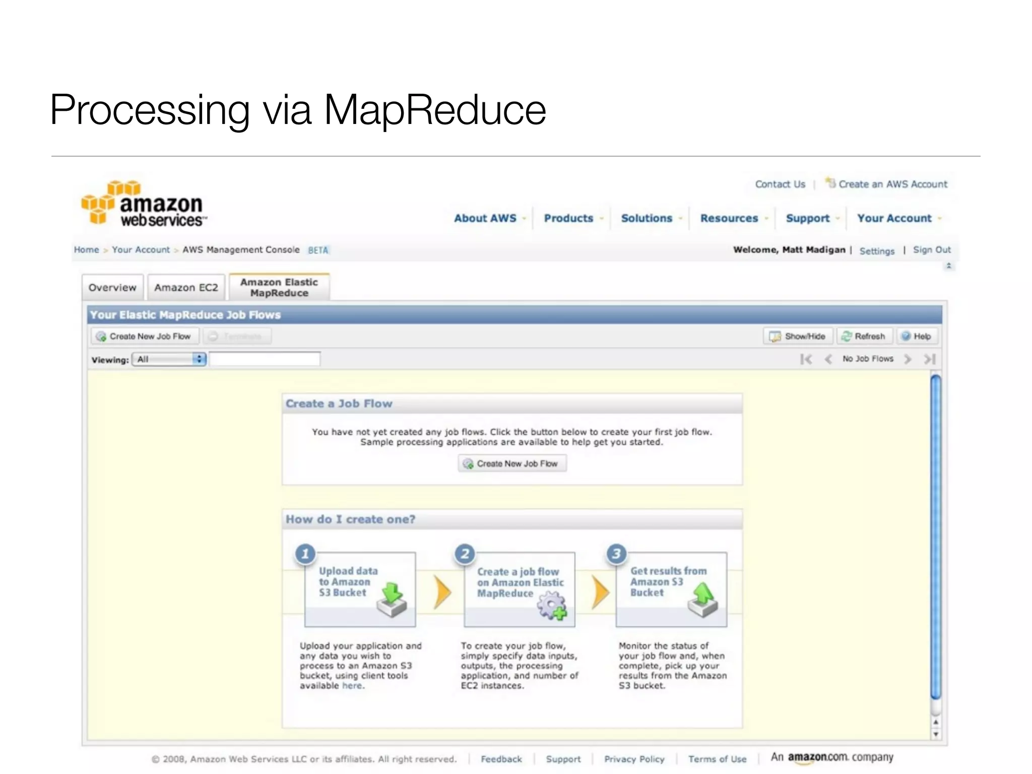
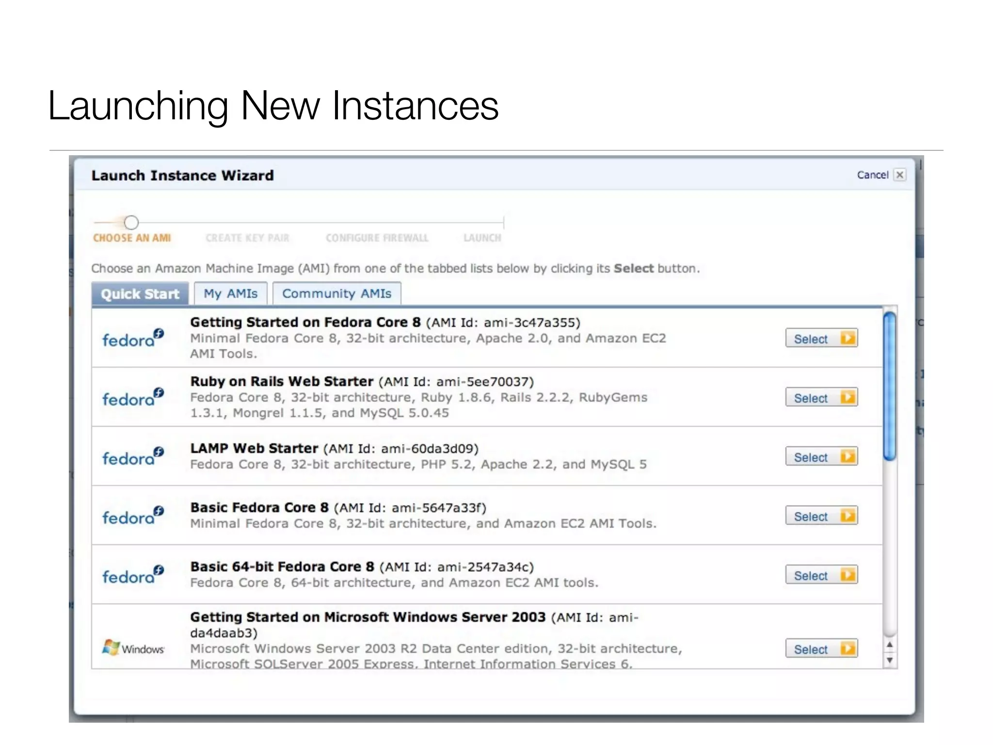
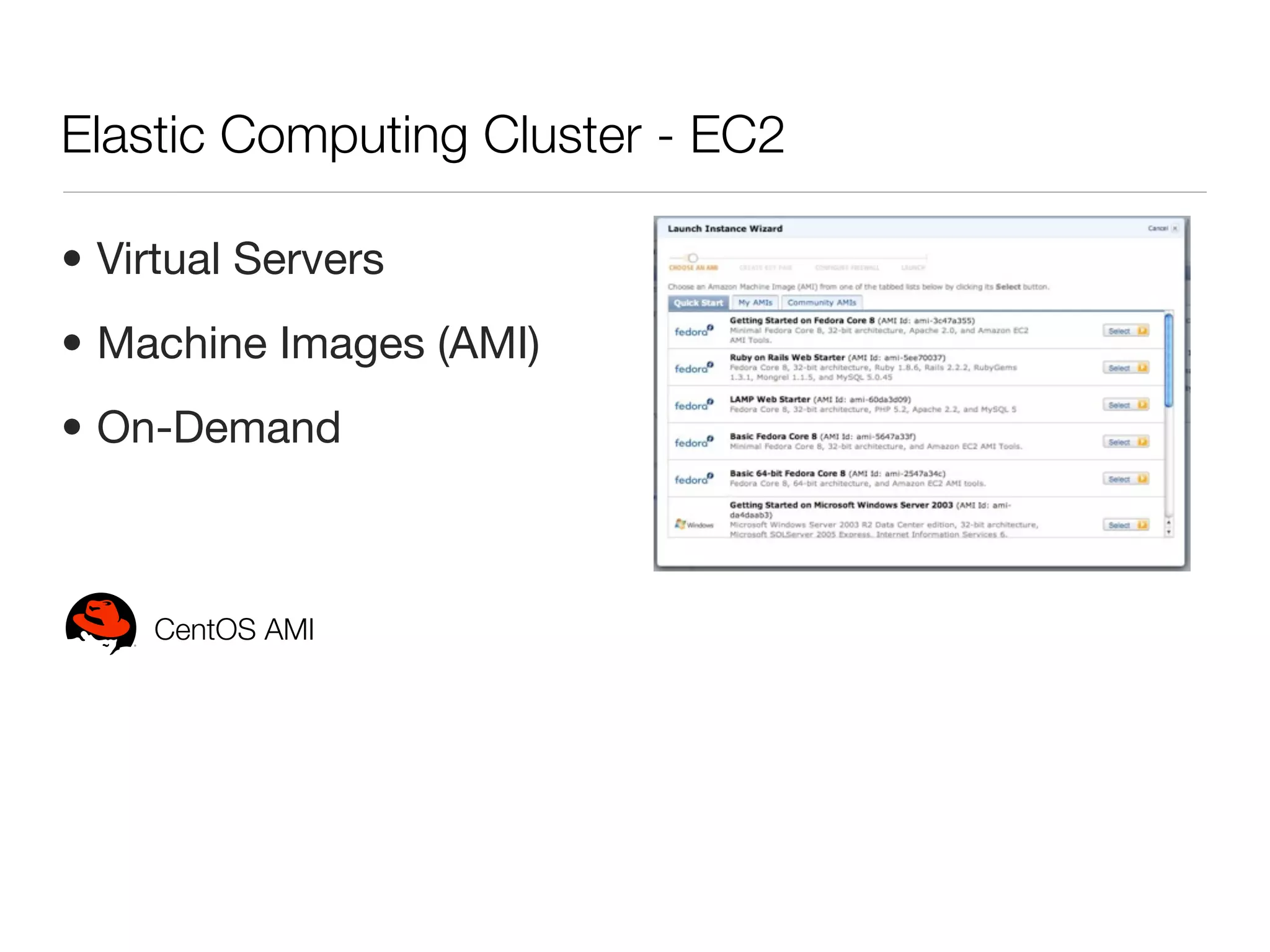
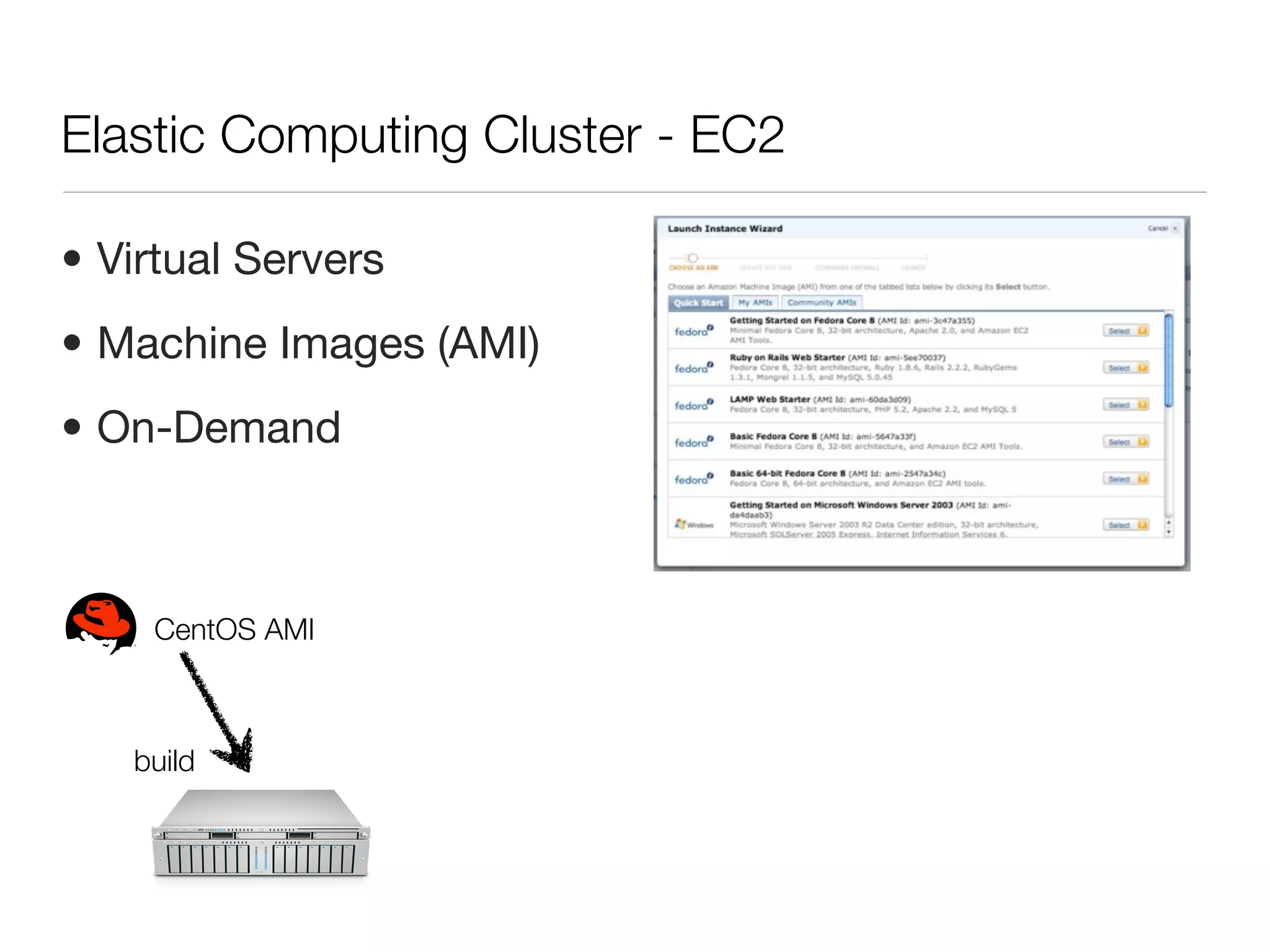
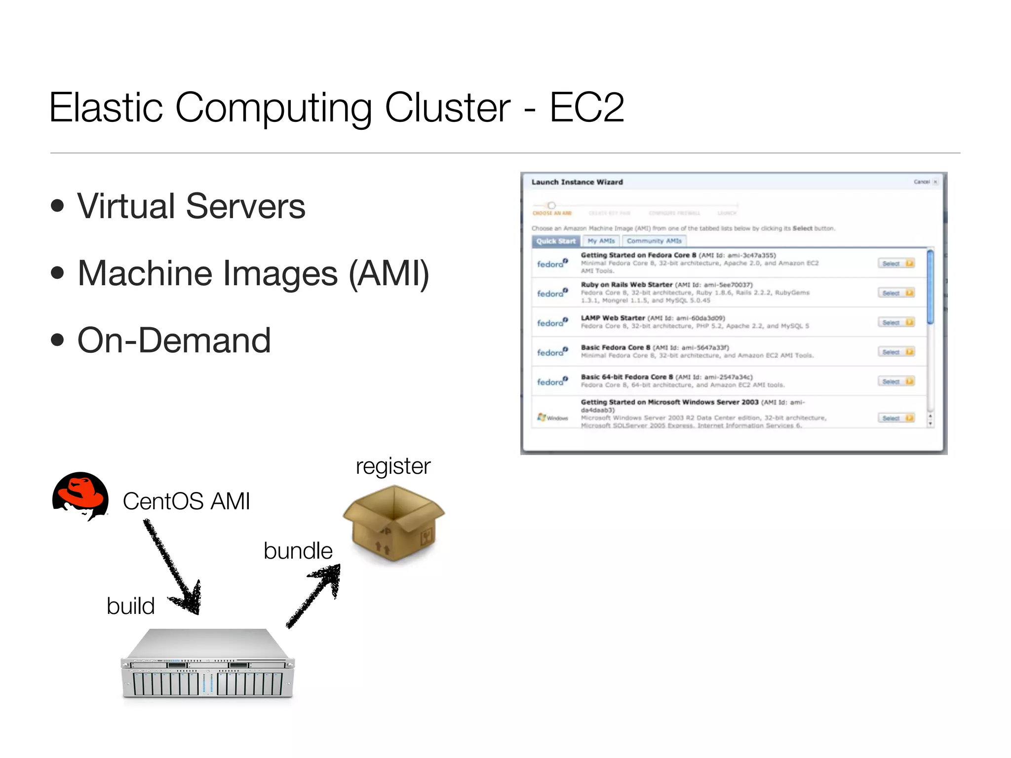
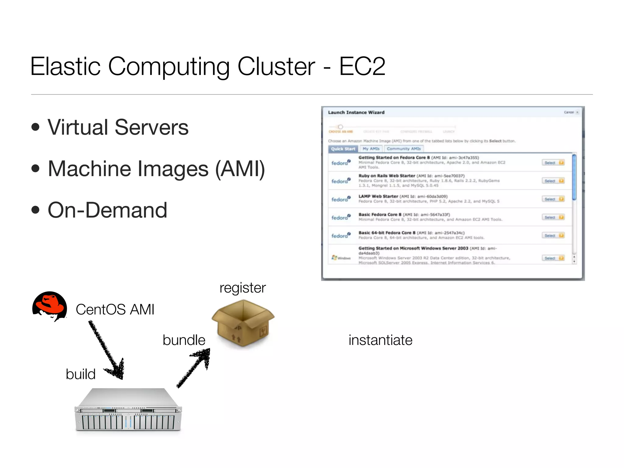
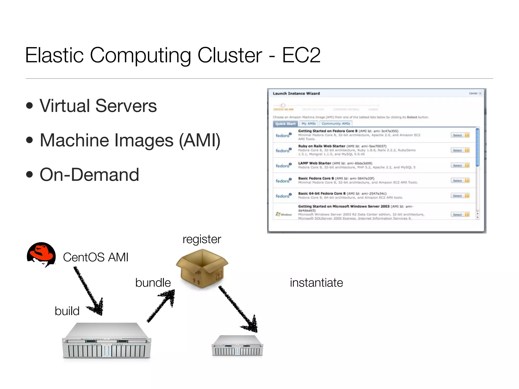
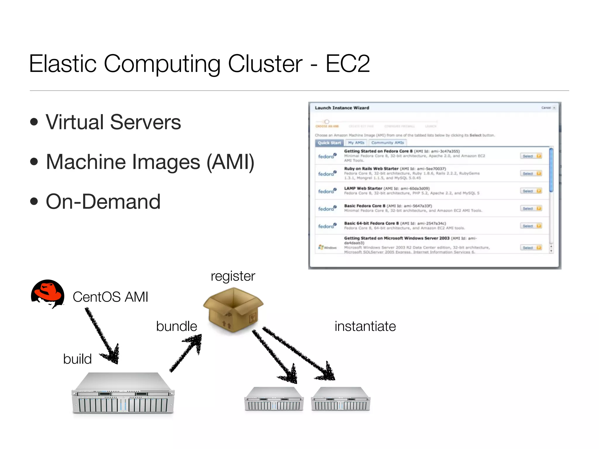
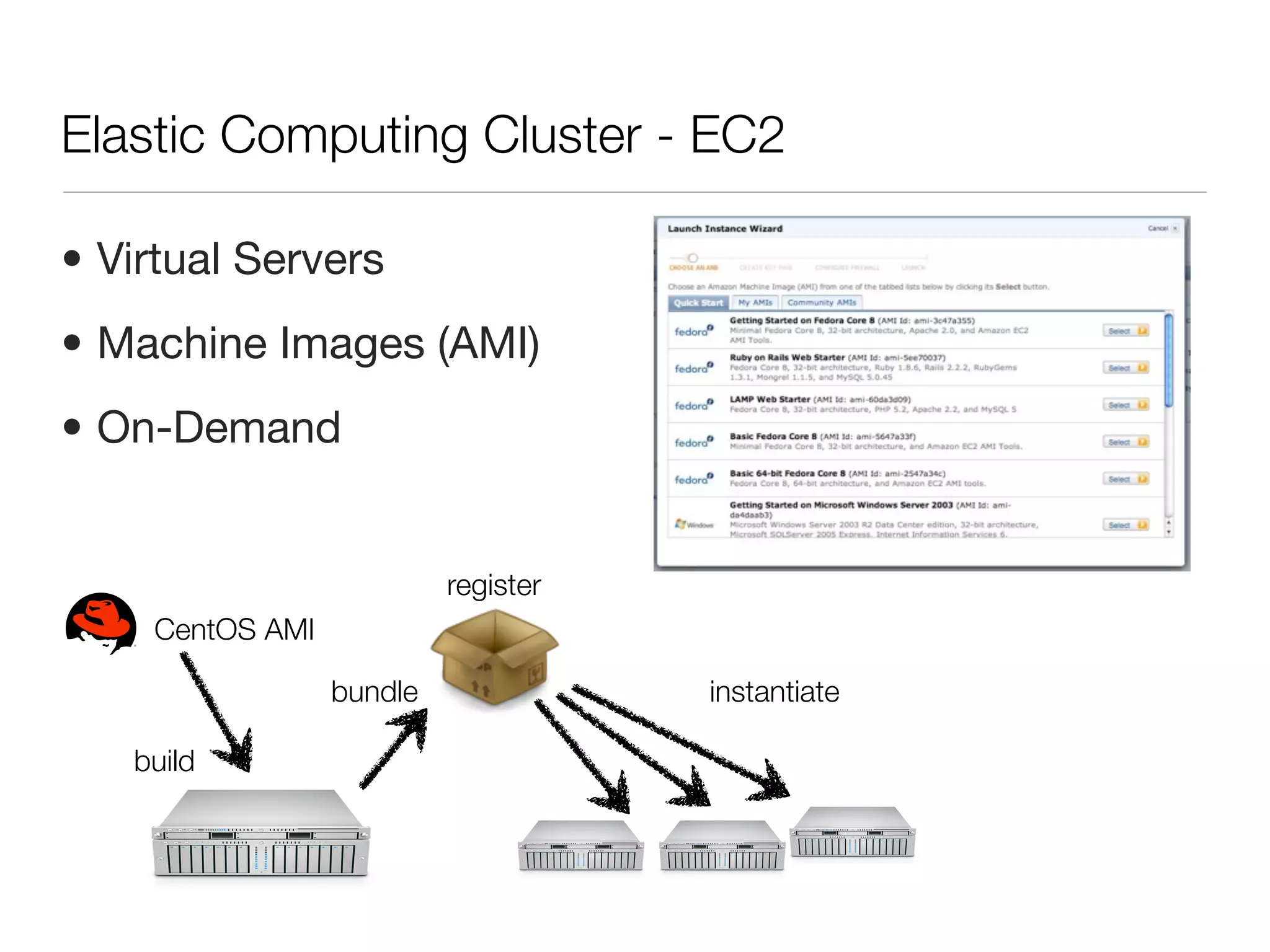
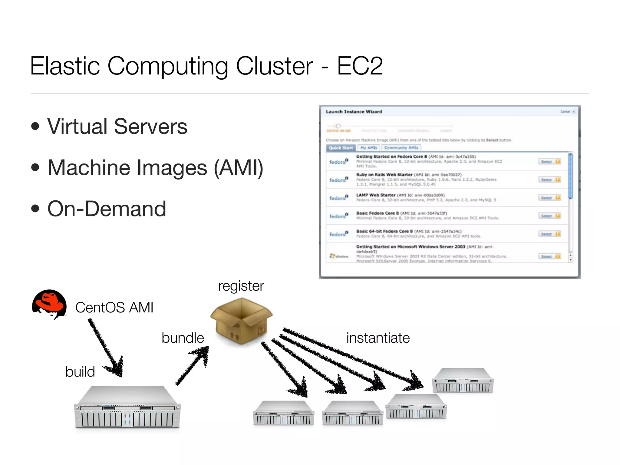
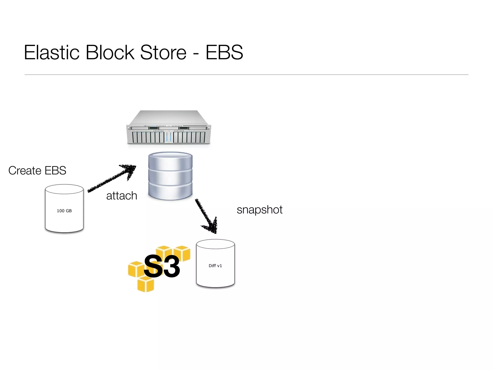
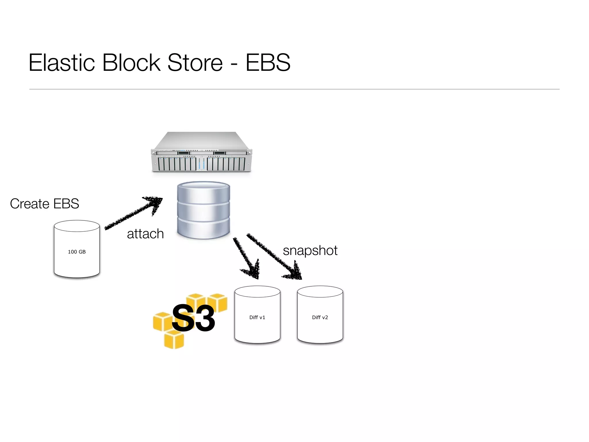
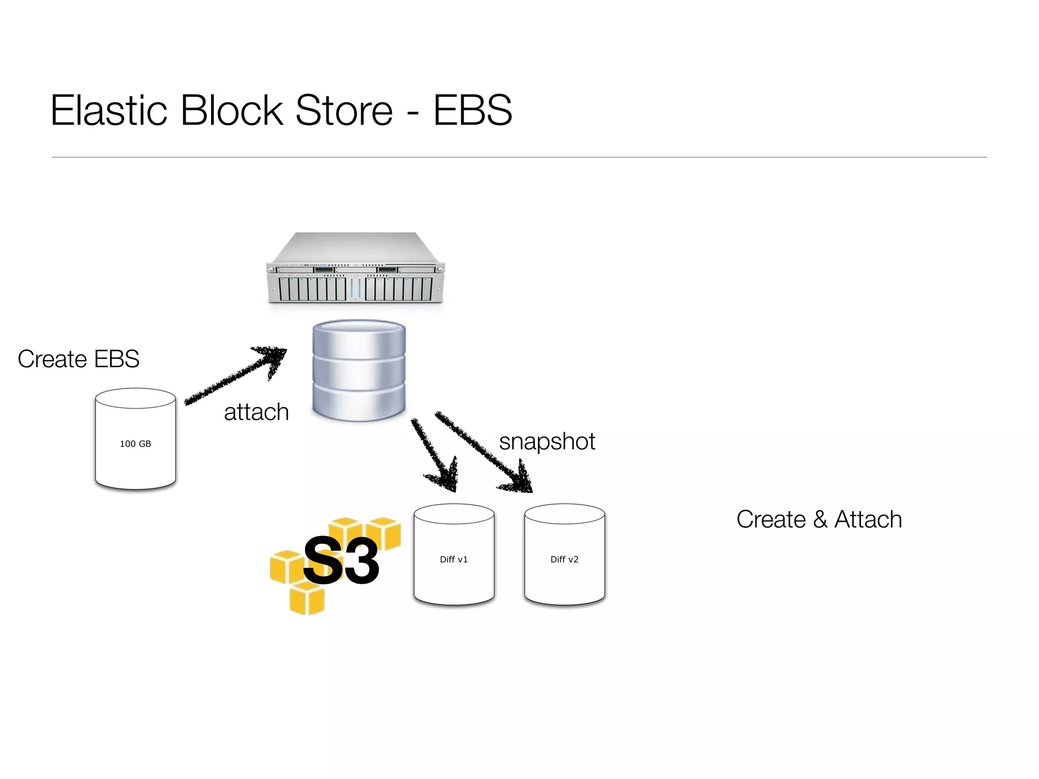
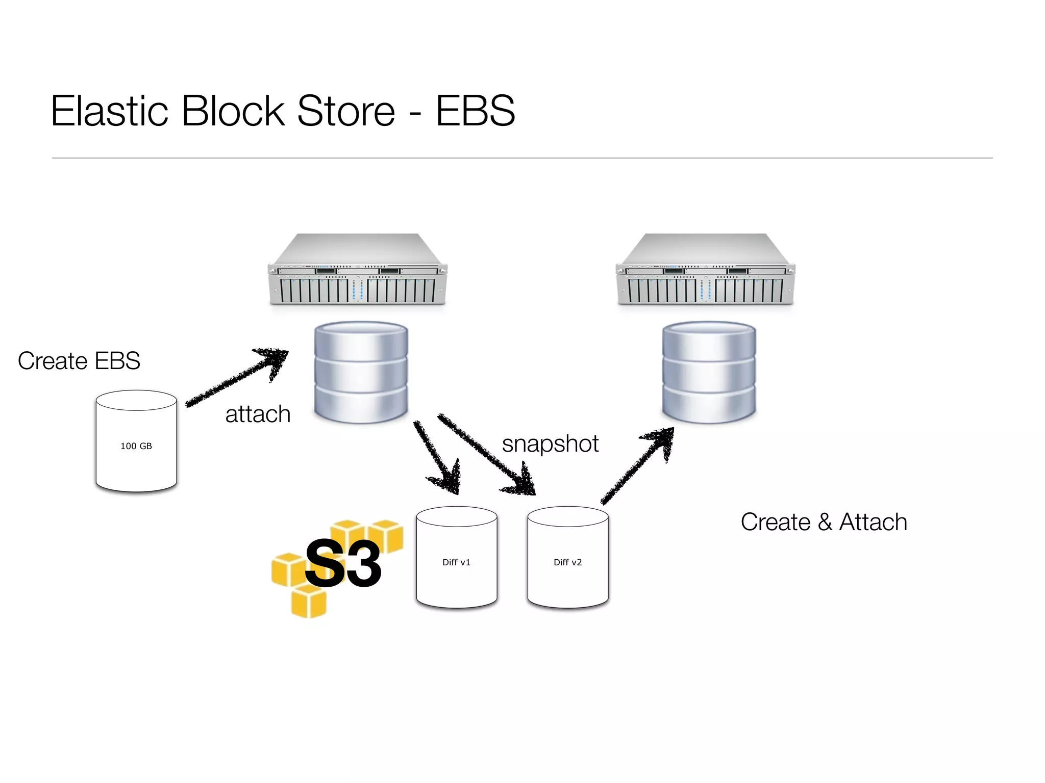
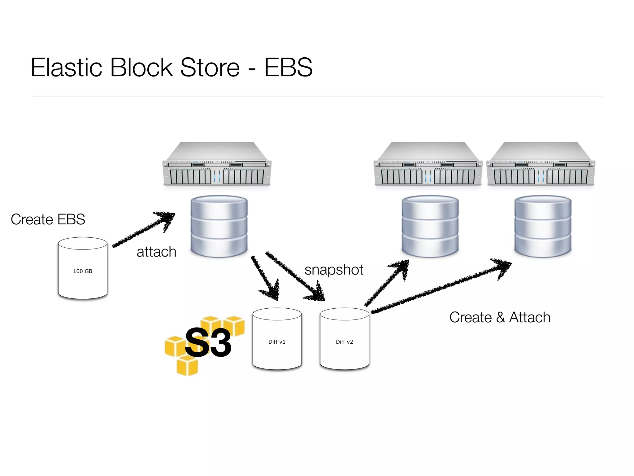
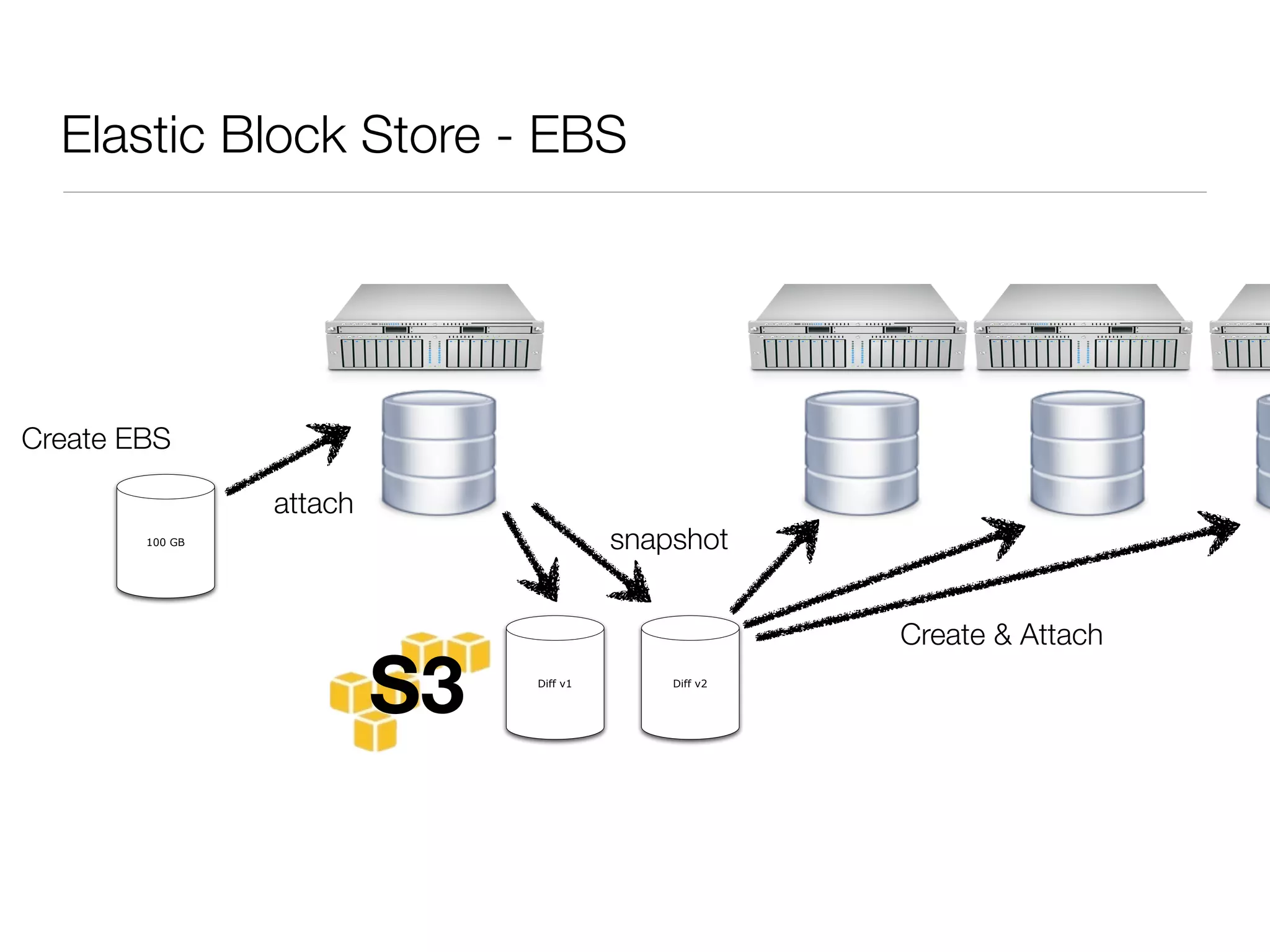
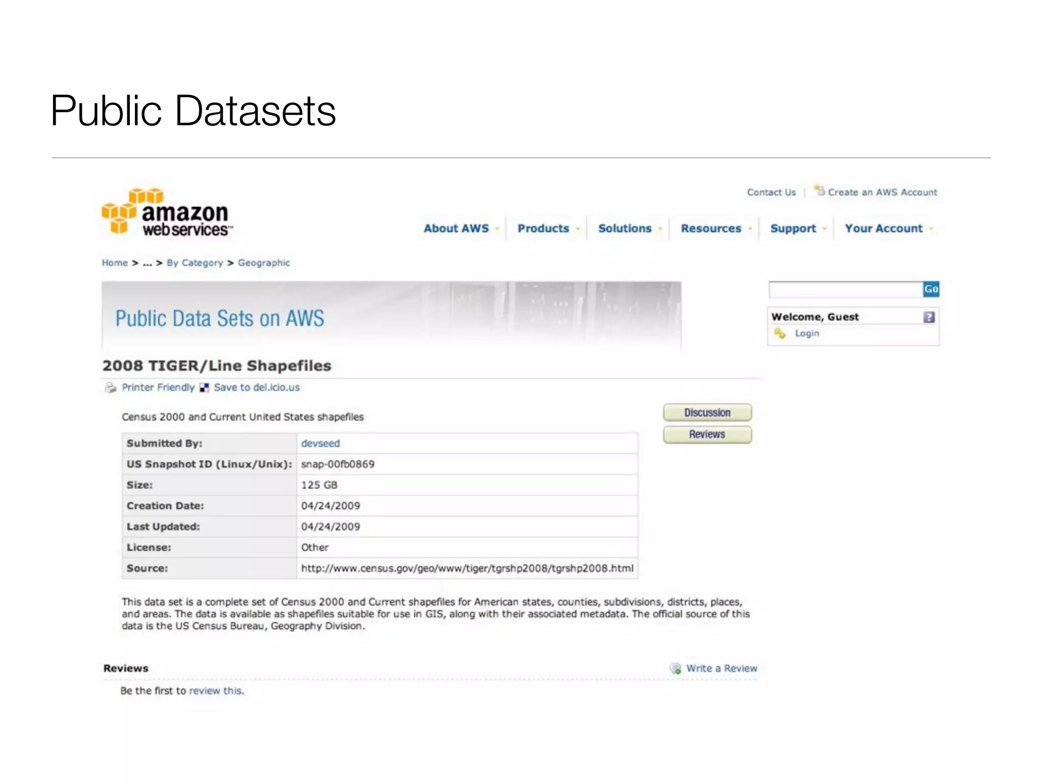
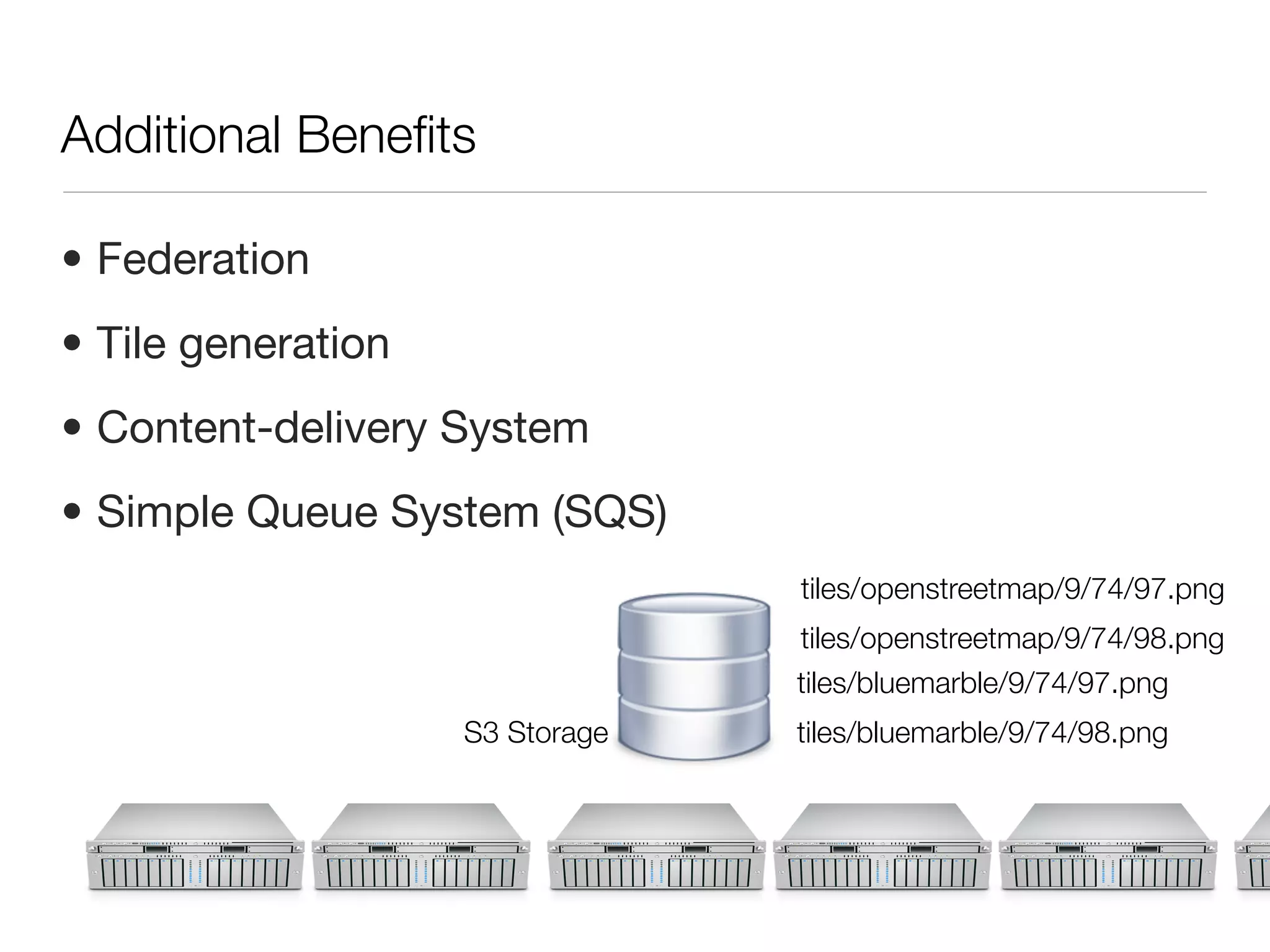
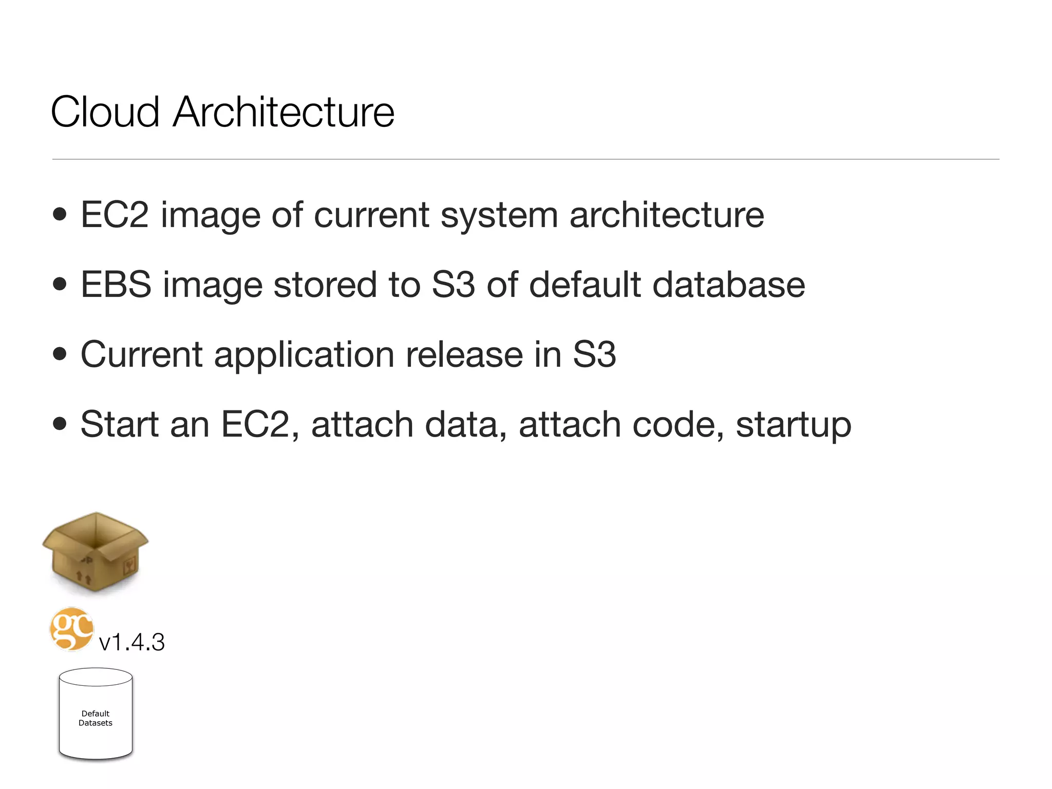
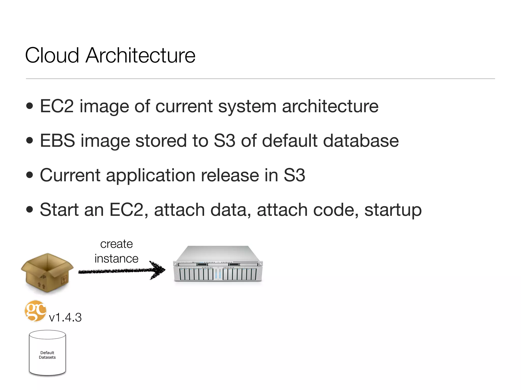
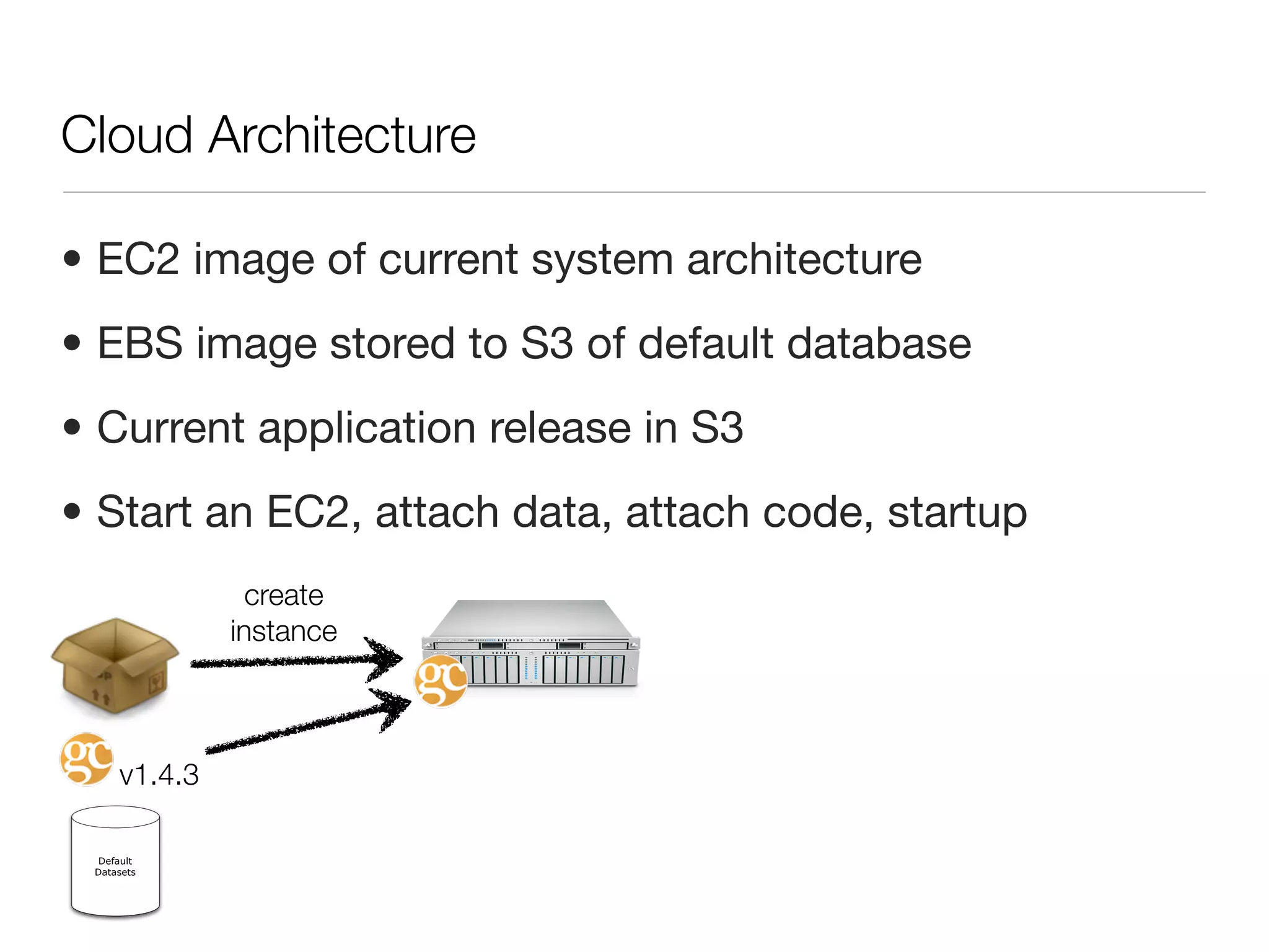
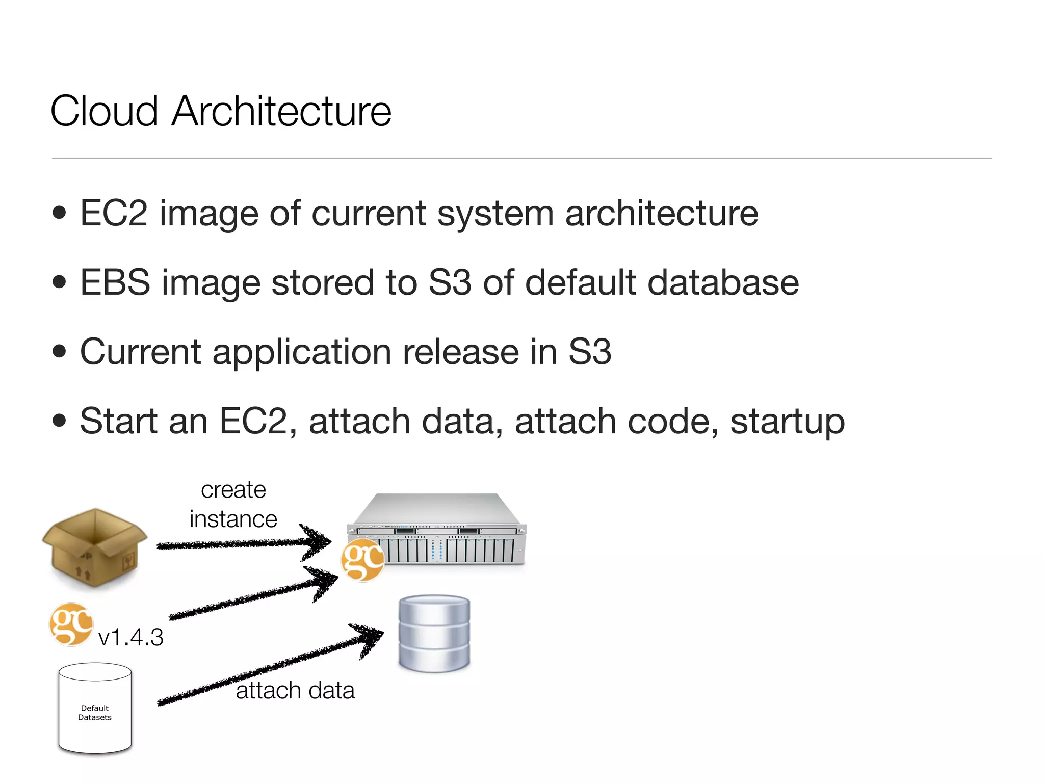
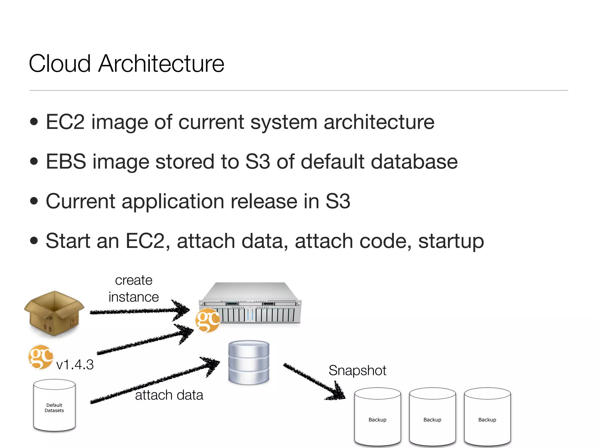
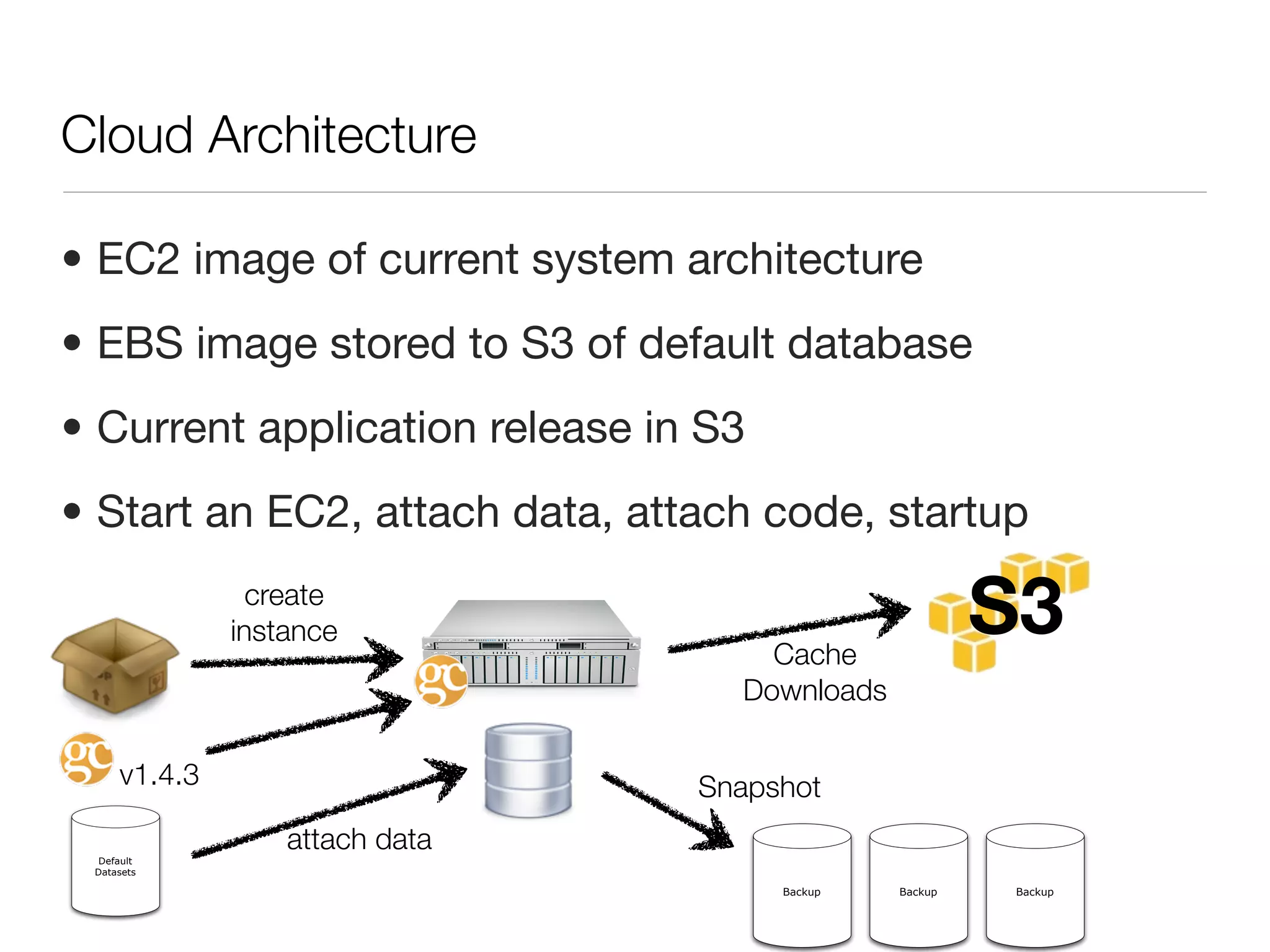

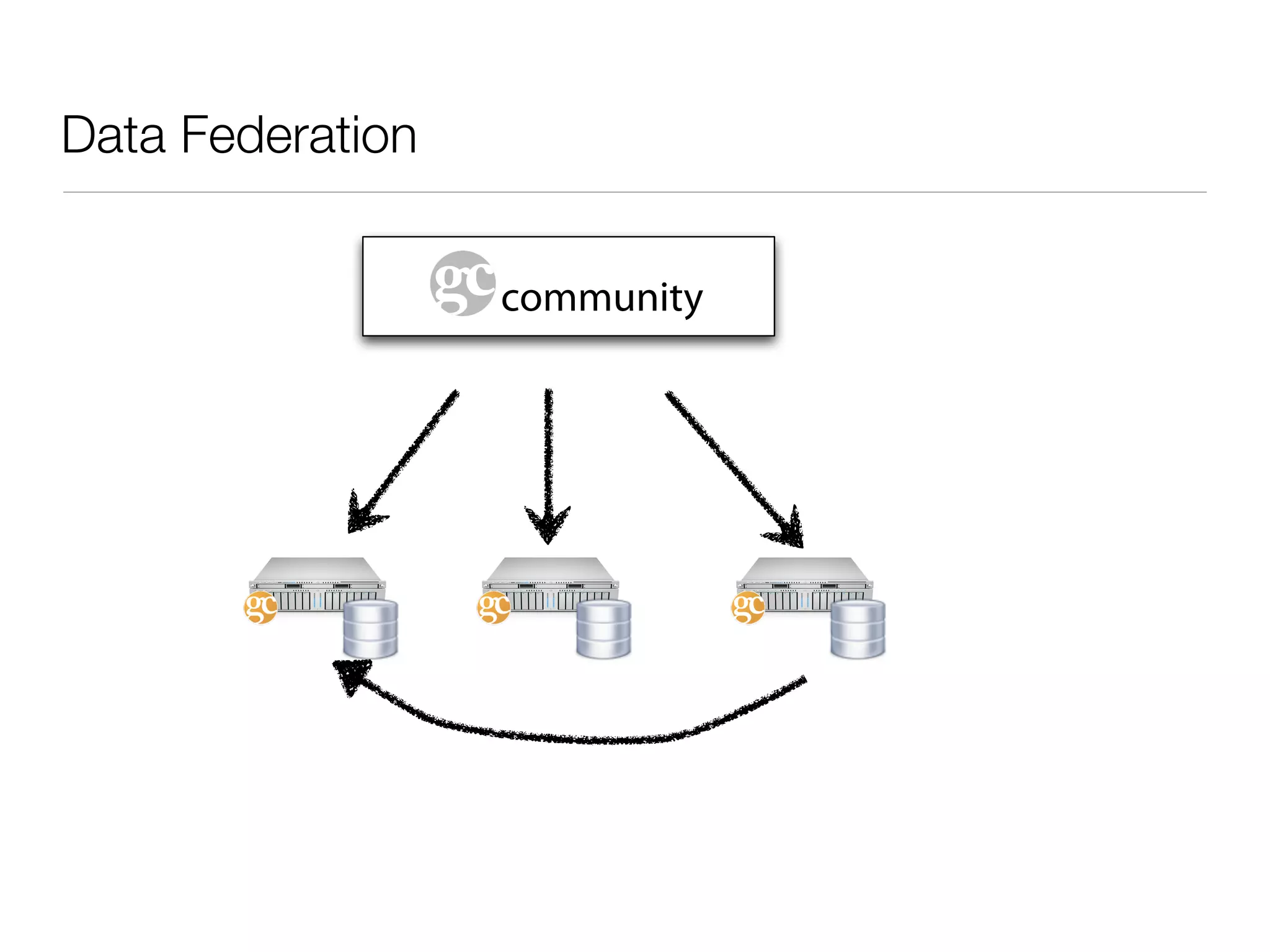
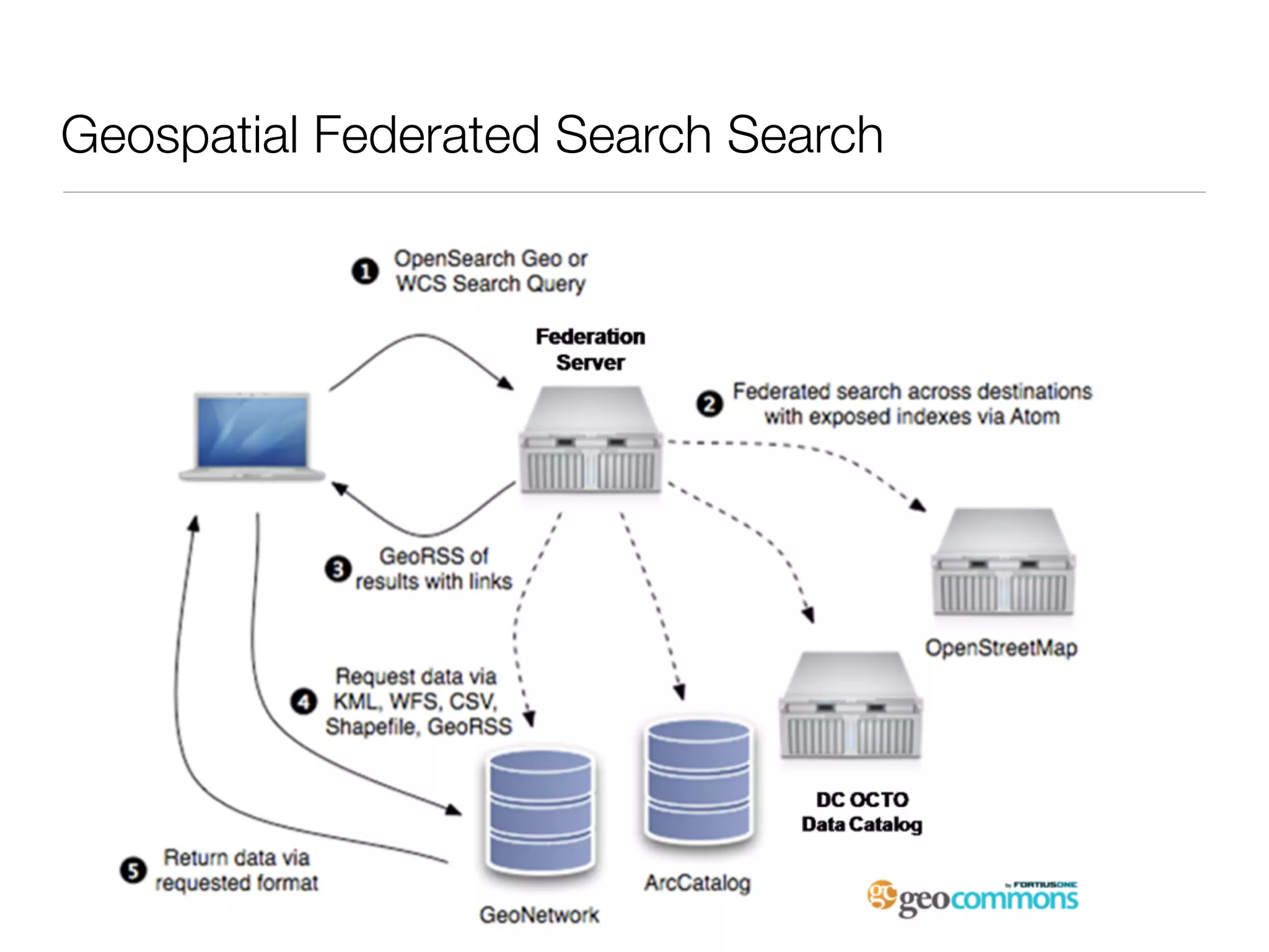
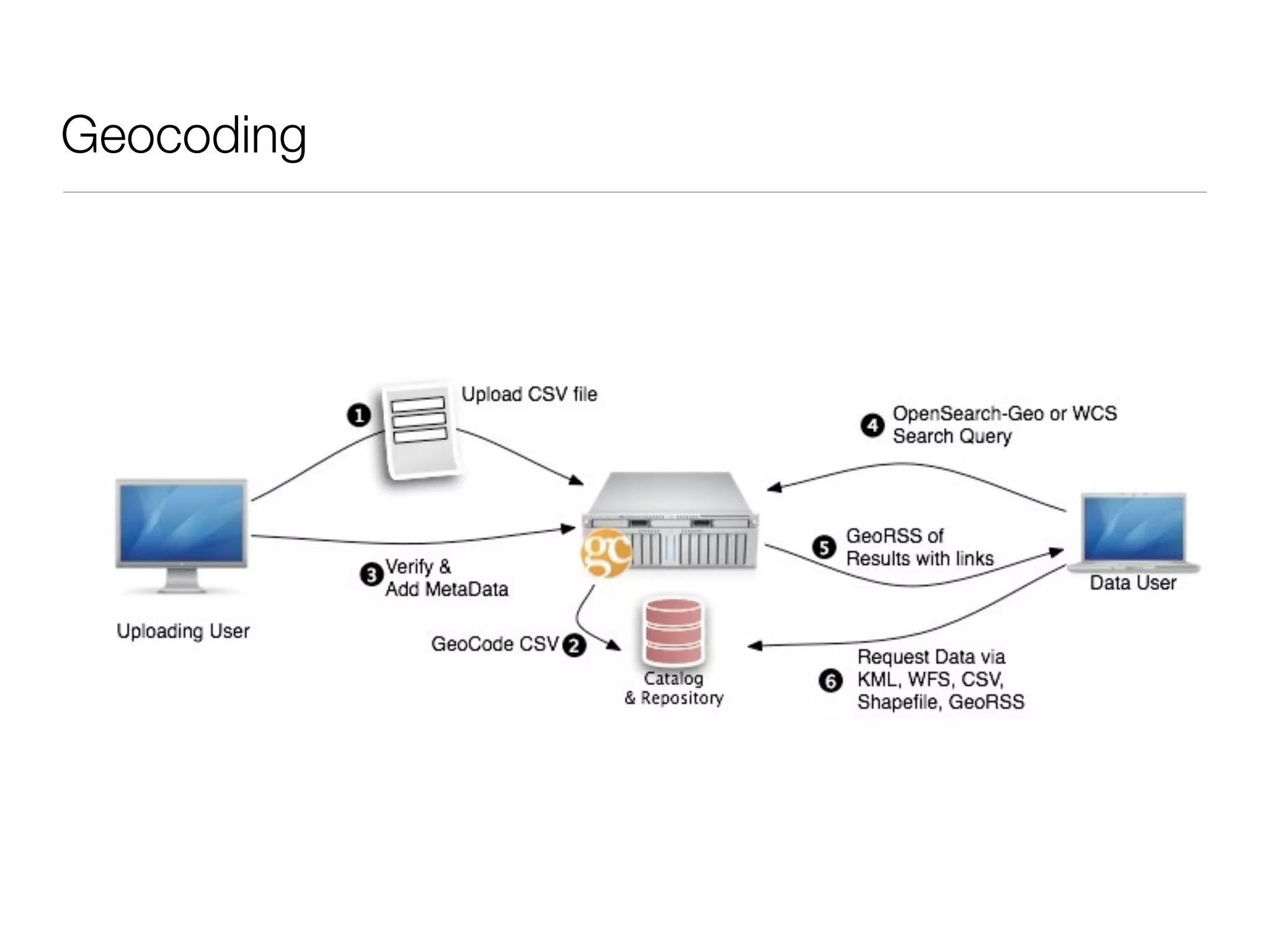
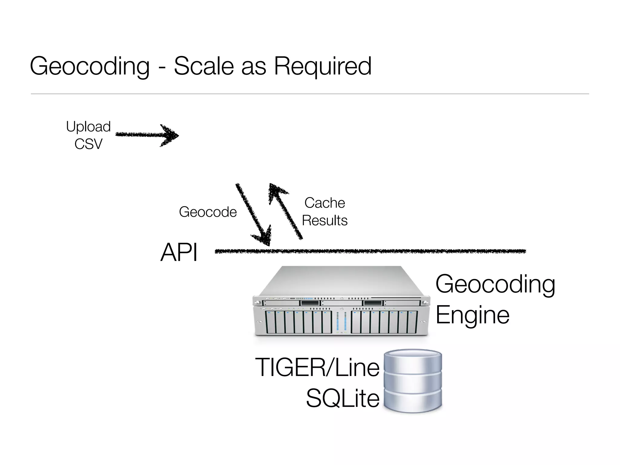
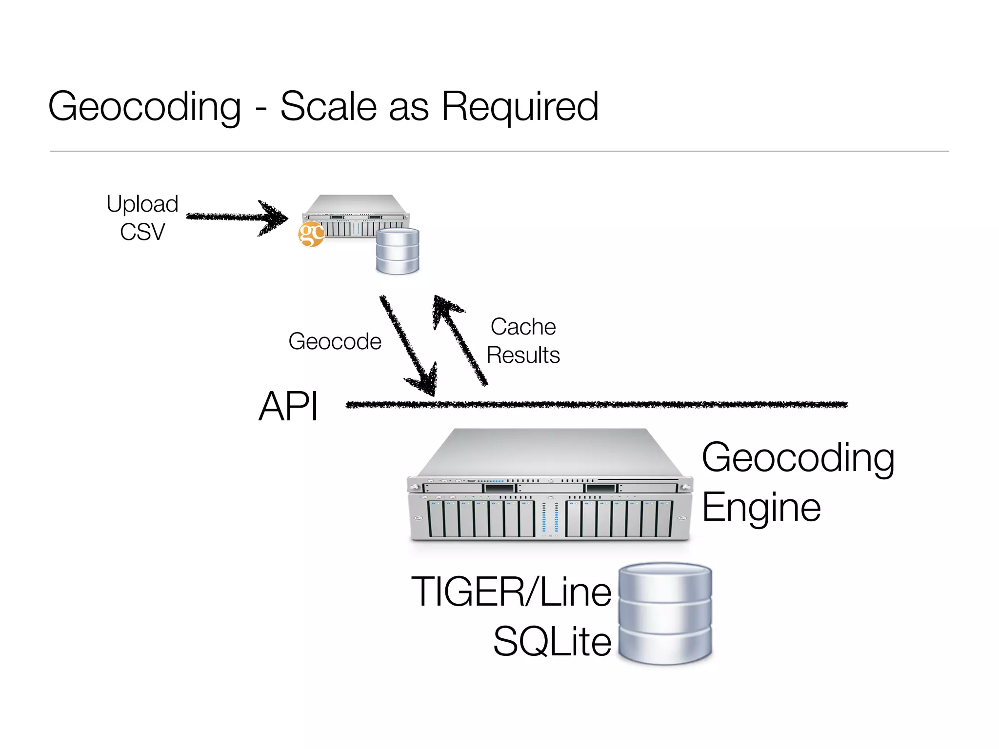

This document discusses using cloud computing for scalable geospatial data processing and access. Key points include: - Leveraging cloud platforms like Amazon Web Services allows scaling computational resources elastically on demand. - Data can be stored redundantly across multiple availability zones for reliability. - A modular architecture with APIs allows components like geocoding to scale independently as needed.


![[よくわかるAmazon Redshift]Amazon Redshift最新情報と導入事例のご紹介](https://cdn.slidesharecdn.com/ss_thumbnails/20140219redshiftupdatesv1tokyo-140224010117-phpapp02-thumbnail.jpg?width=640&height=640&fit=bounds)


![Coded Agents – with UiPath SDK + LangGraph [Virtual Hands-on Workshop]](https://cdn.slidesharecdn.com/ss_thumbnails/codedagentsdeck-251215155422-5497c599-thumbnail.jpg?width=640&height=640&fit=bounds)


![Vibe Coding vs. Spec-Driven Development [Free Meetup]](https://cdn.slidesharecdn.com/ss_thumbnails/vibecodingvsspecdrivendevelopment-251209105622-43f455e7-thumbnail.jpg?width=640&height=640&fit=bounds)


