This presentation covers the Urban Planning stages of Bhubaneswar, one of India's first modern cities along with Jamshedpur and Chandigarh. This city, the current capital of the coastal state of Odisha, was planned the German architect and urban planner, Otto Konigsberger, who also happens to be the author of 'Manual of Tropical Housing and Building.'
National Urban Housing and Habitat Policy-2007JIT KUMAR GUPTA
Presentation looks at the intent, content and scope of National Housing Policy 2007; Housing Finance Institutions, PMAY(U), in the context of housing for all in urban India
Chennai the fourth largest metropolis in India. Chennai Metropolitan Area (CMA) extends over 1189 sq.km.and comprises of
Chennai Corporation,
16 Municipalities,
20 Town Panchayats and
214 villages covered in 10 Panchayats Unions
It encompasses the Chennai District (176 sq.km.), part of Thiruvallur District (637 sq.km.) and a part of Kancheepuram District (376 sq.km.).
INTRODUCTION
COORDINATES - 23.22 ON 72.680 E ELEVATION - 265 feet (81 m)*
LOCATED 23 KM NORTH OF AHEMDABAD (FIN CAP. OF GUJARAT)
PLANNED IN 1960S BY, PRAKASH M APTE & H. K. MEWADA,
AFTER PARTITION OF BOMBAY * STATE : AHEMDABAD WAS MADE AS THE CAPTAL OFGUJARAT
AREA TOTAL 177KM2 ELEVATION : 8IM ( 266 FT)
POPULATION (2011)
TOTAL: 206,167 DENSITY : 1,200/KM2
CLIMATE*
TROPICAL WET AND DRY CLIMATE•
SUMMER MAXIMUM - 36 to 42 °C MINIMUM - 19 to 27 C
WINTER MAXIMUM - 29 C MINIMUM - 14°C
MONSOON: THE AVERAGE ANNUAL RAINFALL IS AROUND 803.4 MM
LANGUAGES
GUJARATI, HINDI, AND ENGLISH• 54% GREEN COVER ON ITS LAND AREA
• THE CITY SITS ON THE BANKS OF THE SABARMATI RIVER, IN NORTH-CENTRALEAST GUJARAT
HISTORY
IN 1960, THE INDIAN STATE OF BOMBAY WAS SPLIT INTO TWO STATES, MAHARASHTRA AND GUJARAT LEAVING GUJARAT WITHOUT A CAPITAL CITY.
AT THE TIME AHMEDABAD WAS SELECTED TO BE THE FIRST CAPITAL OF THE NEWLY CREATED STATE.
• IT WAS LATER PROPOSED THAT A NEW CAPITAL CITY BE CONSTRUCTED FOR THE STATE.
• GANDHINAGAR GOT AN IDENTITY OF ITS OWN WHEN THE STATE OF MUMBAI WAS DIVIDED INTO TWO SEPARATE STATES OF GUJARAT AND MAHARASHTRA.
• IN THE BEGINNING, AHMEDABAD - A COMMERCIAL HUB OF GUJARAT WAS CHOSEN AS THE STATE CAPITAL AND IT WAS PROPOSED THAT A NEW CAPITAL SHOULD BE CONSTRUCTED ALONG THE LINE OF OTHER NEW STATE CAPITALS, PARTICULARLY CHANDIGARH
• THEREFORE TWO WELL-KNOWN INDIAN ARCHITECTS, H.K. MEWADA AND PRAKASH M. APTE (WHO WORKED AS BEGINNER FOR THE CHANDIGARH CITY) DESIGNED THE NEW STATE CAPITAL*
NAMED AFTER MAHATMA GANDHI THE FOUNDATION STONE OF THIS CITY WAS LAID ON 1965 AND IN 1971 THE CAPITAL WAS SHIFTED FROM AHMEDABAD TO GANDHINAGAR
PLANNING
• PLANNED AND IMPLEMENTED BETWEEN 1965-1970
• DETERMINATION TO MAKE GANDHINAGAR A PURELY INDIAN ENTERPRISE, PARTLY BECAUSE GUJARAT WAS THE BIRTHPLACE OF GANDHI.
• TO ESTABLISH AND MAINTAIN A SEPARATE IDENTITY FOR THE NEW CITY THE SURROUNDING AREA OF ABOUT 39 VILLAGES WAS BROUGHT UNDER A PERIPHERY CONTROL ACT (AS IN CHANDIGARH)
• THE AREA LATER CONSTITUTED A SEPARATE ADMINISTRATIVE DISTRICT OF GANDHINAGAR.
• THE CITY WAS PLANNED FOR A POPULATION OF 150,000 BUT CAN ACCOMMODATE DOUBLE THAT POPULATION WITH INCREASE IN THE FLOOR SPACE RATIO FROM 1 TO 2 IN THE AREAS RESERVED FOR PRIVATE DEVELOPMENT.
• THE RIVER BEING THE BORDER ON THE EAST, AND THE INDUSTRIAL AREA TO THE NORTH, THE MOST LOGICAL FUTURE PHYSICAL EXPANSION OF THE CITY WAS ENVISAGED TOWARDS THE NORTH-WEST
Urban Design-Literature study St. Marks Road, BangaloreAnsh Agarwal
Urban Planning
Literature study of St. Marks Road, Bangalore.
Includes:
1. Road Details
2. Survey Details & Analysis
3. Action Needed
4. Proposals
5. Action Made
6. Before & After Scenerio
7. Anatomy of Changes
Radburn, New Jersey is a town planned in 1929 by Clarence Stein and Henry Wright and landscape architect Marjorie Sewell Cautley.
It is based on Radburn Theory of Town Planning.
It is America's first garden community serving as a worldwide example of the harmonious blending of private area and open spaces.
The intent was to built a community which made provisions for the complexities of modern life while still providing open spaces and being economically viable
The community was intended to be a self sufficient entity with residential, Commercial and industrial areas each supplementing the needs of others.
LAND USE /LAND COVER CLASSIFICATION AND CHANGE DETECTION USING GEOGRAPHICAL I...IAEME Publication
Land use and land cover change has become a central component in current strategies for managing natural resources and monitoring environmental changes. Geographical information system and image processing techniques used for the analysis of land use/land cover and change detection of Sukhana Basin of Aurangabad District, Maharashtra state. The tools used ArcGIS10.1 and ERDAS IMAGINE9.1, landsat images of 1996, 2003and 2014. From land use / land cover change detection it is found that during 1996-2014, water bodies cover have loss of 4 Sq. Km. Barren land have 146 Sq.Km. loss and forest area with 96 Sq.Km. loss. It is found that urbanization area has gain of 51 Sq.Km. and agricultural land cover also have gain of 195 Sq.Km.
I’m professional presentation maker . These presentations are for sale for 20$ each, if required you can contact me on my gmail id bestpptmaker@gmail.com and you can also suggest me topics for your required presentations
Water availability assessment in shipra rivereSAT Journals
Abstract Water availability analysis was carried out in Ujjain Basin part of Shipra Basin located in Madhya Pradesh state, at various probabilities for different dependable flow volumes. The flow regime was analyzed in this study using Flow Duration curve technique and the model was developed using MIKE BASIN software. Through MIKE model was developed for the whole Shipra Basin, a diversion canal in the name of KHAN Diversion and Narmada-Shipra link is added. In this study the flow at Ujjain city is mainly influenced by Khan diversion which is developed in the model and Narmada-Shipra link. Three scenarios were developed and net flow to Ujjain city were studied and analyzed for Khumb Mela that is to be held in 2016. The water availability analysis was performed for the individual months. In the present study the availability of dependable flow volumes were calculated month wise at 70, 75, 80, 85, 90, 95 and 100% probability of exceedance. Key Words: water availability, flow duration curve, MIKE BASIN model, Khan Diversion, Narmada-Shipra link.
Emerging City Report - Vijayawada (2014)ResearchFox
This report helps analyze and disseminate information on global emerging cities. The report focuses on the demand and supply of talent both lateral and inexperienced/ freshers, availability of cost-effective infrastructure and other factors that make it a feasible and attractive option for organizations looking to expand and grow in this region and remain competitive.
The objective of this research is to conduct in-depth talent pool and location analysis of respected emerging city across identified technology functions which can provide a detailed view of this emerging location and opportunities for growth.
Salt Lake City is a planned satellite town in the Indian state of West Bengal. It was developed between 1958 and 1965 to accommodate the burgeoning population of Kolkata.
Rethinking Bashundhara Residential Area as a Future CitySumaiya Islam
Urban Design project on Bashundhara Residential Area. Proposals to make the city futuristic and sustainable. So that it can be utilized in rest of the undeveloped areas of Dhaka.
Region: A territorial area of similar characteristics, which is bigger than local area and smaller than the country / nation,
Regions in India, city region & linkages like economic, functional and transportation,
Rural-Urban Linkage,
Rural-Urban Fringe,
Urban periphery settlements: Urban Village and Unauthorised colony/ illegal-land sub-division,
Land Ceiling Repeal Act 1999
A documentation of our study, critical appraisal and analysis of the area around the Rourkela Railway Station and the attempt to transform the zone into a Multi-Modal Hub keeping in purview the close proximity of the Bus Station and Intermediate Public Transport service.
UiPath Test Automation using UiPath Test Suite series, part 4DianaGray10
Welcome to UiPath Test Automation using UiPath Test Suite series part 4. In this session, we will cover Test Manager overview along with SAP heatmap.
The UiPath Test Manager overview with SAP heatmap webinar offers a concise yet comprehensive exploration of the role of a Test Manager within SAP environments, coupled with the utilization of heatmaps for effective testing strategies.
Participants will gain insights into the responsibilities, challenges, and best practices associated with test management in SAP projects. Additionally, the webinar delves into the significance of heatmaps as a visual aid for identifying testing priorities, areas of risk, and resource allocation within SAP landscapes. Through this session, attendees can expect to enhance their understanding of test management principles while learning practical approaches to optimize testing processes in SAP environments using heatmap visualization techniques
What will you get from this session?
1. Insights into SAP testing best practices
2. Heatmap utilization for testing
3. Optimization of testing processes
4. Demo
Topics covered:
Execution from the test manager
Orchestrator execution result
Defect reporting
SAP heatmap example with demo
Speaker:
Deepak Rai, Automation Practice Lead, Boundaryless Group and UiPath MVP
State of ICS and IoT Cyber Threat Landscape Report 2024 previewPrayukth K V
The IoT and OT threat landscape report has been prepared by the Threat Research Team at Sectrio using data from Sectrio, cyber threat intelligence farming facilities spread across over 85 cities around the world. In addition, Sectrio also runs AI-based advanced threat and payload engagement facilities that serve as sinks to attract and engage sophisticated threat actors, and newer malware including new variants and latent threats that are at an earlier stage of development.
The latest edition of the OT/ICS and IoT security Threat Landscape Report 2024 also covers:
State of global ICS asset and network exposure
Sectoral targets and attacks as well as the cost of ransom
Global APT activity, AI usage, actor and tactic profiles, and implications
Rise in volumes of AI-powered cyberattacks
Major cyber events in 2024
Malware and malicious payload trends
Cyberattack types and targets
Vulnerability exploit attempts on CVEs
Attacks on counties – USA
Expansion of bot farms – how, where, and why
In-depth analysis of the cyber threat landscape across North America, South America, Europe, APAC, and the Middle East
Why are attacks on smart factories rising?
Cyber risk predictions
Axis of attacks – Europe
Systemic attacks in the Middle East
Download the full report from here:
https://sectrio.com/resources/ot-threat-landscape-reports/sectrio-releases-ot-ics-and-iot-security-threat-landscape-report-2024/
Let's dive deeper into the world of ODC! Ricardo Alves (OutSystems) will join us to tell all about the new Data Fabric. After that, Sezen de Bruijn (OutSystems) will get into the details on how to best design a sturdy architecture within ODC.
Kubernetes & AI - Beauty and the Beast !?! @KCD Istanbul 2024Tobias Schneck
As AI technology is pushing into IT I was wondering myself, as an “infrastructure container kubernetes guy”, how get this fancy AI technology get managed from an infrastructure operational view? Is it possible to apply our lovely cloud native principals as well? What benefit’s both technologies could bring to each other?
Let me take this questions and provide you a short journey through existing deployment models and use cases for AI software. On practical examples, we discuss what cloud/on-premise strategy we may need for applying it to our own infrastructure to get it to work from an enterprise perspective. I want to give an overview about infrastructure requirements and technologies, what could be beneficial or limiting your AI use cases in an enterprise environment. An interactive Demo will give you some insides, what approaches I got already working for real.
GDG Cloud Southlake #33: Boule & Rebala: Effective AppSec in SDLC using Deplo...James Anderson
Effective Application Security in Software Delivery lifecycle using Deployment Firewall and DBOM
The modern software delivery process (or the CI/CD process) includes many tools, distributed teams, open-source code, and cloud platforms. Constant focus on speed to release software to market, along with the traditional slow and manual security checks has caused gaps in continuous security as an important piece in the software supply chain. Today organizations feel more susceptible to external and internal cyber threats due to the vast attack surface in their applications supply chain and the lack of end-to-end governance and risk management.
The software team must secure its software delivery process to avoid vulnerability and security breaches. This needs to be achieved with existing tool chains and without extensive rework of the delivery processes. This talk will present strategies and techniques for providing visibility into the true risk of the existing vulnerabilities, preventing the introduction of security issues in the software, resolving vulnerabilities in production environments quickly, and capturing the deployment bill of materials (DBOM).
Speakers:
Bob Boule
Robert Boule is a technology enthusiast with PASSION for technology and making things work along with a knack for helping others understand how things work. He comes with around 20 years of solution engineering experience in application security, software continuous delivery, and SaaS platforms. He is known for his dynamic presentations in CI/CD and application security integrated in software delivery lifecycle.
Gopinath Rebala
Gopinath Rebala is the CTO of OpsMx, where he has overall responsibility for the machine learning and data processing architectures for Secure Software Delivery. Gopi also has a strong connection with our customers, leading design and architecture for strategic implementations. Gopi is a frequent speaker and well-known leader in continuous delivery and integrating security into software delivery.
PHP Frameworks: I want to break free (IPC Berlin 2024)Ralf Eggert
In this presentation, we examine the challenges and limitations of relying too heavily on PHP frameworks in web development. We discuss the history of PHP and its frameworks to understand how this dependence has evolved. The focus will be on providing concrete tips and strategies to reduce reliance on these frameworks, based on real-world examples and practical considerations. The goal is to equip developers with the skills and knowledge to create more flexible and future-proof web applications. We'll explore the importance of maintaining autonomy in a rapidly changing tech landscape and how to make informed decisions in PHP development.
This talk is aimed at encouraging a more independent approach to using PHP frameworks, moving towards a more flexible and future-proof approach to PHP development.
DevOps and Testing slides at DASA ConnectKari Kakkonen
My and Rik Marselis slides at 30.5.2024 DASA Connect conference. We discuss about what is testing, then what is agile testing and finally what is Testing in DevOps. Finally we had lovely workshop with the participants trying to find out different ways to think about quality and testing in different parts of the DevOps infinity loop.
Connector Corner: Automate dynamic content and events by pushing a buttonDianaGray10
Here is something new! In our next Connector Corner webinar, we will demonstrate how you can use a single workflow to:
Create a campaign using Mailchimp with merge tags/fields
Send an interactive Slack channel message (using buttons)
Have the message received by managers and peers along with a test email for review
But there’s more:
In a second workflow supporting the same use case, you’ll see:
Your campaign sent to target colleagues for approval
If the “Approve” button is clicked, a Jira/Zendesk ticket is created for the marketing design team
But—if the “Reject” button is pushed, colleagues will be alerted via Slack message
Join us to learn more about this new, human-in-the-loop capability, brought to you by Integration Service connectors.
And...
Speakers:
Akshay Agnihotri, Product Manager
Charlie Greenberg, Host
Slack (or Teams) Automation for Bonterra Impact Management (fka Social Soluti...Jeffrey Haguewood
Sidekick Solutions uses Bonterra Impact Management (fka Social Solutions Apricot) and automation solutions to integrate data for business workflows.
We believe integration and automation are essential to user experience and the promise of efficient work through technology. Automation is the critical ingredient to realizing that full vision. We develop integration products and services for Bonterra Case Management software to support the deployment of automations for a variety of use cases.
This video focuses on the notifications, alerts, and approval requests using Slack for Bonterra Impact Management. The solutions covered in this webinar can also be deployed for Microsoft Teams.
Interested in deploying notification automations for Bonterra Impact Management? Contact us at sales@sidekicksolutionsllc.com to discuss next steps.
Search and Society: Reimagining Information Access for Radical FuturesBhaskar Mitra
The field of Information retrieval (IR) is currently undergoing a transformative shift, at least partly due to the emerging applications of generative AI to information access. In this talk, we will deliberate on the sociotechnical implications of generative AI for information access. We will argue that there is both a critical necessity and an exciting opportunity for the IR community to re-center our research agendas on societal needs while dismantling the artificial separation between the work on fairness, accountability, transparency, and ethics in IR and the rest of IR research. Instead of adopting a reactionary strategy of trying to mitigate potential social harms from emerging technologies, the community should aim to proactively set the research agenda for the kinds of systems we should build inspired by diverse explicitly stated sociotechnical imaginaries. The sociotechnical imaginaries that underpin the design and development of information access technologies needs to be explicitly articulated, and we need to develop theories of change in context of these diverse perspectives. Our guiding future imaginaries must be informed by other academic fields, such as democratic theory and critical theory, and should be co-developed with social science scholars, legal scholars, civil rights and social justice activists, and artists, among others.
Essentials of Automations: Optimizing FME Workflows with ParametersSafe Software
Are you looking to streamline your workflows and boost your projects’ efficiency? Do you find yourself searching for ways to add flexibility and control over your FME workflows? If so, you’re in the right place.
Join us for an insightful dive into the world of FME parameters, a critical element in optimizing workflow efficiency. This webinar marks the beginning of our three-part “Essentials of Automation” series. This first webinar is designed to equip you with the knowledge and skills to utilize parameters effectively: enhancing the flexibility, maintainability, and user control of your FME projects.
Here’s what you’ll gain:
- Essentials of FME Parameters: Understand the pivotal role of parameters, including Reader/Writer, Transformer, User, and FME Flow categories. Discover how they are the key to unlocking automation and optimization within your workflows.
- Practical Applications in FME Form: Delve into key user parameter types including choice, connections, and file URLs. Allow users to control how a workflow runs, making your workflows more reusable. Learn to import values and deliver the best user experience for your workflows while enhancing accuracy.
- Optimization Strategies in FME Flow: Explore the creation and strategic deployment of parameters in FME Flow, including the use of deployment and geometry parameters, to maximize workflow efficiency.
- Pro Tips for Success: Gain insights on parameterizing connections and leveraging new features like Conditional Visibility for clarity and simplicity.
We’ll wrap up with a glimpse into future webinars, followed by a Q&A session to address your specific questions surrounding this topic.
Don’t miss this opportunity to elevate your FME expertise and drive your projects to new heights of efficiency.
LF Energy Webinar: Electrical Grid Modelling and Simulation Through PowSyBl -...DanBrown980551
Do you want to learn how to model and simulate an electrical network from scratch in under an hour?
Then welcome to this PowSyBl workshop, hosted by Rte, the French Transmission System Operator (TSO)!
During the webinar, you will discover the PowSyBl ecosystem as well as handle and study an electrical network through an interactive Python notebook.
PowSyBl is an open source project hosted by LF Energy, which offers a comprehensive set of features for electrical grid modelling and simulation. Among other advanced features, PowSyBl provides:
- A fully editable and extendable library for grid component modelling;
- Visualization tools to display your network;
- Grid simulation tools, such as power flows, security analyses (with or without remedial actions) and sensitivity analyses;
The framework is mostly written in Java, with a Python binding so that Python developers can access PowSyBl functionalities as well.
What you will learn during the webinar:
- For beginners: discover PowSyBl's functionalities through a quick general presentation and the notebook, without needing any expert coding skills;
- For advanced developers: master the skills to efficiently apply PowSyBl functionalities to your real-world scenarios.
"Impact of front-end architecture on development cost", Viktor TurskyiFwdays
I have heard many times that architecture is not important for the front-end. Also, many times I have seen how developers implement features on the front-end just following the standard rules for a framework and think that this is enough to successfully launch the project, and then the project fails. How to prevent this and what approach to choose? I have launched dozens of complex projects and during the talk we will analyze which approaches have worked for me and which have not.
2. LAND UNDER
AGRICULTURE USE
AREA WITH COMPARATIVELY
GENTLE SLOPES HAVE MORE
DENSITY OF RESIDENTIAL AS WELL
AS COMMERCIAL LANDUSE
AREA WITH LESS DENSE
INFORMAL SETTLEMENT AND
THE STEEP SLOPE LEADS TO
WATER-LOGGING.
Contour and
Physiography
Location of Ward 34
NATURAL FEATURES
An Irrigational Canal
– Kansaboti runs
along the Southern
end of the ward.
The area south to
the canal is primarily
agricultural.
Few areas along the
canal are marshy.
Planned Settlements
are present on the
plain areas.
3. The height from the sea level goes on decreasing towards
South and East.
The highest point of this Ward is at the centre and the
North.
Natural drainage follows the arrows in red.
The area shown with darker gradation indicate lower areas
with maximum water logging during rainy seasons.
Areas depicted with lighter gradation more suitable for
habitation and justify the pattern of land uses found out
during survey.
Topography
5. Climatic Features
0
5
10
15
20
25
30
35
40
45
50
Jan
Feb
Mar
Apr
May
Jun
Jul
Aug
Sep
Oct
Nov
Dec
Avg. Max.
Avg. Min.
Ext. Max.
Ext. Min.
0
50
100
150
200
250
300
350
400
Jan
Feb
Mar
Apr
May
Jun
Jul
Aug
Sep
Oct
Nov
Dec
Rainfall
0
5
10
15
20
25
Jan
Feb
Mar
Apr
May
Jun
Jul
Aug
Sep
Oct
Nov
Dec
Rainy Days
0
10
20
30
40
50
60
70
80
90
100
Max.
Expected
Average and Extreme Temperatures Wind Speed
Average Rainfall No. of Rainy Days in a Month
Kharagpur
Tropical Region
Summers-
oMarch to July
oHot and humid
oAvg. Temp.- 30 C (86 F)
Monsoon-
oJuly to October
o Avg. 1140 mm (45 inches)
of rain
Winters are brief but
chilly, lasting from
December to mid
February, with average
temperatures around 22 C
(72 F). Total annual rainfall is
around 1400mm (55 in). Source : http://www.myweather2.com
Source : http://www.myweather2.com
6. Administrative Boundary
Plot Boundary
Scale 1:10,000
LEGEND
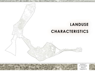
Land Use Map
RESIDENTIAL
53%
COMMERCIAL
2%
INDUSTRIAL
0%
PUBLIC AND
SEMI PUBLIC
3%
RECREATIONAL
1%
TRANSPORT
AND
COMMUNICATI
ON
10%
AGRICULTURE
AND WATER
BODIES
13%
MIXED
1% VACANT
17%
DISTRIBUTION OF LAND USE
(WARD 34)
7. Vejalpur is a city and a municipality in Ahmedabad district in Gujarat.
Population is approximately 3,00,000 as per 2011 census which is
comparable to the population of Kharagpur (3,72,000 in 2011 census)
Land use Study of Ward 42 of Vejalpur, Ahmedabad:
Source : Ward Study of Vejalpur, CEPT University 2012
8. A Comparative Study of Ward 34:
As per the given ward administrative boundary for ward number 34
Total area = 15,79,483 sq.m. = 157.94 ha = 158 ha approximately
Total population as per Hijli Cooperative society in 2001 = 8000 approx.
2012 rate of growth = 3% i.e total population 2012 = 8240
So density of ward 34 = 8240 / 158 = 52 pph
For small towns density is 75 pph
Hence considering it as small town settlement UDPFI STANDARDS are
referred
Percentage Of Developed Land Use, 2012
LAND USE CATEGORY
WARD 34 of Kharagpur,
West Bengal
WARD 42 of Vejalpur,
Ahmedabad
UDPFI STANDARDS
RESIDENTIAL 53 78 45-50
COMMERCIAL 1.5 2 2-3
INDUSTRIAL 0 0 8-10
PUBLIC AND SEMI PUBLIC 3 4 6-8
RECREATIONAL 1 1 12-14
TRANSPORT AND COMMUNICATION 10 4 10-12
AGRICULTURE AND WATER BODIES 13 0 Balance
MIXED .5 5
VACANT LAND 17 4
Table 1.
0
10
20
30
40
50
60
UDPFI
WARD 34
9. RESIDENTIAL
50%
COMMERCIAL
3%
INDUSTRIAL
10%
PUBLIC AND SEMI
PUBLIC
8%
RECREATIONAL
14%
TRANSPORT &
COMMUNICATION
12%
AGRICULTURE AND
WATER BODIES
3%
DISTRIBUTION OF DIFFERENT LAND USE
(UDPFI GUIDELINES)
RESIDENTIAL
53%
COMMERCIAL
2%INDUSTRIAL
0%
PUBLIC AND SEMI
PUBLIC
3%
RECREATIONAL
1%
TRANSPORT AND
COMMUNICATIO
N
10%
AGRICULTURE
AND WATER
BODIES
13%
MIXED
1%
VACANT
17%
DISTRIBUTION OF DIFFERENT LAND USE
(WARD 34)
RESIDENTIAL
78%
COMMERCIAL
2%
VACANT
6%
PUBLIC AND SEMI
PUBLIC
4%
RECREATIONAL
1%
TRANSPORT AND
COMMUNICATIO
N
4% MIXED
5%
DISTRIBUTION OF DIFFERENT LAND USE
(WARD 42 – VEJALPUR, AHMEDABAD)
The distribution of commercial landuse is close to 2% in both
the wards. Ward 34 caters to a lesser residential area as
compared to Vejalpur where the demand seems higher.
The high residential distribution IN Ward 42 Vejalpur can be
attributed to the location of the ward close to Ahmedabad
City.
Transportation attributes to 10% in ward 34 whereas in
Vejalpur it is 4%, highlighting the quantity of road infrastructure .
Both wards lack minimum standards of recreational spaces.
Both wards lack adequate Public and Semi-Public Spaces
10. 0
10
20
30
40
50
60
UDPFI
WARD 34
MINIMUM
STANDARDS
PUBLIC AND
SEMI PUBLIC
6-8
RECREATIONAL 12-14
o There is lack of open and recreational spaces, not satisfying the minimum criteria i.e. 12 %
o Also, there is a lack of public and semi public spaces like healthcare, education and social
facilities, not satisfying the minimum criteria i.e. 6%
Comparison of Ward 34 with UDPFI Guidelines
11. PLOT SIZE AREA 1 AREA 2 AREA 3
Lowest size
200 sq.m.
= 2180 sq. ft. =
5 dis.
245 sq.m.
= 2616 sq. ft.
= 6 dis.
150 sq.m.
= 1615 sq. ft.
= 3.70 dis.
Mean size
280 sq.m.
= 3052 sq. ft.
= 7dis.
325 sq.m.
= 3488 sq. ft.
= 8 dis.
260 sq.m.
= 2834 sq. ft.
= 6.5 dis.
Highest size
400 sq.m.
= 4360 sq. ft.
= 10 dis.
400 sq.m.
= 4360 sq. ft.
= 10dis.
400 sq.m.
=4360 sq. ft.
10 dis.
Plot Area Analysis
Table 2.
Not to Scale
Area 1:
The workable plot size is found
to be 7 dis. but a minimum size
of 5 dis. Is found in this area.
Area 2 and 3:
Initially, it was mandatory for
one to purchase a minimum
plot size of 10 dis. which
had been lowered to
7 dis. and further lowered
to 6 dis.
The larger plots are
found in area 2
which can be
attributed to the
higher income levels
of the residents
12. Land Price
Tax is paid to both
society and
municipality.
Persons have to
buy shares of the
Co-operative
Society, pay
development tax,
and membership
fees. Tax has to be
paid even while
sale of land.
Land in commercial areas of Hijli is owned by
the Society. The shops function on a monthly
rental basis.
OBSERVATIONS ANALYSIS/ INFERENCES
Land price is highest along the Prem Bazar
Main road
Close proximity to the commercial zone
situated along the main road
Areas in The Hijli Co-operative zone have
second highest preference
• Provision of all basic utilities and amenities
by the Society.
• Relatively safe and secure environment.
• A homogeneous social structure.
DVC Mayapur has a almost similar pricing
structure as Hijli Co-operative but is third in
the pricing list.
This can be attributed to the lack of facilities
in this region. But, it is observed that the
development has increased with time due to
the flourishing market and the highway.
Informal settlement pattern is observed in the
areas which are the end of the pricing list.
Closeness to the canal has resulted in water-
logging which makes the region non
developable (in terms of infrastructure)
Areas shaded in pink are non saleable (IIT G-
Type Quarters, Santhal Basti and 100ft area
abutting canal).
Santhal Basti plots are owned by adivasis and
ownership cannot be transferred to others.
Not to Scale
13. Zone A:
Zone B: Zone C:
Unplanned
Or Informal
Settlements
Analysis and Inferences
Not to Scale
14. Due to uneven terrain, few
vacant areas get flooded,
thus creating unhealthy living
conditions
The arterial road is
concrete, yet, the
road connecting
Highway and arterial
road is ‘kutcha’. This is
a result of planning
only for the area
under consideration
and not beyond.
Vacant pockets of
land are being used
for Solid Waste
Disposal
Absence of public and semi-
public areas in Sukantoo
Nagar, Mayapur DVC and
surrounding areas
(REF TABLE 1).
Non-uniform
distribution of
commercial ,
educational &
healthcare activities.
Zone A:
Not to Scale
15. Densification of areas in Hijli
Society and DVC Mayapur
with time due to presence of
comparatively better facilities
in these areas.
Disintegration of plots with
time has led to the creation
of small congested lanes
(1.5-2m wide) bereft of
street lighting
10% of the total land use
belongs to transport of
which 50% of the roads
are of Kutcha type. It
leads to maximum cases
of puddle formation and
water stagnation.
REF TABLE 1.
Non-Uniformly distributed
open spaces
Lack of organized open/
recreational spaces. Few
open spaces present are
non-uniformly distributed
REF TABLE 1.
Vacant spaces
scattered in the ward
can be considered as
possible growth
potentials
Zone B:
Not to Scale
16. Unplanned informal growth of
alongside Kansabati canal is of prime
concern as it is leading to pollution
, thus degrading the environment and
the land value
The waste land
belonging to the farmers
Is converted to shanty
residences alongside the
agricultural land.
The area nearby and abutting canal is a
water-logging region. Also, it cannot be
developed formally for a 100 ft wide area
according to the bye laws. Thus, due to
lack of attention it has evolved informally.
Inadequate
street parking in
commercial
areas resulting in
congestion
Mixed residential
use observed
mostly near
market areas
and certain
corner spots
Linear development in the
fringe area of Chandi
Mandir along the main
cordon route connecting to
Balrampur
Lack of community
toilets forcing people
residing in informal
settlements to
defecate in canal.
Conversion of
agricultural
fringes into
informal
residential zones
due to Political
support and yet
basic services
are missing.
Zone C:
Not to Scale
17. Conclusions
It was observed that the roads were laid all throughout the site but were not in good condition due to failure in
maintenance by the Society and the Municipality. Roads as an important element of development need to be
improved in terms of quality.
Very few organized Open and recreational spaces are present. There is scope for developing more open spaces asof
playgrounds and parks
Absence of social gathering areas beyond Hijli Society.
Potential vacant lands getting converted to waste lands due to absence of regular solid waste collection and
transport at municipal level.
Unofficial yet widely followed regulation concerning sale of land only to persons of a certain ethnic class .
Construction of public toilets, bath and wash facilities in the existing informal areas
Enforcement of strict regulation and bylaws to check growth of unplanned or informal settlements at social and
political level
Intermittent Residential Spaces in commercial areas need to be checked as they interfere with the intensive
commercial activities.
Scope for Parking in public, semi public and commercial areas has to be addressed as it leads to congestion and
reduces the effective width of road.
The terrain in the low lying areas has to be developed to prevent water logging and provide livable and hygienic
spaces for the existing informal settlements in the surrounding region.