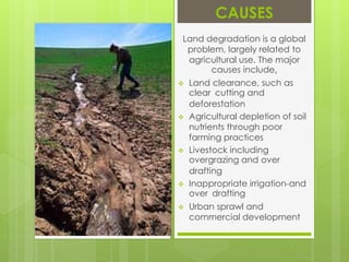
Made by:-
RESOURCES
&
DEVELOPMENT
Everything available in our environment
which can be used to satisfy our needs,
provided, it is technologically accessible,
economically feasible and culturally
acceptable can be termed as ‘Resource’.
In this project we are discussing about the most
important Resource , i.e.,
And are also focusing on different factors affecting
it , which are,
Land is a natural resource of utmost importance.
It supports natural vegetation, wild life, human life,
economic activities, transport and communication
systems.
Land Resources in India enclose approximately 1.3
million sq. miles and is a cape, protruding into the
Indian Ocean, in between the Bay of Bengal on the
east and Arabian Sea on the west. Indian land
resources are segmented into varied relief features, 43%
of land area is plain region; Indian mountain region
constitutes 30% of the area, where as plateaus account
for 27 % of the total surface area on the nation.
Land resouces in india are used for several purposes , such as
A part of the land that is not utilized for the moment
is classified as wasteland.
Cultivated land that is not seeded for one or
more growing seasons
Forests safeguard not only water but soil as well.
They, thus, help in plunging the volume of floodwaters and their
ferocity.
The uncultivated lands are subsidiary lands
and are kept so to re-establish their richness.
Credit must be confirmed
on the farmers that with so modest land under pastures, they
have the biggest number of cattle. They are nurtured mainly on
husk, grain chaff, farm waste and few fodder crops.
Land use pattern in India relates to the physical
characteristics of land, the institutional and other resources
framework like labour, capital available. All these aspects are
associated with the economic development. India has a total
land area of approximately 328 million hectares. Mostly, land
utilization statistics are obtainable for almost 93 % of the
entire area that is around 306 million hectares. From the time
of independence, people have been successful to add another 22
million hectares. As a result, 162 million hectares of land
excels as the net sown area at present. It forms a stupendous
percentage of as high as 51%. No other large country is as
fortunate as India in this regard.
Land degradation is a process in which the value of the
biophysical environment is affected by a combination of human-
induced processes acting upon the land. Also environmental
degradation is the gradual destruction or reduction of the quality
and quantity of human activities animals activities or natural
means example water causes soil erosion, wind, etc. It is viewed
as any change or disturbance to the land perceived to be
undesirable. Natural hazards are excluded as a cause; however
human activities can indirectly affect phenomena such as floods
and bush fires.
CAUSES
Land degradation is a global
problem, largely related to
agricultural use. The major
causes include,
 Land clearance, such as
clear cutting and
deforestation
 Agricultural depletion of soil
nutrients through poor
farming practices
 Livestock including
overgrazing and over
drafting
 Inappropriate irrigation and
over drafting
 Urban sprawl and
commercial development
According to Natural Resources Management
Division, Department of Agriculture and Co-operation,
Ministry of Agriculture, Government of India, we can
conserve our land resources by adopting the following
measures:
 By educating, informing and alerting all
landholders about various aspects of this precious
resource and their sustainable use.
 Contour ploughing is another measure to conserve
our land. By this method, the fields are ploughed,
harrowed and sown along the natural contour of the
hills.
 By terracing method: A series of wide steps are
made along the slope following the contours.
This method is very common in rice growing
regions.
 Under the afforestation and reforestation
programmes, planting of trees, bushes and
grass help to check the soil erosion,
 Strict actions are taken to check reckless
felling of trees and overgrazing.
 Shelter belts (rows of trees) are planted on the
margins of desert areas to check the fury of
wind.
 Construction of dams and gully-trap inculcate
the water-harvesting.


Land resources

  • 1.
  • 2.
    Everything available inour environment which can be used to satisfy our needs, provided, it is technologically accessible, economically feasible and culturally acceptable can be termed as ‘Resource’.
  • 4.
    In this projectwe are discussing about the most important Resource , i.e., And are also focusing on different factors affecting it , which are,
  • 5.
    Land is anatural resource of utmost importance. It supports natural vegetation, wild life, human life, economic activities, transport and communication systems. Land Resources in India enclose approximately 1.3 million sq. miles and is a cape, protruding into the Indian Ocean, in between the Bay of Bengal on the east and Arabian Sea on the west. Indian land resources are segmented into varied relief features, 43% of land area is plain region; Indian mountain region constitutes 30% of the area, where as plateaus account for 27 % of the total surface area on the nation.
  • 6.
    Land resouces inindia are used for several purposes , such as A part of the land that is not utilized for the moment is classified as wasteland. Cultivated land that is not seeded for one or more growing seasons Forests safeguard not only water but soil as well. They, thus, help in plunging the volume of floodwaters and their ferocity. The uncultivated lands are subsidiary lands and are kept so to re-establish their richness. Credit must be confirmed on the farmers that with so modest land under pastures, they have the biggest number of cattle. They are nurtured mainly on husk, grain chaff, farm waste and few fodder crops.
  • 7.
    Land use patternin India relates to the physical characteristics of land, the institutional and other resources framework like labour, capital available. All these aspects are associated with the economic development. India has a total land area of approximately 328 million hectares. Mostly, land utilization statistics are obtainable for almost 93 % of the entire area that is around 306 million hectares. From the time of independence, people have been successful to add another 22 million hectares. As a result, 162 million hectares of land excels as the net sown area at present. It forms a stupendous percentage of as high as 51%. No other large country is as fortunate as India in this regard.
  • 8.
    Land degradation isa process in which the value of the biophysical environment is affected by a combination of human- induced processes acting upon the land. Also environmental degradation is the gradual destruction or reduction of the quality and quantity of human activities animals activities or natural means example water causes soil erosion, wind, etc. It is viewed as any change or disturbance to the land perceived to be undesirable. Natural hazards are excluded as a cause; however human activities can indirectly affect phenomena such as floods and bush fires.
  • 9.
    CAUSES Land degradation isa global problem, largely related to agricultural use. The major causes include,  Land clearance, such as clear cutting and deforestation  Agricultural depletion of soil nutrients through poor farming practices  Livestock including overgrazing and over drafting  Inappropriate irrigation and over drafting  Urban sprawl and commercial development
  • 10.
    According to NaturalResources Management Division, Department of Agriculture and Co-operation, Ministry of Agriculture, Government of India, we can conserve our land resources by adopting the following measures:  By educating, informing and alerting all landholders about various aspects of this precious resource and their sustainable use.  Contour ploughing is another measure to conserve our land. By this method, the fields are ploughed, harrowed and sown along the natural contour of the hills.
  • 11.
     By terracingmethod: A series of wide steps are made along the slope following the contours. This method is very common in rice growing regions.  Under the afforestation and reforestation programmes, planting of trees, bushes and grass help to check the soil erosion,  Strict actions are taken to check reckless felling of trees and overgrazing.  Shelter belts (rows of trees) are planted on the margins of desert areas to check the fury of wind.  Construction of dams and gully-trap inculcate the water-harvesting.
  • 12.