SlideShare a Scribd company logo
1 of 42
OVERVIEW of LAND
MEASUREMENTS
Conservation 2
Mr. Lacelle
An Introduction to Surveying
Overview…
1. AGENCIES & JOBS THAT USE
SURVEYING.
2. TYPES OF SURVEYS.
3. TERMS, SYMBOLS, ABBREVIATIONS,
DEFINITIONS AND EQUIPMENT.
AGENCIES & JOBS THAT
USE SURVEYING
SURVEYING TODAY...
Today surveying affects
most everything in our
daily lives.
THE 5 MAIN AREAS OF THE
SURVEYOR’S WORK
ARE…
▪ Research, analysis, and
decision making.
▪ Field work to gather data.
▪ Computing to process data.
▪ Mapping to represent data.
▪ Stake-out the actual survey.
Two Major Surveying
Methods
GEODETIC
SURVEYING
▪ Surveys which take into account
the true shape of the earth.
▪ Geodetic surveys are typically
carried out with great precision,
often over long distances and
areas (greater than 300 square
miles).
PLANE SURVEYING
▪ the most commonly practiced method of
surveying (treats the earth as a flat or
"plane" surface).
▪ Good enough for small-scale surveys in
limited areas, (the curvature of the earth
has no effect on the results), thus the
computations and results can be
referenced to a plane or flat surface.
▪ Plane surveys are used for the
determination of legal boundaries, for
engineering surveys for the construction
of buildings and roads and for small-
scale topographic surveys.
▪ Generally covers small areas (less than
300 sq. mi.).
Types of Surveys
▪ Control surveys.
▪ Land and Boundary
surveys…
-Original surveys.
-Retracement
surveys.
-Subdivision
surveys.
▪ Hydrographic
surveys.
▪ Route surveys.
▪ Construction
surveys.
▪ As-build surveys.
▪ Mine surveys.
▪ Topographic
surveys.
U.S. Federal Government
Agencies that set Surveying
Standards.
▪ Accurate mapping
cannot be done without
good control.
▪ Networks for geodetic
horizontal and vertical
control are continually
being extended and
upgraded throughout the
country.
▪ NATIONAL GEODETIC
SURVEY (NGS)
▪ BUREAU Of LAND
MANAGEMENT (BLM)
▪ THE U.S. GEOLOGICAL
SURVEY (USGS)
▪ THE DEFENSE
MAPPING AGENCY
(DMA).
▪ U.S. ARMY CORPS OF
ENGINEERS
Land Surveyor
Employment
▪ Surveyors are hired for jobs in
surveying land, using their
skills in mapping, geography
and boundary locations.
▪ Surveyors use a combination
of surveying equipment,
satellites, and aerial
photographs taken from
planes and helicopters to
survey the land.
▪ Land surveyors are
responsible for finding
formations on the surface of
the land such as tectonic
plates and the locations and
borders of important
wetlands.
▪ Land surveyors have a truly
important job which helps all
of humanity and the
environment, as they also
look for formations on the
land such as hazardous
waste locations which can
harm animals and people.
Land Surveyor
Employment
▪ Surveyors also have
the abilities to map
the polar ice caps,
which is so important
to do especially with
today's global
warming. Regular
surveying of polar ice
caps allows the
surveyors to detect
patterns in melting ice
caps and rising water
levels.
▪ Another problem in today's world is
the deforestation of certain rain
forests. Land surveyors use their
equipment to map these areas and
determine what the status is of the
forest areas, where, and how much of
the forests are being cleared. This is
important because the rain forests are
also important to the balance of the
environment and deforestation can kill
the habitat for animals causing them to
become endangered.
▪ Because land surveyors map these
locations on a regular basis, they can
discover patterns in the environment
and the land.
Who Hires Surveyors?
▪ There are all types of employers looking
to hire surveyors. There are federal
governments, state and local
governments, and private companies
looking to hire surveyors for jobs.
▪ Within the Federal Government include
the Bureau of Land Management, the
US Geological Survey, Coast Survey,
and Forest Services. All of these groups
are looking to hire surveyors to work for
them.
▪ Land surveyors don't have to just work
with the natural environment but can
also get jobs in the surveying of land
which has to do with planning of
construction sites and building projects.
▪ Surveyors can also work
with transportation
agencies like with
railroads, highways, and
major roads.
▪ Surveyors can even work
with urban planning, which
is the surveying of cities
and major metropolitan
areas.
▪ There are many private
land surveyors who are
looking to hire land
surveyors who work locally
and do not work for the
state government or for the
federal government.
Who Hires Surveyors?
▪ There are jobs available for land
surveyors in almost every state of the
United States because of the necessity
for urban planning and working with
highways, roads and railroads.
▪ The Western United States is a great
place to look for jobs as a surveyor
because the land formations and
movements with the mountain ranges
is constantly changing, as well as
urban areas which are being built up.
▪ Any state with a
coast line will always
be looking for
surveyors to work for
the Coast Survey.
▪ The best places to
look for a job as a
surveyor is in
forested areas,
states with coastline,
and urban areas.
Land Surveyor Career
▪ becoming a surveyor can provide you
with a comfortable income in a field
where there is relatively high
demand.
▪ While surveying jobs have been
considered in high demand for quite
some time, the demand has
increased due to the current
economic situation in America.
▪ Many landowners and investors have
found that in order to maintain their
lifestyle they must part with some or
all of their property. For this reason,
surveyors are finding themselves with
an influx of business and the current
job market for qualified surveyors is
at its peak.
▪ A surveyor, sometimes referred to as
a land surveyor, is responsible for
accurately measuring (surveying)
land in order to plot out exact
locations and distance between
points.
▪ A surveyor must accurately indicate
land elevations, property lines, land
contour for development, to divide
land, or many other purposes.
▪ A surveyor must have the ability to
understand surveys conducted by
previous surveyors in order to
implement these surveys with his or
her current findings.
▪ A surveyor must have the ability to
accurately and precisely record his or
her findings and keep records of such
findings.
Land Surveyor Career
▪ A land surveyor may have
many job duties associated
with the actual survey of the
land.
▪ A land surveyor must interact
with government agencies to
ensure accurate
recordkeeping.
▪ Surveyors may be hired by
landowners or real estate
brokers to correctly divide
property and mark property
lines.
▪ A land surveyor is responsible
for taking accurate
measurements and recording
the exact land layout in order
to assist in the production of
maps, graphs, or other
documents.
▪ A surveyor may be called
upon from time to time to
attest or swear under oath in
judicial proceedings that the
information contained and
collected is true and accurate
regarding boundaries,
elevations, lines, and
markings.
Land Surveyor Career
▪ All land surveying job
applicants must be licensed in
the state they are applying for a
position in. To do this, most
applicants will take tests and
train while on the job and
become state certified after
passing a final State Board
Certification exam.
▪ Each state implements its own
regulations regarding the
licensure of surveyors. Some
states require a degree from an
accredited university, while
other states only require
surveyor license applicants to
take an assessment
determining their knowledge on
the subject.
▪ A Bachelors degree or
Associates degree in Applied
Science is available from most
universities. The assessment
given by the states that do not
require licensure often requires
vast knowledge of surveying.
▪ It is recommended that anyone
wishing to become a licensed
surveyor first work with a
surveying firm to learn the trade.
Many sources indicate that it
can take up to 5 years of
apprentice work before one is
equipped with the knowledge
needed to pass assessments
given by the state.
Land Surveyor Career
▪ Land surveying jobs
require that a surveyor
generally work a five
day week and eight
hours a day.
▪ An applicant must love
being outdoors under all
weather conditions,
although most work is
performed when there
are no storms in the
area.
▪ An applicant must be in good
physical shape as there is a lot of
climbing and carrying heavy
equipment involved in the job.
▪ Land surveyors also spend time
doing office work like preparing maps
and charts, to present their findings.
they must get along with people and
willing to be part of a team in many
related job activities.
Salary
▪ In the United States, land surveyors
make an average annual salary
ranging from $37,000-70,000.
▪ As a licensed land surveyor in the
United States, the wage varies
widely on where you are employed.
Construction companies may pay
more than private clients and so on.
▪ An average entry wage for a land
surveyor is about $18.00 an hour.
This averages out to an annual
salary ranging from $40,000 to
$65,000.
▪ The salary of a land surveyor varies
on how experienced the surveyor is
and where he/she is employed.
▪ Salaries depend on the state that the
job is available in, as well as the
training and experience an applicant
has.
▪ Jobs are most often available
in architectural firms, real
estate companies, and for
Federal and State agencies.
▪ Some surveyors are self
employed and work on a
contracted basis.
▪ Often times self employed
surveyors do boundary
surveys for home owners and
base their fees on legal facts
about the property.
▪ They may offer a flat fee for
their services, or give an
estimate based on the
property in question.
▪ The cost depends on what
needs to be done and how
long it will take. Fees can run
from hundreds to thousands
of dollars.
Job Outlook
U.S. Dept. of Labor says…
▪ These occupations should experience
faster than average employment
growth.
▪ Surveyors, cartographers, and
photogrammetrists who have a
bachelor's degree and strong
technical skills should have favorable
job prospects.
▪ The architectural, engineering, and
related services industry—including
firms that provided surveying and
mapping services to other industries
on a contract basis—provided 7 out of
10 jobs for these workers.
▪ Federal, State, and local
governmental agencies provided
about 15 percent of these jobs.
▪ Major Federal Government
employers are the U.S.
Geological Survey
(USGS), the Bureau of
Land Management (BLM),
the National Oceanic and
Atmospheric
Administration, the U.S.
Forest Service, and the
Army Corps of Engineers.
▪ Most surveyors in State
and local government work
for highway departments
or urban planning and
redevelopment agencies.
▪ Utility companies also
employ surveyors,
cartographers,
photogrammetrists, and
surveying technicians.
TYPES OF SURVEYS
Surveying or land surveying is
● the technique and science of
accurately determining the
terrestrial or three-dimensional
position of points and the
distances and angles between
them.
● These points are usually on
the surface of the Earth, and
they are often used to
establish land maps and
boundaries for ownership or
governmental purposes.
SURVEYING…
● is typically used to locate
and measure property
lines;
● to lay out buildings,
bridges, channels,
highways, sewers, and
pipelines for construction;
● to locate stations for
launching and tracking
satellites;
● and to obtain topographic
information for mapping
and charting.
● Basically, surveying
determines horizontal
distances, elevation
differences, directions,
and angles.
● These basic
determinations are
applied further to the
computation of areas and
volumes and to the
establishment of locations
with respect to some
coordinate system.
HORIZONTAL DISTANCES
● Each measurement has both length
and direction.
1. Length is expressed in feet or in
meters.
2. Direction is expressed as a bearing of
the azimuthal angle relationship to a
reference meridian, which is the north-
south direction. It can be the true
meridian, a grid meridian, or some
other assumed meridian.
● The degree-minute-second system of
angular expression is standard in the
United States.
Measuring Distances…
● Traverse distances are usually measured with a
surveyor's tape or by EDM (Electronic
Distance Meter), but also may sometimes be
measured by stadia.
● Whether on sloping or level ground, it is
horizontal distances that must be measured.
● In taping, horizontal components of hillside
distances are measured by raising the downhill
end of the tape to the level of the uphill end.
● On steep ground this technique is used with
shorter sections of the tape. The raised end is
positioned over the ground point with the aid
of a plumb bob.
● Where slope distances are taped along the
ground, the slope angle can be measured with
the clinometer. The desired horizontal distance
can then be computed.
Measuring Angles
● The most common instrument for
measuring angles is the transit or
theodolite.
● It is essentially a telescope that
can be rotated a measurable
amount about a vertical axis and a
horizontal axis.
● The transit is centered over a
point with the aid of either a
plumb bob suspended by a string
from the vertical axis or (on some
theodolites) an optical plummet.
Measuring Elevation
● Most measurements are made
by differential leveling,
wherein a horizontal line of
sight of known elevation is
sighted on a graduated rod
held vertically on the point
being checked.
● The transit telescope, leveled,
may establish the sight line,
but more often a specialized
leveling instrument is used.
● For approximate results a hand
level may be used.
Theory of differential leveling.
● Other methods of measuring elevation include
trigonometric leveling which involves
calculating height from measurements of
horizontal, distance and vertical angle;
barometric leveling, a method of determining
approximate elevation difference with aid of a
barometer; and airborne profiling, in which a
radar altimeter on an aircraft is used to obtain
ground elevations.
ASTRONOMICAL OBSERVATIONS
● To determine
meridian direction
and geographic
latitude, observations
are made by a
theodolite or transit
on Polaris, the Sun, or
other stars.
BOUNDARY SURVEY
● The survey which reveals the
corners of the property and
the property lines of a piece of
a land.
● They are usually undertaken to
obtain a building permit, or to
settle the disputes related to
the property and for the
purpose of erecting the fences.
● This survey is considered to be
the basic survey to be
undertaken in the initial stages
of the property.
TOPOGRAPHIC SURVEY
● A survey locating
topographic features -
natural and man made -
such as buildings,
improvements, fences,
elevations, trees,
streams, contours of the
land, etc.
● This type of survey may
be required by a
governmental agency, or
may be used by
engineers and/or
architects for design of
improvements or
developments on a site.
SITE PLANNING SURVEY
● A combination of
boundary and
topographic surveys
for preparation of a
site plan to be used
for designing
improvements or
developments.
CONSTRUCTION SURVEY
● The survey which is being
undertaken at the time of
the construction in order
to have control over the
elevation, the dimensions
of the place horizontal
position, and
configuration, i.e.
stakeout of line and
grade for buildings,
fences, roads, etc.
are referred to as
construction survey.
AS – BUILT SURVEY
● a survey carried out during or immediately
after a construction project for record,
completion evaluation and payment
purposes.
CONTROL SURVEY
● Precise location of
horizontal and vertical
positions of points for
use in boundary
determination,
mapping from aerial
photographs,
construction staking,
and other related
purposes.
GIS and LIS SURVEY AND MAPPING
● Geographic
Information Systems
and Land Information
Systems.
● Surveying and GIS
overlap, and neither
is wholly contained
within the other.
● The main discussion among
surveyors today is whether
GIS is surveying and, if it is,
how those who are not
licensed surveyors can be
stopped from creating it. At
the same time surveyors
realize that they need to
become educated in GIS.
SUBDIVISION SURVEY
● Surveys the
subdivision of a tract
of land into smaller
parcels, showing data
on a map.
ELEVATION OR FLOODPLAIN
SURVEY
● This survey is conducted
to estimate the altitude of
the various sections of
the building or the land.
● The results derived from
this survey are often used
in building plans and it
also helps in determining
whether the property is in
flood zone or not.
COURT EXHIBIT SURVEY
● Analysis of various legal
description and survey
maps, field locating of
record, existing
monuments, and physical
features, and mapping
showing this information
for the purpose of
presenting a visual exhibit
to be used in a
courtroom.
HYDROGRAPHIC AND UNDERWATER
SURVEYS
● These surveys collect
data on the water bodies.
● they provide details
regarding depth of water,
the contours, the
direction and the velocity
of the current, the place
where the immovable
objects are located in the
under waters.
SOIL SURVEY
● or soil mapping, is the
process of
determining the soil
types or other
properties of the soil
cover over a
landscape, and
mapping them for
others to understand
and use.
ARCHAEOLOGICAL SURVEY
● used to accurately
assess the
relationship of
archaeological sites in
a landscape or to
accurately record
finds on an
archaeological site.
MINING AND SUBSURFACE SURVEY
● A survey that determines
the location and
dimensions of
underground parts of a
mine, including the
natural and artificial
features of the mine,
both above and below
ground.
● These surveys are done
with both vertical and
horizontal control,
locating the features in a
three dimensional
manner.
TERMS, SYMBOLS,
ABBREVIATIONS, DEFINITIONS
AND EQUIPMENT
Surveying Units of Measure
■ Acre- 43,560 sq. ft.
■ Hectare- Metric unit of area equal
to 10,000 square meters, or 2.471
acres.
■ Gunter’s Chain- 66 ft. (100 links),
the standard measuring chain
revolutionized surveying. Gunter's
chain was one tenth of a furlong, a
common unit of length in the old
days. An area one chain wide by
ten chains long was exactly an
acre. A mile is 80 chains.
■ Link- 1/100 of a chain or 7.92 in.
■ Engineer’s Chain- a 100 foot
chain containing 100 links of one
foot apiece.
Standard Surveying Terms
■ Azimuth- The number of degrees from
north (or other reference direction) that a
line runs, measured clockwise.
■ Bearing- Quadrantal angle East or West of
North or South, from 0° to 90°.
■ Baseline- In the U.S. Public land
surveying system, a surveyed east-west
(i.e. latitudinal) reference line, often
hundreds of miles in length, from which
tiers of townships are surveyed to the
north and south. There are approximately
two dozen baselines in the lower 48 states.
■ Benchmark- A survey mark made on a
monument having a known location and
elevation, serving as a reference point for
surveying.
■ Boundary- Border line or exterior of a
described parcel.
■ Flag- A bright plastic ribbon tied to a lath
stake. Used to mark points along a survey
line.
■ Contour- Defined line of equal elevation
on a map or plat.
■ Datum- Standard or common reference
base or system.
■ Elevation- Vertical height from a defined
reference datum.
■ Line Tree- Any tree that is on a property
line, specifically one that is also a corner
to another property.
■ Meridian- In the U.S. public land
surveying system, a surveyed north-south
(i.e. longitudinal) reference line, often
hundrends of miles in length, from which
ranges are surveyed to the east and west.
There are approximately two dozen
meridians in the lower 48 states.
■ Metes & Bounds- An ancient surveying
system that describes the perimeter of a
parcel of land in terms of its bearings and
distances and its relationship to natural
features and adjacent parcels.
Standard Surveying Terms
■ Grade- Surface level of ground or
rate/degree of slope.
■ Monument- A permanently placed
survey marker such as a stone shaft
sunk into the ground.
■ Plat- A drawing of a parcel of land.
More specifically, the drawing
created by the surveyor that shows the
field work, with bearings, distances,
etc.
■ Range- In the U.S. public land
surveying system, a north-south
column of townships, identified as
being east or west of a reference
longitudinal meridian, for example,
Range 3 West.
■ Section- In the U.S. public land
surveying system, an area one mile
square.
■ Station- Computed or surveyed point
■ Total Station- A survey instrument
that combines a theodolite and
distance meter.
■ Township- In the U.S. public land
surveying system, an area six miles
square, containing 36 sections. The
townships are organized in tiers and
ranges, identified with respect to a
baseline and meridian. For example,
Township 13 North Range 6 West
describes a township's location.
That’s it!

More Related Content

What's hot

What's hot (20)

Remote sensing, GPS and GIS ppt
Remote sensing, GPS and GIS pptRemote sensing, GPS and GIS ppt
Remote sensing, GPS and GIS ppt
 
Welcome to the presentation on ‘total station
Welcome to the presentation on ‘total stationWelcome to the presentation on ‘total station
Welcome to the presentation on ‘total station
 
Introduction of Surveying
Introduction of Surveying Introduction of Surveying
Introduction of Surveying
 
Total station Surveying
Total station SurveyingTotal station Surveying
Total station Surveying
 
Contouring
ContouringContouring
Contouring
 
Data sources and input in GIS
Data  sources and input in GISData  sources and input in GIS
Data sources and input in GIS
 
Surveying
Surveying Surveying
Surveying
 
Control surveying
Control surveyingControl surveying
Control surveying
 
Trigonometric levelling
Trigonometric levellingTrigonometric levelling
Trigonometric levelling
 
Introduction to Aerial Photogrammetry
Introduction to Aerial PhotogrammetryIntroduction to Aerial Photogrammetry
Introduction to Aerial Photogrammetry
 
Photogrammetry- Surveying
Photogrammetry- SurveyingPhotogrammetry- Surveying
Photogrammetry- Surveying
 
Modern Surveying & Mapping
Modern Surveying & MappingModern Surveying & Mapping
Modern Surveying & Mapping
 
Plane Table Surveying PPt
Plane Table Surveying PPtPlane Table Surveying PPt
Plane Table Surveying PPt
 
Triangulation survey
Triangulation surveyTriangulation survey
Triangulation survey
 
levelling and contouring
levelling and contouringlevelling and contouring
levelling and contouring
 
Gps surveying
Gps surveyingGps surveying
Gps surveying
 
Relief displacement
Relief displacementRelief displacement
Relief displacement
 
Contouring pdf
Contouring pdfContouring pdf
Contouring pdf
 
Distortions and displacement on aerial photograph
Distortions and displacement on aerial photographDistortions and displacement on aerial photograph
Distortions and displacement on aerial photograph
 
Total station
Total station Total station
Total station
 

Similar to Land Measurement Overview: Surveying Terms, Jobs & Salary

Unlocking the Earth's Secrets: The Importance of Soil Testing in NJ.pptx
Unlocking the Earth's Secrets: The Importance of Soil Testing in NJ.pptxUnlocking the Earth's Secrets: The Importance of Soil Testing in NJ.pptx
Unlocking the Earth's Secrets: The Importance of Soil Testing in NJ.pptxsimpletank1
 
Landscape DEFINITION AND MEANING
Landscape DEFINITION AND MEANINGLandscape DEFINITION AND MEANING
Landscape DEFINITION AND MEANINGAbhishek Singh
 
reference letter_Lottinville
reference letter_Lottinvillereference letter_Lottinville
reference letter_LottinvilleBrett Tomlinson
 
Environmental geography
Environmental geography Environmental geography
Environmental geography Mahamudul Hasan
 

Similar to Land Measurement Overview: Surveying Terms, Jobs & Salary (6)

Unlocking the Earth's Secrets: The Importance of Soil Testing in NJ.pptx
Unlocking the Earth's Secrets: The Importance of Soil Testing in NJ.pptxUnlocking the Earth's Secrets: The Importance of Soil Testing in NJ.pptx
Unlocking the Earth's Secrets: The Importance of Soil Testing in NJ.pptx
 
Meet the Reilly's and GTA
Meet the Reilly's and GTAMeet the Reilly's and GTA
Meet the Reilly's and GTA
 
Landscape DEFINITION AND MEANING
Landscape DEFINITION AND MEANINGLandscape DEFINITION AND MEANING
Landscape DEFINITION AND MEANING
 
Innovative Partnership-Based Project Approaches to Increase & Accelerate Adop...
Innovative Partnership-Based Project Approaches to Increase & Accelerate Adop...Innovative Partnership-Based Project Approaches to Increase & Accelerate Adop...
Innovative Partnership-Based Project Approaches to Increase & Accelerate Adop...
 
reference letter_Lottinville
reference letter_Lottinvillereference letter_Lottinville
reference letter_Lottinville
 
Environmental geography
Environmental geography Environmental geography
Environmental geography
 

More from Land Surveyors United Community

More from Land Surveyors United Community (20)

Survey instruments
Survey instrumentsSurvey instruments
Survey instruments
 
Sokkia spectrum survey field reference manual
Sokkia spectrum survey field reference manualSokkia spectrum survey field reference manual
Sokkia spectrum survey field reference manual
 
Sokkia set20 k
Sokkia set20 kSokkia set20 k
Sokkia set20 k
 
Sokkia set6 manual
Sokkia set6 manualSokkia set6 manual
Sokkia set6 manual
 
Sokkia setx10 instruction_manual
Sokkia setx10 instruction_manualSokkia setx10 instruction_manual
Sokkia setx10 instruction_manual
 
Sokkia sdr-8100 operations manual
Sokkia sdr-8100 operations manualSokkia sdr-8100 operations manual
Sokkia sdr-8100 operations manual
 
216 surveying traverse explained
216 surveying traverse explained216 surveying traverse explained
216 surveying traverse explained
 
nikon nivo m-series instruction manual
nikon nivo m-series instruction manualnikon nivo m-series instruction manual
nikon nivo m-series instruction manual
 
Compass surveying
Compass surveyingCompass surveying
Compass surveying
 
Land Surveying Resources Handbook
Land Surveying Resources HandbookLand Surveying Resources Handbook
Land Surveying Resources Handbook
 
Fundamentals hp33s exam-review
Fundamentals hp33s exam-reviewFundamentals hp33s exam-review
Fundamentals hp33s exam-review
 
Using the scientific calculator
Using the scientific calculatorUsing the scientific calculator
Using the scientific calculator
 
Complex numbers & vectors hp35s overview
Complex numbers & vectors hp35s overviewComplex numbers & vectors hp35s overview
Complex numbers & vectors hp35s overview
 
Using the hp35s Calculator
Using the hp35s CalculatorUsing the hp35s Calculator
Using the hp35s Calculator
 
Programming 33s simple
Programming 33s simpleProgramming 33s simple
Programming 33s simple
 
Summing up 33_s
Summing up 33_sSumming up 33_s
Summing up 33_s
 
Hp33s calculator user_guide
Hp33s calculator user_guideHp33s calculator user_guide
Hp33s calculator user_guide
 
Programming Hp33s talk v3
Programming Hp33s talk v3Programming Hp33s talk v3
Programming Hp33s talk v3
 
Trimble R8 gnss r6-5800-364_userguide
Trimble R8 gnss r6-5800-364_userguideTrimble R8 gnss r6-5800-364_userguide
Trimble R8 gnss r6-5800-364_userguide
 
Nikon DTN502 instruction-manual-english
Nikon DTN502 instruction-manual-englishNikon DTN502 instruction-manual-english
Nikon DTN502 instruction-manual-english
 

Recently uploaded

MENTAL STATUS EXAMINATION format.docx
MENTAL     STATUS EXAMINATION format.docxMENTAL     STATUS EXAMINATION format.docx
MENTAL STATUS EXAMINATION format.docxPoojaSen20
 
Presentation by Andreas Schleicher Tackling the School Absenteeism Crisis 30 ...
Presentation by Andreas Schleicher Tackling the School Absenteeism Crisis 30 ...Presentation by Andreas Schleicher Tackling the School Absenteeism Crisis 30 ...
Presentation by Andreas Schleicher Tackling the School Absenteeism Crisis 30 ...EduSkills OECD
 
Incoming and Outgoing Shipments in 1 STEP Using Odoo 17
Incoming and Outgoing Shipments in 1 STEP Using Odoo 17Incoming and Outgoing Shipments in 1 STEP Using Odoo 17
Incoming and Outgoing Shipments in 1 STEP Using Odoo 17Celine George
 
How to Configure Email Server in Odoo 17
How to Configure Email Server in Odoo 17How to Configure Email Server in Odoo 17
How to Configure Email Server in Odoo 17Celine George
 
The Most Excellent Way | 1 Corinthians 13
The Most Excellent Way | 1 Corinthians 13The Most Excellent Way | 1 Corinthians 13
The Most Excellent Way | 1 Corinthians 13Steve Thomason
 
Hybridoma Technology ( Production , Purification , and Application )
Hybridoma Technology  ( Production , Purification , and Application  ) Hybridoma Technology  ( Production , Purification , and Application  )
Hybridoma Technology ( Production , Purification , and Application ) Sakshi Ghasle
 
Alper Gobel In Media Res Media Component
Alper Gobel In Media Res Media ComponentAlper Gobel In Media Res Media Component
Alper Gobel In Media Res Media ComponentInMediaRes1
 
Software Engineering Methodologies (overview)
Software Engineering Methodologies (overview)Software Engineering Methodologies (overview)
Software Engineering Methodologies (overview)eniolaolutunde
 
call girls in Kamla Market (DELHI) 🔝 >༒9953330565🔝 genuine Escort Service 🔝✔️✔️
call girls in Kamla Market (DELHI) 🔝 >༒9953330565🔝 genuine Escort Service 🔝✔️✔️call girls in Kamla Market (DELHI) 🔝 >༒9953330565🔝 genuine Escort Service 🔝✔️✔️
call girls in Kamla Market (DELHI) 🔝 >༒9953330565🔝 genuine Escort Service 🔝✔️✔️9953056974 Low Rate Call Girls In Saket, Delhi NCR
 
_Math 4-Q4 Week 5.pptx Steps in Collecting Data
_Math 4-Q4 Week 5.pptx Steps in Collecting Data_Math 4-Q4 Week 5.pptx Steps in Collecting Data
_Math 4-Q4 Week 5.pptx Steps in Collecting DataJhengPantaleon
 
ECONOMIC CONTEXT - LONG FORM TV DRAMA - PPT
ECONOMIC CONTEXT - LONG FORM TV DRAMA - PPTECONOMIC CONTEXT - LONG FORM TV DRAMA - PPT
ECONOMIC CONTEXT - LONG FORM TV DRAMA - PPTiammrhaywood
 
Class 11 Legal Studies Ch-1 Concept of State .pdf
Class 11 Legal Studies Ch-1 Concept of State .pdfClass 11 Legal Studies Ch-1 Concept of State .pdf
Class 11 Legal Studies Ch-1 Concept of State .pdfakmcokerachita
 
Separation of Lanthanides/ Lanthanides and Actinides
Separation of Lanthanides/ Lanthanides and ActinidesSeparation of Lanthanides/ Lanthanides and Actinides
Separation of Lanthanides/ Lanthanides and ActinidesFatimaKhan178732
 
Introduction to AI in Higher Education_draft.pptx
Introduction to AI in Higher Education_draft.pptxIntroduction to AI in Higher Education_draft.pptx
Introduction to AI in Higher Education_draft.pptxpboyjonauth
 
Solving Puzzles Benefits Everyone (English).pptx
Solving Puzzles Benefits Everyone (English).pptxSolving Puzzles Benefits Everyone (English).pptx
Solving Puzzles Benefits Everyone (English).pptxOH TEIK BIN
 
The basics of sentences session 2pptx copy.pptx
The basics of sentences session 2pptx copy.pptxThe basics of sentences session 2pptx copy.pptx
The basics of sentences session 2pptx copy.pptxheathfieldcps1
 
SOCIAL AND HISTORICAL CONTEXT - LFTVD.pptx
SOCIAL AND HISTORICAL CONTEXT - LFTVD.pptxSOCIAL AND HISTORICAL CONTEXT - LFTVD.pptx
SOCIAL AND HISTORICAL CONTEXT - LFTVD.pptxiammrhaywood
 
BASLIQ CURRENT LOOKBOOK LOOKBOOK(1) (1).pdf
BASLIQ CURRENT LOOKBOOK  LOOKBOOK(1) (1).pdfBASLIQ CURRENT LOOKBOOK  LOOKBOOK(1) (1).pdf
BASLIQ CURRENT LOOKBOOK LOOKBOOK(1) (1).pdfSoniaTolstoy
 

Recently uploaded (20)

MENTAL STATUS EXAMINATION format.docx
MENTAL     STATUS EXAMINATION format.docxMENTAL     STATUS EXAMINATION format.docx
MENTAL STATUS EXAMINATION format.docx
 
Presentation by Andreas Schleicher Tackling the School Absenteeism Crisis 30 ...
Presentation by Andreas Schleicher Tackling the School Absenteeism Crisis 30 ...Presentation by Andreas Schleicher Tackling the School Absenteeism Crisis 30 ...
Presentation by Andreas Schleicher Tackling the School Absenteeism Crisis 30 ...
 
Incoming and Outgoing Shipments in 1 STEP Using Odoo 17
Incoming and Outgoing Shipments in 1 STEP Using Odoo 17Incoming and Outgoing Shipments in 1 STEP Using Odoo 17
Incoming and Outgoing Shipments in 1 STEP Using Odoo 17
 
How to Configure Email Server in Odoo 17
How to Configure Email Server in Odoo 17How to Configure Email Server in Odoo 17
How to Configure Email Server in Odoo 17
 
The Most Excellent Way | 1 Corinthians 13
The Most Excellent Way | 1 Corinthians 13The Most Excellent Way | 1 Corinthians 13
The Most Excellent Way | 1 Corinthians 13
 
Hybridoma Technology ( Production , Purification , and Application )
Hybridoma Technology  ( Production , Purification , and Application  ) Hybridoma Technology  ( Production , Purification , and Application  )
Hybridoma Technology ( Production , Purification , and Application )
 
Alper Gobel In Media Res Media Component
Alper Gobel In Media Res Media ComponentAlper Gobel In Media Res Media Component
Alper Gobel In Media Res Media Component
 
Software Engineering Methodologies (overview)
Software Engineering Methodologies (overview)Software Engineering Methodologies (overview)
Software Engineering Methodologies (overview)
 
call girls in Kamla Market (DELHI) 🔝 >༒9953330565🔝 genuine Escort Service 🔝✔️✔️
call girls in Kamla Market (DELHI) 🔝 >༒9953330565🔝 genuine Escort Service 🔝✔️✔️call girls in Kamla Market (DELHI) 🔝 >༒9953330565🔝 genuine Escort Service 🔝✔️✔️
call girls in Kamla Market (DELHI) 🔝 >༒9953330565🔝 genuine Escort Service 🔝✔️✔️
 
_Math 4-Q4 Week 5.pptx Steps in Collecting Data
_Math 4-Q4 Week 5.pptx Steps in Collecting Data_Math 4-Q4 Week 5.pptx Steps in Collecting Data
_Math 4-Q4 Week 5.pptx Steps in Collecting Data
 
ECONOMIC CONTEXT - LONG FORM TV DRAMA - PPT
ECONOMIC CONTEXT - LONG FORM TV DRAMA - PPTECONOMIC CONTEXT - LONG FORM TV DRAMA - PPT
ECONOMIC CONTEXT - LONG FORM TV DRAMA - PPT
 
Class 11 Legal Studies Ch-1 Concept of State .pdf
Class 11 Legal Studies Ch-1 Concept of State .pdfClass 11 Legal Studies Ch-1 Concept of State .pdf
Class 11 Legal Studies Ch-1 Concept of State .pdf
 
Separation of Lanthanides/ Lanthanides and Actinides
Separation of Lanthanides/ Lanthanides and ActinidesSeparation of Lanthanides/ Lanthanides and Actinides
Separation of Lanthanides/ Lanthanides and Actinides
 
Model Call Girl in Tilak Nagar Delhi reach out to us at 🔝9953056974🔝
Model Call Girl in Tilak Nagar Delhi reach out to us at 🔝9953056974🔝Model Call Girl in Tilak Nagar Delhi reach out to us at 🔝9953056974🔝
Model Call Girl in Tilak Nagar Delhi reach out to us at 🔝9953056974🔝
 
Introduction to AI in Higher Education_draft.pptx
Introduction to AI in Higher Education_draft.pptxIntroduction to AI in Higher Education_draft.pptx
Introduction to AI in Higher Education_draft.pptx
 
Solving Puzzles Benefits Everyone (English).pptx
Solving Puzzles Benefits Everyone (English).pptxSolving Puzzles Benefits Everyone (English).pptx
Solving Puzzles Benefits Everyone (English).pptx
 
The basics of sentences session 2pptx copy.pptx
The basics of sentences session 2pptx copy.pptxThe basics of sentences session 2pptx copy.pptx
The basics of sentences session 2pptx copy.pptx
 
SOCIAL AND HISTORICAL CONTEXT - LFTVD.pptx
SOCIAL AND HISTORICAL CONTEXT - LFTVD.pptxSOCIAL AND HISTORICAL CONTEXT - LFTVD.pptx
SOCIAL AND HISTORICAL CONTEXT - LFTVD.pptx
 
TataKelola dan KamSiber Kecerdasan Buatan v022.pdf
TataKelola dan KamSiber Kecerdasan Buatan v022.pdfTataKelola dan KamSiber Kecerdasan Buatan v022.pdf
TataKelola dan KamSiber Kecerdasan Buatan v022.pdf
 
BASLIQ CURRENT LOOKBOOK LOOKBOOK(1) (1).pdf
BASLIQ CURRENT LOOKBOOK  LOOKBOOK(1) (1).pdfBASLIQ CURRENT LOOKBOOK  LOOKBOOK(1) (1).pdf
BASLIQ CURRENT LOOKBOOK LOOKBOOK(1) (1).pdf
 

Land Measurement Overview: Surveying Terms, Jobs & Salary

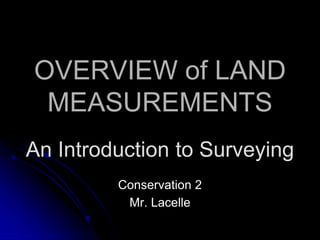
  • 1. OVERVIEW of LAND MEASUREMENTS Conservation 2 Mr. Lacelle An Introduction to Surveying
  • 2. Overview… 1. AGENCIES & JOBS THAT USE SURVEYING. 2. TYPES OF SURVEYS. 3. TERMS, SYMBOLS, ABBREVIATIONS, DEFINITIONS AND EQUIPMENT.
  • 3. AGENCIES & JOBS THAT USE SURVEYING SURVEYING TODAY... Today surveying affects most everything in our daily lives. THE 5 MAIN AREAS OF THE SURVEYOR’S WORK ARE… ▪ Research, analysis, and decision making. ▪ Field work to gather data. ▪ Computing to process data. ▪ Mapping to represent data. ▪ Stake-out the actual survey.
  • 4. Two Major Surveying Methods GEODETIC SURVEYING ▪ Surveys which take into account the true shape of the earth. ▪ Geodetic surveys are typically carried out with great precision, often over long distances and areas (greater than 300 square miles). PLANE SURVEYING ▪ the most commonly practiced method of surveying (treats the earth as a flat or "plane" surface). ▪ Good enough for small-scale surveys in limited areas, (the curvature of the earth has no effect on the results), thus the computations and results can be referenced to a plane or flat surface. ▪ Plane surveys are used for the determination of legal boundaries, for engineering surveys for the construction of buildings and roads and for small- scale topographic surveys. ▪ Generally covers small areas (less than 300 sq. mi.).
  • 5. Types of Surveys ▪ Control surveys. ▪ Land and Boundary surveys… -Original surveys. -Retracement surveys. -Subdivision surveys. ▪ Hydrographic surveys. ▪ Route surveys. ▪ Construction surveys. ▪ As-build surveys. ▪ Mine surveys. ▪ Topographic surveys.
  • 6. U.S. Federal Government Agencies that set Surveying Standards. ▪ Accurate mapping cannot be done without good control. ▪ Networks for geodetic horizontal and vertical control are continually being extended and upgraded throughout the country. ▪ NATIONAL GEODETIC SURVEY (NGS) ▪ BUREAU Of LAND MANAGEMENT (BLM) ▪ THE U.S. GEOLOGICAL SURVEY (USGS) ▪ THE DEFENSE MAPPING AGENCY (DMA). ▪ U.S. ARMY CORPS OF ENGINEERS
  • 7. Land Surveyor Employment ▪ Surveyors are hired for jobs in surveying land, using their skills in mapping, geography and boundary locations. ▪ Surveyors use a combination of surveying equipment, satellites, and aerial photographs taken from planes and helicopters to survey the land. ▪ Land surveyors are responsible for finding formations on the surface of the land such as tectonic plates and the locations and borders of important wetlands. ▪ Land surveyors have a truly important job which helps all of humanity and the environment, as they also look for formations on the land such as hazardous waste locations which can harm animals and people.
  • 8. Land Surveyor Employment ▪ Surveyors also have the abilities to map the polar ice caps, which is so important to do especially with today's global warming. Regular surveying of polar ice caps allows the surveyors to detect patterns in melting ice caps and rising water levels. ▪ Another problem in today's world is the deforestation of certain rain forests. Land surveyors use their equipment to map these areas and determine what the status is of the forest areas, where, and how much of the forests are being cleared. This is important because the rain forests are also important to the balance of the environment and deforestation can kill the habitat for animals causing them to become endangered. ▪ Because land surveyors map these locations on a regular basis, they can discover patterns in the environment and the land.
  • 9. Who Hires Surveyors? ▪ There are all types of employers looking to hire surveyors. There are federal governments, state and local governments, and private companies looking to hire surveyors for jobs. ▪ Within the Federal Government include the Bureau of Land Management, the US Geological Survey, Coast Survey, and Forest Services. All of these groups are looking to hire surveyors to work for them. ▪ Land surveyors don't have to just work with the natural environment but can also get jobs in the surveying of land which has to do with planning of construction sites and building projects. ▪ Surveyors can also work with transportation agencies like with railroads, highways, and major roads. ▪ Surveyors can even work with urban planning, which is the surveying of cities and major metropolitan areas. ▪ There are many private land surveyors who are looking to hire land surveyors who work locally and do not work for the state government or for the federal government.
  • 10. Who Hires Surveyors? ▪ There are jobs available for land surveyors in almost every state of the United States because of the necessity for urban planning and working with highways, roads and railroads. ▪ The Western United States is a great place to look for jobs as a surveyor because the land formations and movements with the mountain ranges is constantly changing, as well as urban areas which are being built up. ▪ Any state with a coast line will always be looking for surveyors to work for the Coast Survey. ▪ The best places to look for a job as a surveyor is in forested areas, states with coastline, and urban areas.
  • 11. Land Surveyor Career ▪ becoming a surveyor can provide you with a comfortable income in a field where there is relatively high demand. ▪ While surveying jobs have been considered in high demand for quite some time, the demand has increased due to the current economic situation in America. ▪ Many landowners and investors have found that in order to maintain their lifestyle they must part with some or all of their property. For this reason, surveyors are finding themselves with an influx of business and the current job market for qualified surveyors is at its peak. ▪ A surveyor, sometimes referred to as a land surveyor, is responsible for accurately measuring (surveying) land in order to plot out exact locations and distance between points. ▪ A surveyor must accurately indicate land elevations, property lines, land contour for development, to divide land, or many other purposes. ▪ A surveyor must have the ability to understand surveys conducted by previous surveyors in order to implement these surveys with his or her current findings. ▪ A surveyor must have the ability to accurately and precisely record his or her findings and keep records of such findings.
  • 12. Land Surveyor Career ▪ A land surveyor may have many job duties associated with the actual survey of the land. ▪ A land surveyor must interact with government agencies to ensure accurate recordkeeping. ▪ Surveyors may be hired by landowners or real estate brokers to correctly divide property and mark property lines. ▪ A land surveyor is responsible for taking accurate measurements and recording the exact land layout in order to assist in the production of maps, graphs, or other documents. ▪ A surveyor may be called upon from time to time to attest or swear under oath in judicial proceedings that the information contained and collected is true and accurate regarding boundaries, elevations, lines, and markings.
  • 13. Land Surveyor Career ▪ All land surveying job applicants must be licensed in the state they are applying for a position in. To do this, most applicants will take tests and train while on the job and become state certified after passing a final State Board Certification exam. ▪ Each state implements its own regulations regarding the licensure of surveyors. Some states require a degree from an accredited university, while other states only require surveyor license applicants to take an assessment determining their knowledge on the subject. ▪ A Bachelors degree or Associates degree in Applied Science is available from most universities. The assessment given by the states that do not require licensure often requires vast knowledge of surveying. ▪ It is recommended that anyone wishing to become a licensed surveyor first work with a surveying firm to learn the trade. Many sources indicate that it can take up to 5 years of apprentice work before one is equipped with the knowledge needed to pass assessments given by the state.
  • 14. Land Surveyor Career ▪ Land surveying jobs require that a surveyor generally work a five day week and eight hours a day. ▪ An applicant must love being outdoors under all weather conditions, although most work is performed when there are no storms in the area. ▪ An applicant must be in good physical shape as there is a lot of climbing and carrying heavy equipment involved in the job. ▪ Land surveyors also spend time doing office work like preparing maps and charts, to present their findings. they must get along with people and willing to be part of a team in many related job activities.
  • 15. Salary ▪ In the United States, land surveyors make an average annual salary ranging from $37,000-70,000. ▪ As a licensed land surveyor in the United States, the wage varies widely on where you are employed. Construction companies may pay more than private clients and so on. ▪ An average entry wage for a land surveyor is about $18.00 an hour. This averages out to an annual salary ranging from $40,000 to $65,000. ▪ The salary of a land surveyor varies on how experienced the surveyor is and where he/she is employed. ▪ Salaries depend on the state that the job is available in, as well as the training and experience an applicant has. ▪ Jobs are most often available in architectural firms, real estate companies, and for Federal and State agencies. ▪ Some surveyors are self employed and work on a contracted basis. ▪ Often times self employed surveyors do boundary surveys for home owners and base their fees on legal facts about the property. ▪ They may offer a flat fee for their services, or give an estimate based on the property in question. ▪ The cost depends on what needs to be done and how long it will take. Fees can run from hundreds to thousands of dollars.
  • 16. Job Outlook U.S. Dept. of Labor says… ▪ These occupations should experience faster than average employment growth. ▪ Surveyors, cartographers, and photogrammetrists who have a bachelor's degree and strong technical skills should have favorable job prospects. ▪ The architectural, engineering, and related services industry—including firms that provided surveying and mapping services to other industries on a contract basis—provided 7 out of 10 jobs for these workers. ▪ Federal, State, and local governmental agencies provided about 15 percent of these jobs. ▪ Major Federal Government employers are the U.S. Geological Survey (USGS), the Bureau of Land Management (BLM), the National Oceanic and Atmospheric Administration, the U.S. Forest Service, and the Army Corps of Engineers. ▪ Most surveyors in State and local government work for highway departments or urban planning and redevelopment agencies. ▪ Utility companies also employ surveyors, cartographers, photogrammetrists, and surveying technicians.
  • 17. TYPES OF SURVEYS Surveying or land surveying is ● the technique and science of accurately determining the terrestrial or three-dimensional position of points and the distances and angles between them. ● These points are usually on the surface of the Earth, and they are often used to establish land maps and boundaries for ownership or governmental purposes.
  • 18. SURVEYING… ● is typically used to locate and measure property lines; ● to lay out buildings, bridges, channels, highways, sewers, and pipelines for construction; ● to locate stations for launching and tracking satellites; ● and to obtain topographic information for mapping and charting. ● Basically, surveying determines horizontal distances, elevation differences, directions, and angles. ● These basic determinations are applied further to the computation of areas and volumes and to the establishment of locations with respect to some coordinate system.
  • 19. HORIZONTAL DISTANCES ● Each measurement has both length and direction. 1. Length is expressed in feet or in meters. 2. Direction is expressed as a bearing of the azimuthal angle relationship to a reference meridian, which is the north- south direction. It can be the true meridian, a grid meridian, or some other assumed meridian. ● The degree-minute-second system of angular expression is standard in the United States.
  • 20. Measuring Distances… ● Traverse distances are usually measured with a surveyor's tape or by EDM (Electronic Distance Meter), but also may sometimes be measured by stadia. ● Whether on sloping or level ground, it is horizontal distances that must be measured. ● In taping, horizontal components of hillside distances are measured by raising the downhill end of the tape to the level of the uphill end. ● On steep ground this technique is used with shorter sections of the tape. The raised end is positioned over the ground point with the aid of a plumb bob. ● Where slope distances are taped along the ground, the slope angle can be measured with the clinometer. The desired horizontal distance can then be computed.
  • 21. Measuring Angles ● The most common instrument for measuring angles is the transit or theodolite. ● It is essentially a telescope that can be rotated a measurable amount about a vertical axis and a horizontal axis. ● The transit is centered over a point with the aid of either a plumb bob suspended by a string from the vertical axis or (on some theodolites) an optical plummet.
  • 22. Measuring Elevation ● Most measurements are made by differential leveling, wherein a horizontal line of sight of known elevation is sighted on a graduated rod held vertically on the point being checked. ● The transit telescope, leveled, may establish the sight line, but more often a specialized leveling instrument is used. ● For approximate results a hand level may be used. Theory of differential leveling. ● Other methods of measuring elevation include trigonometric leveling which involves calculating height from measurements of horizontal, distance and vertical angle; barometric leveling, a method of determining approximate elevation difference with aid of a barometer; and airborne profiling, in which a radar altimeter on an aircraft is used to obtain ground elevations.
  • 23. ASTRONOMICAL OBSERVATIONS ● To determine meridian direction and geographic latitude, observations are made by a theodolite or transit on Polaris, the Sun, or other stars.
  • 24. BOUNDARY SURVEY ● The survey which reveals the corners of the property and the property lines of a piece of a land. ● They are usually undertaken to obtain a building permit, or to settle the disputes related to the property and for the purpose of erecting the fences. ● This survey is considered to be the basic survey to be undertaken in the initial stages of the property.
  • 25. TOPOGRAPHIC SURVEY ● A survey locating topographic features - natural and man made - such as buildings, improvements, fences, elevations, trees, streams, contours of the land, etc. ● This type of survey may be required by a governmental agency, or may be used by engineers and/or architects for design of improvements or developments on a site.
  • 26. SITE PLANNING SURVEY ● A combination of boundary and topographic surveys for preparation of a site plan to be used for designing improvements or developments.
  • 27. CONSTRUCTION SURVEY ● The survey which is being undertaken at the time of the construction in order to have control over the elevation, the dimensions of the place horizontal position, and configuration, i.e. stakeout of line and grade for buildings, fences, roads, etc. are referred to as construction survey.
  • 28. AS – BUILT SURVEY ● a survey carried out during or immediately after a construction project for record, completion evaluation and payment purposes.
  • 29. CONTROL SURVEY ● Precise location of horizontal and vertical positions of points for use in boundary determination, mapping from aerial photographs, construction staking, and other related purposes.
  • 30. GIS and LIS SURVEY AND MAPPING ● Geographic Information Systems and Land Information Systems. ● Surveying and GIS overlap, and neither is wholly contained within the other. ● The main discussion among surveyors today is whether GIS is surveying and, if it is, how those who are not licensed surveyors can be stopped from creating it. At the same time surveyors realize that they need to become educated in GIS.
  • 31. SUBDIVISION SURVEY ● Surveys the subdivision of a tract of land into smaller parcels, showing data on a map.
  • 32. ELEVATION OR FLOODPLAIN SURVEY ● This survey is conducted to estimate the altitude of the various sections of the building or the land. ● The results derived from this survey are often used in building plans and it also helps in determining whether the property is in flood zone or not.
  • 33. COURT EXHIBIT SURVEY ● Analysis of various legal description and survey maps, field locating of record, existing monuments, and physical features, and mapping showing this information for the purpose of presenting a visual exhibit to be used in a courtroom.
  • 34. HYDROGRAPHIC AND UNDERWATER SURVEYS ● These surveys collect data on the water bodies. ● they provide details regarding depth of water, the contours, the direction and the velocity of the current, the place where the immovable objects are located in the under waters.
  • 35. SOIL SURVEY ● or soil mapping, is the process of determining the soil types or other properties of the soil cover over a landscape, and mapping them for others to understand and use.
  • 36. ARCHAEOLOGICAL SURVEY ● used to accurately assess the relationship of archaeological sites in a landscape or to accurately record finds on an archaeological site.
  • 37. MINING AND SUBSURFACE SURVEY ● A survey that determines the location and dimensions of underground parts of a mine, including the natural and artificial features of the mine, both above and below ground. ● These surveys are done with both vertical and horizontal control, locating the features in a three dimensional manner.
  • 39. Surveying Units of Measure ■ Acre- 43,560 sq. ft. ■ Hectare- Metric unit of area equal to 10,000 square meters, or 2.471 acres. ■ Gunter’s Chain- 66 ft. (100 links), the standard measuring chain revolutionized surveying. Gunter's chain was one tenth of a furlong, a common unit of length in the old days. An area one chain wide by ten chains long was exactly an acre. A mile is 80 chains. ■ Link- 1/100 of a chain or 7.92 in. ■ Engineer’s Chain- a 100 foot chain containing 100 links of one foot apiece.
  • 40. Standard Surveying Terms ■ Azimuth- The number of degrees from north (or other reference direction) that a line runs, measured clockwise. ■ Bearing- Quadrantal angle East or West of North or South, from 0° to 90°. ■ Baseline- In the U.S. Public land surveying system, a surveyed east-west (i.e. latitudinal) reference line, often hundreds of miles in length, from which tiers of townships are surveyed to the north and south. There are approximately two dozen baselines in the lower 48 states. ■ Benchmark- A survey mark made on a monument having a known location and elevation, serving as a reference point for surveying. ■ Boundary- Border line or exterior of a described parcel. ■ Flag- A bright plastic ribbon tied to a lath stake. Used to mark points along a survey line. ■ Contour- Defined line of equal elevation on a map or plat. ■ Datum- Standard or common reference base or system. ■ Elevation- Vertical height from a defined reference datum. ■ Line Tree- Any tree that is on a property line, specifically one that is also a corner to another property. ■ Meridian- In the U.S. public land surveying system, a surveyed north-south (i.e. longitudinal) reference line, often hundrends of miles in length, from which ranges are surveyed to the east and west. There are approximately two dozen meridians in the lower 48 states. ■ Metes & Bounds- An ancient surveying system that describes the perimeter of a parcel of land in terms of its bearings and distances and its relationship to natural features and adjacent parcels.
  • 41. Standard Surveying Terms ■ Grade- Surface level of ground or rate/degree of slope. ■ Monument- A permanently placed survey marker such as a stone shaft sunk into the ground. ■ Plat- A drawing of a parcel of land. More specifically, the drawing created by the surveyor that shows the field work, with bearings, distances, etc. ■ Range- In the U.S. public land surveying system, a north-south column of townships, identified as being east or west of a reference longitudinal meridian, for example, Range 3 West. ■ Section- In the U.S. public land surveying system, an area one mile square. ■ Station- Computed or surveyed point ■ Total Station- A survey instrument that combines a theodolite and distance meter. ■ Township- In the U.S. public land surveying system, an area six miles square, containing 36 sections. The townships are organized in tiers and ranges, identified with respect to a baseline and meridian. For example, Township 13 North Range 6 West describes a township's location.