Downloaded 10 times

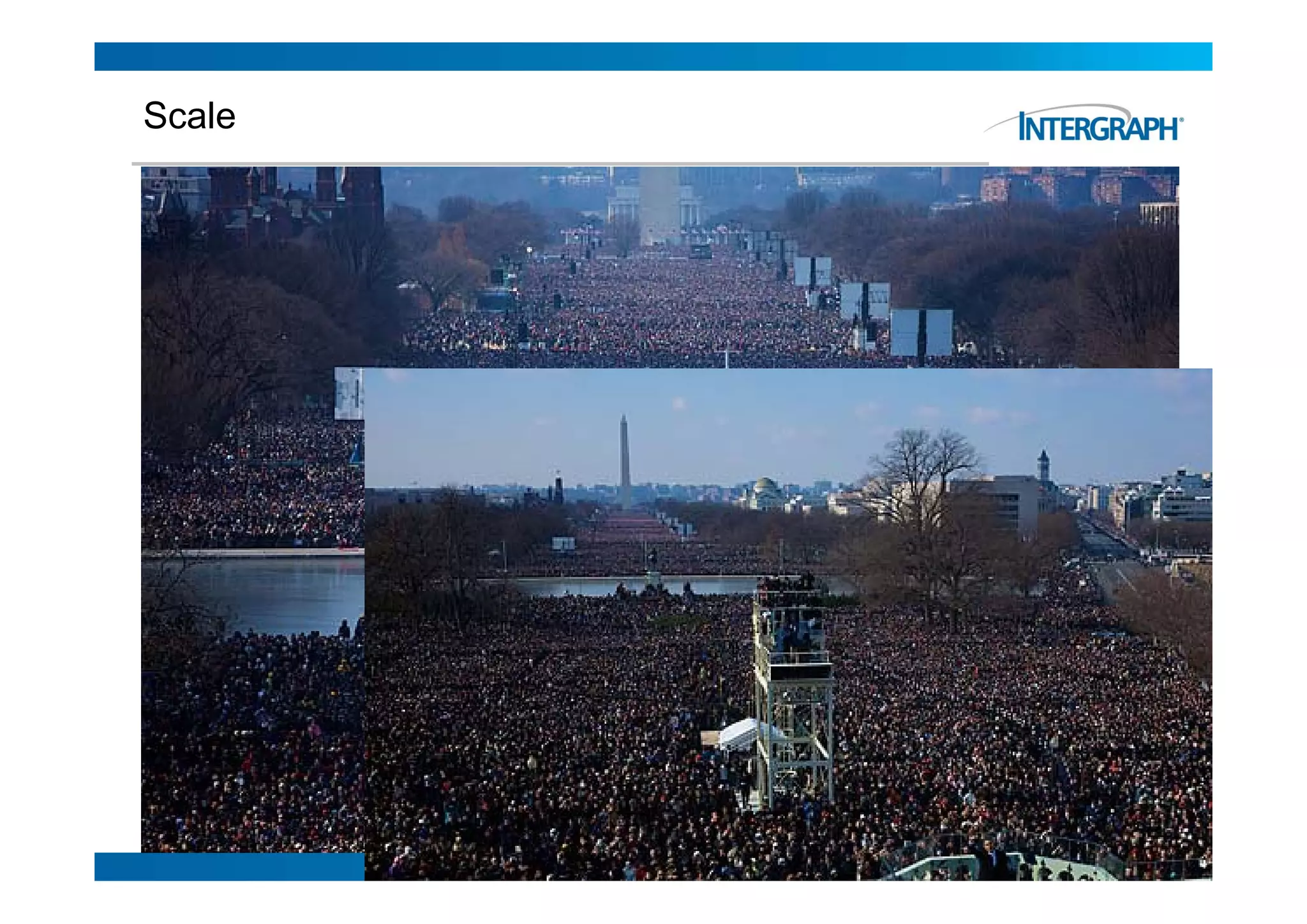
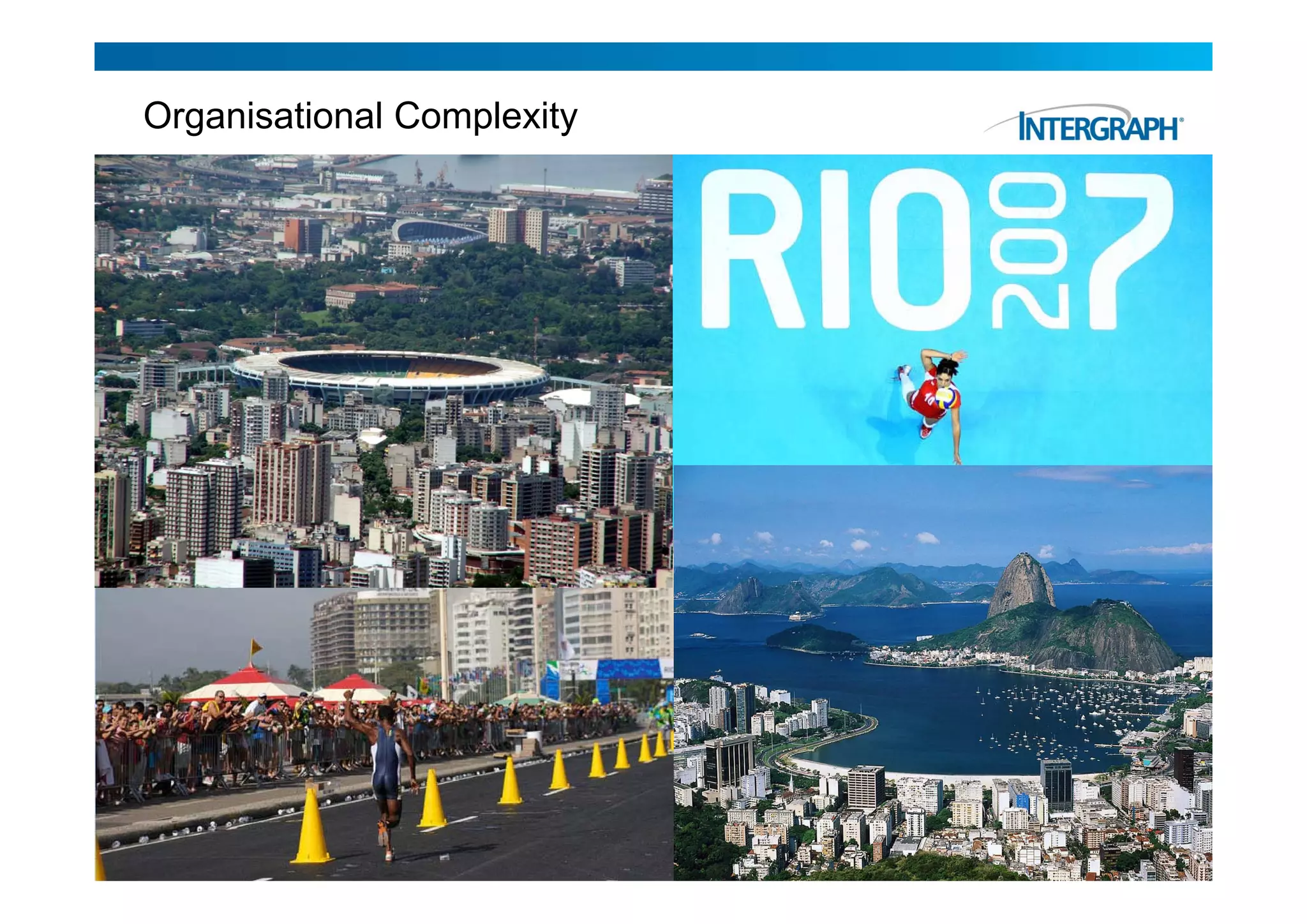
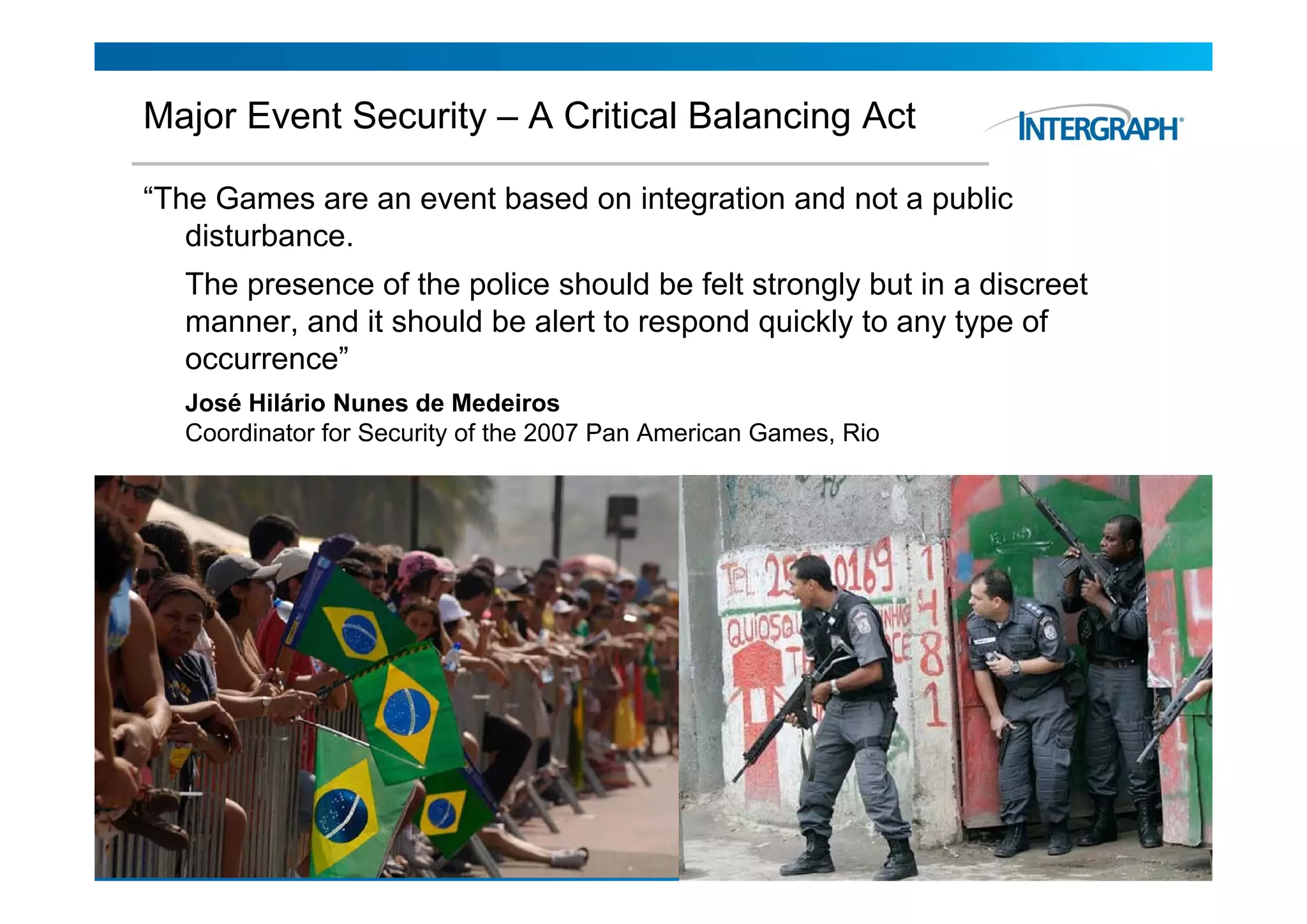
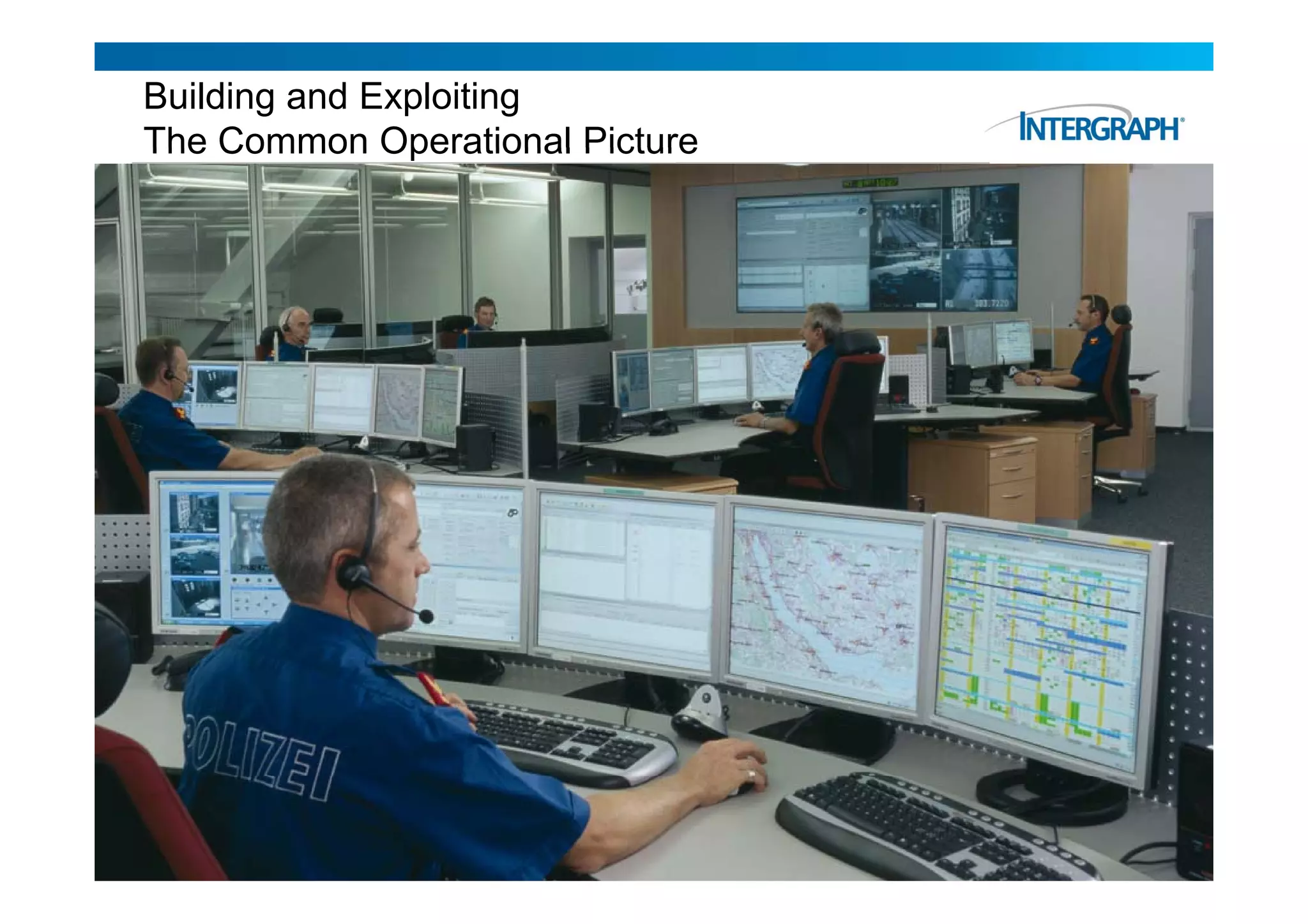
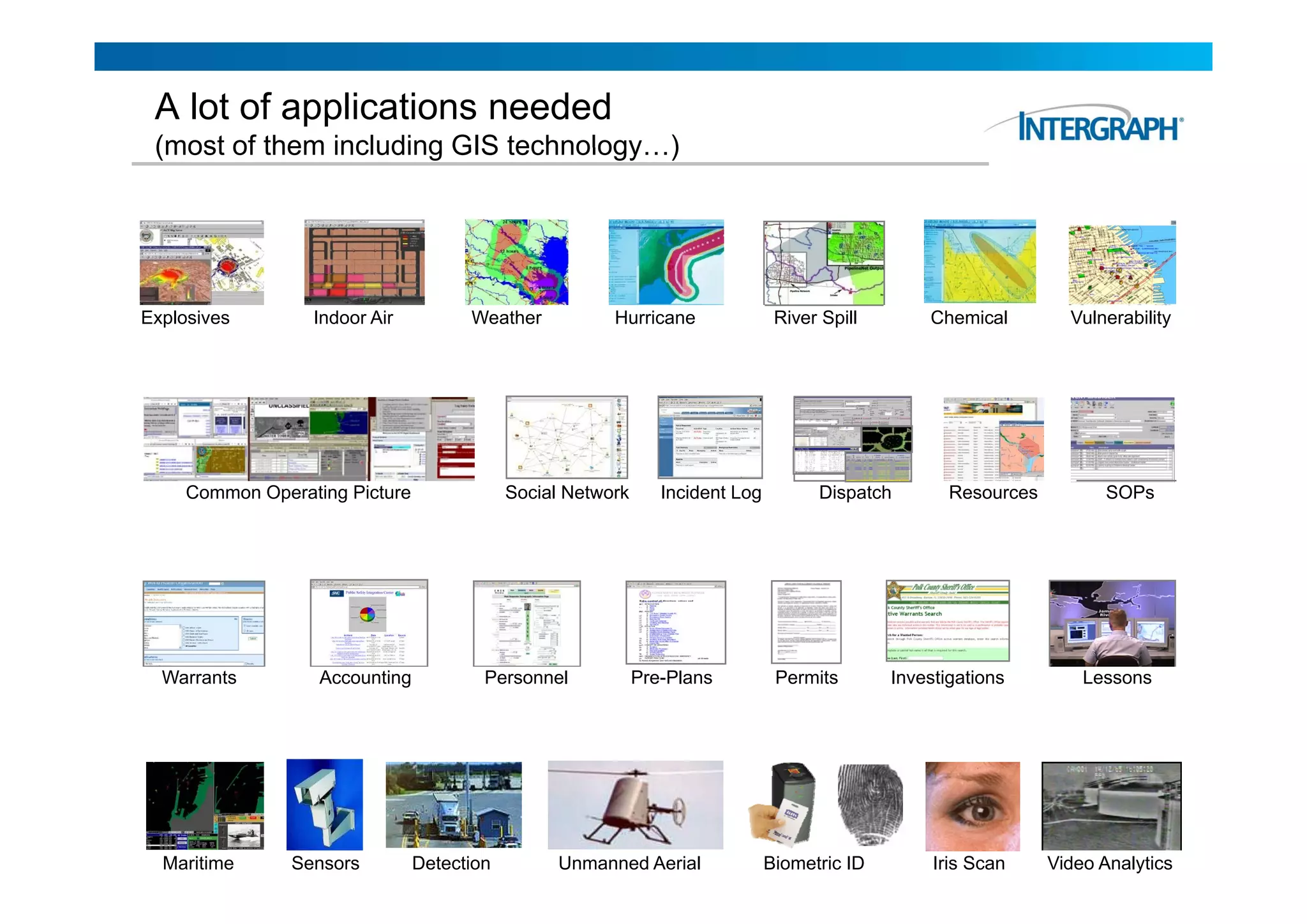
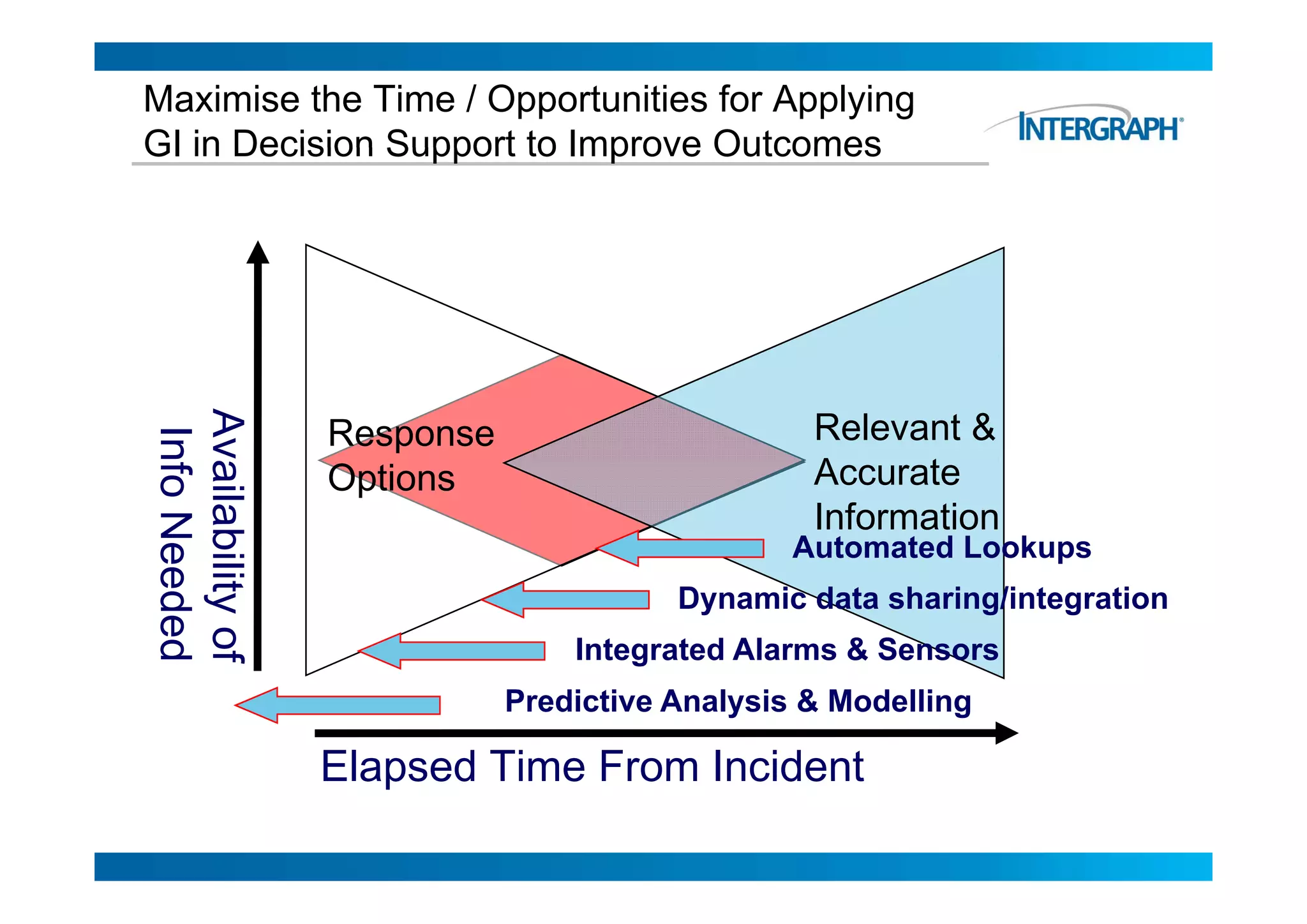
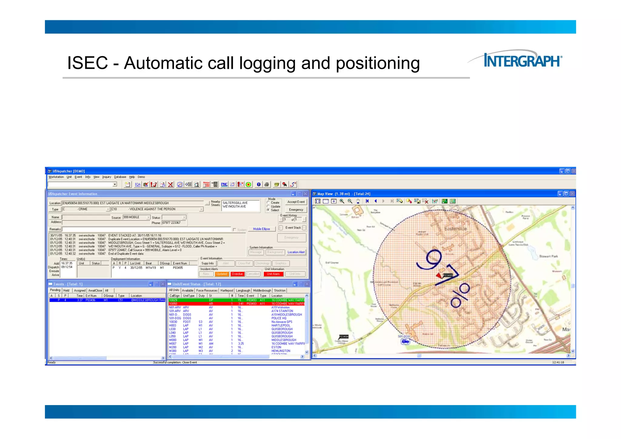
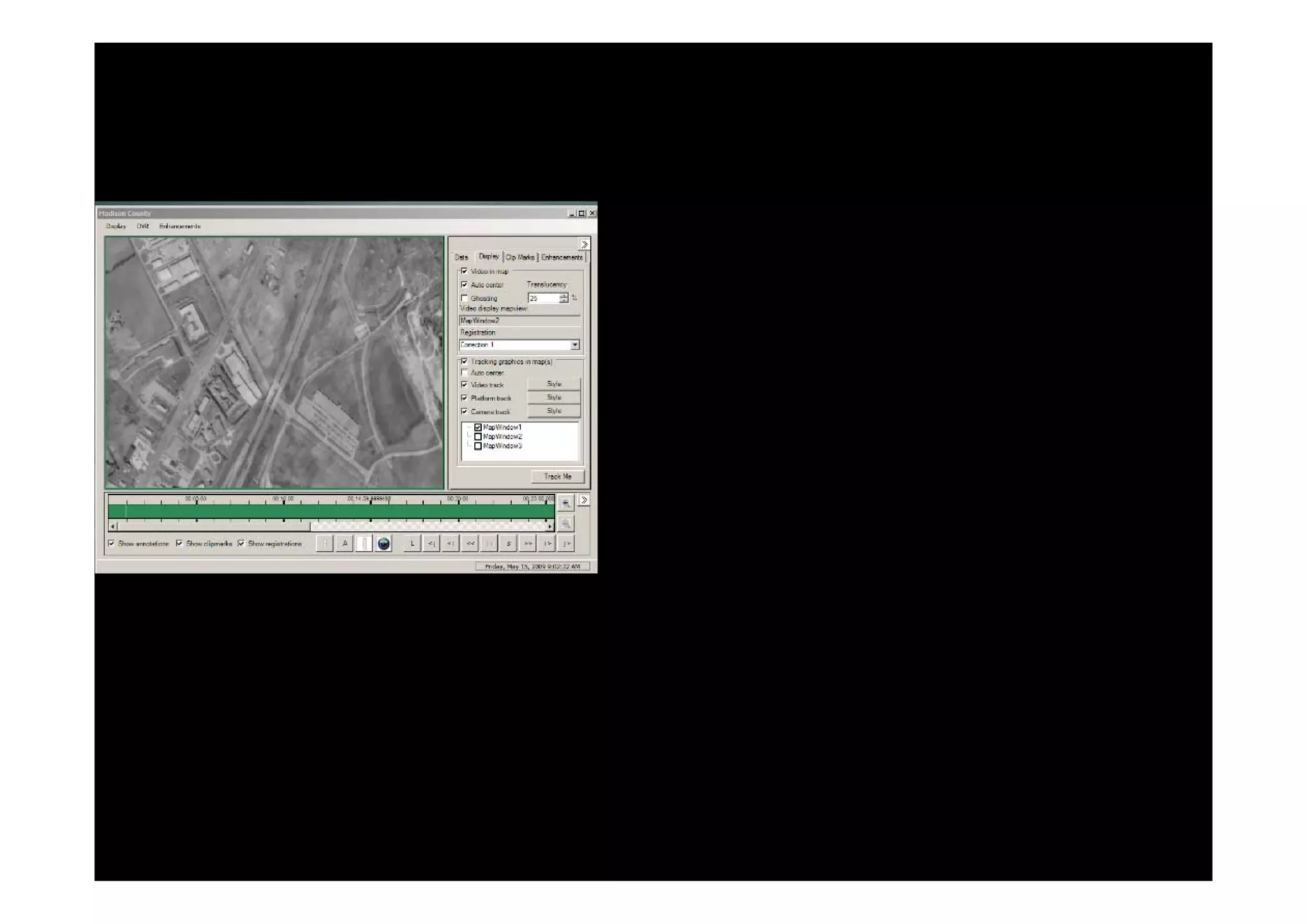
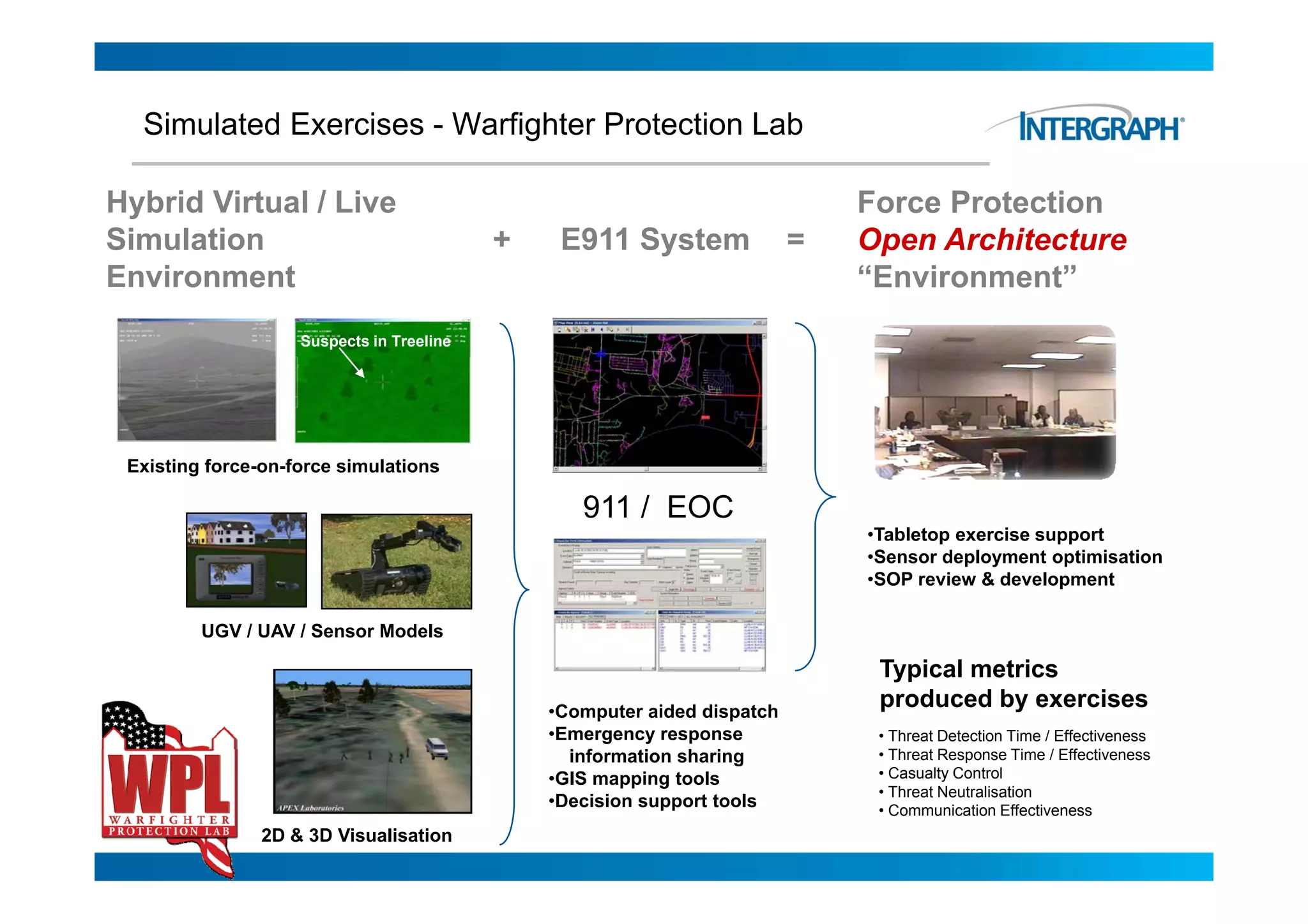
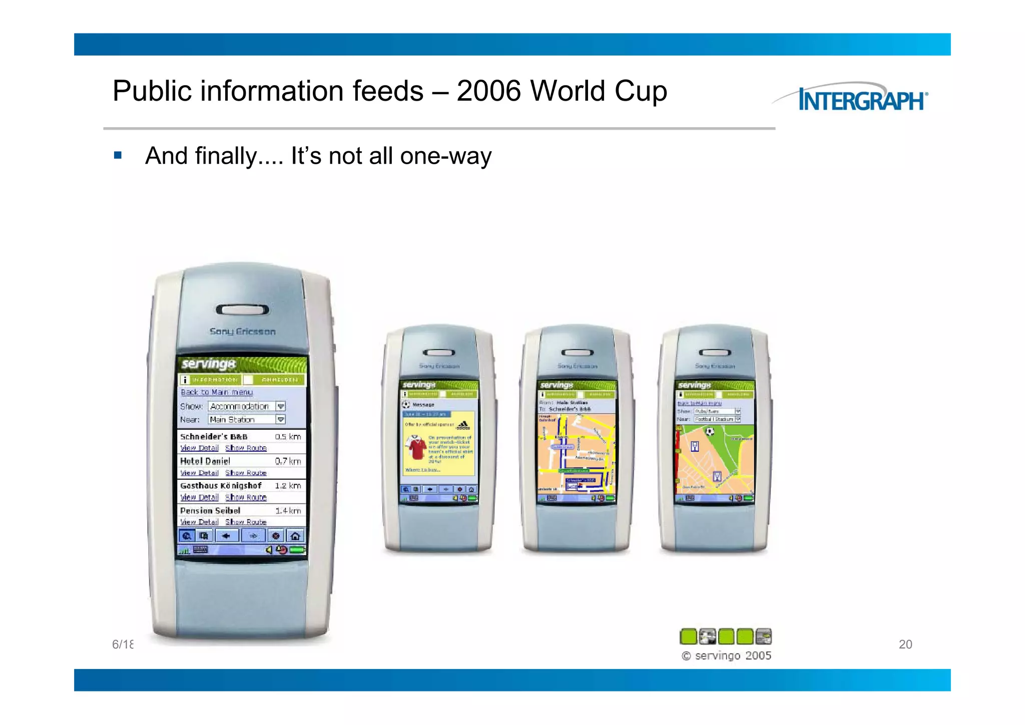

This document discusses the role of geospatial technology in safely and effectively delivering major events. It notes that major events face unique challenges related to scale, organizational complexity, risks, and balancing conflicting requirements. It provides examples of how geospatial technology can help with security, operational decision support, developing a common operational picture, and maximizing the use of geospatial information to improve outcomes.


