The Walker's Map: Designing GPS-enabled mapping for the urban recreational walkers - by Brian Dixon
•
0 likes•975 views

The document discusses designing GPS-enabled mobile wayfinding applications to support users exploring environments on foot while maintaining high situation awareness. It reviews literature on urban recreational walking, wayfinding, cognitive science, situation awareness and interaction paradigms. The research approach involves testbenching applications and considering action theory to understand what happens during exploration. The goal is meaningful integration of users, technology and environments through wayfinding application design.

Recommended
More Related Content
More from British Cartographic Society
More from British Cartographic Society (20)
Recently uploaded
Recently uploaded (20)
The Walker's Map: Designing GPS-enabled mapping for the urban recreational walkers - by Brian Dixon
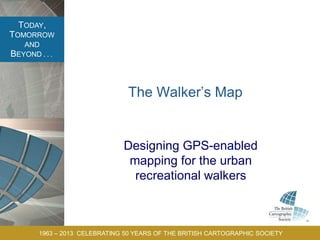
- 1. TODAY, TOMORROW AND BEYOND . . . 1963 – 2013 CELEBRATING 50 YEARS OF THE BRITISH CARTOGRAPHIC SOCIETY The Walker’s Map Designing GPS-enabled mapping for the urban recreational walkers
- 2. TODAY, TOMORROW AND BEYOND . . . 1963 – 2013 CELEBRATING 50 YEARS OF THE BRITISH CARTOGRAPHIC SOCIETY Sorry! I’m a Designer; I have no Discipline
- 3. TODAY, TOMORROW AND BEYOND . . . 1963 – 2013 CELEBRATING 50 YEARS OF THE BRITISH CARTOGRAPHIC SOCIETY PhD Research Question How can GPS-enabled mobile wayfinding applications be designed to rapidly support the user exploring an environment on foot, while allowing them to maintain high situation-awareness?
- 4. TODAY, TOMORROW AND BEYOND . . . 1963 – 2013 CELEBRATING 50 YEARS OF THE BRITISH CARTOGRAPHIC SOCIETY Getting started. Urban recreational walking. What is it? Where do it come from?
- 5. TODAY, TOMORROW AND BEYOND . . . 1963 – 2013 CELEBRATING 50 YEARS OF THE BRITISH CARTOGRAPHIC SOCIETY Wordsworthian Cosmologies
- 6. TODAY, TOMORROW AND BEYOND . . . 1963 – 2013 CELEBRATING 50 YEARS OF THE BRITISH CARTOGRAPHIC SOCIETY Semi-structured interviews. Let’s get phenomenological… Why/Where/How do you walk?
- 7. TODAY, TOMORROW AND BEYOND . . . 1963 – 2013 CELEBRATING 50 YEARS OF THE BRITISH CARTOGRAPHIC SOCIETY Analysis
- 8. TODAY, TOMORROW AND BEYOND . . . 1963 – 2013 CELEBRATING 50 YEARS OF THE BRITISH CARTOGRAPHIC SOCIETY The Findings ‘…the positive aspect is you’re never lost and the negative aspect is that you’re never lost.’ ‘…you’re always constantly looking down if you’re looking at your map on your phone, which doesn’t help because you’re going to miss things.’
- 9. TODAY, TOMORROW AND BEYOND . . . 1963 – 2013 CELEBRATING 50 YEARS OF THE BRITISH CARTOGRAPHIC SOCIETY Exploratory Wayfinding
- 10. TODAY, TOMORROW AND BEYOND . . . 1963 – 2013 CELEBRATING 50 YEARS OF THE BRITISH CARTOGRAPHIC SOCIETY Findings from Cognitive Science Problems: Passive interaction. Unstable Schemata. Lack of environmental referencing. Poor memory for distance. (Willis et al. 2009)
- 11. TODAY, TOMORROW AND BEYOND . . . 1963 – 2013 CELEBRATING 50 YEARS OF THE BRITISH CARTOGRAPHIC SOCIETY Situation Awareness ‘Situation awareness is the perception of elements in the environment within a volume of space and time, the comprehension of their meaning, and the projection of their status into the near future.’ (Endsley 1995)
- 12. TODAY, TOMORROW AND BEYOND . . . 1963 – 2013 CELEBRATING 50 YEARS OF THE BRITISH CARTOGRAPHIC SOCIETY Suggested Interaction Paradigms for Wayfinding Guide, Local, Chaperone, Buddy, Captain. (Graham et al. 2004)
- 13. TODAY, TOMORROW AND BEYOND . . . 1963 – 2013 CELEBRATING 50 YEARS OF THE BRITISH CARTOGRAPHIC SOCIETY The Key Drivers in the Research Tracing Human-Artefact-Environment relations through the literature. Philosophy Anthropology Human Geography
- 14. TODAY, TOMORROW AND BEYOND . . . 1963 – 2013 CELEBRATING 50 YEARS OF THE BRITISH CARTOGRAPHIC SOCIETY Ecological Psychology ‘Ambulatory vision’, Seeing while moving… Guided by ‘vistas’… One vista leads to the next.
- 15. TODAY, TOMORROW AND BEYOND . . . 1963 – 2013 CELEBRATING 50 YEARS OF THE BRITISH CARTOGRAPHIC SOCIETY Graphic Syntax Theory
- 16. TODAY, TOMORROW AND BEYOND . . . 1963 – 2013 CELEBRATING 50 YEARS OF THE BRITISH CARTOGRAPHIC SOCIETY My Research Approach
- 17. TODAY, TOMORROW AND BEYOND . . . 1963 – 2013 CELEBRATING 50 YEARS OF THE BRITISH CARTOGRAPHIC SOCIETY My Research Approach
- 18. TODAY, TOMORROW AND BEYOND . . . 1963 – 2013 CELEBRATING 50 YEARS OF THE BRITISH CARTOGRAPHIC SOCIETY Testbenching
- 19. TODAY, TOMORROW AND BEYOND . . . 1963 – 2013 CELEBRATING 50 YEARS OF THE BRITISH CARTOGRAPHIC SOCIETY Next Steps: Action Theory
- 20. TODAY, TOMORROW AND BEYOND . . . 1963 – 2013 CELEBRATING 50 YEARS OF THE BRITISH CARTOGRAPHIC SOCIETY What happens?
- 21. TODAY, TOMORROW AND BEYOND . . . 1963 – 2013 CELEBRATING 50 YEARS OF THE BRITISH CARTOGRAPHIC SOCIETY Meaningful Integration