Download as PDF, PPTX


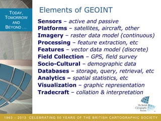
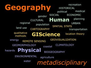


The document celebrates 50 years of the British Cartographic Society, emphasizing the evolution and significance of geospatial intelligence (GEOINT) as actionable knowledge vital for human security. It outlines GEOINT's processes and applications, including the collection and analysis of spatial data, and highlights its interdisciplinary nature involving various fields such as human geography and cartography. Additionally, it discusses R&D priorities and the importance of critical thinking and spatial reasoning in the GEOINT profession.