Download as PDF, PPTX
![Current & recent Geo activities at EDINA
Services:
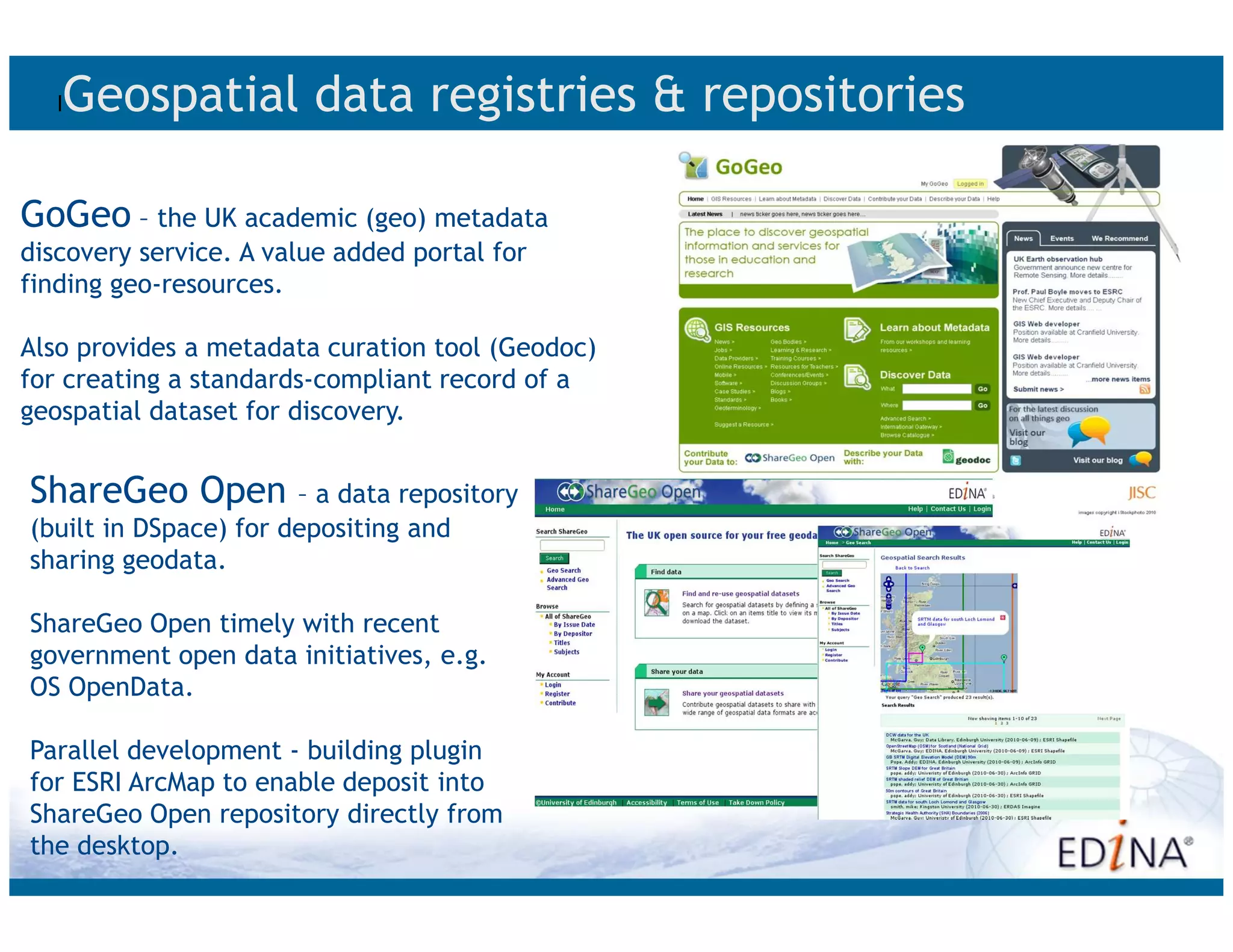
Digimap [for Schools]; UKBORDERS; GoGeo; Unlock; agcensus;
ShareGeo Open; OpenBoundaries; OpenStream
Projects & activities
ESDIN - European Spatial Data Infrastructure Best Practice Network
WSTERIA – secure web services (OGC)
Soils demonstrator – eFramework
AddressingHistory
ShareGeo+
Service hosting (GIGateway, Scottish DMS)
Community engagement and outreach e.g.
Seat on UK LP Location Information Interoperability Board
Chair OGC Universities WG
Sit on Scottish Government GI Steering Group
Acting as contact point between OGC and e-Science GRID communities
AGI Working Groups
Census Advisory Committee and Census Web Services Working Group](https://image.slidesharecdn.com/inspirehe-111125125453-phpapp02/75/Presentation-on-INSPIRE-and-Higher-Education-1-of-2-7-2048.jpg)

The document discusses the importance of effective research data management and digital curation in ensuring long-term access to geospatial data for policymakers and researchers. It emphasizes the role of the INSPIRE directive in improving the sharing and accessibility of spatial information among public authorities in the UK. Additionally, it outlines various initiatives, resources, and tools designed to support data management practices, ensure compliance with regulations, and enhance the usability of geospatial data.


![Coded Agents – with UiPath SDK + LangGraph [Virtual Hands-on Workshop]](https://cdn.slidesharecdn.com/ss_thumbnails/codedagentsdeck-251215155422-5497c599-thumbnail.jpg?width=640&height=640&fit=bounds)


