Env sys igibs envinfo_nov11
•
1 like•346 views

Presentation given at the Collaborative by Nature event (#gecoenv) in Cardiff on 11th November 2011.

Recommended
More Related Content
Viewers also liked
Viewers also liked (15)
Similar to Env sys igibs envinfo_nov11
Similar to Env sys igibs envinfo_nov11 (20)
More from JISC GECO
More from JISC GECO (20)
Recently uploaded
Recently uploaded (20)
Env sys igibs envinfo_nov11
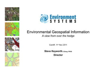
- 1. Environmental Geospatial Information A view from over the hedge Cardiff, 11 th Nov 2011 Steve Keyworth , CGeog, FRGS Director
- 3. Challenges £ € $
- 4. We must deliver on these challenges
- 5. © Ian Medcalf Multiple pressures on the land Renewable energy Climate regulation Recreation opportunities Water regulation Pollination (gardens) Natural flood defence Scenic landscape Food production New build
- 8. Updated habitat map For Wales The revised map will replace the original Phase 1 mapping which took 3 teams of 10 field surveyors 15 years to complete. It uses a time series rule based approach to classify areas of habitat. Excluding the research stage, the new approach has cost <1/10. www.gwylio.org.uk
- 11. The UK punches above its weight * The Royal Society
- 12. The right tools for the job * Bret Victor “ A tool addresses human needs by amplifying human capabilities” .
- 13. The right tools for the job “ That is, a tool converts what we can do into what we want to do . A great tool is designed to fit both sides”. * Bret Victor
- 14. Integrated use of sources, including earth observation, sensor web, in-situ survey, crowd source survey provides benefits from flexible coverage and levels of detail Integrated data Satellite Plane UAS Coverage Level of detail
- 15. Access to data
Editor's Notes
- ESL Academia
- 11/02/08
- 11/02/08
- Environment Systems - Commercial in Confidence 05/05/10 Assessing the Extent and Severity of Erosion on the upland Organic Soils of Scotland using Earth Observation
- Environment Systems - Commercial in Confidence 05/05/10 Assessing the Extent and Severity of Erosion on the upland Organic Soils of Scotland using Earth Observation
- Environmental information is fundamental for: Policy development Service delivery Business decisions Monitoring and evaluating the impacts of decisions.
- Background of demographics changes (population increase and profile change) together with policy and regulatory environment & economic conditions Environment Systems - Commercial in Confidence 23/09/08 LOT1: LUCAS 2009 - Field Work in Ireland and the UK