Download as PDF, PPTX
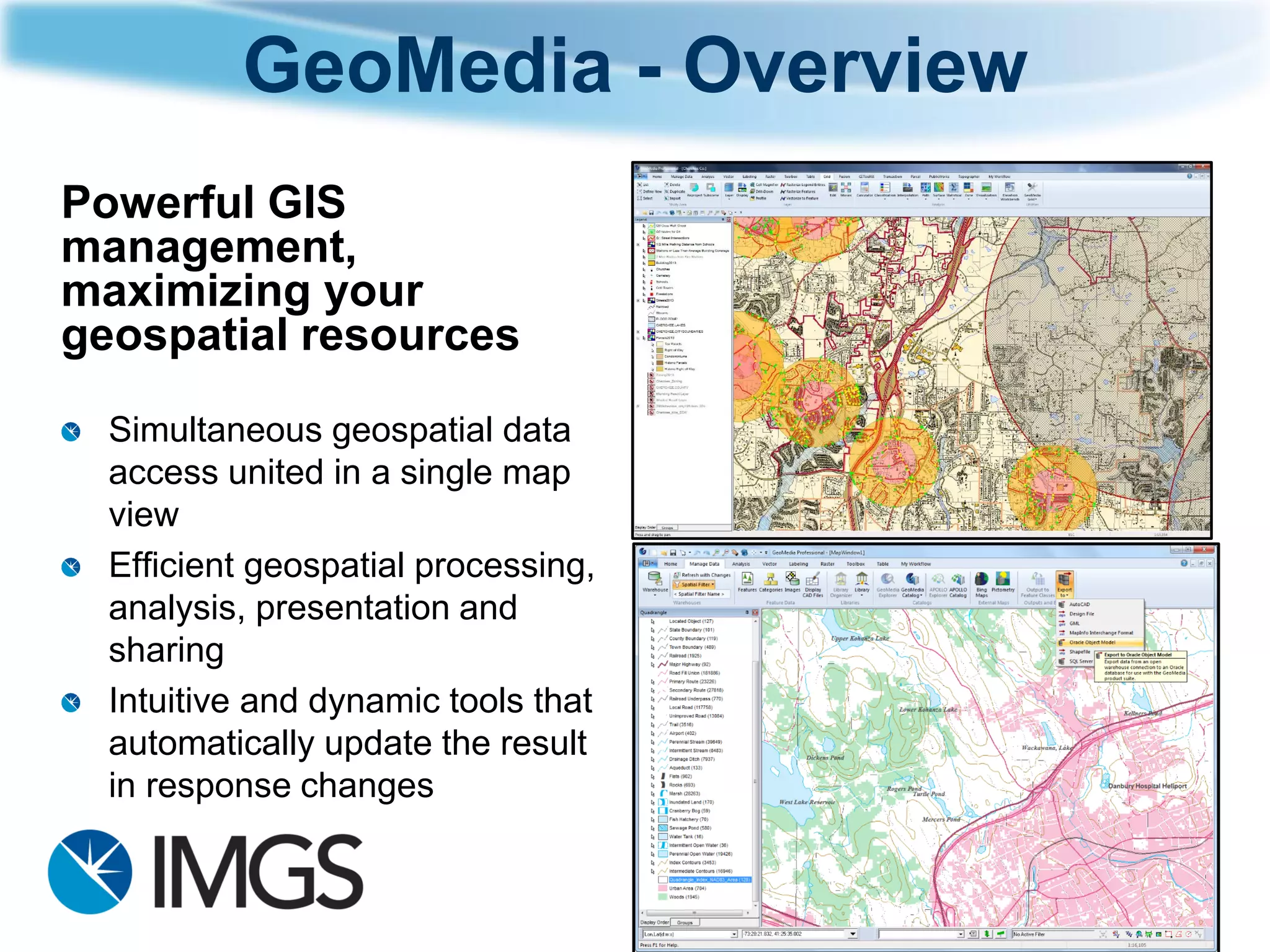
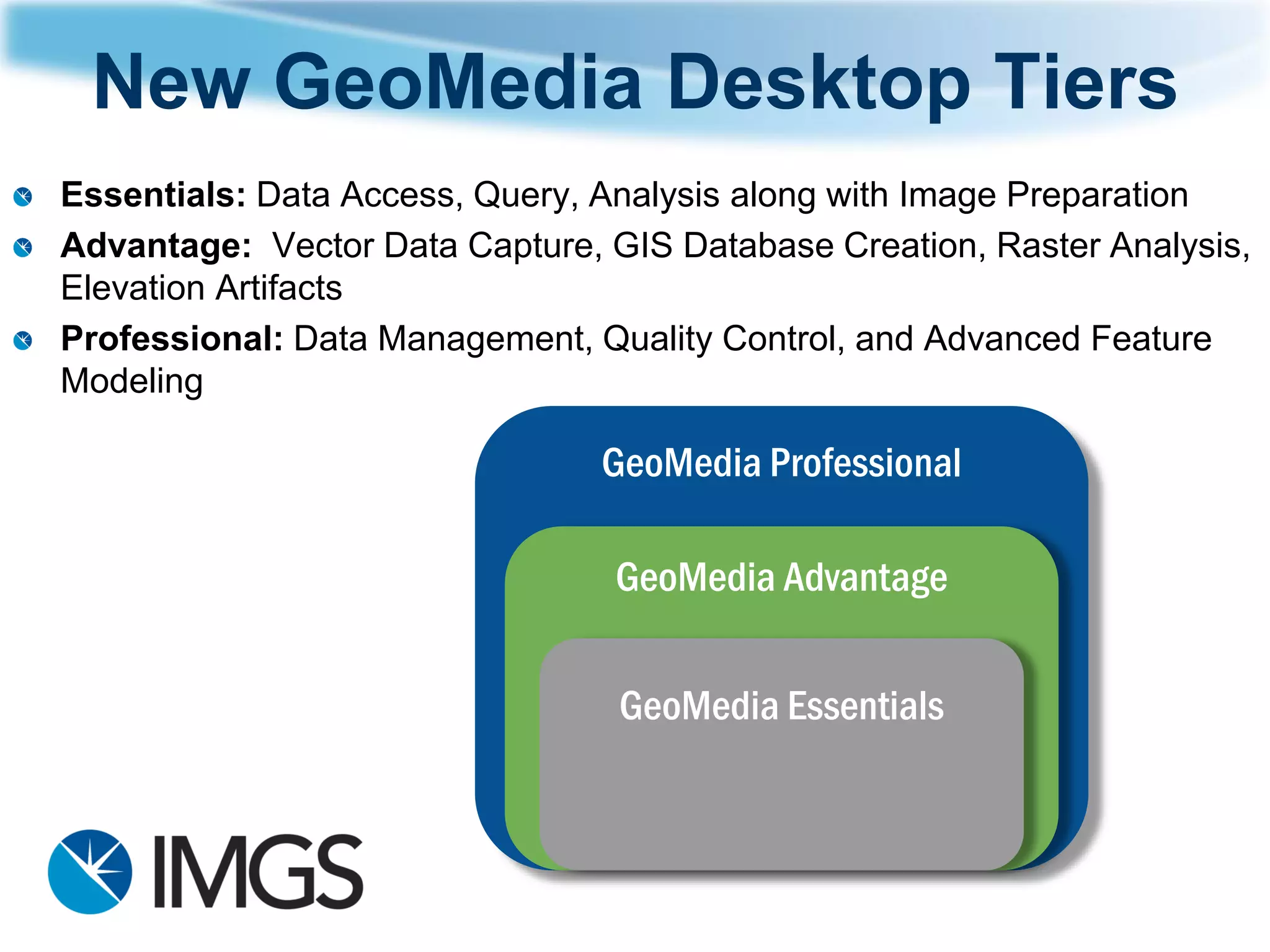
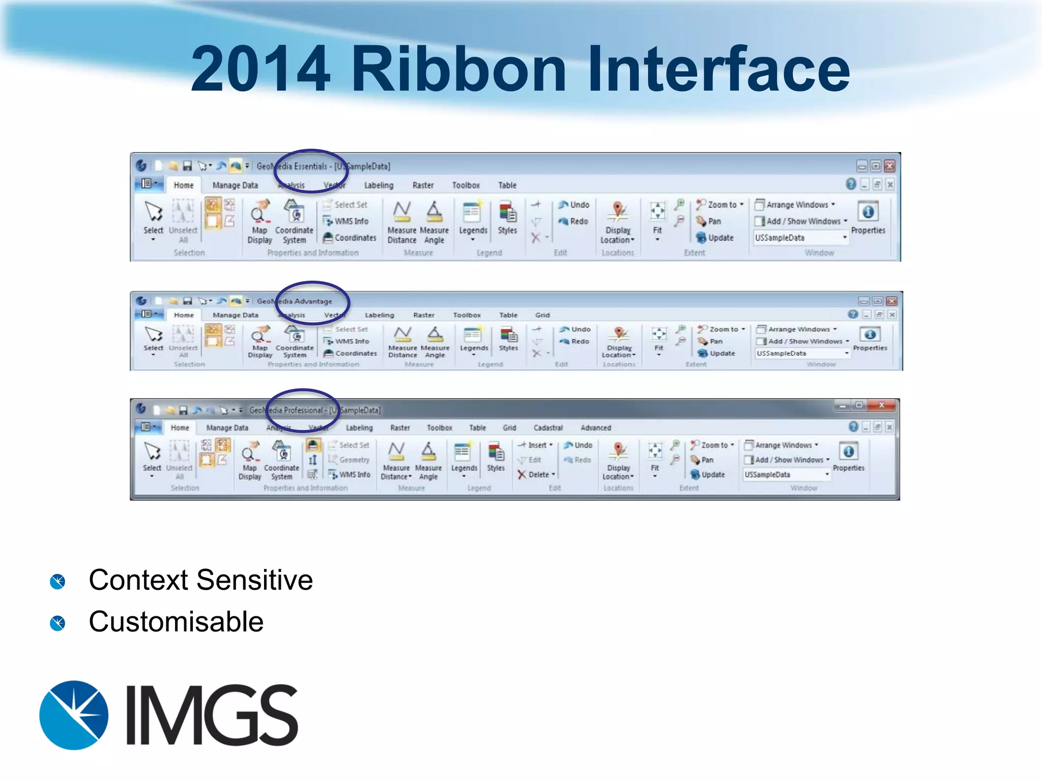
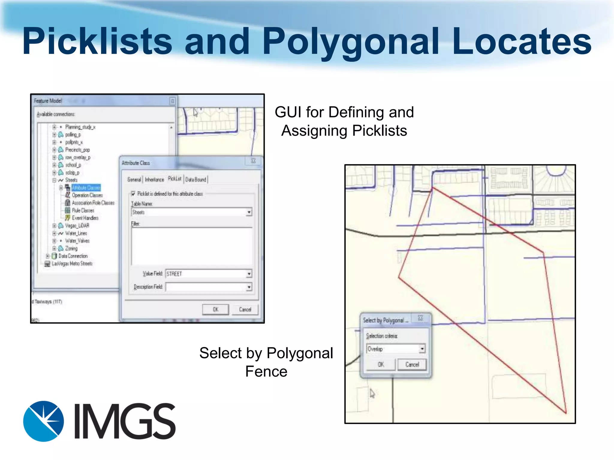
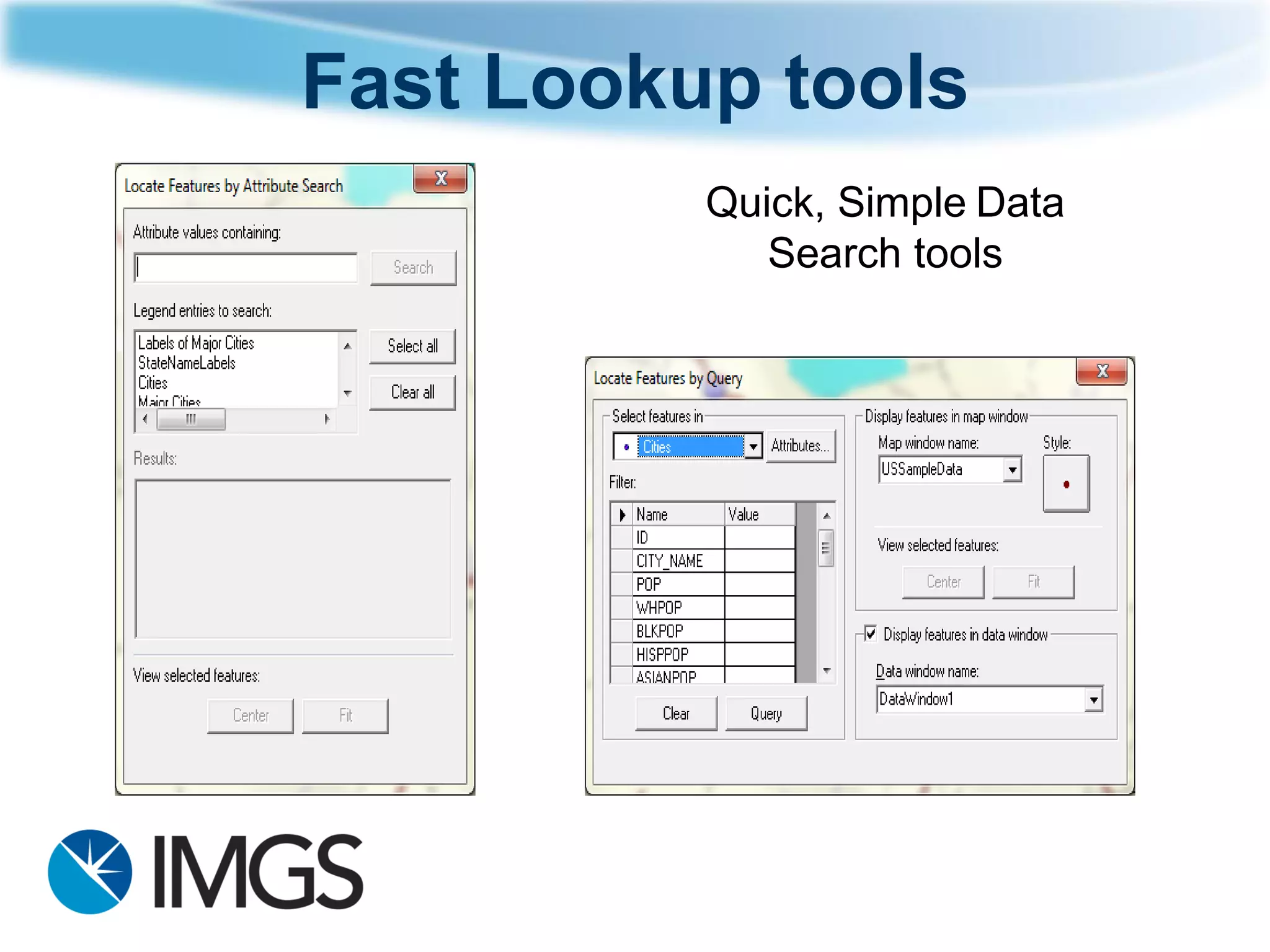
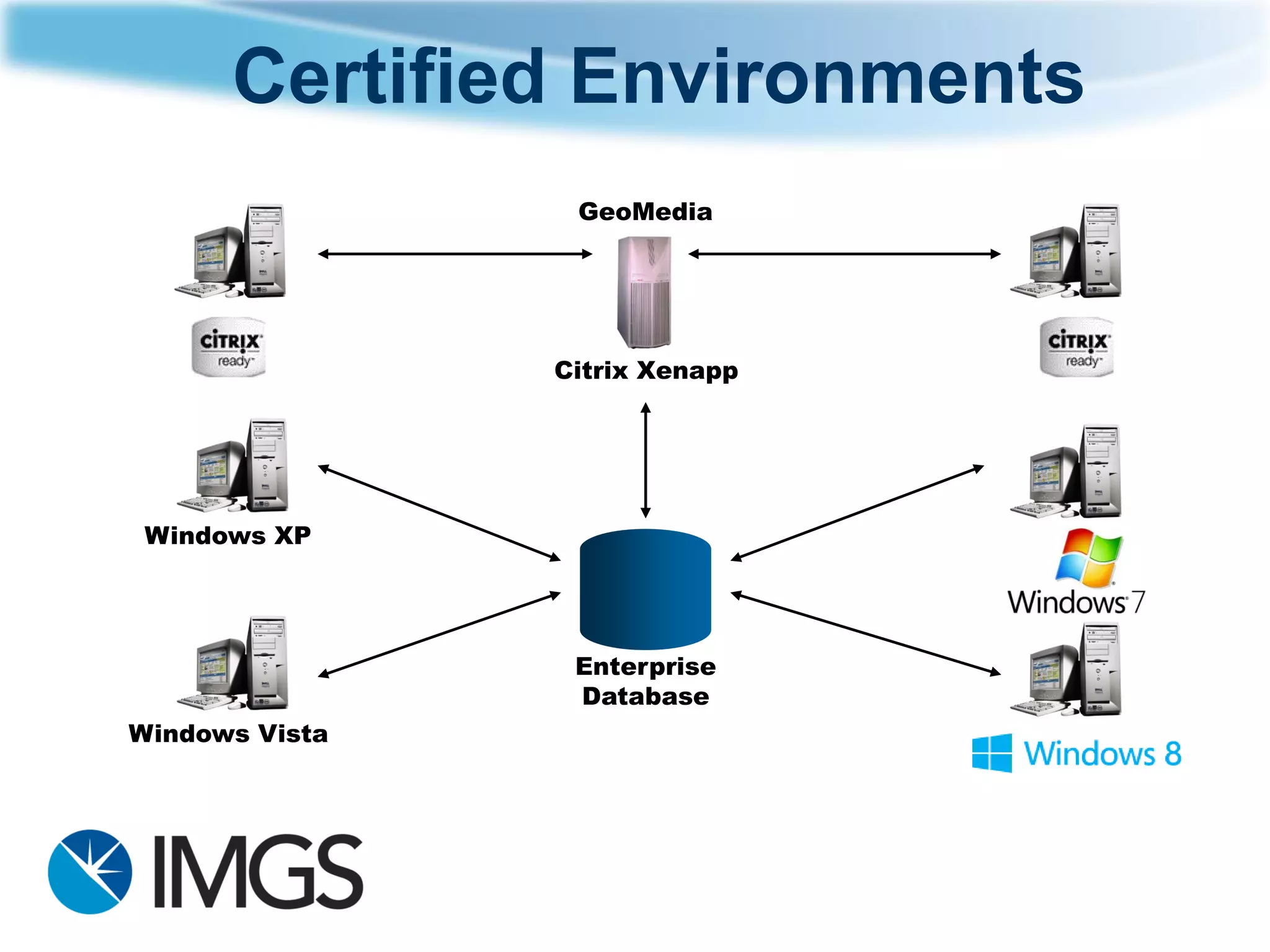
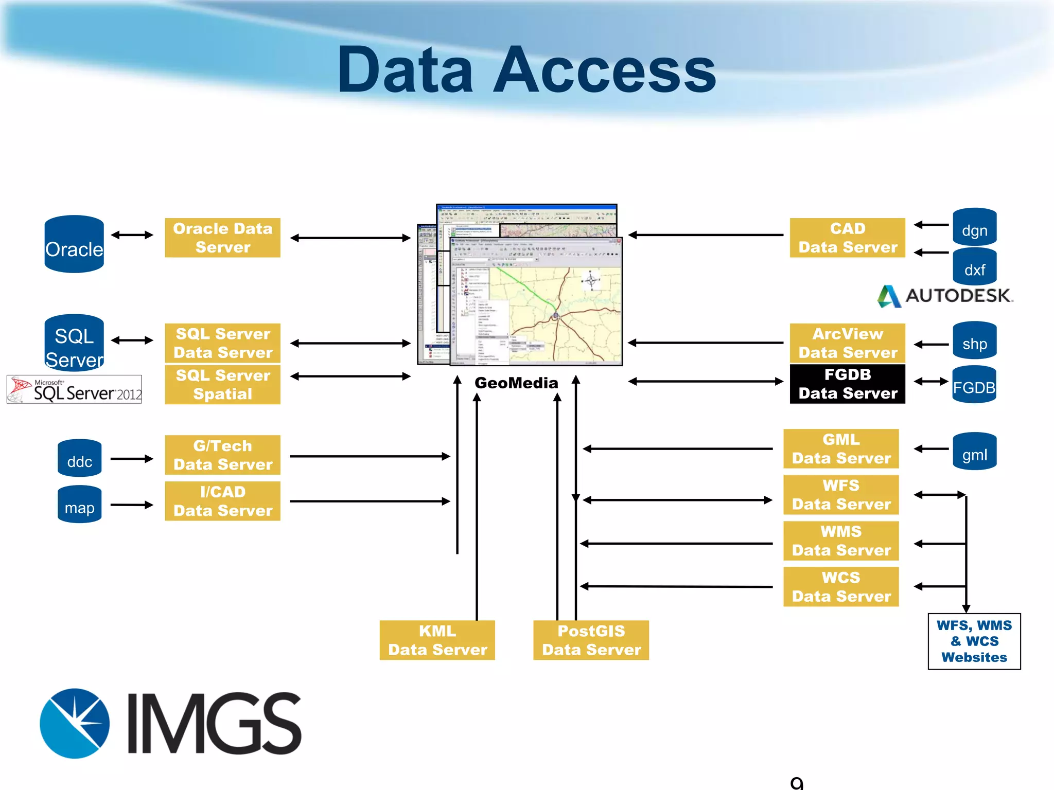
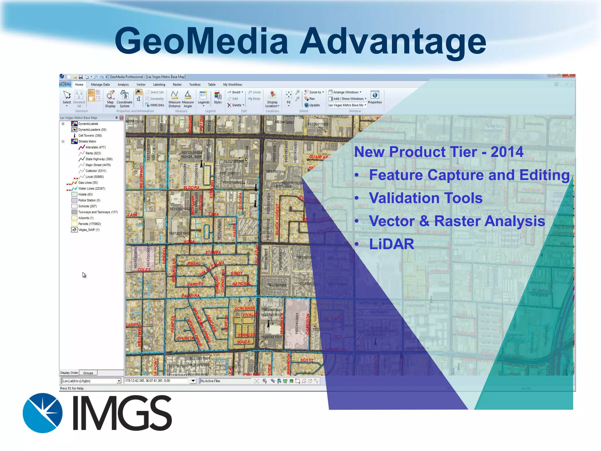
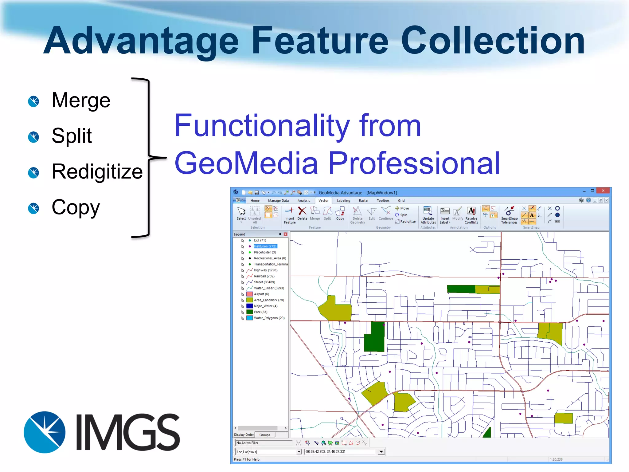
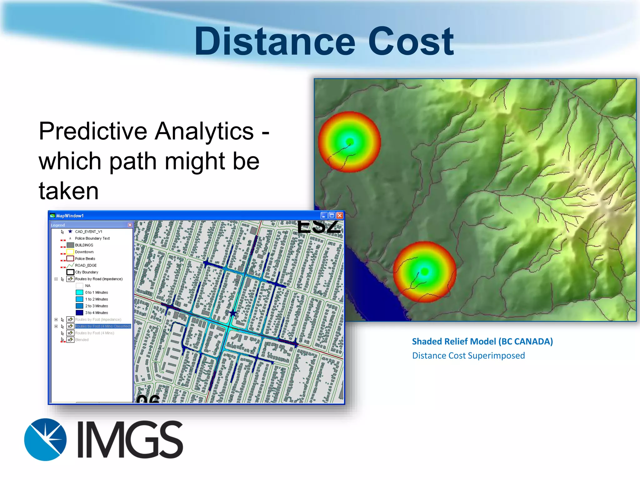
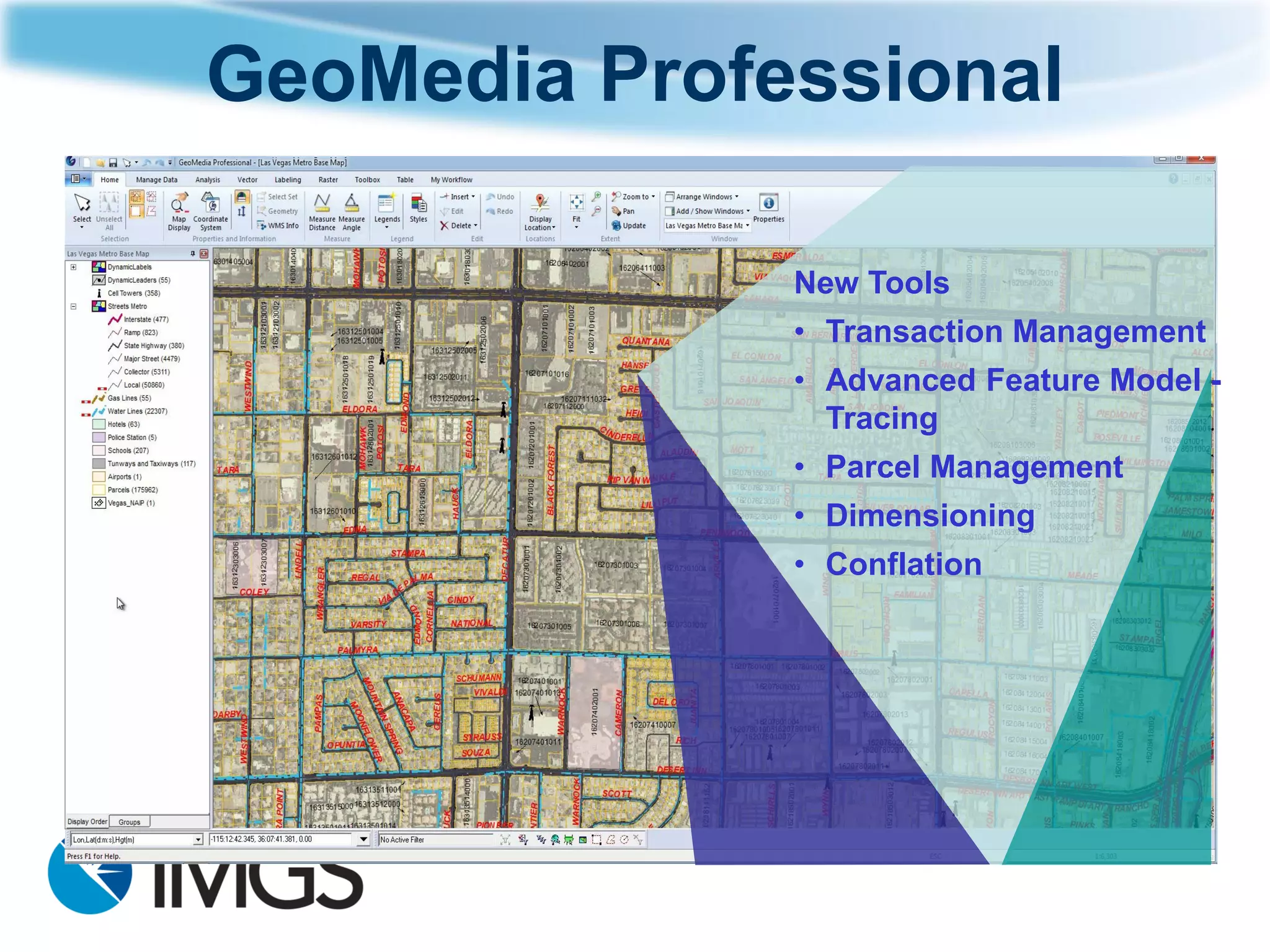
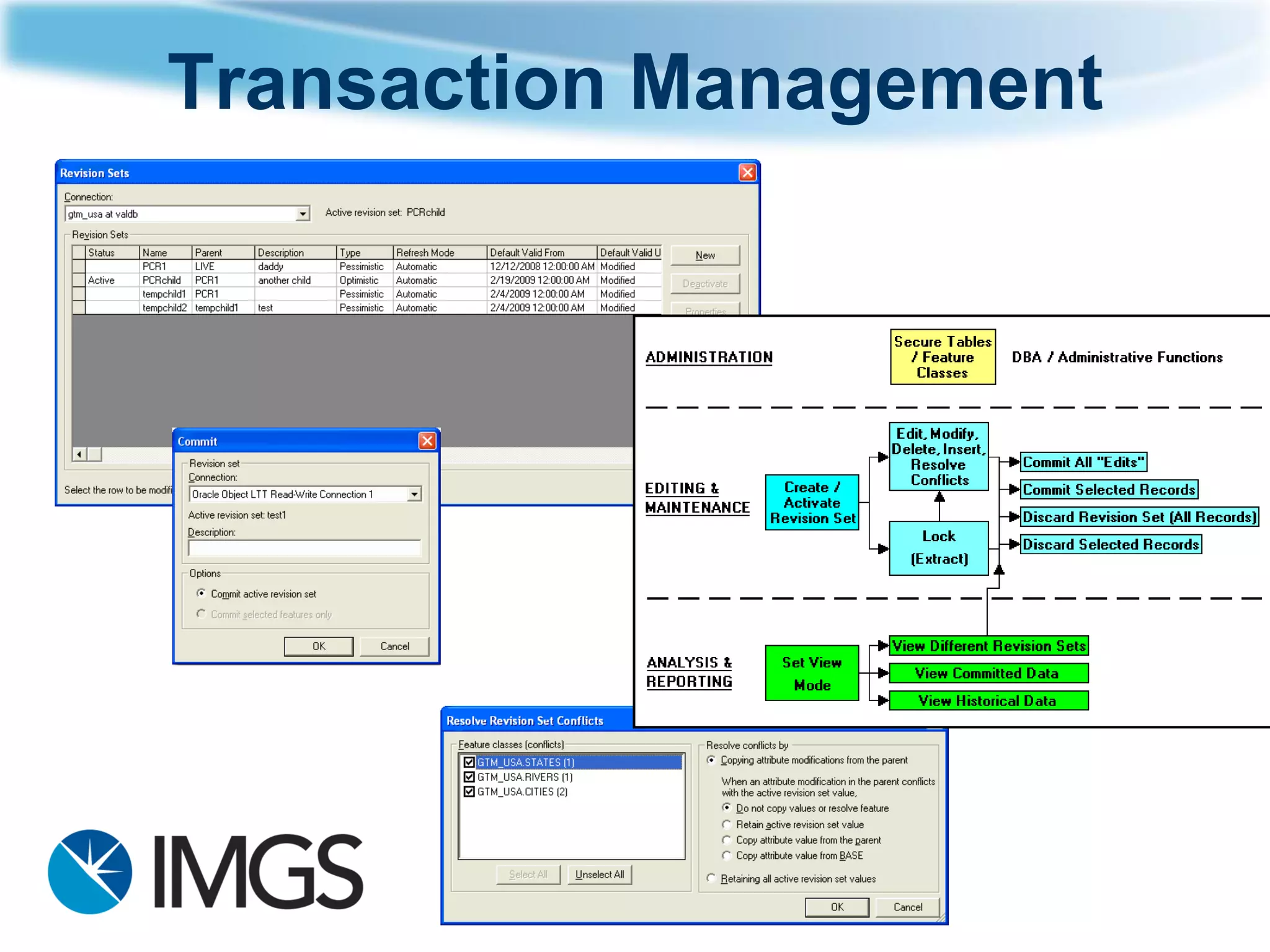
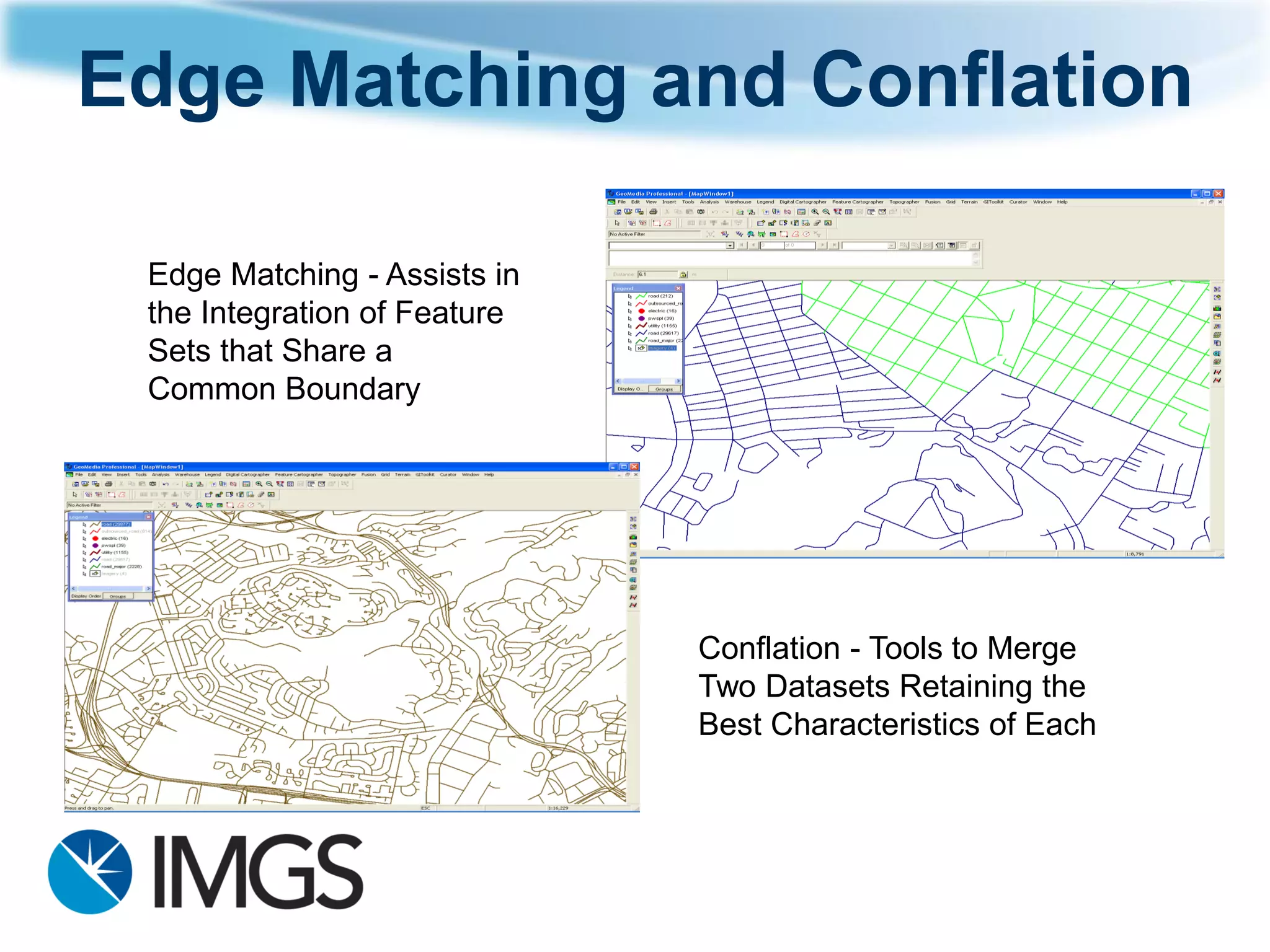
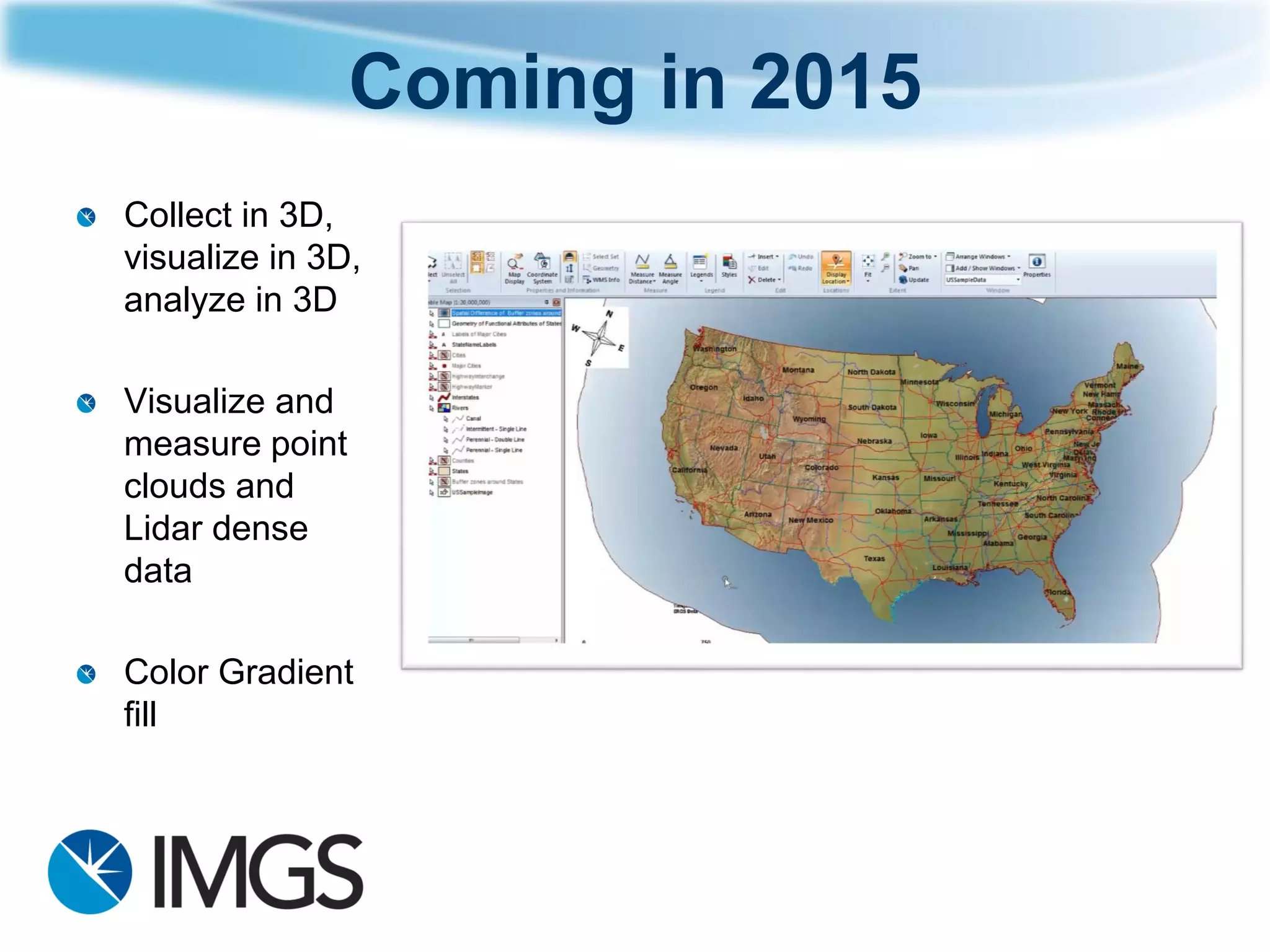
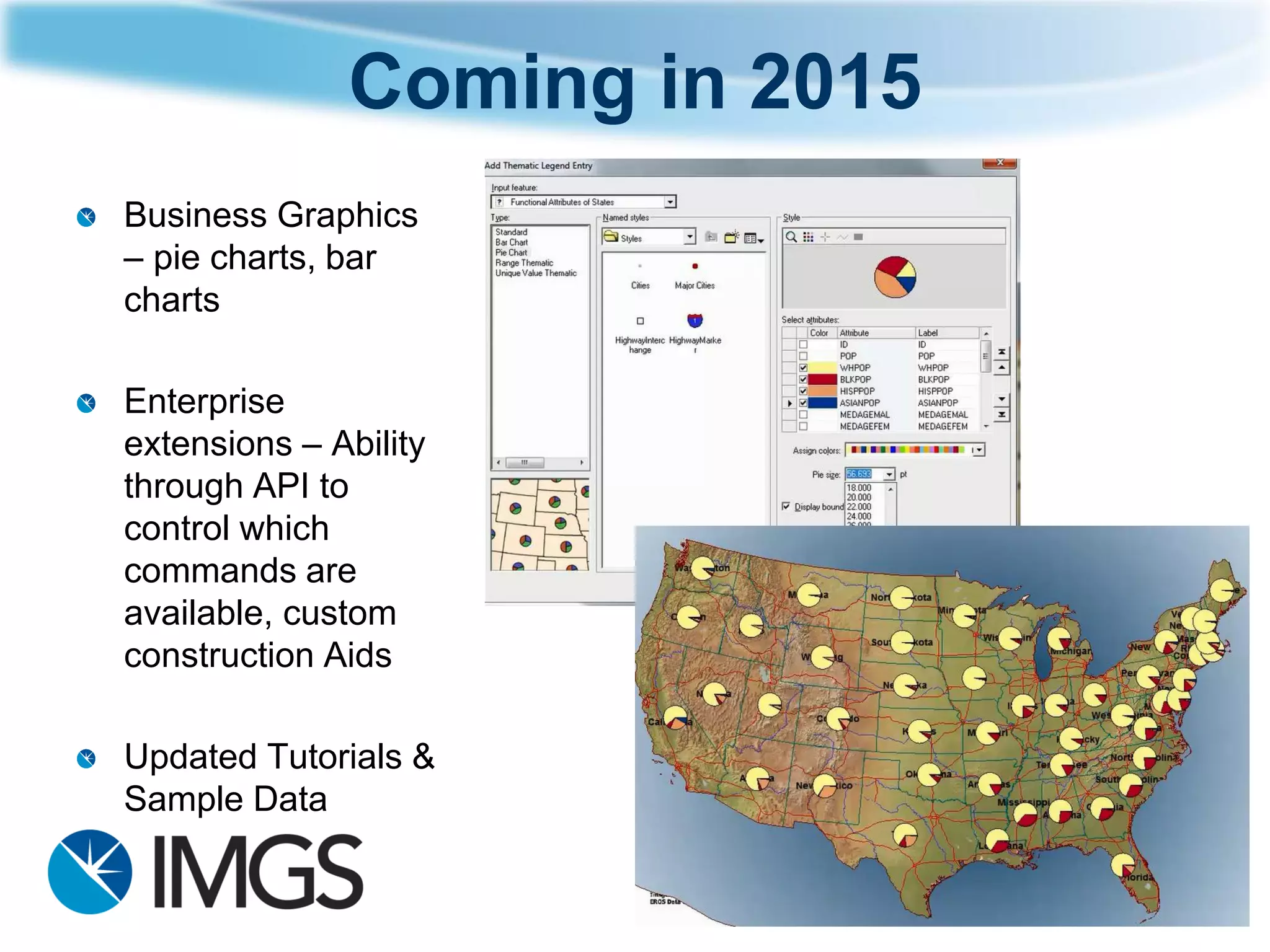

GeoMedia is a GIS software that allows for powerful management of geospatial data through simultaneous access and dynamic updating. The 2014 version includes new product tiers for different capability levels and a customizable ribbon interface. It provides efficient analysis, processing, and sharing of vector, raster, imagery and 3D data through intuitive tools. New features in 2014 include picklists, polygonal selection, fast search tools, and support for additional platforms and databases.