Download as PDF, PPTX
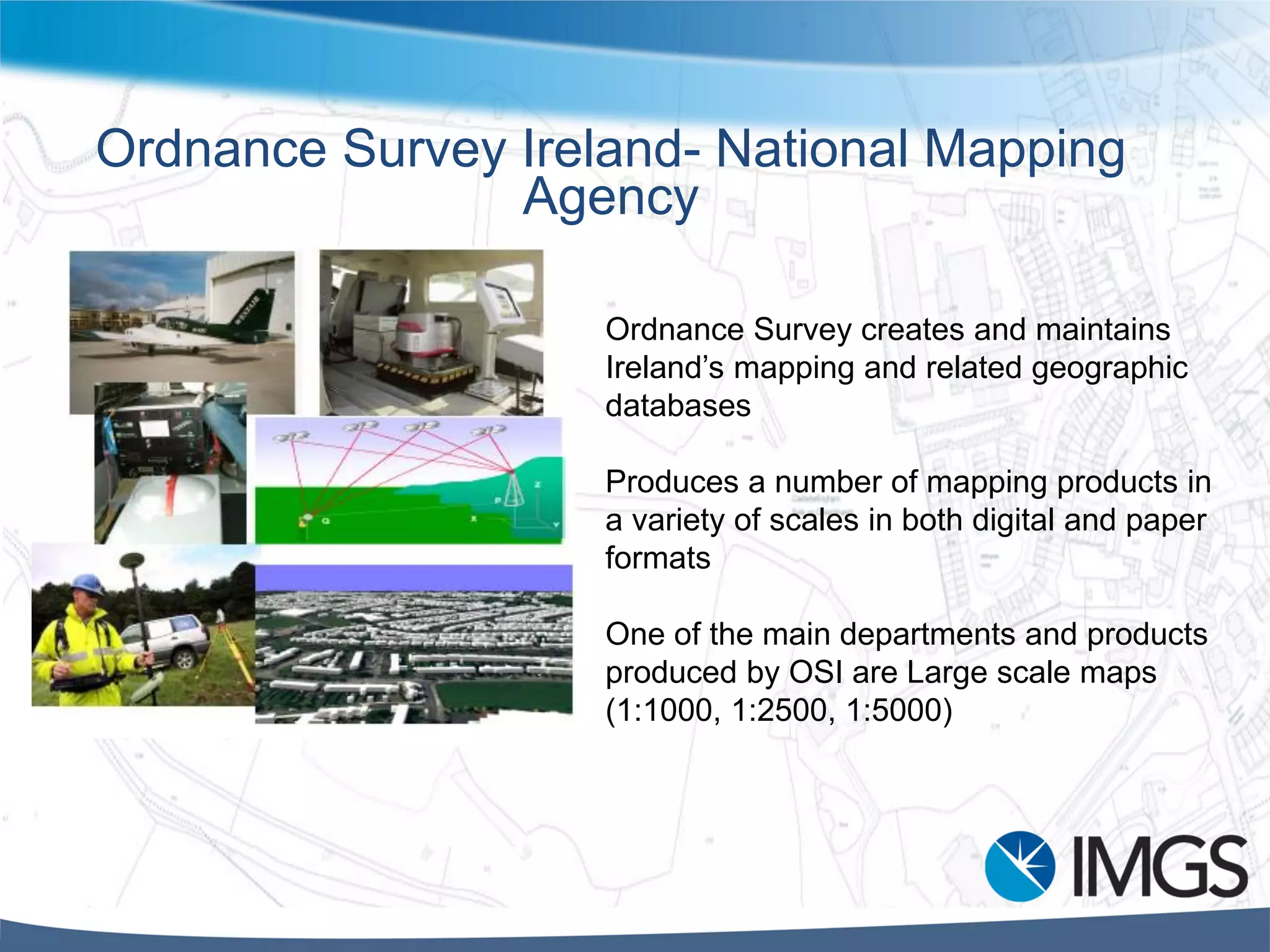
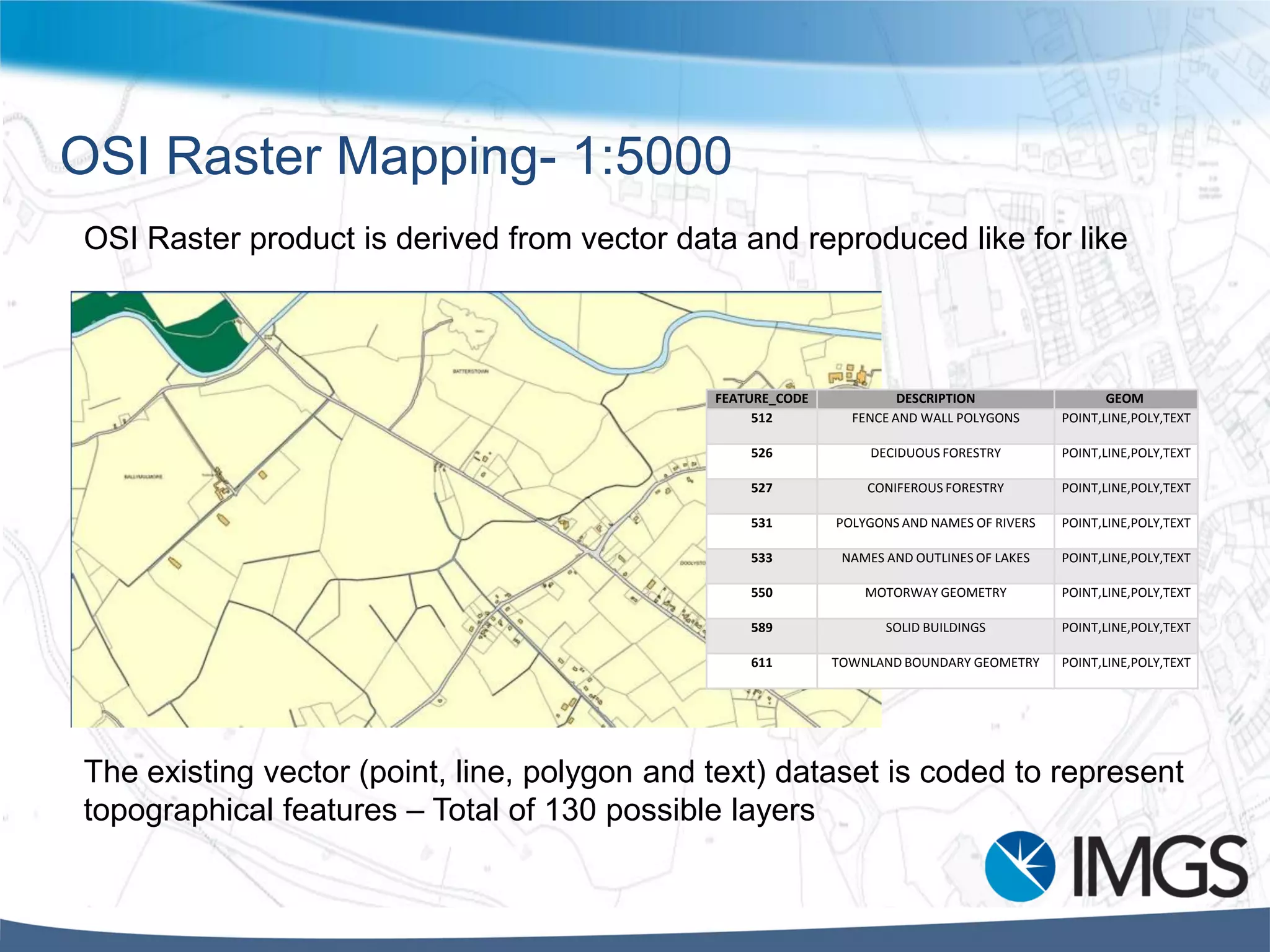
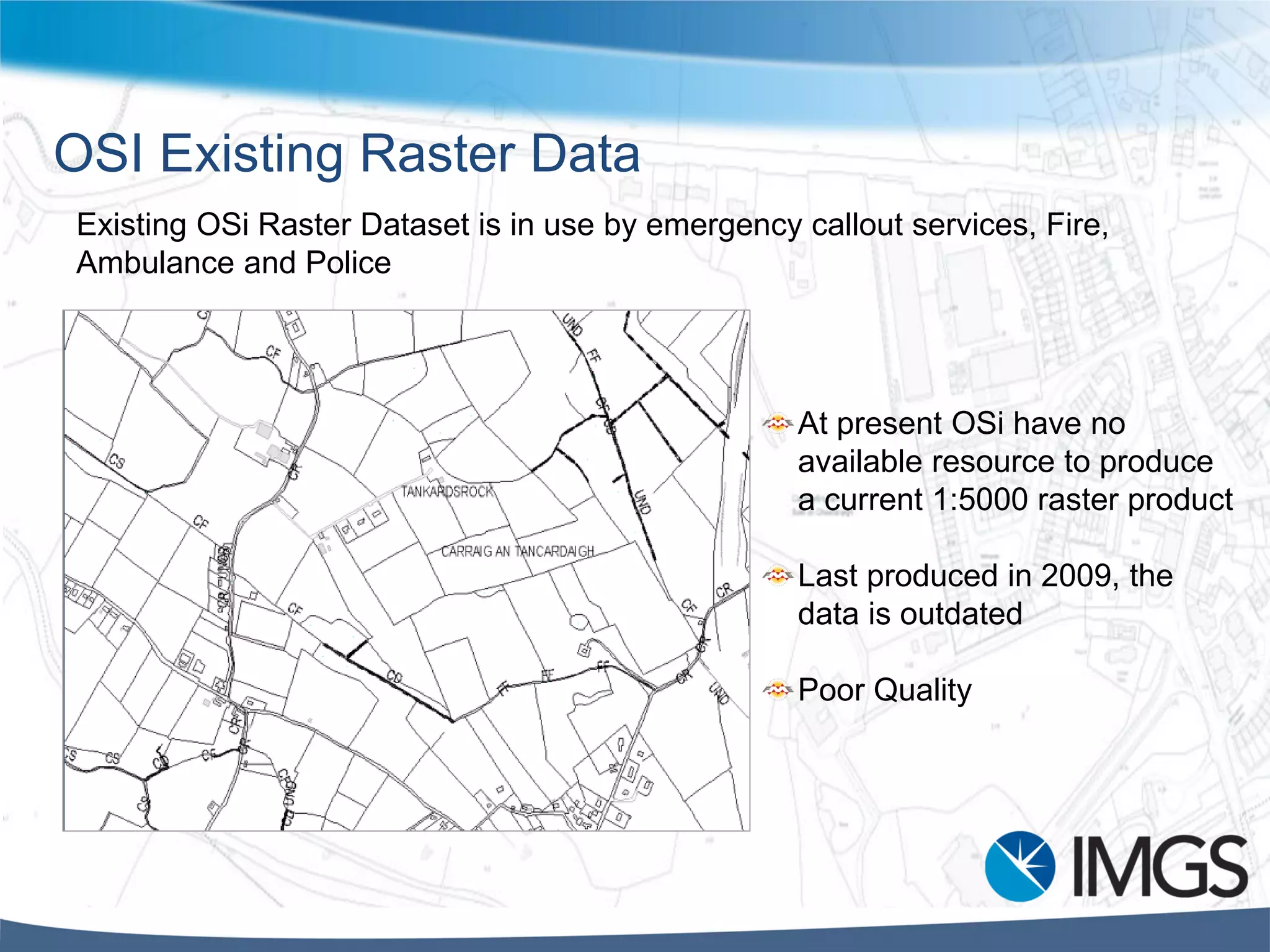
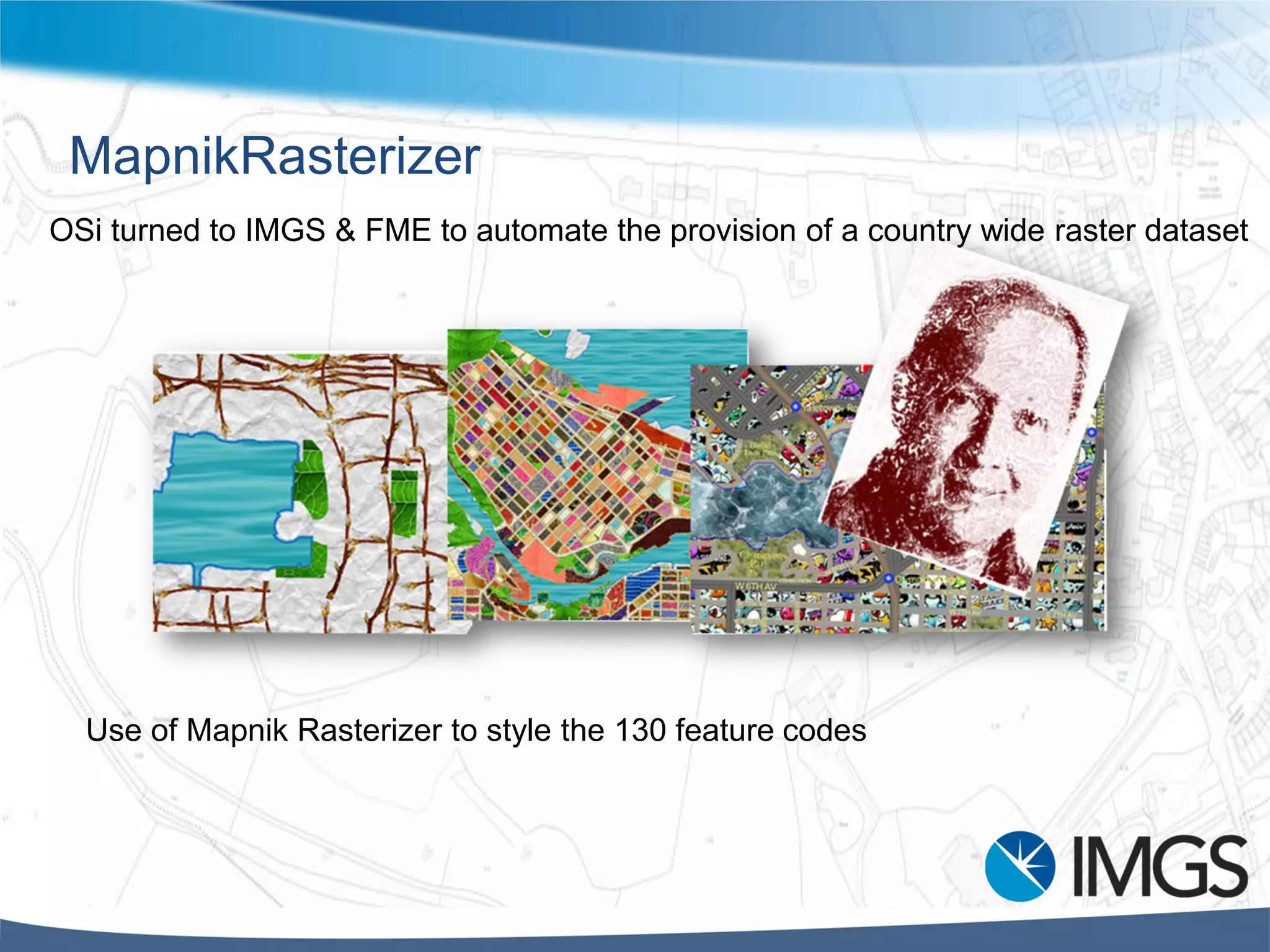
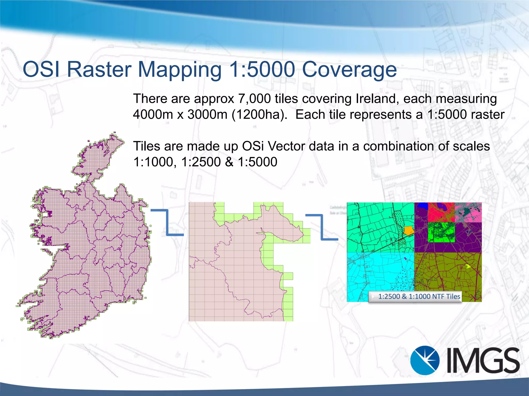
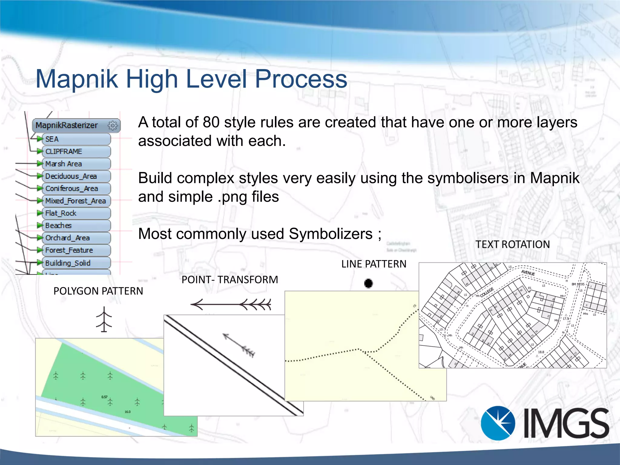
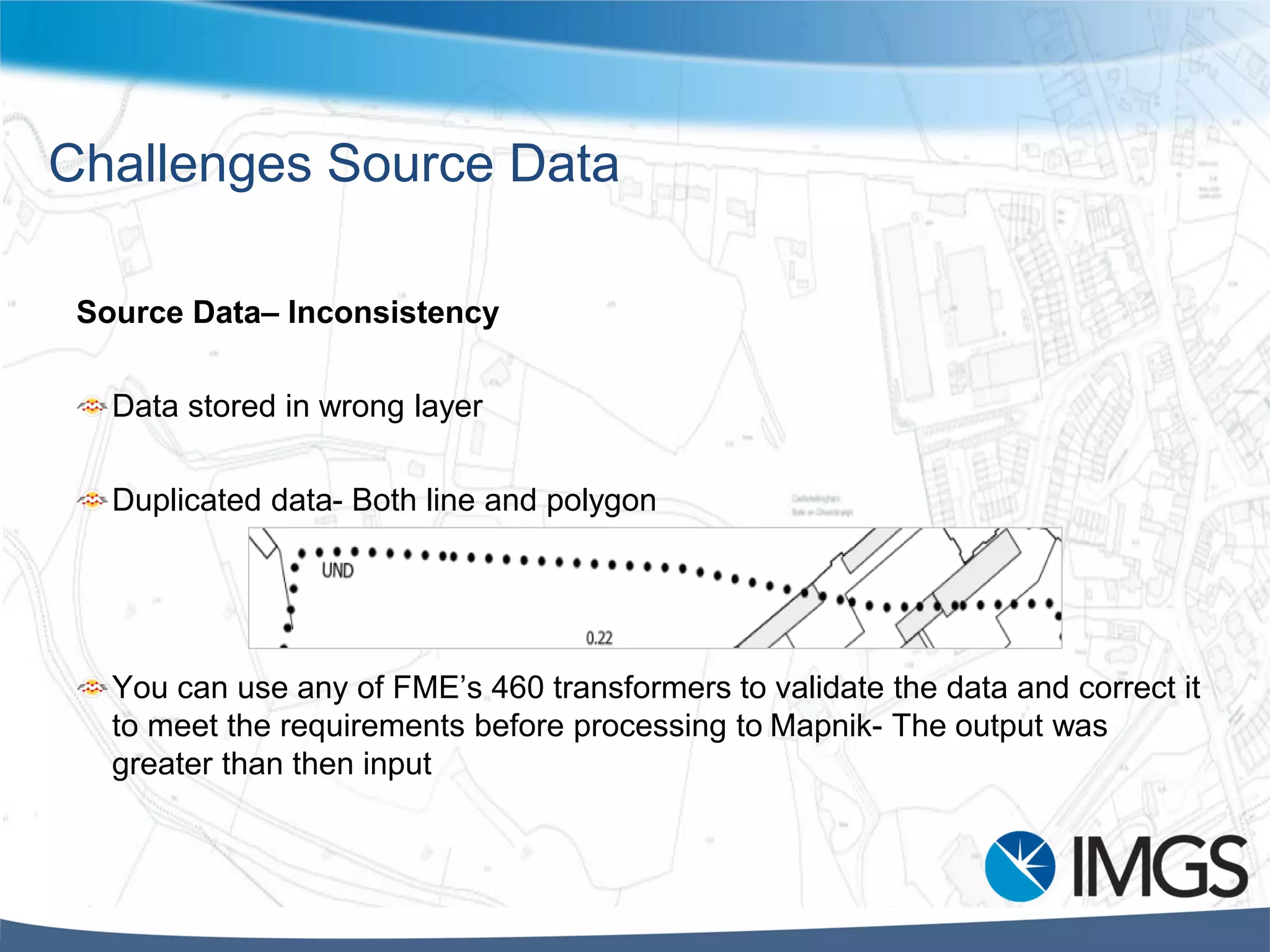

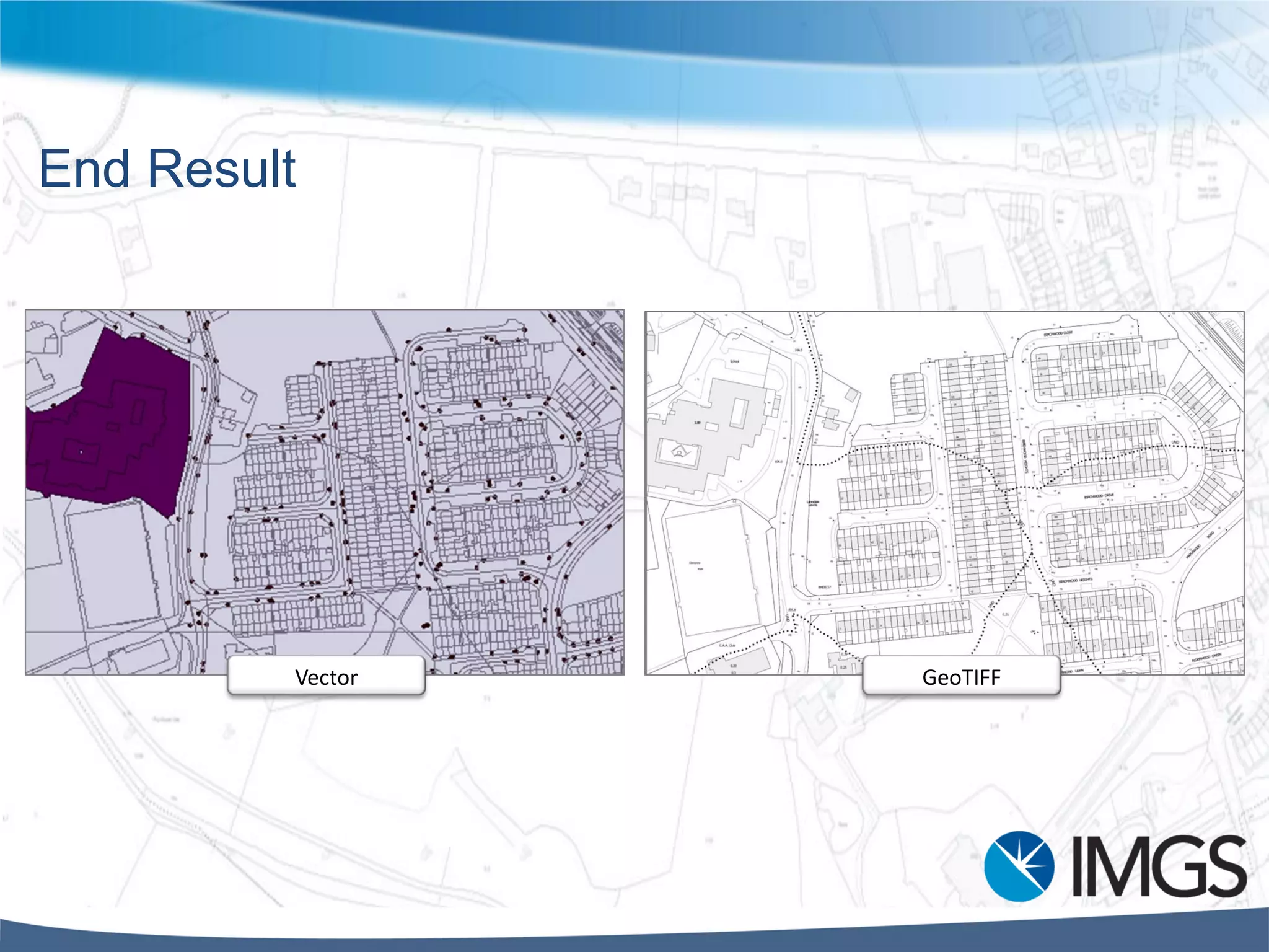
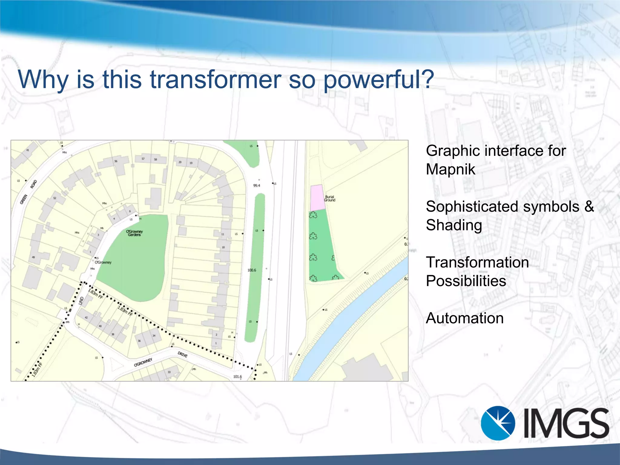

This document discusses Ordnance Survey Ireland's process for automating the production of 1:5000 scale raster maps from their vector data using Mapnik rasterization. Key points: - OSI previously produced paper 1:5000 maps but needed an updated digital raster product for emergency services. - Mapnik was used to style and rasterize OSI's 130-layer vector dataset representing topographical features. - The process involved creating 80 style rules in Mapnik to represent features, then rasterizing over 7,000 tiles covering Ireland at 1:5000 scale. - Challenges included inconsistencies in the source vector data and automating processing of the large dataset, which was addressed using FME and server-