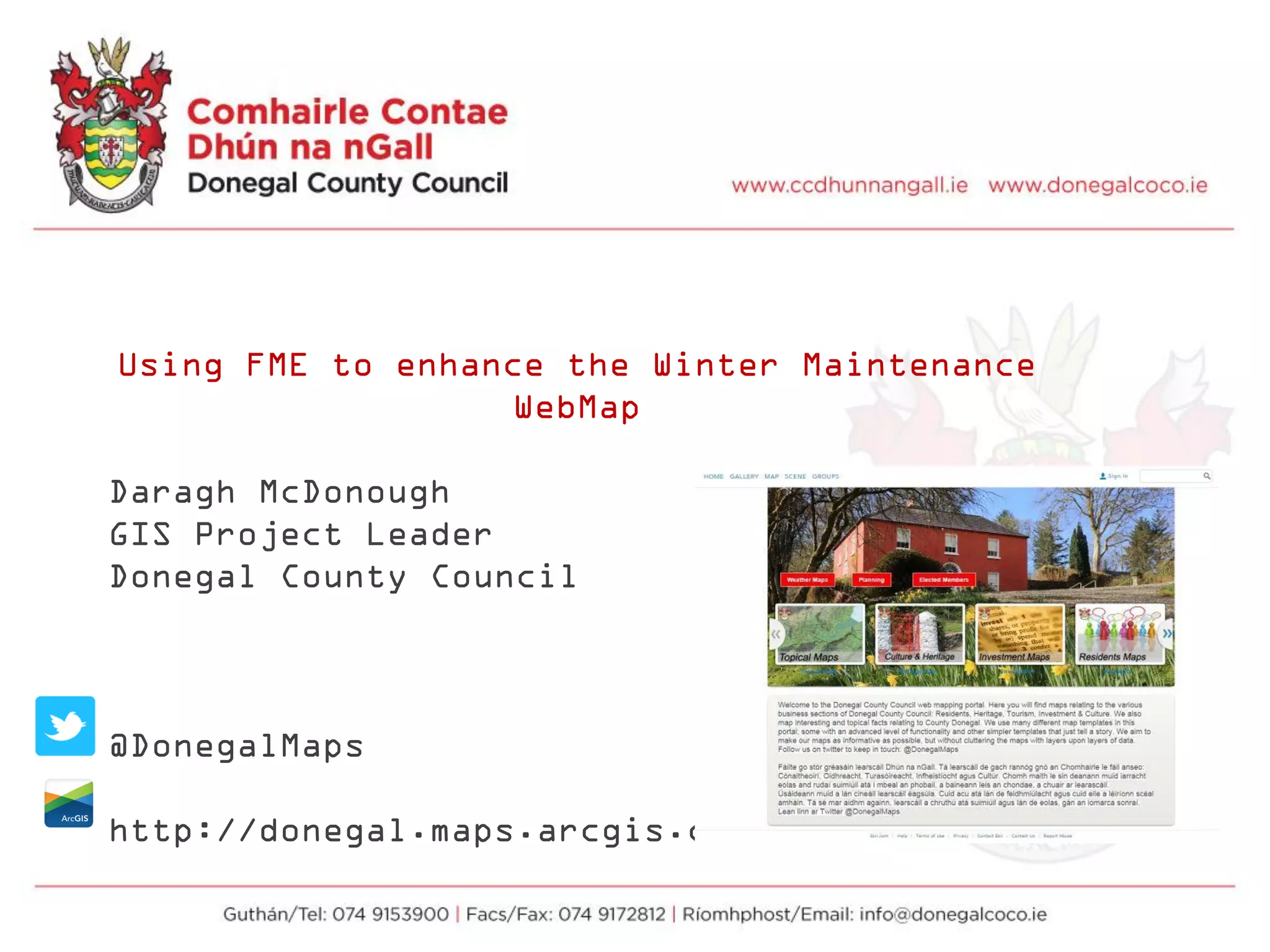
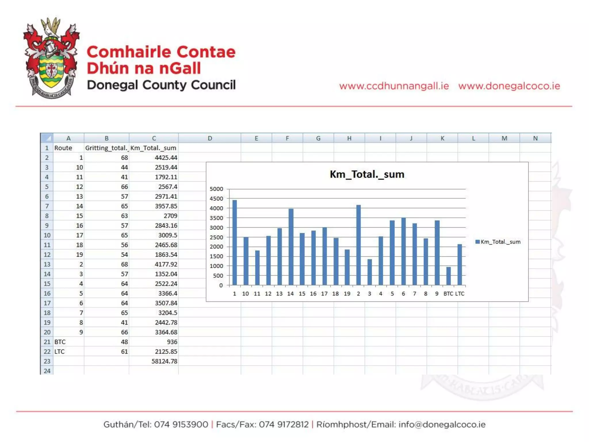
Download as PDF, PPTX


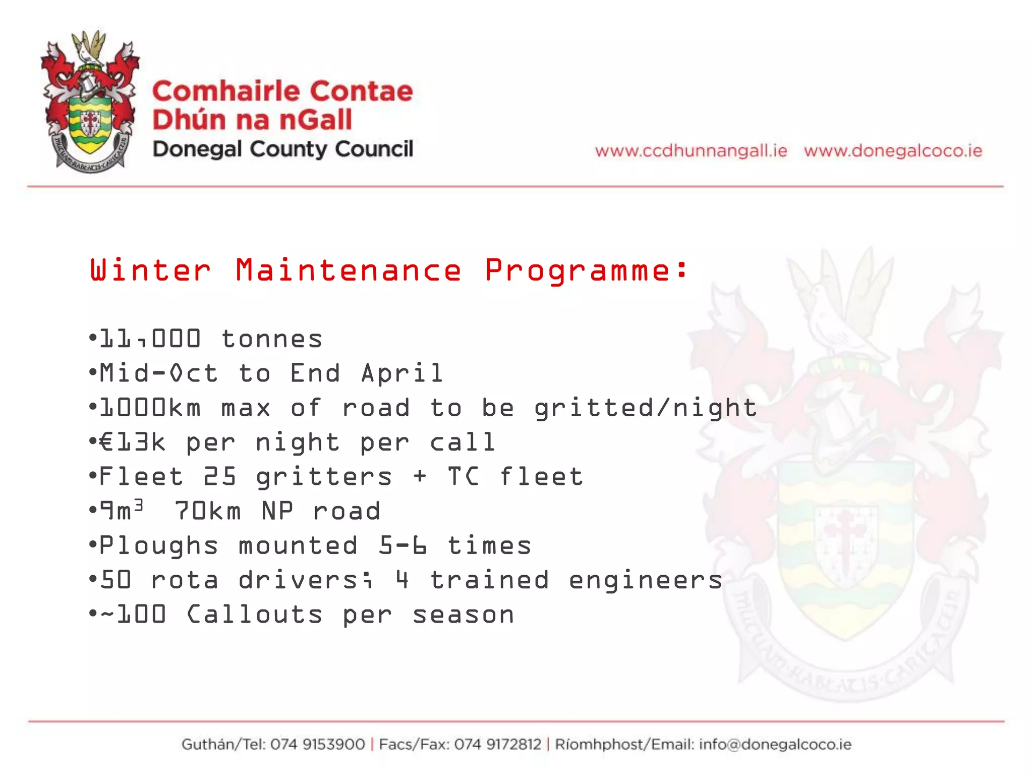

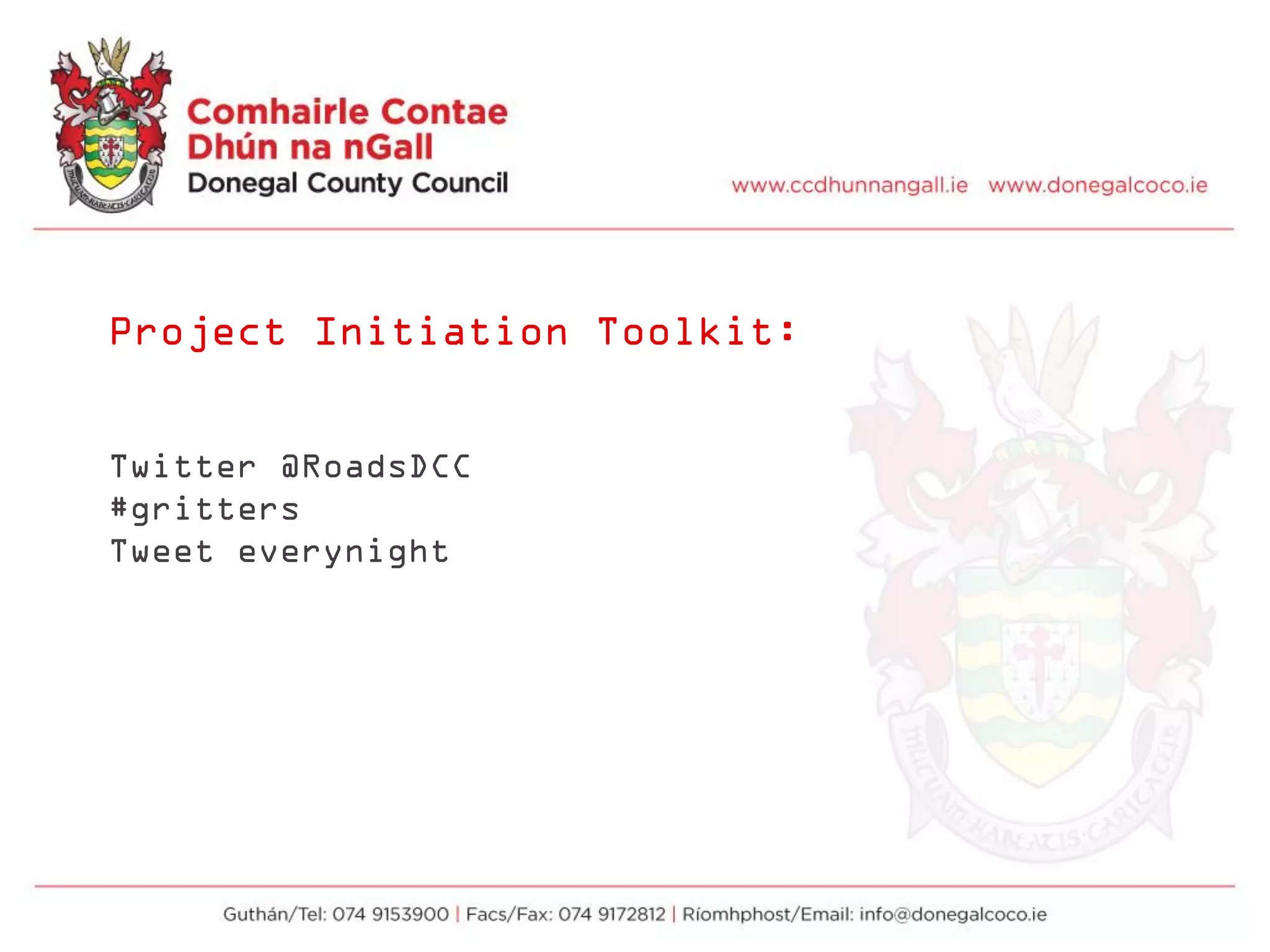
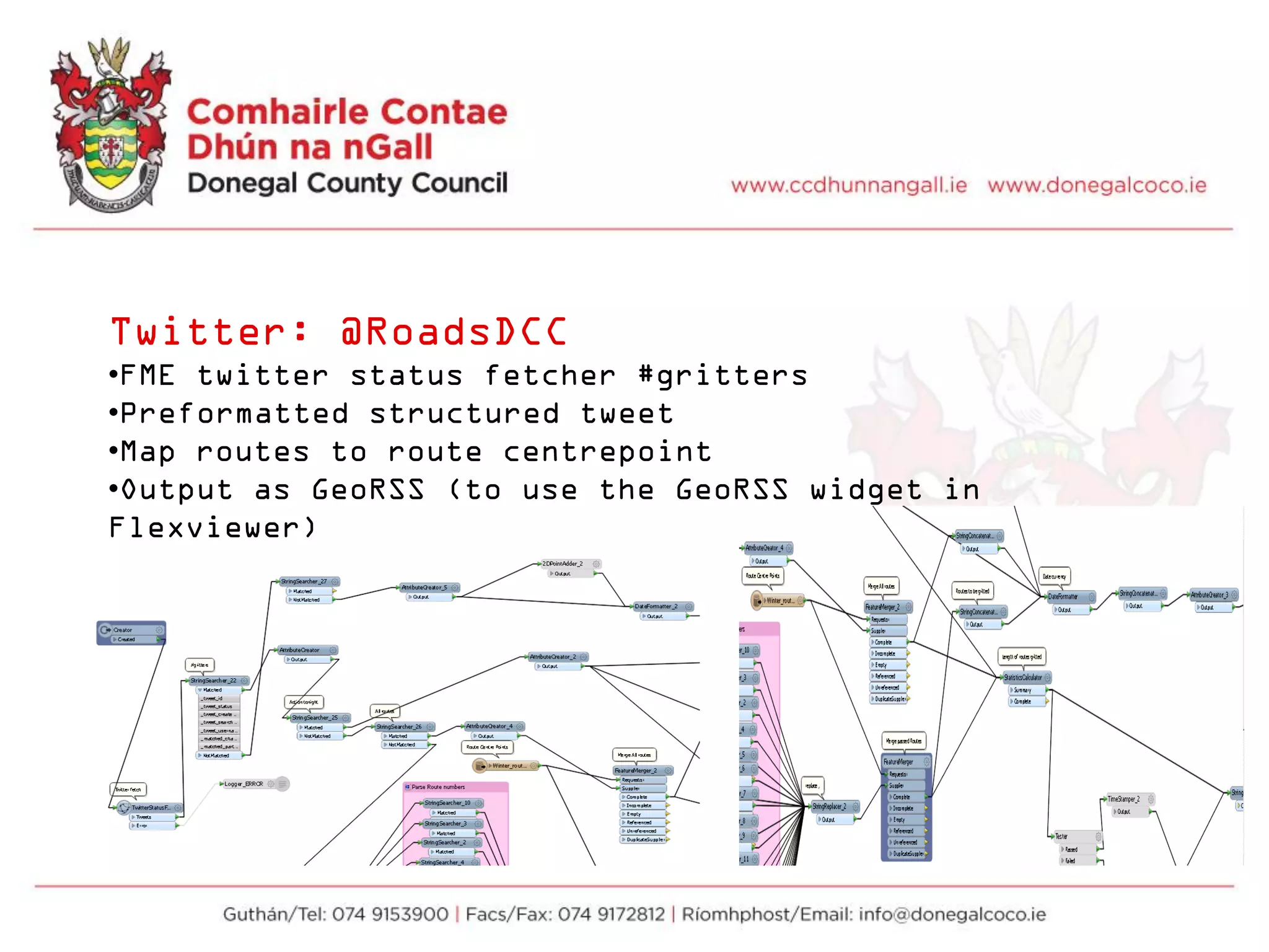
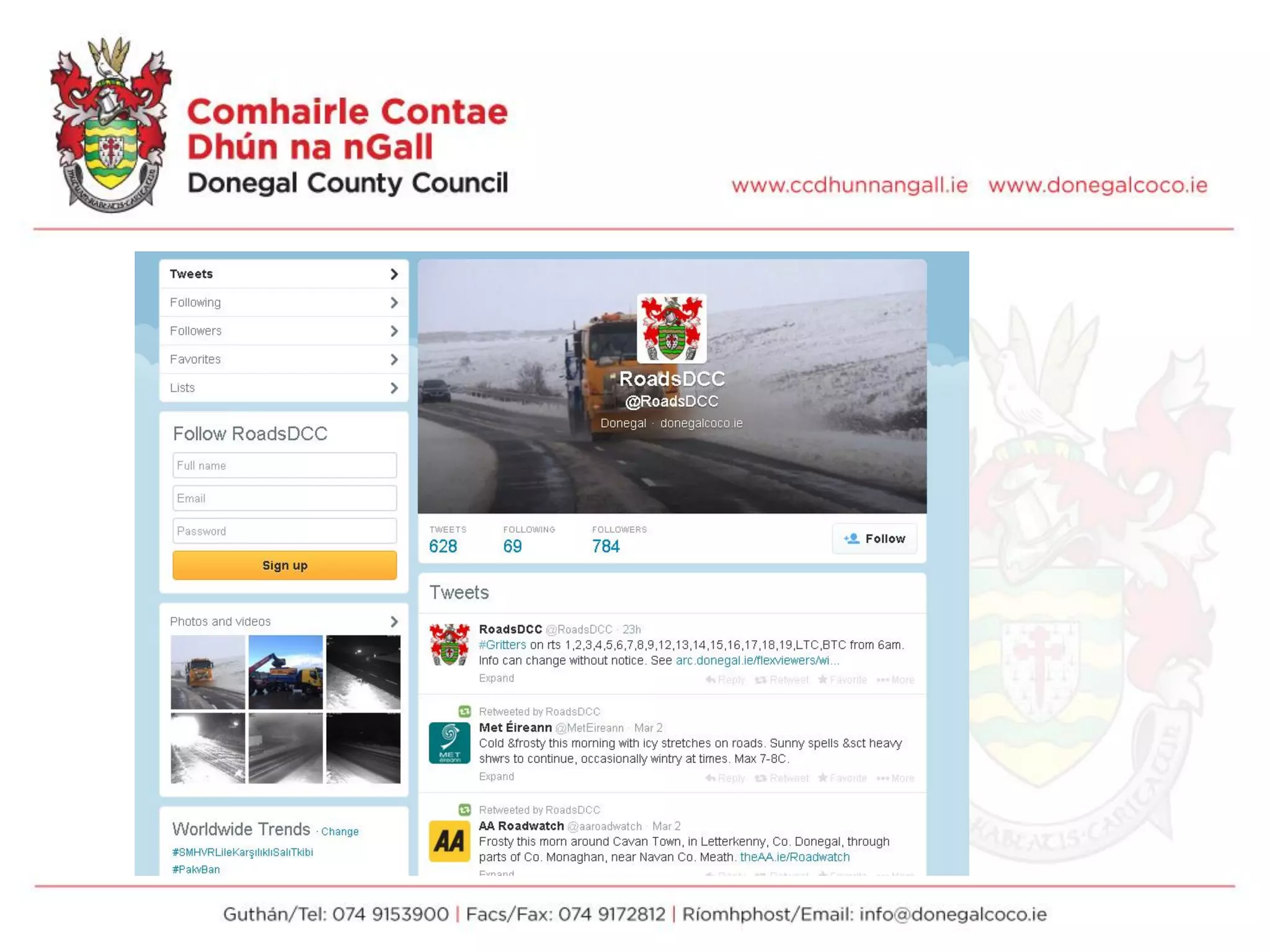

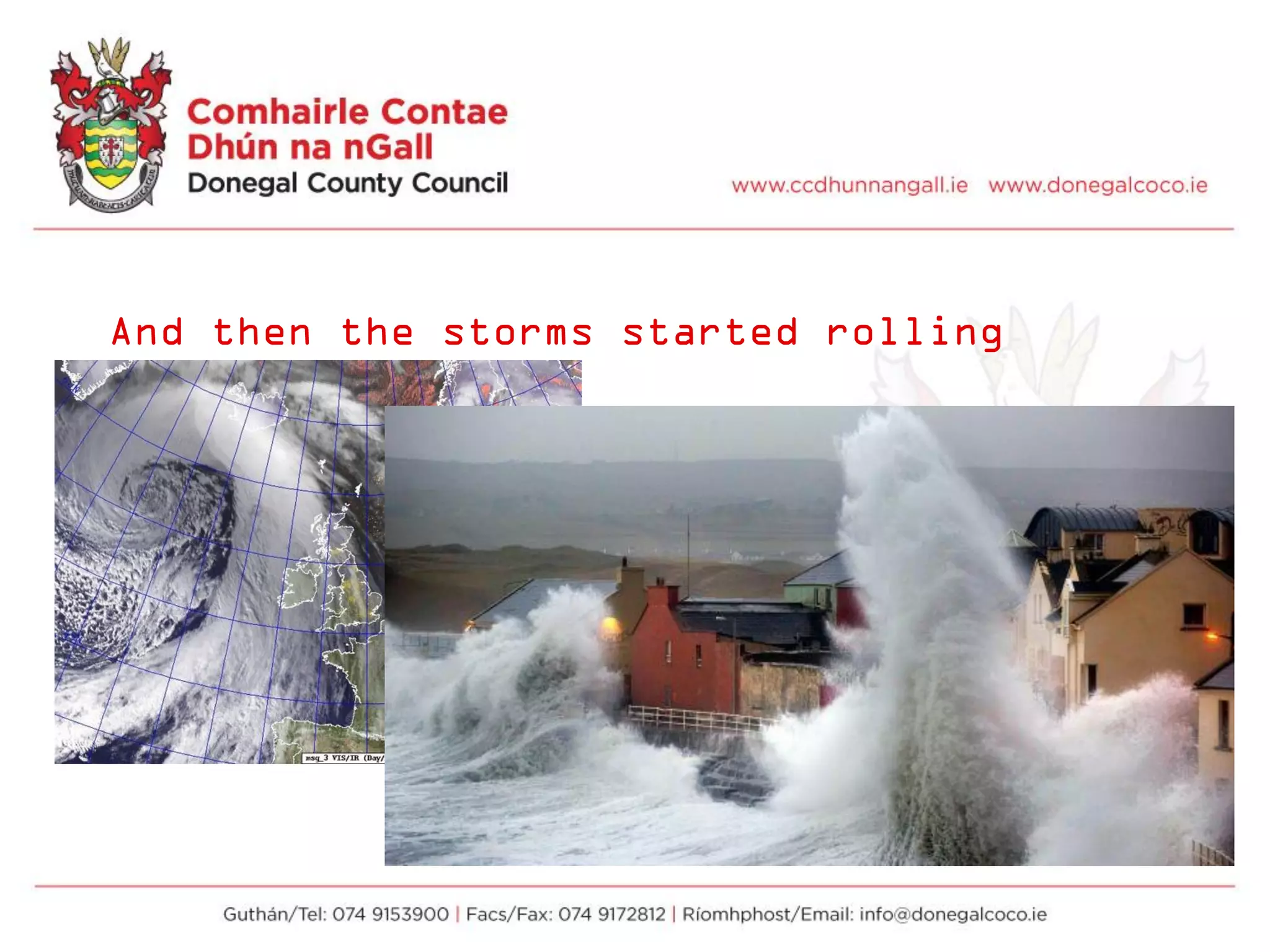

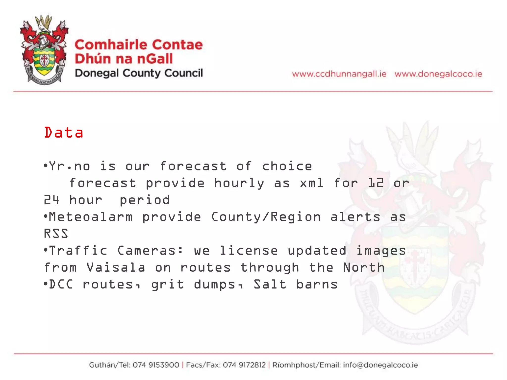


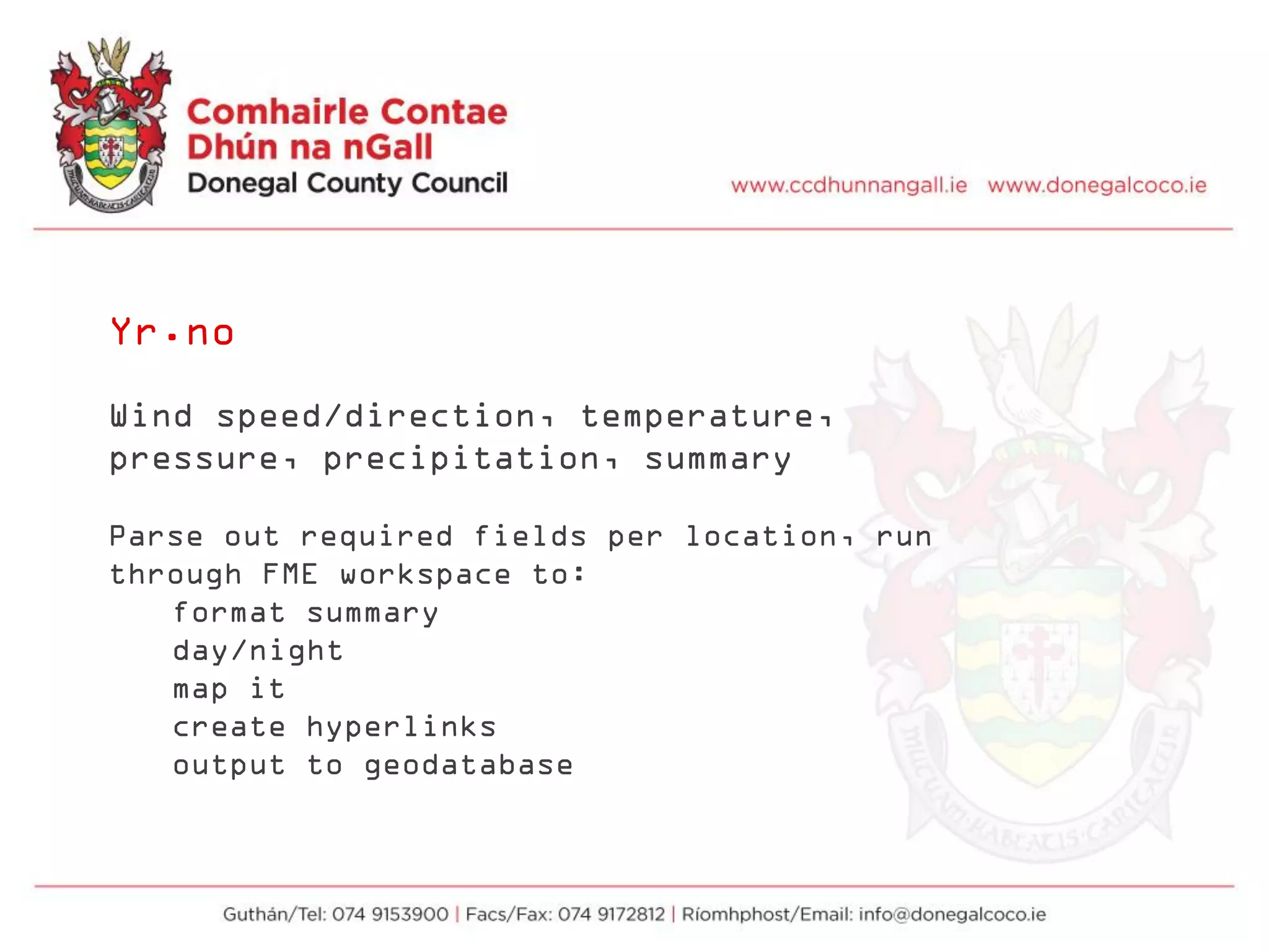
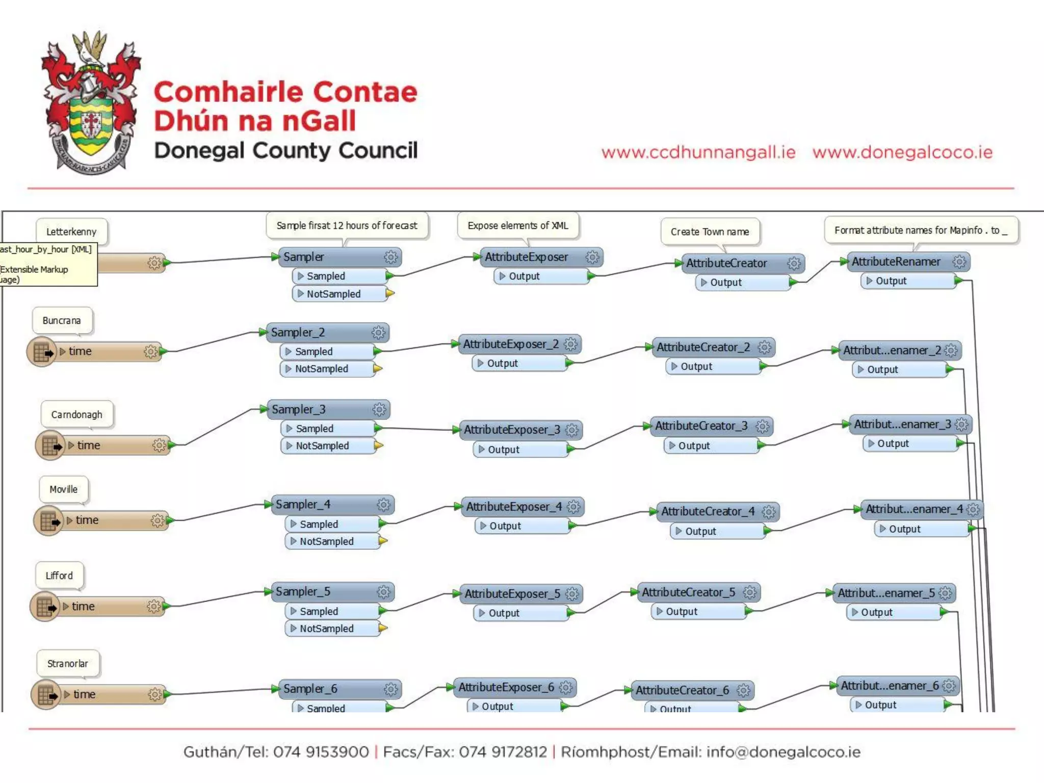
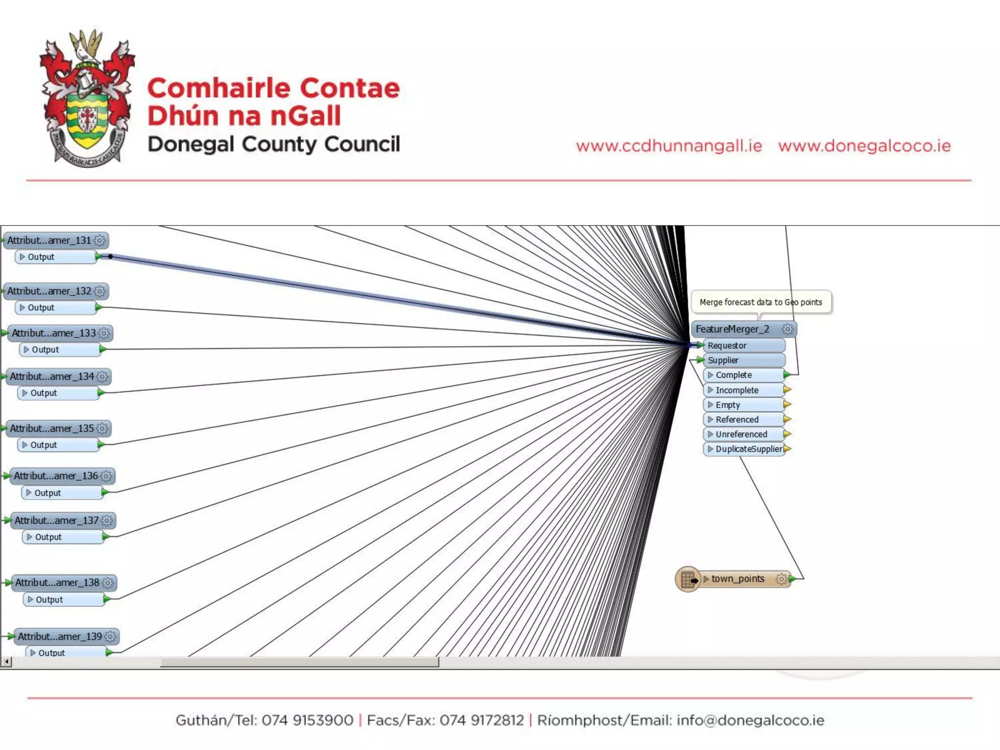
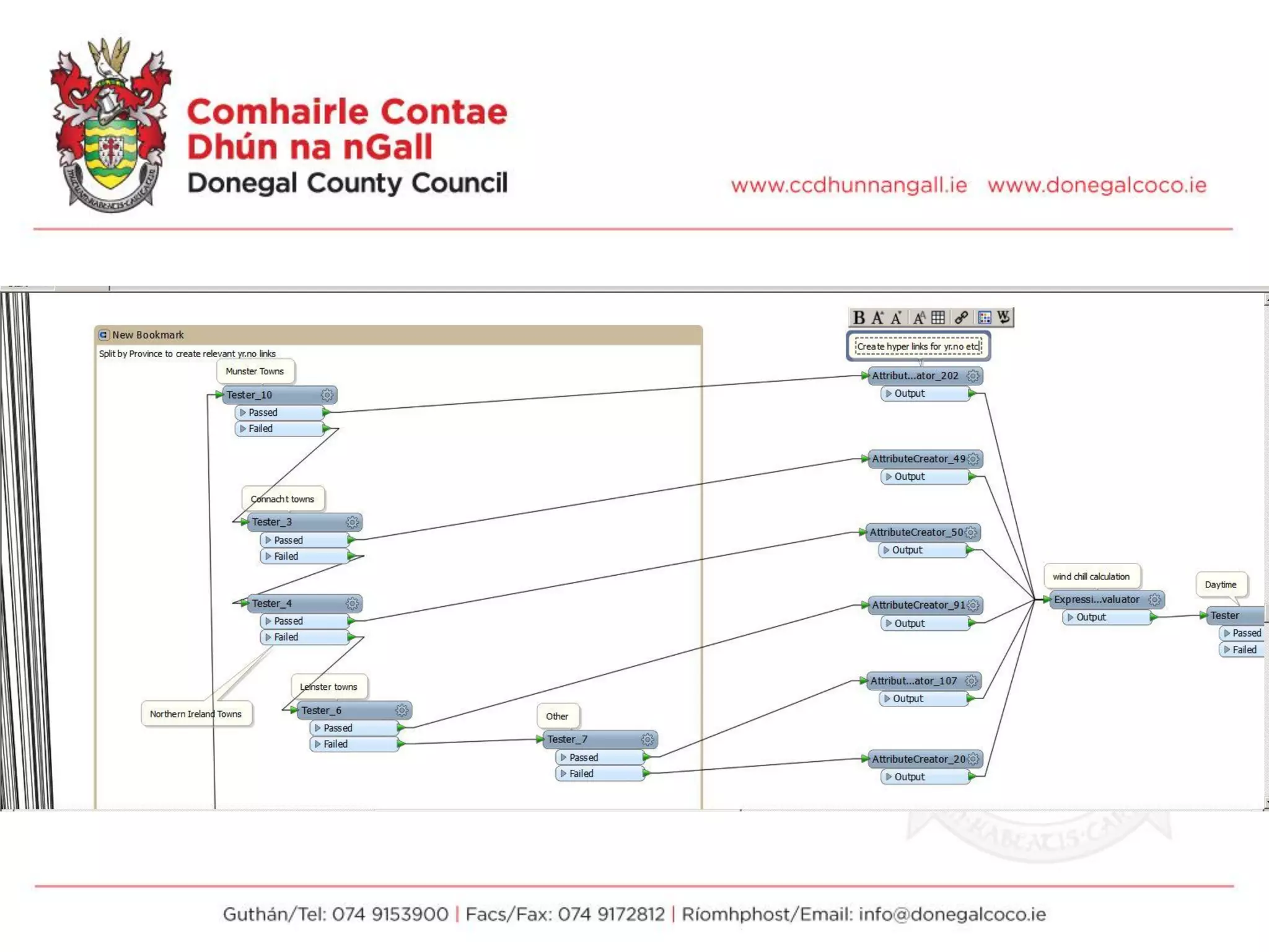
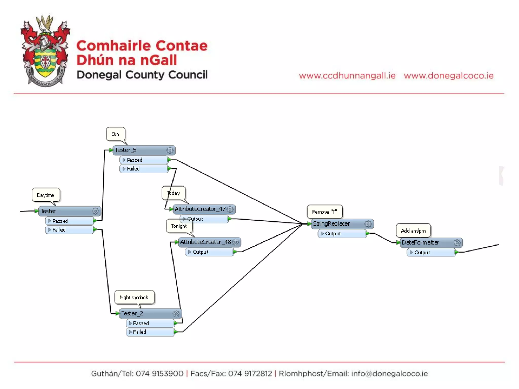

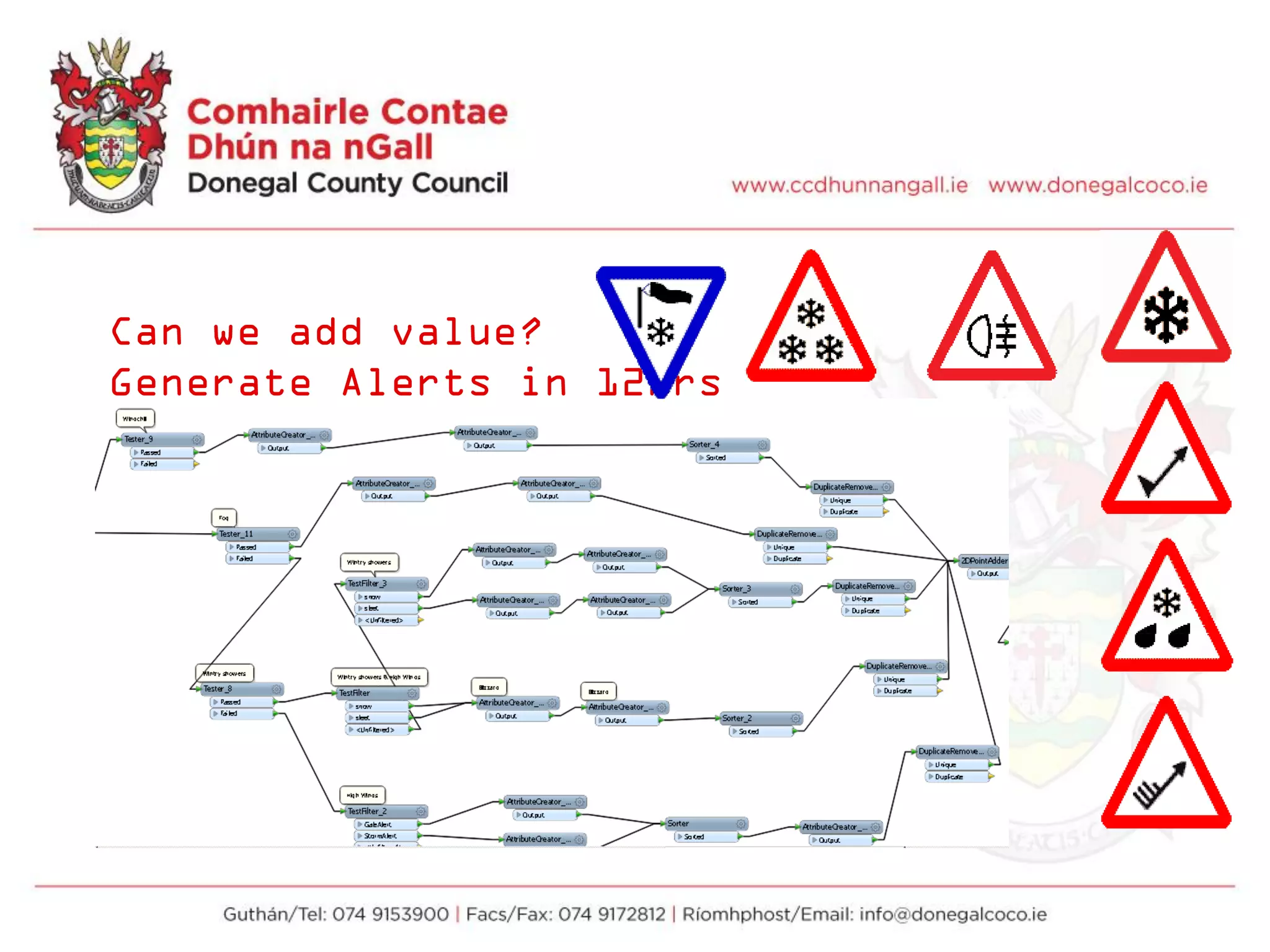
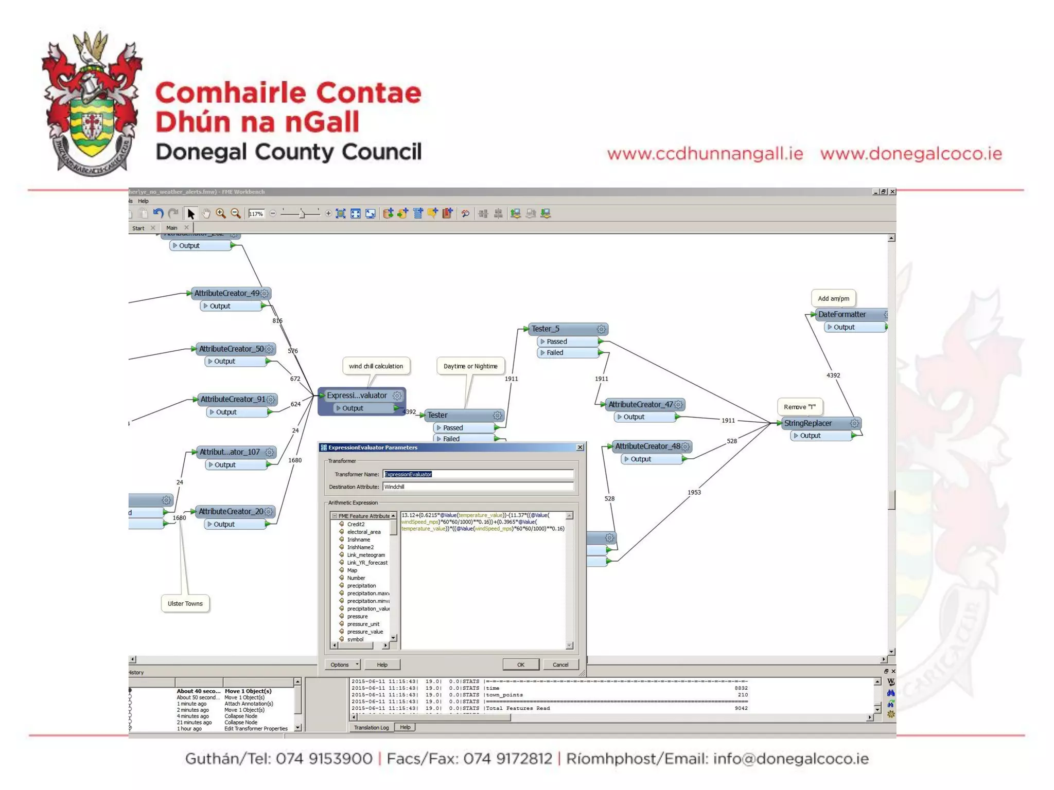
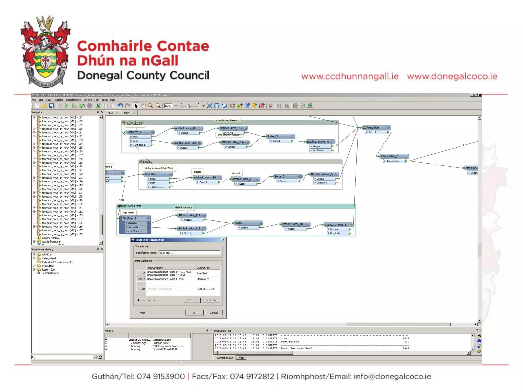
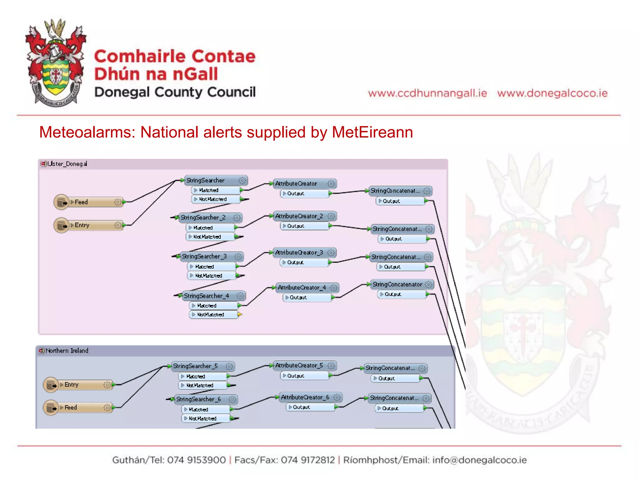
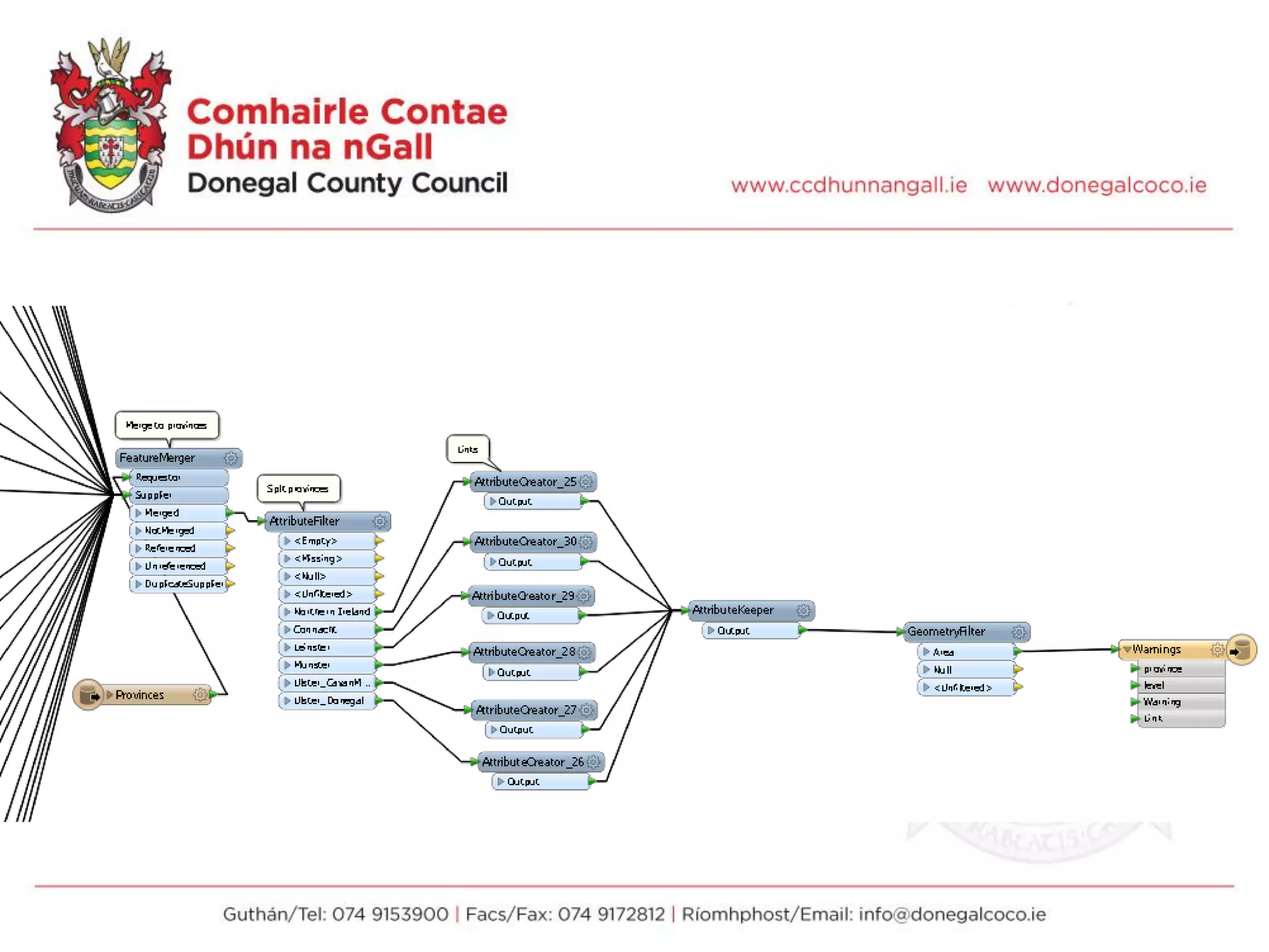
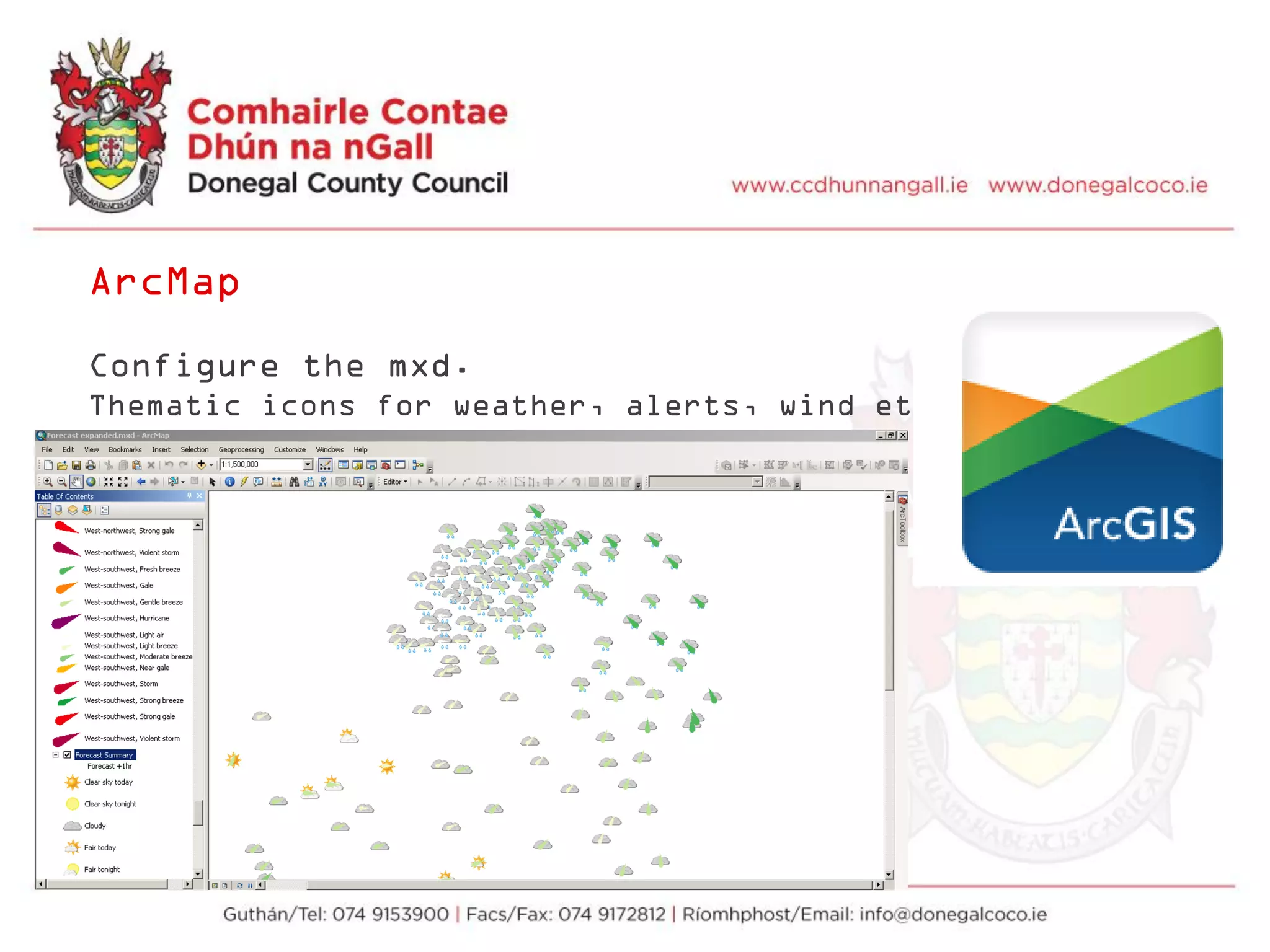
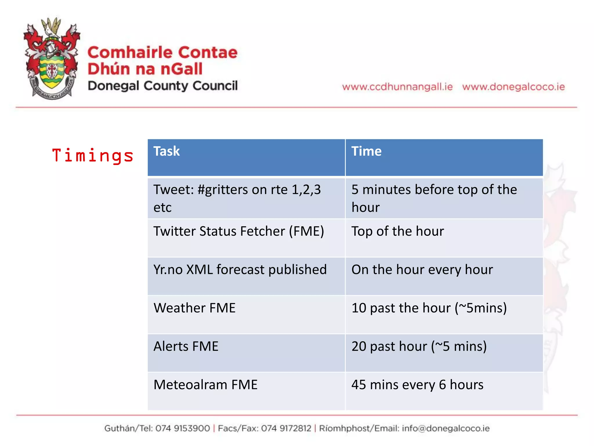
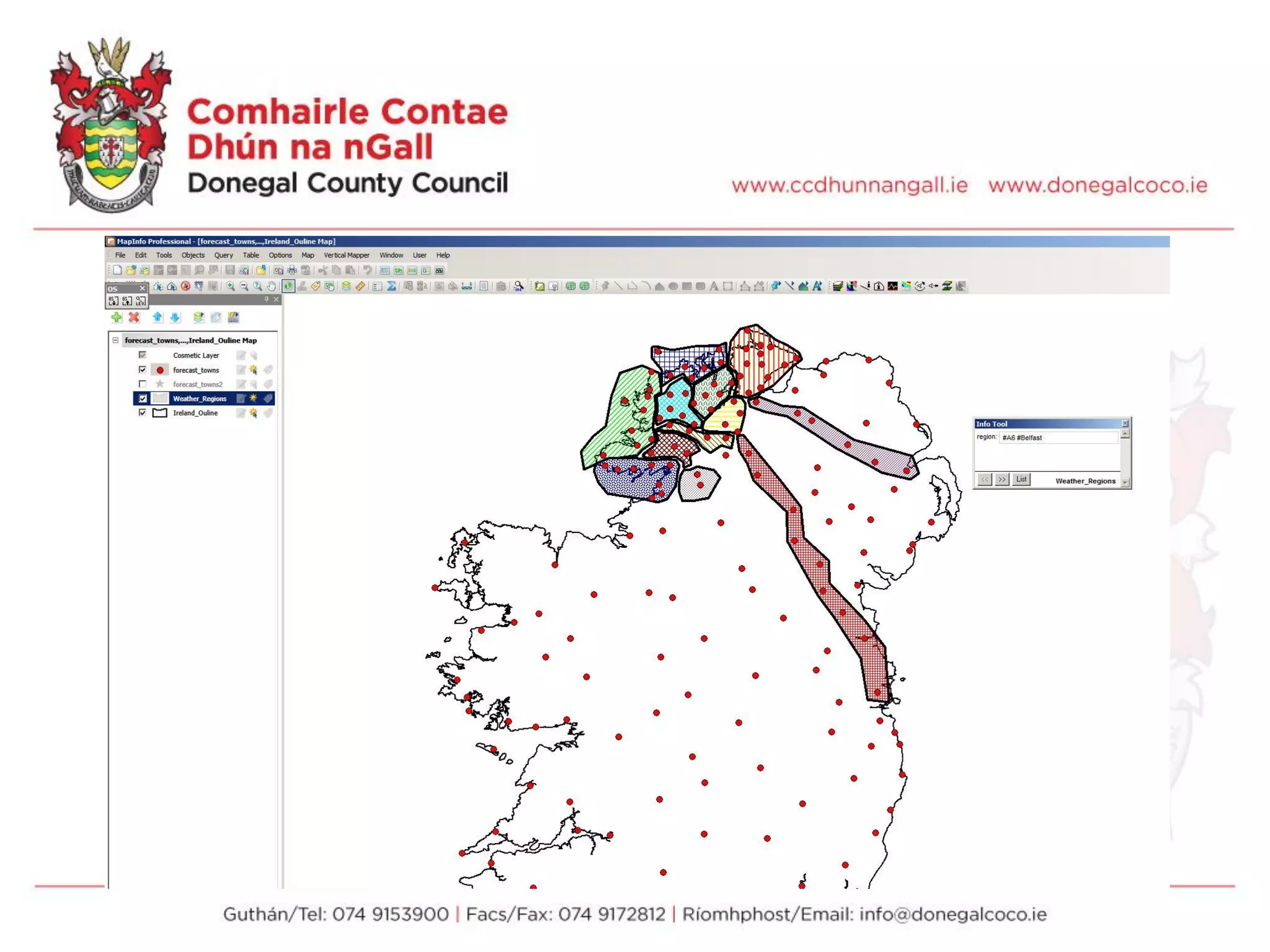
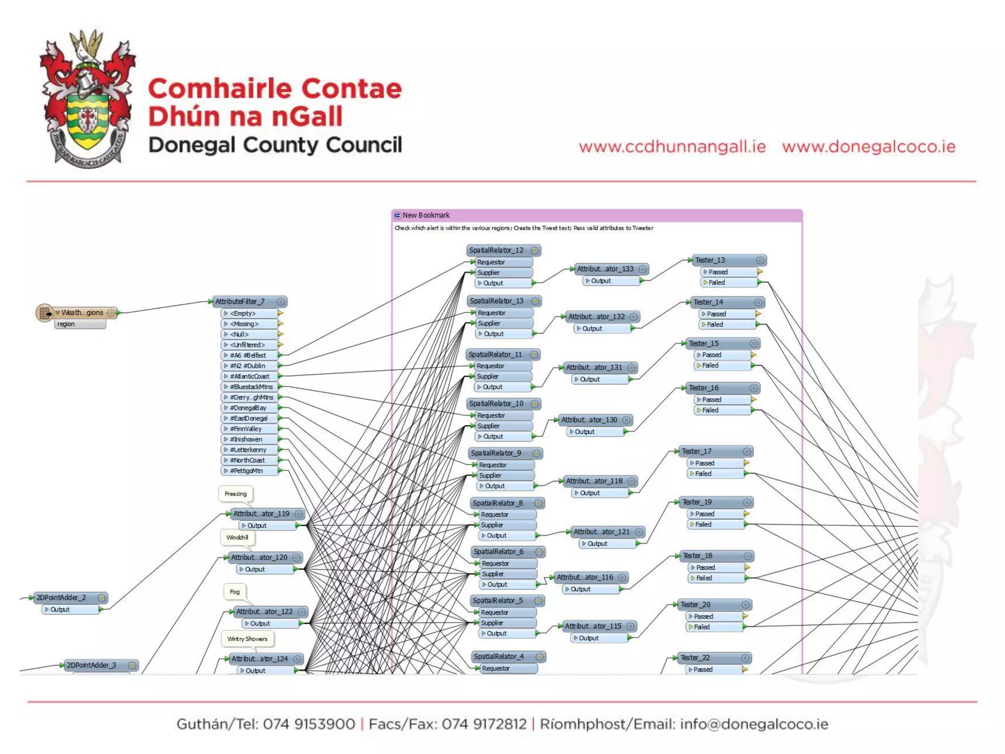
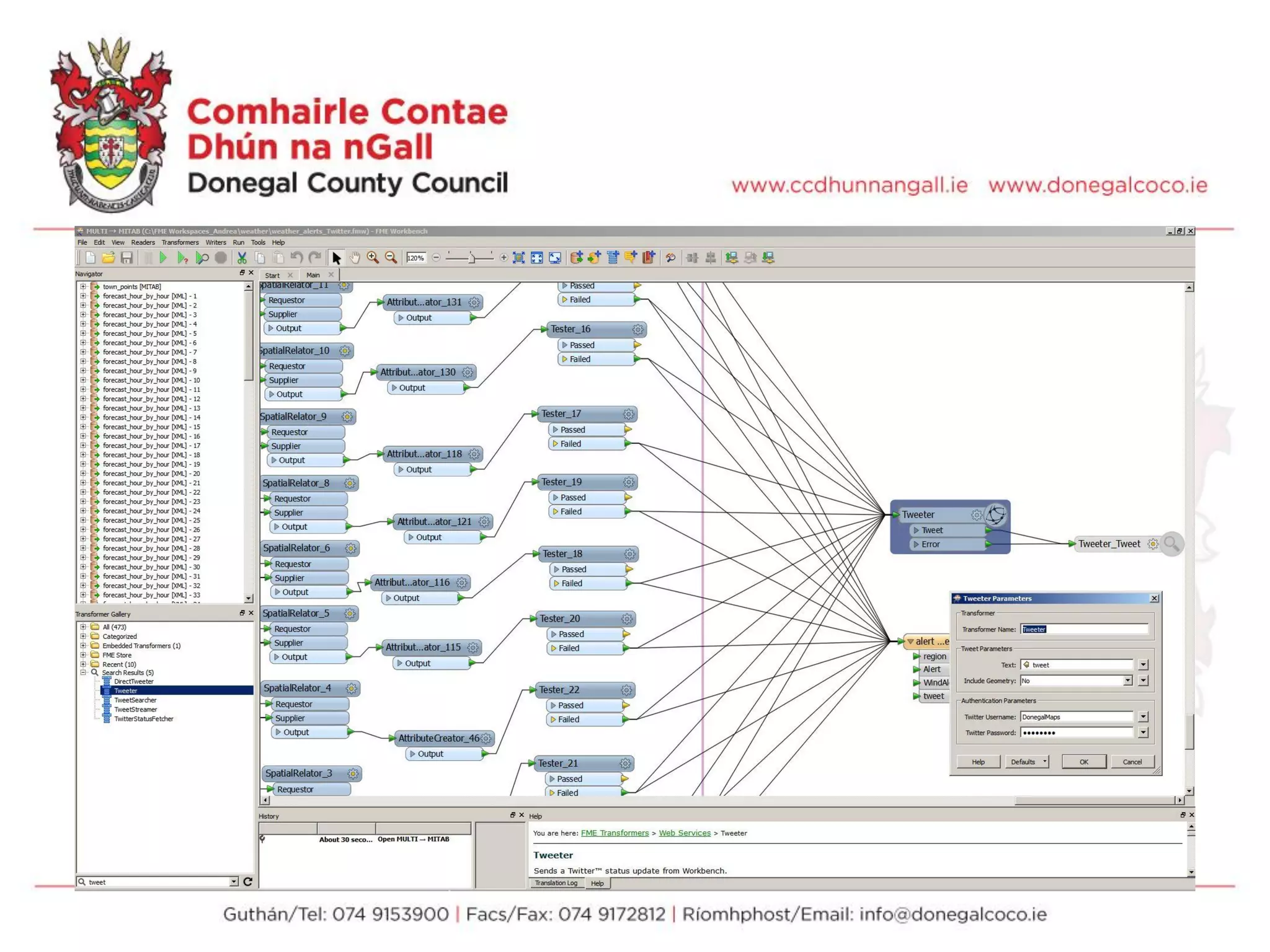
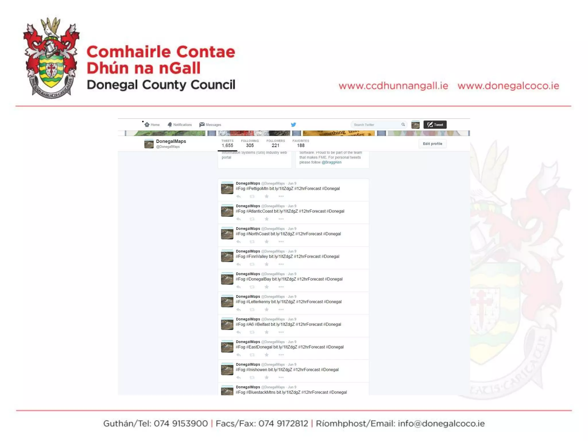
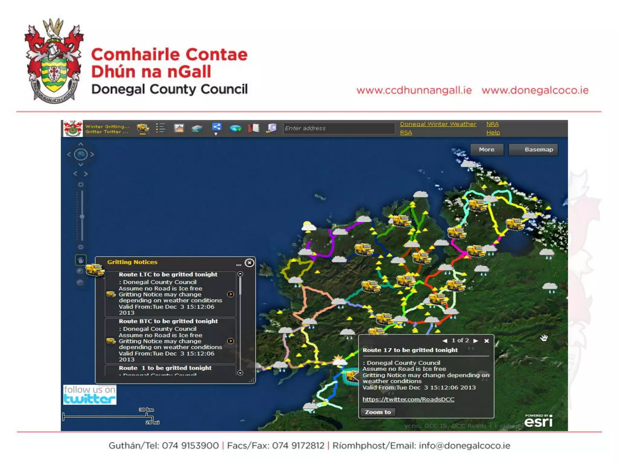
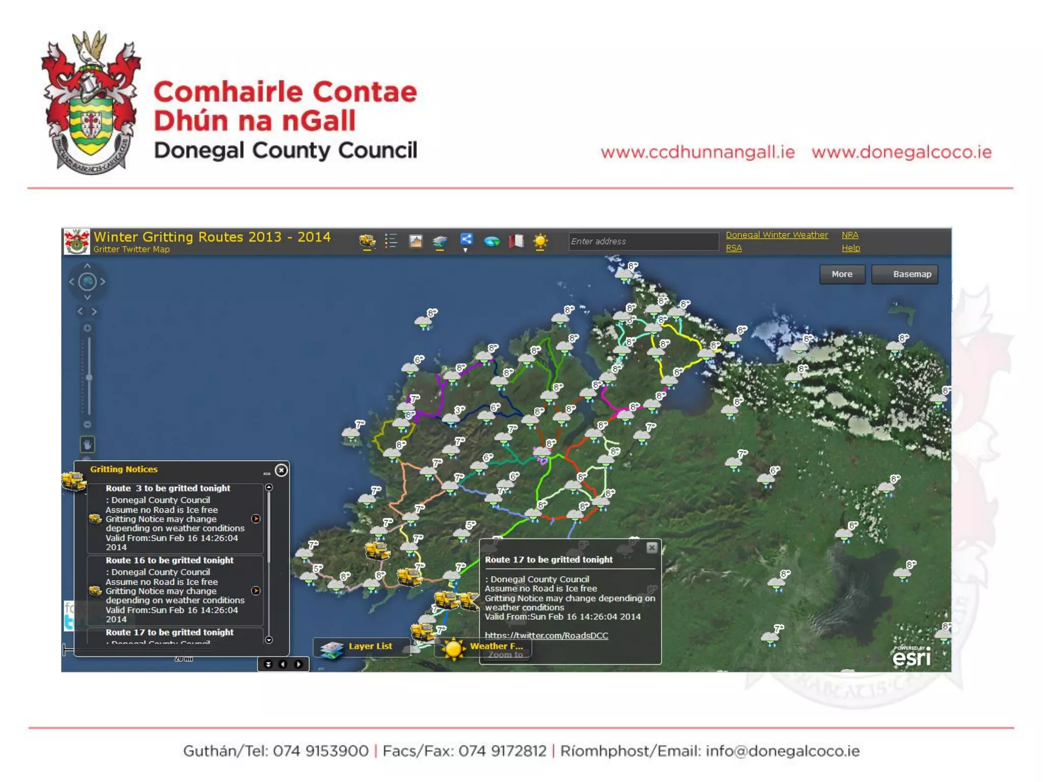
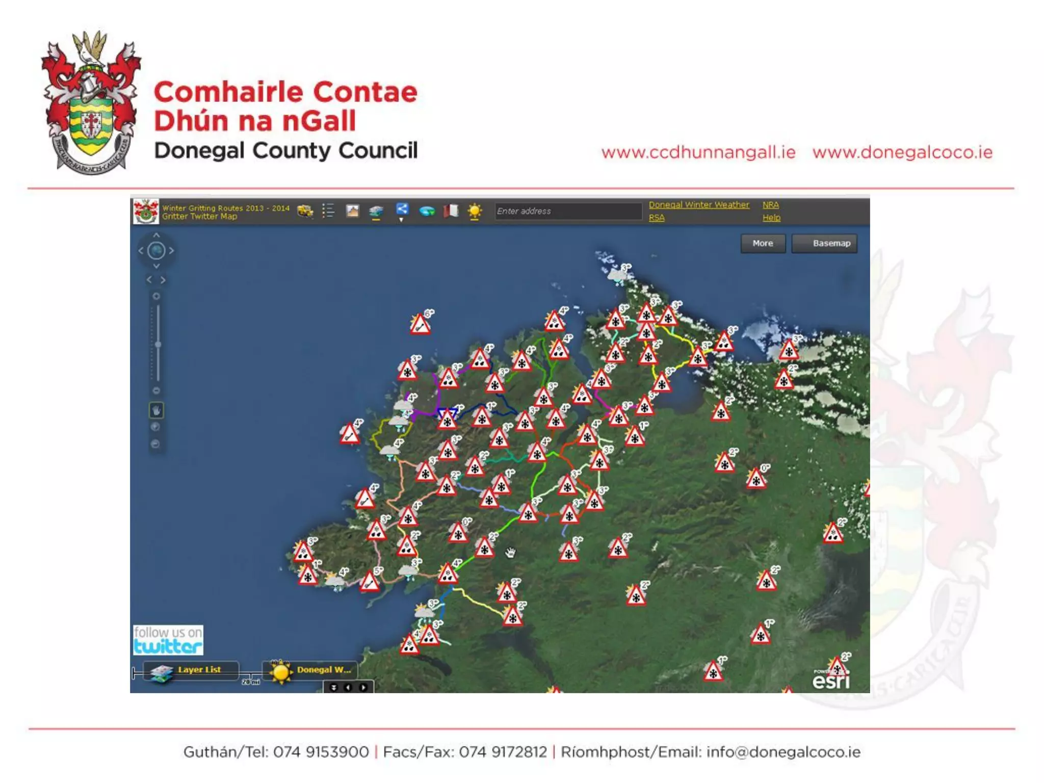
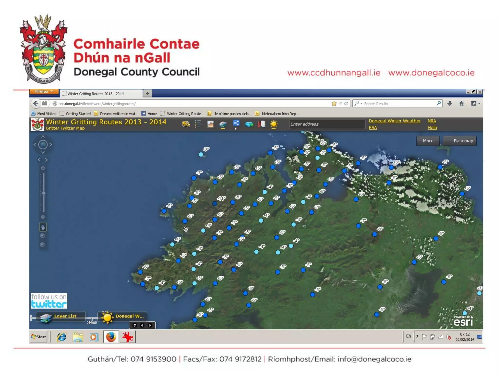
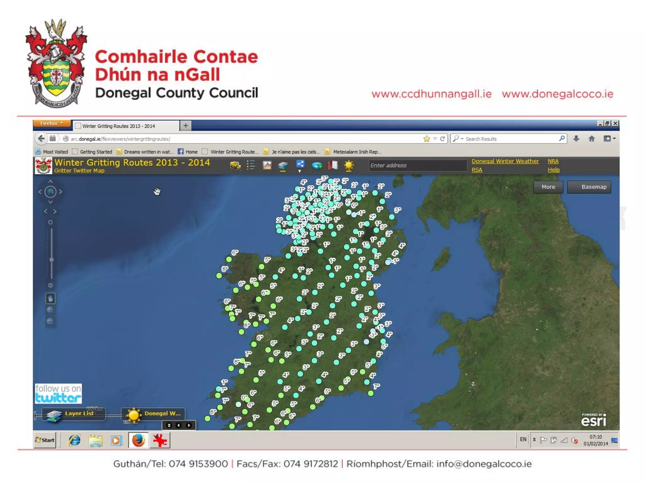
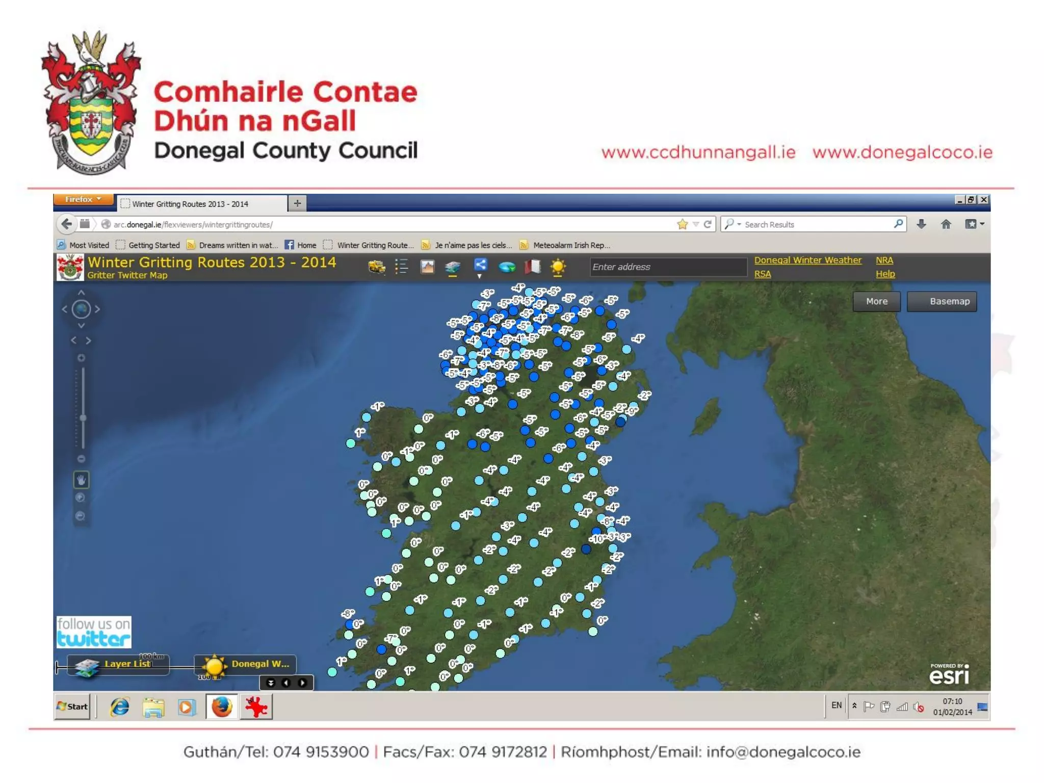

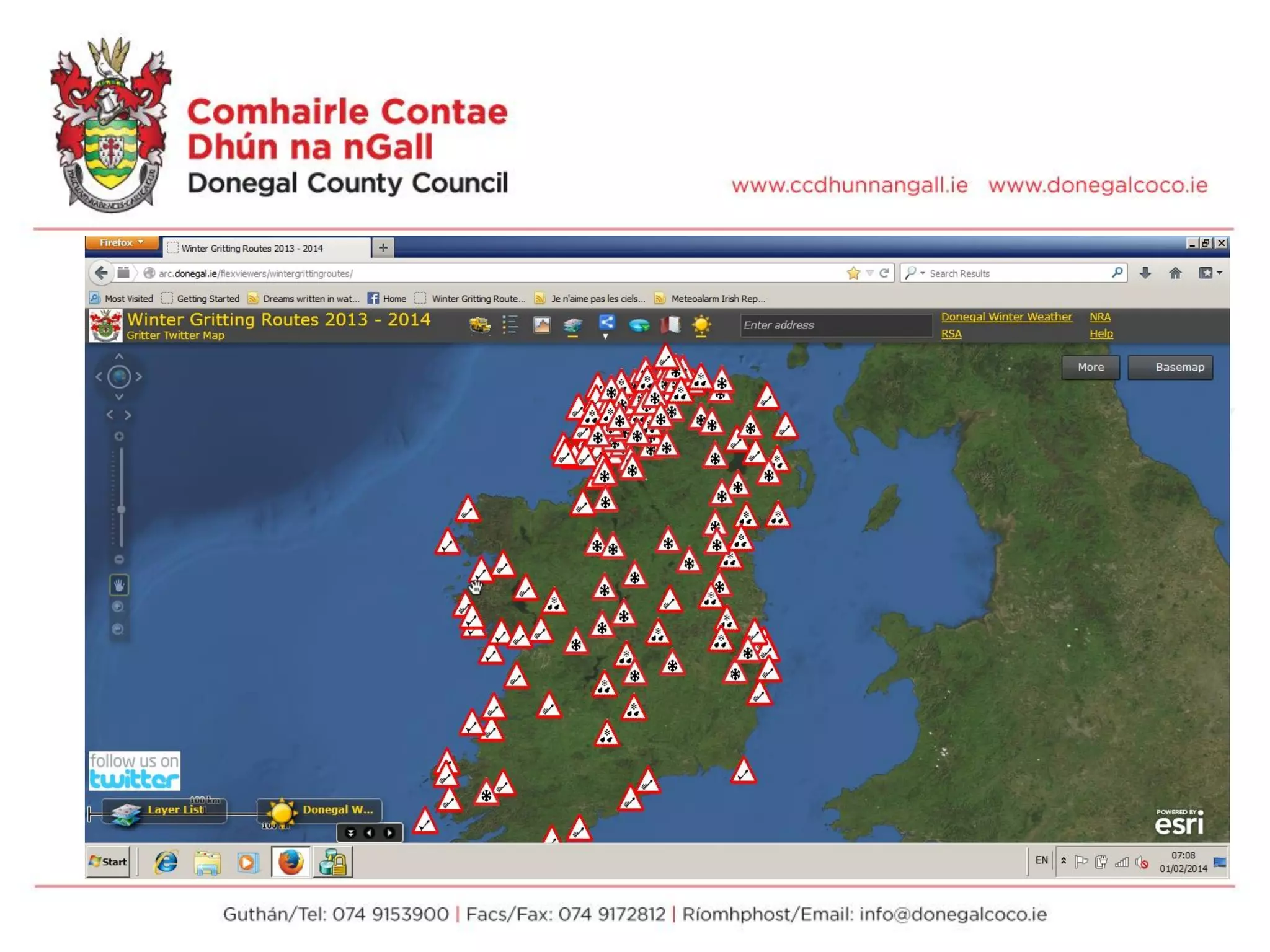

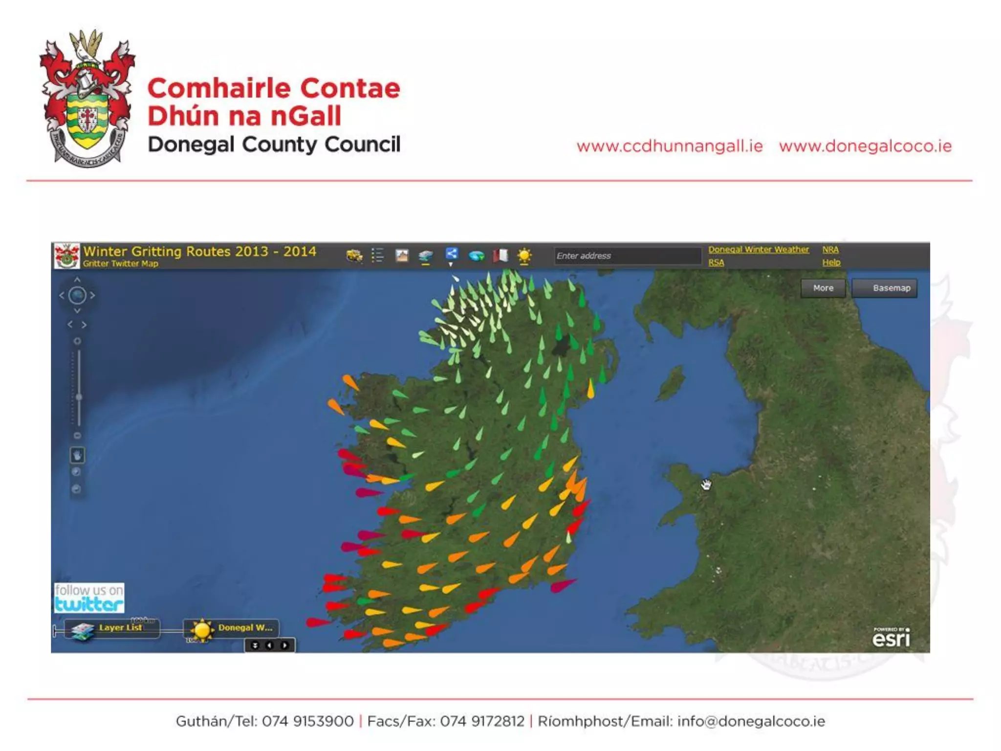

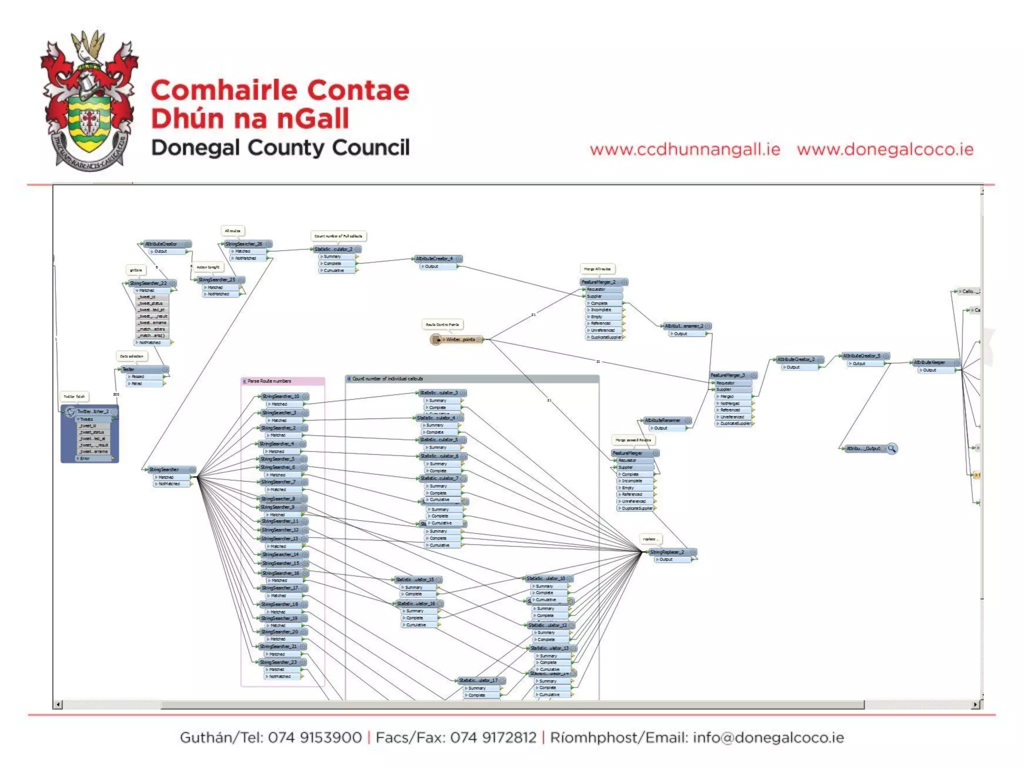


FME was used to enhance Donegal County Council's Winter Maintenance WebMap by integrating additional weather and alert data sources. Data from Yr.no, Meteoalarm, traffic cameras, and the council's own route data were processed through FME workspaces to generate formatted tweets, map visualizations, and output to a geodatabase. This added real-time weather information and alerts to the map to provide updated information on gritting routes and weather conditions to residents. Future plans include incorporating additional coastal and marine data sources to further expand the information available on the map.


