![Information Communication Technology to support sustainable urban planning … non entri alcuno che ignori la Geometria (Platone) Arch. Antonio Caperna, PhD [email_address] http://www.biourbanism.org Università Roma 3 - Dipartimento di Progettazione e Studio dell’Architettura Dottorato di Ricerca in Progetto Urbano Sostenibile (XVII Ciclo)](https://image.slidesharecdn.com/icteng-101207153017-phpapp01/85/ICT-AND-URBAN-PLANNING-By-Antonio-Caperna-1-320.jpg)
![Information Communication Technology to support sustainable urban planning … non entri alcuno che ignori la Geometria (Platone) Arch. Antonio Caperna, PhD [email_address] http://www.biourbanism.org Università Roma 3 - Dipartimento di Progettazione e Studio dell’Architettura Dottorato di Ricerca in Progetto Urbano Sostenibile (XVII Ciclo)](https://image.slidesharecdn.com/icteng-101207153017-phpapp01/75/ICT-AND-URBAN-PLANNING-By-Antonio-Caperna-1-2048.jpg)
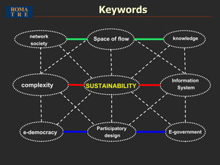
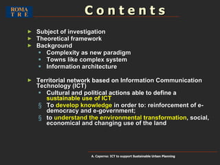
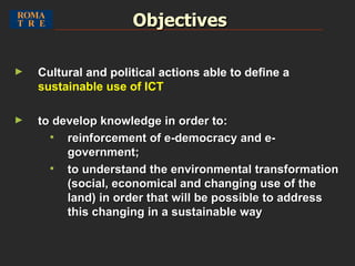
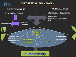
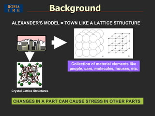
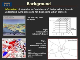
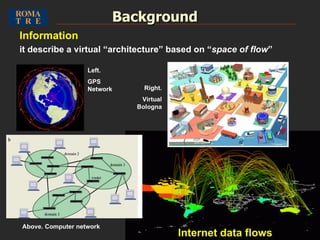
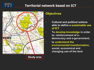
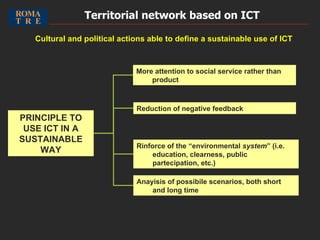
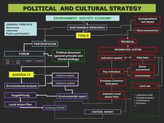
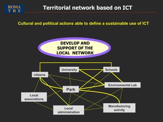
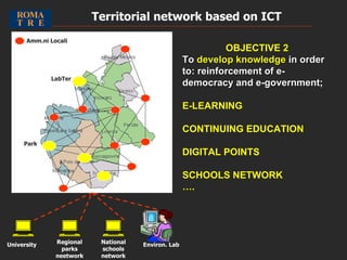
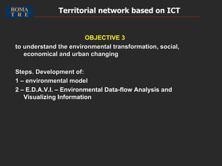
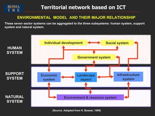
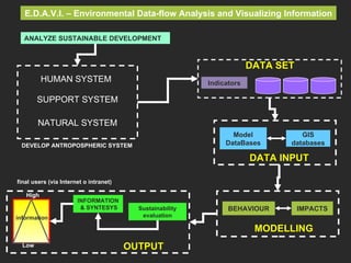
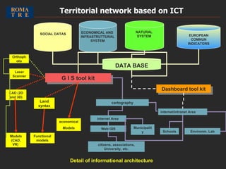
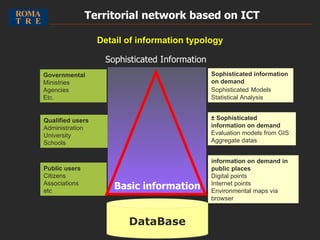

The document discusses using information communication technology (ICT) to support sustainable urban planning. Specifically, it aims to 1) define cultural and political actions for sustainable ICT use, and 2) develop knowledge to reinforce e-democracy, e-government, and understand environmental, social and economic transformations. Key points include viewing cities as complex systems that can be modeled using network and information architectures, and establishing a territorial ICT network to involve citizens in decision making.


