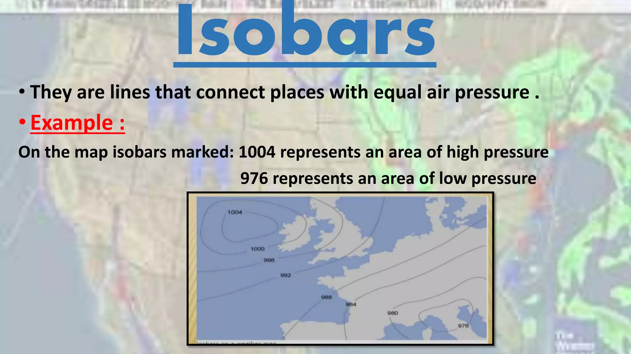
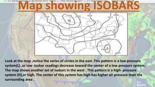
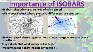
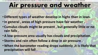
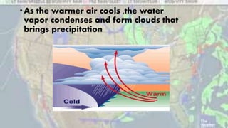
How do scientists predict weather (the whole lesson )
1. Isobars
• They are lines that connect places with equal air pressure .
•Example :
On the map isobars marked: 1004 represents an area of high pressure
976 represents an area of low pressure
2. Map showing ISOBARS
Look at the map ,notice the series of circles in the east .This pattern is a low pressure
system(L) ,or low .Isobar readings decrease toward the center of a low pressure system.
The map shows another set of isobars in the west . This pattern is a high- pressure
system (H),or high. The center of this system has high has higher air pressure than the
surrounding area .
3. Importance of ISOBARS
• Isobars give scientists an idea of wind speed .
• Air moves fastest where pressure differences are greatest .
• Isobars spaced closely together show a large change in pressure over a
small area .
They indicate that wind speeds will be high.
• Widely spaced isobars indicate gentle wind .
4. Air pressure and weather
•Different types of weather develop in highs than in lows.
•In general , areas of high pressure have fair weather .
•Cumulus clouds might be present , but generally little or no
rain falls .
•A low-pressure area usually has clouds and precipitation.
•Storms and rain often follow a drop in air pressure .
•When the barometer reading drops suddenly ,it is likely that
precipitation will fall .
6. Air Masses
• a body of air extending hundreds or thousands of miles
sideways and sometimes as high as the stratosphere and
having nearly the same conditions of temperature and
humidity.
7. Types of air masses
Humid Air masses
Dry Air masses
8. Air Fronts
• When air masses move across the surface of the earth they
may collide.
• These collisions happen halfway between one of the poles and
the equator.
• The 2 air masses don’t mix much when they collide.
• Each keeps its own temperature ,humidity and pressure.
• As a result ,a boundary forms, this boundary is called “Front”.
9. Types of Air Fronts
Scientists classify fronts by the
characteristics and movements of the
two air masses.
10. 1-Warm Front
When a warm air mass moves into an area of cooler
air ,the boundary between the air is called
“Warm front”
The warmer ,less dense air slides up over the cooler
denser air in a wide ,gentle slope
11. •As the warmer air cools ,its relative humidity
increases, and the water vapor condenses into
clouds.
•A warm front usually results in steady rain .
12. 2)Cold Front
• When a cold air mass moves into an area of
warmer air , the boundary between air masses is
called “Cold front”
• The colder ,denser air slides under the warmer air is
pushed up .
13. •As the warmer air cools ,the water
vapor condenses and form clouds that
brings precipitation
14.
15. 3)Occluded front
This produces a wedge of warm air between 2 masses of cold
air .The formation of an occluded front often indicates that a
storm will happen but will not last for long.