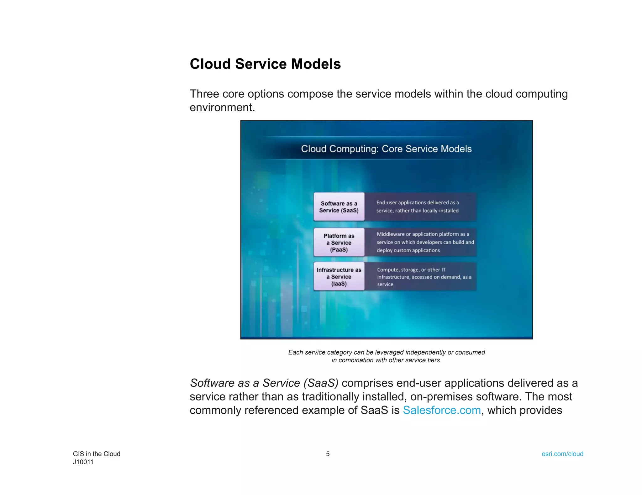
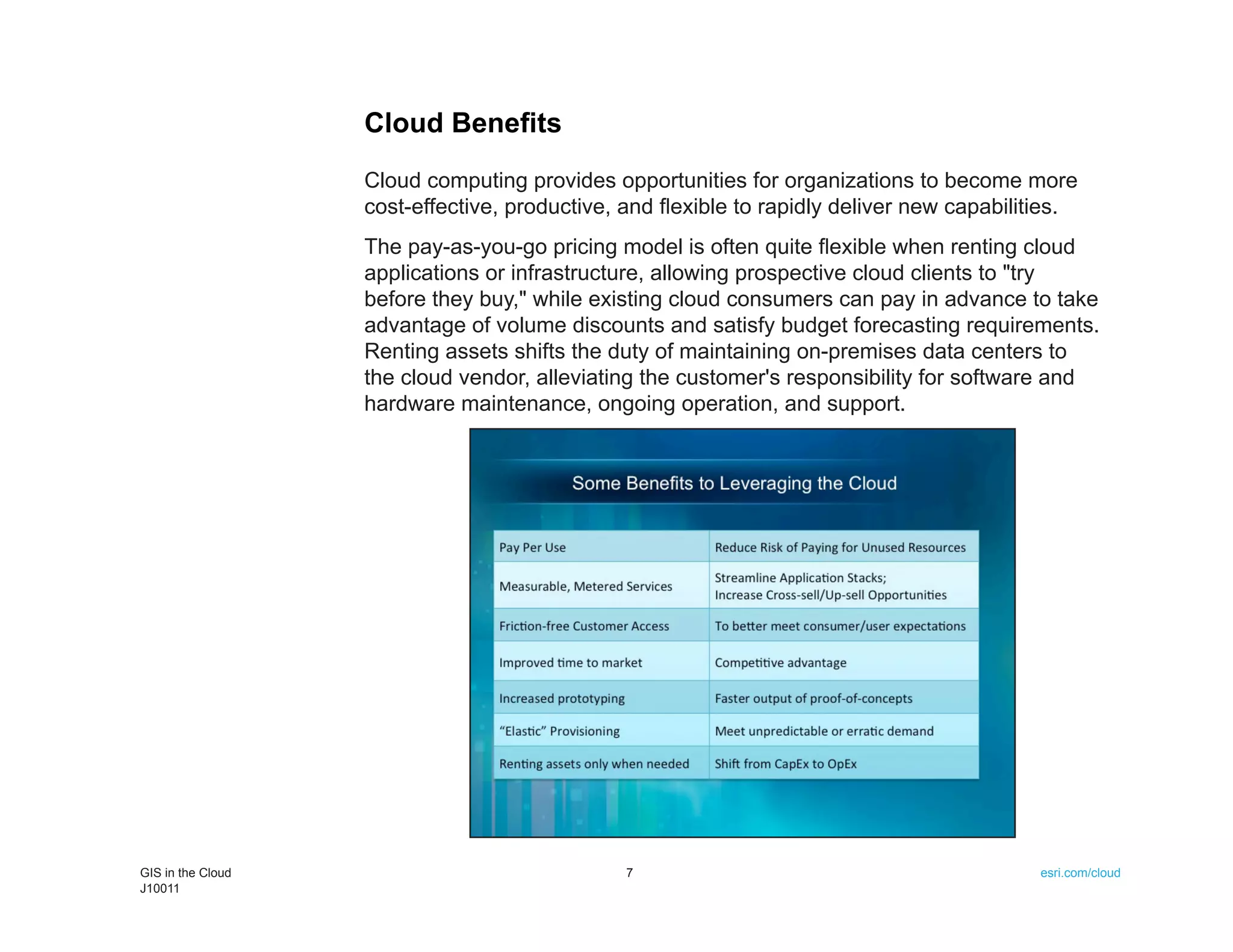
Download as PDF, PPTX

![Migration of an On-Premises Application to the Cloud
Once an ArcGIS Server 10 AMI has been launched in the Amazon
cloud and sufficient storage space has been purchased and configured,
the deployment of an on-premises application to the cloud is very
straightforward. After RDP-ing [i.e., using remote desktop protocol] to the
June 2011 22 GIS in the Cloud
J10011](https://image.slidesharecdn.com/gis-in-the-cloud-111014171626-phpapp02/75/GIS-in-the-Cloud-21-2048.jpg)
![Prior to acquiring ArcLogistics, Morgan says
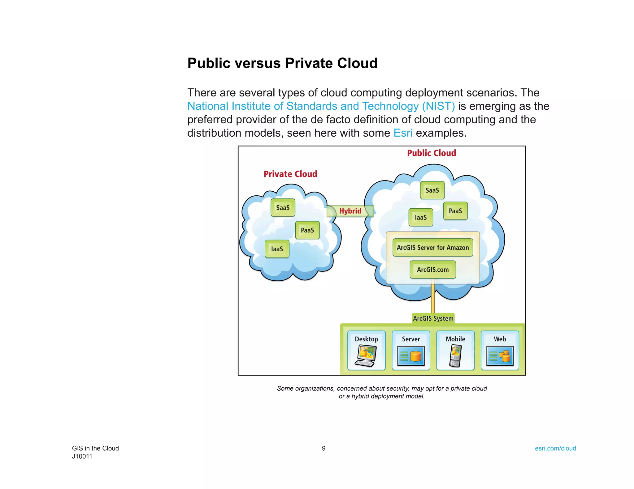
the company was constantly rearranging
routes and providing very large time windows
to customers, which was hurting Shalem
competitively. Shalem employees would joke
about their time windows being in the realm
of, "We'll be there sometime between noon
and 7:00 p.m." Since the implementation of
ArcLogistics, the routing software has helped
reduce time windows to two hours.
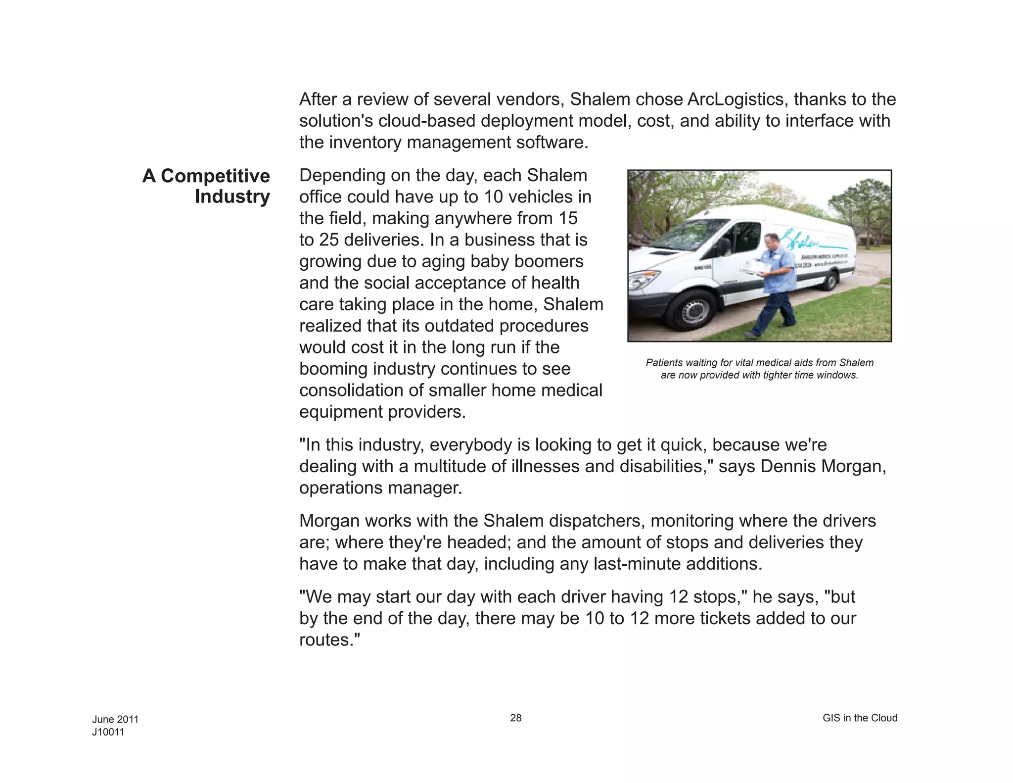
Did the Drivers A concern many have when considering At each stop, ArcLogistics Navigator helps
Revolt? routing and scheduling software is whether drivers reach their destinations according to the
streets selected and sequence established in the
or not dispatchers and drivers will accept route plan.
the software. In many cases, these are
professionals who have spent years learning their local street networks and
customer needs and establishing processes to help get the job done.
Morgan said initially his drivers were against following the plan established
by the software. At first, early routes were suggested, then drivers were
able to run their routes according to their old ways and compare the two
when they got back.
"They were out there three hours longer [with the older routes]. And you
can track them and see," Morgan says. He explains that eventually, the
drivers came around when they realized the route plans created with
ArcLogistics would get them back to base sooner. There were a few drivers
who had issues, especially when it came to the touchy subject of overtime.
However, Morgan and Shalem came up with a bonus system. The drivers
GIS in the Cloud 29 esri.com/cloud
J10011](https://image.slidesharecdn.com/gis-in-the-cloud-111014171626-phpapp02/75/GIS-in-the-Cloud-27-2048.jpg)
![Immediate ROI "Our overtime costs dropped by at least 20 or 25 percent. It's decreased
our fuel consumption and maintenance costs on the vehicles at least 10 or
15 percent, if not more than that," says Paton, who runs a daily report for
the stops made, which includes the mileage that's driven and the fuel costs.
Since using ArcLogistics, the first thing he noticed was the big drop in total
mileage driven. He estimates a mileage decrease of around 10 percent just
in the first week the solution was put in use.
"You will see your money is being recouped right away in maintenance,
gas, [employee] hours, and the whole ball of wax. It's something that I
would advise anyone that's going into a business where you're going to
have multiple vehicles to look into it," Morgan says.
For more information, contact Zach Paton, Shalem Medical Supply (Web:
www.shalemmedical.com).
(Reprinted from the Fall 2010 issue of ArcNews magazine)
GIS in the Cloud 31 esri.com/cloud
J10011](https://image.slidesharecdn.com/gis-in-the-cloud-111014171626-phpapp02/75/GIS-in-the-Cloud-29-2048.jpg)


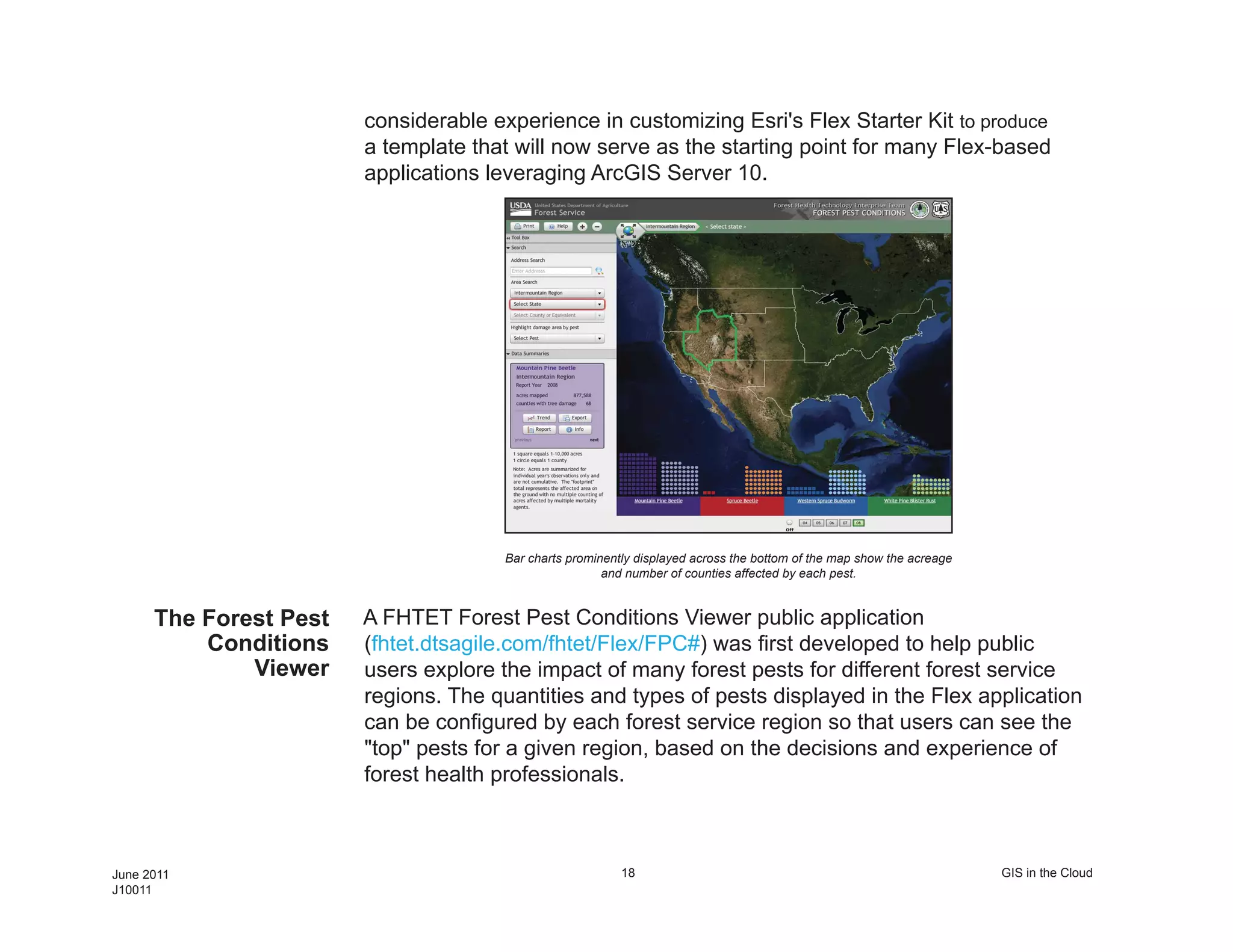
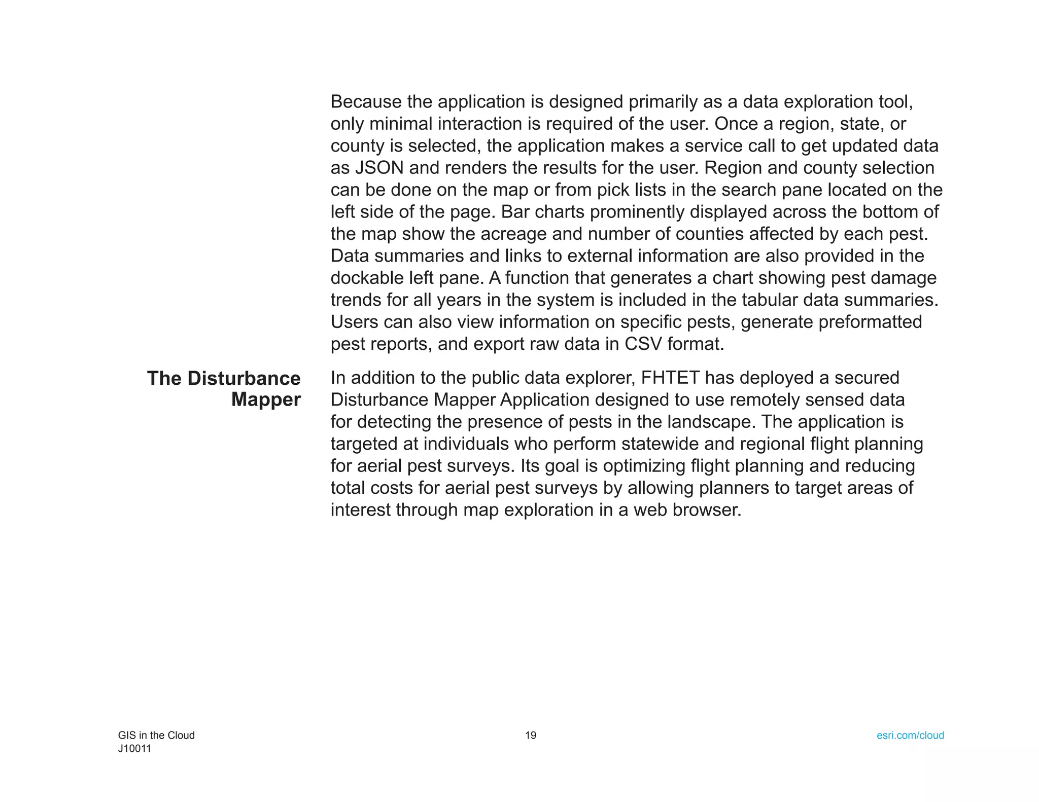
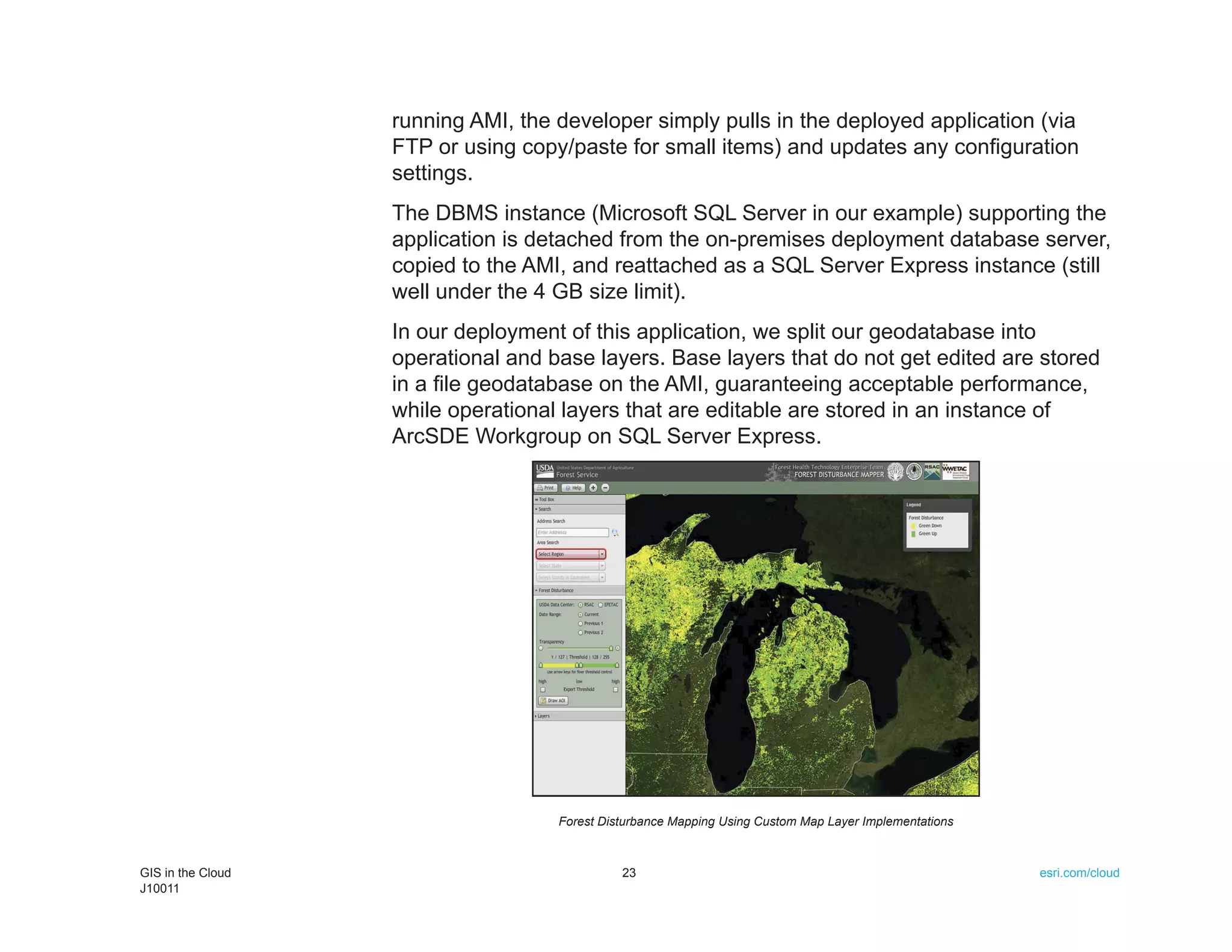
This document discusses two ArcGIS applications deployed in the cloud by the Forest Health Technology Enterprise Team (FHTET). A public Forest Pest Conditions Viewer application allows users to explore forest pest impact data. A secured Disturbance Mapper application uses remote sensing data to identify disturbed forest areas and enable analysis of the causes and effects of disturbances. Both applications were built with ArcGIS Server 10 and deployed to Amazon Web Services for scalability and convenience.