SlideShare a Scribd company logo
GUWAHATI COLLEGE OF ARCHITECTURE
AND PLANNING
COLLEGE SEAL FACULTY SIGNATURE EXTERNAL SIGNATURE
SUBMITTED BY
KUMAR SATYAM
M.PLAN 1ST SEMESTER
Roll Number: 221020028001
Registration Number: 154210117
P O R T F O L I O G E O G R A P H I C A L I N F O R M AT I O N S Y S T E M
CONTENTS
1. INTRODUCTION
2. DIGITIZATION JOGIPARA, JOBE ROAD AREA
3. GEOREFRENCING MAP
4. GMC WARD POPULATION DENSITY
5. LITERACY% GMC WARD MAP
6. INTRODUCTION OF MIRZA DEVELOPMENT PLAN
1. What Is GIS?
o A geographic information system (GIS) is a
computer system for capturing, storing,
checking, and displaying data related to
positions on Earth's surface.
• GIS is an information system that used to input,
store, retrieve, manipulate, analyze and output
geographically referenced data or geospatial
data in order to support decision making for
planning and management of land use, natural
resources, environment, transportation, urban
facilities and other administrative records.
 A GIS is a computer-based system that provides
the following four sets of capabilities to handle
geo-referenced data:
 Input
 Data management (data storage and retrieval)
 manipulation and analysis
 Output.
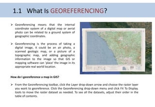
1.1 What Is GEOREFERENCING?
 Georeferencing means that the internal
coordinate system of a digital map or aerial
photo can be related to a ground system of
geographic coordinates.
 Georeferencing is the process of taking a
digital image, it could be an air photo, a
scanned geologic map, or a picture of a
topographic map, and adding geographic
information to the image so that GIS or
mapping software can 'place' the image in its
appropriate real world location.
How do I georeference a map in GIS?
 From the Georeferencing toolbar, click the Layer drop-down arrow and choose the raster layer
you want to georeference. Click the Georeferencing drop-down menu and click Fit To Display.
tools to move the raster dataset as needed. To see all the datasets, adjust their order in the
table of contents.
1.2 What Is REMOTE SENSING?
• Remote sensing is a technology used for obtaining
information about the characteristics of an object through
the analysis of data acquired from it at a distance.
• “The measurement or acquisition of information of some
property of an object or phenomenon, by a recording
device that is not in physical or intimate contact with the
object or phenomenon under study” (Colwell, 1997).
• Reflected sunlight is the most common source of radiation
measured by passive sensors. Examples of passive remote
sensors include film photography, infrared, charge-coupled
devices, and radiometers.
WHAT ARE REMOTE SENSING SATELLITES?
● Cameras on satellites and airplanes take
pictures of large areas on the Earth's
surface that capture much more than can
be seen when standing on the ground.
● Sonar systems on ships can be used to
make images of the ocean floor without
traveling to the bottom of the ocean.
TYPES OF SATELLITES :
1. Weather satellites
2. Astronomy satellites
3. Space Exploration satellites
4. Atmospheric satellites
5. Navigation satellites
6. Communication satellites
Weather satellites
Astrosat ( Astronomy satellite)
Weather Satellite:
As the name suggests, weather satellites provide us the information
about the condition of weather for any location on the Earth.
Astronomy satellite:
The satellites which orbit the Earth and observe other celestial
objects and phenomenon's, are called the astronomy satellites.
Space Exploration Satellites:
Space exploration satellites are those which probe deep into our solar
system and explores numerous planetary bodies, moons, meteorite
and lots of other celestial bodies and phenomena.
Atmospheric Satellite:
Atmospheric Satellites are created and launched into the Low Earth
Orbit (LEO) to monitor Earth's atmosphere.
Navigation Satellites :
The navigation satellites are mainly refers to a constellation of
satellites which helps to navigate the direction and find out a location
on the Earth surface.
Communication Satellites:
It is quite clear from the name that these satellites helps us to
communicate even the longest distance in the world, whether by
television, telephone or others.
Alouette 1
IRNSS
Galileo Satellite ( SES)
THREE TYPES OF REMOTE SENSING PLATFORM
1.Ground Based Remote Sensing Platform
2. Airborne Remote Sensing
3. Spaceborne Remote Sensing
1. Ground Observation Platforms
 Ground observation platforms are used to record detailed information about the objects or features of the earth's
surface. It ranges from 50 m upto 1 km.
 Ground observation platforms include handheld platform, towers, portable masts and vehicles etc.
2. Airborne Based Platforms
 Aircraft remote sensing system may also be referred to as sub-orbital or airborne, or aerial remote sensing system.
Airborne observation platforms include balloons, drones (short sky spy) upto 50 km.
At present, airplanes are the most common airborne platform.
3. Spaceborne Observation Platforms
 In spaceborne remote sensing, sensors are mounted on-board a spacecraft (space shuttle or satellite) orbiting the earth.
 Spaceborne or satellite platform are one-time cost effected but relatively lower cost per unit area of coverage, and can
acquire imagery of entire earth without taking permission.
 Spaceborne imaging ranges from altitude 250 km to 36000 km.
•Space shuttle: 250-300 km
•Space station: 300-400 km
•Low-level satellites: 700-1500 km
•High-level satellites: about 36000 km
• The satellite can be rotated around the earth through different paths. These are called as orbits of
the satellite.
• The satellite orbit are used to cover the required application areas.
Types of satellite orbits :-
1. Equatorial orbits
2. Geosynchronous orbits
3. Polar orbits
4. Inclined orbits
5. Prograde orbits
6. Retrograde orbits
7. Low earth orbits(LEO) and medium earth orbits(MEO)
8. Sun synchronous orbits
1.3 What Is SATELLITE ORBIT ?
Geostationary Orbit
Polar Orbit
Geostationary Orbit
Geostationary satellites orbit the Earth's axis
as fast as the Earth spins.
This orbit allows these satellites to
continuously look at the same spot on the
earth – important for locating the position of
hurricanes and monitoring developing severe
storms.
Polar Orbit
When the satellite rotates in orbit that
covers the north and south poles it is
called as a polar orbit.
Equatorial orbits
When satellite rotates in an orbit above the
equator it is called as an equatorial orbits or
circular or geostationary orbit.
The circular equatorial orbit is exactly in the plane
of equator on the earth. All the points on this orbit
are equidistance from the earth surface.
Geosynchronous orbit.
If the inclination of the orbit of the satellite is
not zero then the orbit is called as
geosynchronous orbit.
Inclined orbit
The satellite following the other orbital path,
other than equatorial or polar is called as an
inclined orbit.
Prograde orbit & Retrograde orbit
Prograde orbit:
An orbit in which the satellite moves in the same
direction as the earth’s rotation is called as a prograde
orbit.
Retrograde orbit:
An orbit in which the satellite moves in opposite
direction on the earth rotation is called as retrograde
orbit.
sun synchronous orbit
A Sun-synchronous orbit can place a satellite
in constant sunlight, which allows the solar
panels to work continually. This orbit is also
useful for imaging, spy, and weather
satellites.
These orbits are used for satellites that need
a constant amount of sunlight.
Satellite
Remote
Sensing
Applications
Défense &
Intelligence
Défense Mapping
Surveillance
Reconnaissance
Target tracking
Global Warming
Research:
Sea-Ice studies
Climate Change
research
Airborne pollution
Natural resources:
Agriculture & Forestry
Environmental
Monitoring
Coastal Monitoring
Conservation &
Research:
Wildlife Conservation
Marine Conservation
Archaeology
1.4
Uses
Of
SATELLITE
SENSORS
Development and
Construction:
Land Development
Engineering &
Construction
Geo Sciences:
Cartography
hydrology
Oceanography
Disaster Response:
Natural Hazards
Earthquakes
Others:
Law enforcement
City & Urban Planning
Navigation Systems
Traffic Monitoring
Systems
Medical Sciences:
CAT Scan
MRI
Xray
Conservation &
Research:
Wildlife Conservation
Marine Conservation
Archaeology
REFERENCE
 https://www.moneycontrol.com/news/photos/world/explainer-what-are-geostationary-satellites-and-how-are-they-different-from-
other-orbiting-satellites-7323381.html
 https://www.slideshare.net/RANE1998/types-of-satellite-orbits-086
 https://www.iasgyan.in/blogs/types-of-orbits-explained
 www.google.com
 http://www.ccpo.odu.edu/SEES/veget/class/Chap_5/5_3.htm#:~:text=Platforms%20refer%20to%20the%20structures,the%20use%20of
%20particular%20sensors.
 https://www.slideshare.net/udaykumardevalla/unit2-51304046
 http://www.ccpo.odu.edu/SEES/veget/class/Chap_5/5_3.htm
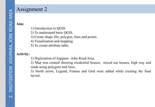
Assignment 2
Aim:
1) Introduction to QGIS.
2) To understand basic QGIS.
3) Create shape file; polygon, lines and points.
4) Visualization and mapping.
5) To create attribute table.
Activity:
1) Digitization of Jogipara –Jobe Road Area.
2) Map was created showing residential houses, mixed use houses, high way and
roads using polygons and lines.
3) North arrow, Legend, Frames and Grid were added while creating the final
layout.
2.
DIGITIZATION
JOGIPARA,
JOBE
ROAD
AREA
2.
DIGITIZATION
JOGIPARA,
JOBE
ROAD
AREA
HOUSE.
NO
CONDITION ELECTRICITY DRAINAGE
DRAINAGE
CONDITION
CONNECTED/
UNCONNECTED DRAIN
ROAD LINK
WATER
SUPPLY
RESIDENTIAL/
MIXED USE
1 Pucca Yes Yes Uncovered Drain Connected Yes Yes Residential
2 Pucca Yes Yes Uncovered Drain Connected Yes Yes Residential
3 Pucca Yes Yes Uncovered Drain Connected Yes Yes Residential
4 Pucca Yes Yes Uncovered Drain Connected Yes Yes Residential
5 Pucca Yes Yes Uncovered Drain Connected No Yes Residential
6 Pucca Yes Yes Uncovered Drain Connected Yes Yes Residential
7 Pucca Yes Yes Uncovered Drain Connected Yes Yes Residential
8 Pucca Yes Yes Uncovered Drain Connected Yes Yes Mixed
9 Pucca Yes Yes Uncovered Drain Connected Yes Yes Residential
10 Pucca Yes Yes Uncovered Drain Connected Yes Yes Residential
11 Pucca Yes Yes Uncovered Drain Connected Yes Yes Residential
12 Pucca Yes Yes Uncovered Drain Connected Yes Yes Mixed
13 Pucca Yes Yes Unavailable Unconnected Yes Yes Residential
14 Pucca Yes Yes Unavailable Unconnected Yes Yes Mixed
15 Pucca Yes Yes Unavailable Unconnected Yes Yes Residential
16 Pucca Yes Yes Unavailable Unconnected Yes Yes Residential
17 Pucca Yes Yes Unavailable Unconnected Yes Yes Mixed
18 Pucca Yes Yes Unavailable Unconnected Yes Yes Residential
19 Pucca Yes Yes Unavailable Unconnected Yes Yes Residential
20 Pucca Yes Yes Unavailable Unconnected Yes Yes Residential
21 Pucca Yes Yes Unavailable Unconnected Yes Yes Residential
22 Pucca Yes Yes Unavailable Unconnected Yes Yes Residential
23 Pucca Yes Yes Unavailable Unconnected Yes Yes Residential
24 Pucca Yes Yes Unavailable Unconnected Yes Yes Residential
25 Pucca Yes Yes Unavailable Unconnected Yes Yes Residential
26 Pucca Yes Yes Unavailable Unconnected Yes Yes Residential
27 Pucca Yes Yes Unavailable Unconnected Yes Yes Mixed
28 Pucca Yes Yes Unavailable Unconnected Yes Yes Residential
29 Pucca Yes Yes Unavailable Unconnected Yes Yes Residential
30 Pucca Yes Yes Unavailable Unconnected Yes Yes Mixed
31 Pucca Yes Yes Unavailable Unconnected Yes Yes Residential
32 Pucca Yes Yes Unavailable Unconnected Yes Yes Residential
33 Pucca Yes Yes Unavailable Unconnected Yes Yes Residential
Attribute Table, JOBE ROAD AREA
Sources: primary data
2.
DIGITIZATION
JOGIPARA,
JOBE
ROAD
AREA
34 Pucca Yes Yes Unavailable Unconnected Yes Yes Residential
35 Pucca Yes Yes Unavailable Unconnected Yes Yes Residential
36 Pucca Yes Yes Unavailable Unconnected Yes Yes Residential
37 Pucca Yes Yes Unavailable Unconnected Yes Yes Residential
38 Pucca Yes Yes Unavailable Unconnected Yes Yes Residential
39 Pucca Yes Yes Unavailable Unconnected Yes Yes Residential
40 Pucca Yes Yes Unavailable Unconnected Yes Yes Residential
41 Pucca Yes Yes Unavailable Unconnected Yes Yes Residential
42 Pucca Yes Yes Unavailable Unconnected Yes Yes Residential
43 Pucca Yes Yes Unavailable Unconnected Yes Yes Residential
44 Pucca Yes Yes Unavailable Unconnected Yes Yes Residential
45 Pucca Yes Yes Uncovered Drain Connected Yes Yes Mixed
46 Pucca Yes Yes Uncovered Drain Connected Yes Yes Mixed
47 Pucca Yes Yes Uncovered Drain Connected Yes Yes Mixed
48 Pucca Yes Yes Uncovered Drain Connected Yes Yes Mixed
49 Pucca Yes Yes Uncovered Drain Connected Yes Yes Mixed
50 Pucca Yes Yes Uncovered Drain Connected Yes Yes Residential
51 Pucca Yes Yes Uncovered Drain Connected Yes Yes Residential
52 Pucca Yes Yes Uncovered Drain Connected Yes Yes Namghar
53 Pucca Yes Yes Unavailable Unconnected Yes Yes Residential
54 Pucca Yes Yes Unavailable Unconnected Yes Yes Residential
55 Pucca Yes Yes Unavailable Unconnected Yes Yes Residential
56 Pucca Yes Yes Unavailable Unconnected Yes Yes Mixed
57 Pucca Yes Yes Unavailable Unconnected Yes Yes Residential
58 Pucca Yes Yes Unavailable Unconnected Yes Yes Residential
59 Pucca Yes Yes Unavailable Unconnected Yes Yes Residential
60 Pucca Yes Yes Unavailable Unconnected Yes Yes Residential
61 Pucca Yes Yes Unavailable Unconnected Yes Yes Residential
62 Pucca Yes Yes Unavailable Unconnected Yes Yes Residential
63 Pucca Yes Yes Unavailable Unconnected Yes Yes Residential
64 Pucca Yes Yes Unavailable Unconnected Yes Yes Residential
65 Pucca Yes Yes Unavailable Unconnected Yes Yes Residential
66 Pucca Yes Yes Unavailable Unconnected Yes Yes Residential
HOUSE.
NO
CONDITION ELECTRICITY DRAINAGE DRAINAGE
CONDITION
CONNECTED/
UNCONNECTED DRAIN
ROAD
LINK
WATER
SUPPLY
RESIDENTIAL/
MIXED USE
Attribute Table, JOBE ROAD AREA
Sources: primary data
2.
DIGITIZATION
JOGIPARA,
JOBE
ROAD
AREA HOUSE.
NO
CONDITION ELECTRICITY DRAINAGE DRAINAGE
CONDITION
CONNECTED/
UNCONNECTED DRAIN
ROAD
LINK
WATER
SUPPLY
RESIDENTIAL/ MIXED
USE
67 Pucca Yes Yes Unavailable Unconnected Yes Yes Residential
68 Pucca Yes Yes Unavailable Unconnected Yes Yes Residential
69 Pucca Yes Yes Unavailable Unconnected Yes Yes Residential
70 Pucca Yes Yes Unavailable Unconnected Yes Yes Residential
71 Pucca Yes Yes Unavailable Unconnected Yes Yes Residential
72 Pucca Yes Yes Unavailable Unconnected Yes Yes Residential
73 Pucca Yes Yes Unavailable Unconnected Yes Yes Residential
74 Pucca Yes Yes Unavailable Unconnected Yes Yes Residential
75 Pucca Yes Yes Unavailable Unconnected Yes Yes Residential
76 Pucca Yes Yes Unavailable Unconnected Yes Yes Residential
77 Pucca Yes Yes Unavailable Unconnected Yes Yes Mixed
78 Pucca Yes Yes Unavailable Unconnected Yes Yes Residential
79 Pucca Yes Yes Unavailable Unconnected Yes Yes Residential
80 Pucca Yes Yes Unavailable Unconnected Yes Yes Residential
81 Pucca Yes Yes Unavailable Unconnected Yes Yes Residential
82 Pucca Yes Yes Unavailable Unconnected Yes Yes Residential
83 Pucca Yes Yes Unavailable Unconnected Yes Yes Residential
84 Pucca Yes Yes Unavailable Unconnected Yes Yes Residential
85 Pucca Yes Yes Unavailable Unconnected Yes Yes Residential
86 Pucca Yes Yes Unavailable Unconnected Yes Yes Residential
87 Pucca Yes Yes Unavailable Unconnected Yes Yes Residential
88 Pucca Yes Yes Unavailable Unconnected Yes Yes Residential
89 Pucca Yes Yes Unavailable Unconnected Yes Yes Residential
90 Pucca Yes Yes Unavailable Unconnected Yes Yes Residential
91 Pucca Yes Yes Unavailable Unconnected Yes Yes Residential
92 Pucca Yes Yes Unavailable Unconnected Yes Yes Residential
93 Pucca Yes Yes Unavailable Unconnected Yes Yes Residential
94 Pucca Yes Yes Unavailable Unconnected Yes Yes Residential
95 Pucca Yes Yes Unavailable Unconnected Yes Yes Residential
96 Pucca Yes Yes Unavailable Unconnected Yes Yes Residential
97 Pucca Yes Yes Unavailable Unconnected Yes Yes Residential
98 Pucca Yes Yes Unavailable Unconnected Yes Yes Mixed
99 Pucca Yes Yes Unavailable Unconnected Yes Yes Residential
100 Pucca Yes Yes Unavailable Unconnected Yes Yes Residential
Attribute Table, JOBE ROAD AREA
Sources: primary data
2.
DIGITIZATION
JOGIPARA,
JOBE
ROAD
AREA
Assignment 3
Aim:
1) To learn georeferencing a topographic map in qgis.
2) To understand georeferencing in QGIS.
3) To convert degree coordinates into decimal coordinates
4) Visualization and mapping.
Activity:
1) Converting the given degree coordinate system to decimal coordinate system.
2 Georeferencing of topographic map.
3.
GEOREFERENCING
3
.
G
E
O
R
E
F
E
R
E
N
C
I
N
G
Assignment 4
Aim:
1) To learn making population density maps of GMC wards in QGIS.
2) To understand the meaning of population density.
3) To import CSV files to QGIS
4) Visualization and mapping.
Activity:
1) Creating Attribute table from Census Data.
2) Import CSV file and link with Attribute table in Qgis.
3) Categorize the symbology of the layers.
4.
POPULATION
DENSITY
MAP
(GMC
WARDS)
4
.
P
O
P
U
L
AT
I
O
N
D
E
N
S
I
T
Y
(GMC
WARDS)
S No. Ward No. Area sq.km Population Pop Density
1 ward 1 4.78 16692 3492
2 ward 2 8.04 16613 2066
3 ward 3 0.87 11106 12766
4 ward 4 0.33 10731 32518
5 ward 5 0.94 12526 13326
6 ward 6 0.69 10171 14741
7 ward 7 0.67 20366 30397
8 ward 8 2.7 7593 2812
9 ward 9 1.83 6746 3686
10 ward 10 11.27 10216 906
11 ward 11 6.22 18514 2977
12 ward 12 4.81 39995 8315
13 ward 13 1.46 29041 19891
14 ward 14 1.07 17629 16476
15 ward15 0.62 19228 31013
16 ward 16 0.34 39056 114871
17 ward 17 0.75 21292 28389
18 ward 18 0.8 7431 9289
19 ward 19 0.88 14957 16997
20 ward 20 0.8 11887 14859
21 ward 21 1.13 7718 6830
22 ward 22 2.9 21169 7300
23 ward 23 7.59 10837 1428
24 ward 24 6.99 17830 2551
25 ward 25 2.33 20707 8887
26 ward 26 2.47 10431 4223
27 ward 27 1.65 12008 7278
28 ward 28 1.01 9828 9731
29 ward 29 1.67 6988 4184
30 ward 30 0.69 5688 8243
31 ward 31 1.35 7387 5472
32 ward 32 0.63 10332 16400
33 ward 33 1.34 8368 6245
34 ward 34 1.62 11088 6844
35 ward 35 1.12 11012 9832
36 ward 36 1.91 13966 7312
37 ward 37 2 15854 7927
38 ward 38 1.76 8589 4880
39 ward 39 1.48 11574 7820
40 ward 40 2.06 7782 3778
41 ward 41 3.69 21514 5830
42 ward 42 2.01 16649 8283
43 ward 43 4.77 9295 1949
44 ward 44 2.68 15073 5624
45 ward 45 2.76 12537 4542
46 ward 46 2.76 28309 10257
47 ward 47 2.24 9772 4363
48 ward 48 1.53 12686 8292
49 ward 49 2.24 30124 13448
50 ward 50 1 14084 14084
51 ward 51 4 30057 7514
52 ward 52 4.4 9000 2045
53 ward 53 1.07 14890 13916
54 ward 54 0.82 24226 29544
55 ward 55 2.86 13670 4780
56 ward 56 2.83 26625 9408
57 ward 57 7.66 13359 1744
58 ward 58 4.56 31876 6990
59 ward 59 4.36 25709 5897
60 ward 60 7.52 26951 3584
Attribute Table, Population Density
Sources: Census 2011, INDIA
4
.
P
O
P
U
L
AT
I
O
N
D
E
N
S
I
T
Y
G
M
C
WA
R
D
Sources: Census 2011, INDIA
Assignment 5
Aim:
1) To learn making Literacy rate maps of GMC wards in QGIS.
2) To understand the meaning of Literacy% of GMC wards in QGIS.
3) To import CSV files to QGIS
4) Visualization and mapping.
Activity:
1) Creating Attribute table from Census Data.
2) Import CSV file and link with Attribute table in Qgis.
3) Categorize the symbology of the layers.
5
.
L
I
T
E
R
A
C
Y
R
AT
E
G
M
C
WA
R
D
Sl no. Ward Total Population Population Literacy Literacy Rate(%)
5
.
L
I
T
E
R
A
C
Y
R
AT
E
G
M
C
WA
R
D Sl no. Ward Total Population Population Literacy Literacy Rate(%)
1 1 16692 13815 82.76419842
2 2 16613 13845 83.33834949
3 3 11106 8797 79.20943634
4 4 10731 9159 85.35085267
5 5 12526 10127 80.8478365
6 6 10171 8363 82.22397011
7 7 20366 16768 82.3333006
8 8 7593 6210 81.78585539
9 9 6746 5539 82.1079158
10 10 10216 8184 80.10963195
11 11 18514 14831 80.10694609
12 12 39995 31036 77.59969996
13 13 29041 21966 75.63789126
14 14 17629 13974 79.26711668
15 15 19228 16701 86.85770751
16 16 39056 32199 82.44315854
17 17 21292 16883 79.29269209
18 18 7431 6458 86.90620374
19 19 14957 12747 85.22430969
20 20 11887 9754 82.05602759
21 21 7718 6083 78.81575538
22 22 21169 17663 83.4380462
23 23 10837 8790 81.11100858
24 24 17830 15007 84.16713404
25 25 20707 17480 84.41589801
26 26 10431 9085 87.09615569
27 27 12008 10396 86.57561626
28 28 9828 8433 85.80586081
29 29 6988 6199 88.7092158
30 30 5688 5009 88.0625879
31 31 7387 6184 83.71463382
32 32 10332 8548 82.7332559
33 33 8368 6980 83.41300191
34 34 11088 9489 85.57900433
35 35 11012 9726 88.32183073
36 36 13966 11325 81.08978949
37 37 15854 13570 85.59354106
38 38 8589 7718 89.85912213
39 39 11574 9811 84.76758251
40 40 7782 6711 86.23747109
41 41 21514 18152 84.37296644
42 42 16649 14467 86.89410775
43 43 9295 8046 86.5626681
44 44 15073 13096 86.88383202
45 45 12537 9715 77.49062774
46 46 28309 22904 80.90713201
47 47 9772 8366 85.61195252
48 48 12686 10625 83.75374429
49 49 30124 24297 80.65661931
50 50 14084 11759 83.49190571
51 51 30057 25838 85.96333633
52 52 9000 7303 81.14444444
53 53 14890 12760 85.69509738
54 54 24226 19130 78.96474862
55 55 13670 11922 87.21287491
56 56 26625 21802 81.88544601
57 57 13359 11649 87.19964069
58 58 31876 26645 83.58953445
59 59 25709 22077 85.8726516
60 60 26951 21244 78.82453341
Attribute Table, Literacy Rate
Sources: Census 2011, INDIA
5
.
L
I
T
E
R
A
C
Y
%
G
M
C
WA
R
D
M
A
P
Sources: Census 2011, INDIA
6. Development Plan Of MIRZA
INTRODUCTION
• Kochpara (CT) Mirza is located in the administrative area of Circle Office, Palashbari, Kamrup, Assam,
India. Mirza town is 33 km from the Dispur Administrative Office, Guwahati. NH-17 passes through
the heart of town and Lokpriya Gopinath Bordoloi International Airport is 8 km away from the town.
• According to the official record Mirza area covers 2 villages Kochpara and Kokjhar which covers an
area of 7.5 sq km. The literacy rate of the town is 94%. Mirza is the educational epicentre of south
Kamrup region.
• The Development Plan of Mirza town is being prepared with an aim to improve and develop the town
in a sustainable manner that is consistent with the policies and objectives contained in URDPFI
Guideline 2014.
AIM
• To prepare Development Plan for Kochpara and Kokjhar (Mirza).
OBJECTIVES
• To understand the problems and opportunities of Kochpara and Kokjhar (Mirza).
• To make future projection of the area on the basis of problems and opportunities.
• To make gap analysis and recommend solutions and proposals for sustainable urban growth.
6
.
1
B
A
S
E
M
A
P
M
I
R
Z
A
6
.
2
D
R
A
I
N
A
G
E
M
A
P
M
I
R
Z
A
GIS FINAL REPORT.pdf

More Related Content

Similar to GIS FINAL REPORT.pdf

Remote sensing
Remote sensingRemote sensing
Remote sensing
NanheGupta2
 
Satellite applications satellite applicationssatellite applications
Satellite applications satellite applicationssatellite applicationsSatellite applications satellite applicationssatellite applications
Satellite applications satellite applicationssatellite applications
nader babo
 
Satellite System
Satellite SystemSatellite System
Satellite communication
Satellite communication Satellite communication
Satellite communication Dawood Aqlan
 
Satellite communication
Satellite communicationSatellite communication
Satellite communicationkarthika nadar
 
Satellite system
Satellite systemSatellite system
Satellite system
kona paul
 
Scanners, image resolution, orbit in remote sensing, pk mani
Scanners, image resolution, orbit in remote sensing, pk maniScanners, image resolution, orbit in remote sensing, pk mani
Scanners, image resolution, orbit in remote sensing, pk mani
P.K. Mani
 
remote sensing for study.docx
remote sensing for study.docxremote sensing for study.docx
remote sensing for study.docx
bbc37142
 
Applications of remote sensing in geological aspects
Applications of remote sensing in geological aspectsApplications of remote sensing in geological aspects
Applications of remote sensing in geological aspects
Pramoda Raj
 
applicationsofremotesensingingeologicalaspects-170606133459.pdf
applicationsofremotesensingingeologicalaspects-170606133459.pdfapplicationsofremotesensingingeologicalaspects-170606133459.pdf
applicationsofremotesensingingeologicalaspects-170606133459.pdf
CIVIL48
 
Satellitecommunication 130914114613-phpapp02
Satellitecommunication 130914114613-phpapp02Satellitecommunication 130914114613-phpapp02
Satellitecommunication 130914114613-phpapp02
Ronak Trivedi
 
Remote Sensing - by Ashwini
Remote Sensing - by AshwiniRemote Sensing - by Ashwini
Remote Sensing - by AshwiniSanthosh Sundar
 
Sc ppt -jntuworld.com__jwfiles
Sc ppt -jntuworld.com__jwfilesSc ppt -jntuworld.com__jwfiles
Sc ppt -jntuworld.com__jwfilesBrem Kumar
 
Satellites .
Satellites . Satellites .
Satellites .
Mohamed Omer
 
A Brief Introduction to Remote Sensing Satellites
A Brief Introduction to Remote Sensing Satellites A Brief Introduction to Remote Sensing Satellites
A Brief Introduction to Remote Sensing Satellites
Alireza Rahimzadeganasl
 
RS_GIS_GPS.pdf
RS_GIS_GPS.pdfRS_GIS_GPS.pdf
RS_GIS_GPS.pdf
AjayHistamine
 
satellite-communications
satellite-communicationssatellite-communications
satellite-communications
jhcid
 
Remote sensing ppt
Remote sensing pptRemote sensing ppt
Remote sensing pptcoolmridul92
 
Remote Sensing and its Application
Remote Sensing and its ApplicationRemote Sensing and its Application
Remote Sensing and its Application
Rashmi Yadav
 
Concepts of Remote Sensing: Process and Stages of Remote Sensing, Remote Sens...
Concepts of Remote Sensing: Process and Stages of Remote Sensing, Remote Sens...Concepts of Remote Sensing: Process and Stages of Remote Sensing, Remote Sens...
Concepts of Remote Sensing: Process and Stages of Remote Sensing, Remote Sens...
ShavnamMehta
 

Similar to GIS FINAL REPORT.pdf (20)

Remote sensing
Remote sensingRemote sensing
Remote sensing
 
Satellite applications satellite applicationssatellite applications
Satellite applications satellite applicationssatellite applicationsSatellite applications satellite applicationssatellite applications
Satellite applications satellite applicationssatellite applications
 
Satellite System
Satellite SystemSatellite System
Satellite System
 
Satellite communication
Satellite communication Satellite communication
Satellite communication
 
Satellite communication
Satellite communicationSatellite communication
Satellite communication
 
Satellite system
Satellite systemSatellite system
Satellite system
 
Scanners, image resolution, orbit in remote sensing, pk mani
Scanners, image resolution, orbit in remote sensing, pk maniScanners, image resolution, orbit in remote sensing, pk mani
Scanners, image resolution, orbit in remote sensing, pk mani
 
remote sensing for study.docx
remote sensing for study.docxremote sensing for study.docx
remote sensing for study.docx
 
Applications of remote sensing in geological aspects
Applications of remote sensing in geological aspectsApplications of remote sensing in geological aspects
Applications of remote sensing in geological aspects
 
applicationsofremotesensingingeologicalaspects-170606133459.pdf
applicationsofremotesensingingeologicalaspects-170606133459.pdfapplicationsofremotesensingingeologicalaspects-170606133459.pdf
applicationsofremotesensingingeologicalaspects-170606133459.pdf
 
Satellitecommunication 130914114613-phpapp02
Satellitecommunication 130914114613-phpapp02Satellitecommunication 130914114613-phpapp02
Satellitecommunication 130914114613-phpapp02
 
Remote Sensing - by Ashwini
Remote Sensing - by AshwiniRemote Sensing - by Ashwini
Remote Sensing - by Ashwini
 
Sc ppt -jntuworld.com__jwfiles
Sc ppt -jntuworld.com__jwfilesSc ppt -jntuworld.com__jwfiles
Sc ppt -jntuworld.com__jwfiles
 
Satellites .
Satellites . Satellites .
Satellites .
 
A Brief Introduction to Remote Sensing Satellites
A Brief Introduction to Remote Sensing Satellites A Brief Introduction to Remote Sensing Satellites
A Brief Introduction to Remote Sensing Satellites
 
RS_GIS_GPS.pdf
RS_GIS_GPS.pdfRS_GIS_GPS.pdf
RS_GIS_GPS.pdf
 
satellite-communications
satellite-communicationssatellite-communications
satellite-communications
 
Remote sensing ppt
Remote sensing pptRemote sensing ppt
Remote sensing ppt
 
Remote Sensing and its Application
Remote Sensing and its ApplicationRemote Sensing and its Application
Remote Sensing and its Application
 
Concepts of Remote Sensing: Process and Stages of Remote Sensing, Remote Sens...
Concepts of Remote Sensing: Process and Stages of Remote Sensing, Remote Sens...Concepts of Remote Sensing: Process and Stages of Remote Sensing, Remote Sens...
Concepts of Remote Sensing: Process and Stages of Remote Sensing, Remote Sens...
 

More from KumarSatyam263033

Environment Forest and Climate Change...
Environment Forest and Climate Change...Environment Forest and Climate Change...
Environment Forest and Climate Change...
KumarSatyam263033
 
Workshop basic measurement drawing .pptx
Workshop basic measurement drawing .pptxWorkshop basic measurement drawing .pptx
Workshop basic measurement drawing .pptx
KumarSatyam263033
 
Integrated Urban Conservation, MURP.pptx
Integrated Urban Conservation, MURP.pptxIntegrated Urban Conservation, MURP.pptx
Integrated Urban Conservation, MURP.pptx
KumarSatyam263033
 
PROFESSIONAL PRACTICE ASSIGNMENT-- 4.pdf
PROFESSIONAL PRACTICE ASSIGNMENT-- 4.pdfPROFESSIONAL PRACTICE ASSIGNMENT-- 4.pdf
PROFESSIONAL PRACTICE ASSIGNMENT-- 4.pdf
KumarSatyam263033
 
Role of vegetation in Landscape Design..
Role of vegetation in Landscape Design..Role of vegetation in Landscape Design..
Role of vegetation in Landscape Design..
KumarSatyam263033
 
URBAN DESIGN 9TH SEM.pdf
URBAN DESIGN 9TH SEM.pdfURBAN DESIGN 9TH SEM.pdf
URBAN DESIGN 9TH SEM.pdf
KumarSatyam263033
 
LANDSCAPE DESIGN.pdf
LANDSCAPE DESIGN.pdfLANDSCAPE DESIGN.pdf
LANDSCAPE DESIGN.pdf
KumarSatyam263033
 
Methodologies For Seismic Retrofitting.pdf
Methodologies For Seismic Retrofitting.pdfMethodologies For Seismic Retrofitting.pdf
Methodologies For Seismic Retrofitting.pdf
KumarSatyam263033
 
BUILDING FORMS AND ITS IRREGULARITIES..pdf
BUILDING FORMS AND ITS IRREGULARITIES..pdfBUILDING FORMS AND ITS IRREGULARITIES..pdf
BUILDING FORMS AND ITS IRREGULARITIES..pdf
KumarSatyam263033
 
BUILDING SERVICES
BUILDING SERVICES BUILDING SERVICES
BUILDING SERVICES
KumarSatyam263033
 
Tensile Structure PDF.pdf
Tensile Structure PDF.pdfTensile Structure PDF.pdf
Tensile Structure PDF.pdf
KumarSatyam263033
 
UNIVERSAL DESIGN GROUP.pdf
UNIVERSAL DESIGN  GROUP.pdfUNIVERSAL DESIGN  GROUP.pdf
UNIVERSAL DESIGN GROUP.pdf
KumarSatyam263033
 
ARCHITECTURAL LITERATURE STUDY.pdf
ARCHITECTURAL LITERATURE STUDY.pdfARCHITECTURAL LITERATURE STUDY.pdf
ARCHITECTURAL LITERATURE STUDY.pdf
KumarSatyam263033
 
CONCEPTUAL DESIGN.pptx
CONCEPTUAL DESIGN.pptxCONCEPTUAL DESIGN.pptx
CONCEPTUAL DESIGN.pptx
KumarSatyam263033
 
NCR regional planning.pdf
NCR regional planning.pdfNCR regional planning.pdf
NCR regional planning.pdf
KumarSatyam263033
 
BUILDING FORMS AND ITS IRREGULARITIES.pptx
BUILDING FORMS AND ITS IRREGULARITIES.pptxBUILDING FORMS AND ITS IRREGULARITIES.pptx
BUILDING FORMS AND ITS IRREGULARITIES.pptx
KumarSatyam263033
 

More from KumarSatyam263033 (16)

Environment Forest and Climate Change...
Environment Forest and Climate Change...Environment Forest and Climate Change...
Environment Forest and Climate Change...
 
Workshop basic measurement drawing .pptx
Workshop basic measurement drawing .pptxWorkshop basic measurement drawing .pptx
Workshop basic measurement drawing .pptx
 
Integrated Urban Conservation, MURP.pptx
Integrated Urban Conservation, MURP.pptxIntegrated Urban Conservation, MURP.pptx
Integrated Urban Conservation, MURP.pptx
 
PROFESSIONAL PRACTICE ASSIGNMENT-- 4.pdf
PROFESSIONAL PRACTICE ASSIGNMENT-- 4.pdfPROFESSIONAL PRACTICE ASSIGNMENT-- 4.pdf
PROFESSIONAL PRACTICE ASSIGNMENT-- 4.pdf
 
Role of vegetation in Landscape Design..
Role of vegetation in Landscape Design..Role of vegetation in Landscape Design..
Role of vegetation in Landscape Design..
 
URBAN DESIGN 9TH SEM.pdf
URBAN DESIGN 9TH SEM.pdfURBAN DESIGN 9TH SEM.pdf
URBAN DESIGN 9TH SEM.pdf
 
LANDSCAPE DESIGN.pdf
LANDSCAPE DESIGN.pdfLANDSCAPE DESIGN.pdf
LANDSCAPE DESIGN.pdf
 
Methodologies For Seismic Retrofitting.pdf
Methodologies For Seismic Retrofitting.pdfMethodologies For Seismic Retrofitting.pdf
Methodologies For Seismic Retrofitting.pdf
 
BUILDING FORMS AND ITS IRREGULARITIES..pdf
BUILDING FORMS AND ITS IRREGULARITIES..pdfBUILDING FORMS AND ITS IRREGULARITIES..pdf
BUILDING FORMS AND ITS IRREGULARITIES..pdf
 
BUILDING SERVICES
BUILDING SERVICES BUILDING SERVICES
BUILDING SERVICES
 
Tensile Structure PDF.pdf
Tensile Structure PDF.pdfTensile Structure PDF.pdf
Tensile Structure PDF.pdf
 
UNIVERSAL DESIGN GROUP.pdf
UNIVERSAL DESIGN  GROUP.pdfUNIVERSAL DESIGN  GROUP.pdf
UNIVERSAL DESIGN GROUP.pdf
 
ARCHITECTURAL LITERATURE STUDY.pdf
ARCHITECTURAL LITERATURE STUDY.pdfARCHITECTURAL LITERATURE STUDY.pdf
ARCHITECTURAL LITERATURE STUDY.pdf
 
CONCEPTUAL DESIGN.pptx
CONCEPTUAL DESIGN.pptxCONCEPTUAL DESIGN.pptx
CONCEPTUAL DESIGN.pptx
 
NCR regional planning.pdf
NCR regional planning.pdfNCR regional planning.pdf
NCR regional planning.pdf
 
BUILDING FORMS AND ITS IRREGULARITIES.pptx
BUILDING FORMS AND ITS IRREGULARITIES.pptxBUILDING FORMS AND ITS IRREGULARITIES.pptx
BUILDING FORMS AND ITS IRREGULARITIES.pptx
 

Recently uploaded

Biological Screening of Herbal Drugs in detailed.
Biological Screening of Herbal Drugs in detailed.Biological Screening of Herbal Drugs in detailed.
Biological Screening of Herbal Drugs in detailed.
Ashokrao Mane college of Pharmacy Peth-Vadgaon
 
Acetabularia Information For Class 9 .docx
Acetabularia Information For Class 9  .docxAcetabularia Information For Class 9  .docx
Acetabularia Information For Class 9 .docx
vaibhavrinwa19
 
CLASS 11 CBSE B.St Project AIDS TO TRADE - INSURANCE
CLASS 11 CBSE B.St Project AIDS TO TRADE - INSURANCECLASS 11 CBSE B.St Project AIDS TO TRADE - INSURANCE
CLASS 11 CBSE B.St Project AIDS TO TRADE - INSURANCE
BhavyaRajput3
 
Honest Reviews of Tim Han LMA Course Program.pptx
Honest Reviews of Tim Han LMA Course Program.pptxHonest Reviews of Tim Han LMA Course Program.pptx
Honest Reviews of Tim Han LMA Course Program.pptx
timhan337
 
The Roman Empire A Historical Colossus.pdf
The Roman Empire A Historical Colossus.pdfThe Roman Empire A Historical Colossus.pdf
The Roman Empire A Historical Colossus.pdf
kaushalkr1407
 
Polish students' mobility in the Czech Republic
Polish students' mobility in the Czech RepublicPolish students' mobility in the Czech Republic
Polish students' mobility in the Czech Republic
Anna Sz.
 
Phrasal Verbs.XXXXXXXXXXXXXXXXXXXXXXXXXX
Phrasal Verbs.XXXXXXXXXXXXXXXXXXXXXXXXXXPhrasal Verbs.XXXXXXXXXXXXXXXXXXXXXXXXXX
Phrasal Verbs.XXXXXXXXXXXXXXXXXXXXXXXXXX
MIRIAMSALINAS13
 
Supporting (UKRI) OA monographs at Salford.pptx
Supporting (UKRI) OA monographs at Salford.pptxSupporting (UKRI) OA monographs at Salford.pptx
Supporting (UKRI) OA monographs at Salford.pptx
Jisc
 
TESDA TM1 REVIEWER FOR NATIONAL ASSESSMENT WRITTEN AND ORAL QUESTIONS WITH A...
TESDA TM1 REVIEWER  FOR NATIONAL ASSESSMENT WRITTEN AND ORAL QUESTIONS WITH A...TESDA TM1 REVIEWER  FOR NATIONAL ASSESSMENT WRITTEN AND ORAL QUESTIONS WITH A...
TESDA TM1 REVIEWER FOR NATIONAL ASSESSMENT WRITTEN AND ORAL QUESTIONS WITH A...
EugeneSaldivar
 
Adversarial Attention Modeling for Multi-dimensional Emotion Regression.pdf
Adversarial Attention Modeling for Multi-dimensional Emotion Regression.pdfAdversarial Attention Modeling for Multi-dimensional Emotion Regression.pdf
Adversarial Attention Modeling for Multi-dimensional Emotion Regression.pdf
Po-Chuan Chen
 
Sha'Carri Richardson Presentation 202345
Sha'Carri Richardson Presentation 202345Sha'Carri Richardson Presentation 202345
Sha'Carri Richardson Presentation 202345
beazzy04
 
A Strategic Approach: GenAI in Education
A Strategic Approach: GenAI in EducationA Strategic Approach: GenAI in Education
A Strategic Approach: GenAI in Education
Peter Windle
 
Unit 2- Research Aptitude (UGC NET Paper I).pdf
Unit 2- Research Aptitude (UGC NET Paper I).pdfUnit 2- Research Aptitude (UGC NET Paper I).pdf
Unit 2- Research Aptitude (UGC NET Paper I).pdf
Thiyagu K
 
Lapbook sobre os Regimes Totalitários.pdf
Lapbook sobre os Regimes Totalitários.pdfLapbook sobre os Regimes Totalitários.pdf
Lapbook sobre os Regimes Totalitários.pdf
Jean Carlos Nunes Paixão
 
Operation Blue Star - Saka Neela Tara
Operation Blue Star   -  Saka Neela TaraOperation Blue Star   -  Saka Neela Tara
Operation Blue Star - Saka Neela Tara
Balvir Singh
 
Palestine last event orientationfvgnh .pptx
Palestine last event orientationfvgnh .pptxPalestine last event orientationfvgnh .pptx
Palestine last event orientationfvgnh .pptx
RaedMohamed3
 
The approach at University of Liverpool.pptx
The approach at University of Liverpool.pptxThe approach at University of Liverpool.pptx
The approach at University of Liverpool.pptx
Jisc
 
Home assignment II on Spectroscopy 2024 Answers.pdf
Home assignment II on Spectroscopy 2024 Answers.pdfHome assignment II on Spectroscopy 2024 Answers.pdf
Home assignment II on Spectroscopy 2024 Answers.pdf
Tamralipta Mahavidyalaya
 
Overview on Edible Vaccine: Pros & Cons with Mechanism
Overview on Edible Vaccine: Pros & Cons with MechanismOverview on Edible Vaccine: Pros & Cons with Mechanism
Overview on Edible Vaccine: Pros & Cons with Mechanism
DeeptiGupta154
 
"Protectable subject matters, Protection in biotechnology, Protection of othe...
"Protectable subject matters, Protection in biotechnology, Protection of othe..."Protectable subject matters, Protection in biotechnology, Protection of othe...
"Protectable subject matters, Protection in biotechnology, Protection of othe...
SACHIN R KONDAGURI
 

Recently uploaded (20)

Biological Screening of Herbal Drugs in detailed.
Biological Screening of Herbal Drugs in detailed.Biological Screening of Herbal Drugs in detailed.
Biological Screening of Herbal Drugs in detailed.
 
Acetabularia Information For Class 9 .docx
Acetabularia Information For Class 9  .docxAcetabularia Information For Class 9  .docx
Acetabularia Information For Class 9 .docx
 
CLASS 11 CBSE B.St Project AIDS TO TRADE - INSURANCE
CLASS 11 CBSE B.St Project AIDS TO TRADE - INSURANCECLASS 11 CBSE B.St Project AIDS TO TRADE - INSURANCE
CLASS 11 CBSE B.St Project AIDS TO TRADE - INSURANCE
 
Honest Reviews of Tim Han LMA Course Program.pptx
Honest Reviews of Tim Han LMA Course Program.pptxHonest Reviews of Tim Han LMA Course Program.pptx
Honest Reviews of Tim Han LMA Course Program.pptx
 
The Roman Empire A Historical Colossus.pdf
The Roman Empire A Historical Colossus.pdfThe Roman Empire A Historical Colossus.pdf
The Roman Empire A Historical Colossus.pdf
 
Polish students' mobility in the Czech Republic
Polish students' mobility in the Czech RepublicPolish students' mobility in the Czech Republic
Polish students' mobility in the Czech Republic
 
Phrasal Verbs.XXXXXXXXXXXXXXXXXXXXXXXXXX
Phrasal Verbs.XXXXXXXXXXXXXXXXXXXXXXXXXXPhrasal Verbs.XXXXXXXXXXXXXXXXXXXXXXXXXX
Phrasal Verbs.XXXXXXXXXXXXXXXXXXXXXXXXXX
 
Supporting (UKRI) OA monographs at Salford.pptx
Supporting (UKRI) OA monographs at Salford.pptxSupporting (UKRI) OA monographs at Salford.pptx
Supporting (UKRI) OA monographs at Salford.pptx
 
TESDA TM1 REVIEWER FOR NATIONAL ASSESSMENT WRITTEN AND ORAL QUESTIONS WITH A...
TESDA TM1 REVIEWER  FOR NATIONAL ASSESSMENT WRITTEN AND ORAL QUESTIONS WITH A...TESDA TM1 REVIEWER  FOR NATIONAL ASSESSMENT WRITTEN AND ORAL QUESTIONS WITH A...
TESDA TM1 REVIEWER FOR NATIONAL ASSESSMENT WRITTEN AND ORAL QUESTIONS WITH A...
 
Adversarial Attention Modeling for Multi-dimensional Emotion Regression.pdf
Adversarial Attention Modeling for Multi-dimensional Emotion Regression.pdfAdversarial Attention Modeling for Multi-dimensional Emotion Regression.pdf
Adversarial Attention Modeling for Multi-dimensional Emotion Regression.pdf
 
Sha'Carri Richardson Presentation 202345
Sha'Carri Richardson Presentation 202345Sha'Carri Richardson Presentation 202345
Sha'Carri Richardson Presentation 202345
 
A Strategic Approach: GenAI in Education
A Strategic Approach: GenAI in EducationA Strategic Approach: GenAI in Education
A Strategic Approach: GenAI in Education
 
Unit 2- Research Aptitude (UGC NET Paper I).pdf
Unit 2- Research Aptitude (UGC NET Paper I).pdfUnit 2- Research Aptitude (UGC NET Paper I).pdf
Unit 2- Research Aptitude (UGC NET Paper I).pdf
 
Lapbook sobre os Regimes Totalitários.pdf
Lapbook sobre os Regimes Totalitários.pdfLapbook sobre os Regimes Totalitários.pdf
Lapbook sobre os Regimes Totalitários.pdf
 
Operation Blue Star - Saka Neela Tara
Operation Blue Star   -  Saka Neela TaraOperation Blue Star   -  Saka Neela Tara
Operation Blue Star - Saka Neela Tara
 
Palestine last event orientationfvgnh .pptx
Palestine last event orientationfvgnh .pptxPalestine last event orientationfvgnh .pptx
Palestine last event orientationfvgnh .pptx
 
The approach at University of Liverpool.pptx
The approach at University of Liverpool.pptxThe approach at University of Liverpool.pptx
The approach at University of Liverpool.pptx
 
Home assignment II on Spectroscopy 2024 Answers.pdf
Home assignment II on Spectroscopy 2024 Answers.pdfHome assignment II on Spectroscopy 2024 Answers.pdf
Home assignment II on Spectroscopy 2024 Answers.pdf
 
Overview on Edible Vaccine: Pros & Cons with Mechanism
Overview on Edible Vaccine: Pros & Cons with MechanismOverview on Edible Vaccine: Pros & Cons with Mechanism
Overview on Edible Vaccine: Pros & Cons with Mechanism
 
"Protectable subject matters, Protection in biotechnology, Protection of othe...
"Protectable subject matters, Protection in biotechnology, Protection of othe..."Protectable subject matters, Protection in biotechnology, Protection of othe...
"Protectable subject matters, Protection in biotechnology, Protection of othe...
 

GIS FINAL REPORT.pdf

  • 1.
  • 2. GUWAHATI COLLEGE OF ARCHITECTURE AND PLANNING COLLEGE SEAL FACULTY SIGNATURE EXTERNAL SIGNATURE SUBMITTED BY KUMAR SATYAM M.PLAN 1ST SEMESTER Roll Number: 221020028001 Registration Number: 154210117 P O R T F O L I O G E O G R A P H I C A L I N F O R M AT I O N S Y S T E M
  • 3. CONTENTS 1. INTRODUCTION 2. DIGITIZATION JOGIPARA, JOBE ROAD AREA 3. GEOREFRENCING MAP 4. GMC WARD POPULATION DENSITY 5. LITERACY% GMC WARD MAP 6. INTRODUCTION OF MIRZA DEVELOPMENT PLAN
  • 4. 1. What Is GIS? o A geographic information system (GIS) is a computer system for capturing, storing, checking, and displaying data related to positions on Earth's surface. • GIS is an information system that used to input, store, retrieve, manipulate, analyze and output geographically referenced data or geospatial data in order to support decision making for planning and management of land use, natural resources, environment, transportation, urban facilities and other administrative records.  A GIS is a computer-based system that provides the following four sets of capabilities to handle geo-referenced data:  Input  Data management (data storage and retrieval)  manipulation and analysis  Output.
  • 5. 1.1 What Is GEOREFERENCING?  Georeferencing means that the internal coordinate system of a digital map or aerial photo can be related to a ground system of geographic coordinates.  Georeferencing is the process of taking a digital image, it could be an air photo, a scanned geologic map, or a picture of a topographic map, and adding geographic information to the image so that GIS or mapping software can 'place' the image in its appropriate real world location. How do I georeference a map in GIS?  From the Georeferencing toolbar, click the Layer drop-down arrow and choose the raster layer you want to georeference. Click the Georeferencing drop-down menu and click Fit To Display. tools to move the raster dataset as needed. To see all the datasets, adjust their order in the table of contents.
  • 6. 1.2 What Is REMOTE SENSING? • Remote sensing is a technology used for obtaining information about the characteristics of an object through the analysis of data acquired from it at a distance. • “The measurement or acquisition of information of some property of an object or phenomenon, by a recording device that is not in physical or intimate contact with the object or phenomenon under study” (Colwell, 1997). • Reflected sunlight is the most common source of radiation measured by passive sensors. Examples of passive remote sensors include film photography, infrared, charge-coupled devices, and radiometers.
  • 7. WHAT ARE REMOTE SENSING SATELLITES? ● Cameras on satellites and airplanes take pictures of large areas on the Earth's surface that capture much more than can be seen when standing on the ground. ● Sonar systems on ships can be used to make images of the ocean floor without traveling to the bottom of the ocean. TYPES OF SATELLITES : 1. Weather satellites 2. Astronomy satellites 3. Space Exploration satellites 4. Atmospheric satellites 5. Navigation satellites 6. Communication satellites Weather satellites Astrosat ( Astronomy satellite)
  • 8. Weather Satellite: As the name suggests, weather satellites provide us the information about the condition of weather for any location on the Earth. Astronomy satellite: The satellites which orbit the Earth and observe other celestial objects and phenomenon's, are called the astronomy satellites. Space Exploration Satellites: Space exploration satellites are those which probe deep into our solar system and explores numerous planetary bodies, moons, meteorite and lots of other celestial bodies and phenomena. Atmospheric Satellite: Atmospheric Satellites are created and launched into the Low Earth Orbit (LEO) to monitor Earth's atmosphere. Navigation Satellites : The navigation satellites are mainly refers to a constellation of satellites which helps to navigate the direction and find out a location on the Earth surface. Communication Satellites: It is quite clear from the name that these satellites helps us to communicate even the longest distance in the world, whether by television, telephone or others. Alouette 1 IRNSS Galileo Satellite ( SES)
  • 9. THREE TYPES OF REMOTE SENSING PLATFORM 1.Ground Based Remote Sensing Platform 2. Airborne Remote Sensing 3. Spaceborne Remote Sensing 1. Ground Observation Platforms  Ground observation platforms are used to record detailed information about the objects or features of the earth's surface. It ranges from 50 m upto 1 km.  Ground observation platforms include handheld platform, towers, portable masts and vehicles etc. 2. Airborne Based Platforms  Aircraft remote sensing system may also be referred to as sub-orbital or airborne, or aerial remote sensing system. Airborne observation platforms include balloons, drones (short sky spy) upto 50 km. At present, airplanes are the most common airborne platform. 3. Spaceborne Observation Platforms  In spaceborne remote sensing, sensors are mounted on-board a spacecraft (space shuttle or satellite) orbiting the earth.  Spaceborne or satellite platform are one-time cost effected but relatively lower cost per unit area of coverage, and can acquire imagery of entire earth without taking permission.  Spaceborne imaging ranges from altitude 250 km to 36000 km. •Space shuttle: 250-300 km •Space station: 300-400 km •Low-level satellites: 700-1500 km •High-level satellites: about 36000 km
  • 10. • The satellite can be rotated around the earth through different paths. These are called as orbits of the satellite. • The satellite orbit are used to cover the required application areas. Types of satellite orbits :- 1. Equatorial orbits 2. Geosynchronous orbits 3. Polar orbits 4. Inclined orbits 5. Prograde orbits 6. Retrograde orbits 7. Low earth orbits(LEO) and medium earth orbits(MEO) 8. Sun synchronous orbits 1.3 What Is SATELLITE ORBIT ?
  • 11. Geostationary Orbit Polar Orbit Geostationary Orbit Geostationary satellites orbit the Earth's axis as fast as the Earth spins. This orbit allows these satellites to continuously look at the same spot on the earth – important for locating the position of hurricanes and monitoring developing severe storms. Polar Orbit When the satellite rotates in orbit that covers the north and south poles it is called as a polar orbit. Equatorial orbits When satellite rotates in an orbit above the equator it is called as an equatorial orbits or circular or geostationary orbit. The circular equatorial orbit is exactly in the plane of equator on the earth. All the points on this orbit are equidistance from the earth surface. Geosynchronous orbit. If the inclination of the orbit of the satellite is not zero then the orbit is called as geosynchronous orbit. Inclined orbit The satellite following the other orbital path, other than equatorial or polar is called as an inclined orbit. Prograde orbit & Retrograde orbit Prograde orbit: An orbit in which the satellite moves in the same direction as the earth’s rotation is called as a prograde orbit. Retrograde orbit: An orbit in which the satellite moves in opposite direction on the earth rotation is called as retrograde orbit. sun synchronous orbit A Sun-synchronous orbit can place a satellite in constant sunlight, which allows the solar panels to work continually. This orbit is also useful for imaging, spy, and weather satellites. These orbits are used for satellites that need a constant amount of sunlight.
  • 12.
  • 13. Satellite Remote Sensing Applications Défense & Intelligence Défense Mapping Surveillance Reconnaissance Target tracking Global Warming Research: Sea-Ice studies Climate Change research Airborne pollution Natural resources: Agriculture & Forestry Environmental Monitoring Coastal Monitoring Conservation & Research: Wildlife Conservation Marine Conservation Archaeology 1.4 Uses Of SATELLITE SENSORS Development and Construction: Land Development Engineering & Construction Geo Sciences: Cartography hydrology Oceanography Disaster Response: Natural Hazards Earthquakes Others: Law enforcement City & Urban Planning Navigation Systems Traffic Monitoring Systems Medical Sciences: CAT Scan MRI Xray Conservation & Research: Wildlife Conservation Marine Conservation Archaeology
  • 14. REFERENCE  https://www.moneycontrol.com/news/photos/world/explainer-what-are-geostationary-satellites-and-how-are-they-different-from- other-orbiting-satellites-7323381.html  https://www.slideshare.net/RANE1998/types-of-satellite-orbits-086  https://www.iasgyan.in/blogs/types-of-orbits-explained  www.google.com  http://www.ccpo.odu.edu/SEES/veget/class/Chap_5/5_3.htm#:~:text=Platforms%20refer%20to%20the%20structures,the%20use%20of %20particular%20sensors.  https://www.slideshare.net/udaykumardevalla/unit2-51304046  http://www.ccpo.odu.edu/SEES/veget/class/Chap_5/5_3.htm
  • 15. Assignment 2 Aim: 1) Introduction to QGIS. 2) To understand basic QGIS. 3) Create shape file; polygon, lines and points. 4) Visualization and mapping. 5) To create attribute table. Activity: 1) Digitization of Jogipara –Jobe Road Area. 2) Map was created showing residential houses, mixed use houses, high way and roads using polygons and lines. 3) North arrow, Legend, Frames and Grid were added while creating the final layout. 2. DIGITIZATION JOGIPARA, JOBE ROAD AREA
  • 16. 2. DIGITIZATION JOGIPARA, JOBE ROAD AREA HOUSE. NO CONDITION ELECTRICITY DRAINAGE DRAINAGE CONDITION CONNECTED/ UNCONNECTED DRAIN ROAD LINK WATER SUPPLY RESIDENTIAL/ MIXED USE 1 Pucca Yes Yes Uncovered Drain Connected Yes Yes Residential 2 Pucca Yes Yes Uncovered Drain Connected Yes Yes Residential 3 Pucca Yes Yes Uncovered Drain Connected Yes Yes Residential 4 Pucca Yes Yes Uncovered Drain Connected Yes Yes Residential 5 Pucca Yes Yes Uncovered Drain Connected No Yes Residential 6 Pucca Yes Yes Uncovered Drain Connected Yes Yes Residential 7 Pucca Yes Yes Uncovered Drain Connected Yes Yes Residential 8 Pucca Yes Yes Uncovered Drain Connected Yes Yes Mixed 9 Pucca Yes Yes Uncovered Drain Connected Yes Yes Residential 10 Pucca Yes Yes Uncovered Drain Connected Yes Yes Residential 11 Pucca Yes Yes Uncovered Drain Connected Yes Yes Residential 12 Pucca Yes Yes Uncovered Drain Connected Yes Yes Mixed 13 Pucca Yes Yes Unavailable Unconnected Yes Yes Residential 14 Pucca Yes Yes Unavailable Unconnected Yes Yes Mixed 15 Pucca Yes Yes Unavailable Unconnected Yes Yes Residential 16 Pucca Yes Yes Unavailable Unconnected Yes Yes Residential 17 Pucca Yes Yes Unavailable Unconnected Yes Yes Mixed 18 Pucca Yes Yes Unavailable Unconnected Yes Yes Residential 19 Pucca Yes Yes Unavailable Unconnected Yes Yes Residential 20 Pucca Yes Yes Unavailable Unconnected Yes Yes Residential 21 Pucca Yes Yes Unavailable Unconnected Yes Yes Residential 22 Pucca Yes Yes Unavailable Unconnected Yes Yes Residential 23 Pucca Yes Yes Unavailable Unconnected Yes Yes Residential 24 Pucca Yes Yes Unavailable Unconnected Yes Yes Residential 25 Pucca Yes Yes Unavailable Unconnected Yes Yes Residential 26 Pucca Yes Yes Unavailable Unconnected Yes Yes Residential 27 Pucca Yes Yes Unavailable Unconnected Yes Yes Mixed 28 Pucca Yes Yes Unavailable Unconnected Yes Yes Residential 29 Pucca Yes Yes Unavailable Unconnected Yes Yes Residential 30 Pucca Yes Yes Unavailable Unconnected Yes Yes Mixed 31 Pucca Yes Yes Unavailable Unconnected Yes Yes Residential 32 Pucca Yes Yes Unavailable Unconnected Yes Yes Residential 33 Pucca Yes Yes Unavailable Unconnected Yes Yes Residential Attribute Table, JOBE ROAD AREA Sources: primary data
  • 17. 2. DIGITIZATION JOGIPARA, JOBE ROAD AREA 34 Pucca Yes Yes Unavailable Unconnected Yes Yes Residential 35 Pucca Yes Yes Unavailable Unconnected Yes Yes Residential 36 Pucca Yes Yes Unavailable Unconnected Yes Yes Residential 37 Pucca Yes Yes Unavailable Unconnected Yes Yes Residential 38 Pucca Yes Yes Unavailable Unconnected Yes Yes Residential 39 Pucca Yes Yes Unavailable Unconnected Yes Yes Residential 40 Pucca Yes Yes Unavailable Unconnected Yes Yes Residential 41 Pucca Yes Yes Unavailable Unconnected Yes Yes Residential 42 Pucca Yes Yes Unavailable Unconnected Yes Yes Residential 43 Pucca Yes Yes Unavailable Unconnected Yes Yes Residential 44 Pucca Yes Yes Unavailable Unconnected Yes Yes Residential 45 Pucca Yes Yes Uncovered Drain Connected Yes Yes Mixed 46 Pucca Yes Yes Uncovered Drain Connected Yes Yes Mixed 47 Pucca Yes Yes Uncovered Drain Connected Yes Yes Mixed 48 Pucca Yes Yes Uncovered Drain Connected Yes Yes Mixed 49 Pucca Yes Yes Uncovered Drain Connected Yes Yes Mixed 50 Pucca Yes Yes Uncovered Drain Connected Yes Yes Residential 51 Pucca Yes Yes Uncovered Drain Connected Yes Yes Residential 52 Pucca Yes Yes Uncovered Drain Connected Yes Yes Namghar 53 Pucca Yes Yes Unavailable Unconnected Yes Yes Residential 54 Pucca Yes Yes Unavailable Unconnected Yes Yes Residential 55 Pucca Yes Yes Unavailable Unconnected Yes Yes Residential 56 Pucca Yes Yes Unavailable Unconnected Yes Yes Mixed 57 Pucca Yes Yes Unavailable Unconnected Yes Yes Residential 58 Pucca Yes Yes Unavailable Unconnected Yes Yes Residential 59 Pucca Yes Yes Unavailable Unconnected Yes Yes Residential 60 Pucca Yes Yes Unavailable Unconnected Yes Yes Residential 61 Pucca Yes Yes Unavailable Unconnected Yes Yes Residential 62 Pucca Yes Yes Unavailable Unconnected Yes Yes Residential 63 Pucca Yes Yes Unavailable Unconnected Yes Yes Residential 64 Pucca Yes Yes Unavailable Unconnected Yes Yes Residential 65 Pucca Yes Yes Unavailable Unconnected Yes Yes Residential 66 Pucca Yes Yes Unavailable Unconnected Yes Yes Residential HOUSE. NO CONDITION ELECTRICITY DRAINAGE DRAINAGE CONDITION CONNECTED/ UNCONNECTED DRAIN ROAD LINK WATER SUPPLY RESIDENTIAL/ MIXED USE Attribute Table, JOBE ROAD AREA Sources: primary data
  • 18. 2. DIGITIZATION JOGIPARA, JOBE ROAD AREA HOUSE. NO CONDITION ELECTRICITY DRAINAGE DRAINAGE CONDITION CONNECTED/ UNCONNECTED DRAIN ROAD LINK WATER SUPPLY RESIDENTIAL/ MIXED USE 67 Pucca Yes Yes Unavailable Unconnected Yes Yes Residential 68 Pucca Yes Yes Unavailable Unconnected Yes Yes Residential 69 Pucca Yes Yes Unavailable Unconnected Yes Yes Residential 70 Pucca Yes Yes Unavailable Unconnected Yes Yes Residential 71 Pucca Yes Yes Unavailable Unconnected Yes Yes Residential 72 Pucca Yes Yes Unavailable Unconnected Yes Yes Residential 73 Pucca Yes Yes Unavailable Unconnected Yes Yes Residential 74 Pucca Yes Yes Unavailable Unconnected Yes Yes Residential 75 Pucca Yes Yes Unavailable Unconnected Yes Yes Residential 76 Pucca Yes Yes Unavailable Unconnected Yes Yes Residential 77 Pucca Yes Yes Unavailable Unconnected Yes Yes Mixed 78 Pucca Yes Yes Unavailable Unconnected Yes Yes Residential 79 Pucca Yes Yes Unavailable Unconnected Yes Yes Residential 80 Pucca Yes Yes Unavailable Unconnected Yes Yes Residential 81 Pucca Yes Yes Unavailable Unconnected Yes Yes Residential 82 Pucca Yes Yes Unavailable Unconnected Yes Yes Residential 83 Pucca Yes Yes Unavailable Unconnected Yes Yes Residential 84 Pucca Yes Yes Unavailable Unconnected Yes Yes Residential 85 Pucca Yes Yes Unavailable Unconnected Yes Yes Residential 86 Pucca Yes Yes Unavailable Unconnected Yes Yes Residential 87 Pucca Yes Yes Unavailable Unconnected Yes Yes Residential 88 Pucca Yes Yes Unavailable Unconnected Yes Yes Residential 89 Pucca Yes Yes Unavailable Unconnected Yes Yes Residential 90 Pucca Yes Yes Unavailable Unconnected Yes Yes Residential 91 Pucca Yes Yes Unavailable Unconnected Yes Yes Residential 92 Pucca Yes Yes Unavailable Unconnected Yes Yes Residential 93 Pucca Yes Yes Unavailable Unconnected Yes Yes Residential 94 Pucca Yes Yes Unavailable Unconnected Yes Yes Residential 95 Pucca Yes Yes Unavailable Unconnected Yes Yes Residential 96 Pucca Yes Yes Unavailable Unconnected Yes Yes Residential 97 Pucca Yes Yes Unavailable Unconnected Yes Yes Residential 98 Pucca Yes Yes Unavailable Unconnected Yes Yes Mixed 99 Pucca Yes Yes Unavailable Unconnected Yes Yes Residential 100 Pucca Yes Yes Unavailable Unconnected Yes Yes Residential Attribute Table, JOBE ROAD AREA Sources: primary data
  • 20. Assignment 3 Aim: 1) To learn georeferencing a topographic map in qgis. 2) To understand georeferencing in QGIS. 3) To convert degree coordinates into decimal coordinates 4) Visualization and mapping. Activity: 1) Converting the given degree coordinate system to decimal coordinate system. 2 Georeferencing of topographic map. 3. GEOREFERENCING
  • 22. Assignment 4 Aim: 1) To learn making population density maps of GMC wards in QGIS. 2) To understand the meaning of population density. 3) To import CSV files to QGIS 4) Visualization and mapping. Activity: 1) Creating Attribute table from Census Data. 2) Import CSV file and link with Attribute table in Qgis. 3) Categorize the symbology of the layers. 4. POPULATION DENSITY MAP (GMC WARDS)
  • 23. 4 . P O P U L AT I O N D E N S I T Y (GMC WARDS) S No. Ward No. Area sq.km Population Pop Density 1 ward 1 4.78 16692 3492 2 ward 2 8.04 16613 2066 3 ward 3 0.87 11106 12766 4 ward 4 0.33 10731 32518 5 ward 5 0.94 12526 13326 6 ward 6 0.69 10171 14741 7 ward 7 0.67 20366 30397 8 ward 8 2.7 7593 2812 9 ward 9 1.83 6746 3686 10 ward 10 11.27 10216 906 11 ward 11 6.22 18514 2977 12 ward 12 4.81 39995 8315 13 ward 13 1.46 29041 19891 14 ward 14 1.07 17629 16476 15 ward15 0.62 19228 31013 16 ward 16 0.34 39056 114871 17 ward 17 0.75 21292 28389 18 ward 18 0.8 7431 9289 19 ward 19 0.88 14957 16997 20 ward 20 0.8 11887 14859 21 ward 21 1.13 7718 6830 22 ward 22 2.9 21169 7300 23 ward 23 7.59 10837 1428 24 ward 24 6.99 17830 2551 25 ward 25 2.33 20707 8887 26 ward 26 2.47 10431 4223 27 ward 27 1.65 12008 7278 28 ward 28 1.01 9828 9731 29 ward 29 1.67 6988 4184 30 ward 30 0.69 5688 8243 31 ward 31 1.35 7387 5472 32 ward 32 0.63 10332 16400 33 ward 33 1.34 8368 6245 34 ward 34 1.62 11088 6844 35 ward 35 1.12 11012 9832 36 ward 36 1.91 13966 7312 37 ward 37 2 15854 7927 38 ward 38 1.76 8589 4880 39 ward 39 1.48 11574 7820 40 ward 40 2.06 7782 3778 41 ward 41 3.69 21514 5830 42 ward 42 2.01 16649 8283 43 ward 43 4.77 9295 1949 44 ward 44 2.68 15073 5624 45 ward 45 2.76 12537 4542 46 ward 46 2.76 28309 10257 47 ward 47 2.24 9772 4363 48 ward 48 1.53 12686 8292 49 ward 49 2.24 30124 13448 50 ward 50 1 14084 14084 51 ward 51 4 30057 7514 52 ward 52 4.4 9000 2045 53 ward 53 1.07 14890 13916 54 ward 54 0.82 24226 29544 55 ward 55 2.86 13670 4780 56 ward 56 2.83 26625 9408 57 ward 57 7.66 13359 1744 58 ward 58 4.56 31876 6990 59 ward 59 4.36 25709 5897 60 ward 60 7.52 26951 3584 Attribute Table, Population Density Sources: Census 2011, INDIA
  • 25. Assignment 5 Aim: 1) To learn making Literacy rate maps of GMC wards in QGIS. 2) To understand the meaning of Literacy% of GMC wards in QGIS. 3) To import CSV files to QGIS 4) Visualization and mapping. Activity: 1) Creating Attribute table from Census Data. 2) Import CSV file and link with Attribute table in Qgis. 3) Categorize the symbology of the layers. 5 . L I T E R A C Y R AT E G M C WA R D
  • 26. Sl no. Ward Total Population Population Literacy Literacy Rate(%) 5 . L I T E R A C Y R AT E G M C WA R D Sl no. Ward Total Population Population Literacy Literacy Rate(%) 1 1 16692 13815 82.76419842 2 2 16613 13845 83.33834949 3 3 11106 8797 79.20943634 4 4 10731 9159 85.35085267 5 5 12526 10127 80.8478365 6 6 10171 8363 82.22397011 7 7 20366 16768 82.3333006 8 8 7593 6210 81.78585539 9 9 6746 5539 82.1079158 10 10 10216 8184 80.10963195 11 11 18514 14831 80.10694609 12 12 39995 31036 77.59969996 13 13 29041 21966 75.63789126 14 14 17629 13974 79.26711668 15 15 19228 16701 86.85770751 16 16 39056 32199 82.44315854 17 17 21292 16883 79.29269209 18 18 7431 6458 86.90620374 19 19 14957 12747 85.22430969 20 20 11887 9754 82.05602759 21 21 7718 6083 78.81575538 22 22 21169 17663 83.4380462 23 23 10837 8790 81.11100858 24 24 17830 15007 84.16713404 25 25 20707 17480 84.41589801 26 26 10431 9085 87.09615569 27 27 12008 10396 86.57561626 28 28 9828 8433 85.80586081 29 29 6988 6199 88.7092158 30 30 5688 5009 88.0625879 31 31 7387 6184 83.71463382 32 32 10332 8548 82.7332559 33 33 8368 6980 83.41300191 34 34 11088 9489 85.57900433 35 35 11012 9726 88.32183073 36 36 13966 11325 81.08978949 37 37 15854 13570 85.59354106 38 38 8589 7718 89.85912213 39 39 11574 9811 84.76758251 40 40 7782 6711 86.23747109 41 41 21514 18152 84.37296644 42 42 16649 14467 86.89410775 43 43 9295 8046 86.5626681 44 44 15073 13096 86.88383202 45 45 12537 9715 77.49062774 46 46 28309 22904 80.90713201 47 47 9772 8366 85.61195252 48 48 12686 10625 83.75374429 49 49 30124 24297 80.65661931 50 50 14084 11759 83.49190571 51 51 30057 25838 85.96333633 52 52 9000 7303 81.14444444 53 53 14890 12760 85.69509738 54 54 24226 19130 78.96474862 55 55 13670 11922 87.21287491 56 56 26625 21802 81.88544601 57 57 13359 11649 87.19964069 58 58 31876 26645 83.58953445 59 59 25709 22077 85.8726516 60 60 26951 21244 78.82453341 Attribute Table, Literacy Rate Sources: Census 2011, INDIA
  • 28. 6. Development Plan Of MIRZA INTRODUCTION • Kochpara (CT) Mirza is located in the administrative area of Circle Office, Palashbari, Kamrup, Assam, India. Mirza town is 33 km from the Dispur Administrative Office, Guwahati. NH-17 passes through the heart of town and Lokpriya Gopinath Bordoloi International Airport is 8 km away from the town. • According to the official record Mirza area covers 2 villages Kochpara and Kokjhar which covers an area of 7.5 sq km. The literacy rate of the town is 94%. Mirza is the educational epicentre of south Kamrup region. • The Development Plan of Mirza town is being prepared with an aim to improve and develop the town in a sustainable manner that is consistent with the policies and objectives contained in URDPFI Guideline 2014. AIM • To prepare Development Plan for Kochpara and Kokjhar (Mirza). OBJECTIVES • To understand the problems and opportunities of Kochpara and Kokjhar (Mirza). • To make future projection of the area on the basis of problems and opportunities. • To make gap analysis and recommend solutions and proposals for sustainable urban growth.