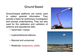
Ground-based platforms aremainly used
to collect spectral information. They
provide a basis for preliminary investigation
and concept understanding. They are also
used for the calibration and validation of
airborne and spaceborne data.
– Hand-held / cranes
– Captive/tethered balloons
– Manned and unmanned
– Relatively inexpensive, stable
Ground Based
4.
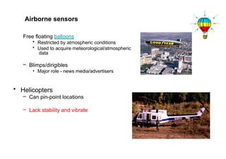
Free floating balloons
•Restricted by atmospheric conditions
• Used to acquire meteorological/atmospheric
data
– Blimps/dirigibles
• Major role - news media/advertisers
• Helicopters
– Can pin-point locations
– Lack stability and vibrate
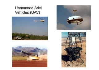
Airborne sensors
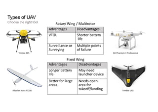
Types of UAV
Choosethe right tool Rotary Wing / Multirotor
Advantages Disadvantages
VTOL Shorter battery
life
Surveillance or
Surveying
Multiple points
of failure
Advantages Disadvantages
Longer Battery
life
May need
launcher device
Better for large
areas
Needs open
area for
takeoff/landing
Fixed Wing
DJI Phantom 3 Professional
Trimble UX5
Altavian Nova F7200
Trimble ZX5
Applications of UAV
CivilEngineering
Infrastructur
e
Inspection
Feasibilit
y
Surveys
Mining
Bridges
Cell Phone
Towers
Power lines
Solar Panels
Transportation Routes Volume Calculation
12.
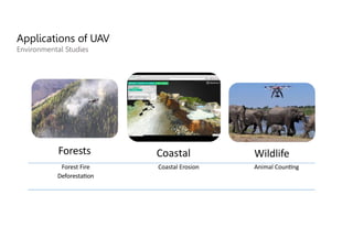
Applications of UAV
HumanitarianEfforts
Disaster
Mapping
Hazard
Monitoring
Emergency
Delivery
Emergency
response
coordination
Search and Rescue
Post disaster assessment
Volcanos
Glaciers
Floods
Medicine
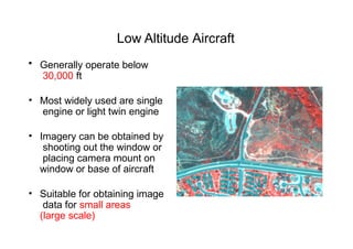
Low Altitude Aircraft
•Generally operate below
30,000 ft
• Most widely used are single
engine or light twin engine
• Imagery can be obtained by
shooting out the window or
placing camera mount on
window or base of aircraft
• Suitable for obtaining image
data for small areas
(large scale)
15.
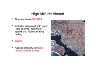
High Altitude Aircraft
•Operate above 30,000 ft
• Includes jet aircraft with good
rate of climb, maximum
speed, and high operating
ceiling
• Stable
• Acquire imagery for large
areas (smaller scale)
16.
Advantages/Disadvantages of Aircraft
•Advantages
– Acquire imagery under suitable weather conditions
– Control platform variables such as altitude
– Time of coverage can be controlled -- flexibility
– Easy to mobilize
• Disadvantages
– Expensive – primarily cost of aircraft
– Less stable than spacecraft
• Drift off course
• Random attitude changes (turbulent motions)
• Motion blurring
17.
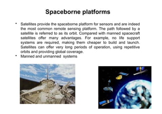
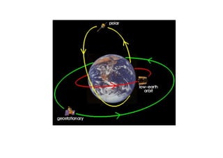
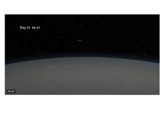
Spaceborne platforms
• Satellitesprovide the spaceborne platform for sensors and are indeed
the most common remote sensing platform. The path followed by a
satellite is referred to as its orbit. Compared with manned spacecraft
satellites offer many advantages. For example, no life support
systems are required, making them cheaper to build and launch.
Satellites can offer very long periods of operation, using repetitive
orbits and providing global coverage.
• Manned and unmanned systems
19.
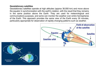
Geostationary satellites
Geostationary satellitesoperate at high altitudes (approx 36,000 km) and move above
the equator in synchronization with the earth's rotation, with the result that they remains
in the same position above the Earth. They are used for meteorological and
communications purposes, and some can monitor the weather over entire hemispheres
of the Earth. This approach provides the same view of the Earth every 30 minutes,
particularly appropriate for observation of rapidly-changing patterns such as weather.
20.
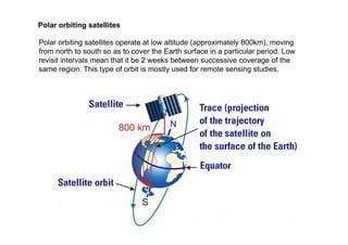
Polar orbiting satellites
Polarorbiting satellites operate at low altitude (approximately 800km), moving
from north to south so as to cover the Earth surface in a particular period. Low
revisit intervals mean that it be 2 weeks between successive coverage of the
same region. This type of orbit is mostly used for remote sensing studies.
21.
Some polar orbitingsatellites are sun-synchronous, which means that they cover each
area of the Earth at a constant local time of day, called local sun time. At any given
latitude, the position of the sun in the sky as the satellite passes overhead will be the
same within the same season. The satellite travels northwards on one side of the
Earth (ascending pass) and then toward the southern pole on the second half of its
orbit (descending pass). The ascending pass is most likely to be on the shadowed
side of the Earth while the descending pass is on the sunlit side.
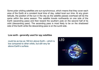
Low earth - generally used for spy satellites
could be as low as 160 km above Earth – which is
low compared to other orbits, but still very far
above Earth’s surface.