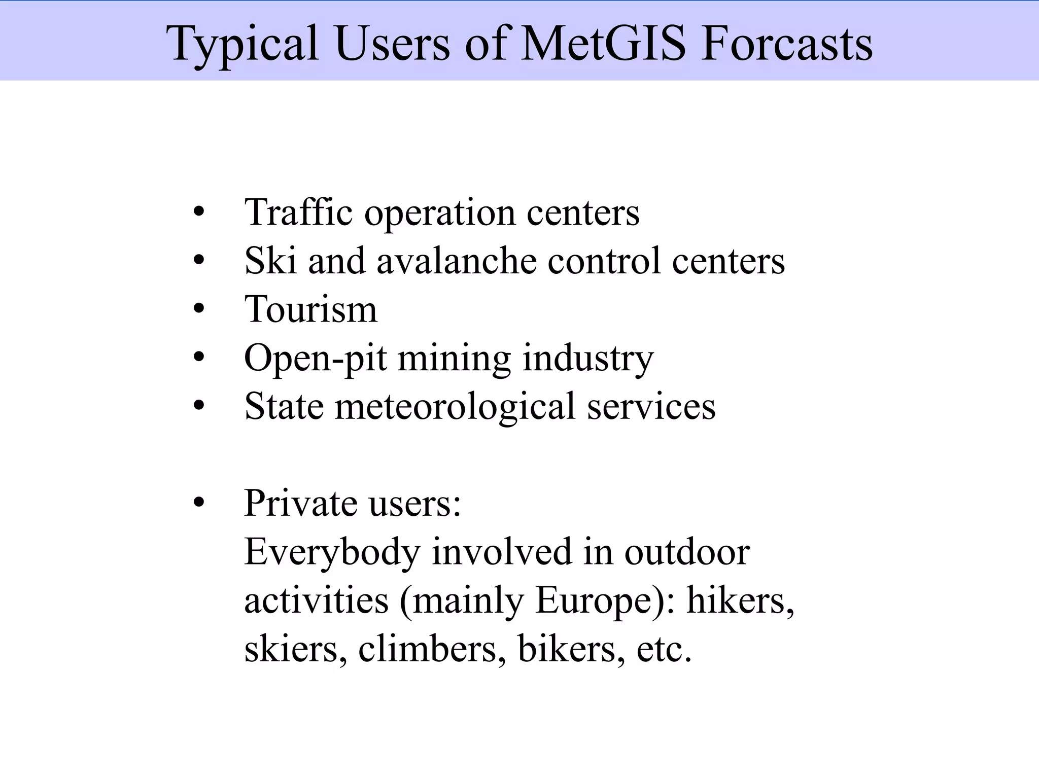
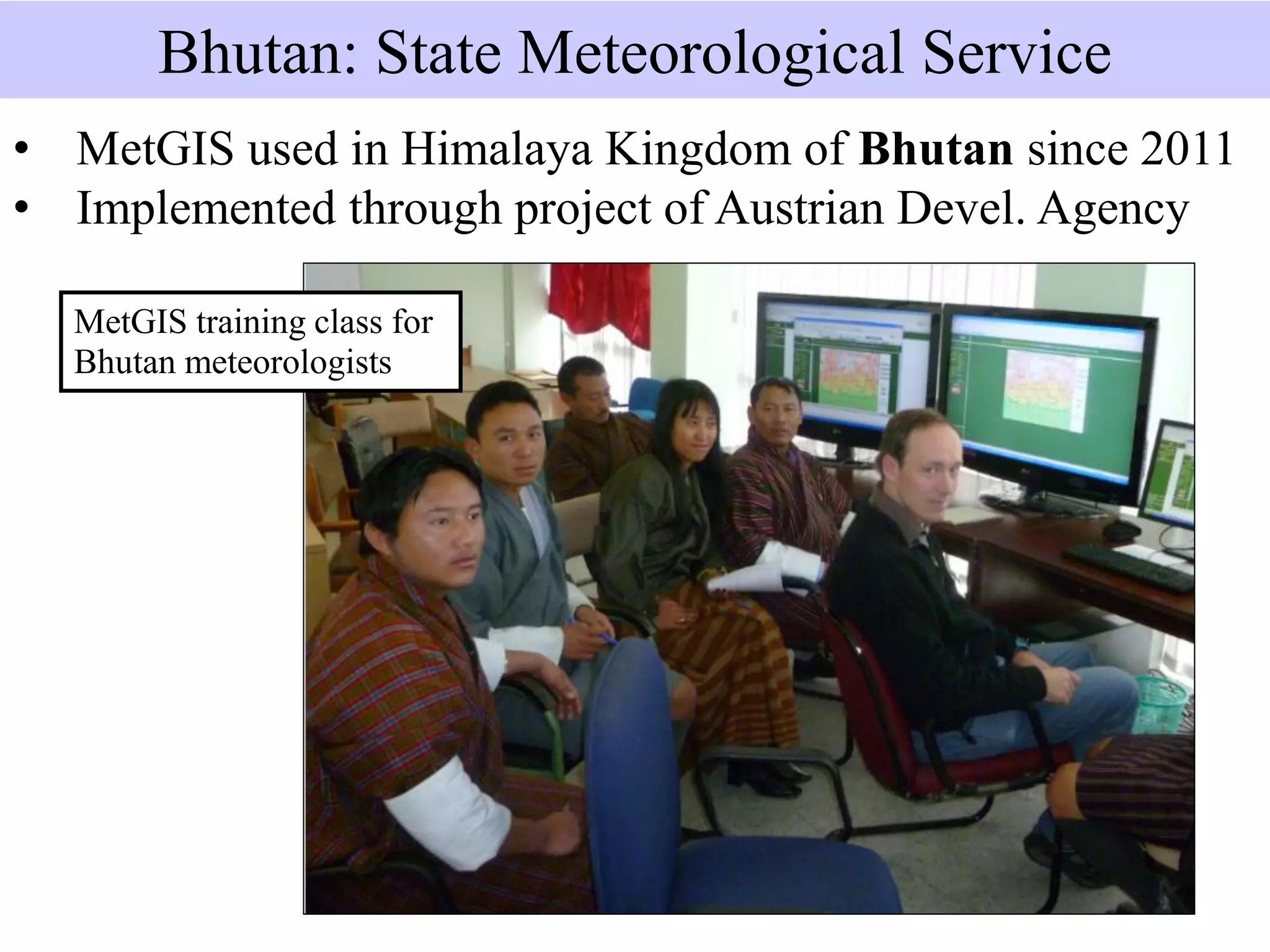
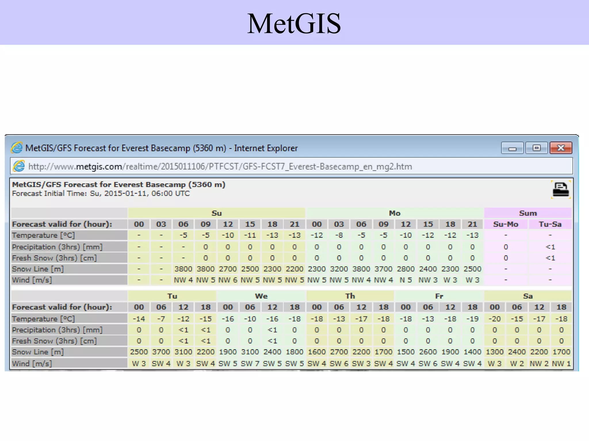
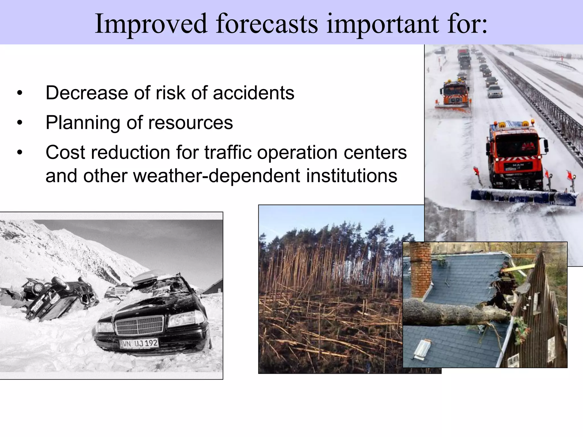
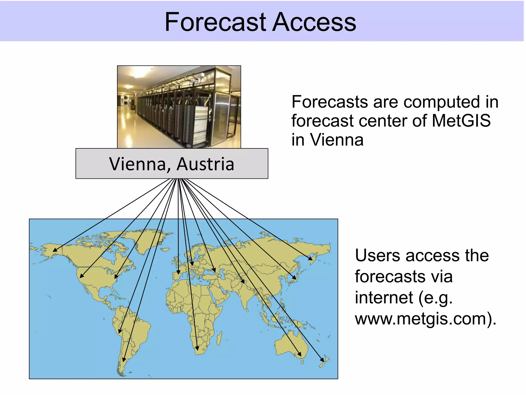
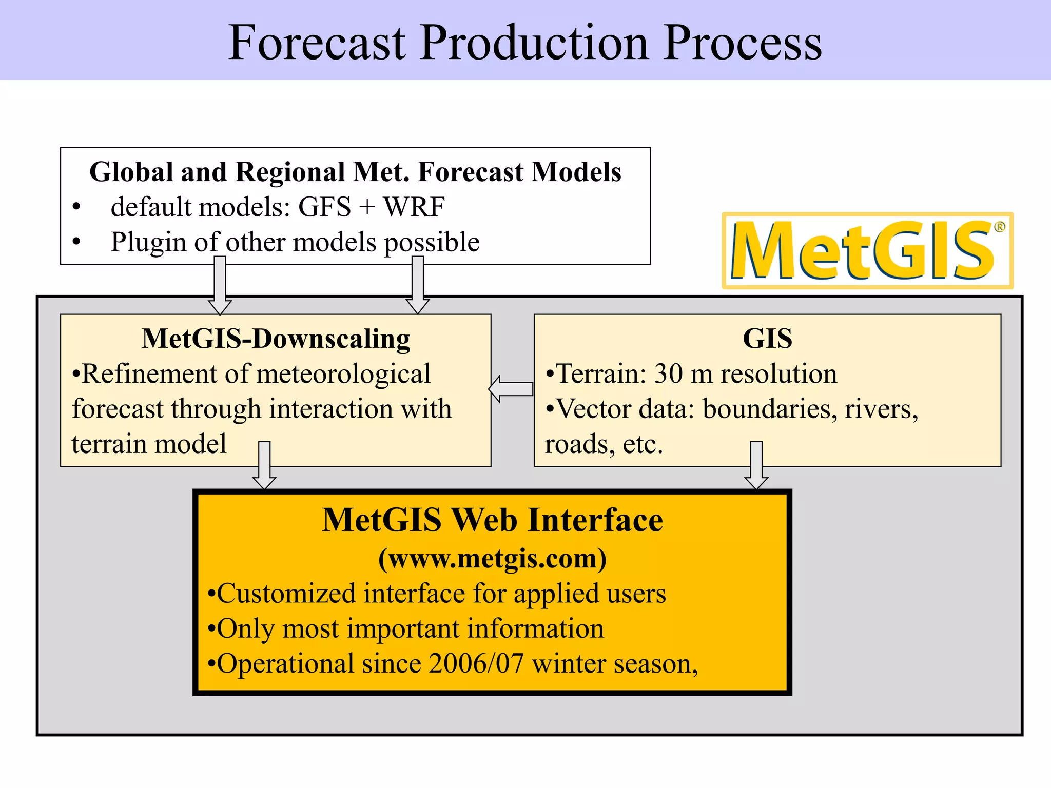
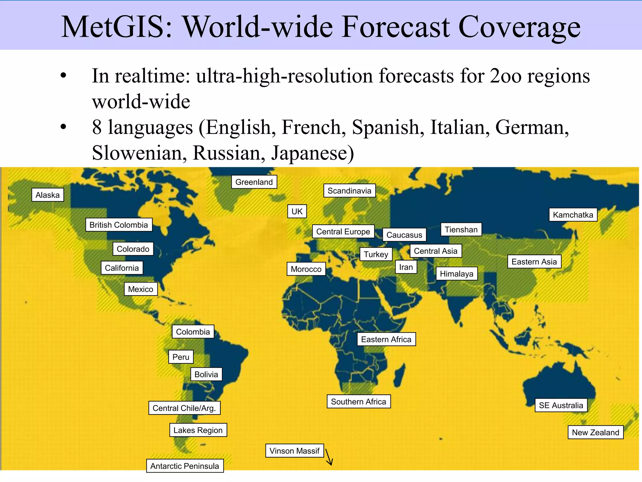
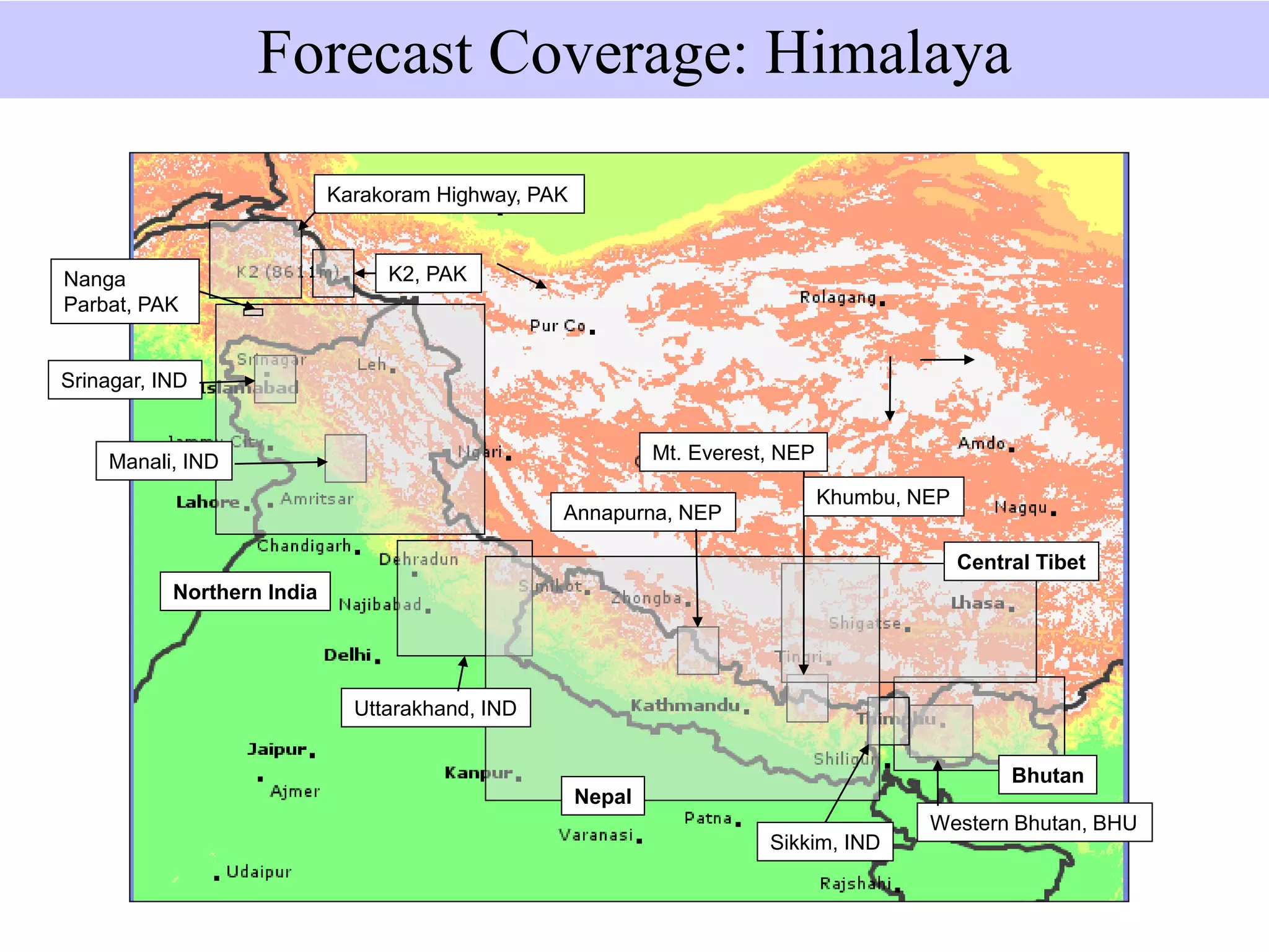
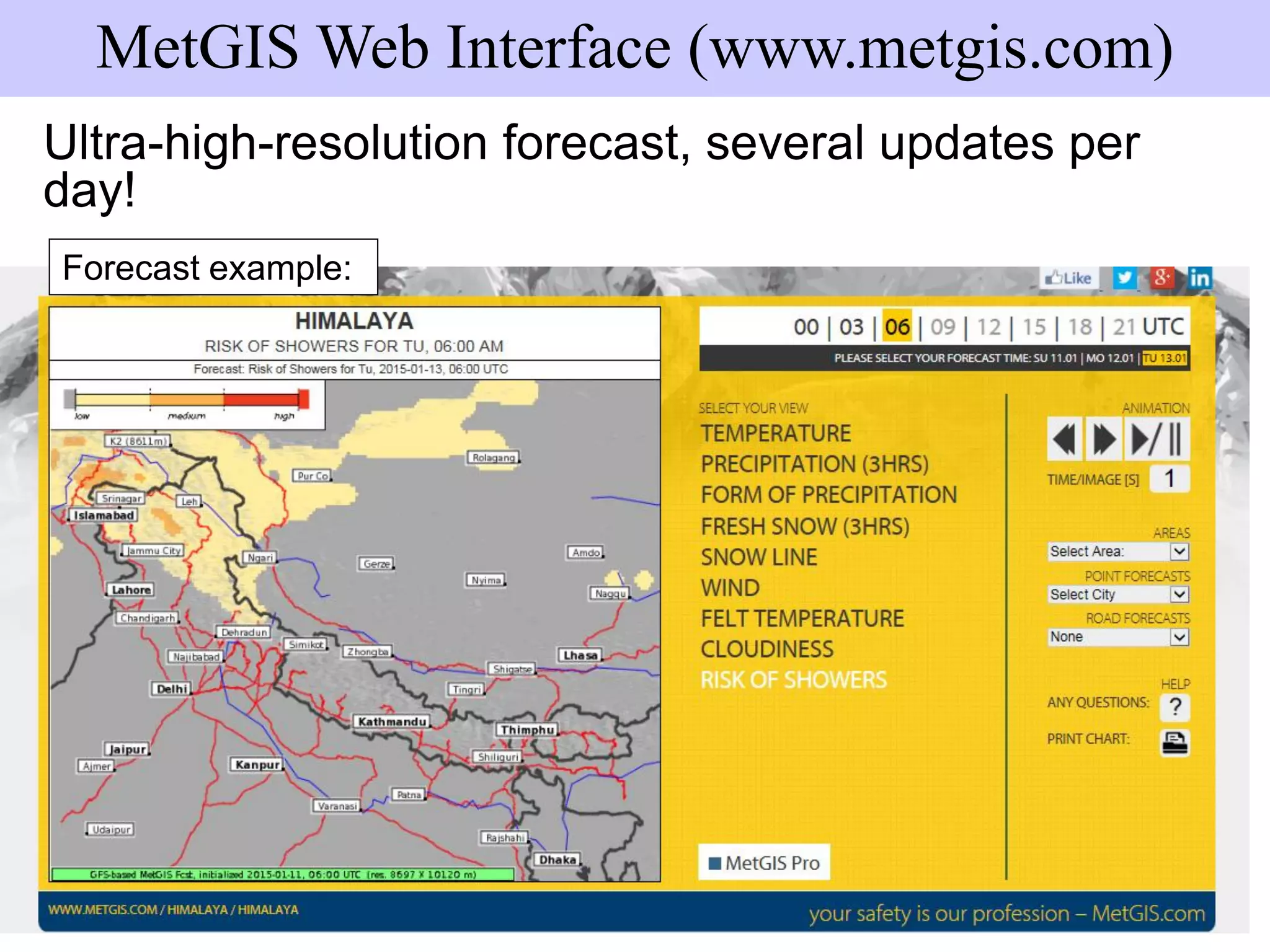
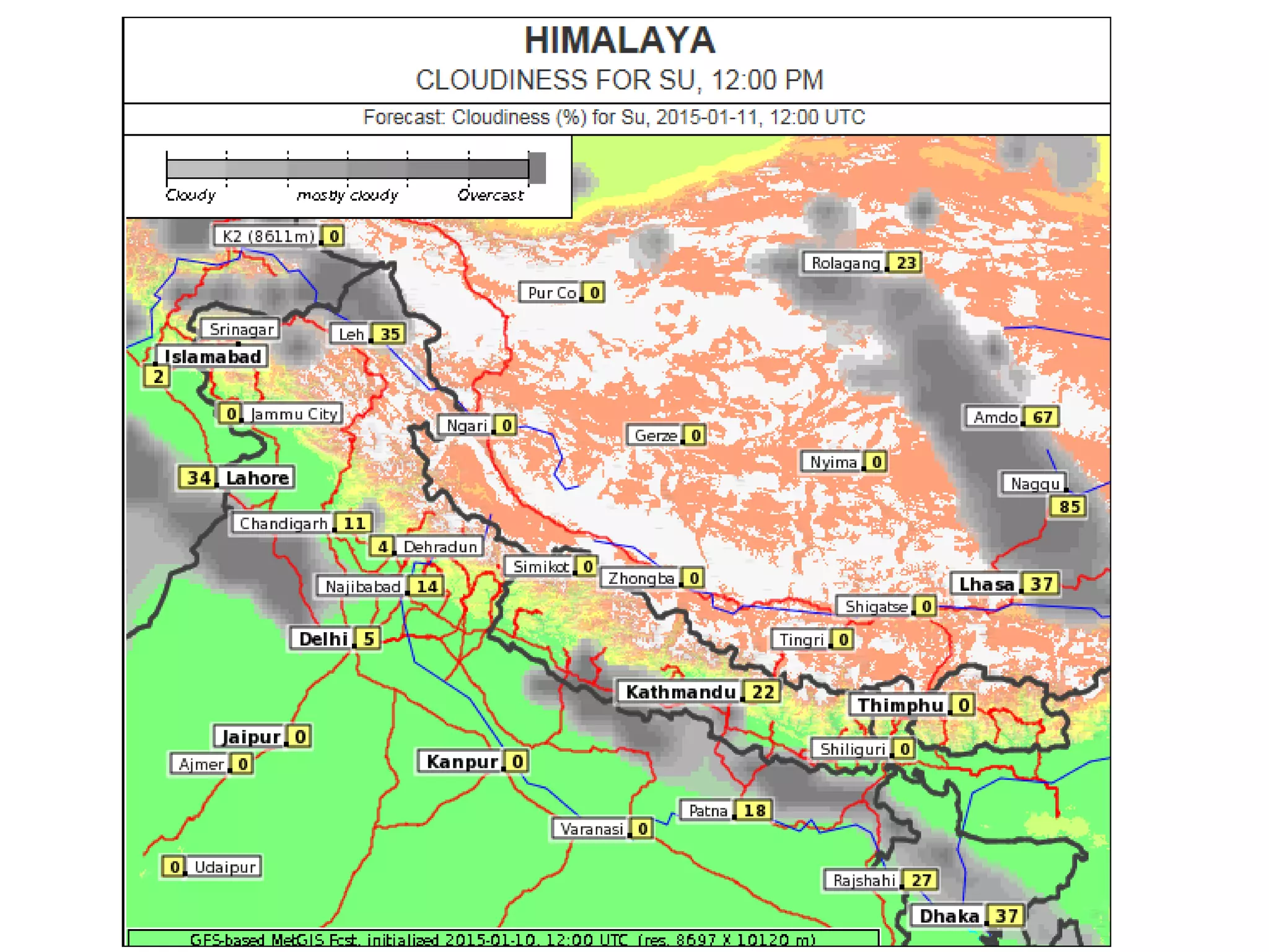
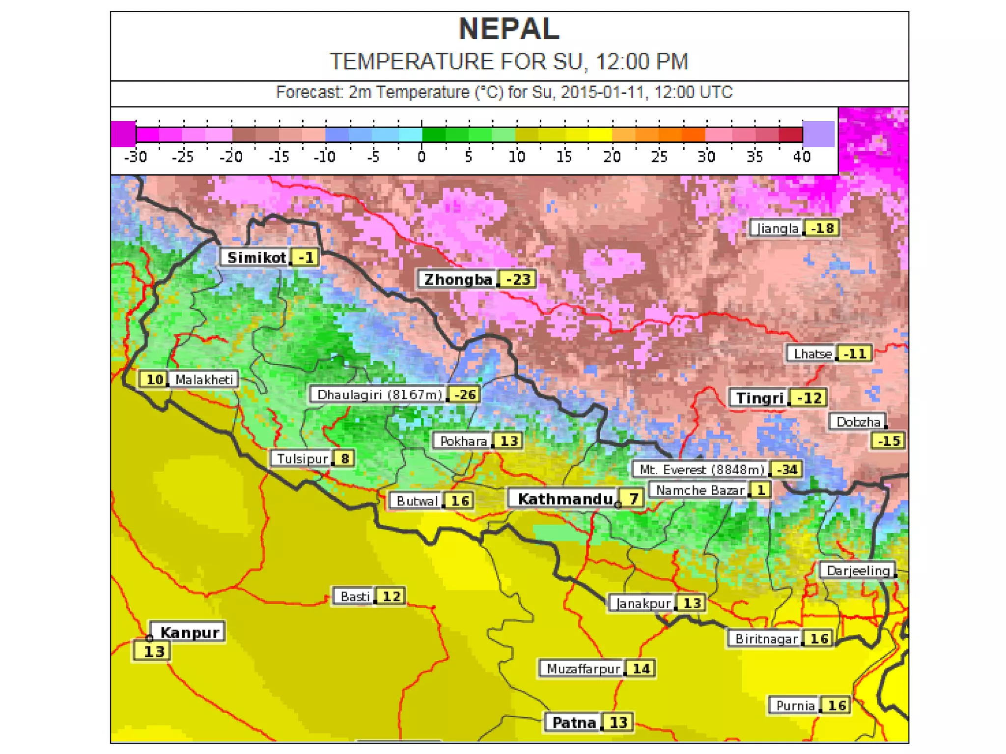
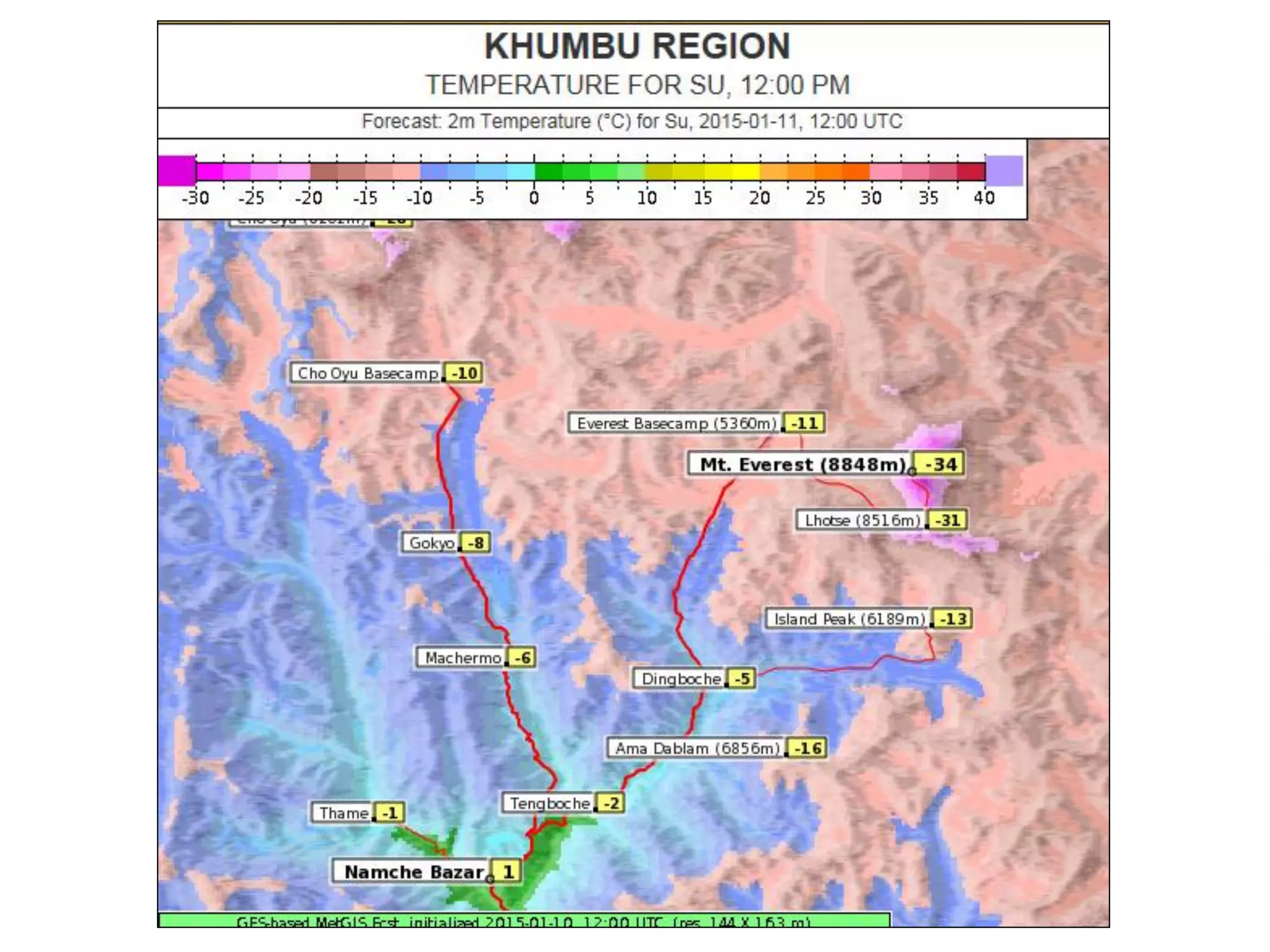
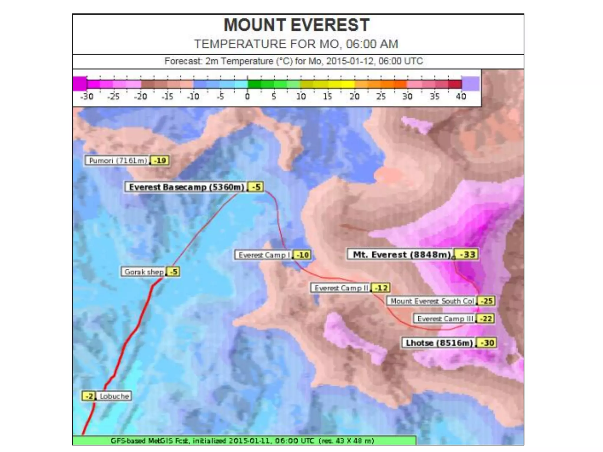
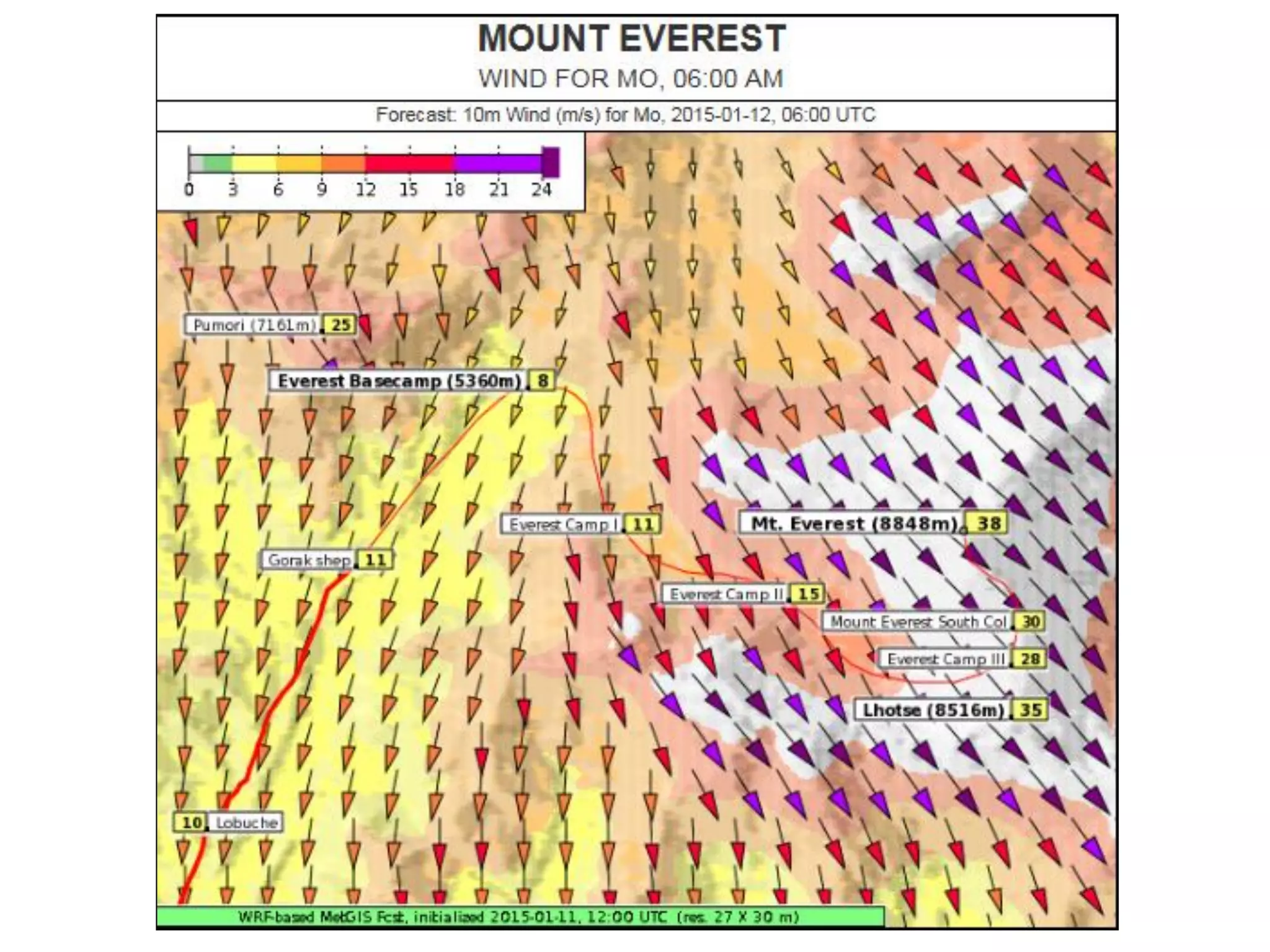
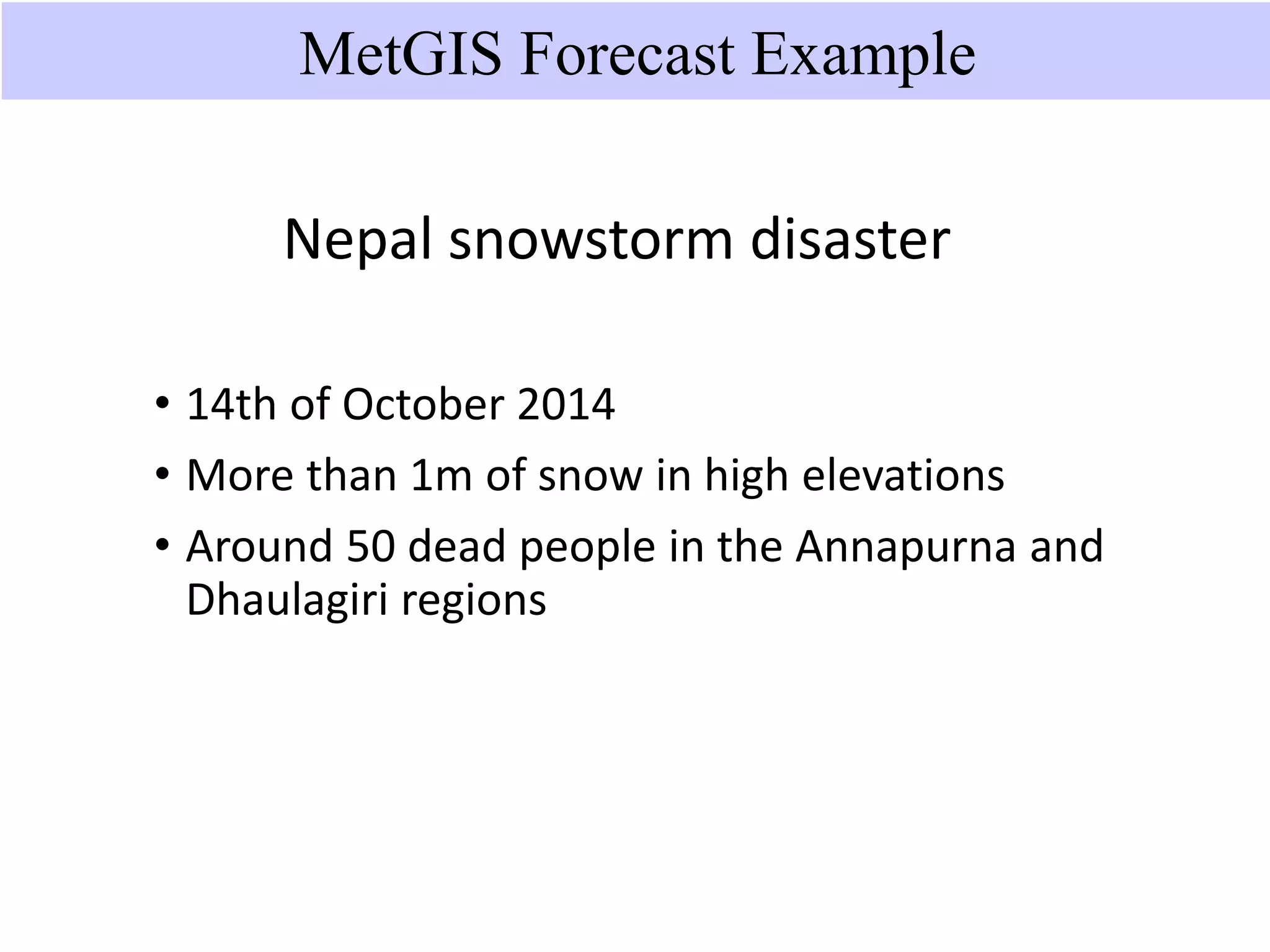
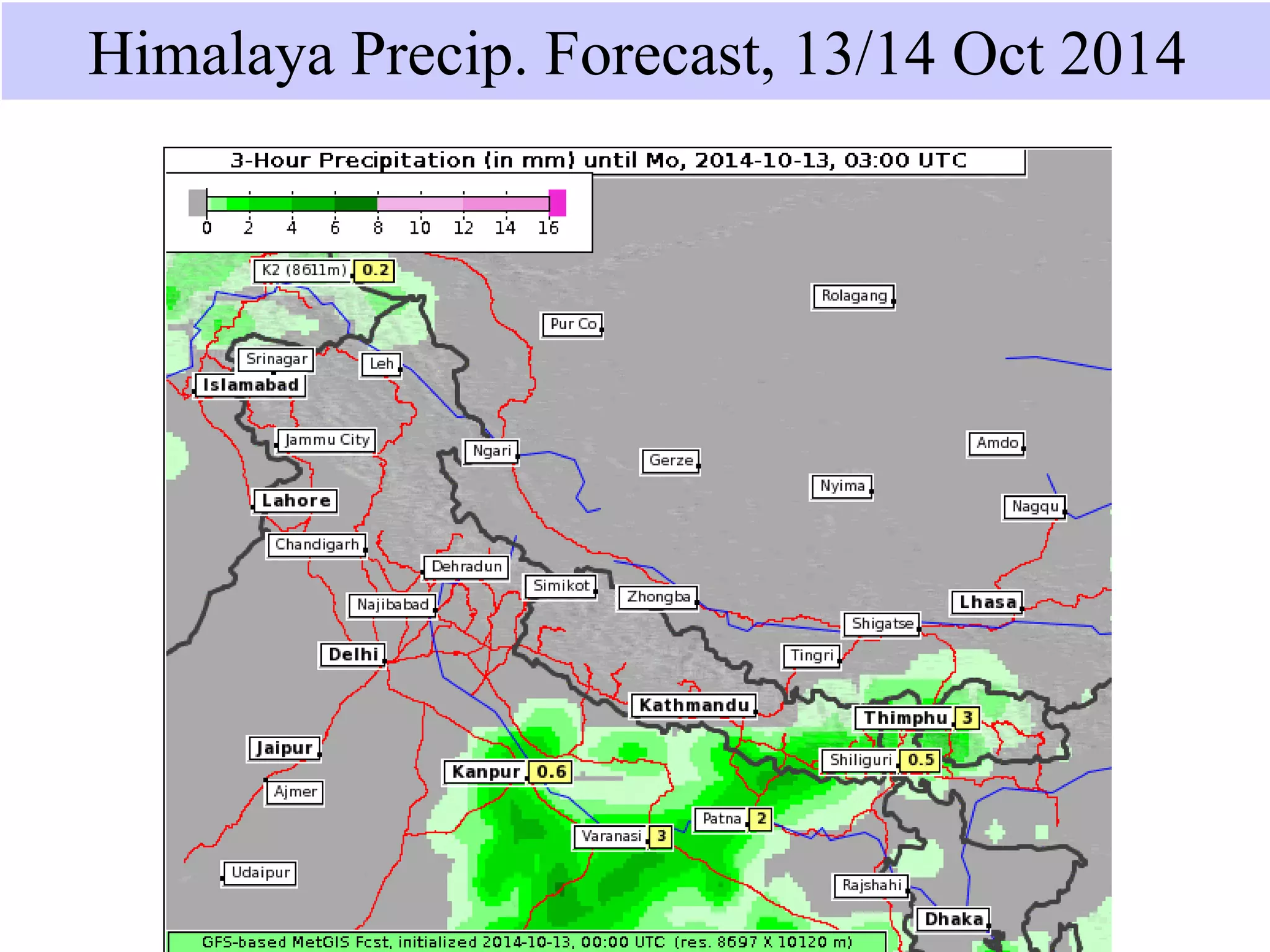
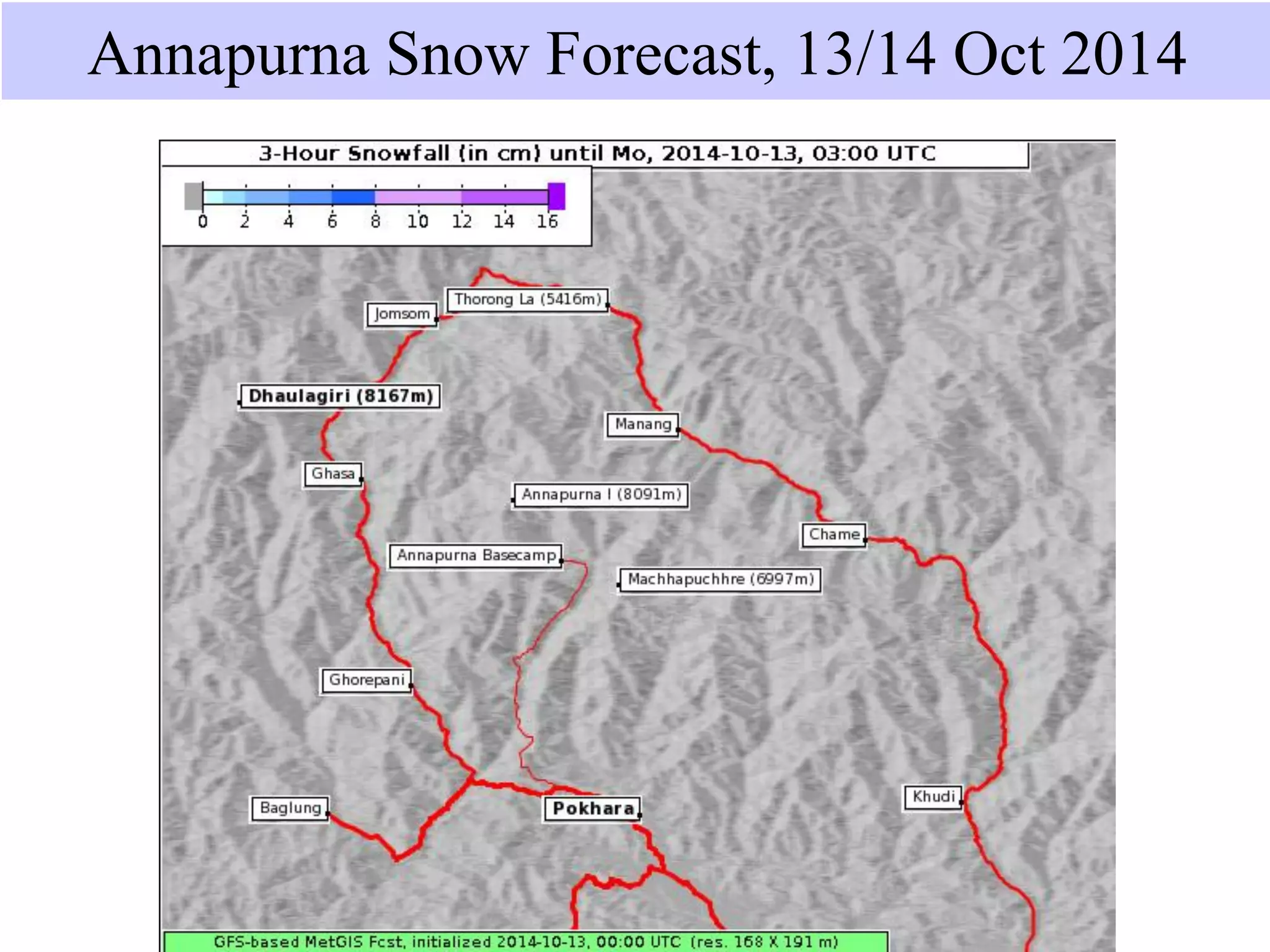
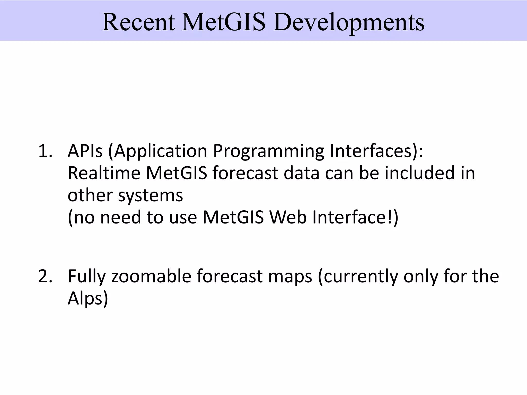
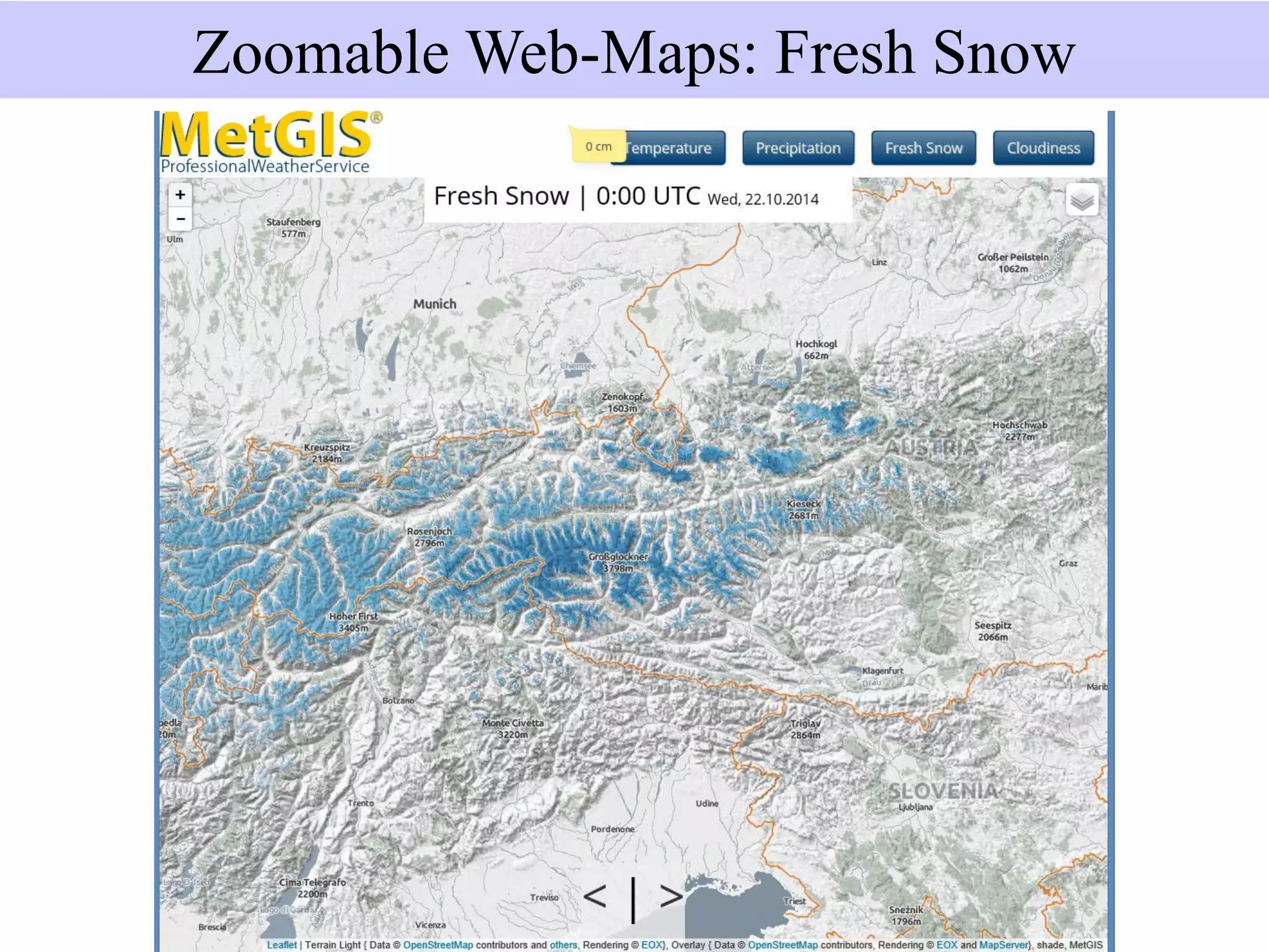
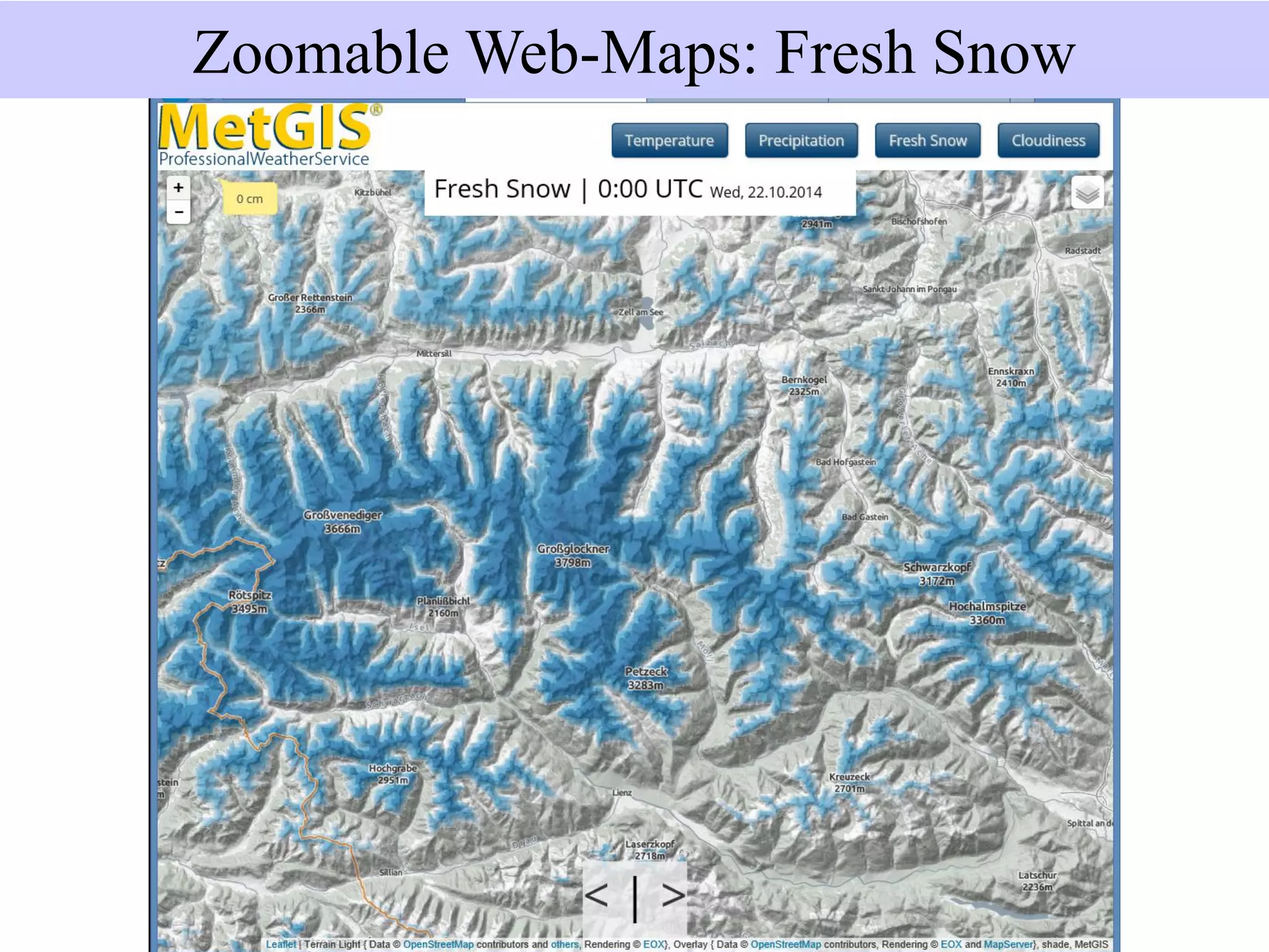
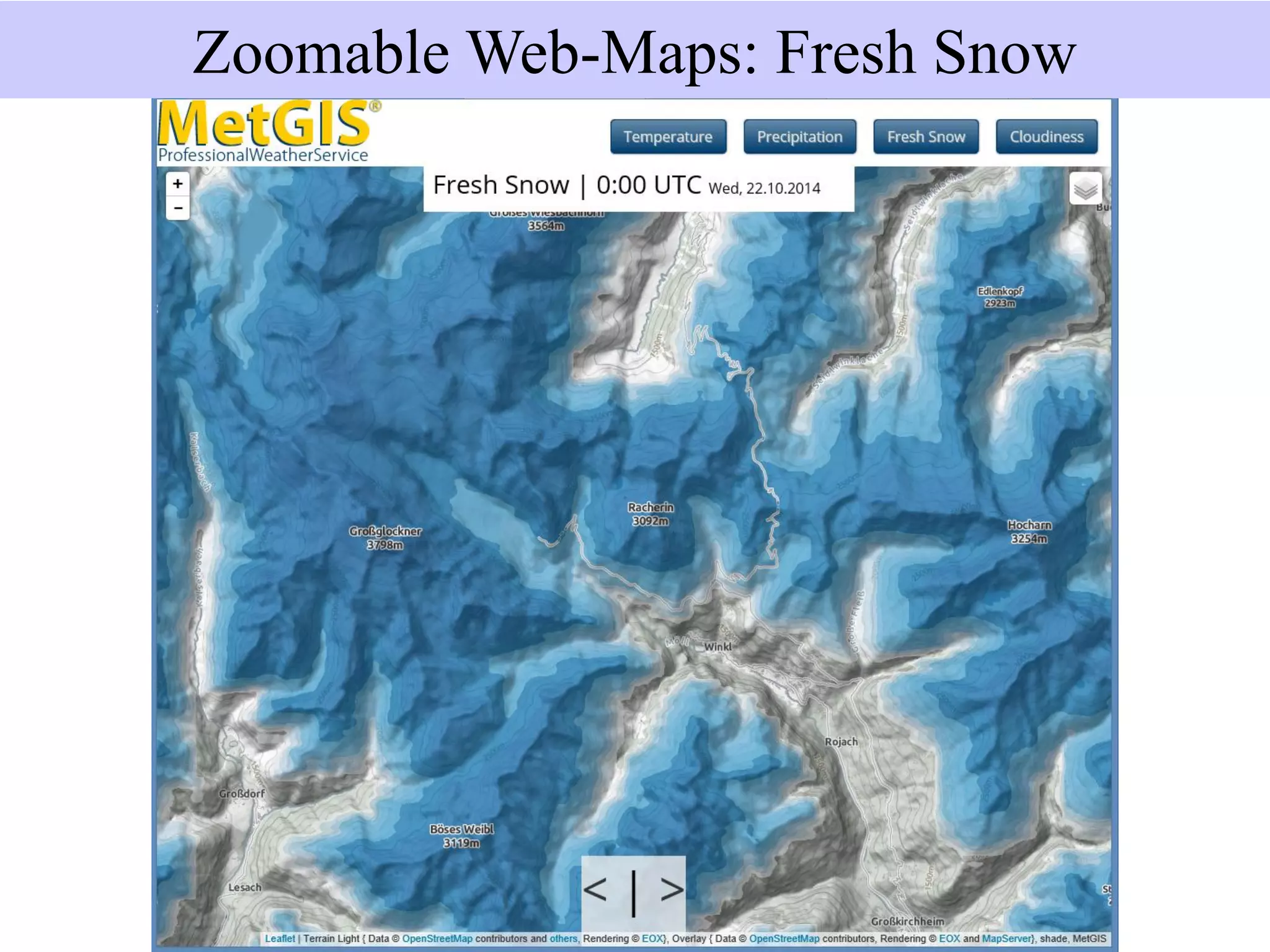
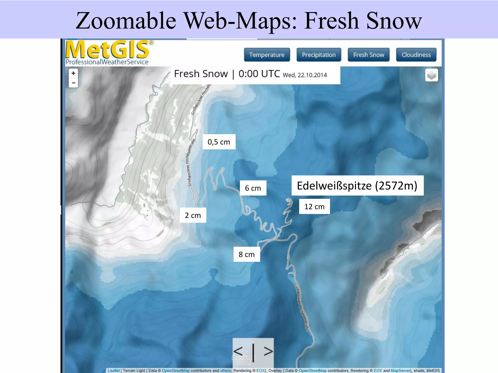
Ultra-high resolution weather forecasts can improve predictions in mountainous regions like the Himalayas using MetGIS technologies. MetGIS combines weather observations, high-resolution terrain data, and meteorological forecast models to provide more accurate forecasts. The forecasts are computed in Vienna and accessed online, providing predictions updated several times per day for over 200 regions worldwide, including the Himalayas. MetGIS forecasts have been used successfully in Bhutan and India in the Himalayas and can help address challenges like accidents, resource planning, and costs for groups that depend on weather.


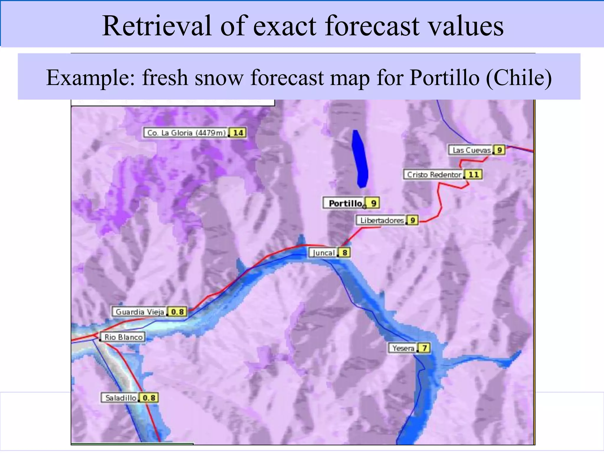


![Snowfall observed at Los Pelambres Depth of
observed
fresh snow
[cm]
Depth of
fresh snow
forecast by
MetGIS [cm]From (start time) Until (end time)
2009-05-29 09:00 2009-05-30 00:00 9 6
2009-06-28 04:30 2009-06-30 03:00 103 87
2009-07-14 11:00 2009-07-15 07:00 12 21
2009-07-21 07:00 2009-07-22 13:00 55 53
2009-07-31 23:00 2009-08-01 04:00 4 1
2009-08-15 03:00 2009-08-16 04:00 51 89
2009-08-17 19:00 2009-08-19 11:00 44 92
2009-09-06 10:00 2009-09-06 23:30 4 3
2009-09-07 03:30 2009-09-07 12:00 6 5
Most important snowstorms hitting the station
Los Pelambres (Chile) during a winter season.
Fresh Snow Forecast Verification](https://image.slidesharecdn.com/geraldspreitzhofer-150216032209-conversion-gate01/75/Gerald-spreitzhofer-41-2048.jpg)