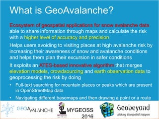
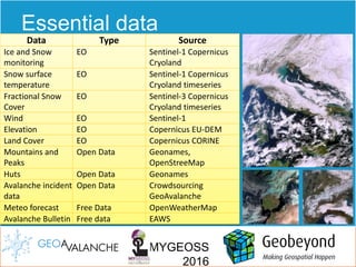
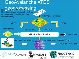
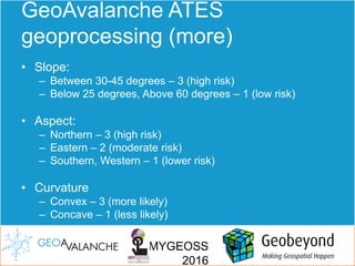
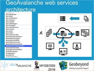
GeoAvalanche is an integrated avalanche risk management system that uses geospatial applications and data sharing to calculate snow avalanche risk with high accuracy. It uses elevation models, crowdsourced data, and earth observation data in an algorithm to assess risk. GeoAvalanche helps users avoid high risk areas and plan safer excursions by increasing awareness of snow and avalanche conditions. The system includes web services for accessing avalanche data, risk calculations, and crowdsourced incident reporting.


![5G Explained! A High Level Overview [Introduction]](https://cdn.slidesharecdn.com/ss_thumbnails/5gexplainedahighleveloverview-260119165306-cc137a3e-thumbnail.jpg?width=640&height=640&fit=bounds)


