Downloaded 66 times


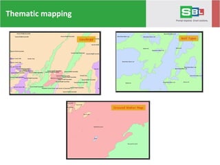
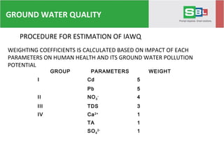
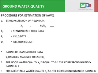
![PROCEDURE FOR ESTIMATION OF IAWQ
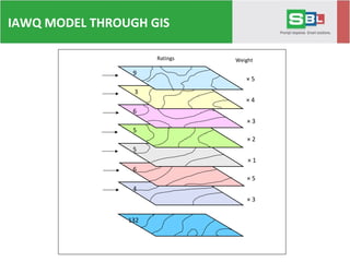
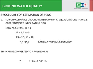
3. THE FINAL IAWQ IS CALCULATED USING THE FORMULA
IAWQ = C / n
∑ =
n
i
YriWri1
)]*(
C CONSTANT (10)
n NO. OF PARAMETERS (7)
Wri Wi / Wmax
Yri Yi / Ymax
Wi WEIGHTING COEFFICIENT
Wmax MAXIMUM WEIGHTING COEFFICIENT(5)
Yi RATES AS CALCULATED FROM EQUATION
Ymax MAXIMUM RATE (10)
GROUND WATER QUALITY](https://image.slidesharecdn.com/geospatial-services-150218225410-conversion-gate01/85/Geospatial-services-65-320.jpg)
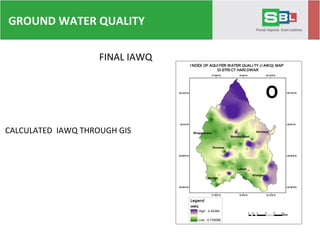


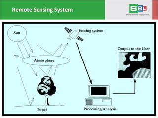
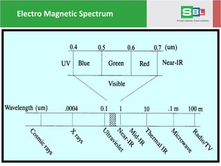
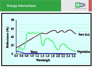
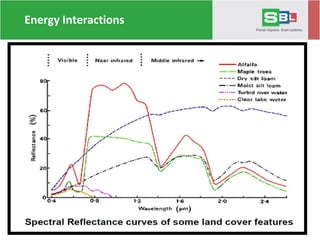
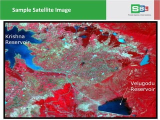
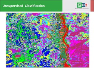
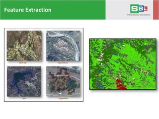
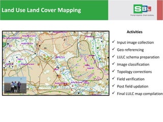
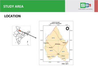
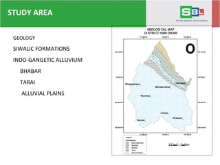
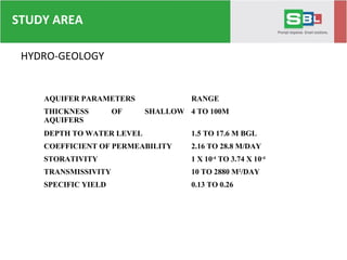
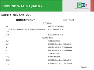
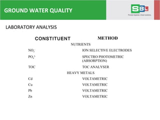
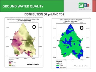
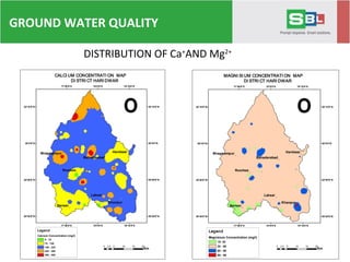
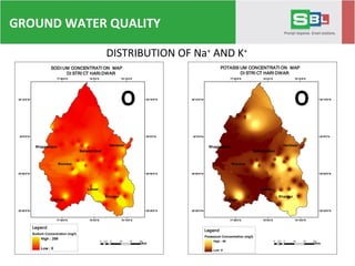
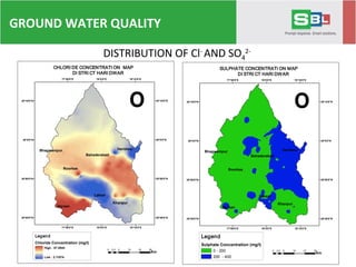
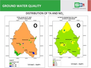
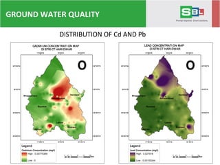
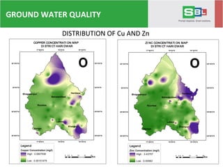
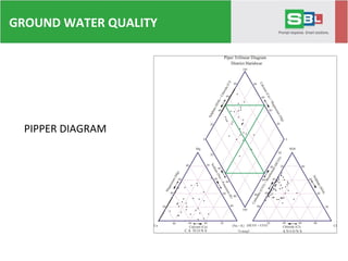
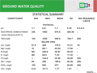
Venugopalan Nair presents a lecture on remote sensing and GIS applications in hydrogeological mapping and water quality modeling, discussing topics such as image processing, classification, and the use of these technologies for sustainable development. The document details various resolutions in remote sensing and outlines a case study on water quality modeling in the Haridwar district of India, addressing groundwater sampling methods and laboratory analysis for various chemical constituents. The findings indicate significant variations in groundwater quality across the study area, highlighting the importance of effective monitoring and management strategies.


![Heritage hetherington lidar_pdf[1]](https://cdn.slidesharecdn.com/ss_thumbnails/heritagehetheringtonlidarpdf1-100701210824-phpapp02-thumbnail.jpg?width=640&height=640&fit=bounds)


