Download as PDF, PPTX
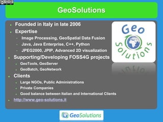
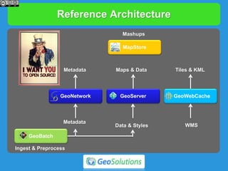
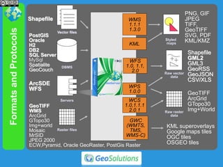
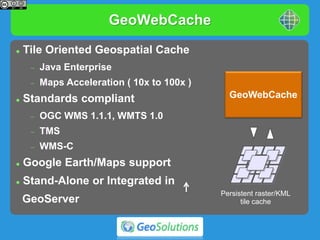
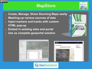
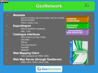


GeoSolutions is an Italian company founded in 2006 that specializes in geospatial data processing, visualization, and open source software development. They discuss their work developing and supporting open source geospatial projects like GeoServer, GeoTools, GeoNetwork, and GeoBatch. They also discuss their experience implementing INSPIRE network service standards and addressing OpenData challenges through these open source solutions.


![5G Explained! A High Level Overview [Introduction]](https://cdn.slidesharecdn.com/ss_thumbnails/5gexplainedahighleveloverview-260119165306-cc137a3e-thumbnail.jpg?width=640&height=640&fit=bounds)


