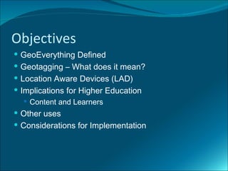
Dom Breadmore (@predacomdom) 's presentation on GPS and Geolocation ideas for Education delivered as part of Teachmeet Takeover at BETT 2011, Olympia, London.
GEO-N-VIRON webinar talk on Geospatial Technology in Sustainable EnvironmentAdityaAllamraju1
My special talk about 'Geospatial Technology in Sustainable Environment’ is a part of the GIS Day celebration 2020 webinar session called GEO-N-VIRON on December 5th, 2020 organized by NestAbide & GeoVin Solutions Pvt. Ltd. Thiruvananthapuram, Kerala.
A Software Tool for Rapid Acquisition of Streetwise Geo-Referenced MapsVladimir Kulyukin
RapGeoRef, a software tool for rapid acquistion of streetwise geo-referenced maps, is
presented. A evaluation study of RapGeoRef was performed on the USU campus with four students.
The participants were told about the purpose of the tool and shown a demo. They were
then asked to construct a geo-referenced database for an area of the USU campus. Upon
completion, they were given the NASA TLX questionnaire to assess the subjective
workload.All participants were able
to complete the task in one day. The analysis of the NASA TLX questionnaire revealed
that the temporal demand was much more prominent to the participants than either
mental or physical effort.
Maps and geolocation are becoming more and more important to the sites we build as the scope of our smallest projects become regional, national and global. Does your next project need to list store locations that sell a product world wide? Do you need to limit content for certain country descriptions? While these thoughts might be scary at first I promise it isn't voodoo and at the end of the talk you will know how to do all of these things.
In this session I will walk you through Drupal common ways to:
- Add maps to your site
- Create locations on your maps (with and without views)
- Locate your users in realtime
- Search for locations within a distance
- Use mobile devices for geolocation
My special talk on 'GIS & Remote Sensing-Introduction to the Primer’ is a part of the 'Learn from the Leaders- 2' webinar series organized by IEEE SIGHT, Bombay section on May 25th, 2021
Mobilising Remote Student Engagement: Lessons Learned from the FieldMorse Project
JISC funded Mobilising Remote Student Engagement Project (MoRSE). A collaborative project between Kingston University and De Montfort University.
http://morse.ac.uk
Why You Should Replace Windows 11 with Nitrux Linux 3.5.0 for enhanced perfor...SOFTTECHHUB
The choice of an operating system plays a pivotal role in shaping our computing experience. For decades, Microsoft's Windows has dominated the market, offering a familiar and widely adopted platform for personal and professional use. However, as technological advancements continue to push the boundaries of innovation, alternative operating systems have emerged, challenging the status quo and offering users a fresh perspective on computing.
One such alternative that has garnered significant attention and acclaim is Nitrux Linux 3.5.0, a sleek, powerful, and user-friendly Linux distribution that promises to redefine the way we interact with our devices. With its focus on performance, security, and customization, Nitrux Linux presents a compelling case for those seeking to break free from the constraints of proprietary software and embrace the freedom and flexibility of open-source computing.
LF Energy Webinar: Electrical Grid Modelling and Simulation Through PowSyBl -...DanBrown980551
Do you want to learn how to model and simulate an electrical network from scratch in under an hour?
Then welcome to this PowSyBl workshop, hosted by Rte, the French Transmission System Operator (TSO)!
During the webinar, you will discover the PowSyBl ecosystem as well as handle and study an electrical network through an interactive Python notebook.
PowSyBl is an open source project hosted by LF Energy, which offers a comprehensive set of features for electrical grid modelling and simulation. Among other advanced features, PowSyBl provides:
- A fully editable and extendable library for grid component modelling;
- Visualization tools to display your network;
- Grid simulation tools, such as power flows, security analyses (with or without remedial actions) and sensitivity analyses;
The framework is mostly written in Java, with a Python binding so that Python developers can access PowSyBl functionalities as well.
What you will learn during the webinar:
- For beginners: discover PowSyBl's functionalities through a quick general presentation and the notebook, without needing any expert coding skills;
- For advanced developers: master the skills to efficiently apply PowSyBl functionalities to your real-world scenarios.
GraphRAG is All You need? LLM & Knowledge GraphGuy Korland
Guy Korland, CEO and Co-founder of FalkorDB, will review two articles on the integration of language models with knowledge graphs.
1. Unifying Large Language Models and Knowledge Graphs: A Roadmap.
https://arxiv.org/abs/2306.08302
2. Microsoft Research's GraphRAG paper and a review paper on various uses of knowledge graphs:
https://www.microsoft.com/en-us/research/blog/graphrag-unlocking-llm-discovery-on-narrative-private-data/
Communications Mining Series - Zero to Hero - Session 1DianaGray10
This session provides introduction to UiPath Communication Mining, importance and platform overview. You will acquire a good understand of the phases in Communication Mining as we go over the platform with you. Topics covered:
• Communication Mining Overview
• Why is it important?
• How can it help today’s business and the benefits
• Phases in Communication Mining
• Demo on Platform overview
• Q/A
GraphSummit Singapore | The Art of the Possible with Graph - Q2 2024Neo4j
Neha Bajwa, Vice President of Product Marketing, Neo4j
Join us as we explore breakthrough innovations enabled by interconnected data and AI. Discover firsthand how organizations use relationships in data to uncover contextual insights and solve our most pressing challenges – from optimizing supply chains, detecting fraud, and improving customer experiences to accelerating drug discoveries.
In his public lecture, Christian Timmerer provides insights into the fascinating history of video streaming, starting from its humble beginnings before YouTube to the groundbreaking technologies that now dominate platforms like Netflix and ORF ON. Timmerer also presents provocative contributions of his own that have significantly influenced the industry. He concludes by looking at future challenges and invites the audience to join in a discussion.
Removing Uninteresting Bytes in Software FuzzingAftab Hussain
Imagine a world where software fuzzing, the process of mutating bytes in test seeds to uncover hidden and erroneous program behaviors, becomes faster and more effective. A lot depends on the initial seeds, which can significantly dictate the trajectory of a fuzzing campaign, particularly in terms of how long it takes to uncover interesting behaviour in your code. We introduce DIAR, a technique designed to speedup fuzzing campaigns by pinpointing and eliminating those uninteresting bytes in the seeds. Picture this: instead of wasting valuable resources on meaningless mutations in large, bloated seeds, DIAR removes the unnecessary bytes, streamlining the entire process.
In this work, we equipped AFL, a popular fuzzer, with DIAR and examined two critical Linux libraries -- Libxml's xmllint, a tool for parsing xml documents, and Binutil's readelf, an essential debugging and security analysis command-line tool used to display detailed information about ELF (Executable and Linkable Format). Our preliminary results show that AFL+DIAR does not only discover new paths more quickly but also achieves higher coverage overall. This work thus showcases how starting with lean and optimized seeds can lead to faster, more comprehensive fuzzing campaigns -- and DIAR helps you find such seeds.
- These are slides of the talk given at IEEE International Conference on Software Testing Verification and Validation Workshop, ICSTW 2022.
Generative AI Deep Dive: Advancing from Proof of Concept to ProductionAggregage
Join Maher Hanafi, VP of Engineering at Betterworks, in this new session where he'll share a practical framework to transform Gen AI prototypes into impactful products! He'll delve into the complexities of data collection and management, model selection and optimization, and ensuring security, scalability, and responsible use.
Sudheer Mechineni, Head of Application Frameworks, Standard Chartered Bank
Discover how Standard Chartered Bank harnessed the power of Neo4j to transform complex data access challenges into a dynamic, scalable graph database solution. This keynote will cover their journey from initial adoption to deploying a fully automated, enterprise-grade causal cluster, highlighting key strategies for modelling organisational changes and ensuring robust disaster recovery. Learn how these innovations have not only enhanced Standard Chartered Bank’s data infrastructure but also positioned them as pioneers in the banking sector’s adoption of graph technology.
SAP Sapphire 2024 - ASUG301 building better apps with SAP Fiori.pdfPeter Spielvogel
Building better applications for business users with SAP Fiori.
• What is SAP Fiori and why it matters to you
• How a better user experience drives measurable business benefits
• How to get started with SAP Fiori today
• How SAP Fiori elements accelerates application development
• How SAP Build Code includes SAP Fiori tools and other generative artificial intelligence capabilities
• How SAP Fiori paves the way for using AI in SAP apps
A tale of scale & speed: How the US Navy is enabling software delivery from l...sonjaschweigert1
Rapid and secure feature delivery is a goal across every application team and every branch of the DoD. The Navy’s DevSecOps platform, Party Barge, has achieved:
- Reduction in onboarding time from 5 weeks to 1 day
- Improved developer experience and productivity through actionable findings and reduction of false positives
- Maintenance of superior security standards and inherent policy enforcement with Authorization to Operate (ATO)
Development teams can ship efficiently and ensure applications are cyber ready for Navy Authorizing Officials (AOs). In this webinar, Sigma Defense and Anchore will give attendees a look behind the scenes and demo secure pipeline automation and security artifacts that speed up application ATO and time to production.
We will cover:
- How to remove silos in DevSecOps
- How to build efficient development pipeline roles and component templates
- How to deliver security artifacts that matter for ATO’s (SBOMs, vulnerability reports, and policy evidence)
- How to streamline operations with automated policy checks on container images
Alt. GDG Cloud Southlake #33: Boule & Rebala: Effective AppSec in SDLC using ...James Anderson
Effective Application Security in Software Delivery lifecycle using Deployment Firewall and DBOM
The modern software delivery process (or the CI/CD process) includes many tools, distributed teams, open-source code, and cloud platforms. Constant focus on speed to release software to market, along with the traditional slow and manual security checks has caused gaps in continuous security as an important piece in the software supply chain. Today organizations feel more susceptible to external and internal cyber threats due to the vast attack surface in their applications supply chain and the lack of end-to-end governance and risk management.
The software team must secure its software delivery process to avoid vulnerability and security breaches. This needs to be achieved with existing tool chains and without extensive rework of the delivery processes. This talk will present strategies and techniques for providing visibility into the true risk of the existing vulnerabilities, preventing the introduction of security issues in the software, resolving vulnerabilities in production environments quickly, and capturing the deployment bill of materials (DBOM).
Speakers:
Bob Boule
Robert Boule is a technology enthusiast with PASSION for technology and making things work along with a knack for helping others understand how things work. He comes with around 20 years of solution engineering experience in application security, software continuous delivery, and SaaS platforms. He is known for his dynamic presentations in CI/CD and application security integrated in software delivery lifecycle.
Gopinath Rebala
Gopinath Rebala is the CTO of OpsMx, where he has overall responsibility for the machine learning and data processing architectures for Secure Software Delivery. Gopi also has a strong connection with our customers, leading design and architecture for strategic implementations. Gopi is a frequent speaker and well-known leader in continuous delivery and integrating security into software delivery.
State of ICS and IoT Cyber Threat Landscape Report 2024 previewPrayukth K V
The IoT and OT threat landscape report has been prepared by the Threat Research Team at Sectrio using data from Sectrio, cyber threat intelligence farming facilities spread across over 85 cities around the world. In addition, Sectrio also runs AI-based advanced threat and payload engagement facilities that serve as sinks to attract and engage sophisticated threat actors, and newer malware including new variants and latent threats that are at an earlier stage of development.
The latest edition of the OT/ICS and IoT security Threat Landscape Report 2024 also covers:
State of global ICS asset and network exposure
Sectoral targets and attacks as well as the cost of ransom
Global APT activity, AI usage, actor and tactic profiles, and implications
Rise in volumes of AI-powered cyberattacks
Major cyber events in 2024
Malware and malicious payload trends
Cyberattack types and targets
Vulnerability exploit attempts on CVEs
Attacks on counties – USA
Expansion of bot farms – how, where, and why
In-depth analysis of the cyber threat landscape across North America, South America, Europe, APAC, and the Middle East
Why are attacks on smart factories rising?
Cyber risk predictions
Axis of attacks – Europe
Systemic attacks in the Middle East
Download the full report from here:
https://sectrio.com/resources/ot-threat-landscape-reports/sectrio-releases-ot-ics-and-iot-security-threat-landscape-report-2024/
Transcript: Selling digital books in 2024: Insights from industry leaders - T...BookNet Canada
The publishing industry has been selling digital audiobooks and ebooks for over a decade and has found its groove. What’s changed? What has stayed the same? Where do we go from here? Join a group of leading sales peers from across the industry for a conversation about the lessons learned since the popularization of digital books, best practices, digital book supply chain management, and more.
Link to video recording: https://bnctechforum.ca/sessions/selling-digital-books-in-2024-insights-from-industry-leaders/
Presented by BookNet Canada on May 28, 2024, with support from the Department of Canadian Heritage.
2. The 2009 Horizon Report, “Geo-
Everything” will significantly impact teaching,
learning, research and creative expression
within the next two to three years.
O
3. Objectives
GeoEverything Defined
Geotagging – What does it mean?
Location Aware Devices (LAD)
Implications for Higher Education
Content and Learners
Other uses
Considerations for Implementation
4. What is GeoEverything?
An emerging technology – implication for education more
evident in 2-3 years
Seeks to answer “What am I doing right now in relation to
the world?”
Gives people, places and things (every physical object) a
location via:
GPS assisted Location Aware Devices (LAD)
LAD automatically record geo-locative data onto a variety of
captured media.
New LAD automatically receive geolocative information.
Transmitted data to a web server or web-based application
Not a new technology, but increasing easier to use.
5. Geotagging (Geocoding) Defined
Ge otag g ing a dig ital photo or othe r ob je ct on a We b
s ite or in a docume nt re fe rs to the attachme nt of
g e og raphical ide ntification data.
http:// ps .ab out.com/
g od/ los s ary/g / e otag .htm
g g
By using a set of unique coordinates, expressed as longitude and latitude (and
sometimes altitude) the location of object, place, or person on Earth can be detected
by G P S receivers. Mobile phones, cameras, and other handheld are beginning to
include features that make use of geolocative data.
We will look at two different methods of receiving geolocative data: GPS and Mobile
6. Global Positioning System (GPS)
GPS:
Is a constellation of 27 (24
working/3 spare) earth orbiting
satellites.
Each working satellite orbits
(circles) around the earth twice
a day.
At any given time, at least 4
satellites are “visible” in the
sky.
To determine location, a GPS
receiver locates 4 or more
satellites, calculates distance
to each, and uses information
to deduce its own location, this
process is called “Triliteration”
Newer cell phones contain a
GPS receiver
For more information about GPS go to: http://electronics.howstuffworks.com/gadgets/travel/gps4.htm
7. Mobile Phone Tracking
Mobile Phone Tracking:
Mobile phone tracking
technology works by
measuring the distance the
phone's signal has to travel to
the nearest mobile masts
based on time and signal
strength.
A triangulation calculation is
made and the position is
plotted on a web map.
As it relies on a mobile's signal
it can only locate a mobile if http://images.google.com/imgres?
the phone is switched on. imgurl=http://www.websafecrackerz.com/images/furniture/3
g_us_phone_diagram.gif
http://www.mobilelocators.com/how.php
8. Geotagging Examples
Ge otag g e d dig ital imag e s : include pre cis e
latitude and long itude coordinate s , and
pos s ib ly altitude along w ith othe r information.
This pe rmits the imag e or othe r ob je ct to b e
e as ily and pre cis e ly pos itione d on a map,
putting the g e otag g e d imag e into conte xt, and
making it more e as ily s e archab le .
W b s ite s , s uch as Goog le Earth, GEODE, and
e
Flickr allow s us e rs to upload g e otag g e d
photos .
http://g ps .ab out.com/ od/ los s ary/ /g e otag .htm
g g
9. Examples of Location Aware Devices
(LAD) and software programs
Nokia N95
Mobiles Cameras with Geolocative Programs
iPhone Blackberry Bold 9000 GPS receivers
T-Mobile G1 LG Chocolate, Ricoh 500SE
D
Dare, Glance
10. GeoEverything Uses for Higher
Education
Mashups – "a web page or application
that combines data or functionality
from two or more external sources to
create a new service.”
http://en.wikipedia.org/wiki/Mashup_(
web_application_hybrid)
11. Why Use Mashups for Higher
Education
Current data, for example:
Election mashups show you the current status of an election as it happens.
Google Map mashups show you current events as they happen around the world
Interactive: Mashups immerse students in the educational experience.
For example Google Earth provides the ability to follow historical events and
review more than 50 years of U.S. Geographical Survey data.
Engaging: Because they are always relevant and immersive, and because
they bring students into the learning process, mashups have the potential to
be highly engaging.
Implement mashups into your curriculum. For example, Social Science
students access census related assignments through Google Maps.
http://blog.blackboard.com/blackboard/2008/09/mashups-in-the.html
12. Application in Higher Education
Research tool for science, medical, political, journalism
students. Examples:
Science and Technology Curriculums - Tracking migration
patterns of animals, monitoring geological activity
Conducting Virtual Field Trips without leaving the classroom or
residence
Simulated games using GPS guided handheld computers
to investigate environmental accidents and events
Search maps for a multitude of media including sounds,
images, videos to enhance the learning process
13. GeoEverything and the Adult Learner
Adds additional dimension to traditional learning
Allows the learner to visualize, experience, and
become immersed in the learning material
Supports adult learning methodology
Makes learning relevant and meaningful
Supports a self directed learning approach
Support individual learning styles: Visual, Auditory,
Kinesthetic, and Environmental
Allows for community based, authentic problem
solving
14. GeoEverything Issues
Privacy – preventing inadvertent, deliberate, or
malicious tracking of individuals
Intellectual Property Rights – who owns what?
Server storage – what will the impact of multiple files
of the same images and data be on the server. Who
cleans up the server and what criteria will be used
for maintenance?
File size – larger files require more storage and take
longer to download
15. References and Resources
h t t p :// c it . d u k e . e d u / b lo g / 2 0 0 9 / 0 1 / 3 0 /
http://horizon.nmc.org/wiki/Geo-Everything
h t t p :// n e t g e n e d . w ik is p a c e s . c o m / G e o
http://en.wikipedia.org/wiki/Geolocation
http://online.rit.edu/faculty/teaching_strategies/adult_learn
http://www.youtube.com/watch?v=k6xi7JClERg