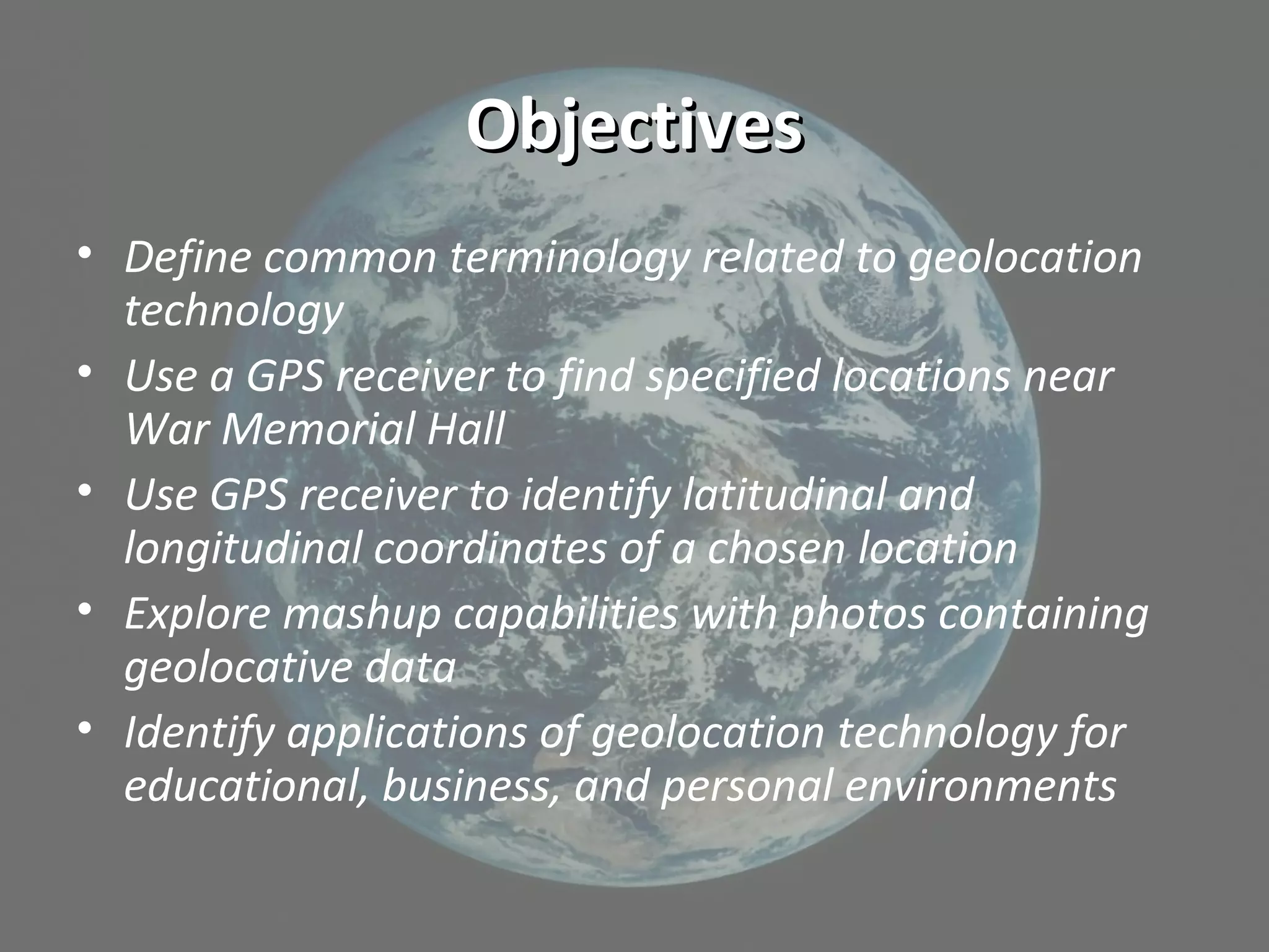
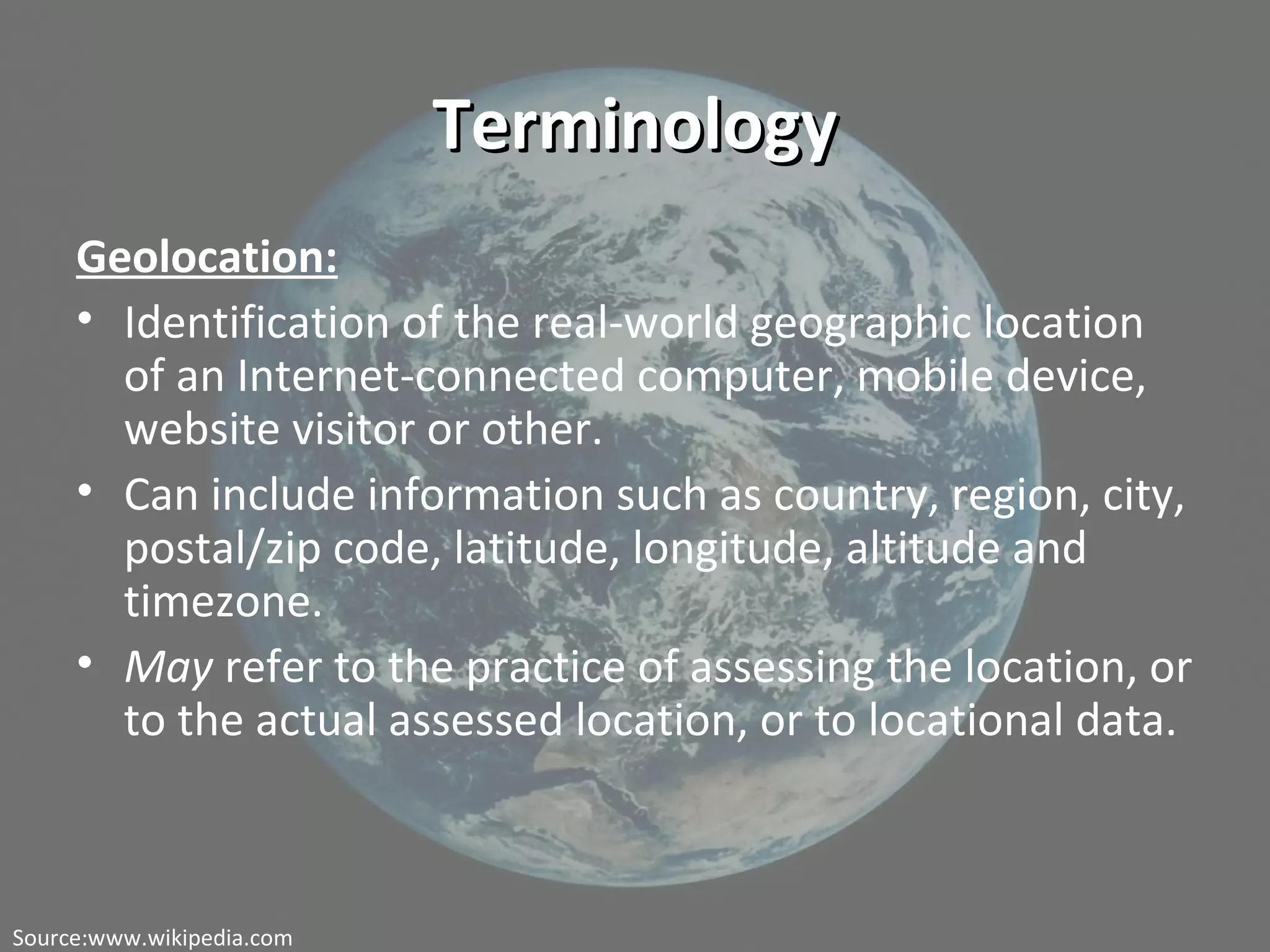
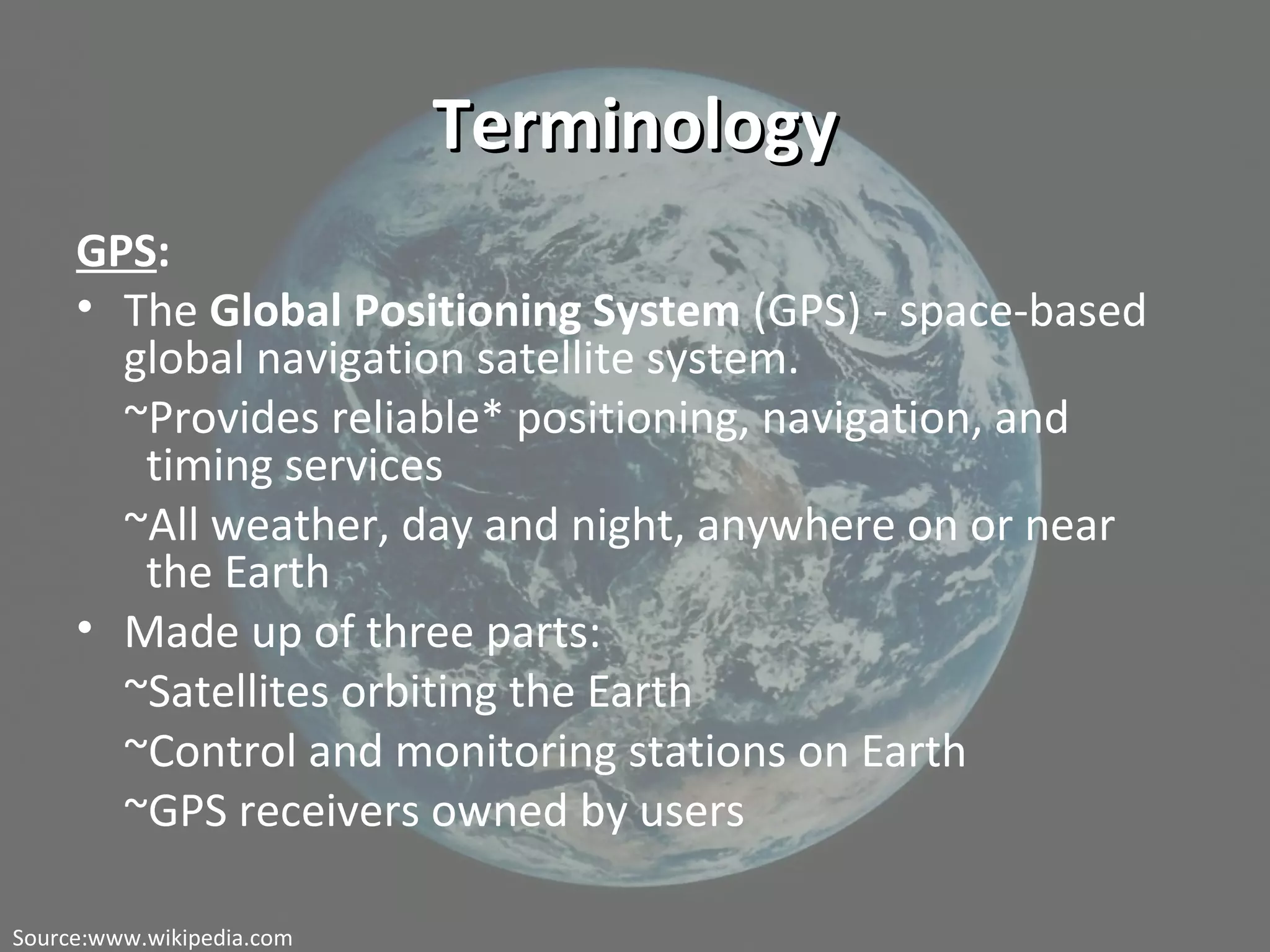
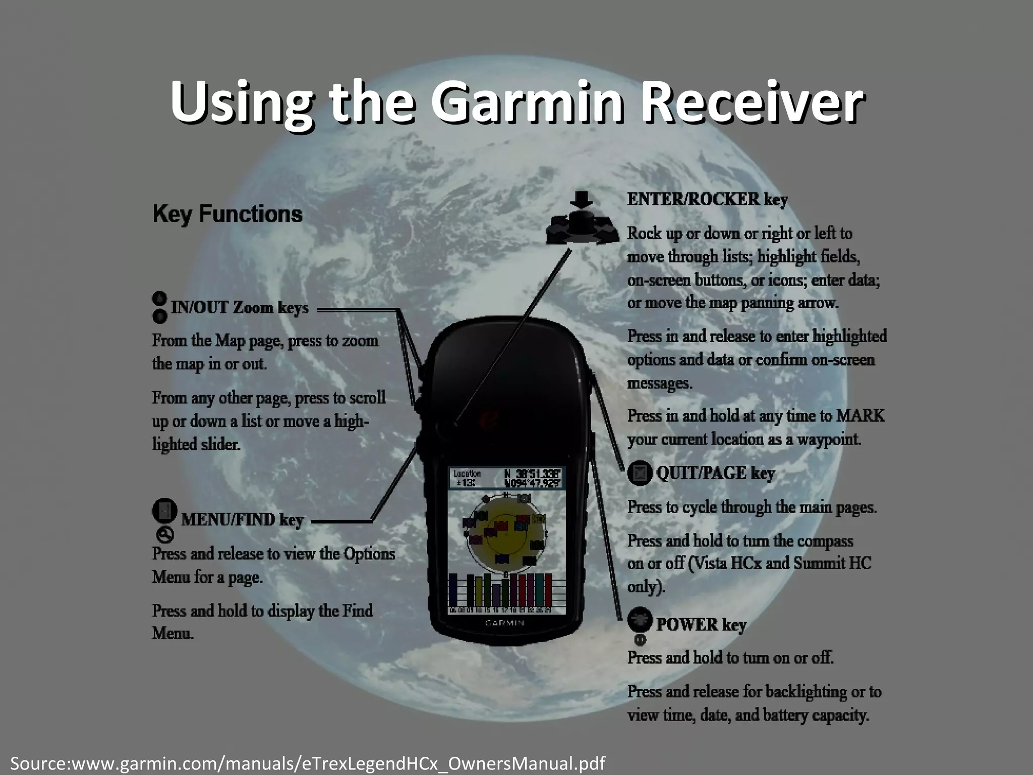
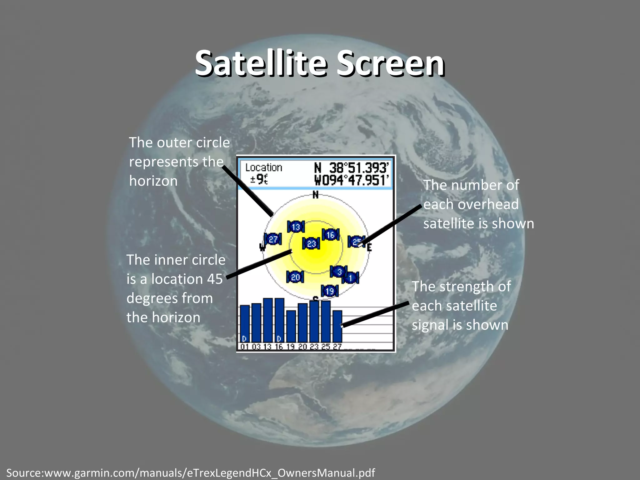
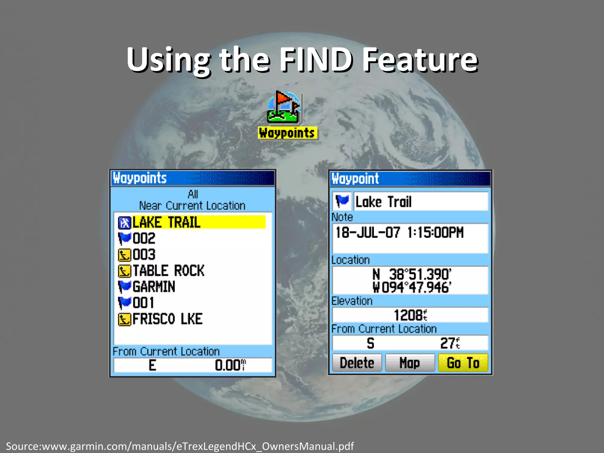
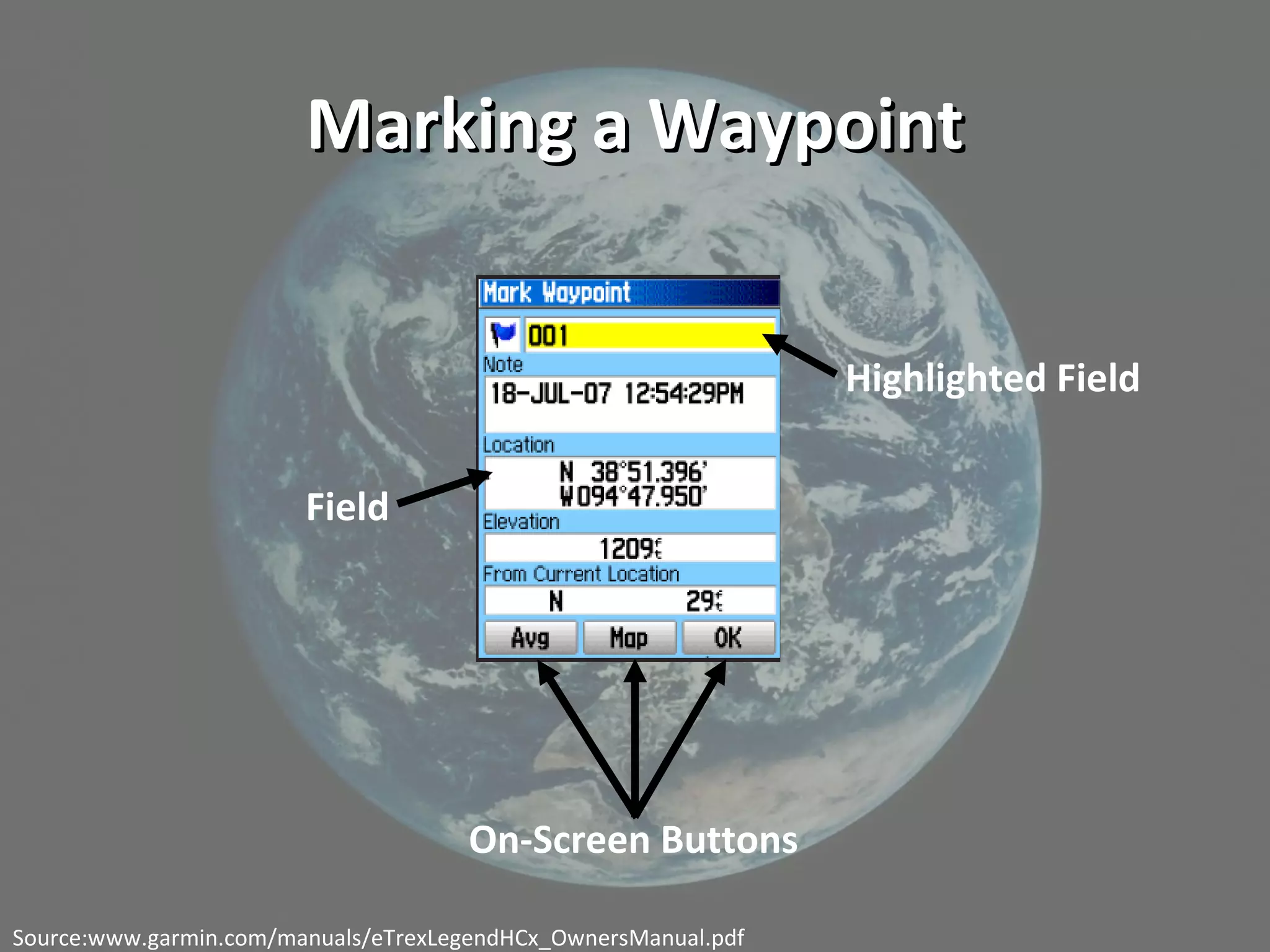
This document discusses geolocation technology and its applications. It begins with definitions of key terms like geolocation, GPS, satellites, waypoints and geocaching. It then demonstrates how to use a GPS receiver to find locations, mark waypoints and view coordinate data. The document discusses using geotagged photos and sharing locations online. It emphasizes that geolocation provides new ways to organize and search information, with implications for research and learning like observing patterns and gaining deeper insights when location data is incorporated.
Creating rich resources with free tools: Customised Google Maps for Learning & Teaching. Presented at the Durham Blackboard Users Conference, January 2013.
Methodological Approaches to Location-Based Social Networking ResearchKatina Michael
This tutorial was accepted into the 2017 IEEE/ACM International Conference on Advances in Social Networks Analysis and Mining. Conference location: Mercure Sydney, Australia, 31 July - 03 August, 2017. Presentation: 11am-1pm. Location based social networking (LBSN) is the convergence between location based services (LBS) and online social networking (OSN). LBSN applications offer users the ability to view and share location details with “friends” remotely, and in real-time, using a smart phone, desktop and/or other mobile devices. Users invite their friends to participate in LBSN and there is a process of consent that follows. LBSN tools essentially mesh together the positives and negatives of OSN and LBS, creating a unique domain of enquiry, thereby forcing researchers to ask new questions. While research in this field is heavily focussed on quantitative analysis and mining techniques, there is a lack of consideration of qualitative approaches to understanding LBSN applications, and the insights that can be garnered from the implementation of such techniques. This introductory tutorial offers alternative methodological approaches, which deliver rich, scenario-based outcomes that can be utilised to supplement existing quantitative techniques. More here: http://www.katinamichael.com/seminars/2017/7/30/methodological-approaches-to-location-based-social-networking-lbsn-research
Presents a case study on how Jarrett Library at East Texas Baptist University in Marshall, Texas, has been using ebrary’s DASH! (data sharing fast), to create searchable databases of content. The case study explores the possibilities that are made available by the use of DASH!, including multiple types of information sharing with other libraries, openly on the Internet, and also how it is used for creating proprietary digital repositories. The case study concludes with the reasons why DASH! will continue to be used by the ETBU library as well as what has been most useful in regards to DASH!, including the availability of usage statistics, the low cost, and ease of use.
2010 Toronto Municipal Election - A Brand Experience PerspectiveAhmad Ktaech
An intriguing and thoughtful look at the 2010 Toronto Municipal Election from a Brand Experience perspective. Provides insights and recommendations for future elections.
Comprender la persona y características del Espíritu Santo, reconociendo su divinidad y valorar el hecho de que el Espíritu Santo sea plenamente capaz de guiar la vida del creyente.
Hypofractionation in early breast cancer is no more a research scholars topic. Multiple studies with robust data have proven its utility. It may hold an important role in many countries with constrained resources. This is a short presentation incorporating important completed and ongoing trials. Feel free to use this.
Presented at EDUCAUSE 2009 in Denver, Colorado on November 5, 2009 by Michael Howser and William (Bill) Miller from the University of Connecticut Libraries Map and Geographic Information Center - MAGIC.
2015 FOSS4G Track: Getting Started with FOSS4G: The Newbie’s Perspective by M...GIS in the Rockies
You’ve heard some buzz about Free and Open Source Software for Geospatial (FOSS4G) technology. You’re intrigued to know more, but hesitant because it seems a bit overwhelming. What is a newbie to do – how do you even know where to start? Taking the first step can be very intimidating, especially if you don’t feel “qualified”, e.g. no programming experience. We’ve been there! This session will present a collection of perspectives and experiences from non-techie newbies who are going through the process of learning FOSS4G software from scratch. We’ll cover common questions and doubts about how to get started, obstacles to avoid, and strategies and helpful resources to help you succeed.
IET Technology Coffee Morning - Location-based learning: education in the WildLiz FitzGerald
Slides presented at the IET Technology Coffee Morning at the Open University.
Abstract and further details available at http://cloudworks.ac.uk/cloudscape/view/2350.
Unfolding - A Library for Interactive Maps and GeovisualizationsTill Nagel
Presentation at the SouthCHI 2013 conference in Maribor, Slovenia.
Won a Best Presentation Award.
More information on Unfolding at http://unfoldingmaps.org
Here are the slides of a talk given on a seminar "Earth observation and deep learning", given at Polytechnique.
The state of progress in a context that evolves very very fast!
2. ObjectivesObjectives
• Define common terminology related to geolocation
technology
• Use a GPS receiver to find specified locations near
War Memorial Hall
• Use GPS receiver to identify latitudinal and
longitudinal coordinates of a chosen location
• Explore mashup capabilities with photos containing
geolocative data
• Identify applications of geolocation technology for
educational, business, and personal environments
3. Once We’ve Completed the Lesson:
Seven Things You Should Know About
Geolocation Technology
1. What is it?
2. Who is doing it?
3. How does it work?
4. Why is it significant?
5. What are the downsides?
6. Where is it going?
7. What are the implications for teaching and
learning?
4. TerminologyTerminology
Geolocation:
• Identification of the real-world geographic location
of an Internet-connected computer, mobile device,
website visitor or other.
• Can include information such as country, region, city,
postal/zip code, latitude, longitude, altitude and
timezone.
• May refer to the practice of assessing the location, or
to the actual assessed location, or to locational data.
Source:www.wikipedia.com
5. TerminologyTerminology
GPS:
• The Global Positioning System (GPS) - space-based
global navigation satellite system.
~Provides reliable* positioning, navigation, and
timing services
~All weather, day and night, anywhere on or near
the Earth
• Made up of three parts:
~Satellites orbiting the Earth
~Control and monitoring stations on Earth
~GPS receivers owned by users
Source:www.wikipedia.com
6. TerminologyTerminology
Satellite:
• An object which has been placed into orbit by human
endeavor
• Sometimes called artificial satellites to distinguish
them from natural satellites such as the Moon
An animation depicting the orbit of GPS satellites
Source:www.wikipedia.com
7. TerminologyTerminology
Geocaching:
• An outdoor activity in which the participants use a
GPS receiver to hide and seek containers (called
"caches") anywhere in the world
• Most often described as a "game of high-tech hide
and seek", sharing many aspects with orienteering,
treasure-hunting, and waymarking
• Quickly becoming a very popular hobby, as
evidenced by the new movie “Splinterheads”
Source:www.wikipedia.com
8. TerminologyTerminology
Waypoint:
• a reference point in physical space used for purposes
of navigation
Waymarking:
• an activity in which people can locate and log unique and
interesting (and some mundane) locations around the
world, usually with a GPS receiver and a digital camera
Source:www.wikipedia.com
9. Using the Garmin ReceiverUsing the Garmin Receiver
Source:www.garmin.com/manuals/eTrexLegendHCx_OwnersManual.pdf
11. Using the FIND FeatureUsing the FIND Feature
Source:www.garmin.com/manuals/eTrexLegendHCx_OwnersManual.pdf
12. Marking a WaypointMarking a Waypoint
Highlighted Field
On-Screen Buttons
Field
Source:www.garmin.com/manuals/eTrexLegendHCx_OwnersManual.pdf
13. The Results Are In!The Results Are In!
• Where did your high-tech treasure hunt take
you?
• What difficulties did you encounter?
• What did you enjoy?
• How could such an activity be useful in a
classroom setting?
Think About:
Information Age vs. Interaction Age
14. Taking it to another level…Taking it to another level…
•Geotagging Photos
•Sharing Photos and their
geolocative data with others
•Data Mashups
15. Your Assignment:Your Assignment:
• Choose a location to add to our VT graduate
student campus tour.
• Using your GPS, mark the waypoint and make
note of the latitudinal and longitudinal
coordinates.
• Take a photo of the location! Bring an
electronic copy of the photo to class, and
email a copy of the photo to me by Monday.
• Have fun!
16. “ The array of emerging web applications that combine
topographical data with geotagged media and
information are at the heart of geolocation’s
importance to educational practice. Many such
applications require no programming skills and can
be used by students to produce custom visualizations
layered over detailed maps or 3-D landscapes using
real-world data.”
-2009 Horizon Report
17. Tonight’s Agenda:Tonight’s Agenda:
• Brief review of last week
• Waypoint assignment: how did it go?
• Geolocation Technology and the Internet
• Seven Things You Should Know
• Wrap-up
18. Taking it to another level…Taking it to another level…
•Geotagging Photos
•Sharing Photos and their
geolocative data with others
•Data Mashups
19. Once We’ve Completed the Lesson:
Seven Things You Should Know About
Geolocation Technology
1. What is it?
2. Who is doing it?
3. How does it work?
4. Why is it significant?
5. What are the downsides?
6. Where is it going?
7. What are the implications for teaching and
learning?
21. Cool LinksCool Links
• NASA GPS Applications Exchange:
http://gpshome.ssc.nasa.gov/
• Travels of Marco Polo:
http://idlethink.wordpress.com/2008/08/31/indulgence-sin/
• Games-Based Learning:
http://lgl.gameslearningsociety.org/
• Creating Interactive Stories:
http://www.mscapers.com/
• How your location-aware iPhone will change your life:
http://otherfancystuff.blogspot.com/2008/11/geocoding-with-
google-spreadsheets-and.html
• Using Geotagged Photos in the Geography Classroom:
http://www.geographyteachingtoday.org.uk/fieldwork/info/teachi
ng-technology/geotagging-photos-to-share-fieldtrips-with-the-
world/
22. Sharing Your FindingsSharing Your Findings
• Identify at least two things you learned about
GPS and geolocation technology from your
research
• Describe how GPS and geolocation technology
are being applied
• Identify the educational and/or research
significance for this application
23. Seven Things You Should Know…Seven Things You Should Know…
1. What is Geolocation?
• Associating a digital resource with a
physical location in terms of latitude and
longitude coordinates.
2. Who is doing it?
• Wikipedia
• Google Maps
• Google Earth
• Photo- and video-sharing web sites
24. Seven Things…Seven Things…
3. How does it work?
• JPEG image format
• includes placeholder for location data
• applications then relate that photo/video with
other place-based services, such as real estate
info or bus schedules
25. Seven Things…
4. Why is it significant?
• The extra layer of data can make the
resource more valuable to a broader
audience.
• Deeper understanding of the geographical
context as well as environmental, social, or
political factors.
26. Seven Things…Seven Things…
5. What are the downsides?
•Data Overload
•Privacy Invasion
6. Where is it going?
•New tools for searching and organizing
information will develop
•Potential dovetail with emergent
cyberinfrastructure projects
27. Seven Things…Seven Things…
7. What are the implications for teaching and learning?
Research implications:
•Sociologist studying dispersion of domestic
violence by neighborhood
•Epidemiologist tracking outbreaks of illness
•MBA student looking into regional purchasing
trends
**location data provides all of these scenarios opportunities to
see obscure patterns and gain a deeper insight into the topic
of study
28. Seven Things…Seven Things…
7. What are the implications for teaching and learning?
Learning Implications:
•Activities that require taking a field trip
might be accomplished through
technologies that use location data to
coordinate information and resources
•Geolocation provides students the
opportunity to contribute to the body of
knowledge used by professionals in their
discipline
29. Cool Links
• The Travels of Marco Polo:
http://idlethink.wordpress.com/2008/08/31/indulgence-sin/
• Game-based learning:
http://lgl.gameslearningsociety.org/
• Creating Interactive Stories:
http://www.mscapers.com/