Downloaded 20 times

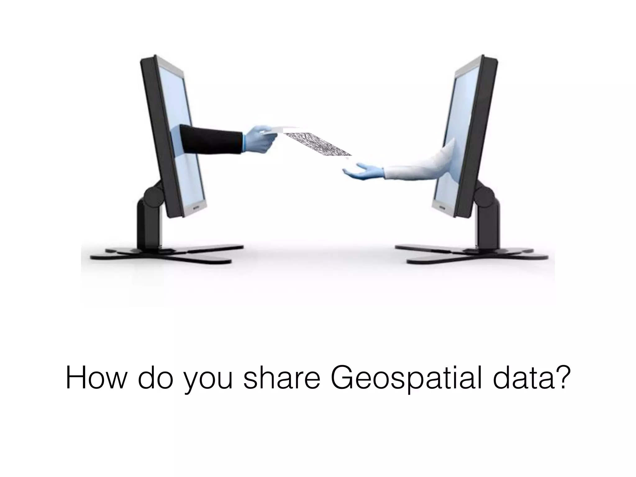
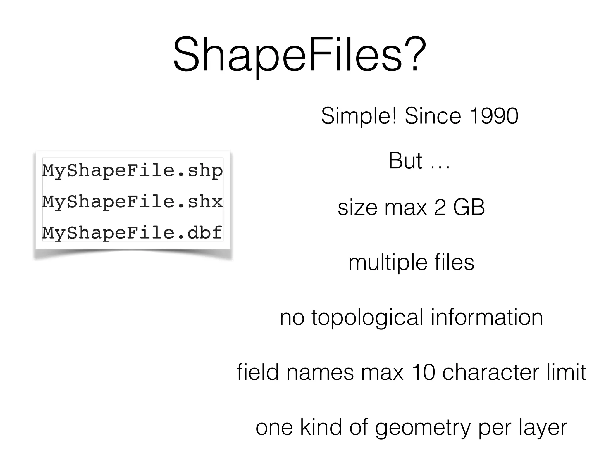
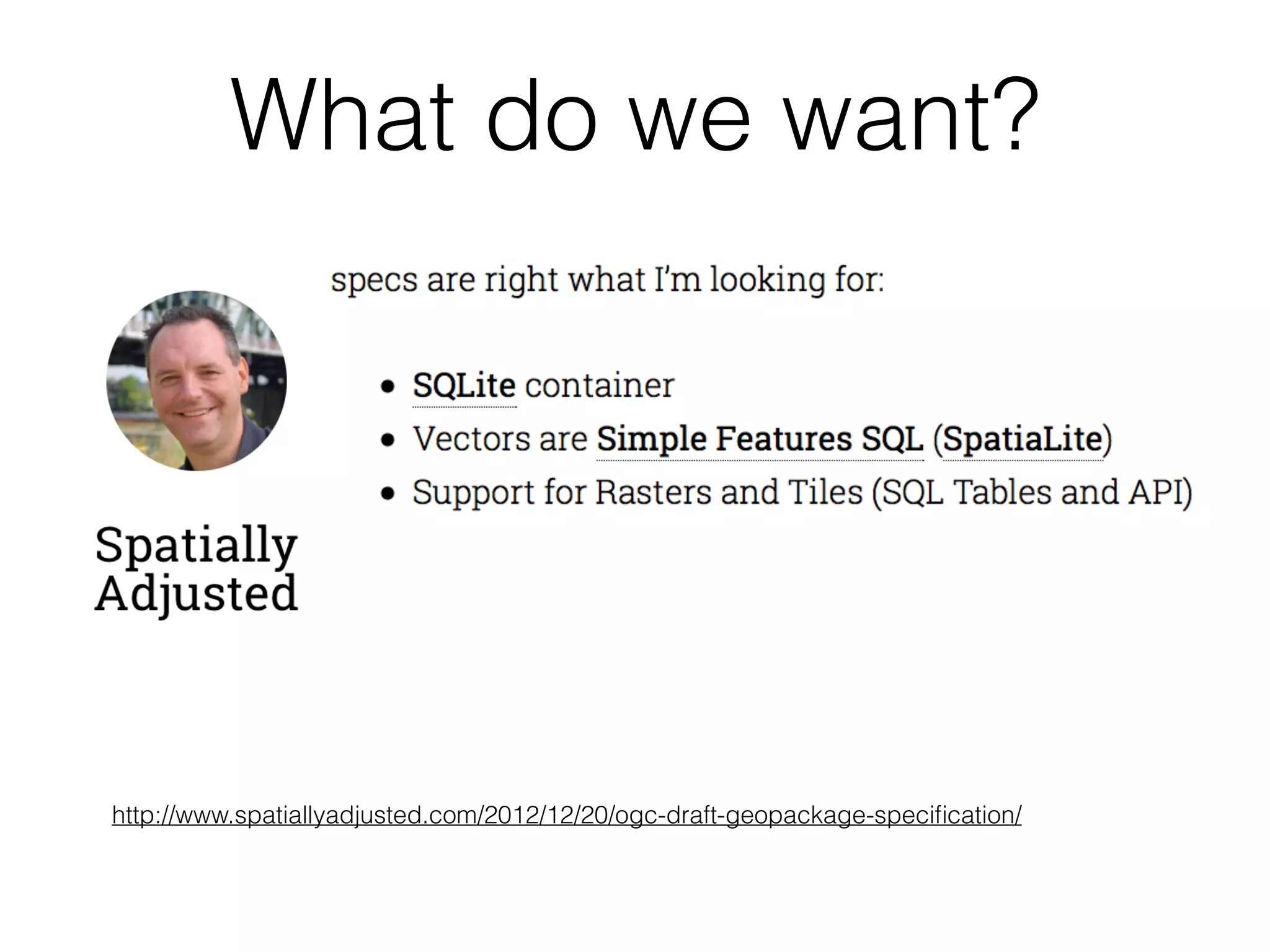
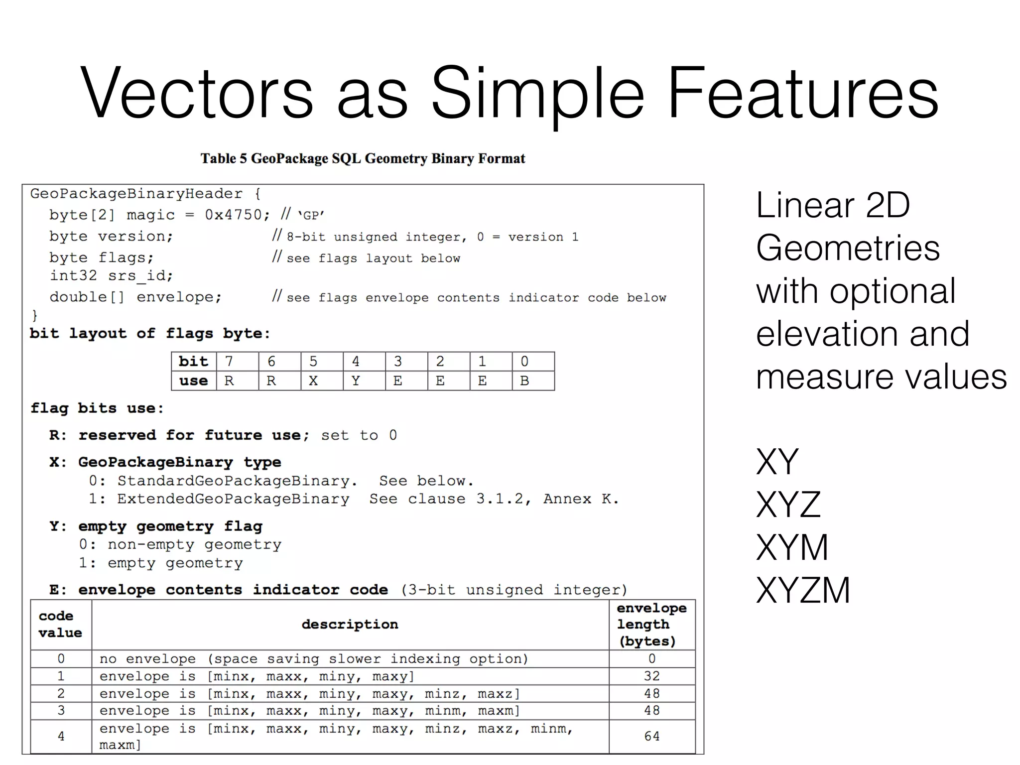
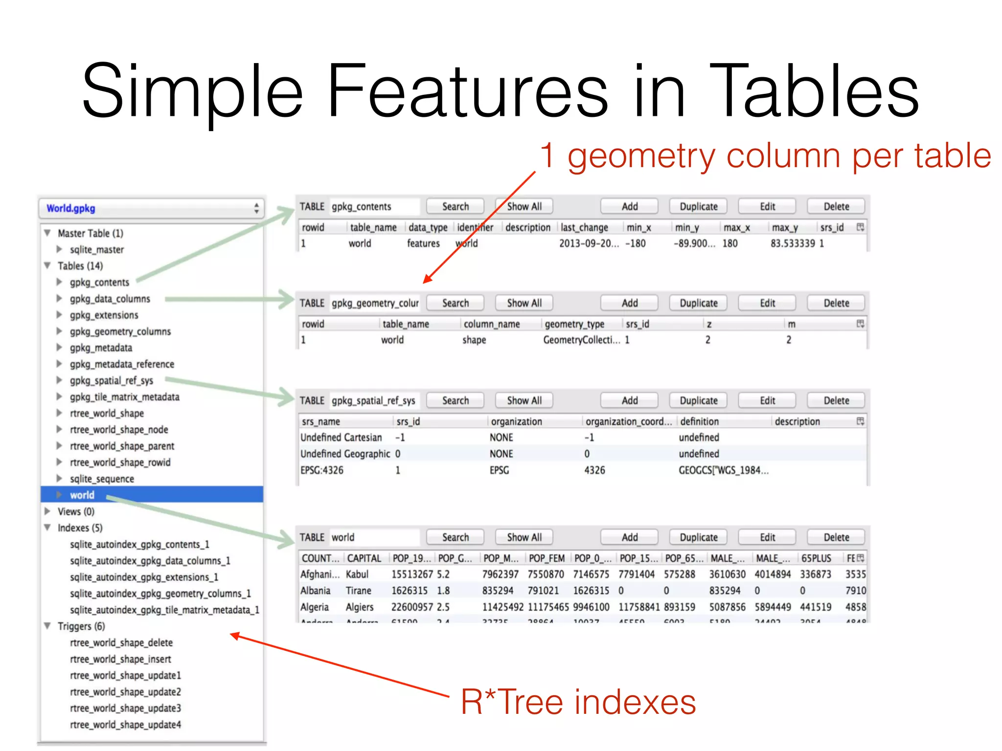
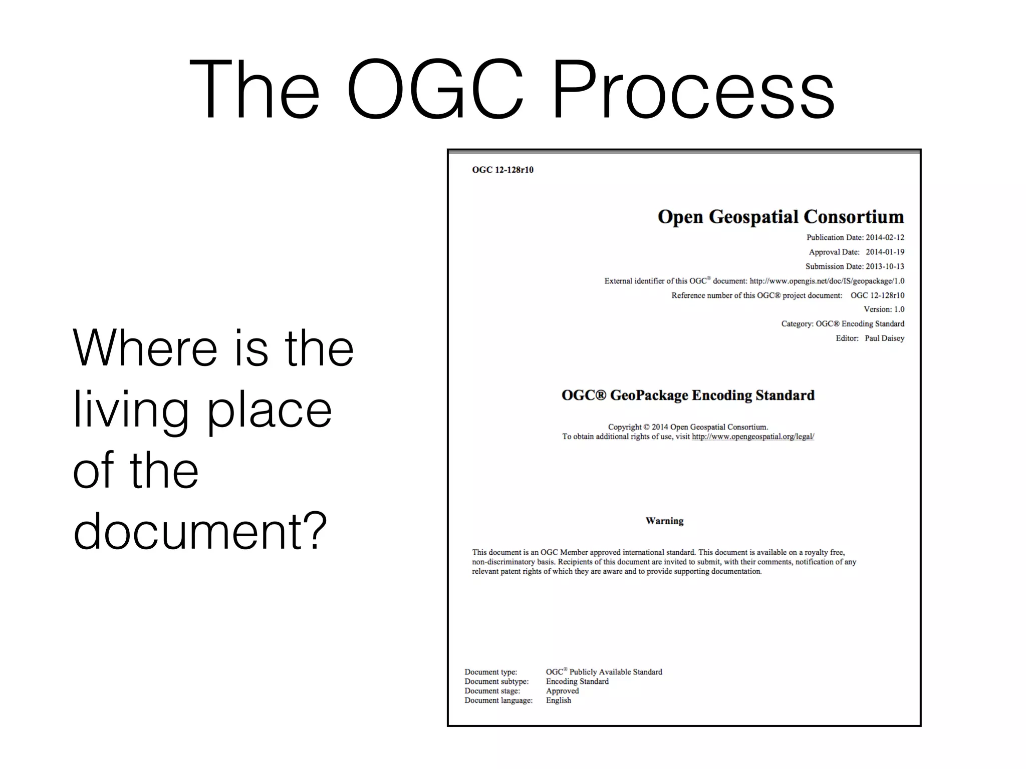
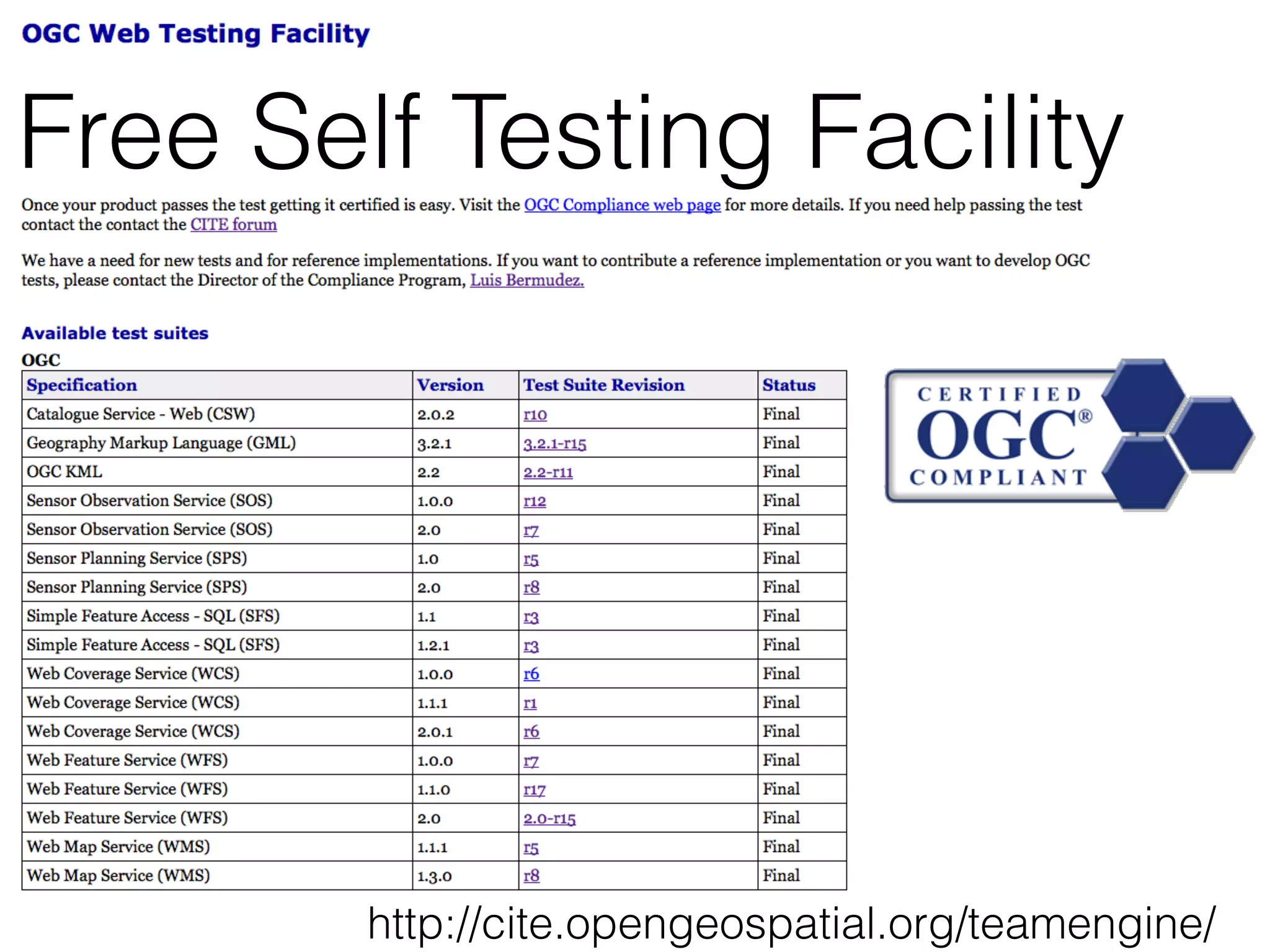
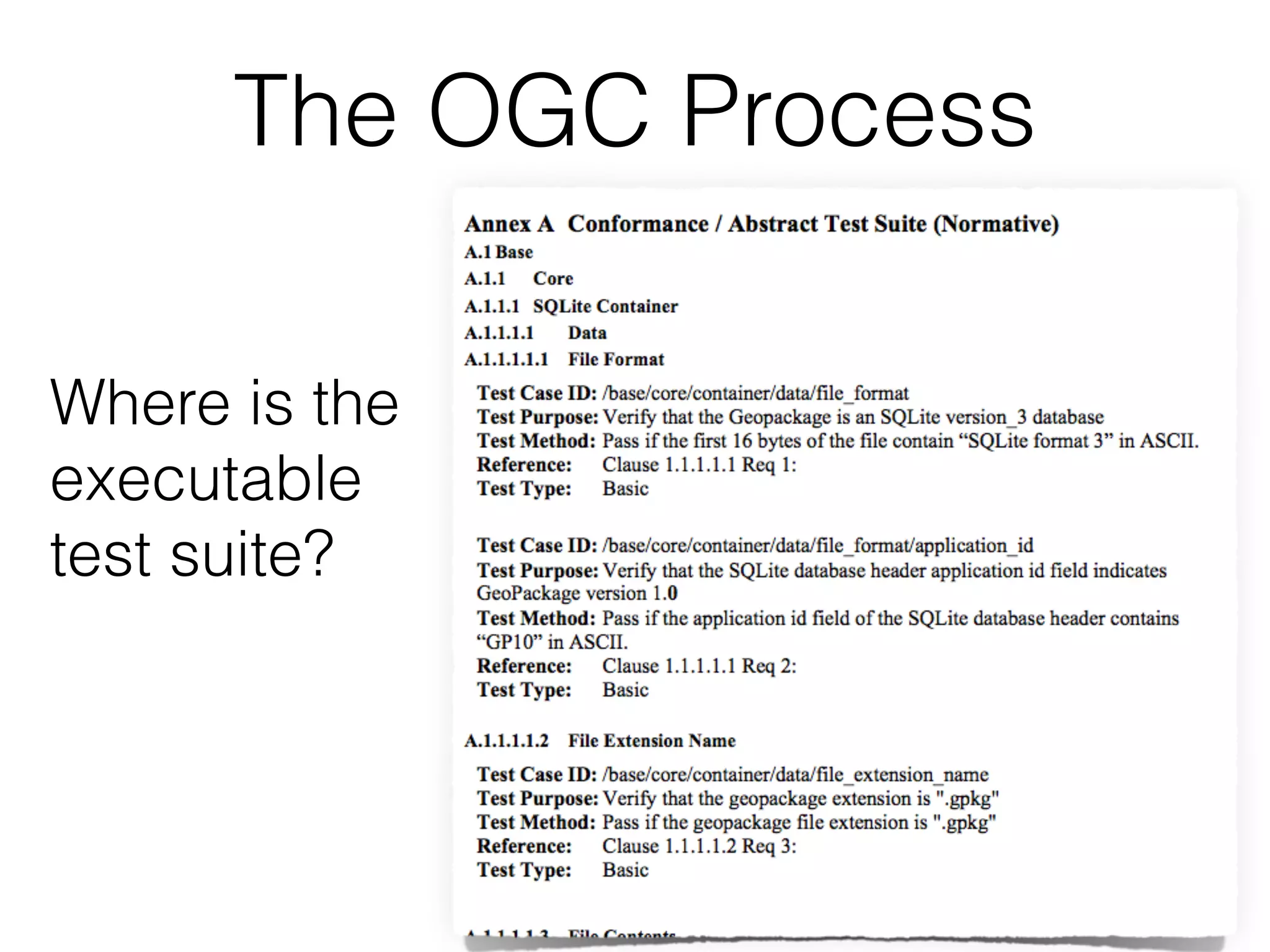
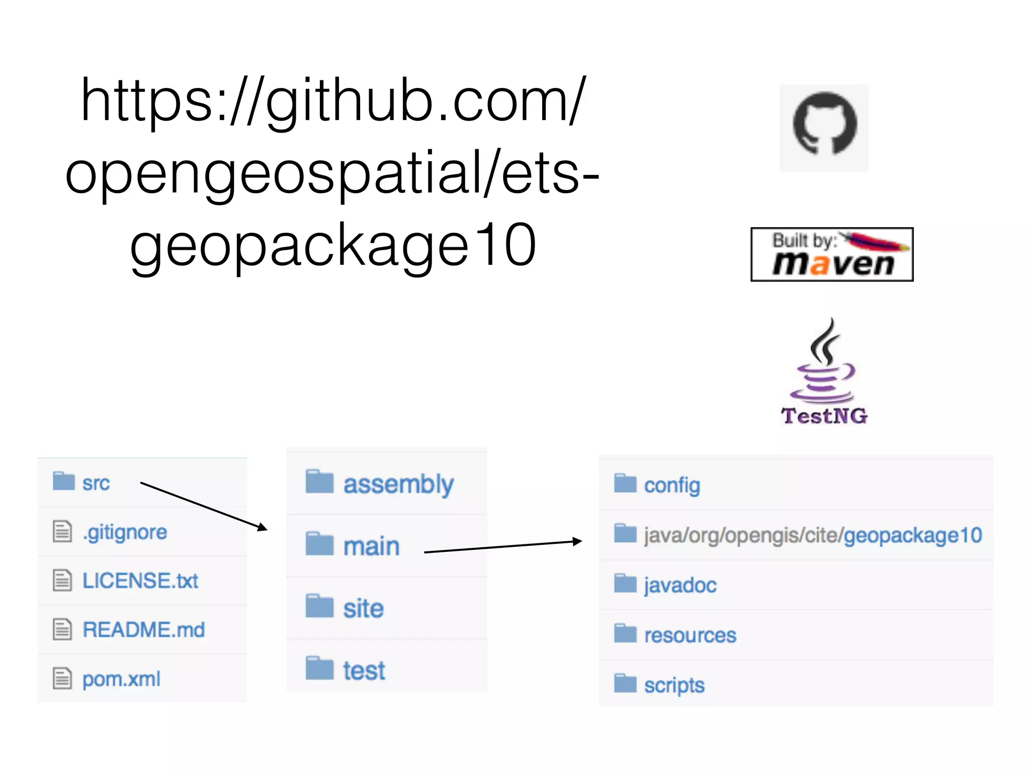
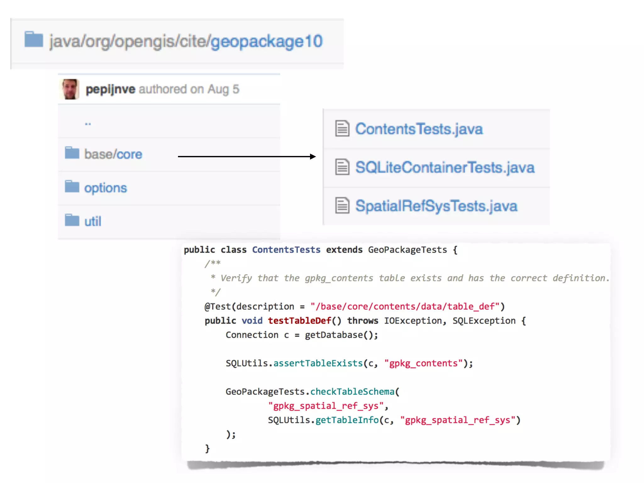
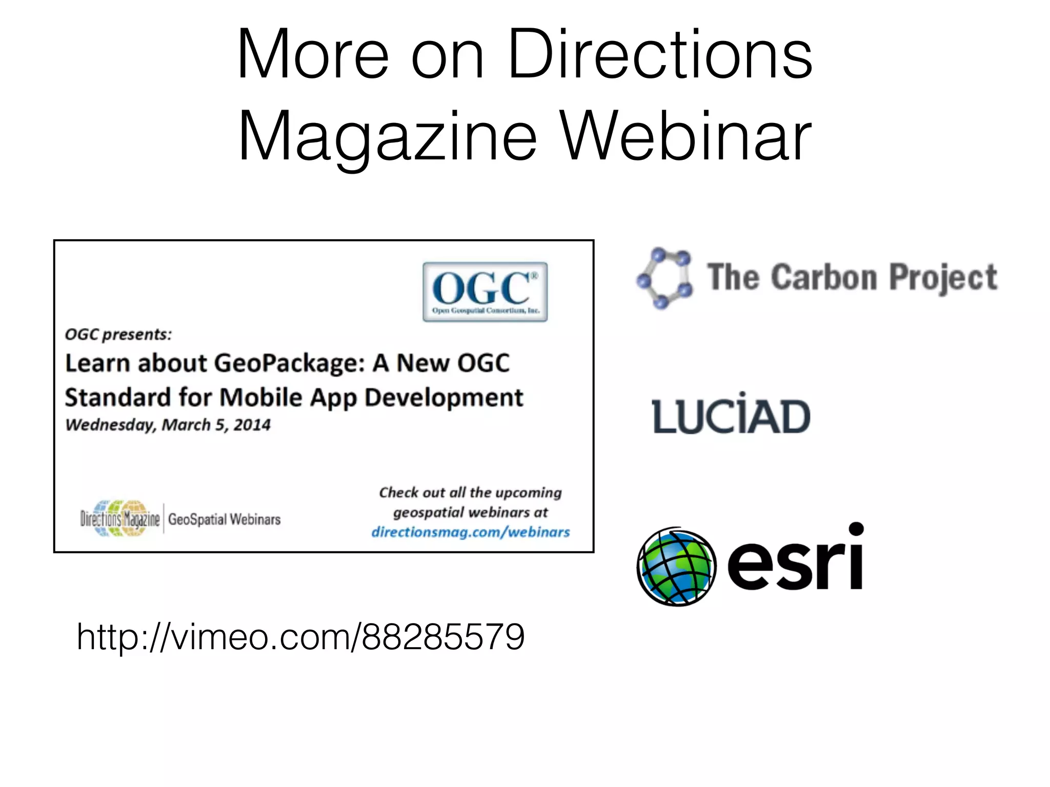
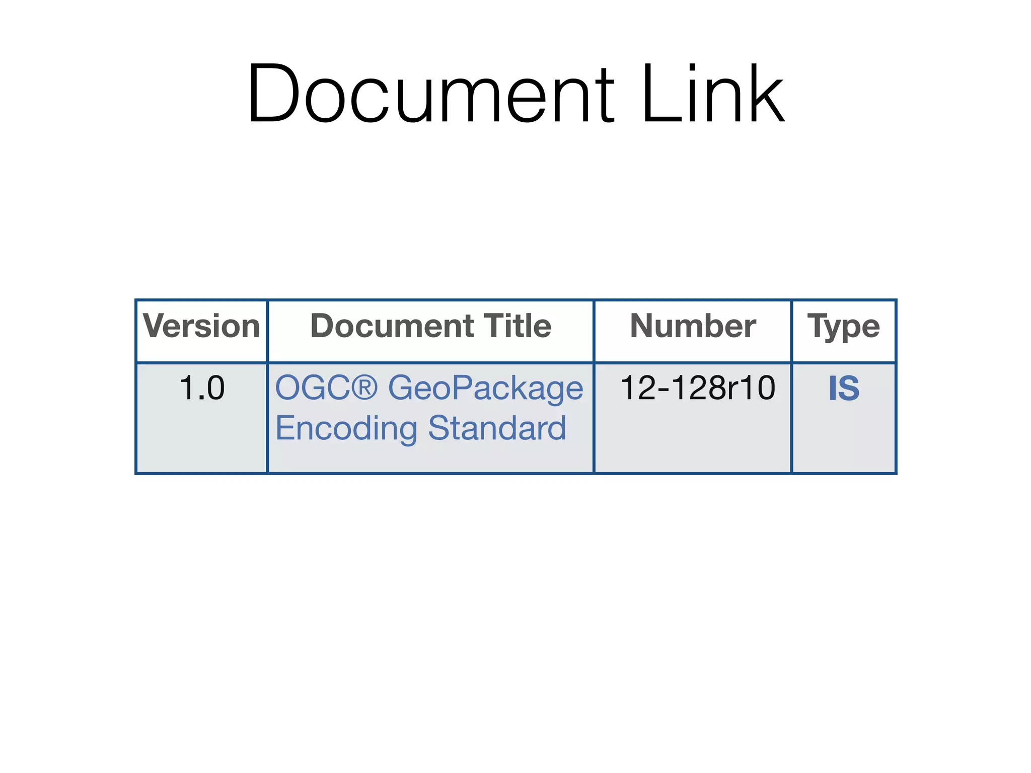

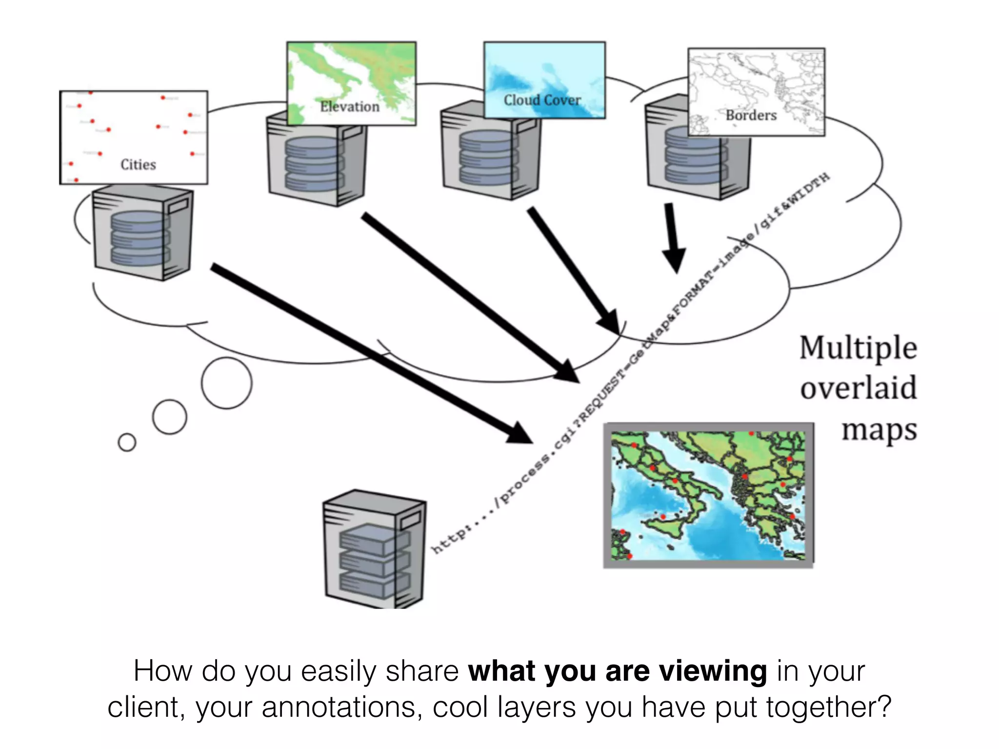
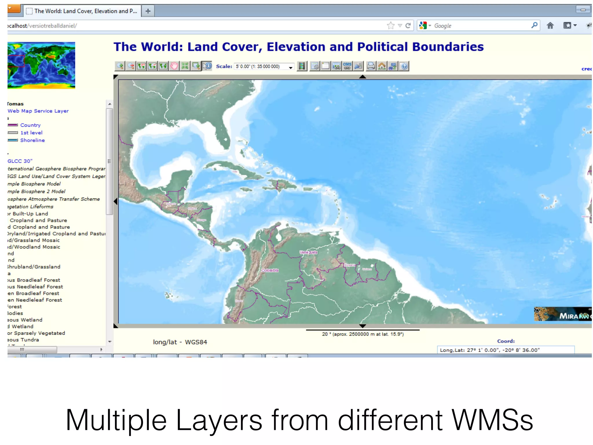
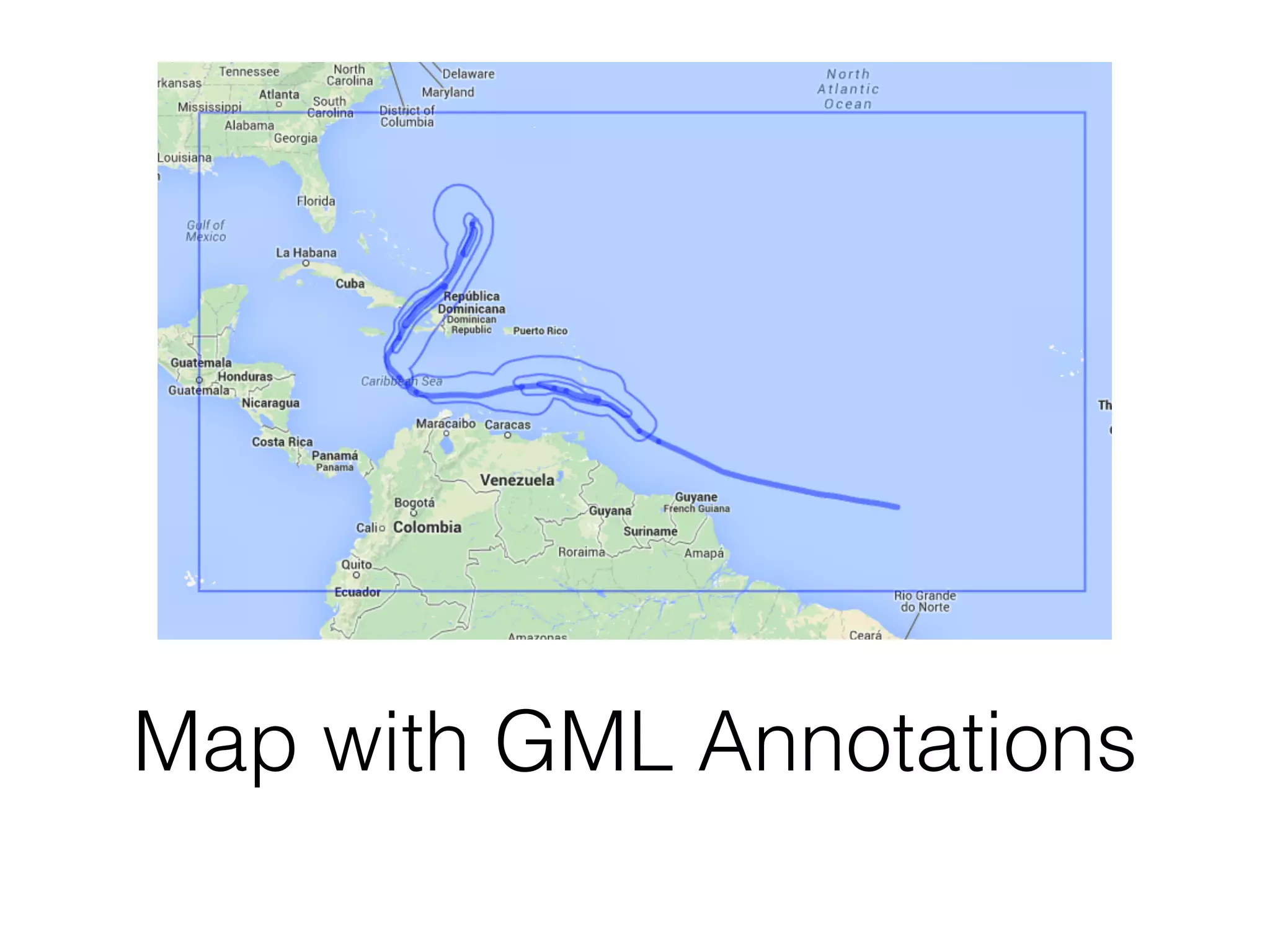
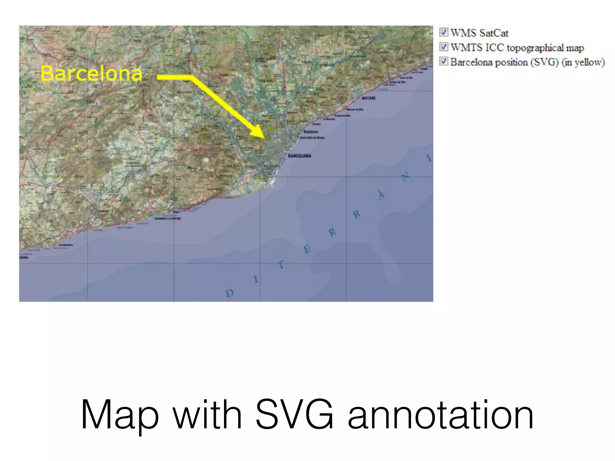
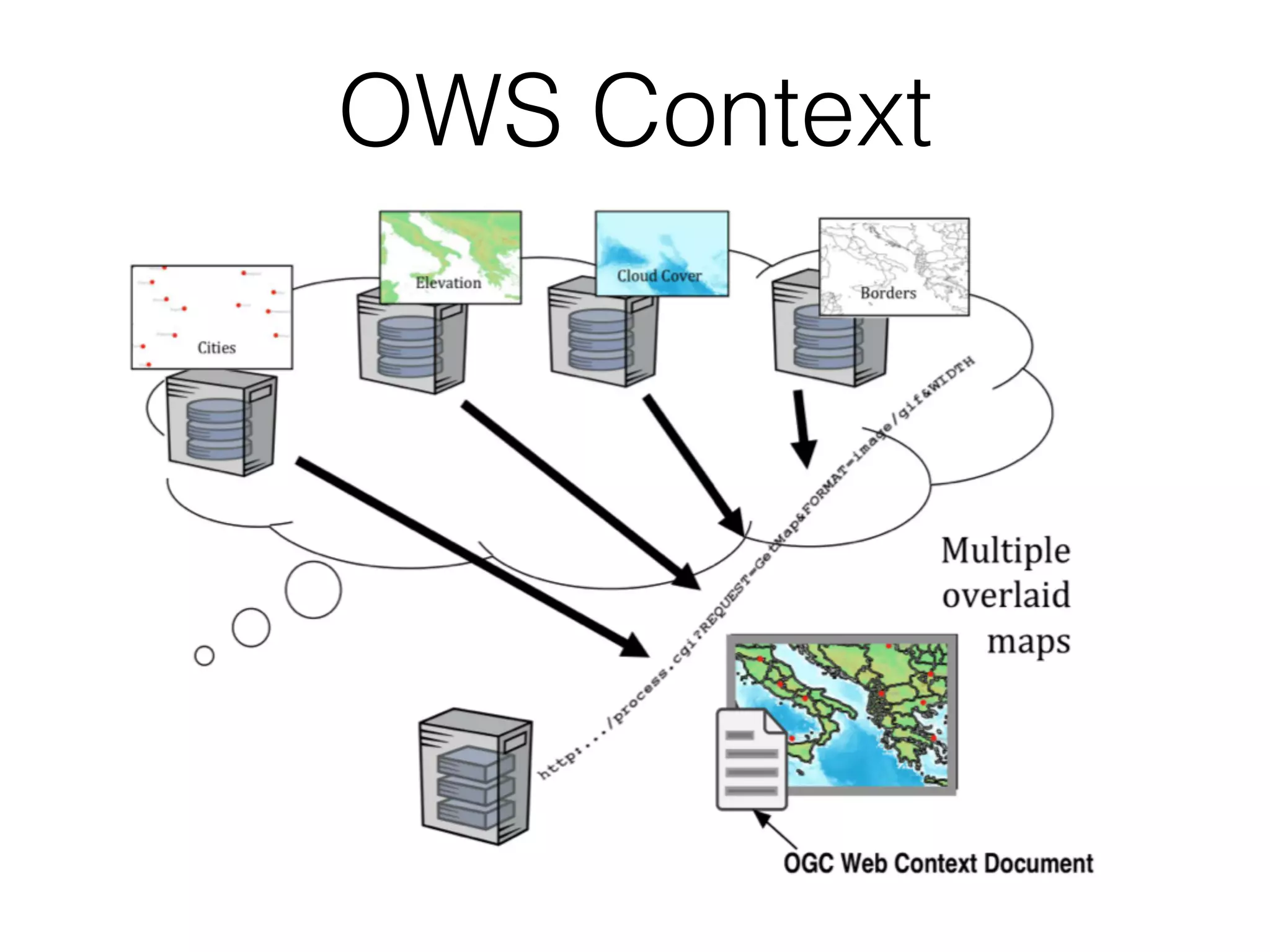

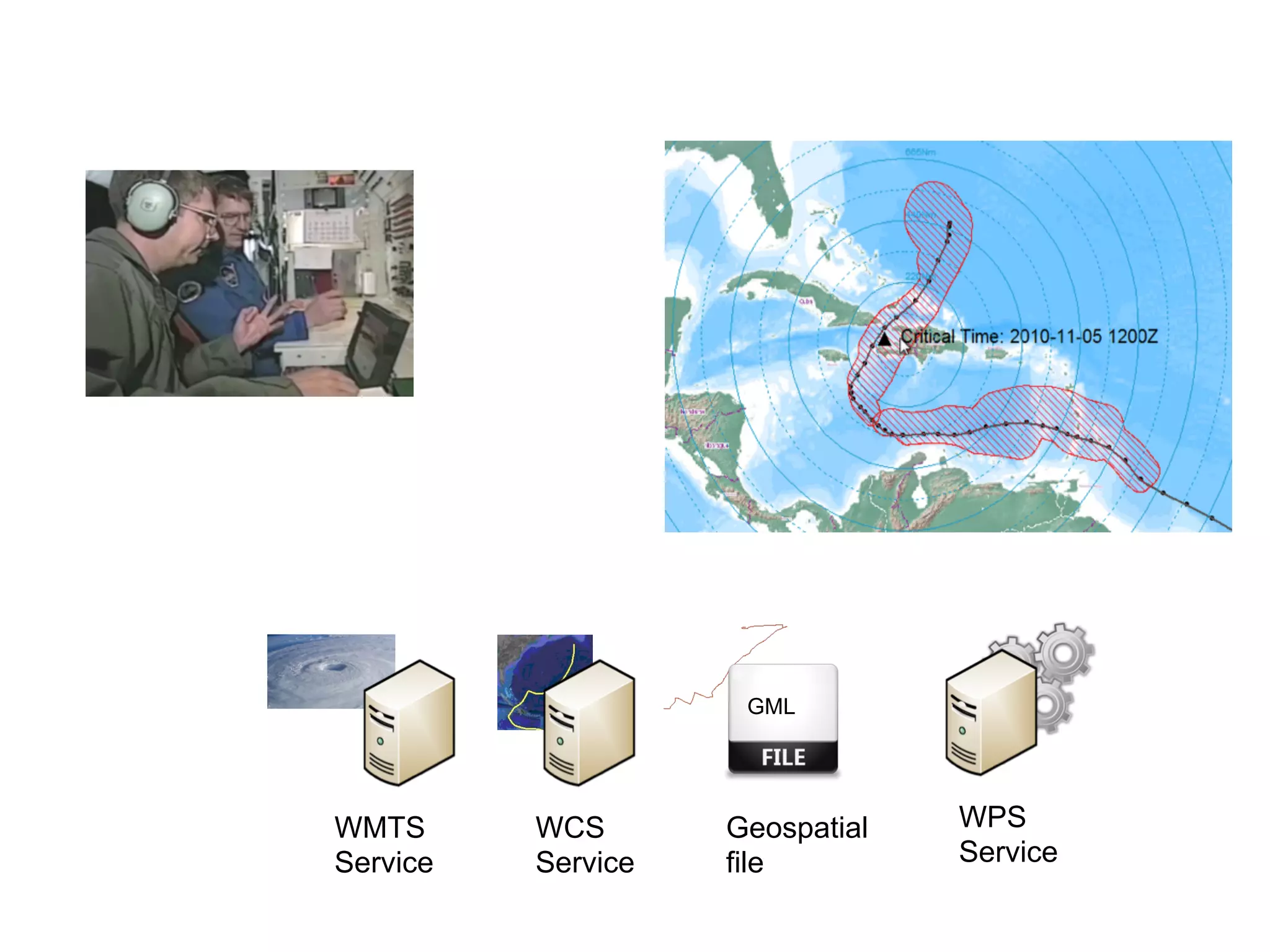


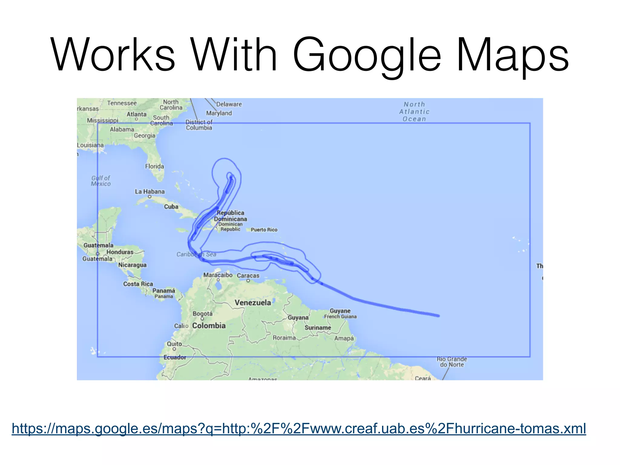
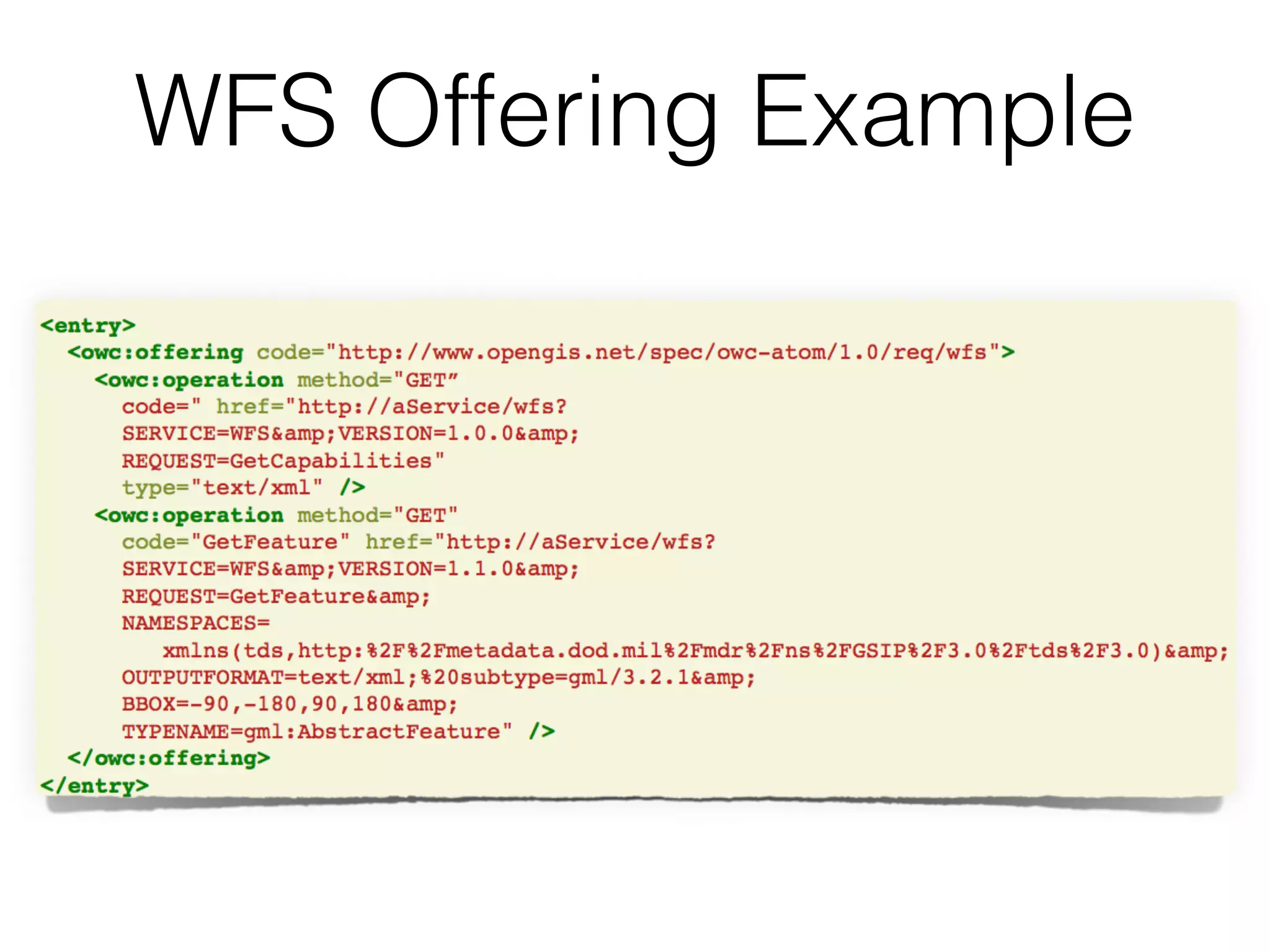
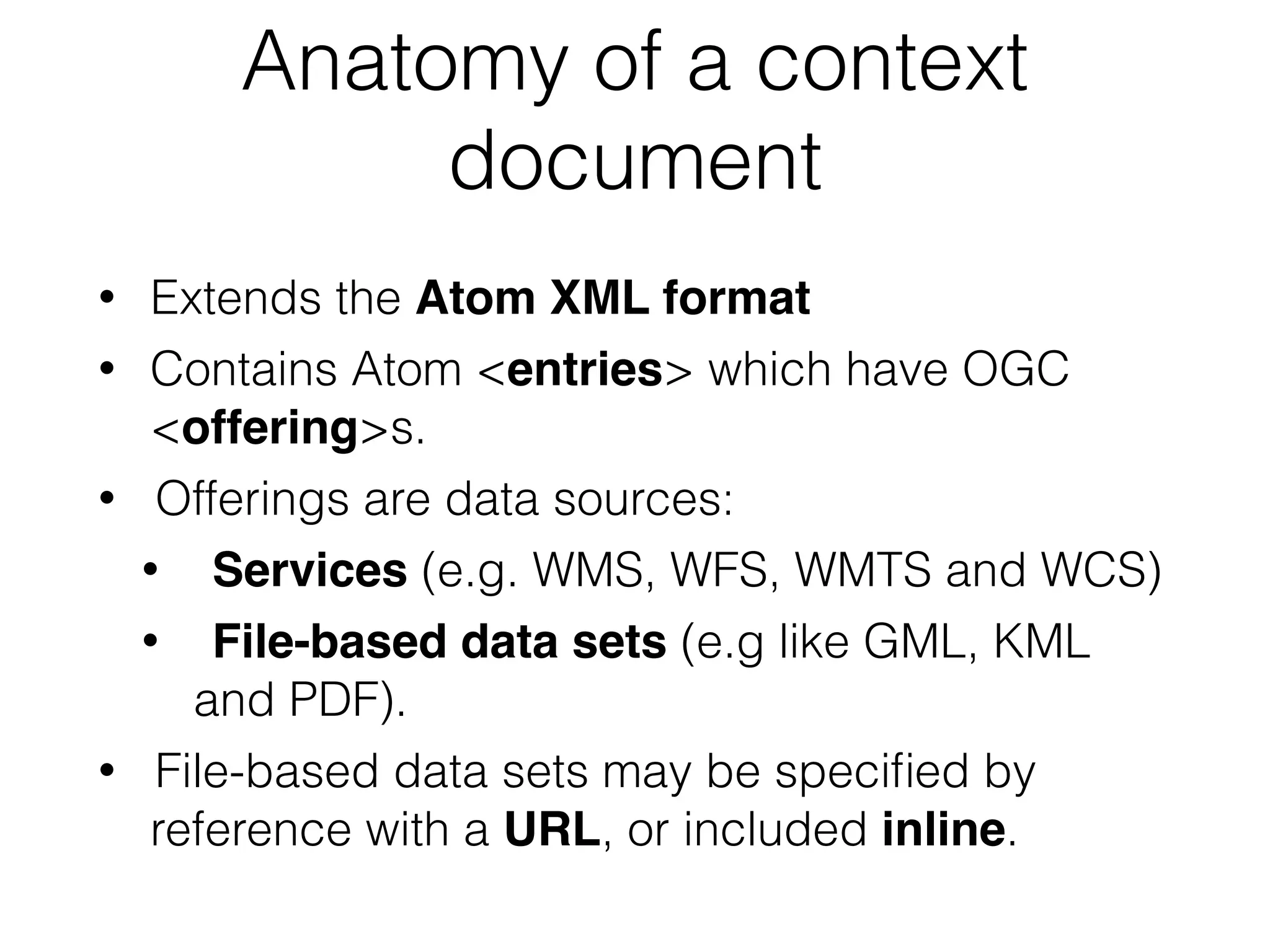
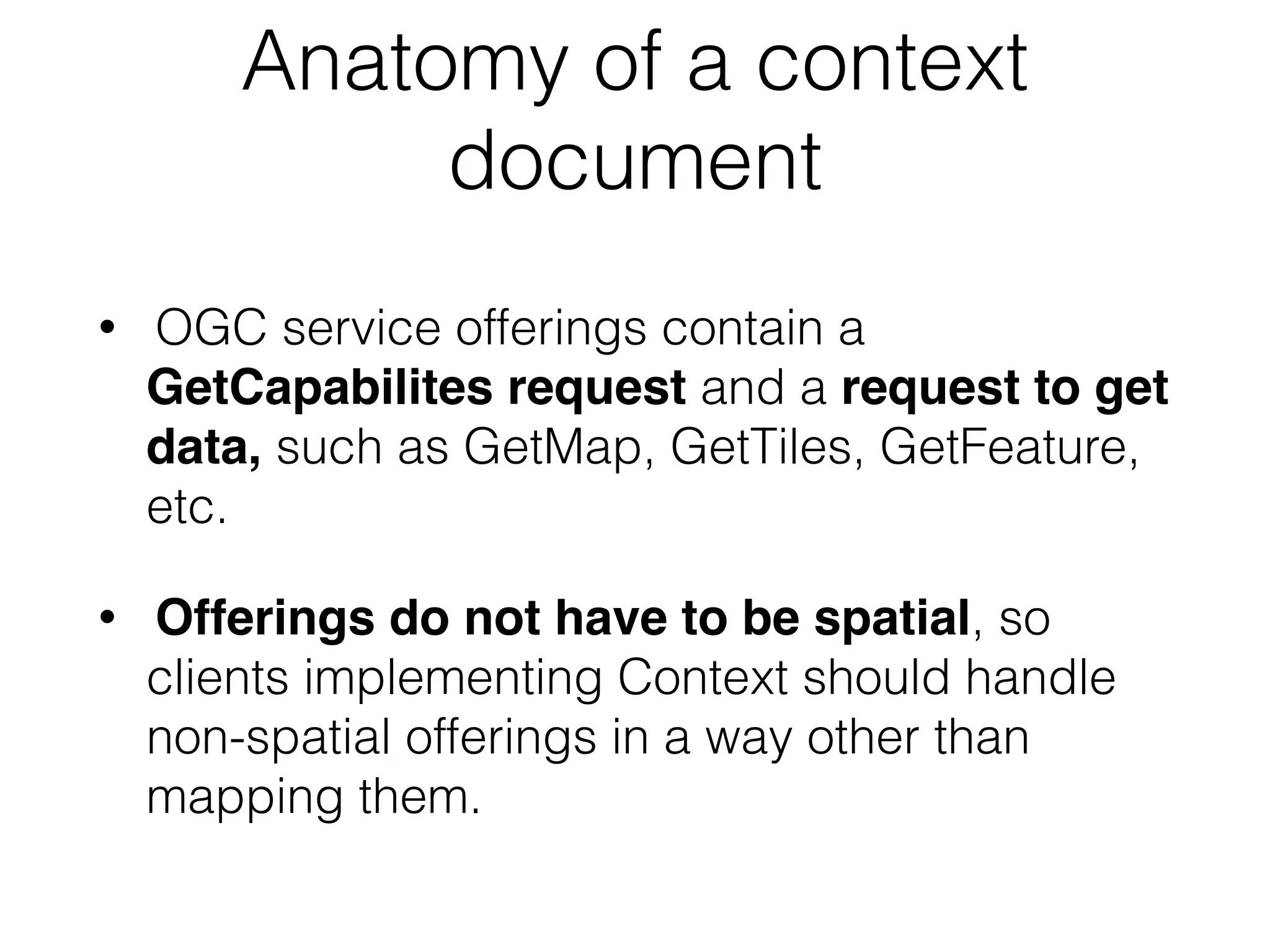

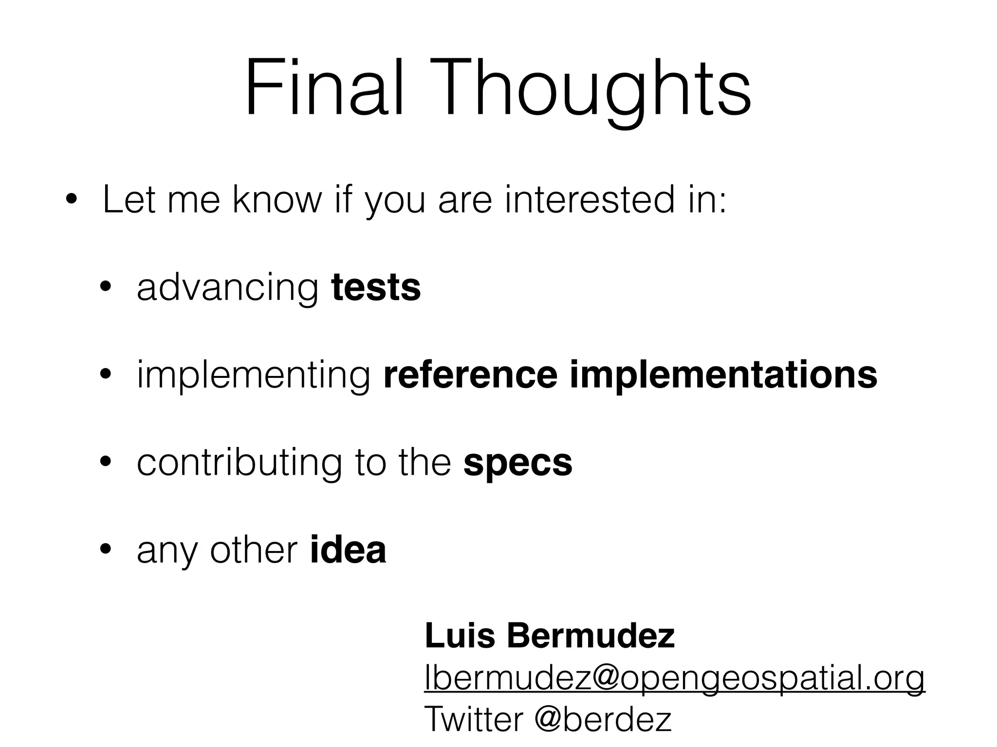

The document provides an update on the new Open Geospatial Consortium (OGC) standards for GeoPackage and OWS context, detailing various geospatial data sharing methods and their limitations. It discusses the features of GeoPackage, including support for vector and raster data, and introduces the concept of context documents for sharing geospatial information in web services. The document concludes with an invitation for collaboration on advancing tests and reference implementations related to these specifications.